Normally, after spending the winter at Jojoba Hills RV Resort in southern California we would have started traveling by about April 1st. We might have several backpacking adventures planned possibly beginning in Grand Canyon or somewhere in southern Utah. The plan would then be to head to higher elevations and cooler temperatures such as the high Sierras or Colorado or Washington State. However this year was different. Primarily it was due to my recovery from complicated foot surgery taking longer than was expected. As a consequence we didn’t leave Jojoba Hills until early July. What we did over the summer is recounted below, dayhiking and spending time with family. I also discovered I could no longer ignore a nagging shoulder issue so we headed back to Jojoba Hills earlier than planned. The result was it has been over a year since we have gone backpacking. So this was definitely not a typical summer for us. However, we can’t feel sorry for ourselves because in the past six years we have been able to do so much. While there are no guarantees for the future we believe we still have at least a few more backpacking seasons left in us and we are really looking forward to next summer as we have some big plans. I’ll let you know how it turns out.
Where we have been – California, Oregon, Washington State and Idaho
7/8 - 9/16 2016
California
- San Jacinto Wilderness - Dayhike to Suicide Rock
- Las Padres National Forest - Dayhikes to Knapp's Castle and Little Pine Mountain
- Pinnacles National Park - Dayhike to Balconies Cave and on the Balconies Cliff and Juniper Canyon Trails
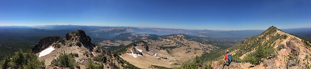
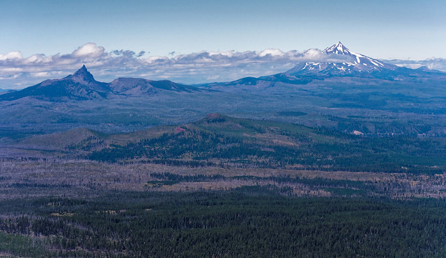
- Lassen Volcanic National Park - Dayhikes to Lassen Peak, Brokeoff Mountain and Bumpass Hell
- Crater Lake National Park - Dayhikes to Mt Scott, Plaikni Falls and Pinnacles
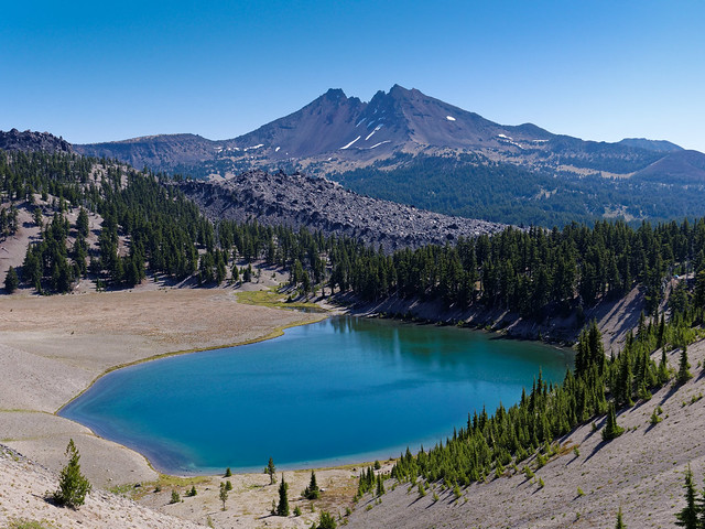
- Three Sisters Wilderness - Dayhikes to Black Crater and South Sister
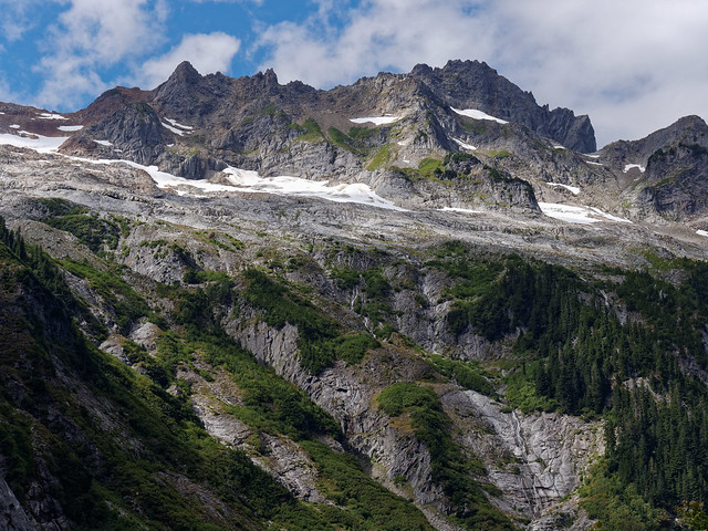
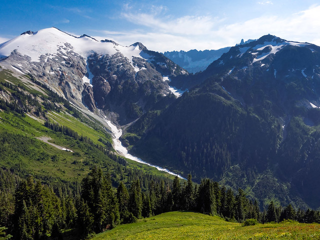
- North Cascades National Park - Dayhike to Cascade Pass and Sahale Arm
- Mt Baker Wilderness - Dayhike to Hannegan Peak
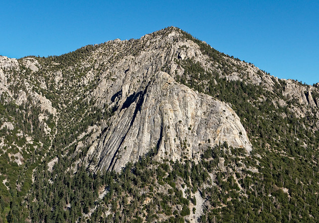
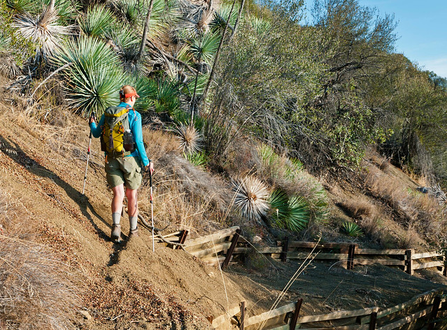
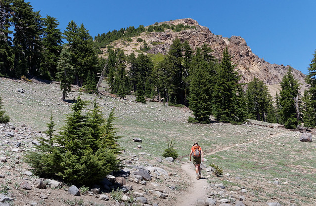
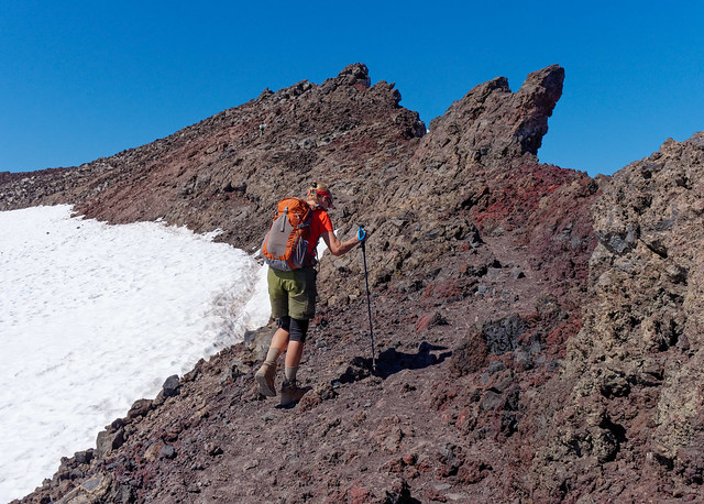
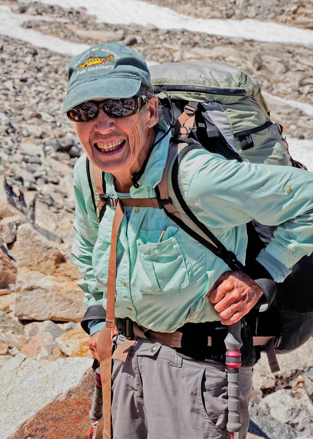
After leaving our winter base our plan was to drive to Washington State. Our first stop was Idyllwild, a lovely small town located in the mountains of California. We blessed the cooler temperatures at the higher elevation after enduring temperatures as high as 112 degrees. While there we did what was my first hike after my foot surgery. I had done some walking on pavement but no farther than 4.5 miles at a time and this was my first time walking on the rougher surface of an actual trail. Our destination was Suicide Rock in the San Jacinto Wilderness. We hiked 7.5 miles round trip and gained 1800 feet. The view included seeing Tahquitz Mountain and Lily Rock in the distance (far right).
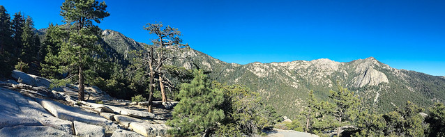
Lily Rock (far right foreground) and Tahquitz Mountain (far right background) seen from Suicide Rock in San Jacinto Wilderness, California
My foot did fine but I was grossly out of shape. Four months hobbling around in a surgical boot will do that to you. All of our photos taken in San Jacinto Wilderness are on Flickr.
Lily Rock (foreground) and Tahquitz Mountain (background) in San Jacinto Wilderness, California
After leaving Idyllwild we headed to just north of Santa Barbara. We did two dayhikes in Las Padres National Forest. The first was 7 miles with 1,900 feet of elevation gain. We started at a much lower elevation so it was much hotter, into the 90’s. Our destination was the ruins of Knapp’s Castle. While it is privately owned it is open to the public. It was built in 1940 but was destroyed by a forest fire only five weeks later and was not rebuilt. Then in 2011 the owner added some stone work and amphitheater seating but the county ordered a stop to construction because of the lack of permits. It doesn't appear that the issue was ever resolved.

Photo by
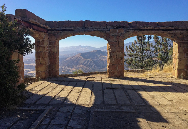
Knapp’s Castle in Las Padres National Forest, California
The second hike was a 13 mile round trip hike up Little Pine Mountain that gained over 3,300 feet. The trail crosses through a lovely gold field.
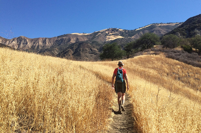
Jean on the trail to Little Pine Mountain in Las Padres National Forest, California
We did this same hike several years ago and there were parts of the trail I had conveniently forgotten about. The trail crosses a steep, and in some places unstable, slope. In the past extensive metal or wood barriers and supports were built in an attempt to stabilize the slope. However, they are proving to be ineffective and apparently no attempt is currently being made to repair or replace them. Several times we had to cross steep loose gravelly sections. A slip and fall over the embankments to the steep rocky slope below probably wouldn't kill you but it could certainly cause some inconvenient injuries.
Jean on the trail to Little Pine Mountain in Las Padres National Forest, California
However, we enjoyed the expansive view from the top.
Seen from Little Pine Mountain in Las Padres National Forest, California
I'm not sure how Little Pine Mountain got its name but it is not due to the size of the cones from the Coulter Pines trees. All of our photos taken in Las Padres National Forest are on Flickr.
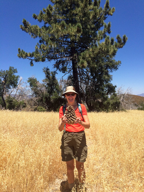
Jean with Coulter Pine cone on Little Pine Mountain in Las Padres National Forest, California
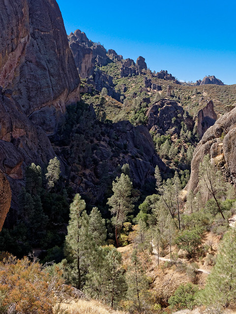
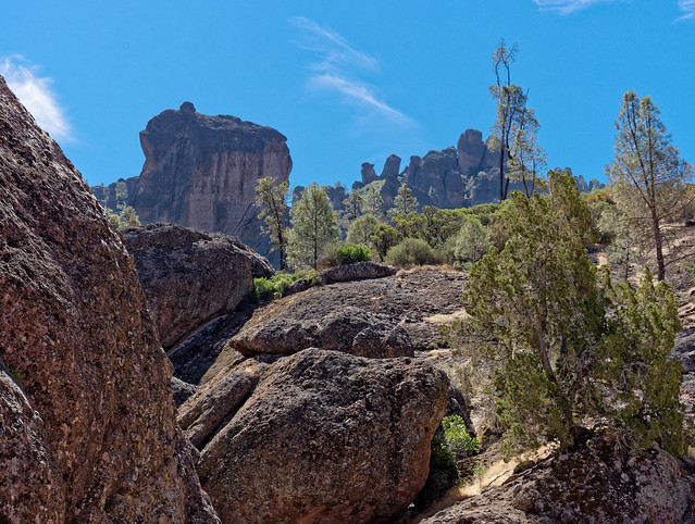
We continued our slow progress north and stopped at Pinnacles National Park. This small park was previously a national monument before being elevated to a national park in 2013. We did one dayhike, a 10 mile loop gaining 2,100 feet in elevation. We first took the Balconies Cave Trail. It is not so much a trail through a "cave" as it is a scramble through the gaps under and between a jumble of boulders that have fallen into a narrow canyon.
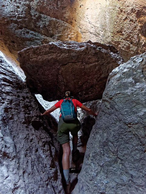
Jean in Balconies Cave in Pinnacles National Park, California
We continued on to the Balconies Cliff Trail ...
Seen from the Balconies Cliff Trail in Pinnacles National Park, California
... before going on to the Juniper Canyon Trail. While it is a beautiful area and we enjoyed our hike we are not sure it warrants national park status. All of our photos taken in Pinnacles National Park are on Flickr.
Seen from the Juniper Canyon Trail in Pinnacles National Park, California
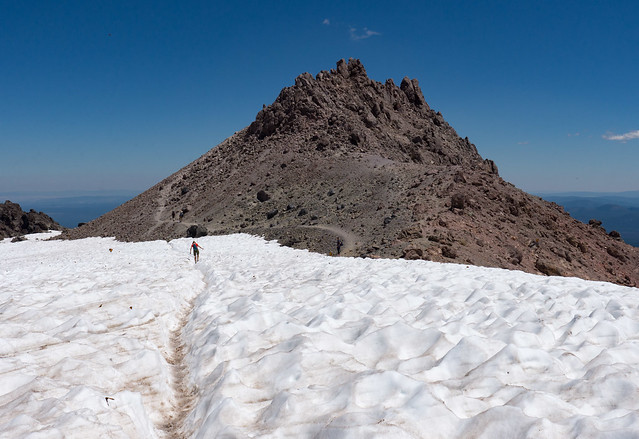
We continued north and our next stop was Lassen Volcanic National Park. The first hike we did was to the top of Lassen Peak. It is only five miles round trip but it gains 2,000 feet so it is steep. This is probably the most popular hike in the park so not surprisingly it was crowded.
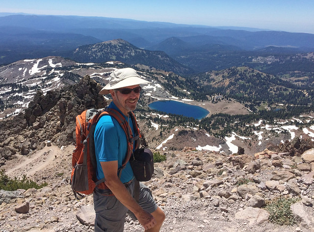
John on trail to Lassen Peak in Lassen Volcanic National Park, California
An unexpected treat was the presence of thousands of butterflies swirling around the rocky slope like heavy snow flurries. Unfortunately, photographs don't do the phenomenon justice.
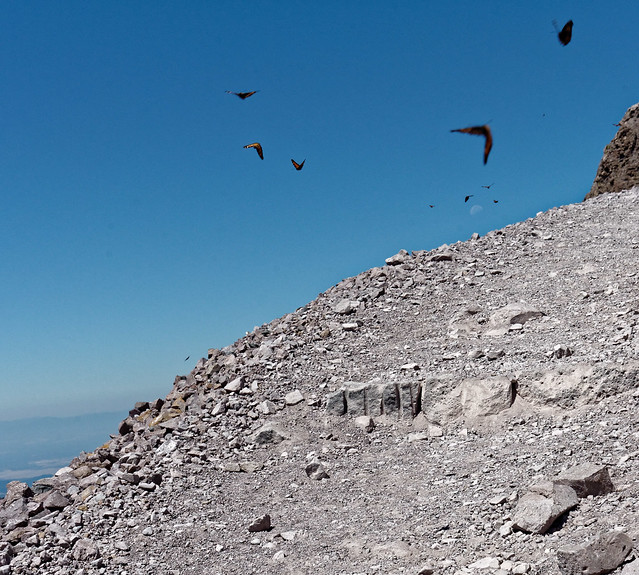
Butterflies on Lassen Peak in Lassen Volcanic National Park, California
The trail is quite good nearly all the way up but does require some scrambling at the top.
Jean approaching summit of Lassen Peak in Lassen Volcanic National Park, California
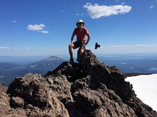
John decided he wanted to sit on the true summit ...
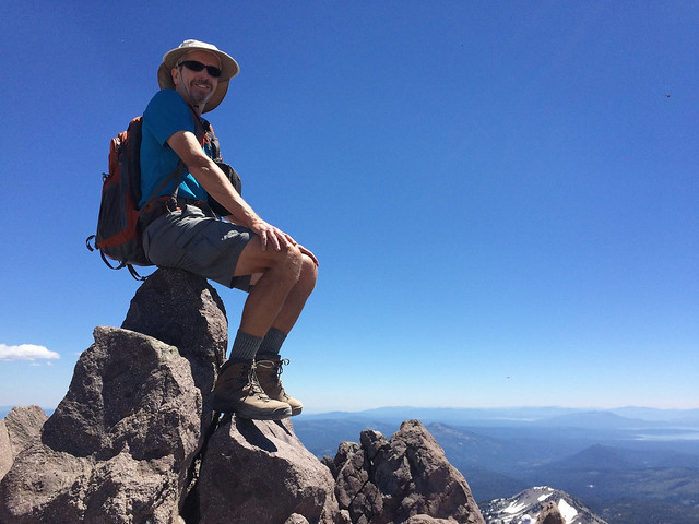
John on the summit of Lassen Peak in Lassen Volcanic National Park, California
... but I was content to forgo that final effort. The views were just as good where I was and I found a perfectly comfortable rock to sit on.
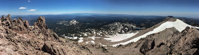
View from Lassen Peak in Lassen Volcanic National Park, California
We had been to Lassen back in 1992 when our kids were small, Dan was seven and Tom almost five. I don't know what we were thinking but we took them on this hike. They did surprisingly well considering how steep it is as well as how boring of a hike it is for kids. However, they really enjoyed playing in the snow near the top and we were soon engaged in a snowball fight with them. Uncharacteristically, both boys started throwing snowballs at another dad who was also having a snowball fight with his son but he was good natured about it. All went well until Tom threw a snowball at him which he simply caught. He immediately gently lobbed it back at Tom and it exploded on the middle of his chest. Although Tom seemed to handle it okay at the time he was apparently deeply offended by this. On multiple nights following this event when I was trying to get him to go to sleep he kept up a monologue of angry sobs "I'm goin' make a rule, a guy can't catch your snowball and throw it back at you, I'm goin' make a rule". It is one of those childhood stories Tom is sick of hearing about but when I texted him from the summit telling him where we were his response was "Did they make that rule yet"?

Tom and Dan on Lassen Peak in Lassen Volcanic National Park, California
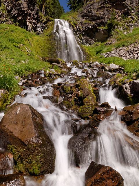
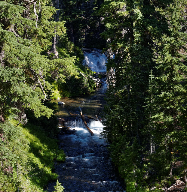
Another hike we did was a short one to the lovely Kings Creek Falls.
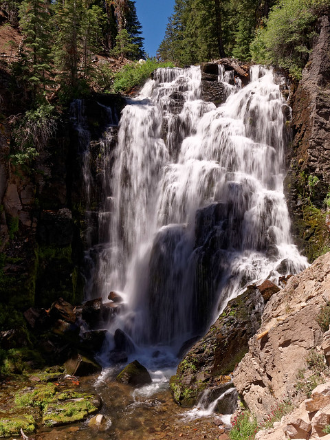
Kings Creek Falls in Lassen Volcanic National Park, California
We also visited Bumpass Hell, a geothermal area in the park. There are two ways to get there; the popular short way and a longer trail that starts at the Kings Creek Picnic area. This longer trail first goes to "Boiling Lake" which sounded like something worth seeing. But it was a bit of a disappointment as it is basically a small lake with a few gas bubbles erupting in the muddy shallows. However, it is a nice woodsy hike and by continuing on you will eventually get to Bumpass Hell. The trail brings you to a place where you get an expansive view ...
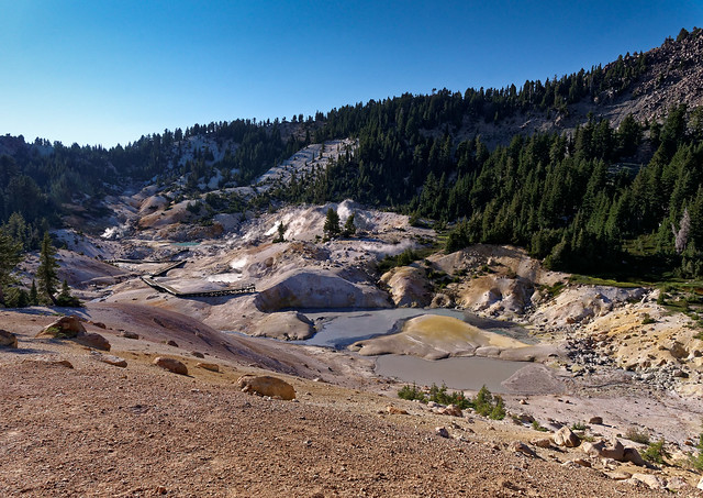
Bumpass Hell in Lassen Volcanic National Park, California
... before dropping you down to the boardwalk.
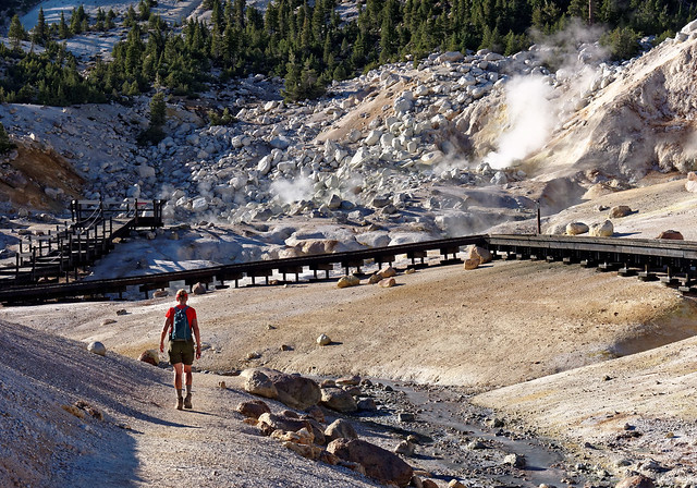
Bumpass Hell in Lassen Volcanic National Park, California
While it lacks the vibrant colors of the geothermal areas in Yellowstone National Park the more subtle colors do have a beauty all their own.
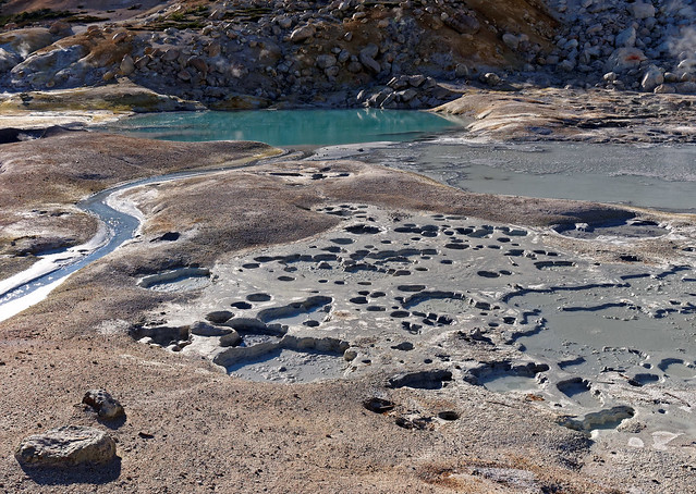
Bumpass Hell in Lassen Volcanic National Park, California
We were there during our favorite time of day, late evening during what photographers call the "Golden Hour".
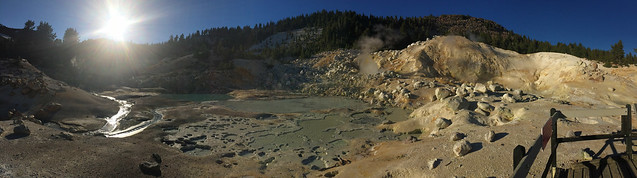
Bumpass Hell in Lassen Volcanic National Park, California
The next hike we did was to Brokeoff Mountain. I'm surprised this hike is not more popular as we thought it was much more scenic than the hike up Lassen Peak but we certainly enjoyed the solitude. After spending so much time in southern California it was a treat to be hiking through the trees and it initially reminded us of the North Cascades. However, as the trail ascended it reminded us more of hiking up some of Colorado's "14ers".
Jean on the trail to Brokeoff Mountain in Lassen Volcanic National Park, California
It is 7.4 miles round trip with 2,600 feet of elevation gain. Once at the top we had a great view of Lassen Peak.
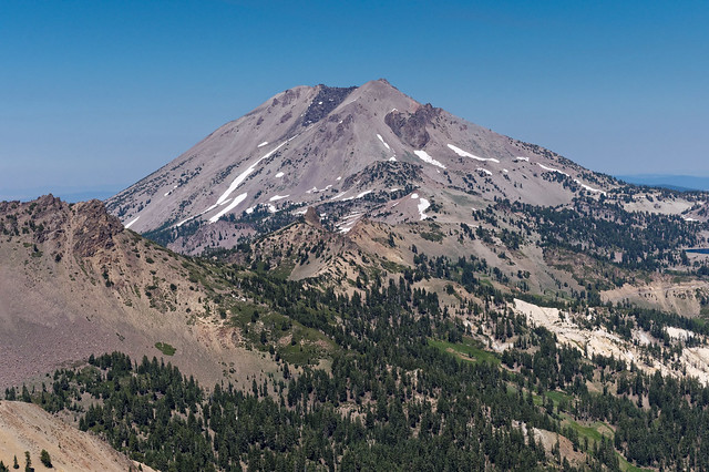
Lassen Peak seen from Brokeoff Mountain in Lassen Volcanic National Park, California
After taking in the views we did something we don't normally do while hiking. Taking advantage of cell service, something we didn't have in the campground, we both checked email and got caught up with the news (it was during the Democratic National Convention). All of our photos taken in Lassen Volcanic National Park are on Flickr.
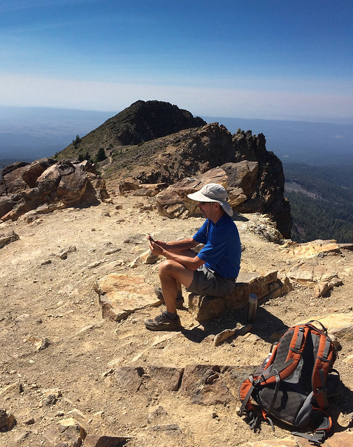
John reading the news on Brokeoff Mountain in Lassen Volcanic National Park, California
After leaving Lassen we continued on to Crater Lake National Park in Oregon. Unfortunately we were there when the Bybee Fire was burning west of the lake.
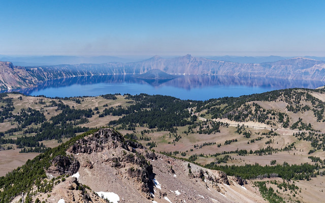
Crater Lake in Crater Lake National Park, Oregon
However, we had visited Crater Lake in June of 2010, our first summer living and traveling in a motorhome, so have had the opportunity to see it with crystal clear skies.
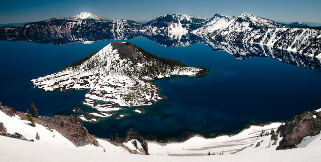
Crater Lake in Crater Lake National Park, Oregon
As it was clear east of the lake we headed out the East Rim Road and visited Plaikni Falls ...
Plaikni Falls in Crater Lake National Park, Oregon
... as well as the Pinnacles.
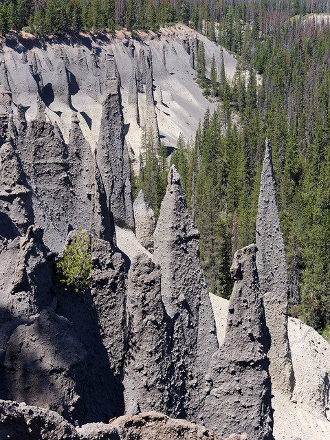
Pinnacles in Crater Lake National Park, Oregon
We wanted to hike up Mt Scott and it initially looked clear. However, by the time we had eaten lunch and driven to the trailhead we were dismayed to see that Mt Scott was now enveloped in smoke. So we returned to Rim Village with the plan to hike up Mt Garfield. However, once we got to that trailhead it was smokey there as well so we decided to leave the park for the day. However, as we were heading back to our car we began hearing music. What we didn't know was that there was a special event taking place, the Britt Crater Lake Project, which consisted of performances by different ensembles throughout the park. What we happened upon was a performance of the Britt Orchestra. They were performing the world premiere of "Natural History", a piece composed by Michael Gordon that had been commissioned by Britt and was inspired by Crater Lake. It was unusual as the musicians were not all standing or sitting together. The audience was literally in the middle. It was true "surround sound". There was also a choir as well as the Klamath tribes drum circle (which was our favorite part).
Britt Orchestra performing in Crater Lake National Park, Oregon
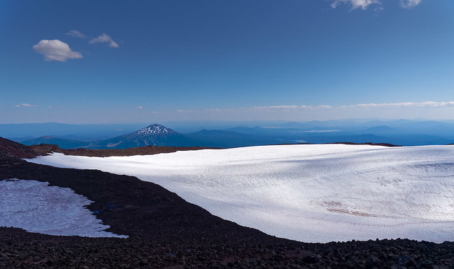
The following day we again drove to the Mt Scott trailhead and were relieved to see it was not smokey so we did the hike to the top. Mt Scott is the highest peak in the park but it is a short hike, only about five miles round trip with 1,200 feet of elevation gain. As we had time after completing this hike we drove back to Rim Village to see if it would be possible to hike up Mt Garfield but smoke was still a problem. We will just have to wait to do that during a future visit. All of our photos taken in Crater Lake National Park are on Flickr.
View from Mt Scott in Crater Lake National Park, Oregon
We then headed to Bend, Oregon where we planned to do some hiking in the Three Sisters Wilderness. The first was up to Black Crater. It is seven miles round trip and gains 2,350 feet.
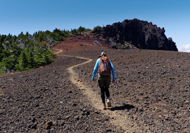
Jean on the trail to Black Crater in three Sisters Wilderness, Oregon
As the volcanic rock we were walking on was red I was confused about why this mountain was named "Black Crater". That is until I saw the actual black crater.
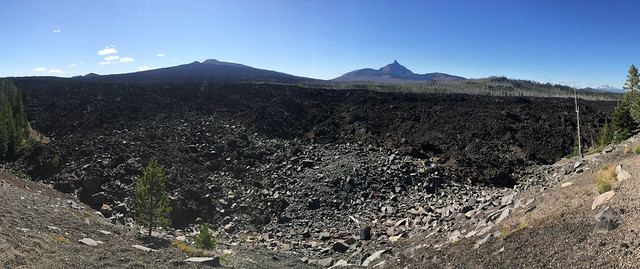
Black Crater in Three Sisters Wilderness, Oregon
It was quite windy and we both felt cold (unfortunately, our time in Southern California had caused us to lose our ability to handle cold). But the views of distant mountains made up for it; North Sister, Mt Washington ...
North Sister and Mt Washington seen from Black Crater in Three Sisters Wilderness, Oregon
... Three Fingered Jack and Mt Jefferson.
Three Fingered Jack and Mt Jefferson seen from Black Crater in Three Sisters Wilderness, Oregon
After taking some time to enjoy the views I hunkered down between some rocks to try to get out of the wind while John took photos.
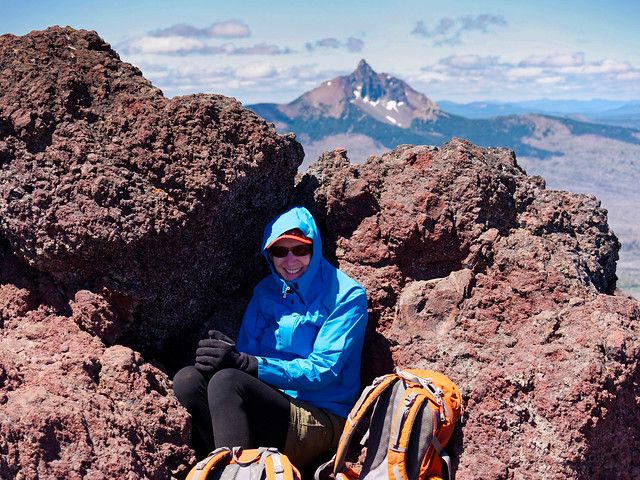
Jean on Black Crater (with Mt Washington in the background) in Three Sisters Wilderness, Oregon
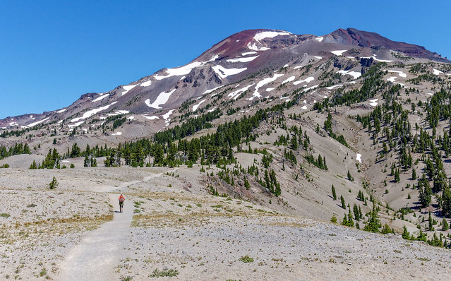
The next hike we did was to the top of South Sister. At 10,358 feet it is the third tallest mountain in Oregon. We started out on the Green Lakes Trail which begins with a long traverse through the woods. We knew we had to gain a lot of elevation and were surprised that we weren't gaining much at all for the first few miles. What we realized later was we had intended to take the Devil's Lake Trail which is shorter and steeper from the outset. It is 11.8 miles round trip and gains 4,900 feet. However, the way we were going was 15.5 miles round trip and gained 5,000 feet. But we were committed and decided a few extra miles wouldn't hurt us in. We knew we would appreciate that easy traverse later on the way out when we would undoubtedly be tired from the long day.
Seen from the Green Lakes Trail in Three Sisters Wilderness, Oregon
The trail did eventually start gaining significant elevation and brought us to Moraine Lake. As the terrain was opening up we began getting views of South Sister ...
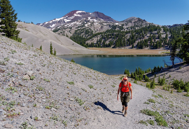
Jean on the trail to South Sister in Three Sisters Wilderness, Oregon
... as well as Broken Top.
Broken Top and Moraine Lake seen from trail to South Sister in Three Sisters Wilderness, Oregon
We continued up and got a good look at our ultimate destination. The trail along this part is great; wide, hard packed and smooth. It is important to enjoy trail surfaces such as these while you have them ...
Jean on South Sister in Three Sisters Wilderness, Oregon
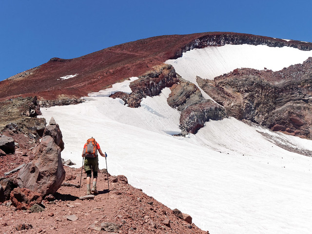
... because they don't last forever. The last two miles to the summit consists of loose rock, scree, gravel and dirt. It is very steep and results in a certain amount of slipping back with almost every step.
South Sister in Three Sisters Wilderness, Oregon
It was discouraging at times. I still wasn't in great shape but I couldn't stand the thought of not getting to the top. I knew if I just kept putting one foot in front of the other we would eventually get there.
South Sister in Three Sisters Wilderness, Oregon
The "trail" deteriorates markedly and becomes a series of braided tracks. This is a popular destination and is very crowded on weekends. But we were there on a weekday so it wasn't too bad.
South Sister in Three Sisters Wilderness, Oregon
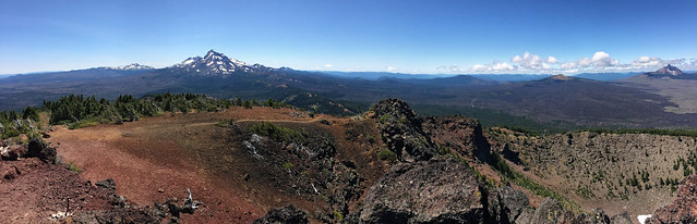
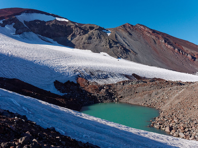
The last ¼ mile of the trail is a traverse around the snow filled crater. We got a good view of Mt Bachelor in the distance.
Mt Bachelor seen from summit of South Sister in Three Sisters Wilderness, Oregon
Most agree it requires a huge effort to get to the summit but all agree the views make it well worth the effort. We could see the nearby Middle Sister and North Sister as well as Three Fingered Jack, Mt Jefferson and Mt Hood in the distance (although the haze makes it a little difficult to see them).
Middle Sister, North Sister, Three Fingered Jack, Mt Jefferson and Mt Hood in the distance seen from South Sister in Three Sisters Wilderness, Oregon
I was initially concerned about how late it was by the time we finally got to the summit but then I reminded myself that we had enough clothes to stay warm as well as good headlamps. A little more food would have been nice but I knew we wouldn't starve. The priority was to get off the loose stuff and back to a decent trail before dark and we had no trouble with that. We did hike the last several miles in the dark but that long traverse through the woods was easy. Although, we discovered we had to watch our step as there were several large toads on the trail. We stopped to look at them but surprisingly neither of us thought to try to get a picture. I think that is a a good indicator as to how tired we were by then.
South Sister in Three Sisters Wilderness, Oregon
We had visited this area in June 2010 and attempted a snowshoe trip up South Sister. The weather was overcast but we hoped it would clear as we gained elevation. But instead, the cloud level lowered. Our goal became to simply gain enough elevation to get a good workout before turning back. However, as the day wore on our definition of what constituted a "good workout" decreased. To give you an idea of how dismal it was this is the only photo John took that day.
Seen while snowshoeing up South Sister in Three Sisters Wilderness, Oregon
However, a few days before that we had great weather and had snowshoed up Mt Bachelor where John took this photo of the Three Sisters; South, Middle and North. I do wish whoever named the individual mountains had come up with more imaginative names for these beautiful peaks. All of our photos taken in the Three Sisters Wilderness are on Flickr.
South, Middle and North Sister seen from Mt Bachelor in Three Sisters Wilderness, Oregon
We continued north to Washington State. Our son Tom had been accepted to Eastern Washington University and we volunteered to help him relocate. Our first task was to drive to Cheney to find him an apartment as he was tied up with school in Bellingham and couldn't do it himself. Once that was accomplished we headed west to visit John’s sister in Lacey. Then our son Dan came for a visit from Pittsburgh. After picking up Tom the four of us headed to Skagit River Resort near Marblemount. While we were there John and Dan did a hike to Cascade Pass and Sahale Arm in North Cascades National Park.
Seen on hike to Cascades Pass and Sahale Arm in North Cascades National Park, Washington
Views in the North Cascades never disappoint.
Seen on hike to Cascades Pass and Sahale Arm in North Cascades National Park, Washington
This was a hike John and I have done before, most recently three years ago. However, partway up on that trip we were caught in a sudden downpour so we turned around. Once back at the car (and soaking wet) we headed out toward a nearby campground where our warm dry motorhome waited for us. But we didn’t make it, at least not that day. We were shocked to discover the road from the trailhead had just washed out. So we, along with 70 other equally wet hikers, spent the night in our cars in the parking lot. The next morning we walked down the road to see if it would be possible to wade across the creek but it looked too deep and too fast to safely attempt. We nervously watched an undaunted climber slowly make his way across the raging creek and were greatly relived when he finally reached the other side. But this did not change our minds about trying it ourselves.
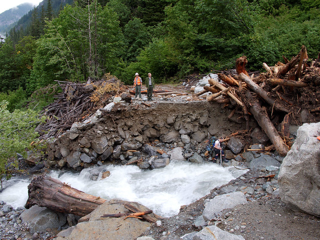
Boston Creek washout in North Cascades National Park, Washington
Lucky for us just a short ways downstream a tree had fallen across the creek and we were able to scoot across it to the other side. It was great to get back to our motorhome and hot showers, dry clothing and, most importantly, food.
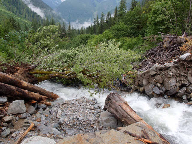
Boston Creek washout in North Cascades National Park, Washington
Fortunately for everyone else still stranded in the parking lot helicopters dropped meals (donated by area restaurants) and other essential items (such as toilet paper). In addition work crews were able to complete a temporary crossing later in the day so everyone else was able to leave. All of our photos taken on these hikes to Cascade Pass are on Flickr.
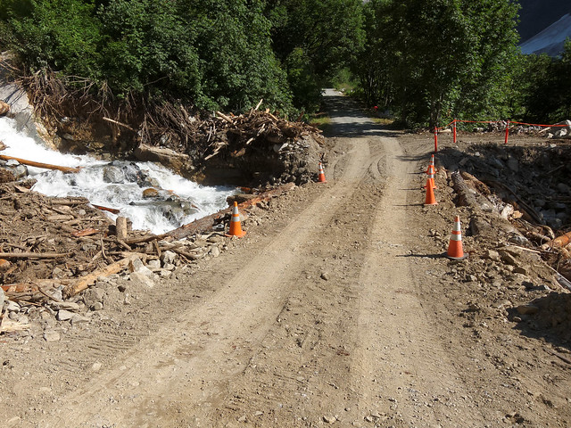
Temporary rod across Boston Creek in North Cascades National Park, Washington
After taking Tom home to Bellingham Dan, John and I planned to do a dayhike to Lake Ann in the Mt Baker Wilderness. However, we ignored a sign announcing a road closure. Unfortunately all three of us failed to check the current date and assumed the closure would not be until the following day. Once confronted with a roadblock we changed our plan and hiked to Hannegan Peak instead. It is 10.4 miles with 3,100 feet of elevation gain.
Dan and John on the trail to Hannegan Pass in Mt Baker Wilderness, Washington
But this is also a worthy hike with one great view ...
Seen from the Hannegan Pass Trail in Mt Baker Wilderness, Washington
... after another.
Seen from the Hannegan Pass Trail in Mt Baker Wilderness, Washington
All of our photos taken in Mt Baker Wilderness are on Flickr.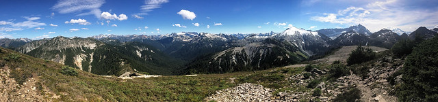
Seen from the Hannegan Pass Trail in Mt Baker Wilderness, Washington
After Dan went home we helped Tom move to Cheney (our motorhome works great as a moving van). While in the area we scouted out Farragut State Park in nearby Idaho. We are always on the lookout for a good place for our family summer vacations; someplace with cabins for the boys to stay in (our motorhome is not quite big enough to comfortably accommodate the addition of two good sized guys), someplace for Tom to play Disc Golf and someplace to go hiking. Farragut has all three. We checked out the hiking options and did a dayhike to the top of nearby Scotchman Peak. This sign should have been a big indicator as to what we would encounter.
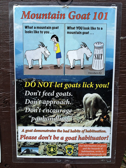
Sign at trailhead for Scotchman Peak within (proposed) Scotchman Peak Wilderness, Idaho
Mountain Goats, ...
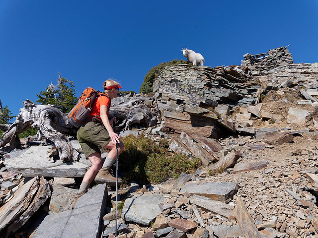
Scotchman Peak within (proposed) Scotchman Peak Wilderness, Idaho
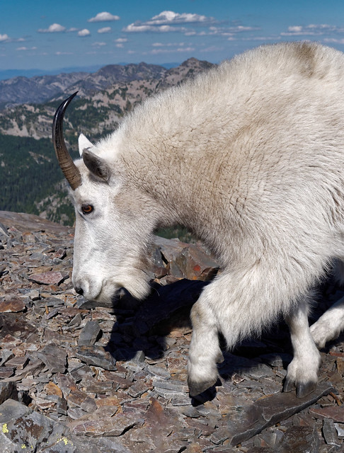
... many Mountain Goats. These were the least shy Mountain Goats we have ever encountered. I was reminded of what the sign said, "DO NOT let the goats lick you!" We are well accustomed to having goats seek out places where either of us has just urinated but this was the first time I have been around goats that wanted to lick me.
Scotchman Peak within (proposed) Scotchman Peak Wilderness, Idaho
There is a small shelter that was laboriously constructed at the top and we took refuge in it to get out of the wind and eat a snack. While the shelter itself is quite sturdy it has remnants of a carelessly constructed wooden roof. Before long a goat approached the shelter from above and started to step on the precarious roof (perhaps to scare us out of it). It made me glad I had my trekking poles with me to try to deter the goat's advances.
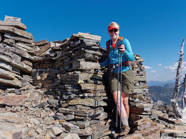
Scotchman Peak within (proposed) Scotchman Peak Wilderness, Idaho
We didn't spend much time on the summit. The views were not really up to our standards. We are quite spoiled and the North Cascades are very hard to beat. However, we could see Lake Pend Oreille in the distance although it was hazy ...
Lake Pend Oreille seen from Scotchman Peak Trail within (proposed) Scotchman Peak Wilderness, Idaho
... and it appeared there was a fire in the distance. All of our photos from our Scotchman Peak hike are on Flickr.
Scotchman Peak within (proposed) Scotchman Peak Wilderness, Idaho
By then it was mid September and we began to make our way slowly south. We decided to travel down the Oregon coast but the Pacific Northwest soon shifted into typical fall weather, wet and grey. We attempted a dayhike up Neahkahnie Mountain but we were in a cloud with enough rain drops to cause us to put on our parkas. Once at the top we could not see anything and the wind drove us back down the trail. We had to rely of our memories of the last time we were there.
John and Jean on Neahkahnie Mountain, Oregon
We then spent several days in our cozy motorhome listening to almost continuous rain. At least it did give us time for John to finish editing his photos and to post them and for me to write the blog. My goal was to be completely caught up before getting back to Jojoba Hills where we will shift into our "summer camp for old people" mode (and I will find out if I need surgery on my shoulder). While it was not a typical summer for us we had fun and enjoyed our time spent with family. And if all goes as planned we have something big to look forward to next summer.
The next bit is just something Jean has been thinking about.
Live long and prosper!
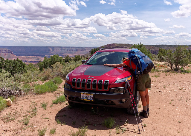
In the past I have not thought much about dying. Getting older, yes, but not about my life actually ending any time soon. Beyond keeping a current will I just haven’t had to. In fact I’ve made light of the subject. More than once I have said that when I “kick the bucket” I hope I do it with my hiking boots on. However, that flippant attitude changed during our misadventure while on an a backpack trip we did last year in Grand Canyon National Park when I thought I was going to get my wish.
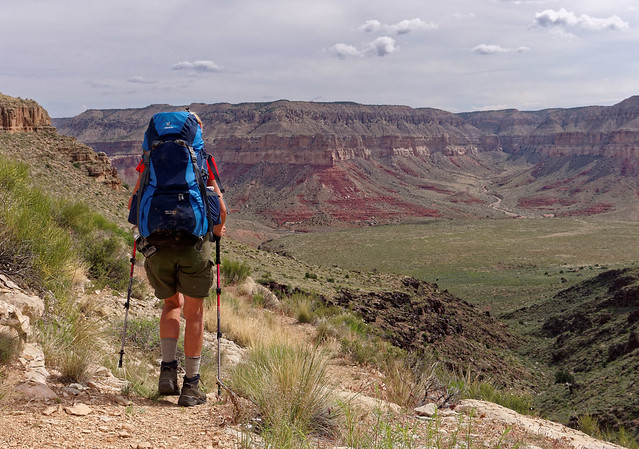
Jean on the Tuckup Trail in Grand Canyon National Park, Arizona
It was the fourth day of an adventurous trip on an unofficial route in Grand Canyon. We first hiked down Tuckup Canyon and then followed the Colorado River downstream to where we planned to hike up and out of Stairway Canyon. All went well until we found ourselves at the bottom of a 50 foot pour-off deep within Stairway. We knew there are ways to get up and over it as we had read accounts by people who had done it.
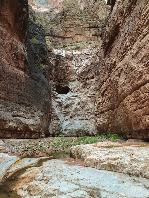
Pour over in Stairway Canyon in Grand Canyon National Park, Arizona
However, try as we might, we just couldn’t find anything either of us thought we could climb safely. So we were finally forced to make the very demoralizing decision to turn around and go back the way we came. At that point we were perched at the top of a steep loose slope high above the canyon floor and I dreaded climbing back down the treacherous slope. I knew a fall and serious injury was a real possibility and we were miles from nowhere in a deep narrow canyon where our personal locator beacon would not have worked. This is a rarely traveled route so it was unlikely anyone would happen by anytime soon. In addition it would be days before John’s sister would make an “overdue hiker” report to the Park Service if she didn’t hear from us.
I tried to be very careful on the way down but, despite my caution, I did fall. Fortunately, I only sustained minor injuries, some lost skin and blood. However, during the brief period of time between when the rock I was holding on to gave way and when I stopped sliding down the slope (on my back head first) I thought I was going to die. Immediately afterward, once I came to a stop and realized I wasn't seriously hurt (only lost skin and blood), I felt a great sense of relief and joy. It was one of the most intense emotions I have ever felt. It took us three days to get back to the trailhead and I was so happy when we reached our trusty Jeep that I burst into tears.
Jean and “Rocky” at the Tuckup Trailhead in Grand Canyon National Park, Arizona
I have thought about that experience many times since then. I have thought about how much I was enjoying my life with John and about all the adventures we haven’t had yet. I have thought about how much I wanted to see how our son’s lives continue to evolve. So I began to wonder realistically just how much more time I might have. Granted there are situations well out of our control such as the dangers of sharing the road with distracted drivers. In addition there are well documented environmental conditions that can negatively impact one’s health. And then there are genetics (although according to the “Danish Twin Study” only about 10 percent of how long we might live is determined by our genes).
I have seen estimates for life expectancy in the US ranging from 78.74 to 86.4 years depending on the source of information. However, none indicate how many of those years might be spent in reasonably good health. Too many of our elderly, while still "alive", are not truly "living". It has made me wonder if there are choices I can make now that will increase the probability I will live a long and high quality life. The first thing that came to mind was a fad I heard about many years ago - “Life Extension”. Wikipedia states “Life extension science... is the study of slowing down or reversing the processes of aging to extend both the maximum and average lifespan. Some researchers in this area … believe that future breakthroughs in tissue rejuvenation, stem cells, regenerative medicine, molecular repair, gene therapy, pharmaceuticals, and organ replacement … will eventually enable humans to have indefinite life spans through complete rejuvenation to a healthy youthful condition” (more information is available from the Life Extensions Foundation). But this is still way too futuristic to be of any benefit to me now. I could go to Life Extension and shop for supplements purported to extend one’s life. However, this just doesn’t seem like the right approach and it sounds expensive. I have also read that a calorie restricted diet could lead to better health and longer life. However, I don’t see how it can work with physically demanding activities such as hiking and backpacking (besides I really enjoy food). Then while researching a different topic I came across a TED Talk titled “How to live to be 100+”.

From it I learned about some research that was done on several geographical areas and communities from around the world that contain a larger percentage of centenarians. These pockets of long lived people where termed “Blue Zones”. So I read the book “Blue Zones” - 9 Lessons for Living Longer from the People Who've Lived the Longest”. It was written by Dan Buettner and is based on the extensive studies he did in four areas in different parts of the world; the island of Sardinia off of the coast of Italy, the main island of Okinawa in Japan, a community of Seventh-Day Adventists in Loma Linda, California and the Nicoya Peninsula in Costa Rica. His research is based on objective measurements as well as the subjective memories of the centenarians. It makes for interesting reading especially when the author recounts individual interactions he had with many mentally sharp and joyful centenarians.

However, one can skip to the last chapter where the author describes the “Nine Lessons” referred to in the title. The first four offer no great revelations as they involve diet and exercise. The first is to “move naturally” and the author makes the point that a gym membership and strenuous exercise sessions are not necessary for long life. The premise is that individuals can incorporate movement into their day to day lives. Examples given are small things like taking the stairs, not using a remote control when watching TV and not using a garage door opener. Perhaps most beneficial is to simply walk more. But basically, any movement is beneficial. For example the centenarians in Okinawa frequently sit on the floor. Getting up and down throughout the day helps them to maintain lower body strength and balance which helps to prevent falls, the bane of existence for many seniors. Many of the centenarians in the Blue Zones maintain gardens which encourages a full range of motion. They also tend to walk a lot. The bottom line is that many small actions done many times every day can add up to something large enough to improve one’s health and increase longevity.

The next three lessons have to do with one’s diet. The people who live within the Blue Zones typically eat a more plant based diet. They consume more fresh fruits and vegetables (another positive result of maintaining gardens). Meat is reserved more for special occasions or used as a condiment to flavor foods rather than being an entrée. The third lesson is that people who live in Blue Zones consume moderate amounts of alcohol, red wine in particular. The fourth involves a saying that the Okinawans have, “Hara Hachi Bu”. It means one should only eat until you are almost full. This is good advice as it takes 20 - 30 minutes for the brain to recognize that the stomach is actually full.

The fifth lesson is in regards to the importance of having a purpose to one’s life. In Okinawa there is a word to describe it; “ikigai”, which translates into “Why I wake up in the morning”. A common characteristic of people living in the various Blue Zones is they feel a deep sense of purpose. In addition, the cultures within the Blue Zones typically revere their elders rather than shunt them into assisted living facilities or nursing homes as is all too common in our current society. The sixth lesson describes the importance of relieving stress.
I admit I was not overly impressed with these first six lessons. They just seemed like good common sense. However, the remaining three have given me much to think about. Lesson number seven is that the people in all of the Blue Zones are part of a spiritual community. The next lesson is to put loved ones first and make family a priority. The last lesson is to find the right “tribe” and to be a part of a "community".
I have thought about these nine lessons and wondered how I could follow them in order to create my own personal “Blue Zone”. I think I have been largely following the first three by eating well and being physically active. However, I have never been much of a wine drinker but maybe I need to rethink that. If it will help to extend my life it might be a “sacrifice” worth making. As to my “ikigai”, my reason to wake up in the morning, I am fortunate to have many. Being able to spend more time with John tops the list.
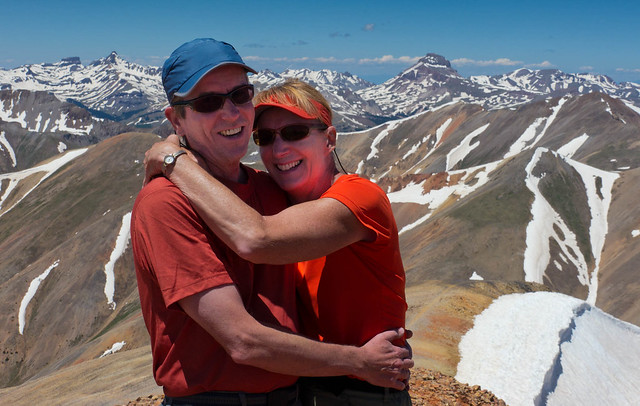
John and Jean on the summit of Redcloud Peak (14,035 ft) in Colorado
And I want to continue watching our son’s lives unfold.
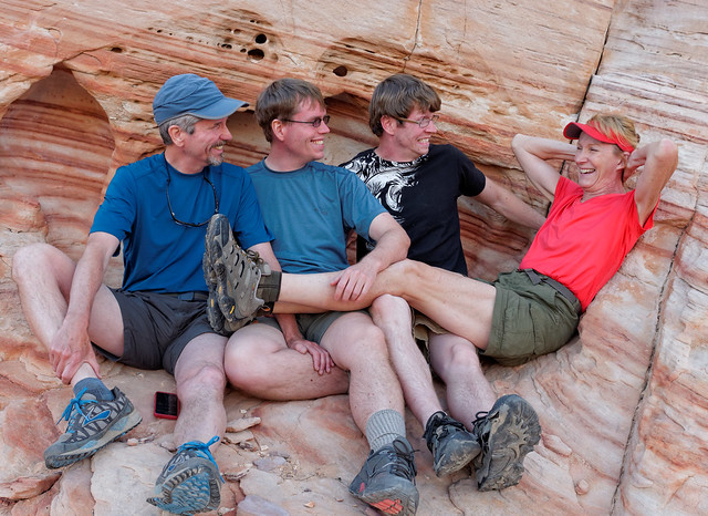
The Strother family at Valley of Fire State Park, Nevada
Also there is still more of the natural world I want to see as well as places I would like to see again.
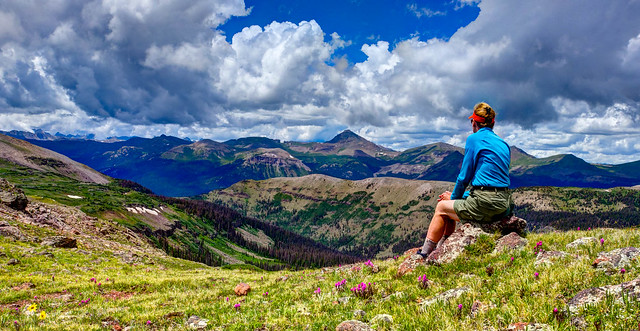
Jean in the Weminuche Wilderness, Colorado
Regarding reducing stress, retirement and living fulltime in an RV has been great. The most stress we experience is finding gas stations where we can get our motorhome (while towing our car) into and out off safely.
Our campsite at the Hoh Rainforest in Olympic National Park, Washington
But when it comes to being a part of a “spiritual community”, well, this is a tough one for me. I have made no secret about my lack of belief in an anthropomorphic god or in any of the organized religions that many people choose to believe in. I have jokingly said the closest thing I have to a religion is “Jediism” (something I have already written about). However, I have not been a part of what is apparently an organized belief. Hopefully “failing” this lesson won’t have too great of a negative impact on my longevity. But maybe I am wrong. Maybe the simple belief there is a power in the universe, a “force” that can be tapped into, does count for something.

When it comes to making family a priority and putting them first I am doing much better than I used to. I grew up in a large “Great American Dysfunctional Family” and wasn’t close to my parents or any of my five siblings. As a young adult I left my home state of Kentucky with John and moved clear across the country to Washington State. I thought John was all the family I needed and limited my visits back east to visit my parents and siblings. However, I did eventually craft relationships with my mother and sisters. I believe John and I have always had good relationships with our two sons. Although, there is one aspect to this lesson that I don’t see our being able to follow. Blue Zone centenarians frequently live with their children and are cared for by daughters or daughters - in - law. I hesitate to plan to depend on either of our sons or their potential future wives to care for us in our later years. It is simply no longer our cultural norm.
That brings me to the last lesson, the one about finding one’s “tribe” and being part of a "community". I realized I wasn’t unfamiliar with this lesson as I had read elsewhere the connection between having a strong sense of belonging to a community and one’s longevity. In Malcolm Gladwell’s book, "Outliers", he described something known as the “The Roseto Effect”. This phenomenon, named for Roseto, Pennsylvania, is where the people (who are of Italian decent) in the community experienced a reduced rate of heart disease. Gladwell states “This was the 1950s, years before the advent of cholesterol lowering drugs and aggressive measures to prevent heart disease. Heart attacks were an epidemic”. Despite the fact that the Rosetans' indulged in many eating, drinking and smoking habits that were not conducive to good health, most of them were dying of old age. In addition “there was no suicide, no alcoholism, no drug addiction, and very little crime”. Researchers could not find any diet, exercise, genetic or regional components to attribute these qualities to. Their conclusion was that it was the close knit community of Roseto itself that enabled the inhabitants to enjoy not only a longer life but a high quality life as well. This Huffington Post article, "The Mystery of the Rosetan People", put it “In short, Rosetans were nourished by people”.

Roseto, Pennsylvania - source of photo
When doing research for another blog post I came across this interesting abstract, “Social Relationships and Health: A Flashpoint for Health Policy”. It begins by stating “Social relationships - both quantity and quality - affect mental health, health behavior, physical health, and mortality risk.” A post titled “Social Ties are Good for Your Health” on a Stanford University sponsored site, “Be Well @ Stanford”, was equally interesting. It begins with “We may all know that relationships with friends and family add immensely to the quality of life. But did you also know that such social ties can help us live longer?” While reading “Cure: A Journey into the Science of Mind Over Body”, a book by Jo Marchant, I learned that social isolation can actually be detrimental to health. Referring to a 30 year study done by James House, an epidemiologist at University of Michigan, the author states that “They concluded social isolation is as dangerous for health as obesity, inactivity and smoking”. His research has been confirmed by further studies. The author writes that "In 2010 U.S. researchers analyzed 148 studies following more than 308,000 people and concluded that lacking social bonds doubles the risk of death from all causes".
So it may be possible this last lesson is the most important one but following it will be a challenge for me. Growing up I didn’t really feel connected to anything or anyone. As adults, John and I lived in a house in a typical suburban neighborhood but we barely knew our neighbors and it was definitely not what could be called a “community”. Once we started living and traveling fulltime in an RV the possibility of being part of a close community became impossible. Granted, we met people during our travels but the interactions were short lived. In fact the primary goal of our travels has been to seek solitude. Not just while backpacking ...
John and Jean at Cape Solitude in Grand Canyon National Park, Arizona
… but where we parked our motorhome for the night as well.
Our campsite in Wrangell – St Elias National Park, Alaska
Regarding finding our “tribe”, well, I believed I had already found it - other backpackers (something I have written about). But the truth is we have very little face to face contact with them and my primary way to “connect” with other backpackers has been through the internet. I belong to a Yahoo Group, a Google Group and two Facebook Groups all related to hiking and backpacking. I read posts made by others and I occasionally contribute. I also periodically check “Camping and Hiking” on Reddit to see if there are any questions I can help answer.
But then, while researching a different topic, I read about a book by Sherry Turkle, a psychologist and professor at M.I.T. Her book, “Alone Together: Why We Expect More from Technology and Less from Each Other”, is based on 15 years of research and hundreds of interviews with adults, teens and children. In it she states we are now “drawn by the illusion of companionship without the demands of intimacy” and that we “confuse the scattershot postings on a Facebook wall with authentic communication”. She writes that people are not making as many phone calls and that we choose keyboards over the human voice as it is more efficient.
In her New York Times op - ed, “The Flight From Conversation”, she wrote “We live in a technological universe in which we are always communicating. And yet we have sacrificed conversation for mere connection”. She states that “face-to-face conversation unfolds slowly. It teaches patience. When we communicate on our digital devices, we learn different habits. As we ramp up the volume and velocity of online connections, we start to expect faster answers. To get these, we ask one another simpler questions; we dumb down our communications, even on the most important matters. It is as though we have all put ourselves on cable news...” She has also given a TED Talk,“Connected, but alone?”. In it she says “we're setting ourselves up for trouble, trouble certainly in how we relate to each other, but also trouble in how we relate to ourselves and our capacity for self-reflection”. It seems to me that our society has been working toward this for many years. It could be said the trend began with the advent of early electronic devices; first radio and then television, when people began to spend more time focused on them than they did sitting around talking with family, friends and neighbors.

Social interaction in the new millennium image by Tim Hartman
Well, this all gave me pause for thought. I looked closely at how digital devices and internet related activities impact my relationships with others especially my family. I do spend a lot of time on my computer; doing research and writing in addition to checking email, Facebook etc. But John, as an avid photographer, spends a great deal of time on his computer as well, editing and post processing photos and researching camera equipment. He is also news “junkie”. However, as we are able to spend a great deal of time together, we find plenty of time to talk especially while backpacking when we are completely without distractions.
John and Jean in Grand Canyon National Park, Arizona
Regarding family members I do use email to connect with some of them. And I have been known to send a text or two. However, with our sons and my closest sister I rely on long phone conversations as well as periodic visits. We manage to get together with our boys about two or three times a year. Although, when they come to visit they, of course, bring their gadgets and both can easily become totally engrossed in them.

Dan, John and Tom
And I admit there are times when John and I join them in being “alone together”.

John, Dan and Tom
However, we do make a point of doing things where we actually are together. Backpacking and dayhiking are activities we have done with them …
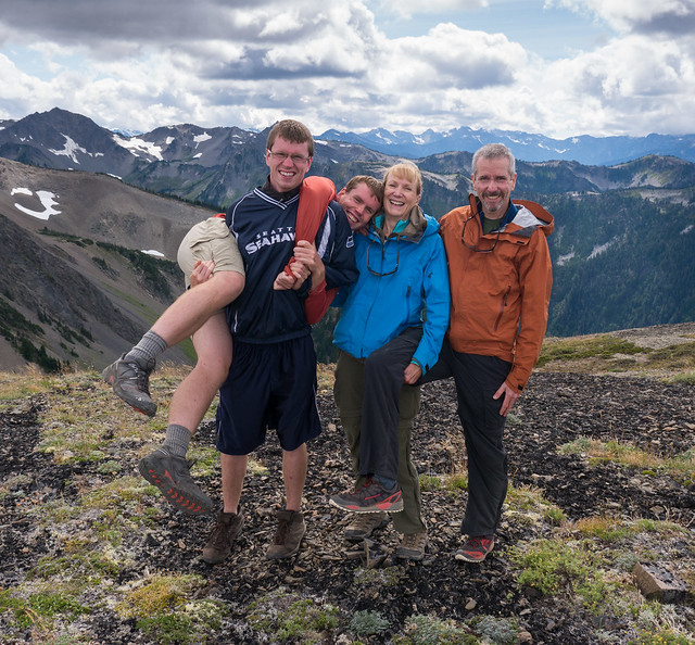
Tom, Dan, Jean and John in Olympic National Park, Washington
… almost their entire lives.

Tom, Dan, Jean and John at Shoshone Lake in Yellowstone National Park, Wyoming
We also play games together. When they visit us we sometimes have easy access to a Miniature Golf course. Granted, it is a silly game but it can be quite fun ...
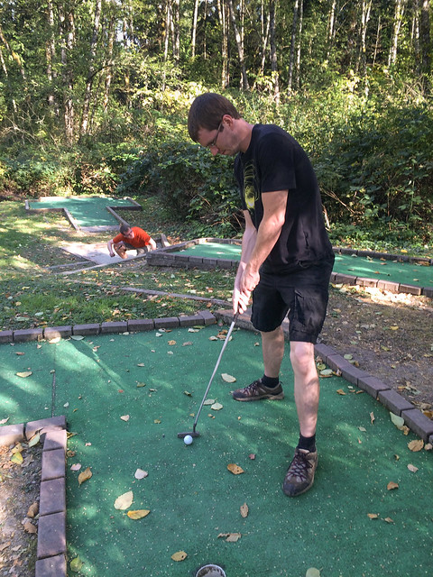
Tom playing Miniature Golf at Mt Vernon RV Campground, Washington
… even when someone forgets what game we are playing.
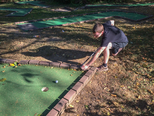
Tom playing Miniature Golf at Mt Vernon RV Campground, Washington?
In addition, we play board games and our current favorites are “Settlers of Catan” and “Ticket to Ride”.
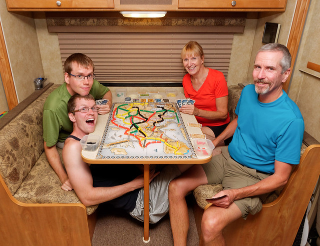
Tom, Dan, Jean and John playing Ticket to Ride
I find it interesting that board games such as these have been turned into “apps” that enable one to play a game by themselves or against online opponents. And I admit I have been tempted. Ticket to Ride is a good two person game and John and I have been enjoying playing it together. However, he is not obsessed with it as I am and begs off before I am ready to stop so I briefly considered getting the app. But I have resisted. So in terms of relationships with my family I think I’m doing pretty well.
However, reading “Alone Together” has caused me to become more realistic about the value of my online activities as a way to connect with members of my “tribe”. I now see that these actions do not make me a part of a “community”. I realized the only way to have a community is for me to interact directly with living breathing human beings. But this is not easy for me as I am a shy introvert and online conversations are much less taxing for me than face to face interactions. I had previously felt I had been given permission to avoid social situations by a book I had read - “Quiet: The Power of Introverts in a World That Can't Stop Talking” by Susan Cain. Then John suggested I read a New York Times article, “Am I Introverted, or Just Rude?”, and it caused me to rethink that view. I have come to see it is fine for me to need “alone time” to recharge my “batteries” but that doesn’t mean it is right for me, even good for me, to shun social interactions. I realized if I truly wanted to create my own “Blue Zone” and reap the benefits of belonging to a community then I needed to look somewhere besides the internet. But where can I, someone who lives and travels fulltime in a RV, find a community where I can comfortably interact with others?
That can be answered in two words - Jojoba Hills. We have been members of Escapees RV Club for several years and have visited several Escapees RV Parks in the western US. We knew that there is the option to lease a site in these parks and we were looking for a “winter base”, some place with a mild winter climate where we could entertain ourselves during the months when we chose not to travel. Also in the back of our minds was that one day, once our traveling days were behind us, we would need a place to settle down. We knew we didn’t want it to be in a more urban area and we didn’t want to go back to the suburbs. We also did not want to be too isolated in a rural setting. So it would seem that it needed to be a small town. But we had concerns about finding a small town we could truly become a part of rather than our always being seen as “outsiders”.
Then in July 2014 we visited Jojoba Hills RV Resort, a 55+ co - op community located just outside of Temecula in southern California. It has 283 sites and about 500 members and from the beginning we liked what we saw. Jojoba Hills is a well appointed RV resort with many amenities and activities located in a beautiful high desert setting.

The pool at the clubhouse complex at Jojoba Hills in Aguanga, California
However, it was what we learned about the people living there that led us to join. Jojoba Hills was largely built by volunteers and as a co - op it is an expectation that members will volunteer in some capacity to help maintain the park. This has created a culture where members are very generous with their time and talents. One has only to look at the Web Calendar to see the broad array of organized activities and member taught classes available. After becoming members we happily embraced the volunteering spirit and found enjoyable ways to contribute to the community and meet other members.

John on a shed roof crew at Jojoba Hills in Aguanga, California
In addition, there are regular social events scheduled; ice cream socials, dinners and dances etc. And like a small town of yesteryear, everyone waves to everyone else and people walk through the community stopping to visit with other members who are sitting out on their patios. Members are what many would call “nosy” and I, in the past, would have resented this intrusion into my life. However, I can now see the value of neighbors knowing more about one another. For example, people at Jojoba Hills know when a neighbor needs help and there is no shortage of members willing to help out no matter what the need.

Volunteers building a deck and ramp for a wheelchair bound member
I had previously assumed it would be necessary to have a lot in common with the other people in order to feel like I was a part of a “community”. That we needed to share interests and engage in many of the same activities. But as far as we know we are the only members who are currently backpackers so they are not really a part of what I think of as our “tribe”. However, what I have come to see is the shared interests and activities of those in a community can simply be a common belief that includes such things as the willingness to help out and caring about the well being of one’s neighbors.
I am the first to admit that Jojoba Hills is a unique community but I have wondered if any of its philosophy could be applied elsewhere in our society. I have wondered what we could do if we were still living in our suburban neighborhood to help turn it into a true “community”? One thing would be to simply take walks in the evening rather than planting ourselves in front of our computers or TV. We could go up to each house, knock on the door and meet the people behind it. We could even take a plate of homemade cookies. We could help organize a Block Party or a Progressive Dinner to help others in the neighborhood get to know each other. We could organize a work party to maintain any common areas. If we didn’t see one of our neighbors for several days we could check up on them. Perhaps they are sick and could really use a little help. One way to help someone feel comfortable asking for help is to first ask them for a favor, a ride to the airport for example. I realize people who are not retired are extremely busy and may not think they have the time to do any of this. But it might help if they viewed these actions as an investment in their future, the dividend being more time and better health later in their life. And it is possible these actions would inspire and encourage others in the neighborhood to become more involved so the burden would not fall to only one household. I am sorry that I can’t go back and try out some of these ideas. I am curious as to whether it could have worked in this day and age.
I believe I have made great progress toward creating my own “Blue Zone”. However, I do realize that actually living to be 100 is not a very realistic goal. I’m not sure I will even want to live that long. Primarily I would just like to extend my life beyond my current life expectancy. I especially want those extra years to be healthy ones. Out of curiosity I went to the Blue Zones website and used their calculator to estimate my current life expectancy. By following the Blue Zones lessons as closely as is practical for me my current life expectancy is 90.3 years with the potential of being relatively disease free until age 82.8. I am 62 now and the possibility I may have 20 more reasonably healthy years left sounds pretty good to me. I do realize there are no guarantees in life but this has made me more optimistic that I may achieve one of my goals - to be like Carol, a delightful woman we met who was also backpacking the entire John Muir Trail. She was 77.
Carol (77) hiking the entire John Muir Trail, California
And who knows, I might even get to be a bit like Bill (AKA "Billy Goat"), a member of the Jojoba Hills Hiking Group. He is 84.

Bill (84) exploring Anza Borego State Park, California with the Jojoba Hills Hiking Group
We are heading back to Jojoba Hills for the winter. While we are there I will maintain the relationships I already have and continue to build new ones. In addition, I plan to stay physically active. A great way to accomplish both will be to go out with the Jojoba Hills Hiking Group. However, I think it would be wiser for us to wait until after we get back home from our hike to drink that wine.

Some of the Jojoba Hills Hiking Group at Tahquitz Peak Lookout in San Bernadino National Forest, California


No comments:
Post a Comment