"Things turn out best for the people who make the best of the way things turn out" (John Wooden) is one of our favorite quotations. It is advice we strive to follow and the past six months have provided us with several opportunities to practice it. If you read our previous post then you know we were poised to begin a summer of backpacking adventures in Washington State but things did not turn out the way we had planned. However, I think you will agree that things turned out pretty well for us.
Where We’ve Been – Mt Rainier National Park, Mt Baker - Snoqualmie National Forest, Mt Baker Wilderness and Glacier Peak Wilderness in Washington State
6/30 – 10/4 2013
In this post:
- Dayhikes in Mt Rainier National Park, Washington
- Dayhikes in Mt. Baker-Snoqualmie National Forest, Washington
- Dayhikes in Mt Baker Wilderness, Washington
- Backpack trip in Glacier Peak Wilderness, Washington
- Backpack trip in Alpine Lakes Wilderness, Washington
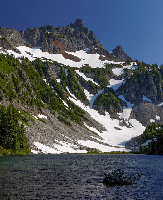
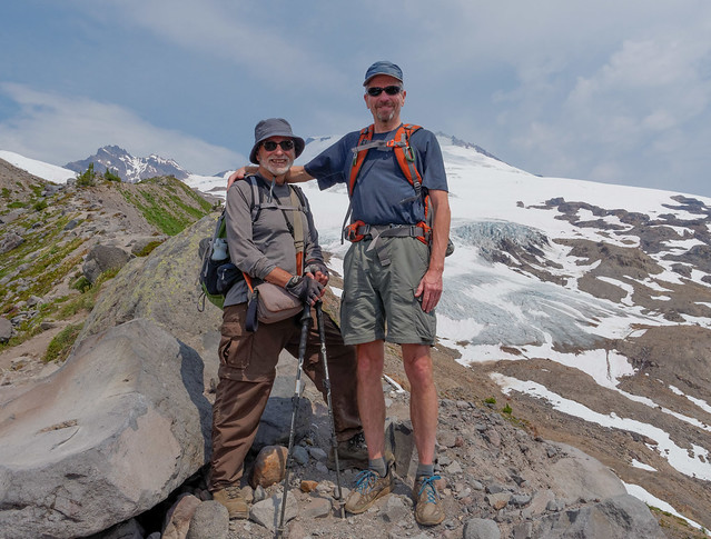
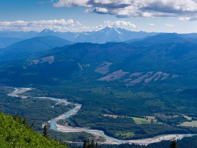
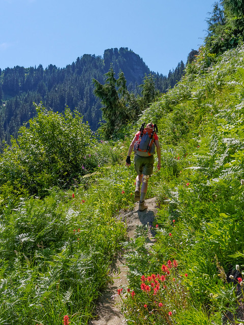
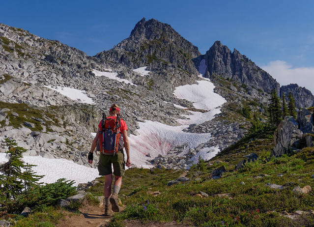
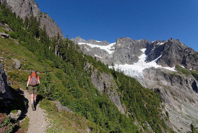
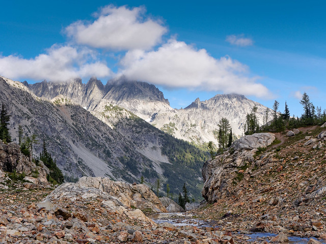
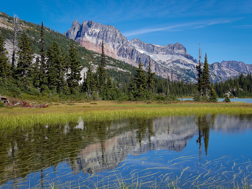
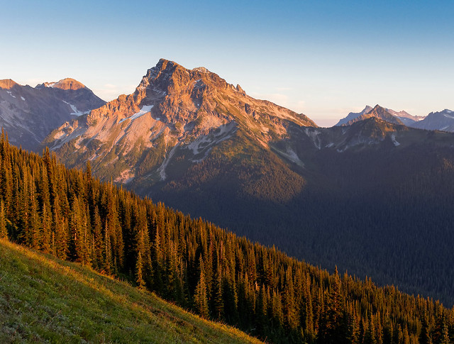
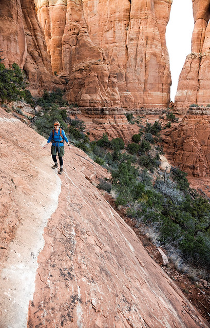
We were excited to head toward Mt Rainier National Park. We took advantage of a sunny day to hike up to Camp Muir, a base camp for seven of the 12 routes to the summit of Mt Rainier. We had thought we might need snowshoes but the snow was well consolidated and the route heavily traveled so we were able to easily do without.
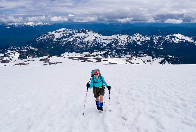
Jean on the route to Camp Muir in Mt Rainier National Park, Washington
The higher we got the better the views of surrounding mountains ...
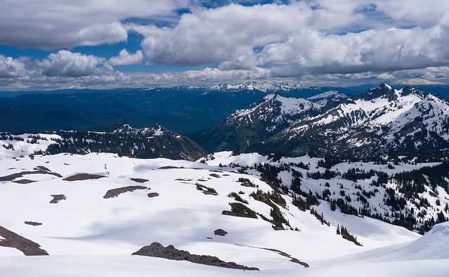
Seen from the route to Camp Muir in Mt Rainier National Park, Washington
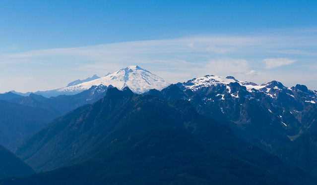
… especially Mt Rainier.
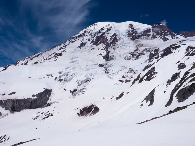
Seen from the route to Camp Muir in Mt Rainier National Park, Washington
As it was a sunny Saturday the route was crowded. In addition to the large number of dayhikers we encountered several groups of tired climbers heading down. We also passed a number of climbers headed up, some hoping to summit the next morning and others training to climb it at a later date.
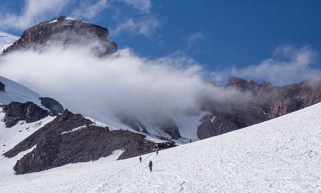
Approaching Camp Muir in Mt Rainier National Park, Washington
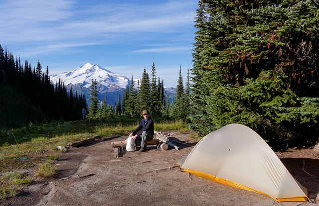
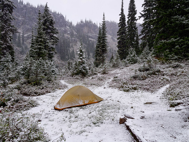
John has climbed Mt Rainier several times in the past but this was my first visit to Tent Gulch".
"Tent Gulch" at Camp Muir in Mt Rainier National Park, Washington
We thoroughly enjoyed the largely clear skies.
Seen from Camp Muir in Mt Rainier National Park, Washington
However, late in the afternoon and into the evening more clouds began moving in completely obscuring Mt Rainier but we did get some lovely views of Mt Adams. All of our photos from this hike are on Flickr.
Mt Adams seen from the route to Camp Muir in Mt Rainier National Park, Washington
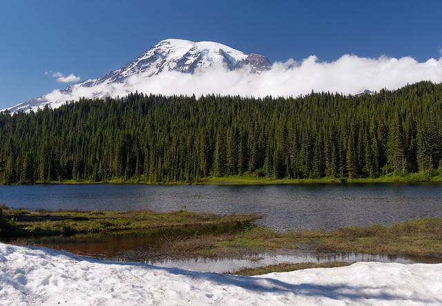
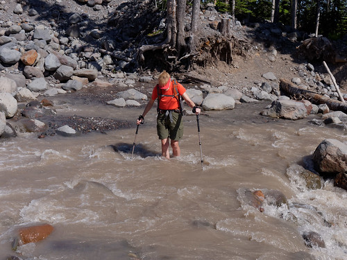
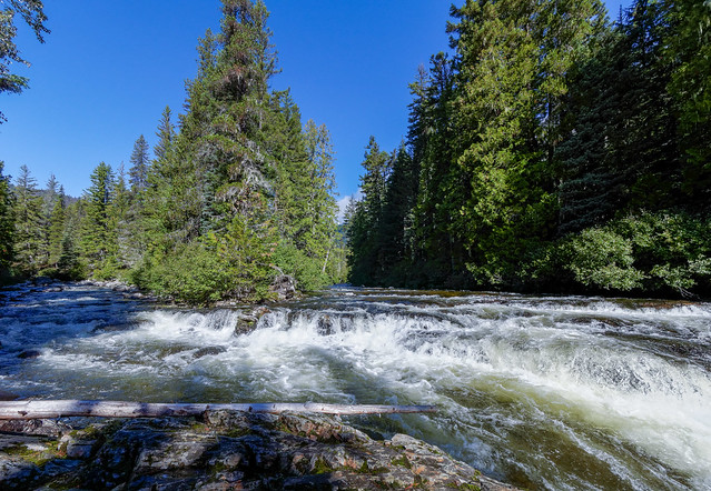
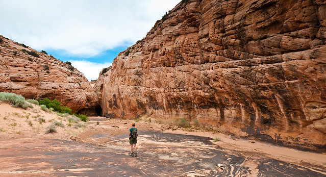
We had been planning to backpack the Wonderland Trail but had to bail out on the second day. Going into it we knew that a potential complication was whether or not we would be able to cross the South Mowich River on the first day of the trip. It had been a heavy snow year and temperatures in late June had been extremely high. The resulting increased snow melt led to higher water levels in all rivers and streams especially late in the day. We were well aware that in some cases backpackers must camp nearby and cross early in the morning when water levels are lower.
But we had reason to be optimistic as a Ranger had told John that all of the bridges were "in". We had no trouble crossing the North Mowich River. However, the bed of the South Mowich is much wider and we were surprised to note that the it was running high enough to overflow through a creek bed.
The South Mowich River overflowing into a creek along the Wonderland Trail in Mt Rainier National Park, Washington
We were able to cross most of the vast river bed but unfortunately the log bridge over the main channel of the river was tipped over on its side and unsafe to walk across. We were unable to locate a spot that we could safely wade across so we decided to scoot across the log bridge. We had both just sat down and were in the process of replacing our boots with water shoes when John noticed that the water level under the log was rising rapidly. In the space of a few minutes the water began rushing over the log and continued to rise.
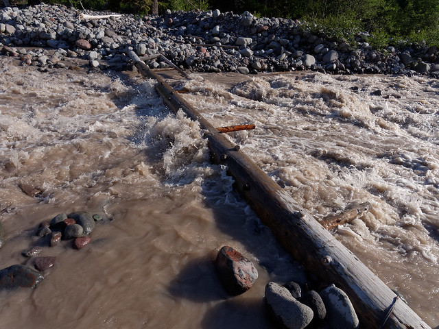
The South Mowich River seen while backpacking on the Wonderland Trail in Mt Rainier National Park, Washington
So we resigned ourselves to camping nearby with the intention of crossing in the morning when the water level should be lower. However, we discovered the next morning that the main channel had changed course and the shallow channel we had "rock hopped" across the evening before …
The South Mowich River seen while backpacking on the Wonderland Trail in Mt Rainier National Park, Washington
... had become a roiling torrent that was impossible to cross and live to tell about it.
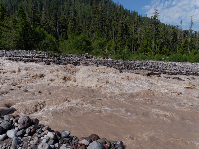
The South Mowich River seen while backpacking on the Wonderland Trail in Mt Rainier National Park, Washington
We had no choice but to hike out that day. But it turned out that the high water level was not the only reason we had to bail out of this trip. I had tripped and fallen the evening before and I injured a wrist (details below).
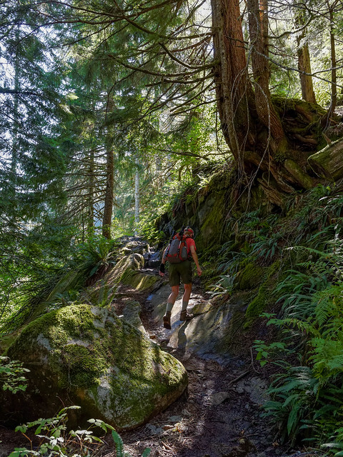
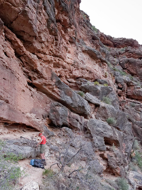
As my injury caused me to be unable to use both trekking poles, which are essential for my knees when I carry a heavy pack, we focused on dayhiking until my wrist healed up enough to backpack again. We decided to stay near Mt Rainier National Park. The first dayhike we did after my injury was on the Laughingwater Creek Trail, an easy one (with one minor exception).
John on (literally) the Laughingwater Creek Trail in Mt Rainier National Park, Washington
We went as far as Three Lakes where we encountered snow.
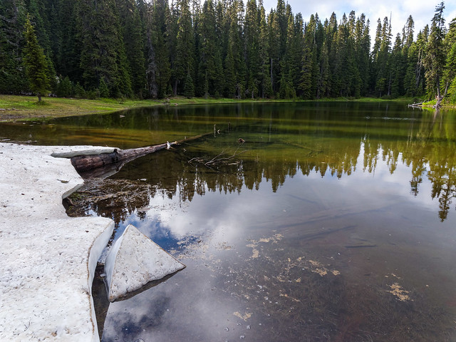
Three Lakes in Mt Rainier National Park, Washington
John took advantage of our close proximity to Mt Rainier National Park for intensive photography. On multiple occasions he drove into the park stating he felt as though he was commuting to a job (but a great job). He did a hike on the Eastside Trail past Chinook Creek ...
Chinook Creek seen from the Eastside Trail in Mt Rainier National Park, Washington
... and Stafford Falls.
Stafford Falls seen from the Eastside Trail in Mt Rainier National Park, Washington
Another day we did a short dayhike on the Owyhigh Lake Trail.
Seen from the Owyhigh Lakes Trail in Mt Rainier National Park, Washington
He also visited the lovely Silver Falls ...
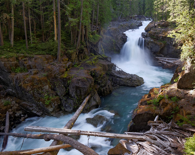
Silver Falls seen from the Eastside Trail in Mt Rainier National Park, Washington
... and the Grove of the Patriarchs. These enormous trees are situated on an island in the Ohanapecosh River so they have been protected from past forest fires.
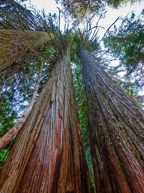
Grove of the Patriarchs in Mt Rainier National Park, Washington
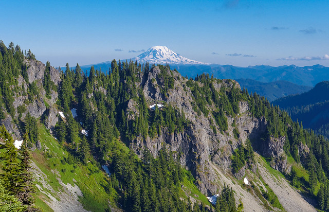
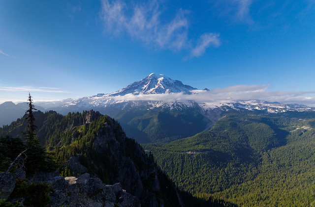
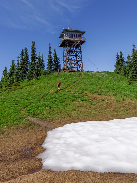
We dayhiked together to the top of Shriner Peak ...
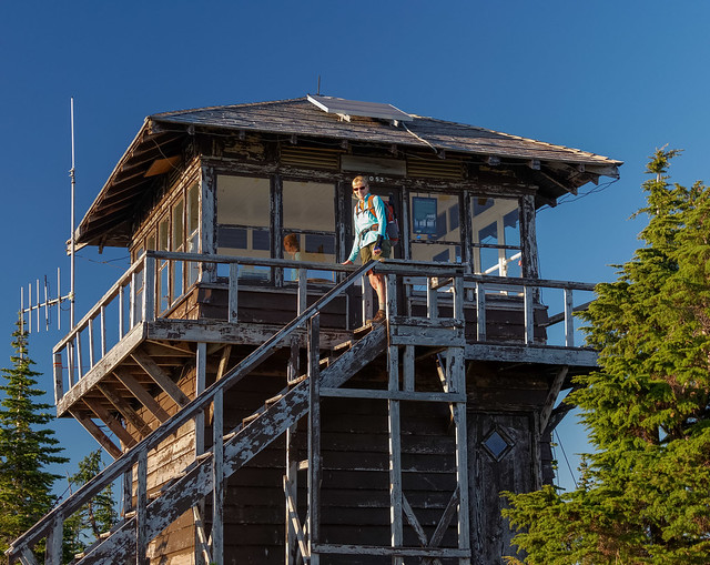
Shriner Peak Lookout seen while dayhiking to Shriner Peak in Mt Rainier National Park, Washington
... and enjoyed great views of Mt Adams as well as surrounding mountains.
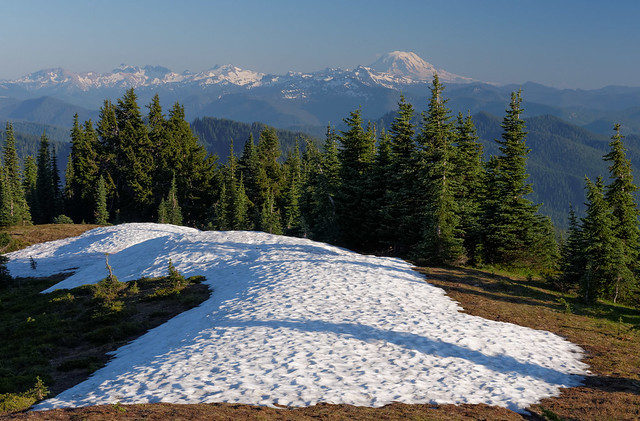
Mt Adams seen while dayhiking to Shriner Peak in Mt Rainier National Park, Washington
On another day John went to the park stopping first for a shot of Mt Rainier and Reflection Lake. Unfortunately it was too windy to capture one of the classic shots of the mountain reflected in the lake.
Mt Rainier and Reflection Lake in Mt Rainier National Park, Washington
He then did a short dayhike to Snow Lake.
Snow Lake seen while dayhiking on the Bench Lake/Snow Lake Trail in Mt Rainier National Park, Washington
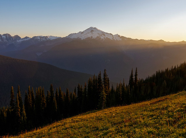
We also did a dayhike to Eagle Peak enjoying another view of Mt Adams …
Mt Adams seen from the Eagle Peak Trail in Mt Rainier National Park, Washington
... as well as Mt Rainier. All of our photos from these hikes are on Flickr.
Mt Rainier seen from the Eagle Peak Trail in Mt Rainier National Park, Washington
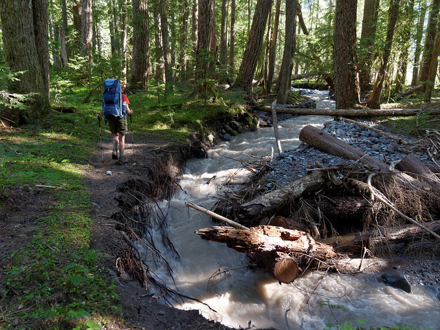
We then headed north to Mt. Baker-Snoqualmie National Forest. This is a huge area that is subdivided into almost countless smaller parts with different designations; wilderness, recreation areas etc, but for simplicity's sake I'm bundling them all within Mt. Baker-Snoqualmie National Forest. Our first hike began on the Park Butte Trail and continued onto the Scott Paul Loop. The bridge over a creek was washed out but fortunately this creek was shallow and had a relatively smooth bottom.
Jean crossing a creek on the Park Butte Trail in Mt Baker National Recreation Area, Washington
We had to cross other creeks higher up but there were bridges available; one made of snow and one made (thankfully) of wood.
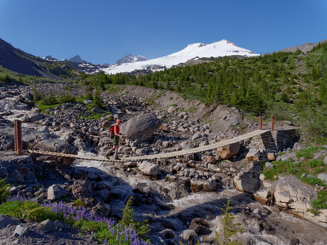
Scott Paul Loop in Mt Baker National Recreation Area, Washington
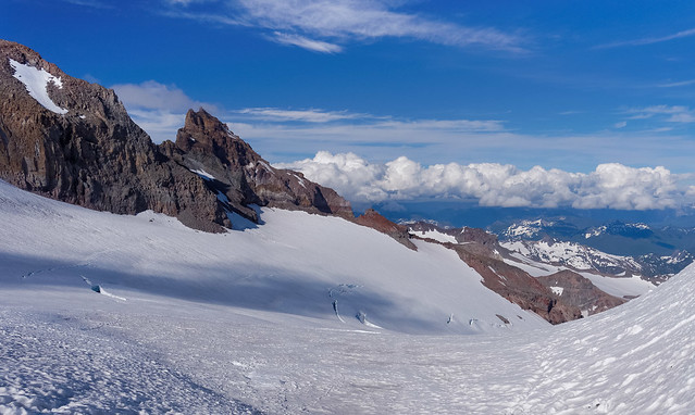
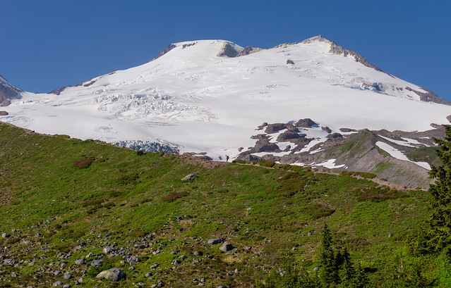
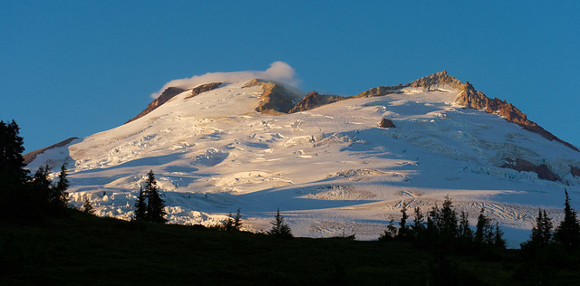
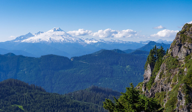
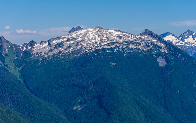
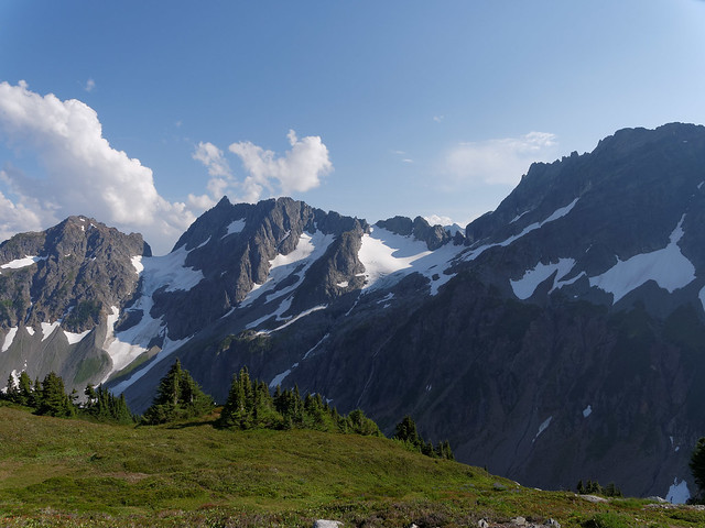
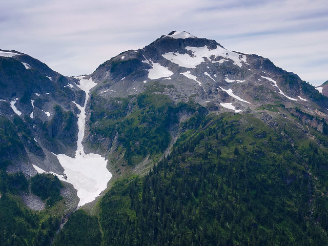
This is an easy hike providing wonderful views of Mt Baker (10,781 feet) for surprisingly little effort.
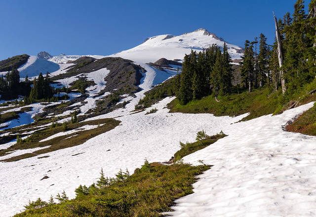
Mt Baker seen from the Scott Paul Loop in Mt Baker National Recreation Area, Washington
A bit of the trail was still covered in snow and we were lured off of it by cairns which marked one of the climbing routes for Mt Baker. Once we realized our mistake we turned around but I gave my knees a break and opted to glissade down a slope.
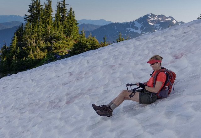
Jean making good use of her reinforced hiking shorts
This trail also provides some great views of Mt Shuksan.
Mt Shuksan seen from the Scott Paul Loop in Mt Baker National Recreation Area, Washington
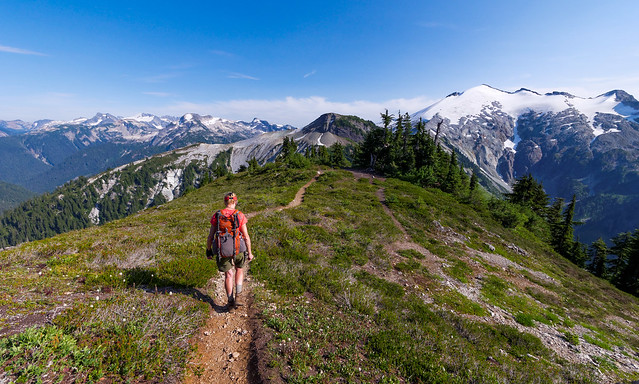
We returned to the same trailhead two days later but this time turned off onto the Railroad Grade Trail, named for the long moraine and if you look close you can see me on it in the middle of the photo below. The views of Mt Baker from this trail are outstanding.
Jean on the Railroad Grade Trail with Mt Baker in Mt Baker National Recreation Area, Washington
While the incline is gradual one does need to be careful while hiking it as the trail frequently skirts the sharp edge of the moraine, quite close in spots.
The Railroad Grade Trail in Mt Baker National Recreation Area, Washington
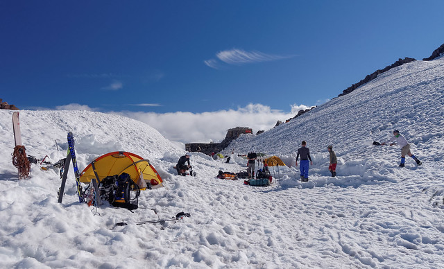
This is a popular route for climbing Mt Baker and a number of people were obviously taking advantage of the great weather. We encountered a number of parties descending and saw quite a few tents of hopeful climbers set up on the rocks.

Climbers tents seen from the Railroad Grade Trail in Mt Baker National Recreation Area, Washington
We observed groups of people practicing crevasse rescue and ice axe self arrest, essential skills for climbers.
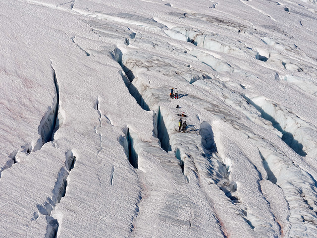
Climbers practicing crevasse rescue on Mt Baker in Mt Baker National Recreation Area, Washington
We returned to this trail on two more occasions. Once with our good friend Miller …
Miller and John on the Railroad Grade Trail in Mt Baker National Recreation Area, Washington
… and again with our sons, Dan and Tom.
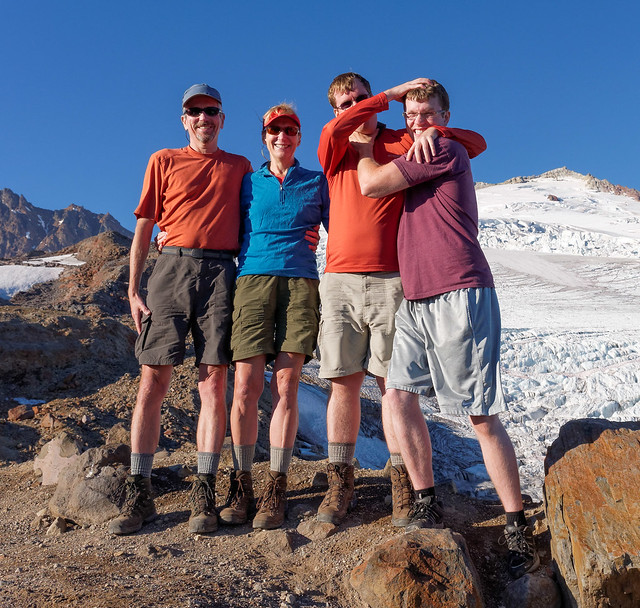
John, Jean, Dan and Tom on the Railroad Grade Trail in Mt Baker National Recreation Area, Washington
It is a popular backpacking destination and there are a number of well established tent sites located in the trees below the moraine. As we passed one such camp I heard the quiet "wooshing" sound made by someone's backpacking stove and it filled me with an intense longing to stay. I so wanted to be able to just sit and watch the changing light on the mountain and enjoy the growing darkness with a cup of hot tea warming my hands rather than doing a hurried hike out. All of our photos from these hikes are on Flickr.
Mt Baker seen from the Railroad Grade Trail with Mt Baker in Mt Baker National Recreation Area, Washington
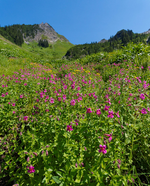
We also did the short but steep hike up Sauk Mountain. The first part switch backs repeatedly across an exposed meadow filled with wildflowers late in the summer (and sometimes annoying biting flies).
Sauk Mt Trail in Mt Baker Ranger District, Washington
From the trail one has views of the Skagit River Valley …
Sauk Mt Trail in Mt Baker Ranger District, Washington
… all the way to Puget Sound.
Puget Sound seen from the Sauk Mt Trail in Mt Baker Ranger District, Washington
One option is to take the side trail down to Sauk Lake but our preference is to always get as high as possible so we continued up.
Sauk Lake seen from the Sauk Mt Trail in Mt Baker Ranger District, Washington
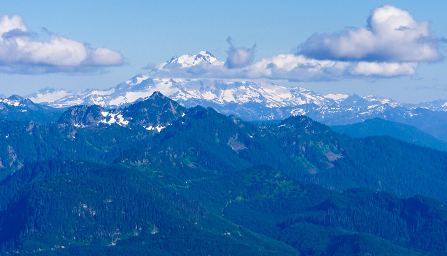
This short hike not only provides great views of Mt Baker …
Mt Baker seen from the Sauk Mt Trail in Mt Baker Ranger District, Washington
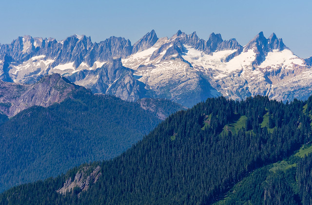
… but of the Picket Range …
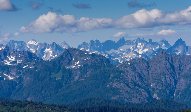
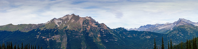
The Pickett Range seen from the Sauk Mt Trail in Mt Baker Ranger District, Washington
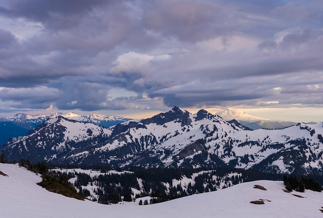
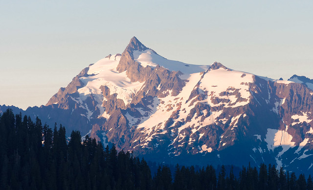
… as well as Glacier Peak.
Glacier Peak seen from the Sauk Mt Trail in Mt Baker Ranger District, Washington
We did this hike on multiple occasions; once just the two of us, once with Miller and later with Dan.
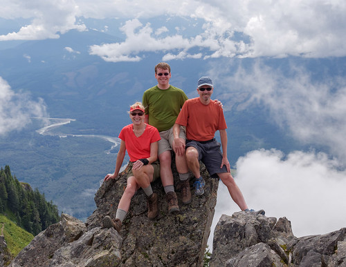
Jean, Dan and John on Sauk Mt in Mt in Mt Baker Ranger district
Another hike we did was to Lookout Mountain. This trail is notorious for a short steep section where it gains about 2400 vertical feet over just two and a half miles. Like many hikes up peaks it starts in woods, ...
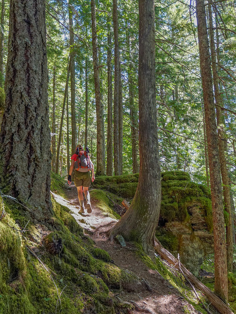
Jean on the Lookout Mt Trail in Mt Baker Ranger District, Washington
... breaking out of the trees and crossing open, sometimes wildflower covered, slopes ...
Jean on the Lookout Mt Trail in Mt Baker Ranger District, Washington
... before reaching the summit.
Lookout Mountain (5719 feet) in Mt Baker Ranger District, Washington
Something not easily seen in the below photo are several stuffed animals near the rafters. There is also a small sign that says "If you are unhappy then you are not here". So true!
Lookout Mt in Mt Baker Ranger District, Washington
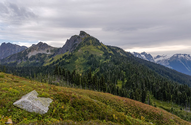
The panoramic view includes the Pickett Range ...
The Pickett Range seen from Lookout Mt in Mt Baker Ranger District, Washington
... and Mt Baker. All of our photos from these hikes are on Flickr.
Mt Baker seen from Lookout Mt in Mt Baker Ranger District, Washington
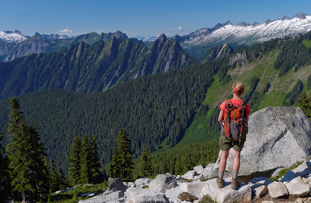
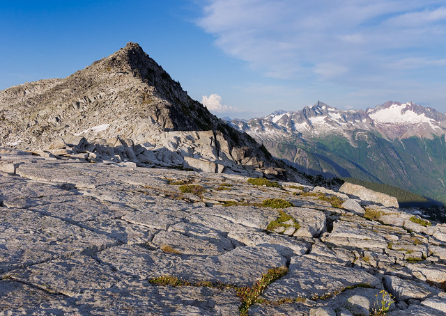
We also did a dayhike to Hidden Lake Peaks, plural because the mountain massif has three "summits" (two are visible in the photo below that was taken from the Lookout Mt Trail). The trail skirts the gully in the lower left hand corner of the photo before cutting to the right above the treeline …
Hidden Lake Peaks seen from the Lookout Mt Trail in Mt Baker Ranger District, Washington
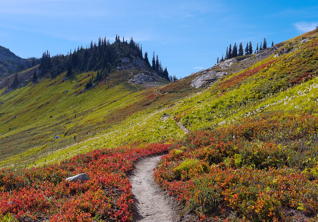
… after passing through thick meadows filled with wildflowers late in the season.
Seen from the Hidden Lake Peaks Trail in Mt Baker Ranger District, Washington
Once above the tree line the views expand to surrounding mountains.
Seen from the Hidden Lake Peaks Trail in Mt Baker Ranger District, Washington
The trail continues up the gully between the peaks (to the left of the highest peak in the photo below).
Seen from the Hidden Lake Peaks Trail in Mt Baker Ranger District, Washington
Once at the saddle we enjoyed views of Hidden Lake …
Hidden Lake seen from the Hidden Lake Peaks Trail in Mt Baker Ranger District, Washington
… and Eldorado Peak on the other side.
Eldorado Peak seen from the Hidden Lake Peaks Trail in Mt Baker Ranger District, Washington
Then one has the choice of turning right and continuing up to the lookout or turning left toward the other two summits. Had we had more time we could have done both but we decided to save the lookout for when our sons came to visit so we turned left. Before too long the route required some scrambling that was best done with two functioning hands so I found a comfortable spot to wait while John continued.
Seen from the Hidden Lake Peaks Trail in Mt Baker Ranger District, Washington
It took longer than he expected and every time he cleared a "hump" he thought he had reached the highest of the the two summits only to see another "hump" ahead. However, his efforts were eventually rewarded.
Seen from the Hidden Lake Peaks Trail in Mt Baker Ranger District, Washington
As is common when hiking with a photographer the pace slows down as evening approaches in order to take advantage of the changing light ...
Seen from the Hidden Lake Peaks Trail in Mt Baker Ranger District, Washington
… and the arrival of what is appropriately known as "the golden hour".
Seen from the Hidden Lakes Peak Trail in Mt Baker Ranger District, Washington
And as is common when hiking with John we hiked out after dark with headlamps.
Mt Baker seen from the Hidden Lake Peaks Trail in Mt Baker Ranger District, Washington
We returned nearly a month later when Dan and Tom came to visit. This is such a great hike we had no trouble being excited about doing it again. Besides, any hike with these guys is a unique experience and I get a break from being the only person in John's photos.
Jean, Dan and Tom on the Hidden Lake Peaks Trail in Mt Baker Ranger District, Washington
Once again we headed up the gully to the saddle …
Seen from the Hidden Lake Peaks Trail in Mt Baker Ranger District, Washington
… and had another view of Hidden Lake but under different weather conditions.
Hidden Lake in Mt Baker Ranger District, Washington
This time we turned right and headed up the trail to the lookout ...
Dan on the trail to Hidden Lake Peaks Trail in Mt Baker Ranger District, Washington
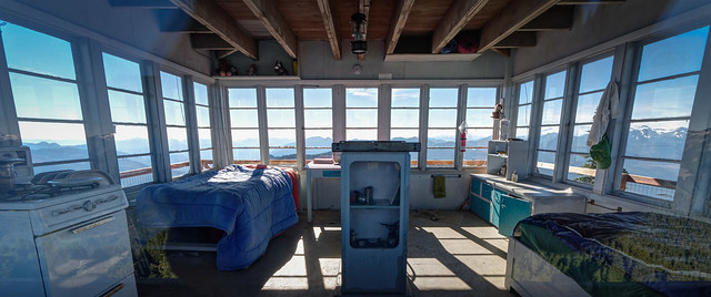
... and were surprised to find it not only unlocked but occupied. Apparently one can stay in the lookout and a fellow was doing just that.
John, Dan, Jean and Tom in the Hidden Lake Lookout in Mt Baker Ranger District, Washington
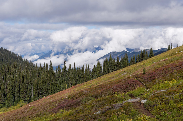
Once we headed back down we noted the clouds were moving down to meet us ...
Seen from the Hidden Lake Peaks Trail in Mt Baker Ranger District, Washington
... but the prospect didn't dampen Tom's enthusiasm as he made his way down the trail.
Tom "hiking" down the Hidden Lake Peaks Trail in Mt Baker Ranger District, Washington
The setting sun created an eerie, almost "radioactive", glow in the sky that we have never seen before.
Seen from the Hidden Lake Peaks Trail in Mt Baker Ranger District, Washington
Once the sun dropped below the clouds it created this dramatic sunset over the distant Puget Sound. Once again we hiked out in the dark with headlamps. All of our photos from these hikes are on Flickr.
Seen from the Hidden Lake Peaks Trail in Mt Baker Ranger District, Washington
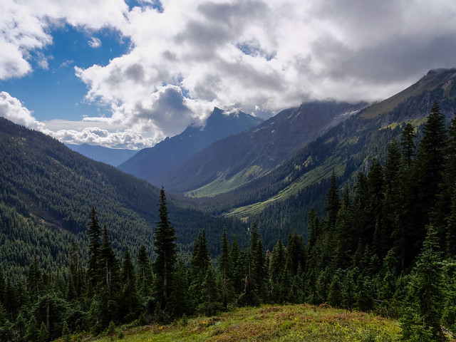
We also went to North Cascades National Park and did a dayhike up to Cascade Pass. We did this hike many years ago and had a photograph of Mixup Peak on our dining room wall for many years and were excited to return. We had intended to go as far as Sahale Arm ...
Seen from the Cascade Pass Trail in North Cascades National Park, Washington
... but we had a "situation" and squandered too much time so we just couldn't get as far as we had hoped. Therefore we decided to go back the next day. We had not gotten a recent weather report and when we started out we were initially dismayed by some low clouds.
Seen from the Cascade Pass Trail in North Cascades National Park, Washington
But they appeared to be rising so we were hopeful that once we got to Cascade Pass that they would have dissipated. We talked to some hikers coming down who said it had been clear at the pass when they were there so perhaps we would get above the clouds. But it was all just wishful thinking as part way up we were startled by a clap of thunder and a sudden downpour. We quickly put on our parkas and headed back down the trail. It rained so hard that there were vigorous rivulets running down the trail and we heard later that a portion of the trail above us had washed out. By the time we got to our car we were soaked and gratefully climbed inside. Our motorhome was parked in a nearby campground so we were anticipating hot showers and dry clothing.
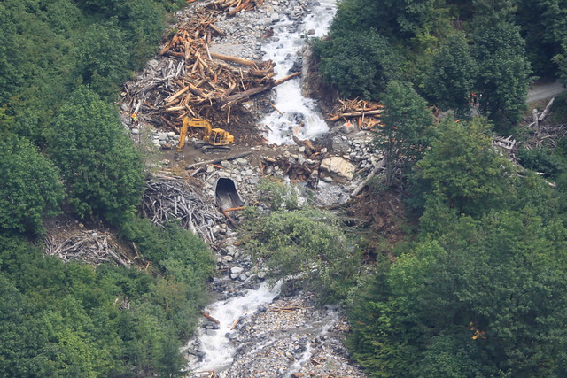
However, after we had driven about a mile down the road we saw a fellow running up the road waving his arms and he gave us some most unwelcome news. The road was washed out at Boston Creek (more info) not far below us and that it was impossible to drive across. We decided to take a look just in case there was some place we could wade across (I was so looking forward to a hot shower). But once there we were amazed by the volume of water actively pushing trees and boulders through the deep gully and rapidly eroding the bank. The photo below was taken later that day after the water had subsided a bit. We were on the opposite side of the gully in the photo below and were concerned that the road grader could be lost.
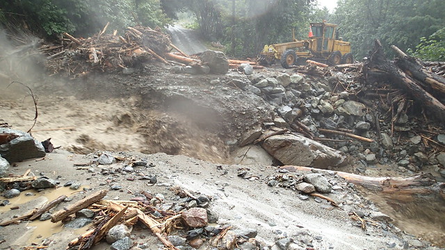
Boston Creek washout in North Cascades National Park, Washington
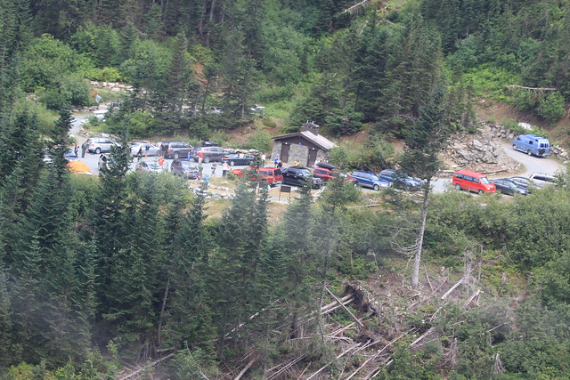
We came to the unfortunate conclusion that we would be spending at least one night in our car in the parking lot, as would nearly 70 other people. Fortunately we had some emergency supplies; two sleeping pads and two "space bags" as well as two fleece jackets. We also still had some water and a bit of food, just enough to see us through till morning. In addition we thankfully had some "pee bottles" stashed under the seat so neither of us had to brave the rain and make the trek to the vault toilets. While I can't say we were truly comfortable that night we did manage to stay warm and to get some sleep. We felt lucky to have a station wagon so we did better than groups of three or more who were forced to try to sleep sitting up in a sedan.
It continued to rain throughout the night but finally stopped by morning. Two backcountry Rangers had been radioed and they returned to the trailhead. One of them even had tortillas, pepperoni and cheese and he was willing to share - a breakfast burrito never tasted so good.
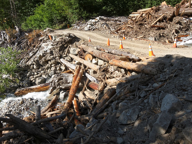
We were in a unique situation. Whereas, nearly all of the other stranded folks had nowhere to go without their car, our "house" was only about eight miles away and we could go home if we could only get across the creek. So we walked down to the washout to check it out. The volume of water had decreased a lot but the Ranger discouraged any attempt to cross it.
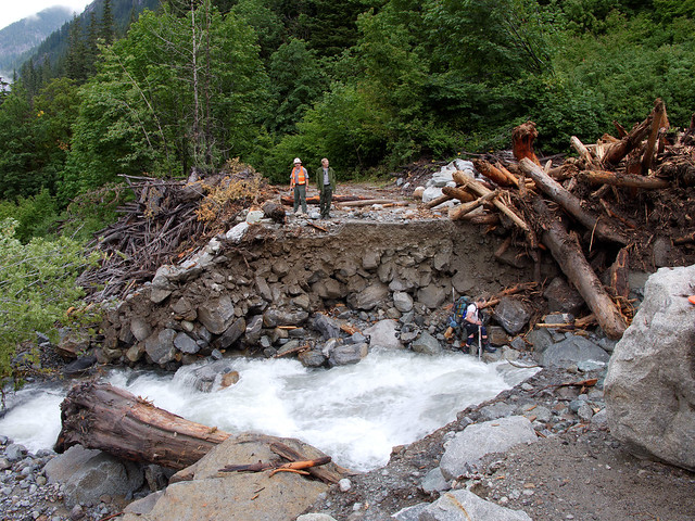
Boston Creek washout in North Cascades National Park, Washington
He was obviously dismayed when a climber on his way up the road toward the trailhead made the decision to wade across the creek. Fortunately, he got across safely but it looked far too risky for us to try.
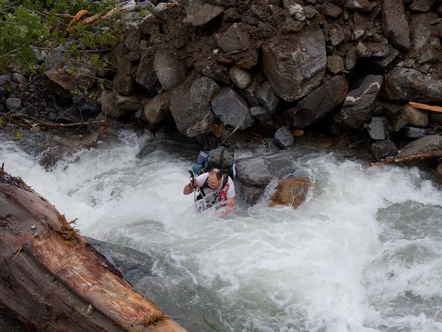
A climber crossing Boston Creek Boston Creek (against the Ranger's advice) in North Cascades National Park, Washington
We noticed that the bank below the road had eroded enough that a tree had fallen across the creek and we were able to scoot across it without incident.
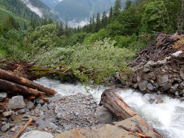
Looking downstream at the tree we used to cross Boston Creek in North Cascades National Park, Washington
We were even lucky enough to be given a ride back to the campground saving us the seven mile walk down the road. Once home we thoroughly enjoyed hot showers, dry clothing and a home cooked meal in our warm cozy home. We thought about the other folks still stranded and later heard that a helicopter had dropped some necessities including toilet paper and boxed lunches donated by restaurants in nearby Marblemount. Fortunately the dry weather held out and the National Park Service arranged for earth moving equipment to construct a temporary bridge.
Boston Creek looking upstream in North Cascades National Park, Washington
We were extremely impressed to learn that the temporary bridge was finished by 4 PM that first day and all stranded hikers were able to leave. We retrieved our car the following day. The road was closed for a while but it eventually opened for a time before snow closed it for the season. We were disinclined to try a third time. Sahale Arm will just have to wait until a future date. All of our photos from this hike/washout are on Flickr.
Temporary bridge across Boston Creek in North Cascades National Park, Washington
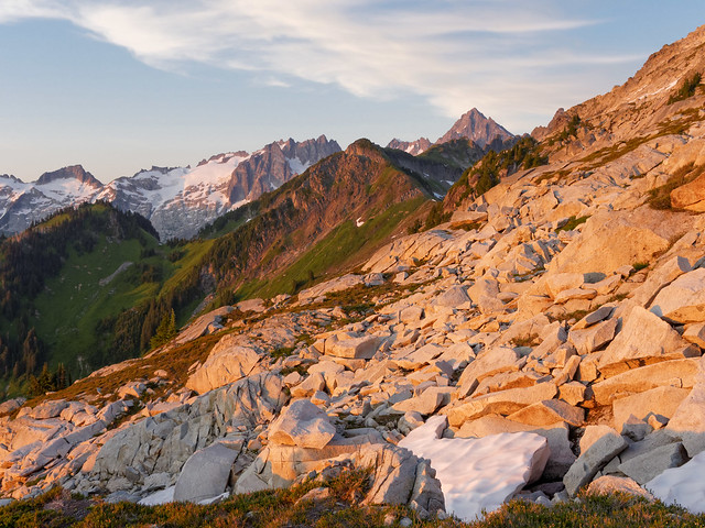
After our wet adventure we went for some dayhikes in the Mt Baker Ski Area with views of Mt Baker ...
Mt Baker in the Mt Baker Ski Area, Washington
... and Mt Shuksan. All of our photos from these hikes are on Flickr.
Mt Shuksan in Mt Baker Ski Area, Washington
While in the area we did a hike on the Lake Ann Trail ...
Seen from the Lake Ann Trail in Mt Baker Wilderness, Washington
... and went as far as the base of Mt Shuksan ...
Seen from the Lake Ann Trail in Mt Baker Wilderness, Washington
... before stopping by Lake Ann on our way down.
Seen from the Lake Ann Trail in Mt Baker Wilderness, Washington
We also did a dayhike up the Hannegan Pass Trail ...
Seen from the Hannegan Pass Tail in Mt Baker Wilderness, Washington
... for views that got better and better ...
Seen from the Hannegan Pass Tail in Mt Baker Wilderness, Washington
... expanding to a 360 degree view from the summit of Hannegan Peak. All of our photos from these hikes are on Flickr.
Seen from the Hannegan Pass Tail in Mt Baker Wilderness, Washington
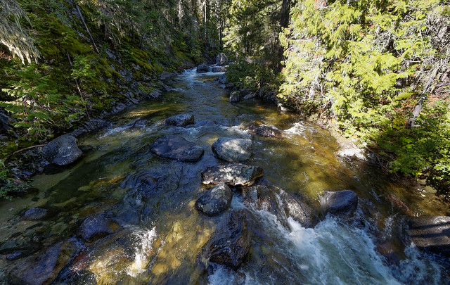
And we did a dayhike on the Copper Lake Trail in Alpine Lakes Wilderness. This is largely a "woods and water" hike ...
Jean on the Copper Lake Trail in Alpine Lakes Wilderness, Washington
... passing the lovely Malachite Falls ...
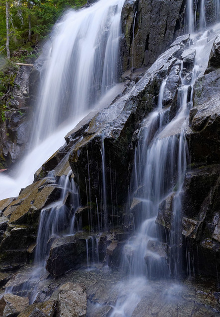
Malachite Falls in Alpine Lakes Wilderness, Washington
... before reaching Copper Lake. All of our photos from this hike are on Flickr.
Copper Lake Trail in Alpine Lakes Wilderness, Washington
At this point in time we knew that my wrist was broken, not sprained, so I would not be able to do any backpacking for the rest of the season. John had been reluctant to think seriously about doing some solo trips, not wanting me to feel "left behind", but I convinced him he should go. At the very least if I couldn't go a long then I could enjoy his adventure vicariously like our blog readers do. My only regret is that I didn't encourage him to do solo trips earlier in the summer when the weather was friendlier. While I was disappointed at not being able to go I remained confident that he would not develop a liking for going alone if only to have someone to carry shared gear; the tent, stove and cups, and set up camp while he is off taking photos.
The following is John's account of his solo backpack trips, the first a 4 day/3 night trip from Spider Meadows to Buck Creek Pass in Glacier Peak Wilderness.
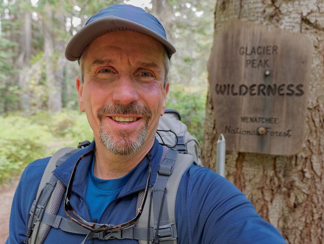
Without Jean to help him John struggles to get his hat on straight!
The Spider Gap - Buck Creek Pass trip is well described in Backpacking Washington by Douglas Lorain and is also available on trails.com. This trip can cover up to 53 miles with side trips. I skipped Flower Dome and High Pass due to weather, so I probably covered about 42 miles in four days. I've poked at this area before, but this is the first time for the whole loop. I did the trip in mid September so bugs weren't an issue but the days were definitely getting shorter and hunters could be a concern. The trip started cloudy and cool but with markedly improving weather forecasted for the next two days. After an easy forest walk along Phelps Creek, the views began when Spider Meadows opened up to the Chiwawa mountains.
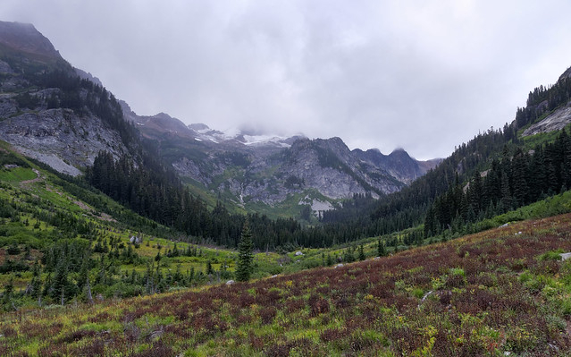
Spider Meadows in Glacier Peak Wilderness, Washington
The climbing really starts after the meadows with wonderful ethereal views.
Chiwawa Mountains seen from Spider Meadows in Glacier Peak Wilderness, Washington
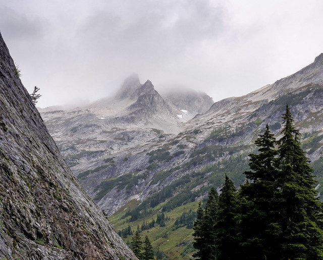
The trail switchbacks up to some high camps right at the base of the tiny Spider Glacier, the source for Phelps Creek. The rock starts to go orange as the views back to Seven Fingered Jack grow and grow.
Seven Fingered Jack from Spider Gap in Glacier Peak Wilderness, Washington
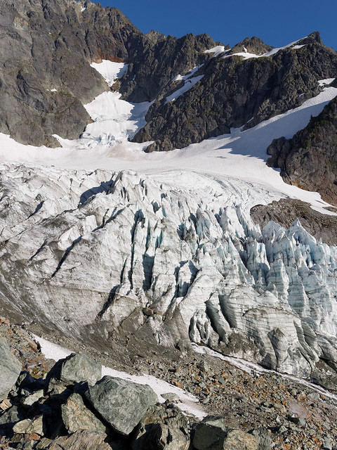
The Spider Glacier (really just a snowfield) is not very steep and is an easy accent. Microspikes or yaktraks might be a help early in the day or season. I felt no need for an ice axe.
Spider Glacier below Spider Gap in Glacier Peak Wilderness, Washington
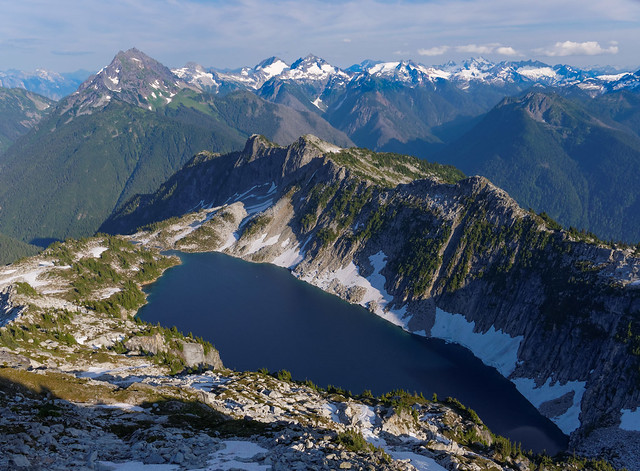
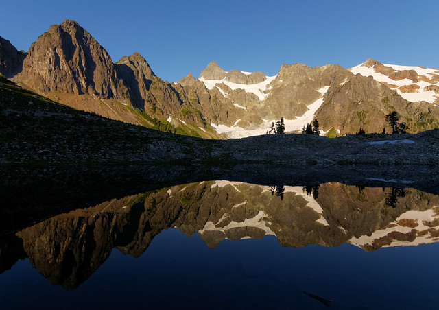
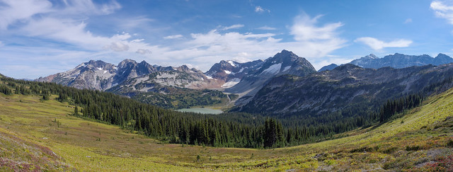
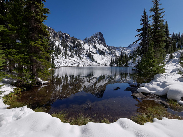
Once the pass is cleared the view of the Lyman basin is spectacular. I was treated to some amazing clouds ...
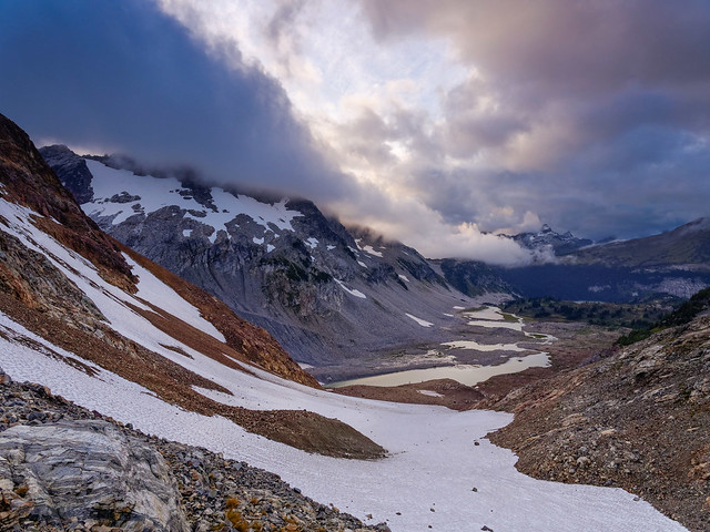
Upper Lyman Lakes in Glacier Peak Wilderness, Washington
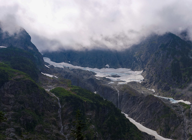
...but since the light was fading I soon started looking for a place to camp. I wanted to stay high since the morning views should be spectacular. I just needed to get far enough down to get water. The snow field decent was gradual and easy and I found a good small spot for my tent on the rocks high above upper Lyman Lake. The next morning I was rewarded with spectacular shadows on Lyman Glacier and a few icebergs in Upper Lyman Lake. I spent much of the morning photographing the glacier before heading down Railroad Creek to the main Lyman Lake.
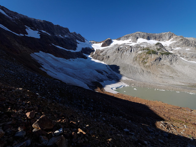
Upper Lyman Lakes and the Lyman Glacier in Glacier Peak Wilderness, Washington
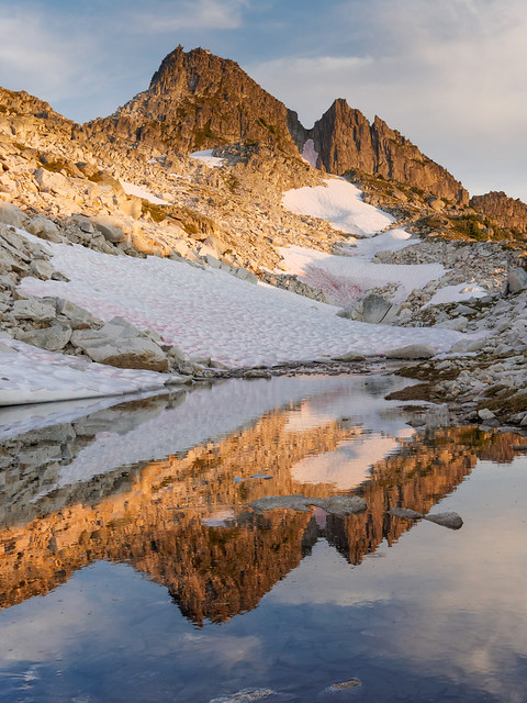
Once down to Lyman Lake I got some great views of Bonanza Peak especially from the west side of Lyman Lake where it is reflected in some lovely grass spattered ponds.
Bonanza Peak and Lyman Lake in Glacier Peak Wilderness, Washington
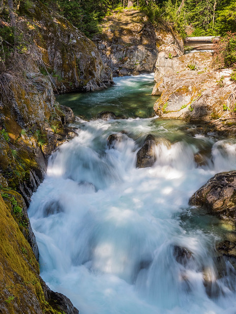
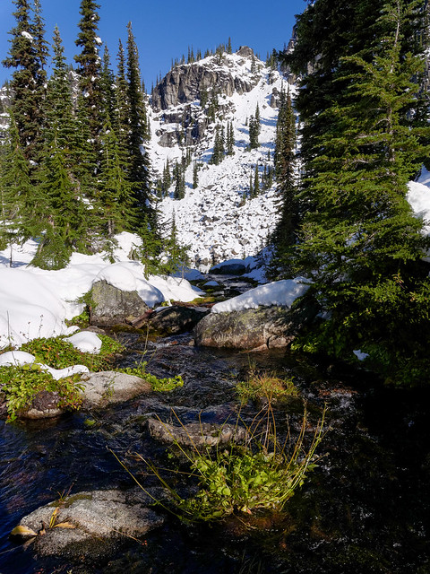
Continuing around the west side of Lyman Lake brought me to Railroad Creek and this a lovely cascade flowing down from the upper Lyman Lakes.
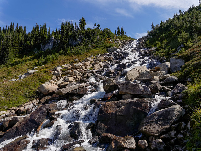
Railroad Creek in Glacier Peak Wilderness, Washington
From there the trail climbs up from Lyman Lake to Cloudy Pass and the views over to Cloudy Peak and Bonanza are wonderful. There is a good camp in the meadows here to allow leisurely exploring up Cloudy Peak and beyond to North Star.
Cloudy Pass in Glacier Peak Wilderness, Washington
As I approached Cloudy Pass I was able to look back at the entire day's hiking from just below Spider Gap, past Upper Lyman Lakes, down to the Lyman Lake, around to Railroad Creek cascade and up to where I stood when I took the below photo. I just love to see the extensive territory that can be covered under human power, especially territory as lovely as this.
Chiwawa Mt, Fortress Mt, Lyman Lake and Spider Gap in Glacier Peak Wilderness, Washington
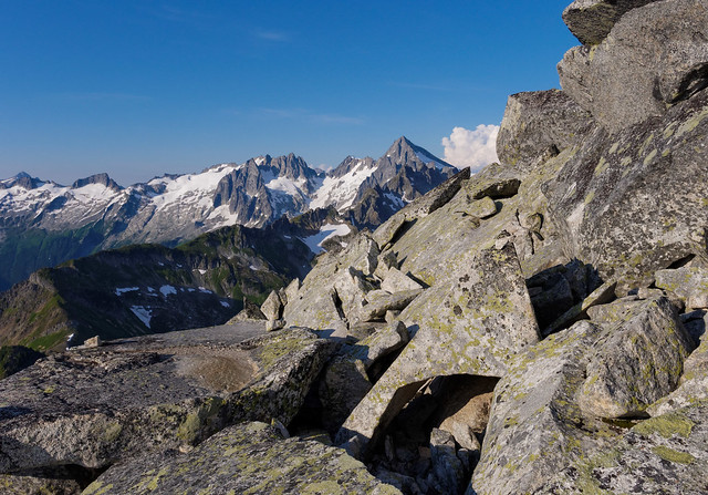
The trail drops down after Cloudy Pass and there is a good short cut over to Suiattle Pass. After a bit of a forest walk the trail heads toward Image Lake and traverses Miners Ridge. Great views of Fortress Mt ...
Fortress Mt seen from Miners Ridge in Glacier Peak Wilderness, Washington
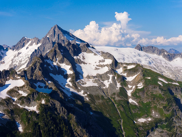
... and Glacier Peak opened up abruptly as I walked in an attractive meadow below Plummer Mt. The light was turning golden and I had to hurry to get to Image Lake before dark.
Glacier Peak from Miners Ridge in Glacier Peak Wilderness, Washington
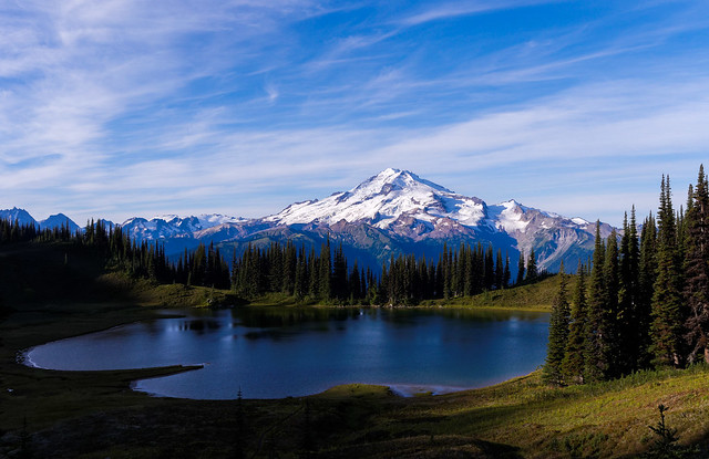
On the third morning I discovered I was the only person at Image Lake - amazing. The trees between the lake and Glacier Peak have grown over the years, so the classic picture has changed some, but beautiful photos can still be taken.
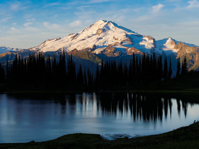
Glacier Peak and Image Lake in Glacier Peak Wilderness, Washington
I hung out at Image Lake from first light until the sun glimmered on the lake. What a treat to see the sun and reflections painting on the water.
Glacier Peak and Image Lake in Glacier Peak Wilderness, Washington
It is such a scenic area that even my campsite had a stunning view.
John in camp near Image Lake in Glacier Peak Wilderness, Washington
I retraced my steps along Miners Ridge, down to the Suiattle river. I met a few PCT through hikers finishing up Washington - it was that time of year.
Miners Ridge in Glacier Peak Wilderness, Washington
I passed this gorgeous and surprisingly unnamed creek.
Unnamed creek within Glacier Peak Wilderness, Washington
After dropping all the way to the river I climbed back up to Middle Ridge on the way to Buck Creek Pass providing a different view of Fortress Mt.
Fortress Mt in Glacier Peak Wilderness, Washington
Now I got to see the long traverse along Miners Ridge over to Image Lake.
The clouds started to move in but I made it up to Buck Creek Pass before dark and the rain. Surprisingly there were no hunters in evidence at the pass and I had a nice solitary camp.
Liberty Cap in Glacier Peak Wilderness, Washington
It rained hard that night and the next morning I awoke to clouds so I decided to not go to High Pass and Triad Lake and proceeded to head out.
Buck Creek Pass in Glacier Peak Wilderness, Washington
The weather improved later in the morning so I had a nice forest walk out to Trinity. Luckily I managed to get a ride back up to Phelps Creek Trailhead saving me a three mile road walk back to my car. All in all it was a very good trip and an area I definitely think we should return to in the future so Jean can see it in person. All of our photos from this trip are on Flickr.
Buck Creek Pass in Glacier Peak Wilderness, Washington
My next solo outing was to be a a 3 day/2 night trip from Icicle Creek to Chain Lakes and Frosty Pass in Alpine Lakes Wilderness. Things did not go as planned and this is a tale of two trips. One of the great virtues of retirement is time. One of the ways of using that virtue is the "do over." If you didn't get it right the first time, you actually have the time to try again. So when I got weathered off of my first trip up to Chain Lakes (low cloud ceiling and very poor visibility) in late September, I was able to try again a few days later. However, even though I had beautiful blue skies the second time I had other difficulties.
The plan for this loop was to go up to Chain Lakes on the first day; past Doelle Lake and cross country to Frosty Pass on day two. Then down Chatter Creek and out on the third day. Most of these pictures are from the second sunny trip. An easy forest walk brought me to a lovely confluence of French and Icicle Creeks. This is a popular easy overnight trip for those backpacking with small children.
Icicle Creek and French Creek in Alpine Lakes Wilderness, Washington
The Icicle Creek trail stays on the east side of the creek and crosses French Creek on an excellent bridge.
French Creek in Alpine Lakes Wilderness, Washington
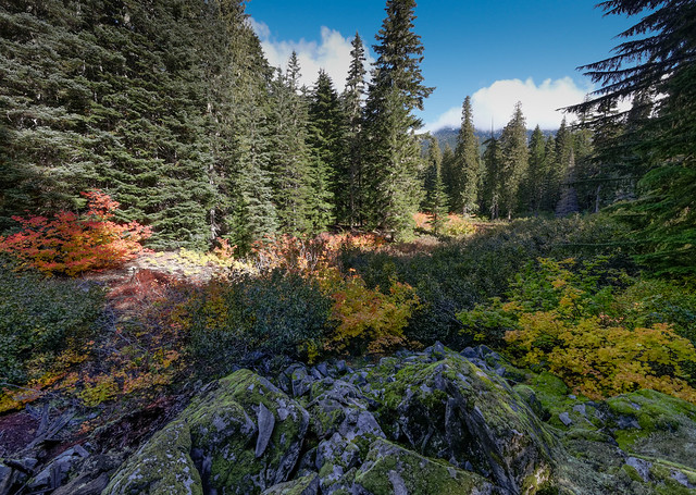
The trail meanders along Icicle Creek and only gains about 1,000 feet in the first 10 miles. It was moving quickly from fall to winter, though there were still some color left.
Seen from the Icicle Creek Trail in Alpine Lakes Wilderness, Washington
It had been raining heavily, so the real standout features in the forest were fungi, ...
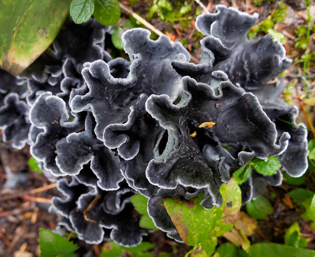
Seen in Alpine Lakes Wilderness, Washington
... some of the prettiest I've ever seen.
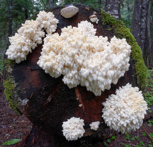
Seen in Alpine Lakes Wilderness, Washington
Looking closely at this fungus it's more like the stalactites in a cave than vegetation.
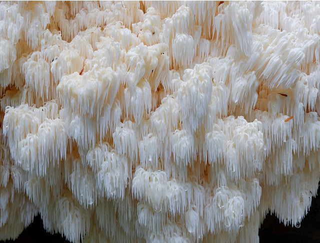
Seen in Alpine Lakes Wilderness, Washington
These pictures are good examples of using the stacked focus technique where multiple images are merged to have clear focus from both near and far. This really works well with these fungi. From my first trip I learned that I really needed a tripod for the second trip.
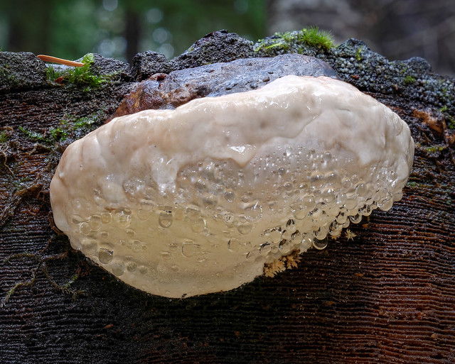
Seen in Alpine Lakes Wilderness, Washington
Up close this fungus really looks like it wants to eat you - I've never seen this much color in one fungus before.
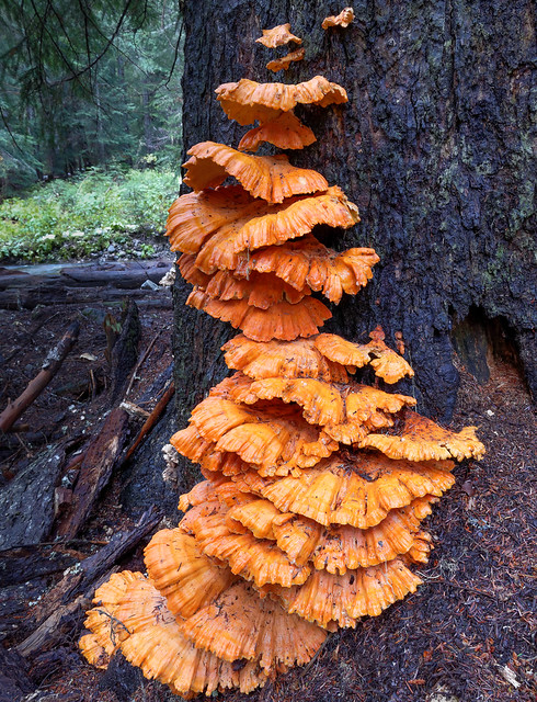
Seen in Alpine Lakes Wilderness, Washington
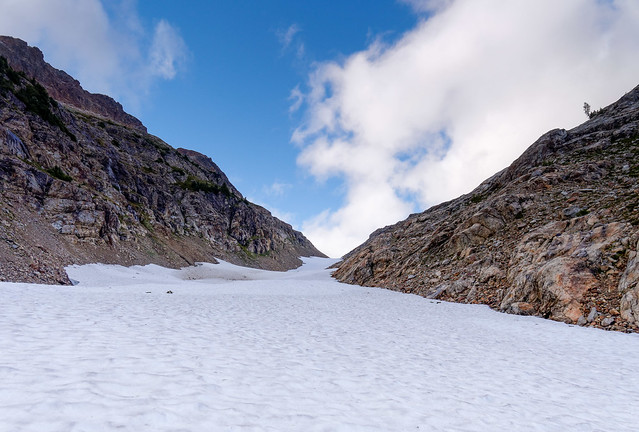
Not long after all the fungi, the Chain Lakes trail branches off the Icicle Creek trail. It is a very steep trail up to Chain Lakes (2,000 feet in about two miles). I knew the trail well from the previous trip last week. I also knew there was no flat ground to camp on until I reached the lakes. I was feeling pretty good starting the last two miles with three hours of daylight. However I encountered snow at about 4,000 feet.
Elk tracks on the trail to Chain Lakes in Alpine Lakes Wilderness, Washington
The snow got deeper and deeper and my pace slowed and slowed. It started to get dark, but I still had about half of a mile to go and 500 feet vertically. I was trying to follow a trail with one to two feet of fresh snow by headlamp. I was "post-holing" and climbing over slide alder bent by the fresh snow. The higher I went the deeper the snow got.
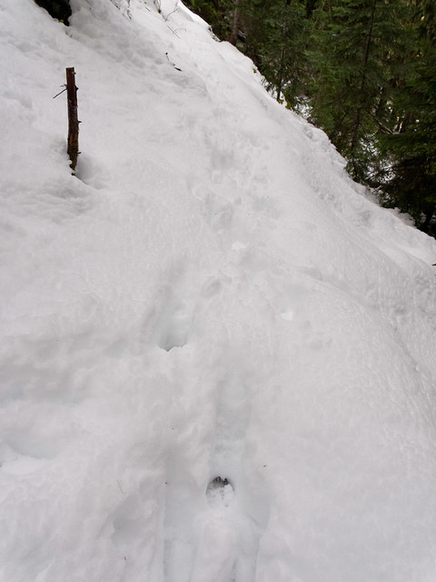
The "trail" to Chain Lakes in Alpine Lakes Wilderness, Washington
I eventually reached the first lake but it was well after dark. There was two to three feet of fresh snow; a winter wonderland, but it was totally disorienting in the dark. My goal was to camp somewhere with tree protection at the second lake. I figured there will be less snow and I should have a good tent spot. The trail was now totally impossible to follow, so I traced the stream up to the second lake.
Lo and behold I found a tent spot with only a few inches of snow, level and just big enough for my tiny tent. There was very little snow seen on branches above so snow bombs should be minimal. It is cold. I knew the clock was ticking on how long my hands would function. My shelter went up quickly and I post-holed over for water. I stripped off my boots and totally soaked socks and cooked Ramen noodles from the welcome comfort of my sleeping bag. It was quite cold but I was still surprised when my boots froze in about 15 minutes. My NeoAir mattress worked great on the snow and I slept well. My only discomfort came when it was time to slip on frozen boots to go out to pee.
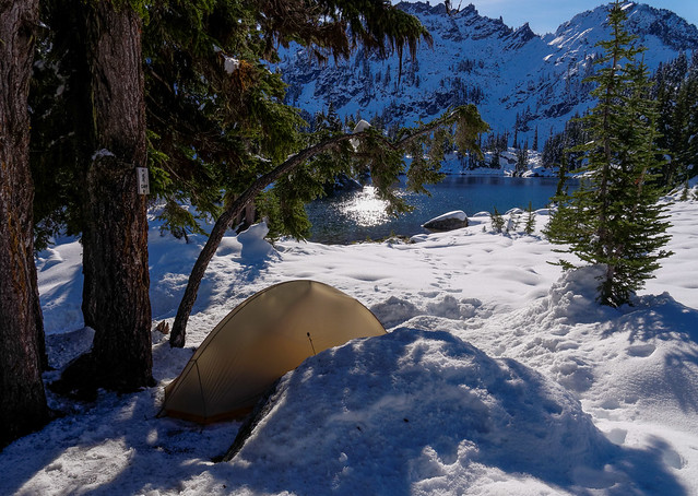
Campsite by Chain Lakes in Alpine Lakes Wilderness, Washington
The next day the sun finally hit my tent and everything warmed up nicely. Thankfully I didn't have to deal with the frozen boots issue anymore.
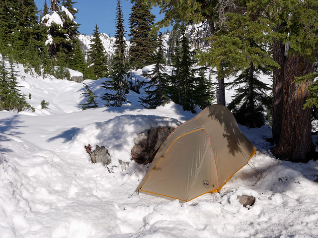
Campsite by Chain Lakes in Alpine Lakes Wilderness, Washington
The weather is quite a contrast to my first trip here with just a light snow.
Campsite by Chain Lakes in Alpine Lakes Wilderness, Washington
In addition the low cloud ceiling on the first trip provided more limited views of the middle Chain Lake ...
Middle Chain Lake in Alpine Lakes Wilderness, Washington
... and the upper Chain Lakes. This was as high as I got on the first trip. Doelle Lake is up in the clouds and there would be no way to find the route to Frosty Pass in these conditions.
Upper Chain Lakes in Alpine Lakes Wilderness, Washington
However, on my second trip it was absolutely gorgeous out. But when I tried to walk around for some photos I could barely move. I was nearly totally immobilized by the snow. Without snowshoes I could only cover about a 100 feet in five minutes so getting up to the viewpoint above the lakes, just a quarter mile away, would take an hour or two.
Chain Lakes in Alpine Lakes Wilderness, Washington
So I took a few more photos, including this wonderful reflection in the first of the Chain Lakes ...
Chain Lakes in Alpine Lakes Wilderness, Washington
... and decided to make a quick exit. When I crossed this creek I considered making an attempt to get to Doelle Lakes but the snow was just too much without snowshoes. I shouldn't have been surprised. After all, these were the unpredictable Cascades.
Alpine Lakes Wilderness, Washington
The descent went quite a bit faster. I could even plunge step a lot of it. Looking at the trail in daylight, I'm amazed that I was able to cover so much of it after dark. On my way out I discovered I did have other, fortunately unseen, company on this trip ... illustrated by the is fresh black bear paw print in the photo below.
When I finally hit dirt I'm so happy to move quickly that I just want to walk all of the way out. I've now covered this ten mile section of the Icicle Creek trail 4 times in the last week. I know it a little too well. So there we have it: the first trip ends with lots of clouds and little snow; the second trip ends with no clouds and lots of snow. I certainly never expected this on October 3rd, but it was very cool to see the same spot in such dramatically different conditions just one week apart. I guess one "do over" is not enough so I'll need to do this one again. Only next time I'll be sure to bring my best friend Jean (and not just because I want someone else to carry some of the gear. All of our photos from these trips are on Flickr.
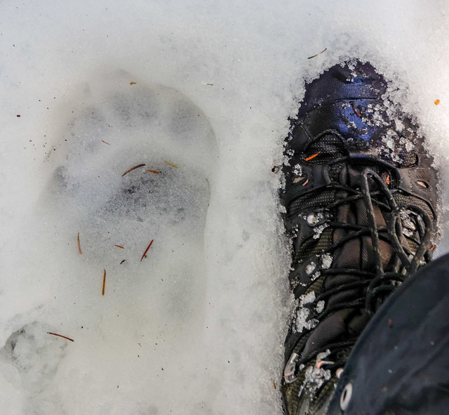
Black Bear paw print seen in Alpine Lakes Wilderness, Washington
So that wraps up our Washington State adventures for 2013. While things didn't turn out as planned we had a great summer and the North Cascade Mountains are going to be here for a while so we will get more opportunities in the years to come. Due to my (Jean's) wrist injury we will be spending the winter in the Seattle area (details below). We are hopeful that in the spring we will be able to head south where we would love to do more backpacking in the Grand Canyon.
One thing we did during the months we spent in the Seattle area was replace our trusty, but aging, 2005 Subaru Outback. This has been a great car and it has gotten us into and back out of some really tricky places in Washington (snow), Colorado (rock) and Arizona (sand) but not without some "drama". And "Dusty" is showing some wear and tear from all of our adventures and is approaching the time when some major service will be needed. So …
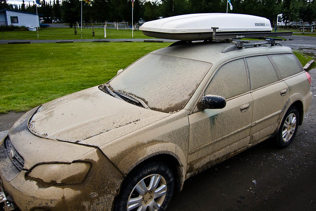
"Dusty" after being towed across the Taylor Highway in Alaska
… we are currently waiting for our cherry red 2014 Jeep Cherokee "Trail Hawk" to be built and delivered. The adventure continues!

This next bit is just something I have been thinking about.
Seduced by the "dark side"
I was 23 when I saw the first Star Wars movie and I'm a little embarrassed to admit that it is still one of my all time favorite movies primarily because I found the concept of the "Force" to be quite compelling. It is a common thing for humans to want to believe in something greater than themselves. But I have never been comfortable with the idea that the something is a higher consciousness, a deity, because it has always seemed to me that he/she is not being fair. I have never been able to understand why so much bad stuff happens to so many innocent people especially children. It is never my intent to criticize the religious beliefs of others. It is just that I like the idea that there is a non judgmental power in the universe, a life "force", that is available for us to draw upon.

My temperament, the inherited portion of my personality, is "INFJ" so I am introverted and hypersensitive. According to Susan Cain in her book "Quiet – The power of introverts" I am also shy and "rejection sensitive". In addition I grew up in a dysfunctional family that had too many challenges and too few resources. Children in dysfunctional families commonly take on one of the "basic roles"; "Hero", "Scapegoat" etc. My temperament and birth order, the fifth out of six kids, set me up to become the "Lost Child" and I was neglected. On top of that I inherited a brain chemical imbalance, Cyclothymia, which causes mood swings. It is a milder form of Bipolar Disorder but it lacks the "glamor" of stereotypical "Manic-Depressive" conditions. Whereas, individuals with Bipolar I or Bipolar II often express their mania with high energy and a "party" attitude my mania is frequently expressed as anxiety and irritability.
Jean and John crossing Grewingk Creek while backpacking in Kachemak Bay State Park, Alaska
This undoubtedly accounts for the fact that throughout the years (especially since menopause) I have hosted many internal battles between my "light" and "dark" sides. Counseling and medication (as well as the love of a good man) have all helped decrease the frequency and the intensity but I have never been able to prevent all of the attacks by my inner "Storm Troopers". They are constantly on the alert waiting for opportunities to strike. However, not long ago I become aware that my inner "Rebel Alliance" has been receiving help from an unexpected source, this portion of the blog, where I write about things that I think about. I have come to realize that too often when the battle is fought verbally (either aloud or just in my head) my "dark side" becomes empowered whereas when the battle is fought in writing my "light side" has more time to prepare an effective defense.
So far I have used this blog to prevail over my apprehension at getting older and concerns about my screwed up feet and bad knees. I have also worked through some issues I have had with my parents and siblings. In addition I've written about the fears I have experienced while exploring the outdoors with John, my "adventurous" husband. I have even written about my trepidation when posting to this blog specifically the fear of exposure that comes with posting anything the least bit personal on the internet.
All of this would seem to be out of character for a shy introvert but Susan Cain mentioned something else in her book, "Quiet", that helps explain it. She wrote that studies have shown that introverts are more likely to express intimate facts about themselves online than extroverts. It is apparently because they feel like they can express their "real self" online in a way they are unable to do with others in person. Another advantage for me is that I have the time to organize my thoughts into something more coherent and no one can interrupt me while I'm at it. It also helps that I can't read the body language of readers and see that few if any are really interested in knowing this much about me.
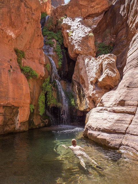
Jean at Elves Chasm in Grand Canyon National Park, Arizona
That is not to say my "dark side" hasn't put up a fight. Each post has taken me an inordinate amount of time to write because of skirmishes between my "light" and "dark" sides. All too often when I reread something I've written the next day (or the next week) I realize how whiney or bitchy I sound. John and I both want our blog to be positive but my "dark side" is insidious so John maintains some veto power over the content. So far he has only had to use it once when I had vehemently insisted "We're not Snowbirds" and said how much I resented being called that. I have since toned it down.
"Give off light, or darkness, Padawan. Be a candle, or the night" – Yoda
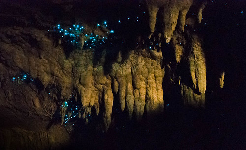
Glow worms in Waipu Cave on New Zealand's North Island
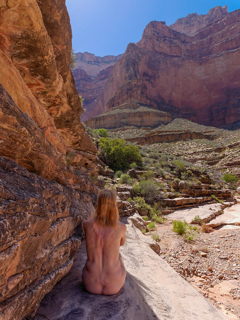
However, it was different when I wrote the previous post, "You are so lucky", as I did not have to fight a single battle with my "dark side". That post also covered the month we had just spent in Grand Canyon National Park where we had done three backpack trips. Of the three our favorite was the Tonto West Trail. To quote the National Park Service trail description "This segment of the Tonto Trail is notorious, regarded by canyon experts as the most difficult and potentially dangerous section of this long transcanyon trail system". Part of the challenge is the lack of reliable water and the limited "bailout" opportunities. At one point we had to carry two days worth of water with us and carefully ration what we had to ensure we had enough until we got to our next reliable water source.
"Do or do not... there is no try." - Yoda
Jean on the Tonto West Trail in Grand Canyon National Park, Arizona
The week long trip was challenging at times but we did what we needed to do and it has become our fifth all time favorite backpack trip. We both loved the solitude; we went four entire days in a major national park during peak season without seeing another person. But a big reason for me was I felt as though I had undergone a sort of a transformation; that I had been given a test and had passed it. I had endured and persevered. As a result I achieved a level of self confidence in the backcountry that I had never felt before. I could truly believe that despite my advancing age, my bad knees and my screwed up feet that the "Force" was strong in me and I felt like I was on my way to become a backcountry "Jedi"!
With that mindset I was really pumped up about our upcoming adventures in Washington State. The day after I updated our blog we began a backpack trip on the Wonderland Trail in Mt Rainier National Park. However, if you read the post above then you already know that things did not turn out as planned. Due to high water levels and the log bridge being tipped over we were unable to safely cross the South Mowich River so we could not continue at that time.
The South Mowich River in Mt Rainier National Park, Washington
That in itself was no big deal as we had the entire summer ahead of us and we could come back at a later date. The big problem occurred while we were walking along the riverbed looking for a place to safely cross the river. I had failed to notice a stick amongst the rocks that was angled up toward me in such a way that it wasn't very visible and it didn't register in my mind as an obstacle. As a result I didn't lift my foot up high enough and my bootlace got caught on it. It was just enough to cause me to lose my balance and I fell forward on my left hand and left knee. I’ve fallen before and accepted that the palm of my hand would be sore for a few days but my primary concern was for my knee. I got up and walked around a bit and to my great relief it felt okay. I assumed I'd have some bruises but I saw no reason why my fall would interfere with our plans.
Once we accepted that we were unable to cross the river that evening we backtracked a bit to camp with the intention to try to cross in the morning when water levels were lower. While John went to get water I set up camp. Soon after my wrist began to swell and it became quite painful. Before long I lost all function. I couldn't hold a trekking pole, which my knees rely on, much less an ice axe, which my life could depend on in the coming days, so we came to the disappointing conclusion that our only option was to bag this trip and hike out the next morning. I was devastated.
"When you look at the dark side, careful you must be ... for the dark side looks back". - Yoda
Looking toward the entrance of Tunnel Slot Canyon in Grand Staircase - Escalante National Monument, Utah
Later that evening John sat down next to me while I sitting in camp dejectedly cradling my painful wrist. When he gently said "not feeling so lucky now are you" I burst into tears. I was thinking that at the very least my wrist was sprained and I knew that it would probably take about six weeks to heal up. I was berating myself for my clumsiness and my careless inattention. I was furious at myself for destroying our grand plans for not only this trip but the next couple of trips. I also felt so guilty for depriving John of the adventures he too had been looking forward to and had spent many hours researching and planning.
"Once you start down the dark path, forever will it dominate your destiny" – Yoda
Jean in Tunnel Slot Canyon in Grand Staircase - Escalante National Monument, Utah
To his credit from the moment I first realized that I was injured John has been great. Ever the optimist, he immediately looked at the bright side and said no problem; we'll focus on dayhiking while my wrist healed up. He pointed out an advantage of this new plan would be that he would have more time for photography. He went on to say that even if we couldn't backpack anymore this summer we had already done three great trips that year and there was always next year. He continued to try to cheer me up by going so far as to say that even if we never went backpacking again we have had such great experiences these past three years that we couldn't complain.
Intellectually I understood what he was saying and I really appreciated his saying it but unfortunately, emotionally, I wasn't buying it. My "dark side" proceeded to launch a well coordinated attack; first mocking me for having just written such a disgustingly upbeat blog entry; “Life is good!”, "You are so lucky!", then ridiculing me for thinking of myself as a competent backpacker, a "backcountry Jedi". Give me a break! My "light side" did try to counter with evidence that I was indeed still lucky. After all, I had only injured a wrist and not a knee or an ankle. I'm right handed and had injured my left wrist. Heck, I felt especially lucky to even have wrists because far too many war veterans can no longer say the same thing. Yes, I was sorely disappointed but my "light side" asserted that I could still feel lucky at the same time.
“In a dark place we find ourselves, and a little more knowledge lights our way” – Yoda
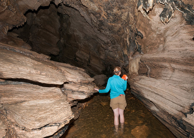
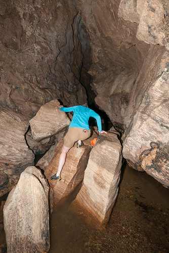
Jean wading through Organ Cave within Abbey Caves on New Zealand's North Island
But the "Empire" struck back with a vengeance turning my disappointment into guilt and self condemnation. Why do you have to be so clumsy? Why can't you pay attention to where you are walking? Why do you fall down so much? What if something is broken? How much is it going to cost to fix it? How much time is it going to take to get over it? What right do you have for screwing everything up? Do you really think that you are worth all this trouble? And then it fired the "Death Star" and I started thinking things like ... Doesn't John deserve a better life partner? Someone less accident prone? Someone less emotionally damaged? Someone without a mood instability? Needless to say my "Rebel Alliance" suffered a crushing defeat.
We hiked out the next morning and it was humiliating to need help with everything from tying my boot laces to snapping my pants after every "call of nature". Once back to our car we headed to the nearest health care facility, the Emergency Room at St Elizabeth's Hospital in Enumclaw. My wrist was X-Rayed and the ER doctor told me my wrist was sprained, not broken, so I was given a splint and an ice bag and sent on my way. Over the next few days my wrist seemed to be improving so I was able to muster a bit of optimism that there would still be time to do some of the trips we had planned. In the mean time we could do some great dayhikes. My "light side" was fighting back!
“Patience you must have my young Padawan” - Yoda
Jean and splint on the Laughingwater Creek Trail in Mt Rainier National Park, Washington
However, after about two weeks I hit a plateau. Every morning I woke up hoping to see and feel some improvement but every day I was disappointed. I would then tell myself that it would be better tomorrow. Unfortunately it wasn't. If anything it was getting worse. I realize now that I was in denial as I didn't want to take the time or spend the money to see another doctor. I just figured that I'd be told that injuries in "older" people such as me take longer to heal. But after four weeks I was getting concerned and after six weeks I was quite worried. Some internet searching led me to the conclusion that I had most likely broken my Scaphoid bone, one of seven small bones comprising the wrist joint.
What I have since learned is that Scaphoid fractures often don't show up in initial X-Rays. Based on what I have since read I know it would have been better for the ER doctor to tell me that and put a cast on my wrist and instruct me to see an orthopedic doctor in 10 – 14 days so the X-Rays could be repeated. At that point the doctor might conclude that it was indeed just a sprain and remove the cast or the X-Ray may show a fracture. In some cases a CT scan or an MRI might be required to make an accurate diagnosis.
Assuming that my wrist was fractured I learned that at this point in time there was a real possibility that I would need to have surgery to repair it. We came to the realization that we would need to stay in one area for at least two to three months. As we live in a motorhome we had options about where that would be and we chose Mt Vernon for its close proximity to North Cascades National Park. I located an Orthopedic Surgeon whose specialty included hands but unfortunately it took three weeks to see her. When I was finally seen the initial X-Rays were inconclusive and the doctor said I was a "puzzle". However, additional X-Rays confirmed that my Scaphoid was indeed fractured but she said the bone looked "funky". Not reassuring to hear.

X-Ray of Jean's Scaphoid fracture
An MRI convinced her that I needed to see someone more specialized and she referred me to a surgeon in Seattle so we reluctantly left the mountains and headed toward the big city. This new surgeon told me that my Scaphoid fracture had healed some but in a "crimped" position. He also told me that I have some torn ligaments as well. He went on to say that this is a rare combination of injuries that he had only seen it once before and that was in the hand of a boxer. The conclusion was that I must have sustained some of these injuries in a previous fall. Well, this was definitely not the first time I have fallen on my left hand. The worst was in a bike crash back in 1997. In addition there have been a few times over the years when I have tripped and fallen while trail running and hiking. In fact, just this past April I tripped and fell on my left hand while backpacking in the Grand Canyon.
He said I was "complicated" (not reassuring) and laid out two options. I could continue to splint my wrist and "wait and see" if it eventually healed completely on its own. If it didn't, or if it still hurt, then surgery would be needed. OR I could go ahead and have the surgery now. In either case, surgery would involve chiseling the bone apart, sticking a bone graft between the pieces and screwing it all together in a more normal position. He also said that nothing could be done for the torn ligaments at that time. I thought deeply about both options and talked it over with John. While I always want to avoid unnecessary surgery I concluded that I had already been doing the "wait and see" drill for over two months without noticeable improvement so I opted for the surgery.
Unfortunately he had a pretty full schedule and I almost cried when I learned that I would have to wait another six weeks, until mid October, to have the surgery. I realized that not only had I obliterated our summer plans but this late surgery date and the lengthy recovery period would also destroy our plans for the fall and winter as well. We had been planning to head south by November to spend the winter in sunny Arizona again. We intended to do more backpacking in Grand Canyon. We'd have our boys visit us again for the holidays and had been looking forward to taking them hiking over red rocks and under blue skies; so different from the wet grey December weather in the Pacific Northwest. But no, we would not be doing any of that because I had screwed everything up for all of us.
Periodically ever since I first fell I have struggled emotionally as my "light" and "dark sides" have clashed and regrettably there were times when John got caught in the crossfire. To complicate matters he was waging his own internal battles as it was only natural that he felt disappointment and frustration for this complete disruption to our plans. To his credit his "light side" has largely prevailed and outwardly he has remained supportive and caring. However, there were a few times when my "Storm Troopers" aggressively provoked his inner "dark forces" and we engaged in some epic battles. One time I even became afraid that I had finally pushed him too far. He has proven over the years that he can take a lot of verbal abuse from me but even he has limits to what he can endure.
"That place… is strong with the dark side of the Force" - Yoda
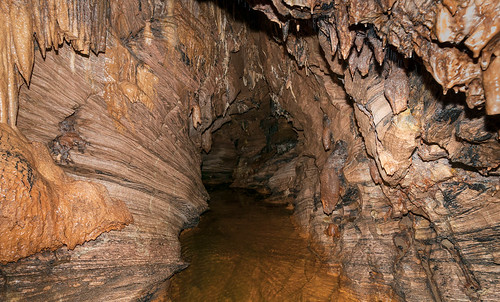
Organ Cave within Abbey Caves on New Zealand's North Island
"A domain of evil it is. In you must go" - Yoda
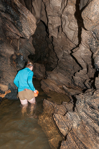
Jean in Organ Cave within Abbey Caves on New Zealand's North Island


Jean at the base of the cliff with a 20 foot rappel on the Royal Arch Loop in Grand Canyon National Park, Arizona


"Impossible to see, the future is." - Yoda

But no matter what happens I know that I will be able to handle it because the "Force" will be with me … always.
Jean in Organ Cave within Abbey Caves on New Zealand's North Island
I felt helpless because I saw no way that I could make our situation any better. Intellectually I knew that at the very least I should try to not make it worse with my irritability but emotionally I found that impossible at times. It was almost as though being bitchy enabled me to feel less helpless. I found a distorted sense of power and control by pushing John away. Fortunately I came to understand that fear is the most powerful and destructive of all emotions and I could see that I needed to identify just what it was that I was so deeply afraid of.
"Named must your fear be before banish it you can" – Yoda
Jean wading through Organ Cave within Abbey Caves on New Zealand's North Island
I first examined the obvious, the fear of rejection, but I have come to trust John's total commitment to our marriage. Nobody does "for better and for worse" as well as he does. I realize that I have a deeper fear of physical disability. I fear the loss of independence and becoming a burden on my family. This is obviously not an uncommon fear but it is especially prevalent for me right now because I am feeling particularly fragile and vulnerable to injury. I know I am clumsy and fall down easily so I know that I need to be very careful where I place my feet when walking over uneven surfaces. When I hurt my wrist I had thought I was being careful. But despite my caution I still tripped on a stick and fell on some rocks. Even though I thought I was paying attention I sustained an injury that will take months to recover from and thousands of dollars to pay for. I shudder to think about the thousands of the sticks and rocks I will encounter in the years to come and if I can injure myself when I am paying attention then what might I do to myself if/when I spaced out?
What I believe that I fear above all else is complete emotional disability due to that hateful inherited brain chemical imbalance. Those who spend their lives "hiking" on more level emotional "trails" …
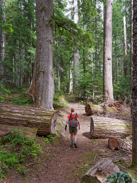
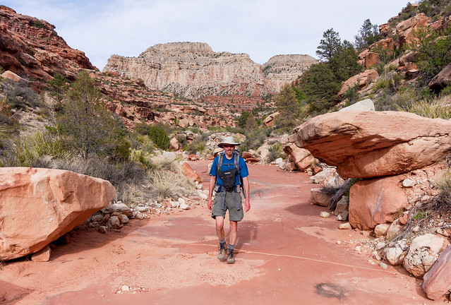
John hiking down Arch Canyon in Grand Canyon National Park, Arizona
… can't really understand what it is like for those of us who are frequently negotiating "routes" where constant vigilance is required to avoid tumbling down an emotional "cliff". It is exhausting and if one "falls" it is so difficult to "climb" back up again and the resulting emotional "bruises" and "scrapes" take a long time to heal. Some are bad enough that they leave "scars".
Jean on dayhike to Cathedral Rock in Coconino National Forest, Arizona
Fortunately medications, Lamictal (a mood stabilizer) and Wellbutrin, (an antidepressant), do help my emotional "trail" to even out. However from the beginning I have resented having to take medication for my mood disorder because part of me still viewed this as a character flaw, not a legitimate physical condition. Reading the long lists of potential side effects and warnings are scary (seizures etc) and living with some of the common side effects (drowsiness etc) is annoying. However, recent events have led to my starting a second mood stabilizer, Risperidone. I have to say that it has helped but that part of me that resented taking two medications really resented taking three. But I consoled myself with the belief that the need for it was only temporary. I assumed that once I got through my surgery and was well on the way to recovery that I could go off this additional medication. However, if I am honest with myself then I have to admit that I had been having trouble emotionally even before I injured my wrist.
When I wrote about the "misadventure" we had while backpacking the Royal Arch Loop in Grand Canyon National Park in the previous post, I left out a few details. We had goten separated while on the Tonto Trail heading toward South Bass beach where we were to camp that night. I was ahead of John because as he had stopped to take photos. So I reached the junction with the shortcut trail (illustrated by the red arrows) down from the Tonto Platform to the beach before he did. Once at the junction I sat down to wait for him. Unfortunately John inadvertently got off the main trail and missed this junction and ended up taking the long way to the beach (illustrated by the blue arrows) by first traveling to the beginning of the side canyon before making a sharp turn onto the South Bass Trail down through the canyon back toward the beach.

South Bass Canyon in Grand Canyon National Park, Arizona
After sufficient time passed and still no John, I became quite concerned to the point that I had a full blown anxiety attack. I was completely immobilized by indecision and it took quite a while for me to get a grip on myself. Once I did, I decided to backtrack far enough to reassure myself that he wasn't still behind me (possibly injured). But I didn't find him so I headed back to the junction. I knew John hadn't taken the shortcut so I could only conclude that he had for some unknown reason taken the long way around. I then took the shortcut trail down toward the beach hoping that I would find him there.
I got to the beach just before dark and talked to another backpacker who told me that John had been there but he had left again to look for me. I was told that he planned to backtrack up the canyon but take the shortcut trail up to the Tonto Platform and then continue around the long way again. He had every reason to believe that he would run into me somewhere along the way but for some unknown reason he hadn't. There was nothing for me to do but wait for him. So I set up camp with the limited gear I had with me (tent and stove but no air mattress or food) and tried to get some sleep. He made it back to the beach quite late that night and we were both greatly relieved. Given the additional miles he had put in (and the additional weight of water for me that he had carried) John was especially tired so we ate a quick supper and went to sleep without trying to figure out how we had missed each other.
We had originally planned to get an early start in order to beat some of the extreme heat on our strenuous hike out of the canyon. Unfortunately we slept much later than we had intended so we got a late start. On the way we talked at length about the events of the day before. John did eventually realize that he had missed the junction but he assumed that I would not wait for him very long before heading to the river as we were both low on water. And he decided it would be shorter for him to continue on his way rather than backtrack. But that didn't explain just how we had missed each other when he was out looking for me. I felt some anxiety to keep moving but John wanted to take time to examine what he unwisely referred to as "the crime scene".
It was unwise because I literally erupted. In hindsight I realize it was caused by a combination of things; partly the aftermath of the extreme anxiety I had felt the day before. I was also a bit hurt when I learned that John hadn't known that I would wait for him and he hadn't even considered backtracking to where I might be. In addition I felt guilty for his being tired from having to look for me the previous evening. But most of all I felt angry because I thought he was accusing me of committing a "crime" which I thought was extremely unfair because I was the one who had followed our agreed upon procedure. If we get separated while hiking and there is a trail junction ahead then the person in the lead waits at the junction for the other person to catch up.
But the fact was that he did not blame anybody for anything. It is just not his way. All he wanted to do was solve the mystery of how we missed each other when I was coming down the shortcut trail within the same time frame that he was heading up. What we finally figured out was that we had simply missed each other during a brief period of time when he was about 100 yards too far up the canyon because he had trouble finding the junction with the shortcut trail. And he spent several minutes talking to some folks camped in the canyon before backtracking and locating it. When he finally did find the junction he had no way of knowing that I had already reached it and was now headed down the canyon towards the river.

South Bass Canyon in Grand Canyon National Park, Arizona
Once the mystery was solved he was content to continue on our way. But I still believed that he thought the whole thing was my fault and I remained upset for quite a while longer. He couldn't understand where my fury was coming from and was at a loss as to what he could say to help the situation especially since he couldn't keep up with me. I can hike impressively fast, especially uphill, when I am pissed. Fortunately, ascending several thousand feet to the South Rim in high heat helped me to settle down. Afterward I felt completely drained but I also felt frightened because I had demonstrated some risky behavior.
When John insisted that we revisit the "crime scene" I experienced something known as "Diffuse Physiological Arousal" or "DPA" for short. It is a physical condition where a person is completely flooded with intense emotions that practically render them incapable of rational thought or action. What needs to happen is to let the person sit quietly or walk around by themselves until they have calmed down. But John did not fully appreciate the situation and continued to push me to return to "the scene of the crime". As a result I felt an irrational need to just get away and I started rapidly climbing up the steep unstable slope adjacent to the shortcut trail. Fortunately, a small part of my brain was still rational enough that I was able to get over to the trail without breaking my neck. What has been illuminating about this event, the absolute worst experience I have ever had while hiking or backpacking, is that it happened only three days before we began the trip where my "transformation" took place. In hindsight this "fall" off of an emotional "cliff" should have been enough evidence that my current medications were not effectively controlling my mood swings.
"Fear is the path to the dark side. Fear leads to anger. Anger leads to hate. Hate leads to suffering" – Yoda
Jean at the base of the cliff with a 20 foot rappel on the Royal Arch Loop in Grand Canyon National Park, Arizona
In the past when I have written about personal issues I have wanted to be completely honest. But the fact is that up until now I have intentionally avoided ever saying anything about my mood disorder because it really embarrasses me. It causes me to feel ashamed of myself and after a meltdown I feel a fair amount of self loathing. So why am I writing about it now? Well, one reason is I have never felt so frightened by it. I have never felt that it could enable me to do something so foolish and downright dangerous as to put my life at risk.
What I need to do is come to grips with my Cyclothymia. I need to accept that it is a legitimate physical condition and not a flaw in my character nor is it something I can control through shear willpower. Brain chemical imbalances run in families and that includes Bipolar I, Bipolar II, Cyclothymia, ADD, Narcolepsy, Schizophrenia and depression. I have a significant family history of brain chemical imbalances; my mother had Narcolepsy, one sister has Adult ADD and another sister, as well as two nieces (and most likely my brother), is bipolar. But I have yet to complete a health history form that asks about it. For many years I struggled with some depression and irritability but hadn't connected it with anything related to my family's health histories. Counseling helped but things still weren't "right" with me. However once I became aware of the family connection I told my Nurse Practitioner and appropriate medications were prescribed.
Cyclothymia is thought to be rare, affecting only about 1% of the overall population. However, I've read that Cyclothymia frequently goes undiagnosed because the mood swings are not as obvious as those experienced by individuals with a more "typical" bipolar disorder. If that is so then it seems to me that there are more of us walking around than was previously believed. This is a scary thought indeed. However, despite the fact that I have never met anyone else who admitted to having Cyclothymia I find comfort in knowing that they are out there and that I am not alone. When I first started writing this post I didn't know how it was going to turn out and how I was going reach some sort of positive resolution but once again writing about a personal issue has helped "light" to conquer "dark". I no longer feel like I have something to hide nor do I feel quite so flawed.
“You will know the good from the bad when you are calm, at peace. Passive." - Yoda
Jean on dayhike to Cathedral Rock in Coconino National Forest, Arizona
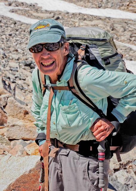
Dramatic personal change does not happen overnight and there will undoubtedly be times when I struggle. But something I have already discovered is that rereading previous posts has helped me to deal with recurring issues like my concerns with getting older . It reminds me that I have climbed Mt Kilimanjaro despite my bad knees and that I have hiked the John Muir Trail despite my screwed up feet. It also reminds me of the times when we have been told by younger backpackers than we are an "inspiration" to them. Best of all it reminds me of the inspiring people we have met who don't let anything keep them from doing what they love to do.
Carol at age 77 backpacking the John Muir Trail in California
I believe that rereading this post in the future will help me to continue to accept myself for who I am without condemnation. I am hopeful that it will help me to believe that even with a brain chemical imbalance and my emotional scars that I am a good person and worth all the bother.
Jean and her favorite "Toadstool" on Paria Plateau in northern Arizona
This is important because there is still a small part of me that wonders what will happen if one of my worst fears comes to pass. What if I have a serious accident or develop a devastating disease? After all, that sort of thing happens every day to people all around the world. I mean if a minor injury like a fractured wrist can send me over an emotional "cliff" then what would happen if I had to have a limb amputated or I became paralyzed? One often hears stories of individuals who exhibit extraordinary resilience in the face of personal tragedy and I admire them immensely but I just wasn't confident that I could emulate any of them.

Boston Marathon bombing victims learning to run again with their prosthetic legs
Photo courtesy of Steven Senne
As I never want to repeat my recent emotional turmoil I tried to plan ahead and figure out what I would do if something really bad does happen. But of course, without knowing what the future holds for me that is impossible. Fortunately, I found some reassurance in an unassuming book, "Feel the fear … and do it anyway" , by Susan Jeffers. Her advice is to not waste time worrying about what we would do if any of our fears are realized because odds are that few, if any, of them will ever come to pass. And if something bad does happen we should just be confident that we will cope with it and do what needs to be done. She recommends that we adopt three words - "I'll handle it".
“Train yourself to let go of everything you fear to lose.” – Yoda
Jean cooling off in Coyote Creek while on backpack trip through Coyote Gulch in Grand Staircase - Escalante National Monument, Utah
It would seem that what she is advocating is optimism and self confidence but feeling this way does not come easily to me. The fact is that I have never thought of myself as an optimistic or confident person and old habits die hard. I have read several "self help" books to try to remedy that but just couldn't get their techniques to consistently work for me. Perhaps I just haven't read the right book or repeated the right affirmation. But I have to admit that what sounds the most appealing right now is to just make some popcorn and watch some Star Wars movies. I know all this talk about "Jedi" and the "Force" sounds silly but hey, if this is what enables me to finally have a more positive outlook on life then why not?
I do believe that the "Force" exists and that it is especially strong in the wild places of our natural world and I am so looking forward to returning to the backcountry to continue my "training".
"A Jedi must have the deepest commitment, the most serious mind" – Yoda
Jean (wearing "Dry Pants") on the trail to "The Subway" in Zion National Park, Utah
I wonder if I could find a "Jedi Master" to teach me. I'll have to keep my eyes and my mind open.
“Looking? Found someone you have ... Judge me by size, do you?" - Yoda
Update:
I had my surgery on October 18th and my surgeon, Dr John Miyano (whom I can highly recommend) says everything went fine. He said he achieved 45 degrees of correction between the two pieces of my Scaphoid. I also took this opportunity to have a chronic thumb issue resolved. I had assumed that the ache I have felt in my left thumb for the past several years was due to arthritis. However, I found out earlier this year that it is in fact due to the loss of a ligament (undoubtedly from a past fall on my hand) causing my thumb to be unstable. So in addition to the fracture repair Dr Miyano also fused the joint at the base of my thumb.

The preceding three and a half months of discomfort and uncertainty felt like I was "hiking" through a "forest" without making any noticeable progress.
Seen on the Rakiura Track in Rakiura National Park on Stewart Island, New Zealand
Waking up after my surgery was like breaking out of the "trees" being able to see the "trail" ahead knowing that I would now begin to make some real forward progress.
Jean on the John Muir Trail in Kings Canyon National Park, California
But the "trail" to recovery will not be level or smooth. The Scaphoid is notorious for taking a long time to heal due to the fact that it has a very limited blood flow. A certain percentage of Scaphoid fractures never heal properly especially in cases such as mine where it was not diagnosed and treated in a timely manner. The bone graft may not "take" and may need to be repeated. In addition it is unknown what problem the torn ligaments will cause. More wrist surgery could very well be in my future. Even if all goes well and sufficient healing takes place I am facing a lengthy rehabilitation phase. It is going to take a fair amount of time and effort to regain most of the strength and flexibility I will have lost due to the long months that my wrist and thumb have been immobilized. But I have a great deal of experience at doing what is necessary to get me where I want to be.
Jean on the trail ascending to Forester Pass (13,200 feet) on the John Muir Trail in Kings Canyon National Park, California
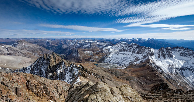
No matter how well things turn out my wrist will never be "normal" and I will be more prone to developing arthritis. However, I have every reason to believe that my surgery will provide me with a functional wrist and hand. So no matter what it takes to get to my recovery "summit" I know the "view" from the top will make it well worth the effort…
View from the top of Mount Sneffels (14,158 ft) in the Uncompahgre National Forest, Colorado
… and that John will be with me every step of the way.
John and Jean on the summit of Redcloud Peak (14,035 ft) in Colorado
Once my wrist and thumb heal up enough that Dr Miyano gives me permission to leave the state we plan to head south. Our intention is to return to the Grand Canyon by April to do more backpacking. Our son Dan is planning to visit us there.
Seen from the Tanner Trail in Grand Canyon National Park in Arizona
We could then follow the warmer weather north and do more backpacking in the high Sierras. Hiking the John Muir Trail was great but we want to spend more time there exploring the lesser traveled trails.
Chief Lake along the John Muir Trail in the John Muir Wilderness, California
What we are looking forward to the most is a trip to Peru! There is a trip we have wanted to do but the company we want to go with, Andes Adventures, has not offered it for years. However, we recently learned that one is scheduled for June 2014. This particular tour does the obligatory trek up the Inca Trail to Machu Picchu but the part we are most excited about is a six day trek around Mt Ausangate. This trail goes through several high mountain passes, the highest being 16,600 feet.

Mt Ausangate (20,905 feet) seen from the trail below Palomani Pass (16,600 feet), Peru
However, we are well aware that it is possible that none of this will come to pass.
"Impossible to see, the future is." - Yoda
Jean and John hiking on the South Bass Trail in Grand Canyon National Park, Arizona
But no matter what happens I know that I will be able to handle it because the "Force" will be with me … always.
"You must feel the Force around you; here, between you, me, the tree, the rock, everywhere … " – Yoda
Jean celebrating her 59th birthday in Ruby Canyon in Grand Canyon National Park in Arizona


No comments:
Post a Comment