After spending last spring in Grand Canyon, summer in Colorado and fall in Washington State we headed back to Jojoba Hills RV Resort, our winter base located in Southern California. We both got back into playing Pickleball, going out with the hiking group and engaging in our respective volunteer activities. If ever that is not enough to keep us busy we can always do pottery, play cards, go swimming, learn Line Dancing or do any number of the many other activities here. Jojoba Hills is like summer camp for old people! Staying in one place for five months out of the year is quite a switch for us. We have officially become “Snowbirds”! This winter brought another big change in our living circumstances. After living and traveling full time for five and a half years in our 27 foot Class C motorhome we purchased a 42 foot fifth wheel trailer to serve as our winter base housing. Our trusty motorhome will now be spending winters in the storage lot. However, as much as we love our activities here and our new spacious digs I know we will always look forward to loading up our motorhome in the spring to begin another great travel season and having more backpacking adventures.
Where we have been – Mt Rainier National Park, Washington
9/8 - 10/17 2015
In this post:
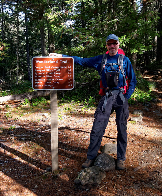
- Backpack trip – 6 days/5 nights on the Wonderland Trail from Sunrise to Longmire
- Backpack trip – 4 days/3 nights on the Wonderland Trail from Longmire to Sunrise
We left Colorado in mid August and headed to Washington State where we planned to help our son Tom relocate from Seattle to Bellingham. Our first task was to find him an apartment. Not an easy thing to accomplish in a college town right before Fall Quarter but we lucked out. After that job was done we had a bit of time before we were needed to help him move his stuff. We looked at options for backpacking and decided to do at least a portion of the Wonderland Tail in Mt Rainier National Park.
We had attempted to do it starting in late June 2013 but that trip was star crossed from the beginning. It had been a heavy snow year followed by early season hot temperatures which caused high water levels in rivers especially the South Mowich. We were unable to get across it on our very first day out. I also fell and broke my wrist so it seemed that trip just wasn't meant to be. But this time felt different and we were optimistic. John calculated that if we had favorable weather we had the time to complete the entire trail over two trips with a short break in between.
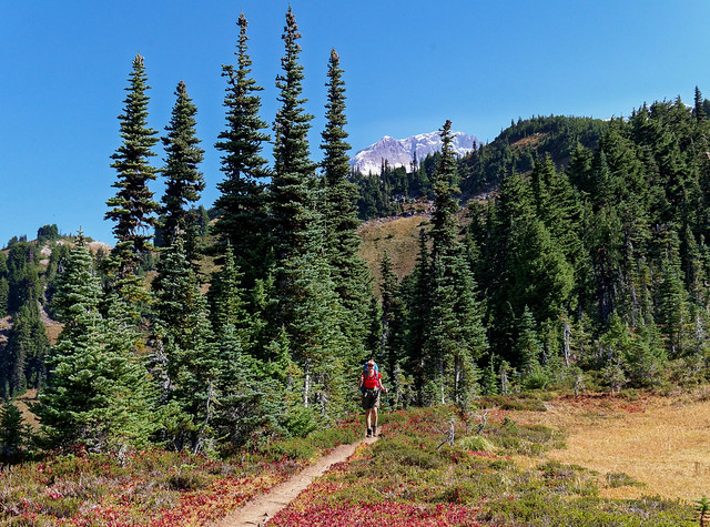
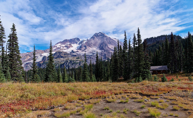
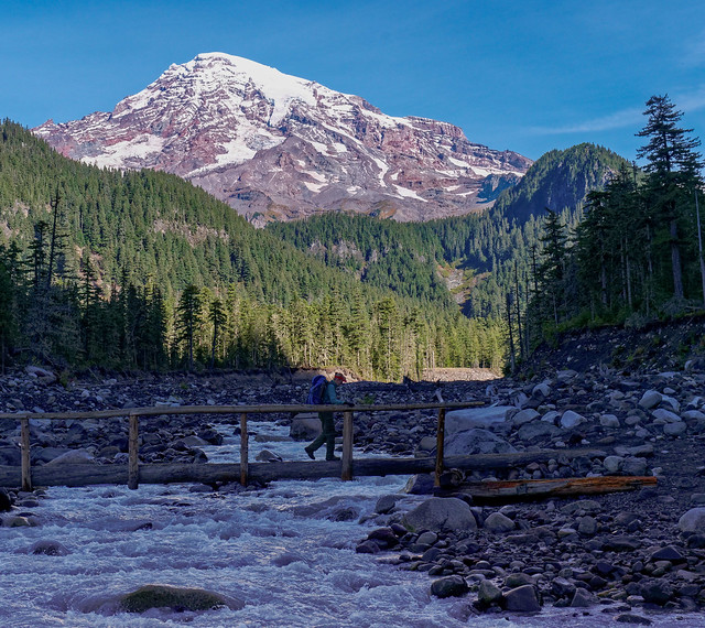
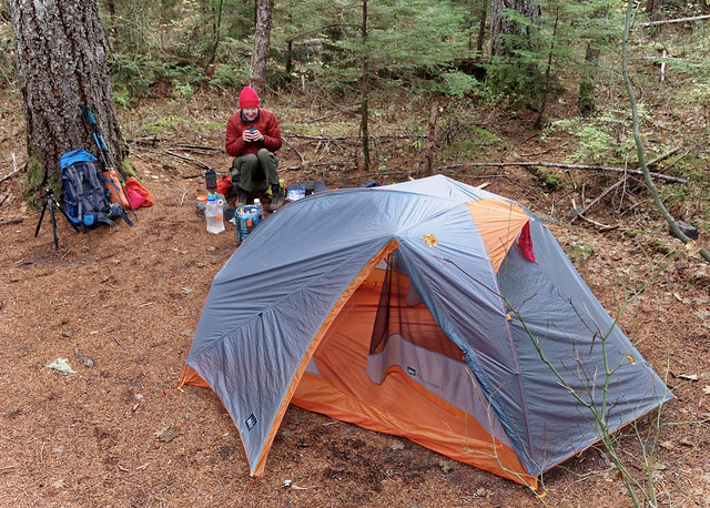
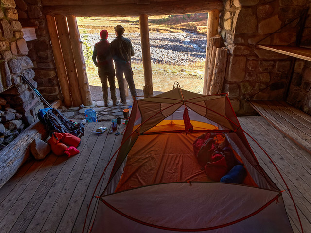
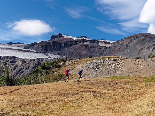
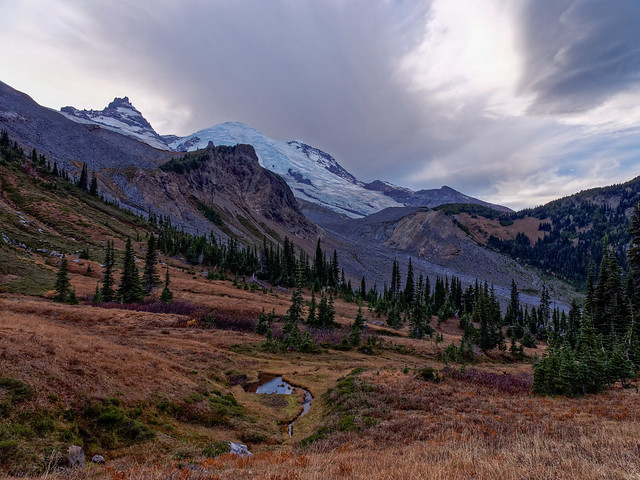
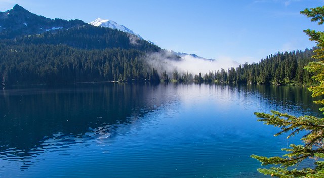
We arrived at Mt Rainier National Park on Labor Day with a good weather forecast. We planned to do a 6 day/5 night trip beginning at Sunrise and coming out at Longmire. We knew that all of the Wonderland Trail campsites would undoubtedly be reserved so John determined which “Cross Country Zones” (map) would work for us. Typically permits for these are much easier to obtain. We actually preferred this as the official camping areas on the Wonderland Trail tend to be crowded and located in the damp dark woods and not particularly scenic. However, the Park Service frowns upon this. They don't want Wonderland Trail hikers to use the Cross Country Zones for "overflow" camping. Their experience has been that Wonderland Trail hikers obtain permits for Cross Country Zones but run out of the time and energy needed to look for an appropriate site and try to sneak into a designated campsite. However, our daily mileage was modest, about 10 miles per day, and we were committed to avoiding that predicament. One disadvantage to camping in the Cross Country Zones was that we would not have access to a "bear pole" to hang our food so we were both carrying bear canisters.
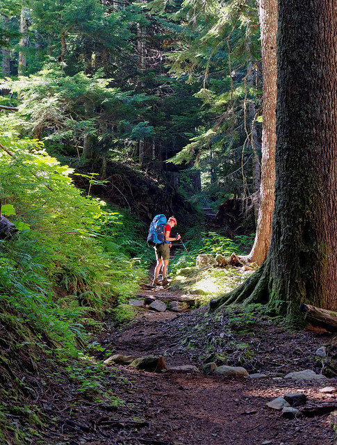
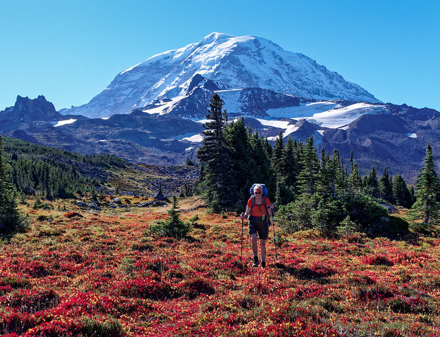
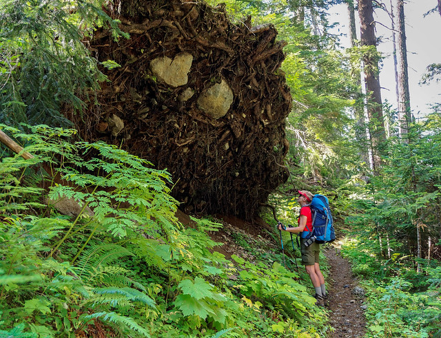
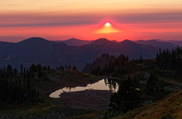
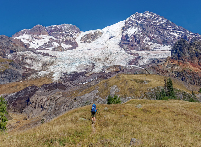
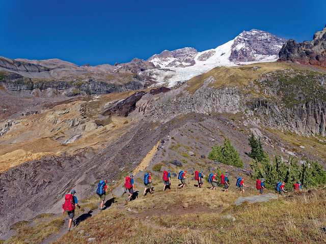
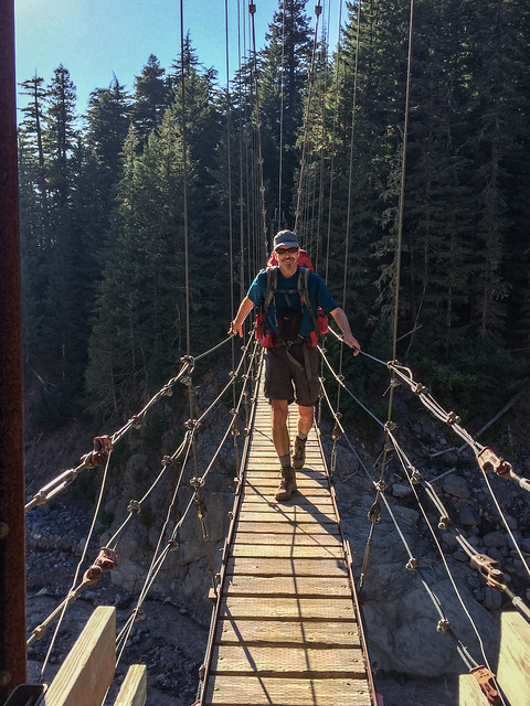
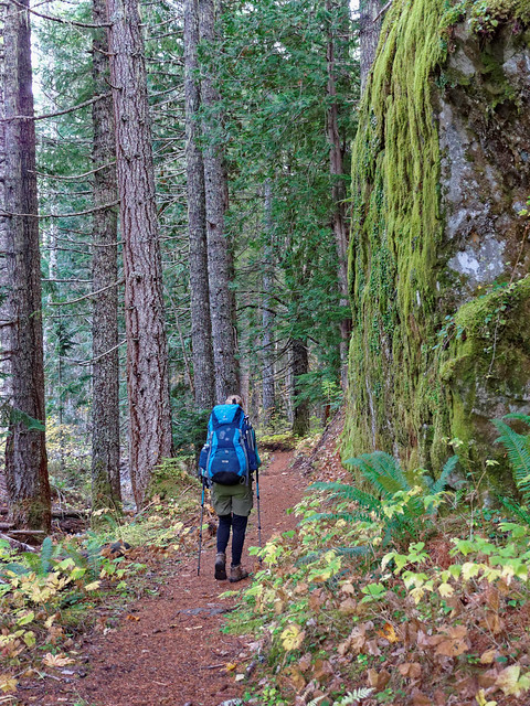
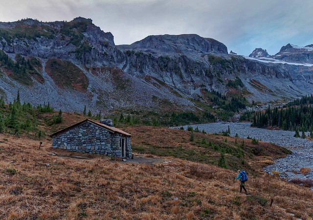
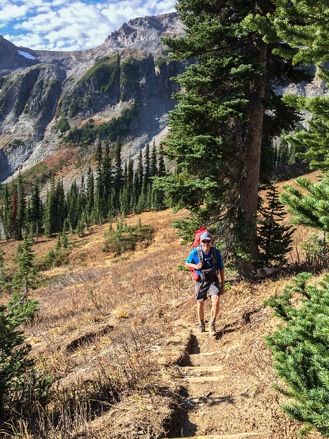
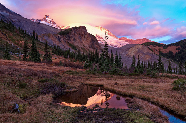
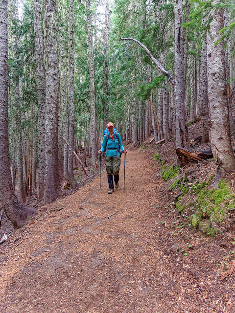
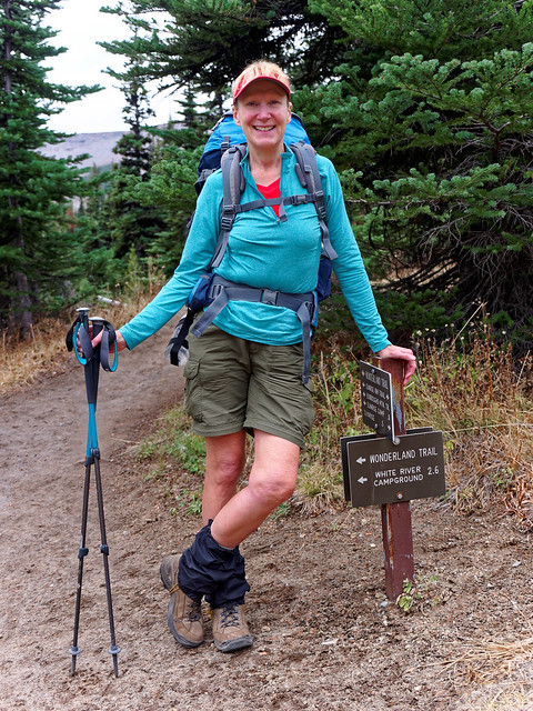
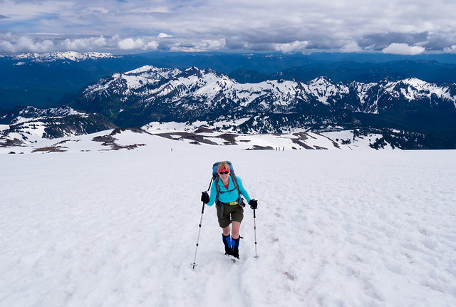
On the first day we left our motorhome at Longmire and drove our Jeep to Sunrise. The sky was clear, the views of the mountain were beautiful and not surprisingly the trails near Sunrise were crowded.
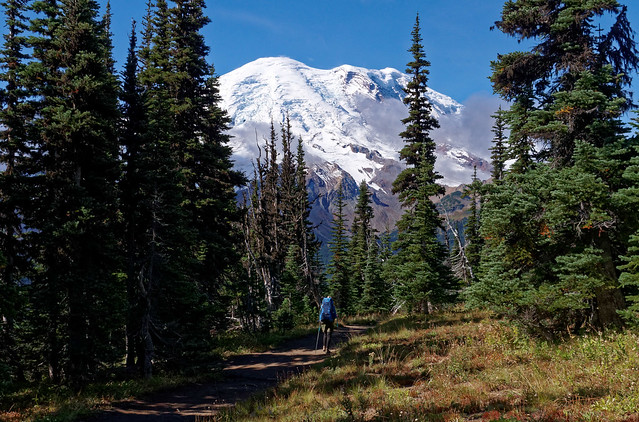
Jean on the Wonderland Trail in Mt Rainier National Park, Washington
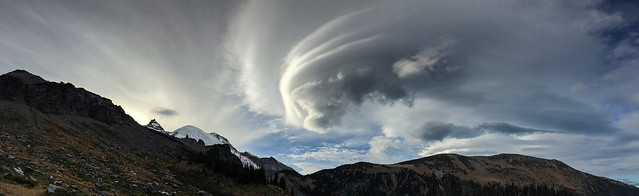
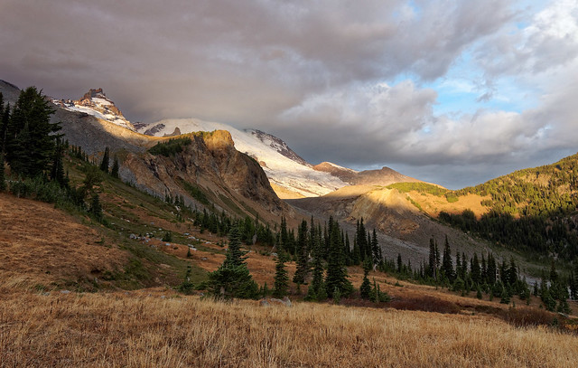
Before long the weather turned a little cloudy ...
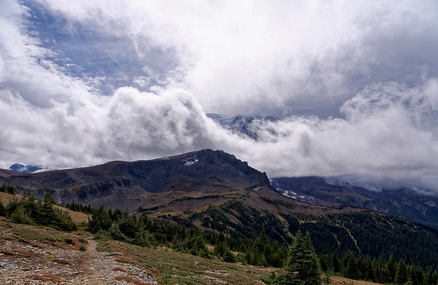
Seen from the Wonderland Trail in Mt Rainier National Park, Washington
... and as we continued down the trail we left the crowds behind.
Jean on the Wonderland Trail in Mt Rainier National Park, Washington
We could just barely see the Mt Fremont Lookout (upper right in the photo below).
Mt Fremont Lookout seen from the Wonderland Trail in Mt Rainier National Park, Washington
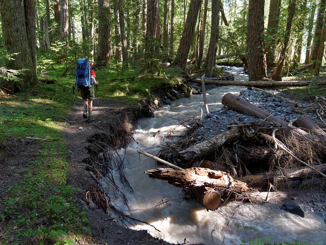
Along the way we met an interesting young woman named Ellen. I'm afraid John talked her ears off at first, a side effect of retirement (and the nature of the beast). However, he did eventually ask her about her own life. The trail continued to descend and we eventually crossed the Winthrop Creek.
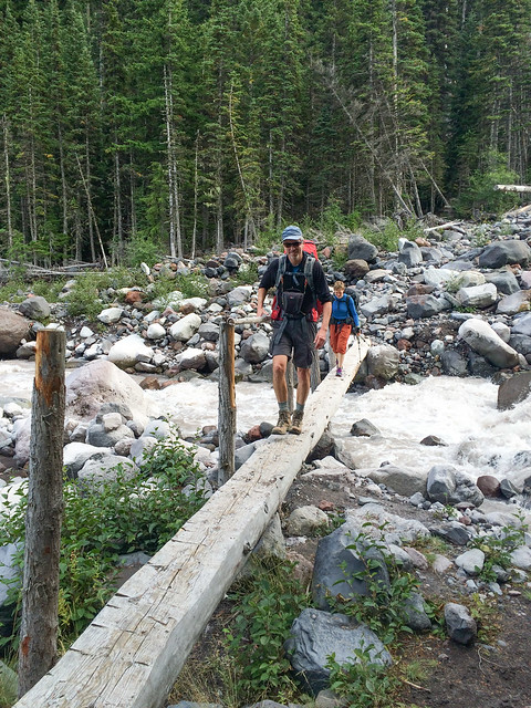
John and Ellen crossing the Winthrop Creek in Mt Rainier National Park, Washington
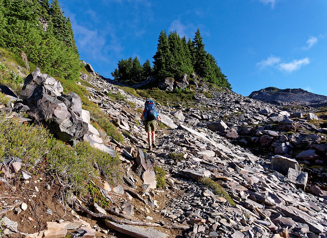
It was then time to begin a long uphill hike starting with a steep climb out of the creek bed. This pattern of descent/ascent would be repeated many times on this trip.
Jean on the Wonderland Trail in Mt Rainier National Park, Washington
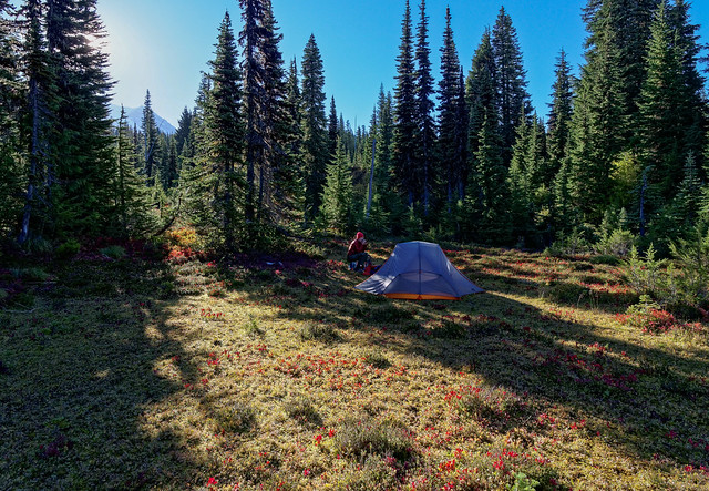
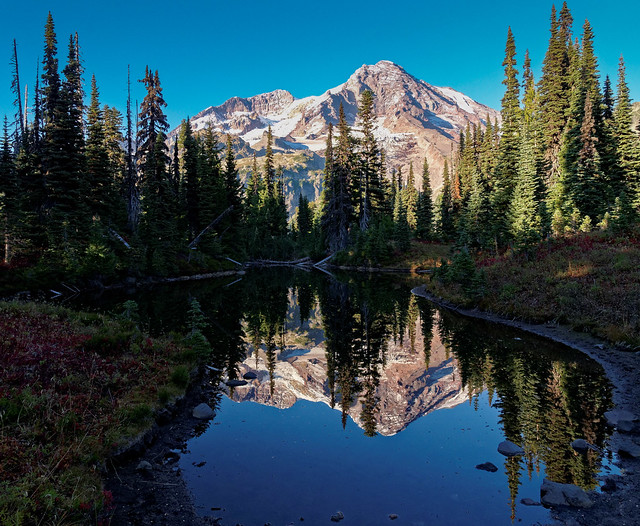
The hike up with our full packs took its toll on us and toward the end of the day we looked forward to reaching camp. We had been provided a photo copied topo map with vague magic marker outlines for every camping zone but it was hard to read and less than precise. We would spend our first night in the Mineral Mountain Cross Country Zone (XMIN). In hindsight this was not the best choice for a camping zone as it was very challenging to find a usable legal spot, one that is level enough and with a patch clear of trees that was large enough for our spacious tent. We were only required to be a quarter of a mile off of the trail but that did not mean we could expect to only have to go that far. The Backcountry Ranger who issued our permits hinted at the difficulty by asking “Have you been there before?” The information on the back of the map indicates hikers should allocate an hour or two to locate a site in a cross country zone. We bushwhacked through the trees and finally found a usable spot to pitch our tent and it had obviously been used before. As we had wandered around and had lost sight of the trail I am uncertain if we were actually "legal". But we were definitely out of sight of the trail (and we kept our voices down). A better plan for us would have been to obtain a permit for the Carbon Alpine Zone (ACAR) located a bit farther down the trail beyond Mystic Lake. We could have loaded up with water at the lake and dry camped.
Our campsite in Mineral Mountain Cross Country Zone in Mt Rainier National Park, Washington
We got a late start the next day. We like our leisurely mornings too much and John wanted to take photos of Mystic Lake.
Mystic Lake in Mt Rainier National Park, Washington
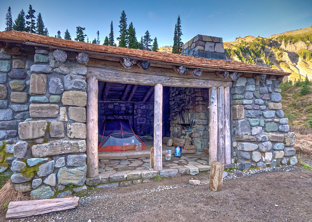
In addition John got talking with a Ranger stationed at the patrol cabin.
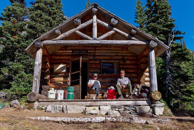
Mystic Lake Ranger Patrol Cabin in Mt Rainier National Park, Washington
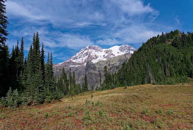
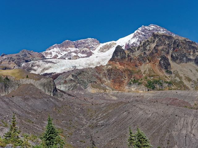
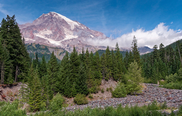
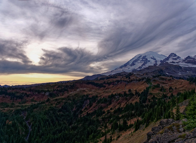
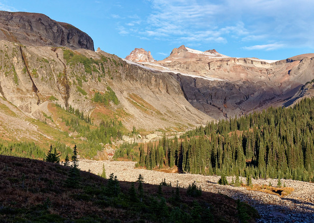
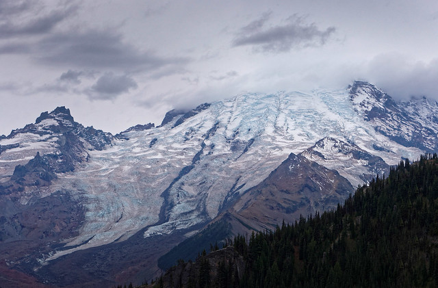
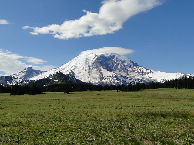
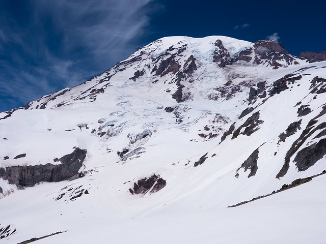
But we eventually got going and had great views of the mountain.
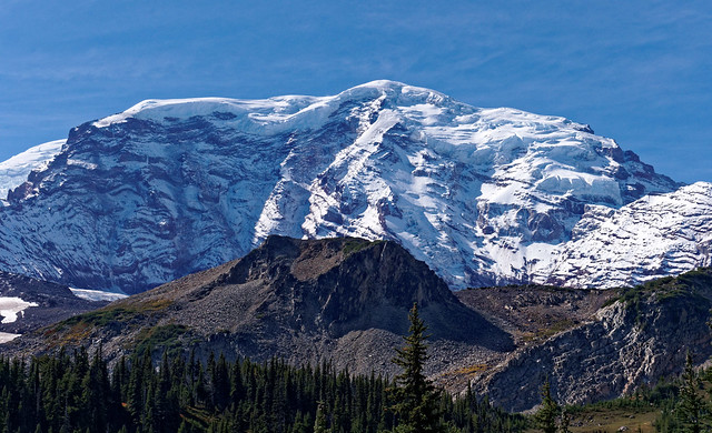
Mt Rainier seen from the Wonderland Trail in Mt Rainier National Park, Washington
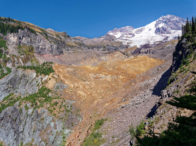
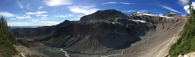
We again descended and this time passed the Carbon Glacier ...
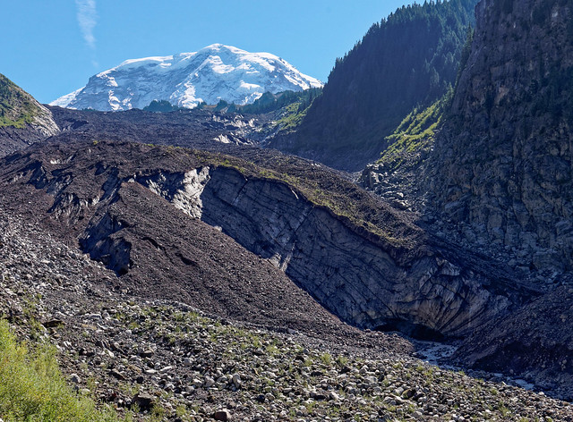
The Carbon Glacier seen from the Wonderland Trail in Mt Rainier National Park, Washington
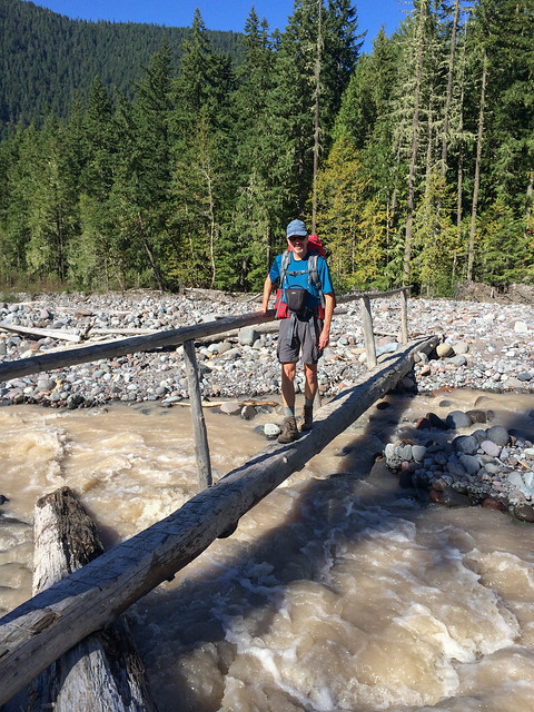
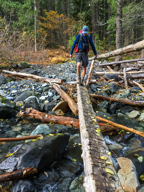
... before crossing the Carbon River.
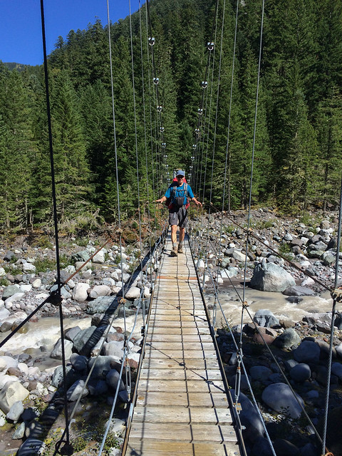
John crossing the Carbon River on the Wonderland Trail in Mt Rainier National Park, Washington
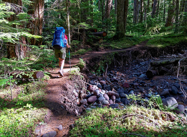
The trail initially took us through forest before beginning our next ascent.
Jean on the Wonderland Trail in Mt Rainier National Park, Washington
At this point we did a detour off of the Wonderland Trail in order to pass through Spray Park. John knows from personal experience that this way is far more scenic than the lower and woodsier portion of the Wonderland Trail we were bypassing.
Jean on the Wonderland Trail in Mt Rainier National Park, Washington
Once we were higher we were treated to expansive views including a distant view of Glacier Peak.
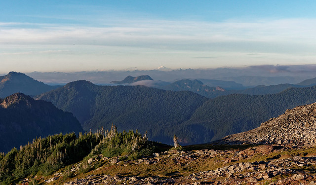
Glacier Peak seen in the distance from the Wonderland Trail in Mt Rainier National Park, Washington
Spray Park is one of our favorite areas of the park and have been there several times in the past. It is an area worthy of multiple visits.
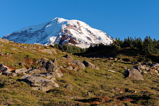
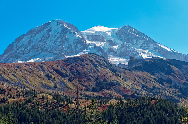
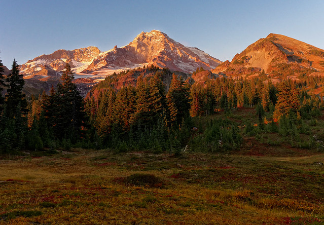
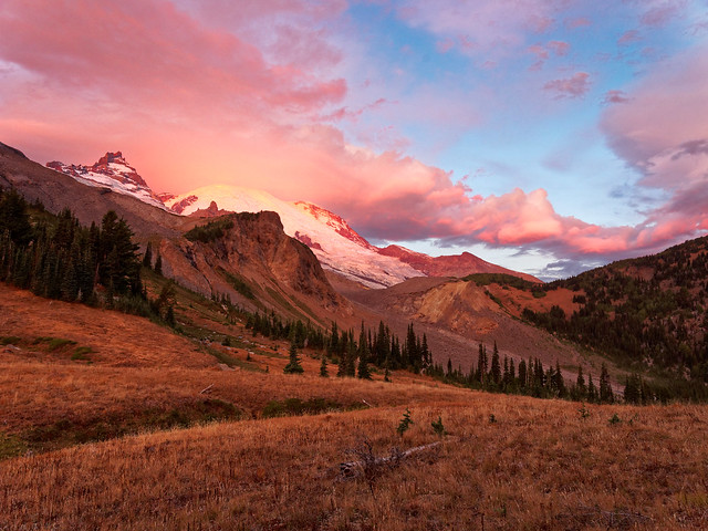
Mt Rainier in Mt Rainier National Park, Washington
We were to camp in the Spray Park South Camping Zone (XSPR) and being so open it was much easier to find an appropriate site. Water was not an issue due to the many clear tarns (pools of snow melt) in the area. We had great views of not only Mt Rainier but of Observation Rock (in front of the mountain) and Echo Rock (to the left of the mountain) as well. John took advantage of the photo opportunities provided by the fact we were backpacking rather than day hiking. First there was the mountain in golden evening light, ...
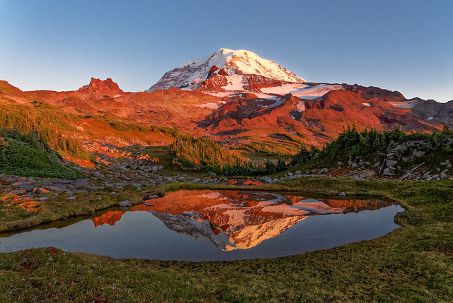
Mt Rainier in Mt Rainier National Park, Washington
... then there was the sight of the multitude of stars ...
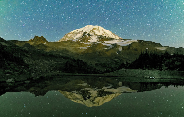
Mt Rainier in Mt Rainier National Park, Washington
... and then there were the views in the clear morning.
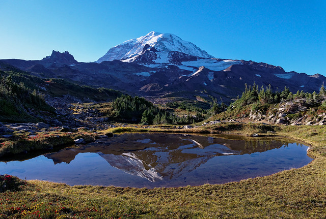
Mt Rainier in Mt Rainier National Park, Washington
This was probably our favorite campsite of the trip.
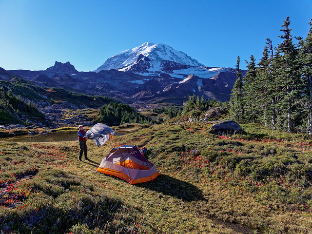
Our camp in the Spray Park South Camping Zone in Mt Rainier National Park, Washington
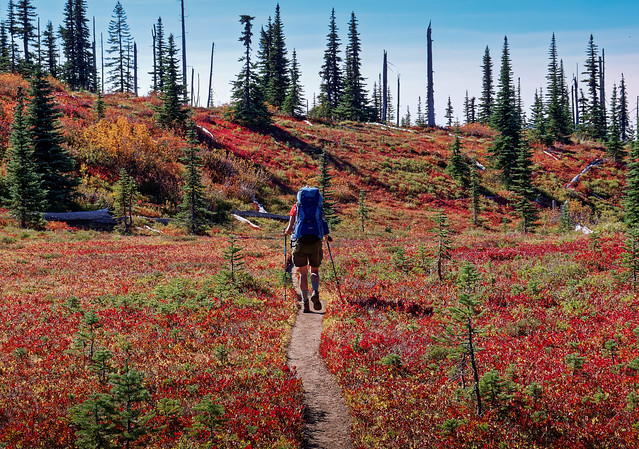
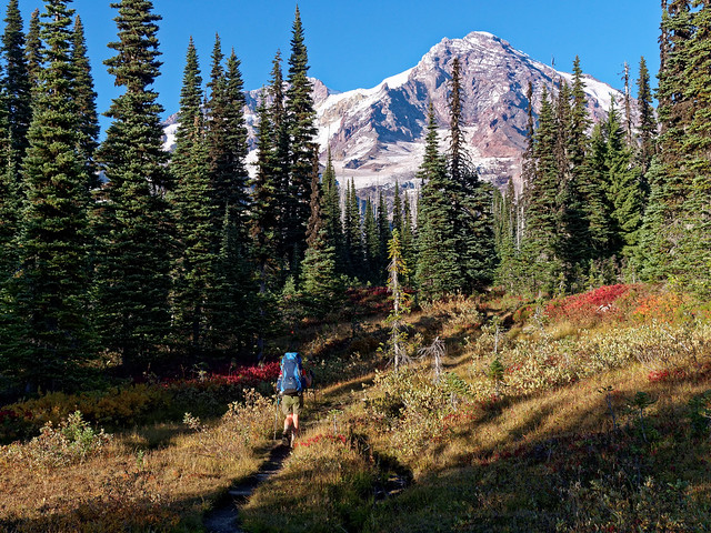
Once again we headed out and hiked through the alpine meadows. The wildflowers were long gone but we enjoyed the lovely red foliage which celebrated the onset of fall.
Jean on the Wonderland Trail in Mt Rainier National Park, Washington
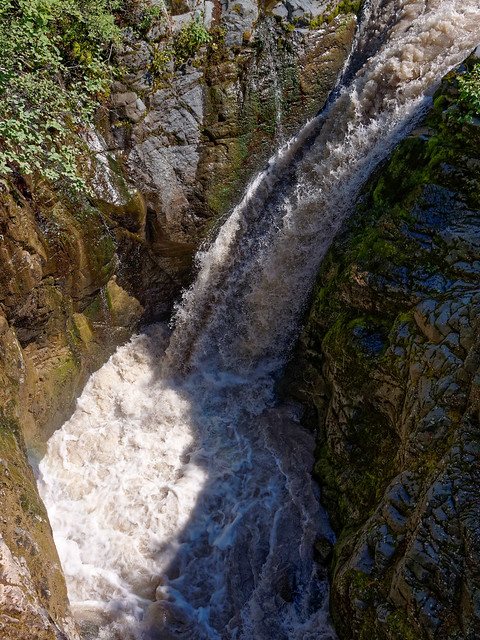
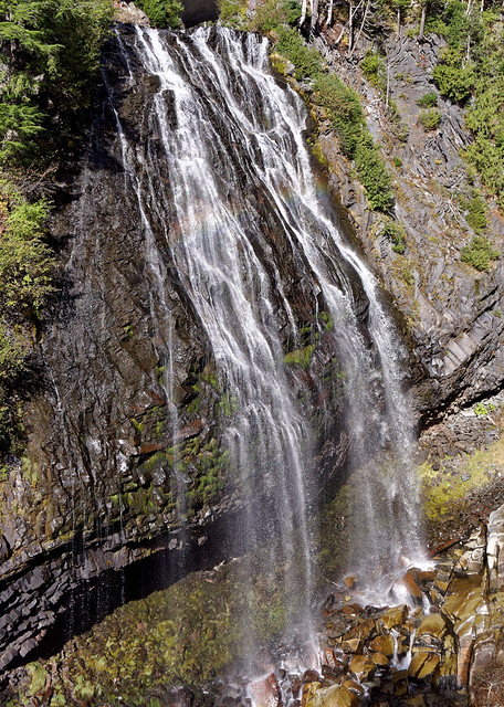
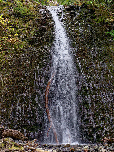
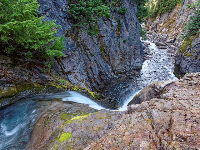
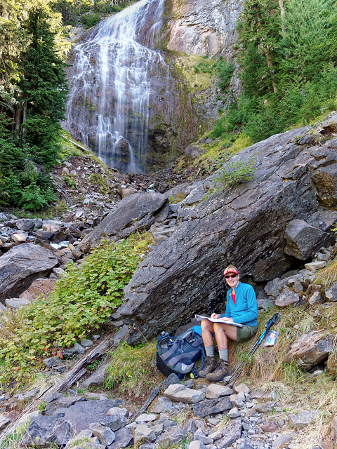
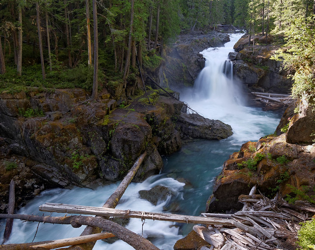
We then headed down (again) and took the short side trail to see the ethereal Spray Falls.
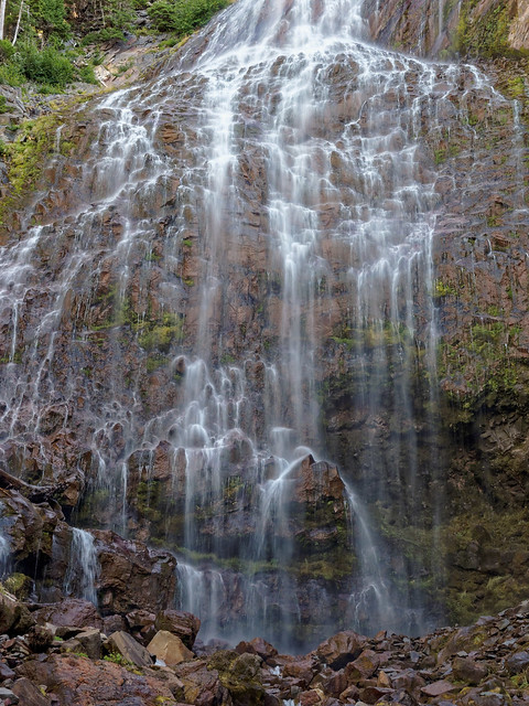
Spray Falls in Mt Rainier National Park, Washington
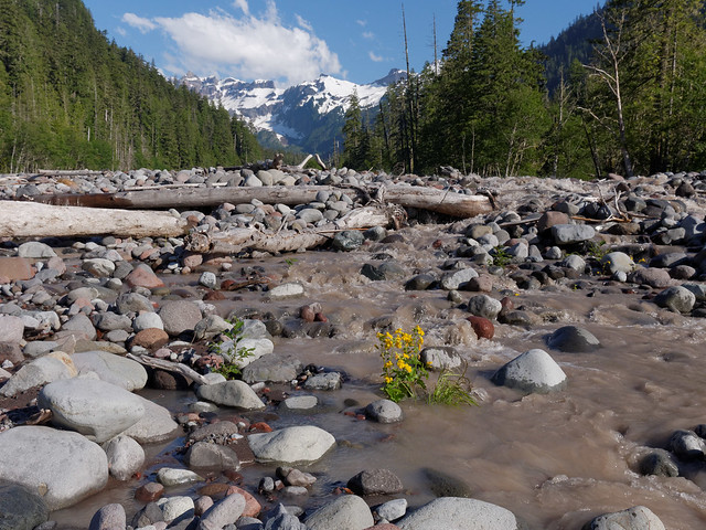
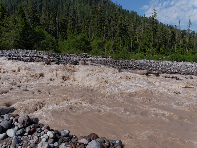
After a short break we continued down the wooded trail. The spongy surface and gentle grade made for fast walking. We knew we were getting close to Mowich Lake when we began to encounter more and more day hikers. The Wonderland Trail does not go all the way to Mowich Lake as it takes a more direct route down to yet another river valley. We first crossed the North Mowich River and then hiked through the woods on our approach to the South Mowich River. We were relieved to not see any water flowing through the creek bed as it indicated the river would not be exceptionally high.
Jean on the Wonderland Trail in Mt Rainier National Park, Washington
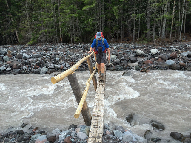
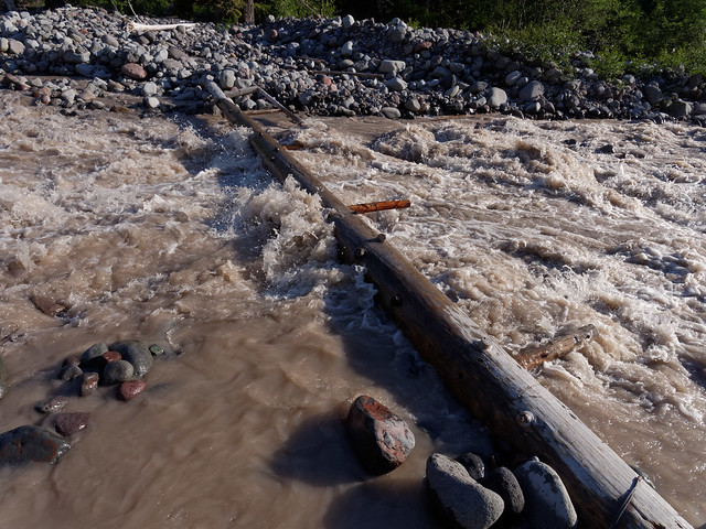
I was quite relieved to see that all bridges over the South Mowich River were in. This was the site of our "misadventure" in 2013 when early season plus heavy snows plus extreme heat equaled high water flow and washed out bridges thus ending our trip before it had really gotten started.
John crossing the South Mowich River in Mt Rainier National Park, Washington
Once again the trail ascended from a river valley. We camped that night in the Sunset Park Cross Country Zone (XSUN) near Golden Lakes and easily found a good (and legal) site.
Our camp in the Sunset Park Cross Country Zone in Mt Rainier National Park, Washington
The next day we again got to enjoy the colorful meadows.
Jean on the Wonderland Trail in Mt Rainier National Park, Washington
Back in the high country we were again treated to expansive views.
Mt Rainier in Mt Rainier National Park, Washington
One of the things that we love about backpacking in the Cascades is the ready availability of water. So different from our experiences in Grand Canyon.
John on the Wonderland Trail in Mt Rainier National Park, Washington
Once again the trail descended to a river valley. This time it was the South and North Puyallup Rivers.
North Puyallup River in Mt Rainier National Park, Washington
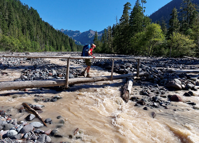
I really appreciated the substantial log bridge with railings on both sides which enabled us to cross the deep gorge created by the roaring North Puyallup River.
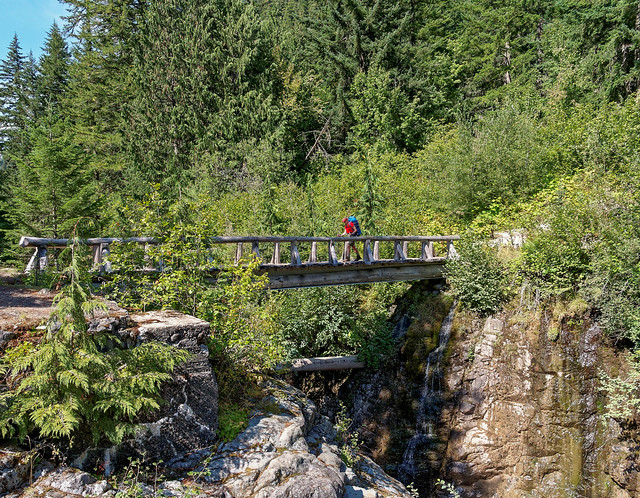
Jean crossing the North Puyallup River in Mt Rainier National Park, Washington
As we crossed we saw remnants of a rock wall on the other side of the river. It is apparently what is left of a bridge that was planned back in the 1930's.
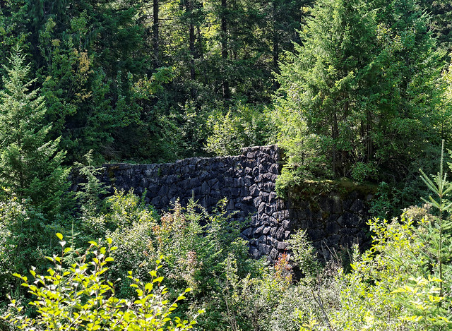
Remnants of an old bridge at the North Puyallup River in Mt Rainier National Park, Washington
The intent was to continue the Westside Road from the south up through this more remote area of the park. The road was completed as far as the North Puyallup River but in 1934 the Park Service decided that the project would negatively impact the area too much and it was abandoned. We are so glad they did. It is hard to imagine what this part of the park would be like if cars were allowed in it. Then again, given the fact the Park Service has not been able to keep the existing Westside Road open after repeated washouts this portion of the road would have ultimately been closed anyway.
Abandoned portion of the Westside Road in Mt Rainier National Park, Washington
We again hiked through woods ...
Jean on the Wonderland Trail in Mt Rainier National Park, Washington
... and meadows.
Mt Rainier in Mt Rainier National Park, Washington
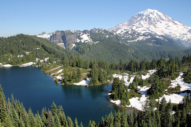
Toward the end of the day we reached St Andrews Lake.
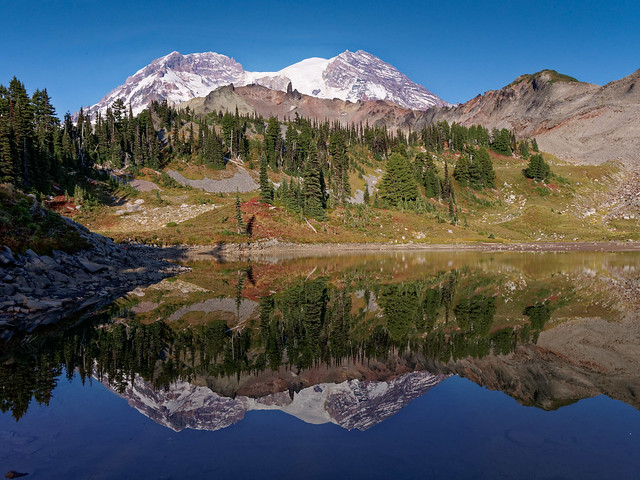
Mt Rainier and St Andrews Lake in Mt Rainier National Park, Washington
We had been told of a great campsite in the Tokaloo Alpine Zone (ATOK) above St Andrews Lake. We found it with little trouble and set up camp (To find it walk around the lake to the left and follow a social trail up a knoll. The site is located on the other side of the trees to the left).
Our camp in the Tokaloo Alpine Zone in Mt Rainier National Park, Washington
The sunset that night was unusual and beautiful.
Sunset over St Andrews Lake in Mt Rainier National Park, Washington
After another leisurely morning in camp we continued on.
Jean on the Wonderland Trail in Mt Rainier National Park, Washington
We descended into yet another river valley, this time the South Puyallup River ...
South Puyallup River in Mt Rainier National Park, Washington
... and we crossed another blessed bridge.
John crossing the South Puyallup River in Mt Rainier National Park, Washington
Then we made yet another ascent ...
Mt Rainier in Mt Rainier National Park, Washington
... as we headed toward Emerald Ridge.
Jean on the Wonderland Trail in Mt Rainier National Park, Washington
Several years ago while John was trail running he did a series of photographs of himself in this very same spot which he used to create a composite image.

John, John, etc etc etc on the Wonderland Trail in Mt Rainier National Park, Washington
He wanted to do the same sort of image with both of us. It took some time to set up his camera and get all of the images he needed (as well as do the post processing) but I think the result is interesting and worth the time he spent on it.
John and Jean, John and Jean, etc etc etc on the Wonderland Trail in Mt Rainier National Park, Washington
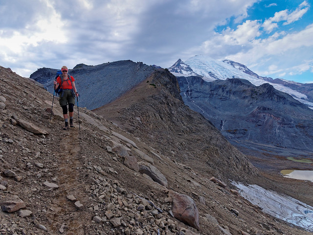
The Wonderland Trail takes hikers through an ever changing landscape, be it wooded valleys or mountain meadows and provides great views of the mountain and the result of its glaciers.
Mt Rainier in Mt Rainier National Park, Washington
Of course we descended again, this time crossing Tahoma Creek.
John crossing Tahoma Creek in Mt Rainier National Park, Washington
We would camp in the Pyramid Peak Cross Country Zone (XPYR) near Mirror Lakes that night. We took the side trail toward the lakes.
Jean on the Mirror Lakes trail in Mt Rainier National Park, Washington
We got water from a creek along the way but I was a bit uneasy about sitting on the deteriorating bridge. It felt a little flimsy.
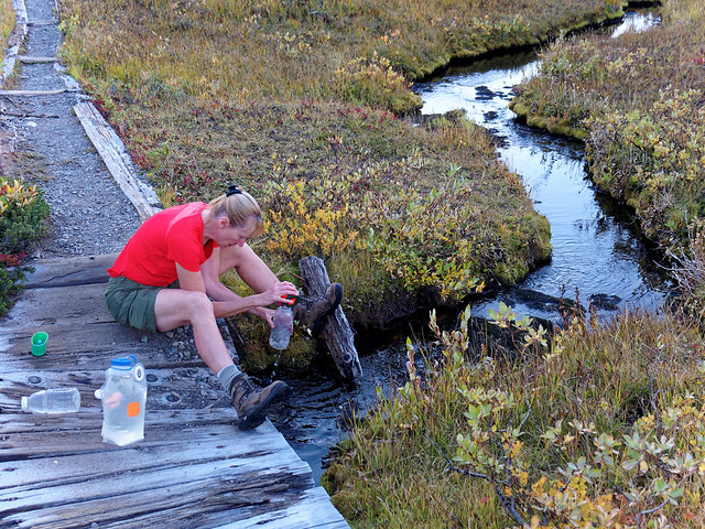
Jean on the Mirror Lakes Trail in Mt Rainier National Park, Washington
Little did I know that it was in much better condition than a rotting bridge we would encounter later.
John on the mirror Lakes Trail in Mt Rainier National Park, Washington
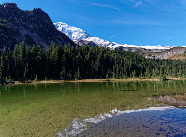
The day was clear and windless so the lakes got to live up to their name.
Mt Rainier and Mirror Lake in Mt Rainier National Park, Washington
We continued past the end of the maintained trail looking for a site. We were uncertain which direction to go until a Park Ranger happened by. He had actually been looking for us as he knew how many parties were to camp in the zone and he was making sure all were camped legally. He was quite protective of the area. It had apparently been overused in the past when the Westside Road was still open providing easy access. He led us up a social trail much farther than we thought was necessary but we ended up in an excellent spot with great views. Mt Rainier looks completely different from this side. We could also see Pyramid Peak (to the right).
Mt Rainier and Pyramid Peak in Mt Rainier National Park, Washington
This was our last night out on this portion of the trip and we made a special point of enjoying our last morning in camp.
Our camp in the Pyramid Peak Cross Country Zone in Mt Rainier National Park, Washington
We eventually got going ...
John on the Wonderland Trail in Mt Rainier National Park, Washington
... and before long passed the Patrol Cabin at Indian Henry's Hunting Ground.
Patrol Cabin at Indian Henry's Hunting Ground in Mt Rainier National Park, Washington
Later on it was time to make one final descent/ascent, this time crossing Kautz Creek.
Jean on the Wonderland Trail in Mt Rainier National Park, Washington
We took in one last view of the mountain before getting back to our motorhome waiting for us at Longmire.
Mt Rainier in Mt Rainier National Park, Washington
Once back we checked the weather forecast and were disappointed to see that it would deteriorate. So we decided to postpone the remainder of the trip for an undetermined future date. However, in mid October after helping Tom move we were excited to see that there was a very favorable weather window so we headed back to Mt Rainier National Park. We planned to do the remaining segment in four days. However, our intent was to obtain permits for designated campsites this time. The days were noticeably shorter so we would have less time to look for cross country camping spots. In addition the designated camping areas have “bear poles” for hanging food so we could avoid carrying the additional weight of a bear canister. We had no trouble obtaining permits this late in the season. In fact at that point in time we were the only ones who had been issued permits at our desired camping areas for those dates. However, we were disappointed to hear that all of the bear poles had been taken down for the season so we had to take a bear canister after all. Oh well.
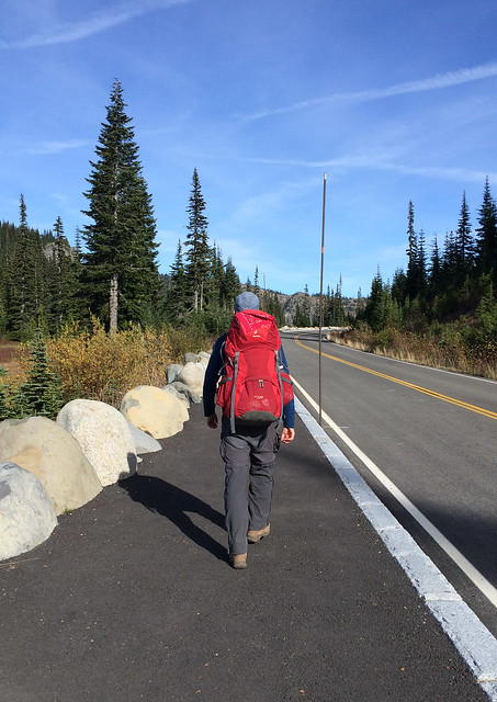
Later that day we dropped our Jeep off at Sunrise where we would end our trip. One potential complication to doing this trip so late in the season was how long the road to Sunrise would remain open. We hoped it would be open long enough for us to complete the trip before closing for the season. Had it been scheduled to close we would have parked our Jeep at White River. We could then hike up the short but steep trail segment to Sunrise to complete the trail and then turn around and hike back down to White River. However, we happily learned that the road was not scheduled to close in the near future. The next morning we once again parked our motorhome at Longmire and headed out.
John on the Wonderland Trail in Mt Rainier National Park, Washington
After leaving Longmire we soon dropped down and crossed the Nisqually River.
Jean crossing the Nisqually River in Mt Rainier National Park, Washington
We did a short side trip to see Narada Falls.
Narada Falls in Mt Rainier National Park, Washington
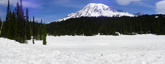
Before long we got to the aptly named Reflection Lakes. This is a popular spot due to the easy access. It is literally next to a road.
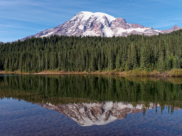
Mt Rainier and Reflection Lakes in Mt Rainier National Park, Washington
In fact we needed to walk down the road a ways before resuming our hike on the Wonderland Trail. We noticed that the Park Service had put up the "snow poles" along roads, a definite sign that winter was coming.
John heading to the Wonderland Trail in Mt Rainier National Park, Washington
We soon got back on the actual trail and continued to descend into the lush forest. This portion of the trail runs parallel to Steven's Canyon Road so we were concerned we would have to listen to constant road noise. Fortunately it wasn't a weekend and the all too common packs of loud motorcycles were not out in full force.
Jean on the Wonderland Trail in Mt Rainier National Park, Washington
We encountered a series of waterfalls including Martha Falls ...
Martha Falls in Mt Rainier National Park, Washington
... and Sylvia Falls.
Sylvia Falls in Mt Rainier National Park, Washington
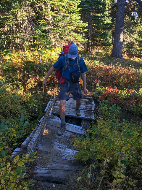
We were again grateful for log bridges but some were no longer in optimal condition. I would be surprised if this one survived the winter.
John on the Wonderland Trail in Mt Rainier National Park, Washington
We spent our first night out at Maple Creek Camp. It was a typical Wonderland Trail campsite located in the dark woods. So different from our open campsites we enjoyed on our previous trip.
Our camp at Maple Creek Camping Area in Mt Rainier National Park, Washington
We continued on the next morning. We got an earlier start than usual as there were no photo opportunities or views to distract us. The trail crossed the road and took us to Box Canyon, another popular area due to the easy access.
Box Canyon in Mt Rainier National Park, Washington
This is a challenging spot to photograph but John keeps trying. Normally he would find a way to get in a better position to get the shot he wants but there is simply no place safe enough for him to climb down to.
John on the Wonderland Trail in Mt Rainier National Park, Washington
As was true on our previous trip we soon began another ascent. This time up to Cowlitz Divide. While I love waterfalls it is a joy to get up high enough to see great distances and get expansive views.
Mt Rainier in Mt Rainier National Park, Washington
We would spend our second night at Indian Bar Camp.
Indian Bar in Mt Rainier National Park, Washington
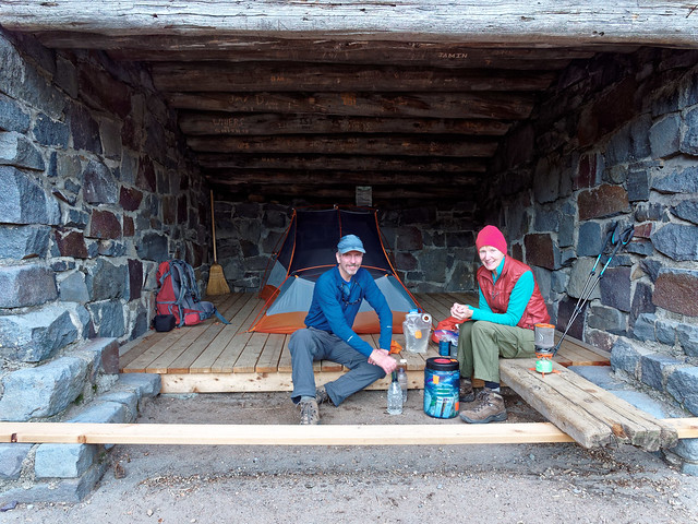
The actual campsites are located in the trees so we opted to use the shelter instead. There were no other people around so we felt this was okay. While I set up our tent (which we used to keep mice from running over us at night) and started to work on supper (which simply means I boiled water) ...
Indian Bar Shelter in Mt Rainier National Park, Washington
... John headed out to take photos in the evening light.
Indian Bar in Mt Rainier National Park, Washington
Photo opportunities included Wauhaukaupauken Falls.
Wauhaukaupauken Falls in Mt Rainier National Park, Washington
He eventually returned to camp and we thoroughly enjoyed our "dining room" with a view.
Our camp in the Indian Bar Shelter in Mt Rainier National Park, Washington
The next day we continued to ascend.
John on the Wonderland Trail in Mt Rainier National Park, Washington
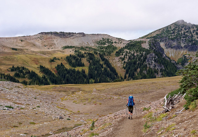
The open country provided us with views behind us ...
Indian Bar in Mt Rainier National Park, Washington
... as well as ahead. Our hike for the day would be a short one ...
Seen from the Wonderland Trail in Mt Rainier National Park, Washington
... but the sun felt surprisingly hot for so late in the season and the hike took more out of me than I had anticipated.
John and Jean on the Wonderland Trail in Mt Rainier National Park, Washington
Once we got over Panhandle Gap we began a welcome descent.
Jean on the Wonderland Trail in Mt Rainier National Park, Washington
The area just below this side of Panhandle Gap has its own stark beauty. I have been there before earlier in the season when the pool of glacial melt was a bright turquoise blue.
Seen from the Wonderland Trail in Mt Rainier National Park, Washington
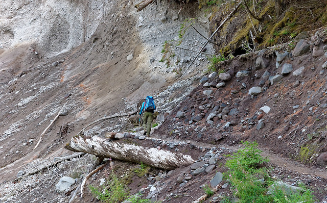
We needed to cross the South Fork of Fryingpan Creek. As we approached we looked with dismay at the displaced log bridge and the roiling waters of the creek. There was an obvious spot where we could ford. Unfortunately neither of us had brought water shoes and it wasn't well suited for doing barefoot so fording would mean getting our boots wet. This was something we wanted to avoid as we knew our boots would have no chance to dry out. John checked downstream a short distance looking for a spot that we could rock hop across but with no luck. The creek did narrow up but became steeper and faster flowing. So we headed upstream keeping an eye out for suitable rocks to step across. Initially the creek had cut in and formed a gully so we also needed to make sure the bank on the other side was not too steep to climb up. At one point we became stuck in the gully unable to continue following the creek closely so we needed to climb out of it. John made it up the steep loose side with much trouble. I finally made it up with much more trouble. I suppose we could have backtracked but we hated to give up distance that had been so tedious to gain. Once out of the gully we continued to follow the creek up for about a half a mile more before we finally began to encounter more narrow portions of this now well braided creek. We painstakingly worked our way across the many channels and were relieved to finally be all the way on the other side of the creek.
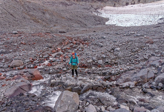
Jean at Frying Pan Creek in Mt Rainier National Park, Washington
We then slowly made our way over the rocks downstream in order to get back to the trail. Fortunately our hiking day had been short enough that it was no real hardship to take the time and expend the energy required for this convoluted stream crossing. Approaching Summerland from Panhandle Gap gives the best view of why this area is called “Summerland”. The change from the grey rocks to the green trees and golden meadows is dramatic. Even more so when the copious wildflowers are in full bloom.
Summerland in Mt Rainier National Park, Washington
The clouds thickened which created a far more dramatic sky.
Seen from the Wonderland Trail in Mt Rainier National Park, Washington
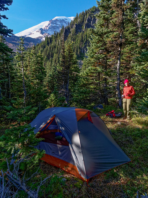
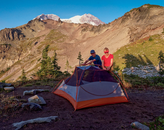
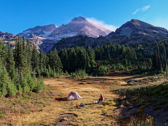
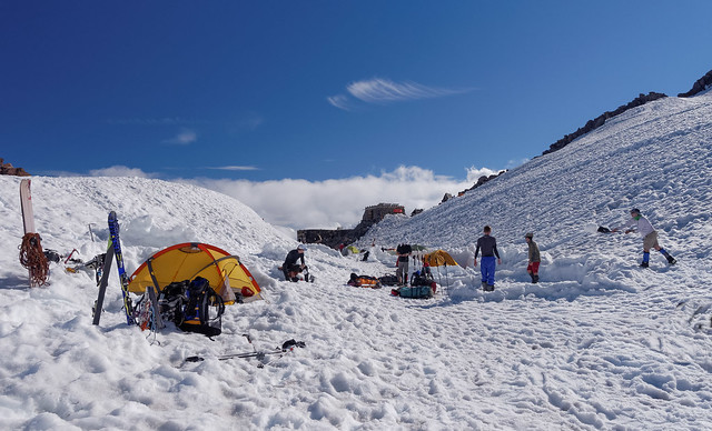
We spent our last night out in Summerland Camp. The clouds encouraged us to camp within the shelter for fear of rain. One other couple showed up but they were content to camp in one of the designated sites in the trees. We would of course welcome them in the shelter if it rained in the morning providing them with a dry place to eat.
Our camp in the Summerland Shelter in Mt Rainier National Park, Washington
The next morning John headed out to take photos.
Summerland in Mt Rainier National Park, Washington
It was a beautiful morning and he eagerly captured the changing morning light.
Summerland in Mt Rainier National Park, Washington
Eventually more clouds moved in and rain seemed imminent. I don't know why I thought to check but I was surprised to discover there was cell service. However, I resisted most of the temptation of having internet access and only used it to get a current weather forecast which confirmed our fears that there was rain predicted.
Summerland in Mt Rainier National Park, Washington
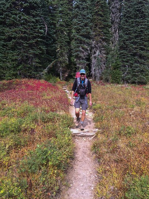
As we prepared to hike out it began to sprinkle and we accepted the fact we would be hiking in the rain that day. We now carry rain kilts which are easy to quickly slip on. However, to be effective it is best to combine them with rain gaiters which require taking off one's boots before putting them on, not a pleasant task in active rain. John chose not to put his on but I decided to go ahead and wear mine hoping they would serve as a "good luck charm" against rain.
Jean on the Wonderland Trail in Mt Rainier National Park, Washington
We hiked quickly down the easy trail and not surprisingly, as it was a Saturday and this is an extremely popular trail, we began to encounter many day hikers. Several were very lightly clad and unburdened with packs. As the weather cleared some and the rain never materialized I felt a bit silly in my gaiters but I was not motivated to sit down, take off my boots and remove them. When it came time to cross Fryingpan Creek again I was grateful for a bridge and could now appreciate the creek rather than see it as an impediment.
Fryingpan Creek in Mt Rainier National Park, Washington
We did have one concern, whether or not the bridge over the White River was still in after a recent storm and unseasonably warm temperatures which melted snow causing high water levels. Had it been out we would have had to backtrack and follow the road to White River Campground. We were quite relieved to see it but found it to feel less than secure. It is made from a thinner log than we had encountered over other water courses and it appeared to have a large split forming. It felt too "springy" for my tastes. In addition I sometimes find it a bit disorienting looking down at the rapidly flowing water. I imagine even if it survives the winter the Park Service will be replacing sometime next season.
John crossing the White River in Mt Rainier National Park, Washington
We needed to walk through the now closed White River Campground and it was a bit eerie, like walking through a ghost town. We ate our lunch at a civilized picnic table by the empty Ranger cabin in welcome sunshine.
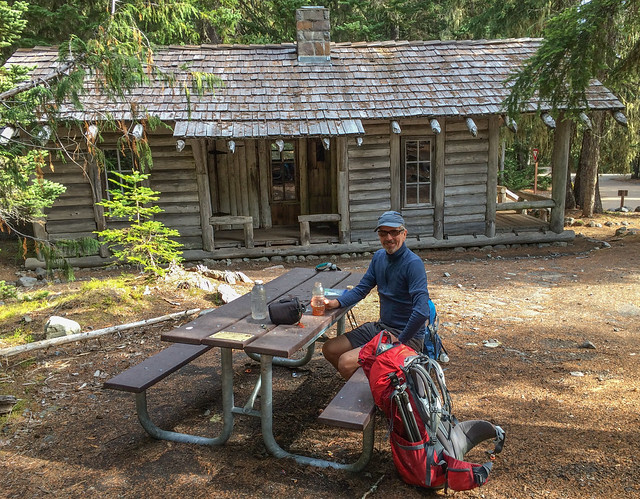
John at White River Campgrounds in Mt Rainier National Park, Washington
We were delighted that the rain was still holding off as we hiked up the steep 2.6 miles to Sunrise. The rain held off until right when we reached our car. I have been wanting to do this trip for a long time and felt very fortunate to now have done it. All of the photos from these two backpack trips are on Flickr.
Mt Rainier in Mt Rainier National Park, Washington
After leaving the park we visited with our son Tom and John's sister Elizabeth before heading south for the winter. We had wanted to go to Grand Canyon this past April and possibly complete our goal of hiking every named trail and route in the park. However, I needed some foot surgery which ended up being more complicated and the recovery is taking longer than we had anticipated so we have been taking a much longer break from traveling than we have done before. We will stay at our winter base in southern California until just after July 4th and then we will head back to Washington State. We plan to do some backpacking, we just haven't decided where yet.
This next bit is just something Jean has been thinking about.
Love at first sight
We relocated from Kentucky to Washington State in 1977. We arrived in Seattle in early November to the grey wet weather the region is well known for. I remember seeing a bumper sticker that announced the “Seattle Rain Festival … November - May” and I initially assumed it was meant as a joke. But then, looking at the dripping air around me, I wasn’t so sure. I definitely had no regrets about leaving Kentucky but I just wasn’t ready to fully commit to this state. Then two weeks later the clouds lifted, the sun came out and it happened. I fell in love! I fell in love with a mountain. I fell in love with THE Mountain, Mt Rainier. It was truly love at first sight and I have thought of myself as a Washingtonian ever since.

Mt Rainier seen from Seattle, Washington - Source of photo
We first visited Mt Rainier National Park in April 1978 when we drove to the aptly named “Paradise”. I was so excited to be there. We had just taken up cross country skiing and while John was getting the hang of it I was not. We had gotten as far as Reflection Lakes where I was trying to master staying upright while skiing down a minor slope. But with little success. I fell down and got up laughing several times. When it was getting late in the day John said we had better head back but I wanted to give it just one more try. Not surprisingly I fell down again. Only this time instead of laughing I cried out in pain. My left leg was at an odd angle and I couldn’t move it. It became apparent that my hip was dislocated.
We were grossly unprepared to deal with such an event. The only extra clothing I had with me was a wool sweater. John helped me to put it on but it could not protect me from the wet snow I was lying on so I soon began to feel cold. To make matters worse clouds were moving in and it started to snow. John knew he had to go get help but I couldn’t bear the thought of being left alone and possibly becoming buried under the snow. I didn't know what to do. I looked toward the mountain. I don't know what I was looking for. Perhaps reassurance that everything would turn out okay. But all I got was a cold icy stare of indifference before the clouds moved in and completely obscured the mountain. I realized then that this mountain did not care if I lived or died. So I did what any other girl whose love is unrequited does, I started to cry.
Mt Rainier at Reflection Lake, Mt Rainier National Park, Washington - Photo by Michael J. Scarfo, Jr
But I was extremely lucky. Another cross country skier soon showed up and said he would go get help. And shortly after that three fellows who had been doing some winter climbing arrived and they sprung into action. They got an insulated pad under me, warm clothes on me and a tent set up over me. They even made me some hot chocolate! I have no doubt that they saved my foolish life. I don’t remember how long it took but a Park Ranger showed up with a group of Ranger Scouts. They loaded me onto a sled and towed me back to Paradise where I was medicated with 15 glorious milligrams of Morphine. I was then transported to the nearest hospital (over 60 miles away) and put back together. I shudder to think what would have happened if those fellows had not shown up. Rest assured we learned our lesson well that day and have never been so ill prepared.
But despite my initial heartbreak I still loved that mountain and in the succeeding decades we visited Mt Rainier National Park many times. As a mountain climber, John’s relationship with the mountain has been much more intimate than mine, having stood on the summit four times. In addition he has hiked or run every trail within the park. But over the years I have done a fair amount of hiking and backpacking in the park in many of the most scenic parts. However, despite all that I have done and seen I have felt incomplete regarding the park as there is an iconic trail I had not done in its entirety, The Wonderland Trail. It is a 93 mile loop that circumnavigates the mountain descending into valleys, crossing meadows and ascending over passes. If you read the post above then you know we backpacked the Wonderland Trail last fall. We hadn’t planned to do it last year but when the opportunity arose we jumped at the chance.
Jean on the Wonderland Trail in Mt Rainier National Park, Washington - Photo by John Strother
At the beginning of our trip I felt a great sense of anticipation. But as we hiked I also became aware of feelings of nostalgia. We started at Sunrise and I found myself thinking of previous trips and experiences in the park. As we approached the junction with the Burroughs Mountain Trail I thought back to the first time I hiked this trail. It was July 1978 and my sister Laurel was visiting from North Carolina. At that time there wasn’t a trail all the way out to Third Burroughs and in fact a Ranger told us if we saw anything that remotely looked like a trail to avoid it. An effort was being made to preserve the wild nature of the tundra and it was working. It was a weekday and there were very few other people out there with us. Undoubtedly, the necessity of crossing a snow slope deterred some. Snow in July was a novelty for both of us but we weren't going to let it stop us. Whatever the reason it was a wonderfully lonely experience. I felt as though we were exploring someplace wild within the Arctic Circle. Not surprisingly there is now a constructed trail and multiple signs reminding the multitude of hikers to stick to it in order to protect the delicate tundra.

Burroughs Mountain in Mt Rainier National Park, Washington - Source of Photo
As John and I continued we got a very distant view of the Mt Fremont Lookout (near the top right of the photo).
Mt Fremont Lookout in Mt Rainier National Park, Washington
It brought back memories of the summer of 1988 when we did a fair amount of day hiking with our young children; Dan, who was three and Tom, who was nine months. We carried both in kid carriers.

Jean (with Tom) on the trail to Mt Fremont Lookout in Mt Rainier National Park, Washington - Photo by John Strother
One of the first we did was out to Mt Fremont Lookout.

I can remember looking down from the lookout to the aptly named “Grand Park”, someplace John and I hiked to years later. It is a huge meadow that invokes feelings of being in the "Sound of Music".
Mt Rainier seen from Grand Park in Mt Rainier National Park, Washington - Photo by "BikeJr"
I love mountain meadows. Depending when you are there the wildflowers can be gorgeous. The varieties are extensive and they change depending on the elevation.

Wildflowers in Mt Rainier National Park, Washington - Photo by John Strother
The next day John and I veered off of the Wonderland Trail temporarily in order to hike through the much more scenic “Spray Park”. I suppose I have to admit I have not technically done the entire Wonderland Trail but our belief is that this is the route it should take rather than the lower, wooded area the trail currently takes hikers through. We have previously day hiked and backpacked to Spray Park and have loved seeing the vast number of Avalanche Lilies present earlier in the season.

Mt Rainier and Avalanche Lilies in Mt Rainier National Park, Washington - Photo by John Strother
The area contains many scattered "tarns", clear pools fed by snow melt. The below photo was taken many years ago but when I compare it to a photo John took on this trip it looks like it was taken from the exact same spot.

Mt Rainier in Mt Rainier National Park, Washington - Photo by John Strother
On one backpack trip to Spray Park our friend Miller went with us. We did a side trip to the top of Observation Rock which provides a great view of Mt Rainier.

Jean, John and Miller on Observation Point in Mat Rainier National Park, Washington - Photo by John Strother
From the top you can also look down at Echo Rock.

Echo Rock in Mt Rainier National Park, Washington - Photo by John Strother
Besides the expansive views there are more intimate sights including colorful lichen ...

Seen on Observation Point in Mt Rainier National Park, Washington - Photo by John Strother
... and patches of moss like vegetation complete with tiny flowers tucked in between the volcanic rocks.

Seen on Observation Point in Mt Rainier National Park, Washington - Photo by John Strother
On another trip I got the opportunity to get a lesson in how to glissade. It was as much fun as I had always imagined it would be not to mention faster and easier on the knees than walking down the slope.

Jean descending from Observation Point in Mt Rainier National Park, Washington - Photo by John Strother
After leaving Spray Park we headed down the trail toward Mowich Lake. As we have done before we did the short side trip to see Spray Falls.
Jean and Spray Falls in Mt Rainier National Park, Washington - Photo by John Strother
Had we stayed on the Wonderland Trail instead of detouring through Spray Park we would have passed the junction with the trail up to Tolmie Peak Lookout.

Tolmie Peak Lookout in Mt Rainier National Park - Source of Photo
I was reminded of two day hikes to this lookout and while I was not on the first it was still a memorable day for me. It took place the summer I was very pregnant with Tom. John wanted to go for a hike and took two year old Dan with him for a "boys day out". It was the longest period of time I had ever been separated from Dan and I felt a variety of emotions that day. I first felt free and unburdened (despite my advancing pregnancy). I marveled at how easy it was to leave the house, get in the car and do some errands. However, I later went through "little body withdrawal". As it got late in the day I felt lonely for the two of them and was quite happy when they returned home.

Dan at Tolmie Peak Lookout in Mt Rainier National Park, Washington - Photo by John Strother
The following summer saw all four of us there. It is quite different carrying a baby on your back rather than a loaded backpack. The center of balance is different and they may kick and bounce at inopportune moments which threatens your balance. And you have to walk very carefully when they go to sleep. But then a backpack does not keep you entertained with happy babbling nor does it play with your hair or pat you on the back.

John, Dan, Jean and Tom at Tolmie Peak Lookout in Mt Rainier National Park, Washington
The view from the lookout of Eunice Lake and Mt Rainier makes the hike well worth it.
Eunice Lake and Mt Rainier seen from Tolmie Peak Lookout in Mt Rainier National Park, Washington - Photo by Alex Jabur
As we approached Mowich Lake I also thought back to the time we did a day hike up nearby Fay Peak. Getting to the top involved hiking up scree and loose rock, not a surface I enjoy hiking on but at least it is easier going up than down. John wanted to make a loop of it and I was hoping that there would be an easier and more stable way down on the other side. However, we talked to another hiker on the top and he informed us that the best way down was the way we had just came up.

Fay Peak in Mt Rainier National Park, Washington - Source of Photo
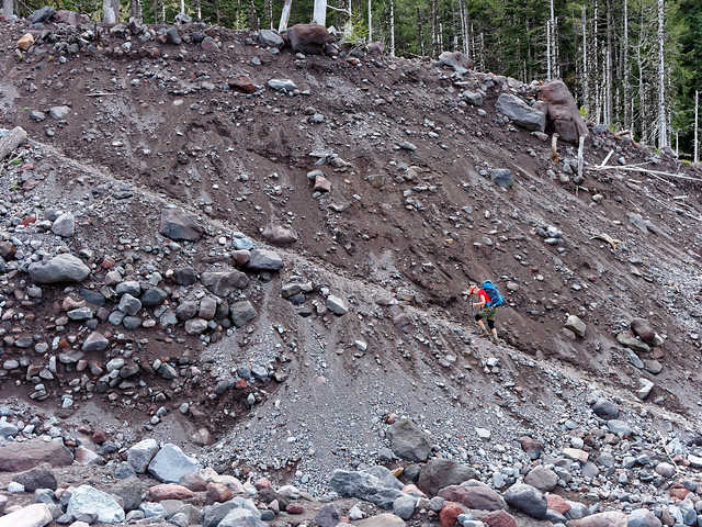
So we started down. This was a memorable hike for me but not in a good way. It marked the beginning of issues with my left knee. I didn't suffer an acute injury. Rather it was a chronic issue that undoubtedly had been brewing for a while. It was as though my knee just decided it had been "silent" for long enough. It began hurting and started making horrible grinding and popping noises. It really scared me as I feared my knee was going to "give out" completely right then and there. I was afraid I would fall and be unable to hike out. John would then have to go get help and I would be left alone (and there might be bears). I have always had the ability to "see" the bad things that can happen in any given circumstance (something I have already written about). What I "saw" then was that this would be the last hike I could ever go on (and John would trade me in on a younger, stronger hiking partner). I became quite upset and anxious (something I didn't know at the time was I apparently needed a second medication for my mood instability, also something I have already written about).
But my fears were unfounded. I got down safely and we hiked out without incident. Ever since then my knee has bothered me off and on but fortunately I have been able to do quite a bit of hiking and backpacking. This includes going down scree and loose rock that was worse than what we encountered on Fay Peak. Looking at this photo in the past made me cringe as I remembered how my knee felt and sounded. But now I am much more accustomed to it and looking at photos taken since then help me to believe that it is possible to get stronger and more confident despite getting older. It makes me wonder what I could be capable of by the time I am 80!

Jean descending a loose rock slope in Mt Rainier National Park, Washington - Photo by John Strother
We rejoined the Wonderland Trail near Mowich Lake and as we headed down the trail toward the Mowich River I started thinking back to 2013 on our previous attempt at doing the Wonderland Trail. It was the end of June in a high snow year and we knew the road up to Mowich Lake was still closed as the parking lot had not yet been plowed. So we parked at the trailhead for Paul Peak. It was 90 degrees out and it felt odd to be carrying gaiters, ice axes and Microspikes but we knew we would need them in the days to come.
While we were preparing to start out a pickup truck drove up and three scantily clad young people got out; two guys and a girl. They had plastic kayaks in the back of the truck and we were curious about their plans. They looked at the closed gate, then approached us and asked us if we knew why it was closed. John explained about the road and parking lot not being plowed yet and they looked perplexed. One fellow asked how far it was to the lake as they were considering walking and carrying their kayaks. It wasn’t all that far but John mentioned that there would very likely still be ice and snow on at least portions of the lake.
This astounded them. “Snow?” they all said in unison. I said something like “Well, you're in the mountains, it’s colder higher up”. They talked amongst themselves for a few minutes and soon drove off. I suppose they had seen a sizable lake on a map and assumed they could spend the day on the water in their shorts, tank tops and flip flops basking in the hot sun.
Mowich Lake in Mt Rainier National Park, Washington - Photo by Michael Burke
I was apprehensive as John and I headed down the trail this time toward the North and South Mowich Rivers. This was because we were approaching the site of my most impactful injury. It happened on that same trip in 2013. We had been assured by a Park Ranger that the bridges over both rivers were “in”. However, as I mentioned before it was late June, still early in the season for such a high snow year. Recent high temperatures led to a great deal of snow melt which causes very high water levels in rivers. Fortunately getting across the North Mowich was no problem. But as we continued on the trail we looked at this swollen creek with interest as it coursed through the woods between the North and South Mowich Rivers.
Jean on the Wonderland Trail in Mt Rainier National Park, Washington - Photo by John Strother
Once on the river bed we were initially able to rock hop across the braided river channels wherever there wasn't a log.
South Mowich River in Mt Rainier National Park, Washington - Photo by John Strother
However, when we approached the main channel of the South Mowich River we were dismayed to see that the main bridge was tipped on its side. I suppose technically the bridge was “in” but that didn’t mean we could safely walk across it. We looked for a safer place to cross without luck so we decided to scoot across the bridge. But while we were taking our boots off the water level started rising noticeably and soon reached the bridge, even lapping over it in places. We decided to backtrack to the woods and set up camp. We assumed we could cross in the morning when the water level should be lower.
South Mowich River in Mt Rainier National Park, Washington - Photo by John Strother
Earlier while we had been looking for a safer place to cross I had stumbled and fell on some rocks. I landed on my left knee and left hand. I was immediately concerned about my knee and greatly relieved to discover it was uninjured. However, later in the day my wrist became quite swollen and painful. We were forced to make the disappointing decision to hike out the next day. We went to the closest ER where my wrist was X-Rayed. I was told it was "just sprained" which was a big relief. We were optimistic that we would be able to do this trip later in the summer after I healed up. What we didn’t learn until many weeks later was my wrist was actually broken. Granted, not a serious injury but making a long story short the initial misdiagnosis led to delayed treatment which necessitated complicated surgery (including a bone graft) and a prolonged recovery period. This resulted in our canceling several great backpack trips we had planned to do that summer (and caused us to spend the winter in the grey wet Pacific Northwest).

Jean and "friend" - Photo by John Strother
The South Mowich River in Mt Rainier National Park, Washington- Photo by John Strother
Needless to say I don’t have fond memories of the South Mowich River and this year I was not completely reassured when the Park Ranger who issued our permits said “All the bridges are in”. The backpackers we talked to, who were doing the trail in the opposite direction, didn’t mention any problems although one fellow did say that getting across it was an “obstacle course”. I was still wary and I irrationally thought that perhaps everyone we passed was the type to think of waist deep water as no problem. Intellectually I knew it was probably fine but emotionally I wasn’t going to trust anything except my own eyes and would not relax until we were all the way across. I was beginning to feel more optimistic when we reached the creek bed in the woods between the North and South Mowich Rivers and saw that it was bone dry. So different from the swollen creek we saw in 2013.
Jean on the Wonderland Trail in Mt Rainier National Park, Washington
I was so relieved to see this bridge.
Jean crossing the South Mowich River in Mt Rainier National Park, Washington
The river is "braided" with multiple channels of varying widths and depths. I realized that the "obstacle course" that previous hiker referred to was the necessity of finding the best way across the many channels. Some are easy to "rock hop" across but I blessed every upright log bridge we encountered over the wider deeper ones.
John crossing the South Mowich River in Mt Rainier National Park, Washington
Later that day we approached an area we have backpacked in twice before - Emerald Ridge. The first was a quick trip, we were just out one night. The day started out clear but early in the afternoon a rain storm blew in. We quickly put up our tent and literally dove inside right before the dark clouds really let loose.

Mt Rainier National Park, Washington - Photo by John Strother
Fortunately, the storm moved through quickly and we were able to eventually leave our tent in order to prepare supper. Our only water source was glacial melt so there was no hope of having clear water. We tried letting it settle out for a while which did allow the gravel and sand to sink to the bottom but what was left was a milky brown, like very weak chocolate milk. It was okay in our Backpacker dinners but the next morning John decided that Tang made with it was not as enjoyable as usual. However, my hot chocolate was fine. Perhaps it was even a bit "richer" made with the "robust" water.

Our camp on Emerald Ridge in Mt Rainier National Park, Washington - Photo by John Strother
But the light show in the morning more than made up for any issues with the water.

Seen from Emerald Ridge in Mt Rainier National Park, Washington - Photo by John Strother
On the second trip in this area of the park a Park Ranger gave us a ride up the closed portion of the Westside Road. This enabled us to hike as far as St Andrews Lake.

St Andrews Lake in Mt Rainier National Park, Washington - Photo by John Strother
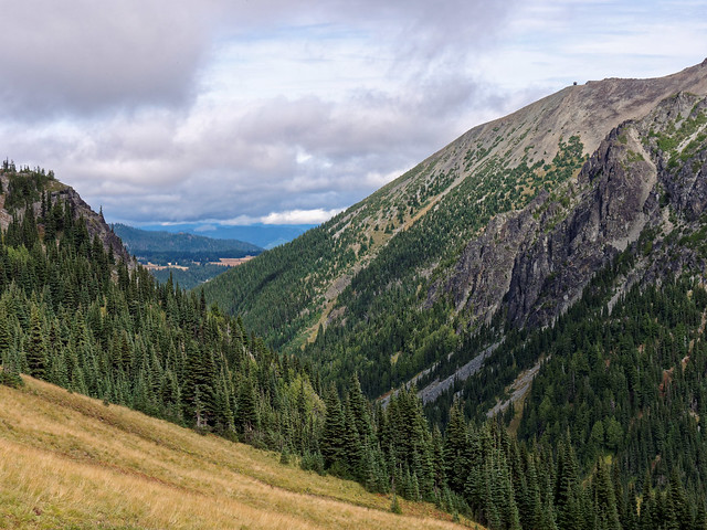
After dark we could see the lights from the city of Tacoma in the distance.

Tacoma seen from Mt Rainier National Park, Washington - Photo by John Strother
This was also supposed to be just an overnight trip and we planned to head home on Sunday. However, as we were hiking out John made a causal observation and said “I don’t have a meeting until 1:00 tomorrow”. As we continued to hike we both thought about that and began to wonder if we could stay out another night. We figured that if we got an early start on Monday morning we could hike out, drive home and have just enough time for John to take a fast shower and eat a quick lunch before going to the office for his meeting. So we took stock of what food we had left; two Probars, two Tiger’s Milk bars and two Tisa instant tea cubes. We decided that was enough so once we reached Emerald Ridge we went well off the trail to find a spot to put up our tent. Yes, we were camping without a permit and this is not a practice we normally condone but we justified it at the time as we were in a remote area of the park and we had not seen any other people. We undoubtedly would have been able to obtain a permit had we thought to ask for it.

Jean hiking on Emerald Ridge in Mt Rainier National Park, Washington - Photo by John Strother
We had the Probars and the tea for supper and saved the Tiger’s Milk bars for breakfast. We so enjoyed that evening and the next morning. We felt like we were playing “hooky”. Something we both came to realize was this marked a turning point for John as he began thinking much more about the reality of retirement. We longed for the time when we could have the time and flexibility we now enjoy.

Seen from Emerald Ridge in Mt Rainier National Park, Washington - Photo by John Strother
On our current trip we continued on the Wonderland Trail and when we came to the junction with the trail to Indian Henry's Hunting Ground I remembered the time when I hiked it by myself while John was trail running elsewhere in the park. It is funny the things that jump out in one's memories. This trail goes through a lush patch of wild blueberries. I remember passing a young couple who were actively picking and eating some of the berries. The young woman looked up, smiled with a blueberry stained mouth and suggested that I stop and do the same.
I smiled back and said I prefer to leave the berries for the bears. She immediately stood straight up, her jaw dropped and with panic in her eyes she quickly looked all around her saying "Bears! There are bears out here?" She then turned to the fellow with her and said "You didn't tell me there would be bears out here!" I felt badly for making what seemed to me to be a lighthearted comment (But I have to admit that I do think everyone should leave the berries for the bears). I tried to reassure her by saying I hadn't seen any bears and they might be sleeping through the heat of the day but to no avail. So I kept going. Hopefully her companion was able to calm her down.
But I couldn't be critical of her naivete as I had felt a similar panic the first time we planned to backpack in Yellowstone National Park. I imagine I had the same wide eyed look on my face while the backcountry park ranger gave us extensive instructions. Most were ones I have become quite familiar with; making noise while you hike, cook and eat at least a good distance away from where you camp etc. But this ranger also instructed us to find trees we could climb (but can't bears climb trees?). He also said we should not sleep in the same clothes we cooked in. This was advice John said we could ignore and indeed, we have never gone that far but, at the time, I was quite nervous about it and slept poorly wondering if I smelled like something a bear would want to eat..
The end of the day would see us arriving at Longmire where this portion of the trip would end. As we passed Cougar Rock Campground I thought back to trips to the park we have done with our boys in “Max”, our Volkswagen camper, and when we stayed at Cougar Rock.

Tom, Dan, "Max" and John at Cougar Rock Campground in Mt Rainier National Park, Washington
While exploring around the campground on one such trip we happened upon the remnants of an old wooden water pipe. Dan, who was absolutely fascinated with anything to do with wires and pipes (he is now an Electrical Engineer), wanted to know where it went. We started bushwhacking through the woods but before long Tom (with his shorter legs) had enough so he and I returned to the campground. However, Dan was undeterred. Unfortunately, he and John were unable to continue to a satisfactory end. At least on that trip.

Dan and old water pipe in Mt Rainier National Park, Washington - Photo by John Strother
The next time we stayed at Cougar Rock Campground Dan was still determined so we all set out again. This time we happened upon a sketchy path and eventually found what was left of a dam and a cabin. We later learned that this had at one time served as the water source for Longmire, the former site of the park headquarters.

Dan and an old dam in Mt Rainier National Park, Washington - Photo by John Strother
Dan dubbed this cabin the “Pump house” ...

Dan in an old cabin in Mt Rainier National Park, Washington - Photo by John Strother
... and both boys occupied themselves exploring the contents. They each found "treasures". Fortunately neither of them expressed an interest in bringing them home. We would have had to explain to them that it is illegal to remove such artifacts from a national park.

Tom in an old cabin in Mt Rainier National Park, Washington - Photo by John Strother
Although I have trouble thinking of a decades old jar of sugar as an "artifact".

Dan in an old cabin in Mt Rainier National Park, Washington - Photo by John Strother
As we neared Longmire I had another memory, a time when we brought my mom to Mt Rainier and stayed in the historic National Park Inn at Longmire.

National Park Inn at Longmire in Mt Rainier National Park, Washington - Source of Image
On our first morning there John got up early and went for a trail run. My plan was for Mom and me to enjoy a relaxed cup of coffee in our room before waking the boys up and taking them to the dining room for breakfast. However we awoke to a power outage so that alluring coffee pot remained cold and empty. And unfortunately, the dining room was closed. By begging, I was able to obtain some small boxes of Frosted Flakes for the now awake and hungry Dan and Tom but the staff were unwilling to sell me some eggs or anything that I could prepare in our VW camper for the rest of us. Fortunately, the power was restored before either of us became too hungry and before John returned from his run. It was circumstances such as this that reinforced a “backpacker’s mentality” in me where you always have what you need to survive with you at all times. To this day I hesitate to travel anywhere without food just in case.
On our current trip once we got to Longmire we retrieved our motorhome and went to a campground just outside the park. We had hoped the good weather would hold long enough for us to take a day to clean up and resupply our packs and then complete the trail. However, the weather forecast was not good so we drove to Sunrise the following day to get our Jeep. We didn’t have time to wait out the weather as we needed to get to Seattle to help our son move to Bellingham. At that time we were uncertain when we might finish the Wonderland Trail. But as luck would have it we found ourselves back at Longmire in October within a favorable weather window ready to complete the trail. This time we dropped our Jeep off at Sunrise before driving to Longmire where we parked our motorhome.
If you continue up the road from Longmire you eventually get to Paradise. Even though the Wonderland Trail does not go all the way to Paradise I couldn’t help but think back about times when we have been there. There is of course the time I spent in the First Aid Room after dislocating my hip but fortunately I have better memories. I thought back to the first time we took my mom to Paradise. It was in April 1988 and I’m not sure what possessed us to take her to Mt Rainier that day as the weather was far from optimal and there was little chance of seeing much of anything.
But I must have really wanted her to see this mountain I loved so much that I was willing to take a chance. We arrived at the Jackson Memorial Visitor Center at Paradise (which has since been torn down) in a cloud and cold rain. Fortunately, we were able to park quite close to the door to the lower level of the Visitor Center. We got out of the car and I encouraged Mom to hurry inside while John and I got our two young boys out of their car seats. But when we got inside Mom was nowhere to be seen. I could not imagine what had happened to her in such a short period of time. John set out to look for her while I waited anxiously. He eventually found her on the upper level; cold, wet and quite out of breath. Rather than going straight through the door into the lower level she had walked out of the parking lot, uphill on the road and across the broad patio to the main entrance on the upper level.
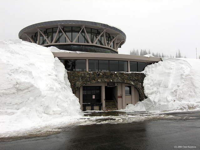
Jackson Memorial Visitor Center at Paradise in Mt Rainier National Park, Washington - Photo by Chris Knutson
I was so relieved to have found her but I couldn’t figure out why she had walked so far in such miserable weather. I asked her why she didn’t go through the door that we were parked right next to and she exasperatedly replied “What door?!?” Apparently when confronted with the 12+ feet of snow surrounding the building she simply had not recognized the tunnel through the snow as an entrance into the building. I felt absolutely terrible about it and berated myself for not personally leading her to the door beyond the tunnel and helping her inside and getting her seated on a bench. After all, she was elderly, overweight and was a former chain smoker at a much higher altitude than she was used to. But I have to admire her gumption. Rather than quickly giving up and turning around she persevered on a trek that must have felt like an Arctic expedition to her. I think she even felt a bit proud of herself.
And then there was the time we took John’s mother to Paradise. It was June in 1983 and the weather was much more cooperative.

John, Delora (John’s mom) and Jean at Mt Rainier National Park, Washington
A highlight of that trip was spending a memorable night in the historic Paradise Inn.
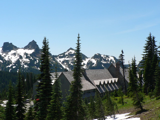
Paradise Inn in Mt Rainier National Park, Washington - Photo courtesy of Mt Rainier National Park Service
We spent a pleasurable evening tucked away in the cozy mezzanine of the rustic building playing Pinochle.
Mezzanine within Paradise Inn in Mt Rainier National Park, Washington State - Photo by Dolan Halbrook
We have also been there with just our boys. Living in a maritime climate meant we got very little snow where we lived. We were fond of saying we kept the snow in the mountains where it belonged and where we could go visit it whenever we wanted to. So sometimes we took the boys to Mt Rainier simply to play in the snow. On one such visit to Paradise they had a blast diving head first into holes that had formed in the deep snow.

Tom and Dan in Mt Rainier National Park, Washington - Photo by John Strother
John and I have returned to Paradise on other occasions since then to do some snowshoeing …

Jean in Mt Rainier National Park, Washington - Photo by John Strother
… as well as hiking. John took the below photograph on the way up to Camp Muir.
Jean heading toward Camp Muir in Mt Rainier National Park, Washington - Photo by John Strother
Not too long ago we were contacted by someone from the National Park Service asking our permission to use this photo in a brochure. We were flattered and of course agreed.

Mt Rainier National Park brochure
We had great weather that day and wonderful views of the mountain.
Mt Rainier, Washington - Photo by John Strother
While at Camp Muir we did the short walk over to "Tent Gulch", where hopeful climbers camp the day before attempting the summit. I can't say they will spend the night there as they will start their climb to the summit in the middle of the night.
"Tent Gulch" at Camp Muir in Mt Rainier National Park, Washington - Photo by John Strother
We continued on the Wonderland Trail toward Reflection Lakes. While I still shudder when I think back to when I dislocated my hip I have other memories of being in this scenic spot.

Dan at Reflection Lakes in Mt Rainier National Park, Washington - Photo by John Strother
After leaving Reflection Lakes we headed down a portion of the trail I have never been on. While many of the trails in the park are focused on mountains the highlights of this portion of the trail are several waterfalls. The following day we crossed over Box Canyon. This was a common stopping place whenever we were in this part of the park as it is just a short walk from the road. I have never gotten tired of seeing the gracefully curved sides of this slot canyon.

Box Canyon in Mt Rainier National Park, Washington - Photo by John Strother
As we continued we encountered a junction with the Cowlitz Divide Trail that begins near the Stevens Canyon Entrance of the park. I remembered a time when Miller went snowshoeing with us. This entrance to the park was closed for the season and it felt odd to simply walk past a park entrance without even showing our Park Pass.

Miller and Jean snowshoeing in Mt Rainier National Park, Washington - Photo by John Strother
Also near that entrance is access to the Silver Falls Loop Trail. We have done the short easy trail on multiple occasions.

Jean and Silver Falls in Mt Rainier National Park, Washington - Photo by John Strother
It is a lovely falls no matter what time of year you see it.
Silver Falls in Mt Rainier National Park, Washington - Photo by John Strother
Something I love about water falls is when you get closer to them you can focus on smaller sections. Watching the water hitting the rocks below can be quite mesmerizing.
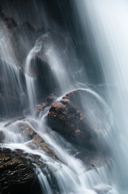
Silver Falls in Mt Rainier National Park, Washington - Photo by John Strother
If you head up Hwy 123 you soon come to the parking lot for the "Grove of the Patriarchs", home to majestic old growth trees.

"Grove of the Patriarchs” in Mt Rainier National Park, Washington - Photo by John Strother
Over the years we have made the short walk several times including one with our two boys.

Tom and Dan with one of the “Patriarchs” in Mt Rainier National Park, Washington - Photo by John Strother
Years later John and I sought out this same tree and noted the addition of the raised boardwalk. We have since learned that the action of many feet walking around the base of big trees can actually compact the soil and impair the shallow roots. I felt terrible for all the times we have done that very thing.
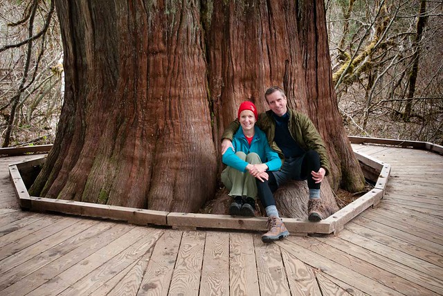
Jean and John with one of the “Patriarchs” in Mt Rainier National Park, Washington - Photo by John Strother
Another time John, our friend Miller and I were snowshoeing in the park we wanted to go over to Grove of the Patriarchs. However, we discovered the bridge leading to it had been mangled by the weight of the snow. John, the eternal optimist, initially looked to see if we could climb over the wreckage but Miller and I were skeptical. Fortunately John's better sense prevailed and we moved on without attempting it.

Miller and Jean in Mt Rainier National Park, Washington- Photo by John Strother
By continuing up 123 to Hwy 410 you reach the trailhead for the Crystal Lakes Trail. This was one of the early hikes we did with our kids.

John and Dan on the trail to Crystal Lakes in Mt Rainier National Park, Washington - Photo by Jean Strother
Although the trail is steep it is only six miles round trip. Something that amazes me about the park is how many beautiful spots are so accessible.

Lower Crystal Lake in Mt Rainier National Park, Washington - Source of Photo
We continued on the Wonderland Trail and our destination for the day was Indian Bar. As we were hiking up the trail I thought back to a time when John was doing one of his runs around the mountain on the Wonderland Trail and I provided support for him. On two consecutive days I drove our van to where he would finish his run for the day and we would camp together. The preceding night I had picked him up at Longmire. The next morning he started his run there and I drove to Box Canyon so I could do a day hike to Indian Bar. I left our van in the parking lot and when John reached that point later in the day he would be able to take a well deserved lunch break in relative comfort while I hiked.
When I was ready to head back to the trailhead from Indian Bar I figured John would be coming my way before long. And lo and behold I saw a figure running toward me in the distance (I’d recognize that stride anywhere). When we met on the trail we stopped only briefly as we both had miles to go in order to get to the White River Campground, our destination for the day. But we made the most of our brief visit, we kissed (and not just a quick peck) before separating and continuing on in our respective directions. I have no idea what nearby hikers who witnessed this brief interlude thought about it.
When I was ready to head back to the trailhead from Indian Bar I figured John would be coming my way before long. And lo and behold I saw a figure running toward me in the distance (I’d recognize that stride anywhere). When we met on the trail we stopped only briefly as we both had miles to go in order to get to the White River Campground, our destination for the day. But we made the most of our brief visit, we kissed (and not just a quick peck) before separating and continuing on in our respective directions. I have no idea what nearby hikers who witnessed this brief interlude thought about it.
In July 2009 we did a backpack trip to Indian Bar with our son Dan. We were unable to drive all the way to the trailhead as the road was still closed. So we hiked up the Cowlitz Divide Trail and encountered one stream crossing we couldn't rock hop across. We had not brought water shoes but fortunately we found a spot with relatively smooth rock so walking barefoot was not too bad although the water was bitter cold.

Jean in Mt Rainier National Park, Washington - Photo by John Strother
It was the Fourth of July and we were surprised that there was not a single other person out there over the holiday weekend. Apparently the snow deterred people although we found it well consolidated and had no trouble even without snowshoes.

Dan in Mt Rainier National Park, Washington - Photo by John Strother
Indian Bar is one of my favorite places in the park and it was a treat to be there while there was still so much snow..

Mt Rainier in Mt Rainier National Park, Washington - Photo by John Strother
The campsites were all covered in snow so we set up camp within the shelter.


Dan, Jean and John in the shelter at Indian Bar in Mt Rainier National Park, Washington - Photo by John Strother
On our current trip John and I again camped in the shelter. The next morning as we approached Panhandle Gap I was reminded of a backpack trip we did where we hiked well off of the trail above Panhandle Gap. A highlight of that trip was seeing a large flock of Mountain Goats ...

Mountain Goats seen in Mt Rainier National Park, Washington - Photo by John Strother
... including this doe with triplets.

Mountain Goats seen in Mt Rainier National Park, Washington - Photo by John Strother
Of course we also thoroughly enjoyed the panoramic view of Mt Rainier.


Jean and Mt Rainier in Mt Rainier National Park, Washington - Photo by John Strother
After crossing Panhandle Gap we started our descent toward Summerland. There is a dramatic line of demarcation between the grey rock and the beginning of the green meadows of Summerland.

As we descended through the stark landscape ...

Mt Rainier National Park, Washington - Photo by Jean Strother
As we descended through the stark landscape ...

Mt Rainier National Park, Washington - Photo by Jean Strother
... I was reminded of how I felt on that previous trip. We were there when the wildflowers were in full bloom and Summerland was a riot of color. When I first stepped off of the rocks I remember feeling like Dorothy when she leaves her black and white existence behind and enters the Technicolor land of Oz. The meadows were now a subdued gold but it was still a welcome change from the grey rock of Panhandle Gap.
Summerland in Mt Rainier National Park, Washington - Photo by John Strother
I also thought back to the first time I had been to Summerland. It was the summer of 1988 when we took Dan and Tom hiking with us, carrying both of them in kid carriers. Tom was an active kid but was generally content to ride between stops. However, this time it became apparent he really wanted down so we let him “hike” for awhile. The dust billowed up around him as he made his way up the trail and he reminded us of the “Peanuts” character, “Pig - Pen”.
Tom “hiking” the trail to Summerland in Mt Rainier National Park, Washington - Photo by John Strother
Summerland is another of my favorite places in the park due in part to the wildlife that can be seen. Marmots are abundant and their whistles of warning are frequent. However, many seem more habituated to humans and our presence does not see to interfere with their relaxing on sunny rocks.

A Marmot in Mt Rainier National Park, Washington - Photo by John Strother
The area also boasts a wide variety of wildflowers and I think my favorite is the Western Anemone. Not so much for the flower itself ...

Western Anemone in Mt Rainier National Park, Washington - Source of Photo
... but for the unusual seed head it forms later in the season. One of Dan's favorite books as a kid was "The Lorax" by Dr Seuss and we thought these looked like miniature Truffula Trees (which, as the Lorax says, "everyone, everyone, everyone needs").

Western Anemone in Mt Rainier National Park, Washington - Photo by John Strother
We pitched our tent inside the shelter, someplace I remembered being before.

The next morning I finished packing up while John was out taking photos. Once I was done I sat on a log and enjoyed the view. As I looked at the increasing clouds and felt some sprinkles I found myself wondering what the weather forecast was for the day. I was trying to decide whether or not to put on my rain gaiters. I just recently started taking my iPhone backpacking and primarily use it to take photos of John but I pulled it out of my pocket to see if I could pick up anything. I was surprised there was cell service so I checked and learned there was rain forecasted. Sitting there with internet access I was tempted to check my email and take a photo of where I was to share with my family or post it on Facebook But I came to my senses and put my phone away. I then just focused on my surroundings appreciating how it "felt" to be there creating memories I know I will have when I look back at John's photographs.

Tom, Jean and Dan inside the Summerland shelter in Mt Rainier National Park, Washington
The next morning I finished packing up while John was out taking photos. Once I was done I sat on a log and enjoyed the view. As I looked at the increasing clouds and felt some sprinkles I found myself wondering what the weather forecast was for the day. I was trying to decide whether or not to put on my rain gaiters. I just recently started taking my iPhone backpacking and primarily use it to take photos of John but I pulled it out of my pocket to see if I could pick up anything. I was surprised there was cell service so I checked and learned there was rain forecasted. Sitting there with internet access I was tempted to check my email and take a photo of where I was to share with my family or post it on Facebook But I came to my senses and put my phone away. I then just focused on my surroundings appreciating how it "felt" to be there creating memories I know I will have when I look back at John's photographs.
We eventually got started and hiked quickly down the easy trail. It was a Saturday so this popular trail was crowded with many day hikers who were lightly clad and unburdened with packs. We took a lunch break at the now empty White River Campground.
John at the White River Campground Ranger Station in Mt Rainier National Park, Washington
While we were there I remembered an embarrassing event the last time I had been in this campground. John was doing one of his three day runs around the mountain, I was providing support and we were to camp at the White River Campground that night. I arrived late in the day tired and hungry after doing that dayhike to Indian Bar followed by a long drive. It was Labor Day weekend and I was anxious about finding a campsite as we didn’t have a reservation. So I pulled into the first one I saw.
It was a tight fit but I didn’t want to risk losing this site in case it was the last one. I decided to get out and walk around a bit to look for a better one. I was parked next to some brush and didn't want to risk scratching to door so I got out through the side sliding door. Once out, I shut the door behind me. And then I heard the door lock. With a sinking feeling I realized that I had left the keys in the ignition. I knew John had a key with him but he was undoubtedly still hours away. In addition to being tired and hungry I was starting to get cold. I wasn’t sure what to do. So I shyly approached the three young men in the adjacent campsite. I explained my predicament and they took pity on me. I was soon seated by their fire wrapped in a blanket eating some delicious Ravioli. It turned into quite an enjoyable evening.
It was a tight fit but I didn’t want to risk losing this site in case it was the last one. I decided to get out and walk around a bit to look for a better one. I was parked next to some brush and didn't want to risk scratching to door so I got out through the side sliding door. Once out, I shut the door behind me. And then I heard the door lock. With a sinking feeling I realized that I had left the keys in the ignition. I knew John had a key with him but he was undoubtedly still hours away. In addition to being tired and hungry I was starting to get cold. I wasn’t sure what to do. So I shyly approached the three young men in the adjacent campsite. I explained my predicament and they took pity on me. I was soon seated by their fire wrapped in a blanket eating some delicious Ravioli. It turned into quite an enjoyable evening.
I had written a note in the dirt where the Wonderland Trail enters the campground telling John what site I was in. However, as it was quite dark he felt it was safer to get off of the trail and take the road the rest of the way to the campground so he never saw my note. When he first arrived at the campground he went to the registration board to see where I was parked. The only problem was I had completely forgotten about registering. So there he was, it was late, he was exhausted (having run over 30 miles that day), quite hungry and beginning to get chilled. He had no food or shelter. He was also concerned that something had happened to me. Not knowing what else to do he wandered through every loop in the campground and finally found our van on the last one. But he was perplexed when I was nowhere to be seen. Fortunately he approached the adjacent site and found me happily chatting away with my new friends. I sheepishly told him what had happened but he was too relieved to be annoyed.
Back to the present I tried to put that memory behind me and focus on what was ahead, the last leg of our trip, a steep 2.6 mile hike up to Sunrise. We had expected to be hiking in the rain all day but surprisingly we remained dry for the entire day. After reaching the parking lot I stopped and looked back at the mountain, expecting what I don't know but what I got this time was a misty tolerance. It appeared that the clouds were stuck on the summit and it was almost as if the mountain was purposely holding them back. It wasn’t until we reached our car that it finally started to rain. Perhaps my love for this mountain will never be reciprocated but our rain free hike that day was a gift and I was very grateful for it.
Mt Rainier in Mt Rainier National Park, Washington
Now that I have done the Wonderland Trail I feel a sense of completeness. While I would have liked to have stood on the summit at least once in my life I am content with the choices I made that prevented it. And I don’t want it badly enough now to do what would be necessary to achieve it at this point in my life. However, I believe I have seen the best parts of the park and there are no more trails there I feel a need to hike. There is so much more in Washington State that we want to see and as we get older our time to spend hiking is becoming increasingly precious so we don’t know if we will ever return to Mt Rainier National Park. But “The Mountain” is such a presence in the state I know that whenever we return to Washington State we will definitely see it if only in the distance. Since first moving to Washington State in 1977 I have seen many amazing mountains; in Canada, Nepal, Peru, Tanzania, New Zealand as well as the US. I have fallen in love with many of them but there will always be a special place in my heart for my first.
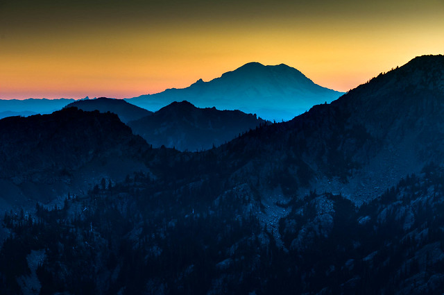
Mt Rainier seen from the Lake Ingalls Trail, Washington - Photo by John Strother


1 comment:
Hi, I have just spent about 3 hours looking at your beautiful photos. One of your them popped up when I was searching for hikes around Homer Alaska, and I just kept reading. What adventurous trips you have had! We are leaving in 3 weeks for a 2-week cruise to Anchorage, starting with 2 days in Seattle. We hope to drive to Mount Rainier but with only a day there it'll be hard to choose just one trail to take. (That's if the mountain is even visible; if not we might go to Cascades). I read about your hikes in MRNP, beautiful! I kept jotting down the trails and trying to find them on the maps, but we'll only have time for one.
We are about the same age I think (I'm 62) and while we liked day hikes when we lived in Colorado and Arizona, we have never backpacked (just tent and pop-up trailer camping).
I've passed along your Peru photos to my daughter; she spent 5 weeks in Cusco in June 2014 (the same time you were there), working in an orphanage and doing a lot of sightseeing. She took the 5 day hike to Machu Pichu on the Salcantay route. Quite an experience for her, just out of college.
Anyway, I plan to check out more of your trips, so enjoyable to read about them. Thank you!
Sandy Cols in Columbus GA
Post a Comment