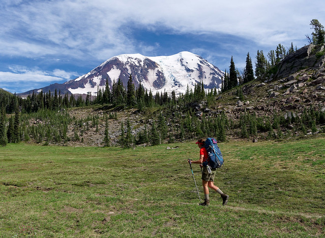
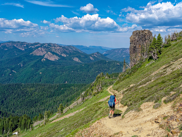
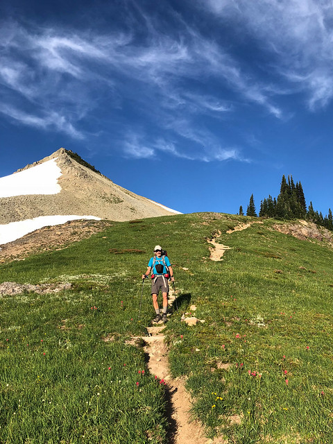
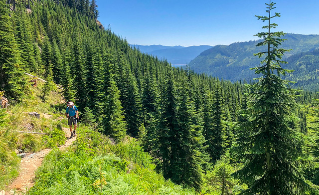
Thru hikers, those backpackers who are doing all of a long trail such as the Appalachian Trail or the Pacific Crest Trail, commonly adopt easy to remember "trail names" to help distinguish them from others with the same first name. Names of some of the thru hikers we met include "Care Bear", "Airborne", "Barefoot Kid", "Twigs" and "Hangry". When we were asked "What's your trail name?" my first thought was that, as we were not thru hikers, we did not warrant trail names. We were classified as "section hikers", those only doing a portion of a long trail. I later learned we were also "Lashers", short for "Long Ass Hikers", those going at least 500 miles. But I still didn't feel like we needed trail names as I didn't believe there were all that many 60 something couples named Jean and John hiking the PCT through Washington that summer.
But we did talk about trail names a bit. John's first suggestion was "Tare and the Hortoise", a modified version of the Aesop story, "The Tortoise and the Hare" but I just couldn't bond with it. I briefly considered naming myself "Full Moon" after a young male Aussie thru hiker happened upon me while I was answering a "call of nature" and John, after a particularly intense encounter with mosquitoes, considered naming himself "Three bites on my (insert slang term for male genitalia)". Both amusing but neither seemed quite right. Then we realized we already had a trail name - panafoot. This is a word that John created and we have defined as "covering great distances to see more of the world under one’s own power". I believe it is fitting that we shared a trail name as we are very much a team. I also think it is fitting as we were planning to walk farther than we had ever walked before.
Where We Have Been - Pacific Crest Trail through Washington State
7/7 - 8/14/2018
We had been thinking about hiking the Pacific Crest Trail (PCT) through Washington State for quite some time and decided this was the year to do it. There is a wealth of information available online about the PCT and the Pacific Crest Trail Association's website, www.PCTA.org, is a great place to start. We initially used Craig's PCT Planner but John felt we needed a more detailed tool so he used Halfmile's PCT maps, especially Halfmile's iPhone app, to help plan our trip. We later learned many PCT hikers use Guthook's Pacific Crest Trail app. However, Halfmile's iPhone app reported cumulative elevation gain and loss and it could be used to simulate a track which proved to be invaluable in planning.
What we soon realized was our normal leisurely pace of about ten miles per day would require us to carry way too much food between resupply points. Not only would it stress our aging joints it would slow us down too much and we had some time constraints. We didn't want to start too early and be faced with a lot of snow. But, we also needed to be done by about mid August to not interfere with a get together with our two sons later that month. The conclusion John came to was we would need to average about 15 miles per day in order to not have to carry more than seven days worth of food on a regular basis. We were reasonably confident we could do it.
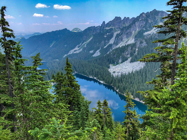
Fortunately, we had done a better job maintaining conditioning over the past winter than we had previous years. While at Jojoba Hills RV Resort, our winter base, we had hiked 6 - 12 miles twice a week carrying 30 pound packs while gaining significant elevation. We also did extensive backpacking in Grand Canyon this past spring including three trips on more remote "routes" that involved a fair amount of "off trail" hiking.
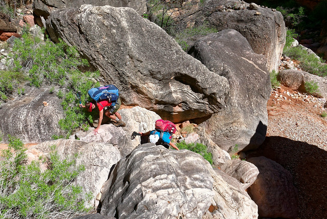
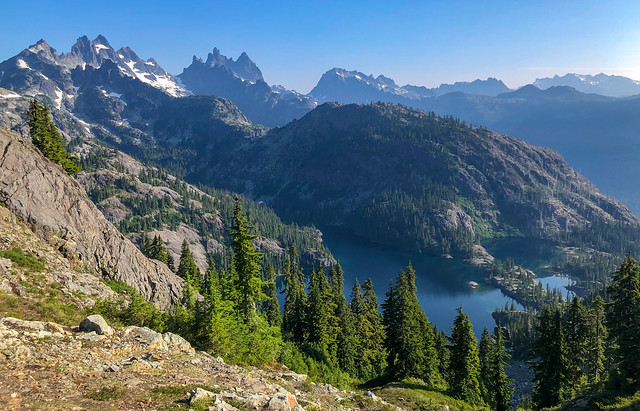
Jean and John on the Royal Arch Loop in Grand Canyon National Park, Arizona
Whereas, "trails" and "routes" in Grand Canyon can be quite steep and rough the PCT is our nation's premier trail. It was constructed for use by horses so the grade is much more moderate than what one usually encounters in the canyon. We have been on parts of the PCT in Washington in the past that can be classified as a "superhighway" in comparison. However, in hindsight, we had unrealistically high expectations for the overall quality of the PCT.
We planned to hike south to north as it is currently illegal to enter the US from Canada on the PCT. So we completed the necessary forms and quickly received the documents we needed to enter Canada at Monument 78 on the PCT. Unfortunately, there is no longer a Greyhound Bus route that stops at Manning Provincial Park in British Columbia to take PCT hikers back to civilization. Fortunately for us, John's sister was willing to drive up to Canada to pick us up. However, we then felt the need to make a reservation at Manning Park Lodge so Elizabeth would have a guaranteed place to stay. That meant even before we started the trip we needed to decide the exact date of when we would finish. John did careful calculations using Halfmile's data on locations of water and campsites and created an extensive spreadsheet. He determined if we started in early July we could finish on August 14th. So, he booked a room at Manning Park Lodge for three nights and we hoped for the best as we had no "Plan B".

Manning Park Lodge, British Columbia in Canada - source of photo
Prior to starting this trip many of the decisions we needed to make revolved around food; primarily what to pack in our resupply, how much to pack and where to send it. Determining our first resupply was the most puzzling. Getting off the PCT at Forest Service Road #23 and walking or hitching to Trout Lake was an option but it would require a 13.8 mile one-way detour. We did not think that so early in the trip we would feel a great enough need for a shower and laundry to justify such a time consuming detour. We also did not believe we could make it all the way from Cascade Locks to White Pass without resupply. It was over 148 miles. We knew if we tried to carry ten days of food our packs would be way too heavy which would slow our pace too much.
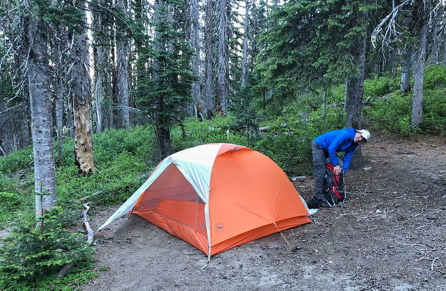
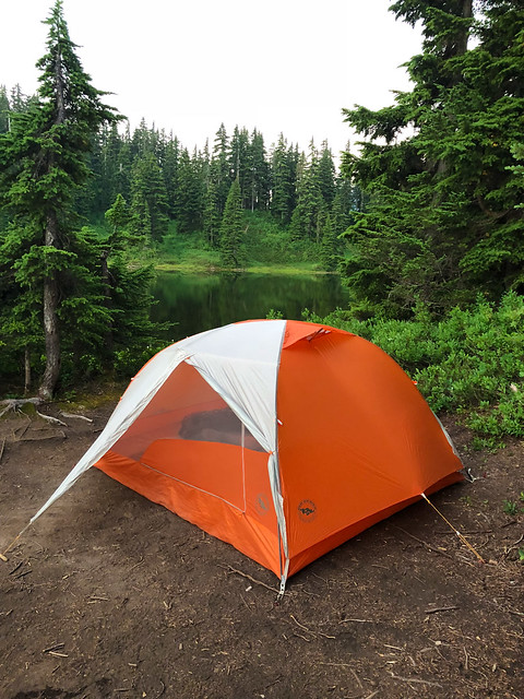
What we decided to do was drive to a suitable access point and bury a 5-gallon bucket containing our food resupply and hide a shovel. We would of course retrieve both bucket and shovel after the trip. So, the day before we began, we drove out Forest Service Road 24 to the large parking area adjacent to the PCT and buried our bucket. Fortunately, there was a lot of disturbed soil where an effort had been made to block a dirt road to vehicular traffic so it was easy to dig a deep enough hole. Our hope was a bulldozer would not be going through there anytime during the following week.
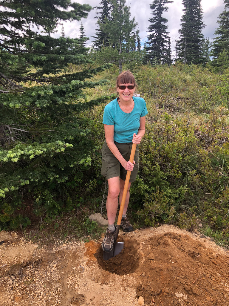
Jean burying a food resupply bucket near the PCT in Washington State
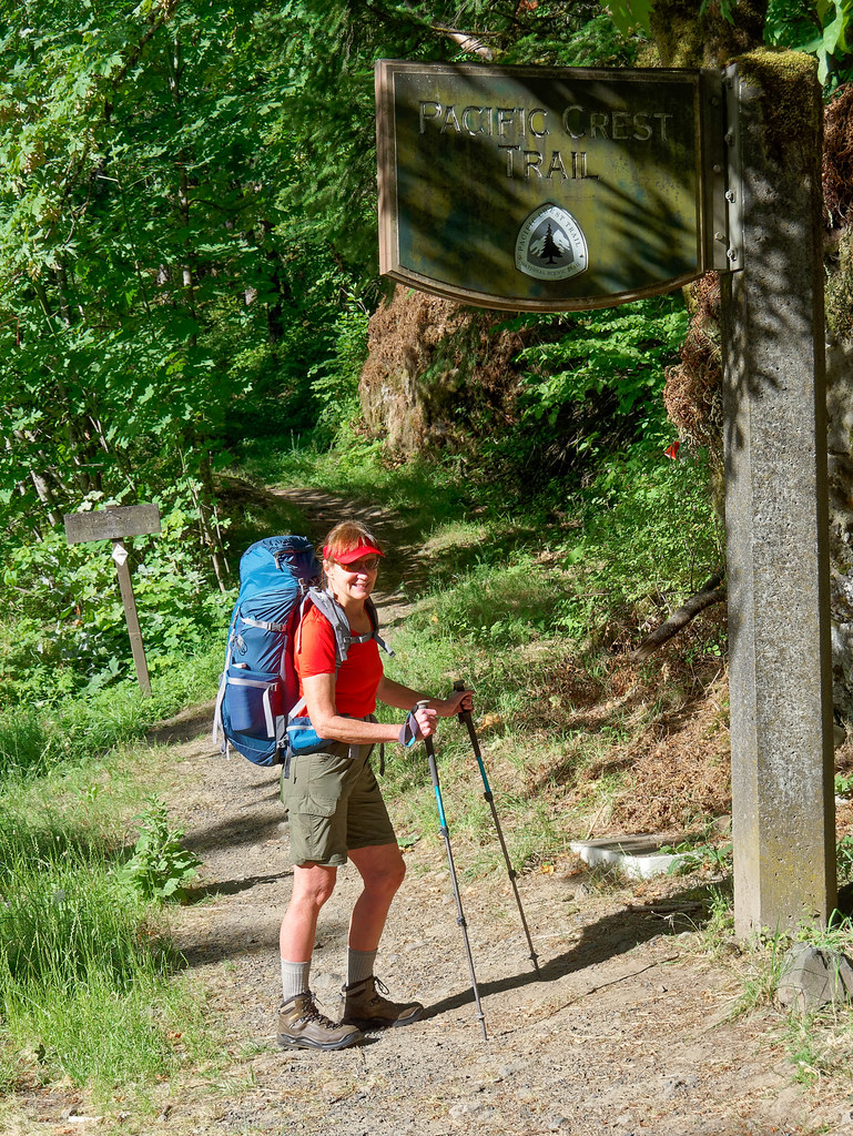
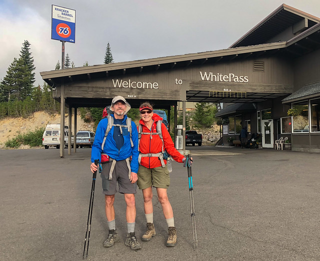
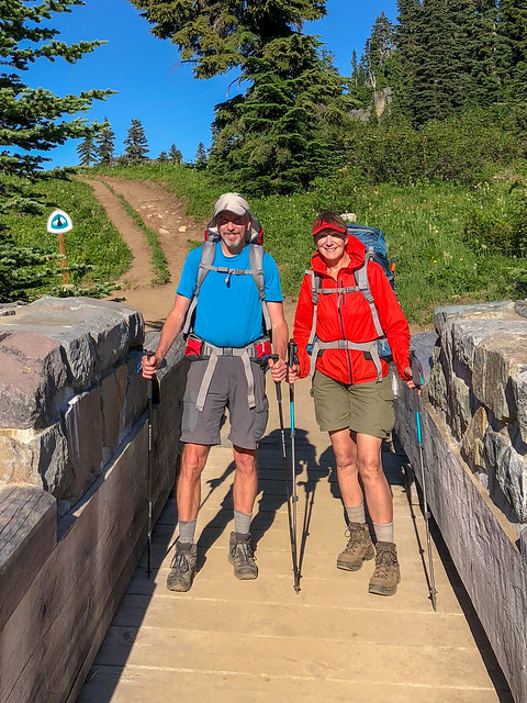
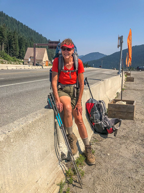
After burying our bucket we drove to Stevenson, Washington where we spent a noisy Friday night in a funky motel. Early the next morning Elizabeth dropped us off in Cascade Locks in Oregon so we could walk across the "Bridge of the Gods". We wanted to be able to say we had done all of Washington so that meant we had to get to the middle of the bridge from one side or the other.
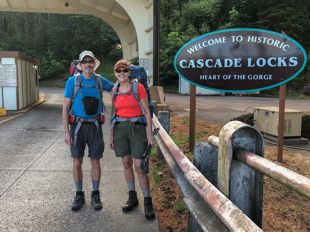
John and Jean on the PCT at Cascade Locks, Oregon
However, I was less than thrilled about being anywhere on this bridge after seeing it had no pedestrian walkway and motorists were way too comfortable with driving close to us. I finally resorted to sticking my trekking poles out so at least motorists would be more motivated to avoid getting a nasty scratch on their car even if they were unconcerned about hitting me.
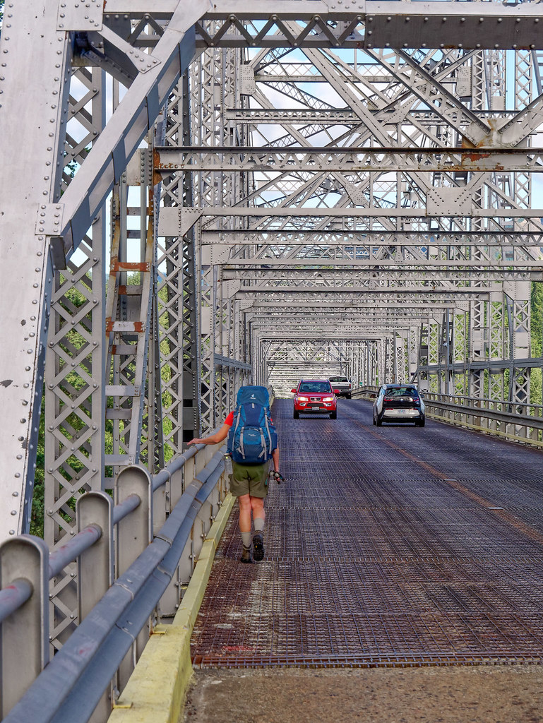
Jean on the "Bridge of the Gods", Oregon
John was willing to stop briefly to take a photo of the Columbia River but I just wanted to hurry up and get off the bridge in one piece.

The Columbia River seen from the "Bridge of the Gods, Oregon
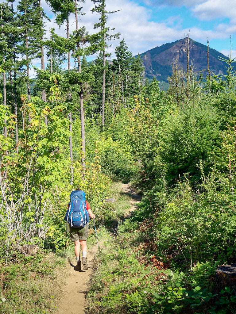
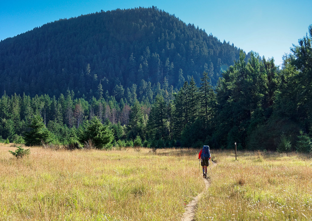
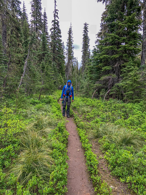
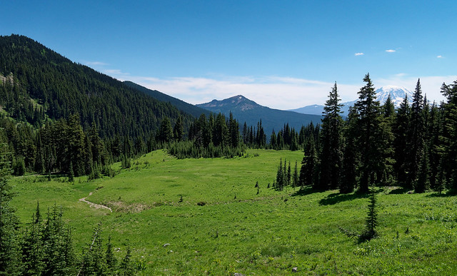
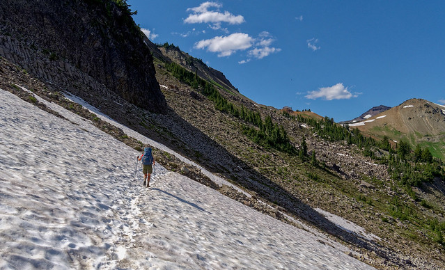
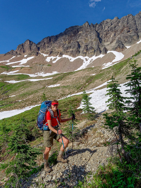
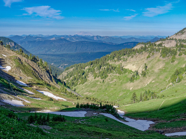
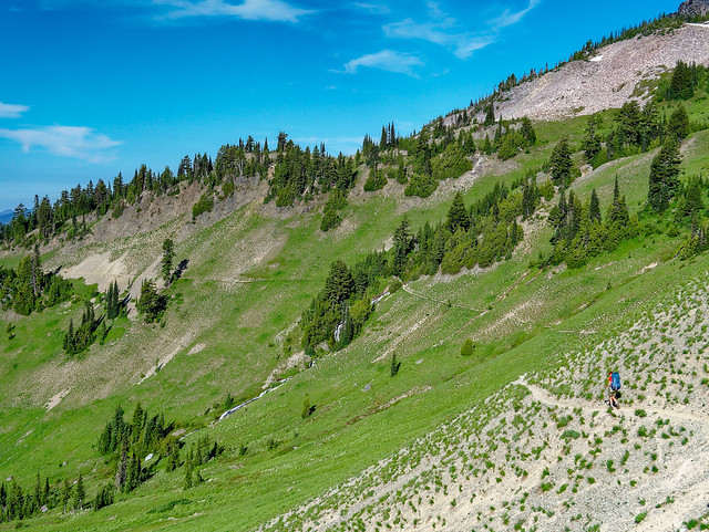
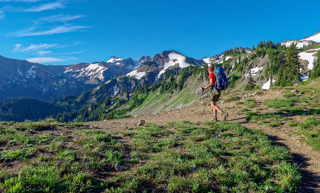
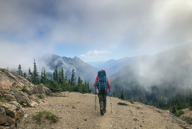
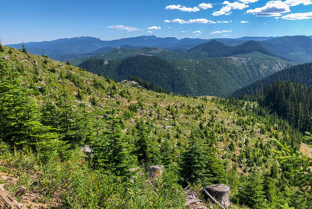
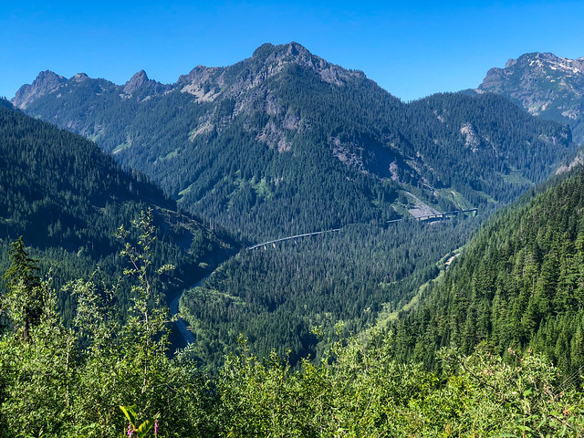
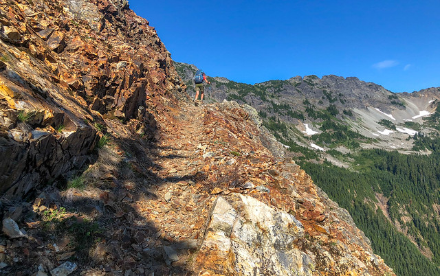
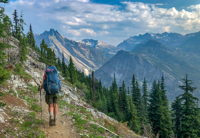
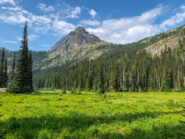
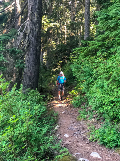
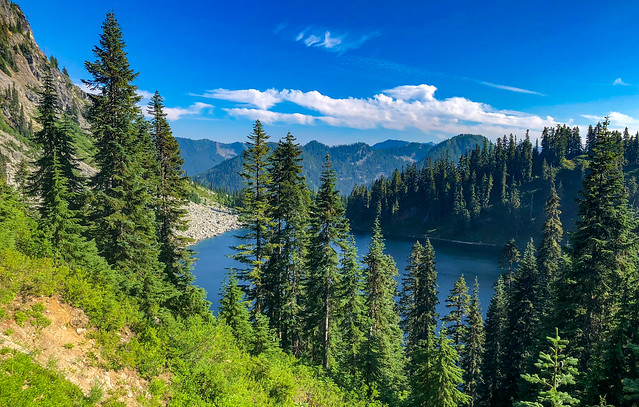
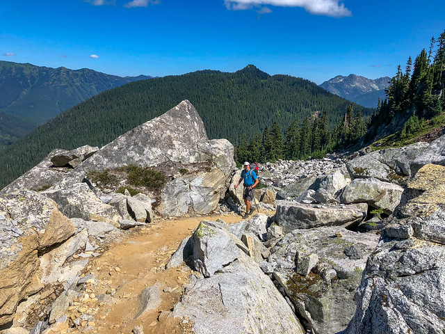
It was such a relief to finally be able to get off the road and onto a trail. Now all we had to do was walk. We were beginning our trip in Section H - Cascade Locks to Highway 12 (at White Pass). We were at PCT mile 2,146 and our destination, the Canadian border, was PCT mile 2,650, 504 miles away.
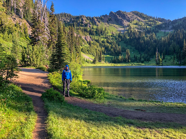
Jean on the PCT in Washington State
We wondered if we would see many northbound thru hikers, AKA "NoBos", but we knew we were well ahead of the "herd", the bubble of PCT hikers who started at the Mexico border around April. We were passed by a few thru hikers and later learned that an early season snow storm in the Sierra had stymied the majority of NoBo hikers. Those who had reached Washington State this early in July had either beaten the storm or had the skills necessary to navigate the trail immediately after it.
Jean on the PCT in Washington State
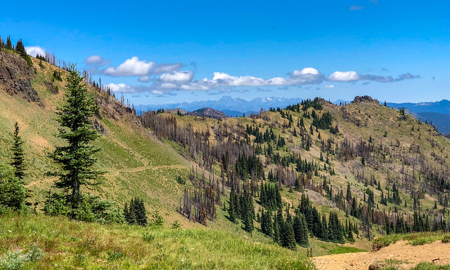
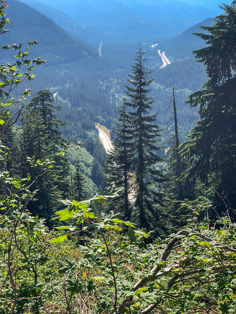
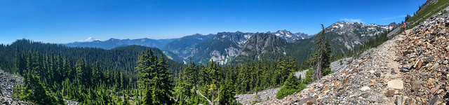
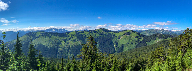
The weather was perfect; warm but not too hot and with no rain in the extended forecast. During those first few days when the trail took us up out of the valleys we had views of the mighty Columbia River, ...
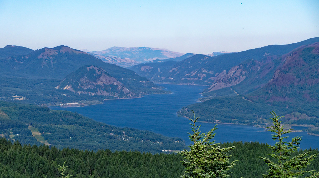
The Columbia River seen from the PCT in Washington State
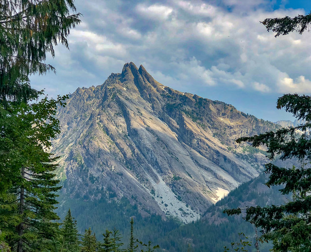
... the angular Mt Hood, ...
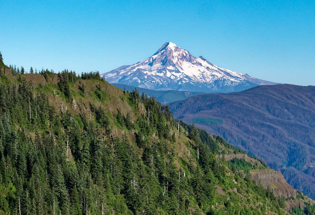
Mt Hood seen from the PCT in Washington State
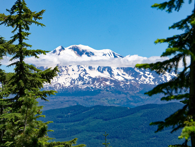
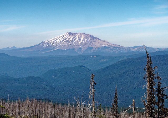
... a seemingly bashful Mt St Helens, ...
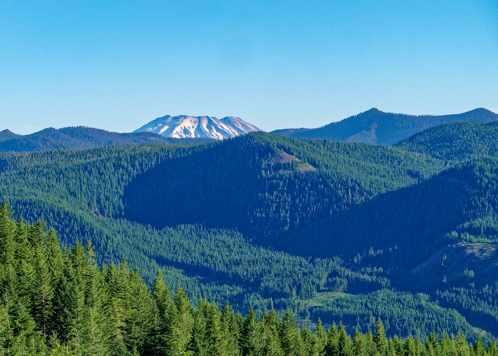
Mt St Helens seen from the PCT in Washington State
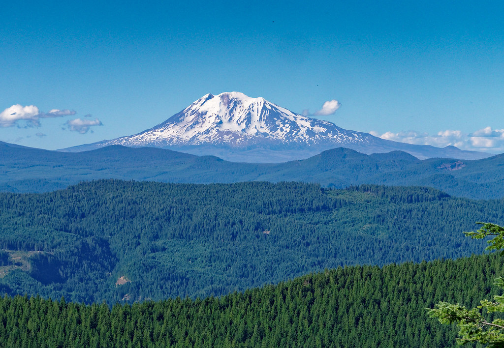
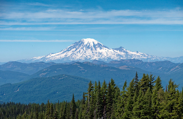
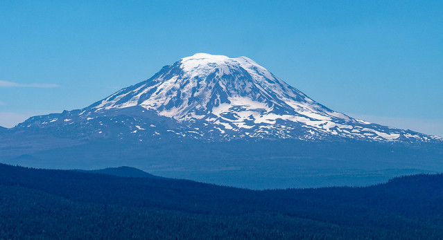
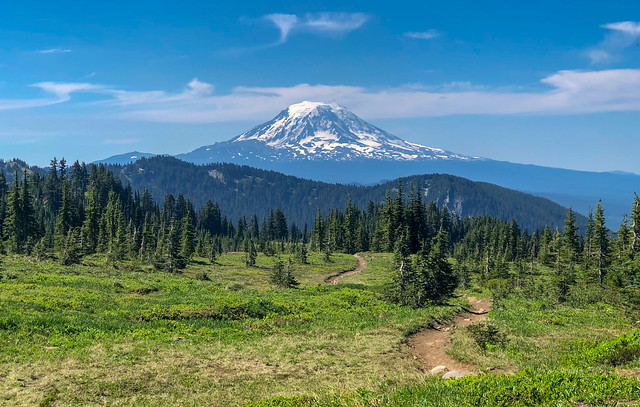
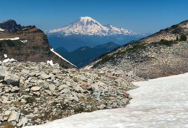
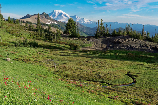
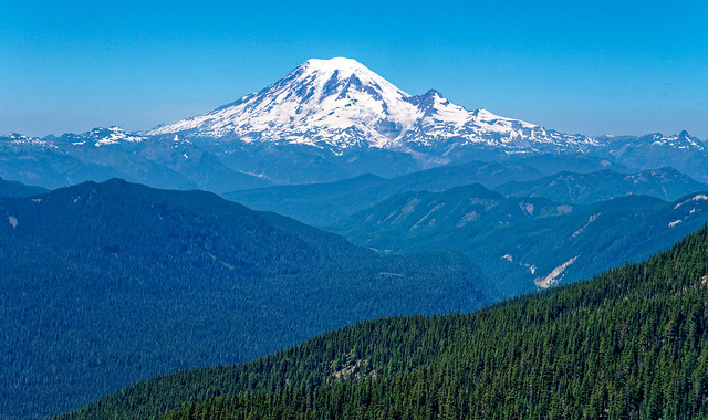
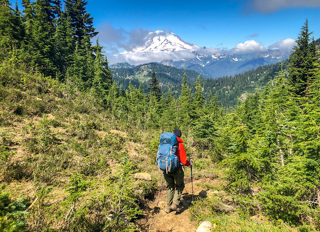
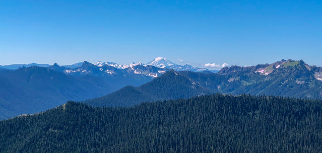
... and the majestic Mt Adams.
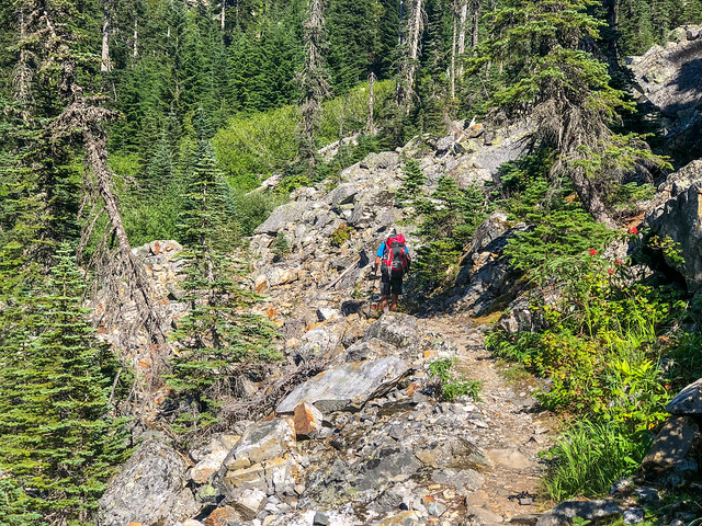
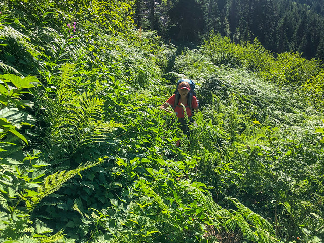
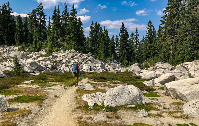
When the trail went through the valleys it was often brushy ...
Mt Adams seen from the PCT in Washington State
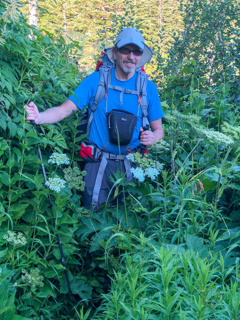
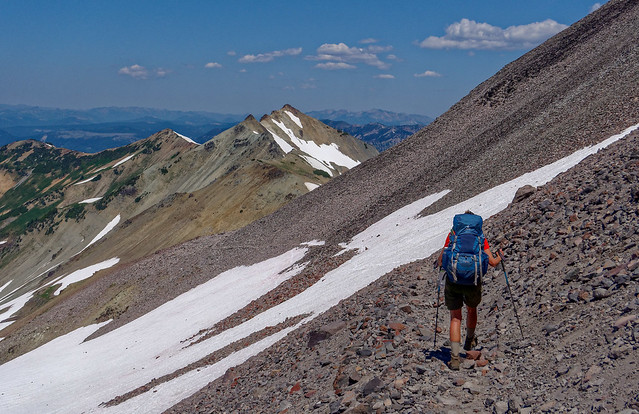
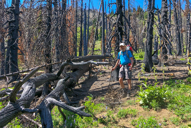
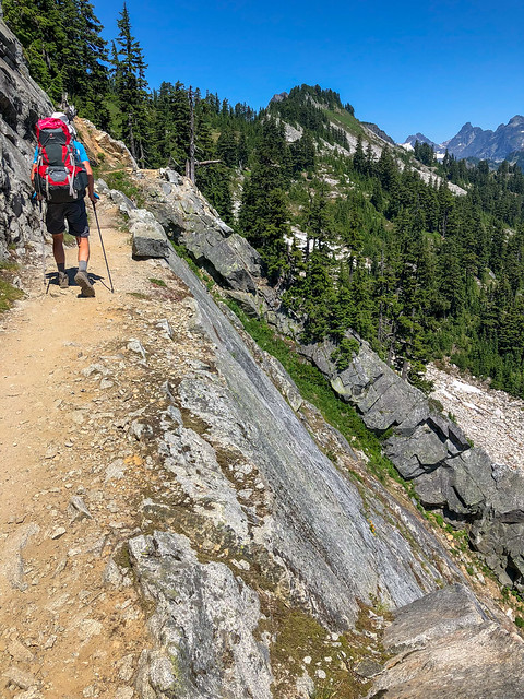
John on the PCT in Washington State
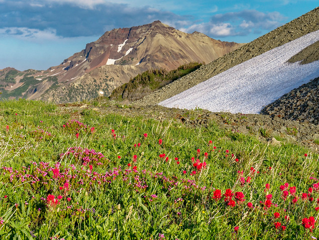
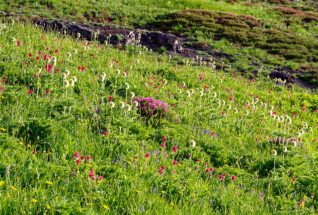
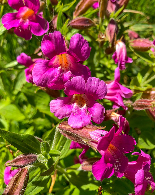
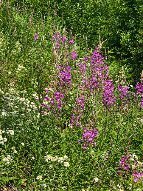
... but the early summer wildflowers were beautiful.
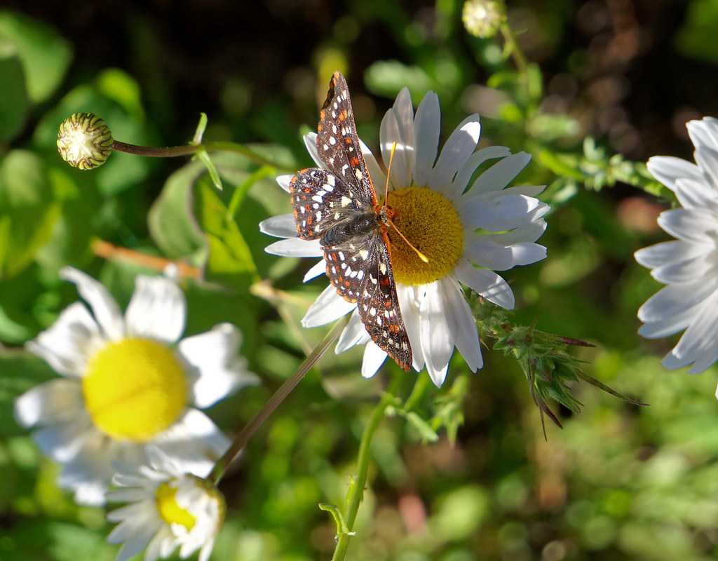
Butterfly on a daisy seen from the PCT in Washington State
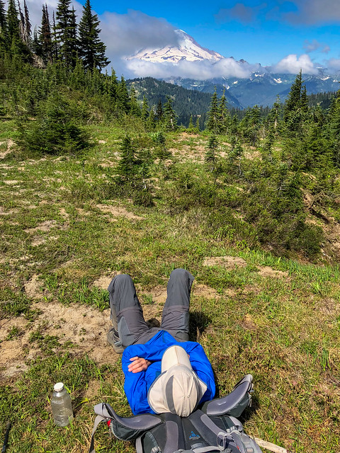
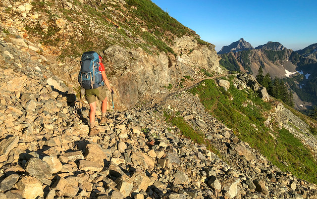
I have to admit those first few days were quite hard on us physically. The reality was it had been eight weeks since we had last backpacked in Grand Canyon and, despite good intentions, neither of us had kept up with our conditioning. Intellectually we knew we would get stronger fast but it was a bit demoralizing in those early days. We quickly discovered in order to make our needed miles we had to get up early and limit our breaks. On some days we needed to stop at a water source and eat supper quickly before packing up and hiking for a couple of hours more before finally stopping to make camp for the night.
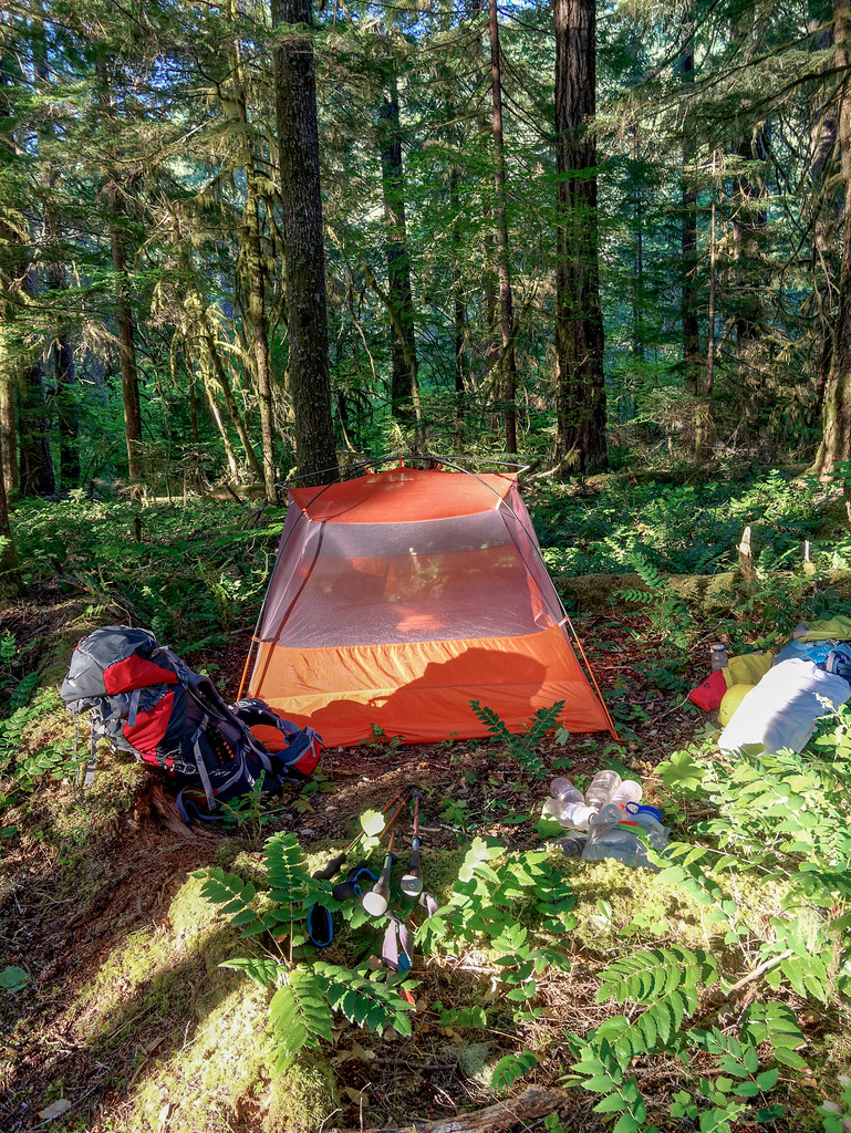
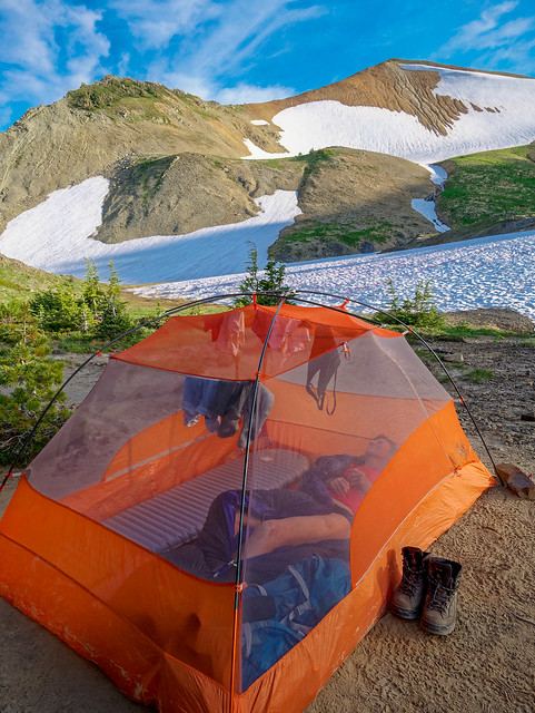
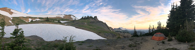
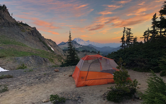
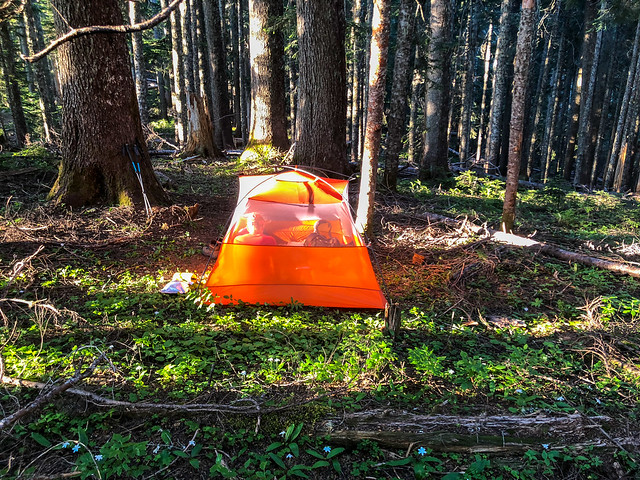
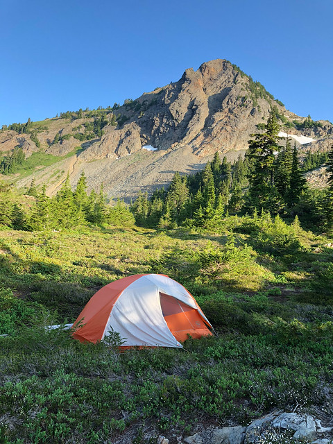
Our camp on the PCT in Washington State
Jean on the PCT in Washington State

Seen from the PCT in Washington State
John on the PCT in Washington State
Mt Adams seen from the PCT in Washington State
On the fourth day of our trip we allowed ourselves to sleep in a bit, meaning the alarm went off at 6:00 instead of the customary 5:00. We didn't have as far to go and there would be less elevation gain. It was also overcast and temperatures were noticeably cooler. A highlight of the day was seeing a yearling Black Bear near the trail. He was untroubled by our presence or our voices but the noise made by tapping trekking poles together caused him to scurry into the trees.
July 10 - 12.12 miles, 2066 feet gained, 470 feet lost, we camped near PCT mile 2,203.
John on the PCT in Washington State
While many PCT hikers used Guthook's Pacific Crest Trail app to track their mileage we used Halfmile's iPhone app. I also carried a notebook with me to make notes about the trip as I knew by the time I got around to writing this I would have forgotten too much (as I sit here five months later I am so happy I did!) It is the nature of a long trip such as this, especially one with a firm deadline, to be focused primarily on the number of miles one hikes each day. We had a schedule to keep and could not afford to get behind on it. In addition to the number of miles we covered each day I also made note of our elevation gain and loss as well as what PCT mile we camped near. So, here are the first of our daily stats:
July 7th - 13.09 miles, 4,301 feet (of elevation) gained 1,494 feet (of elevation) lost, we camped near PCT mile 2,157.
July 8th - 16.75 miles, 3408 feet gained, 5241 feet lost, we camped near PCT mile 2,174.
July 7th - 13.09 miles, 4,301 feet (of elevation) gained 1,494 feet (of elevation) lost, we camped near PCT mile 2,157.
July 8th - 16.75 miles, 3408 feet gained, 5241 feet lost, we camped near PCT mile 2,174.
Jean on the PCT in Washington State
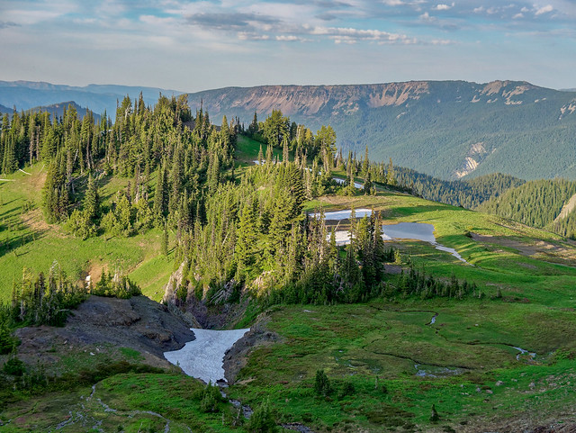
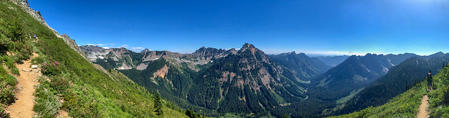
I have to admit neither of us was thrilled with this section of this iconic trail. It starts at the lowest point on the PCT (the Columbia River) and goes up over ridges and down through valleys countless times. While it goes through a lovely forested area we both prefer to be above treeline where we can look out great distances and, most importantly, see mountains.
Seen from the PCT in Washington State
Our attitude was obviously impacted by our level of fatigue and the fact that our feet hurt. We both sorely regretted having let our conditioning slide leading up to this trip.
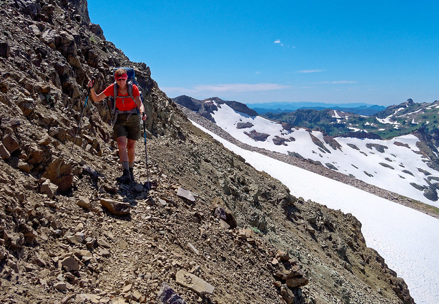
John on the PCT in Washington State
I also soon realized the tumble I took the first day of the trip did more damage than I previously thought. It had happened late in the day when I was tired and had let my concentration lapse briefly. I tripped on a rock and did a face-plant on the trail. Fortunately, nothing seemed badly hurt, just an assortment of bruises, so I got up and continued on. However, over the next few days I became aware of pain around my sternum. While it did not bother me when I was walking during certain motions it was quite painful. Hooking and tightening the hip-belt on my pack and getting in and out of our tent was bad but going from sitting to lying or lying to sitting inside the tent was momentarily excruciating. I normally have a pretty high pain tolerance but it was weakened by fatigue and several times it brought me to tears. It was a concern for both of us.
July 9th - 16.43miles , 4,417 feet gained, 2,056 feet lost, we camped near PCT mile 2,191.
July 9th - 16.43miles , 4,417 feet gained, 2,056 feet lost, we camped near PCT mile 2,191.
Mt Adams seen from the PCT in Washington State
July 10 - 12.12 miles, 2066 feet gained, 470 feet lost, we camped near PCT mile 2,203.
John on the PCT in Washington State
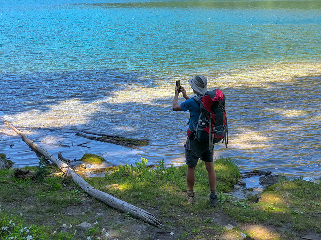
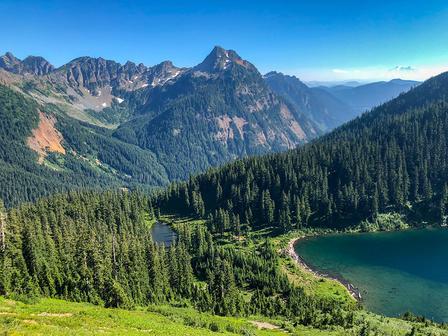
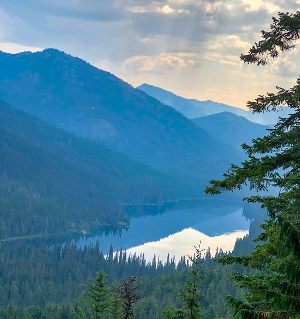
The next day we continued hiking through the woods past several small lakes ...
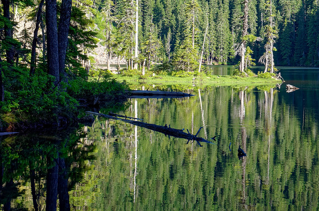
Seen from the PCT in Washington State
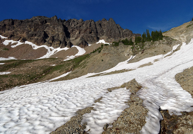
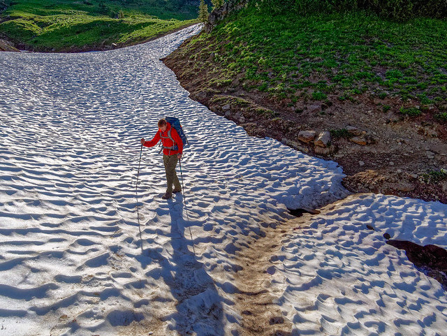
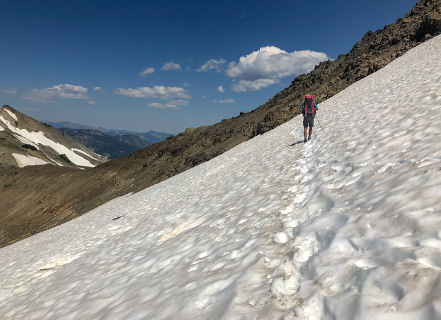
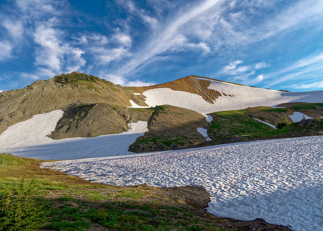
... before encountering our first patch of snow.
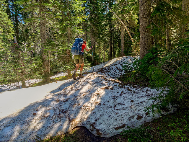
Jean on the PCT in Washington State
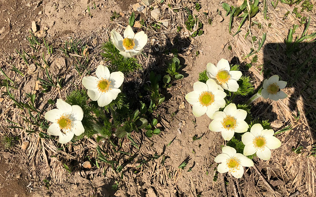
The damp areas, which until recently had been covered by snow, were now home to countless lovely Avalanche Lilies.
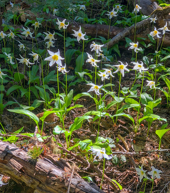
Avalanche Lilies seen from the PCT in Washington State
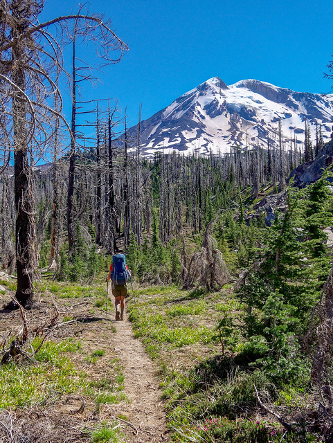
A highlight of this day was getting a closer view of Mt Adams through the trees. This provided us with visual proof we were making forward progress!
Mt Adams seen from the PCT in Washington State
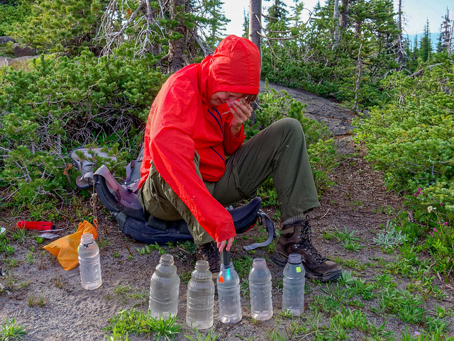
This was also the day we retrieved our first resupply bucket. It was quite hot that day but fortunately we found a patch of shade to sit in while we organized our food. Mosquitoes had been a nuisance and I was prepared to set up our tent for a bug-free work space but fortunately there was enough of a breeze to keep them at bay. When we were done, we placed our trash back in the bucket and reburied it before hiding the shovel again. We then hoisted our now much heavier packs and continued down the trail.
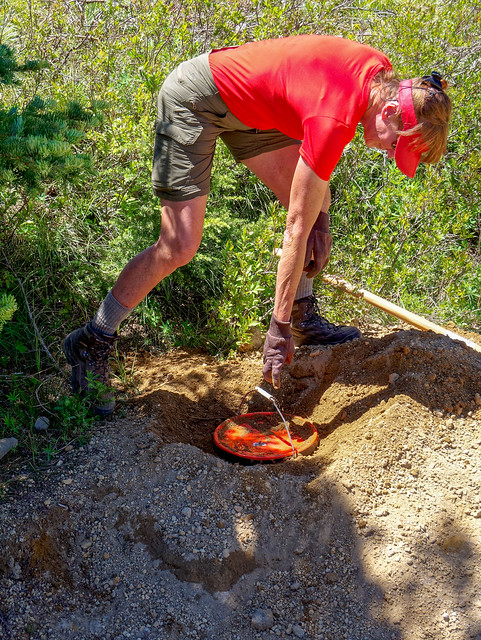
Jean retrieving our food resupply bucket near the PCT in Washington State
As I mentioned, mosquitoes were a problem for us. They proved to be quite adept at biting through clothing without our being aware they were there. I was shocked to see the sheer number of bites on John's back and totally dismayed to discover I had an equal number of bites on my belly and shoulders. We had not even thought to bring insect repellent. Our preference is to avoid using potentially toxic chemicals on our skin but the onslaught weakened our resolve. We began to fantasize about dousing ourselves in the most potent repellent we could buy at White Pass, which would be our first encounter with "civilization" but that wouldn't happen for another seven days.
July 11th - 13.48 miles, 1,124 feet gained, 1,900 feet lost, we camped near PCT mile 2,216.
July 11th - 13.48 miles, 1,124 feet gained, 1,900 feet lost, we camped near PCT mile 2,216.
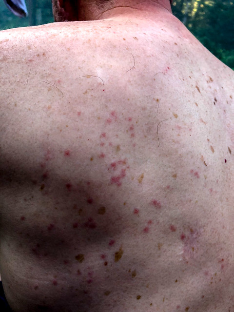
Mosquito bites on John's back
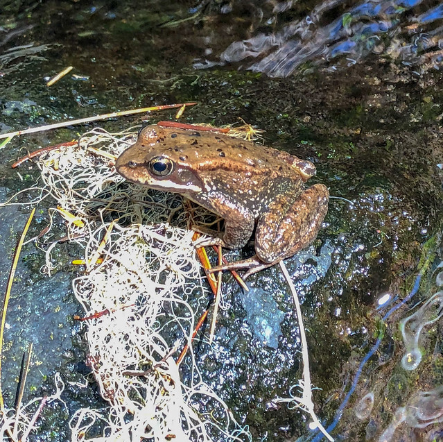
The following day was supposed to be a bigger day but we just didn't get as far as planned. The mosquitoes and flies were relentless. Fortunately, we were able to take short breaks by streams where the temperatures were a bit cooler and there might be a breeze to give us some transient relief from the bugs. To give you some idea of what it was like, the photo of the frog below was the only photo either of us took that day. I had taken it quickly with my iPhone while collecting water. John was carrying his heavy camera and a tripod but was just not finding the time nor the inclination to use it. He started thinking about mailing it to his sister when we got to White Pass. But this was not a decision to be taken lightly by such an avid photographer.
July 12 - 13.85 miles, 2,912 feet gained, 1,968 feet lost, we camped near PCT mile 2,230.
July 12 - 13.85 miles, 2,912 feet gained, 1,968 feet lost, we camped near PCT mile 2,230.
Seen from the PCT in Washington State
There was a heat advisory the following day so after getting up early we made a point of enjoying the brief period of the cool early morning temperature and the lack of bugs.
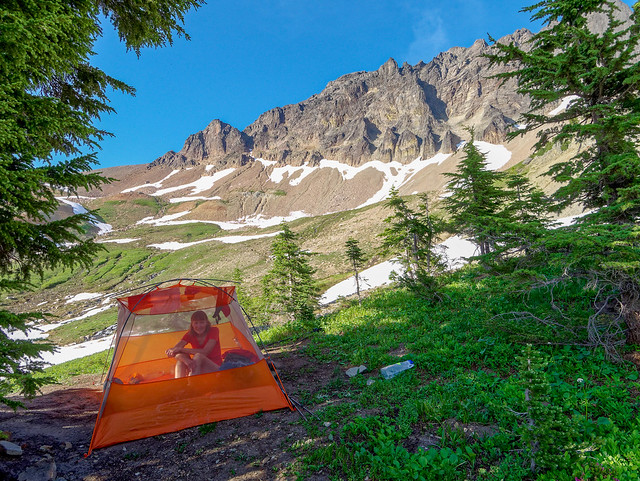
John in our camp on the PCT within Mt Adams Wilderness in Washington State
As we had stopped short the previous day we now had more miles ahead of us. Fortunately, the trail through this burned forest was in good shape with no downed trees so we made fast progress
John on the PCT within Mt Adams Wilderness in Washington State
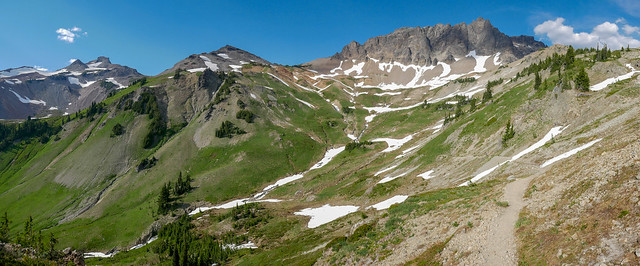
We were also finally getting out of the woods and into a more alpine area. So, we were getting more views of mountains; Mt Adams, ...
Jean on the PCT within Mt Adams Wilderness in Washington State
... Mt St Helens ...
Mt St Helens seen from the PCT within Mt Adams Wilderness in Washington State
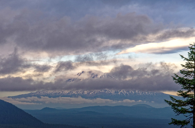
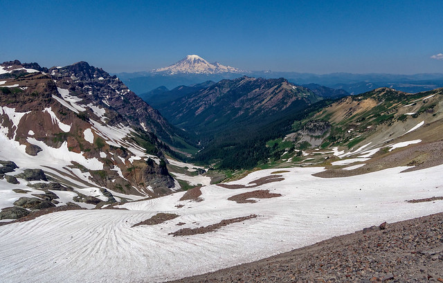
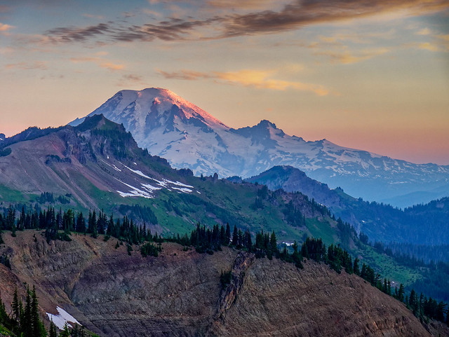
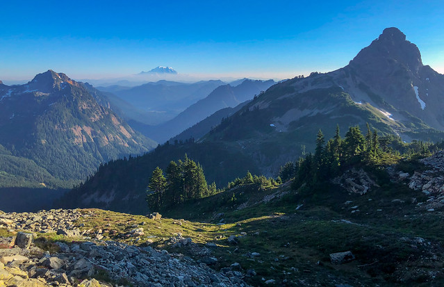
... and even Mt Rainier. "The Mountain", as Rainier is sometimes referred to, has a special place in my heart (see "Love at First Sight") so it really lifted my spirit to see it.
Mt Rainier seen from the PCT within Mt Adams Wilderness in Washington State
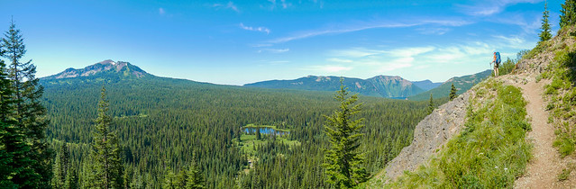
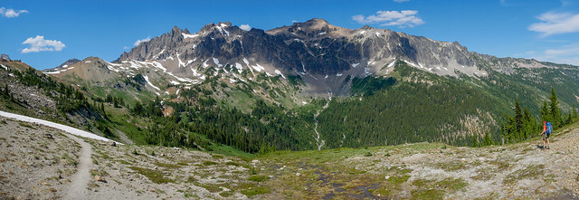
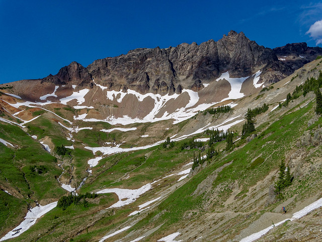
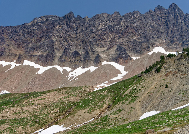
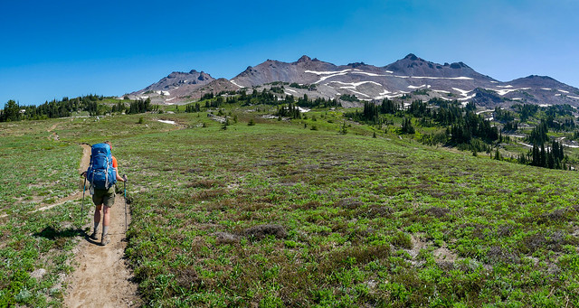
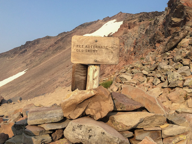
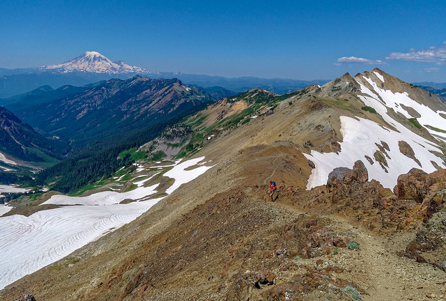
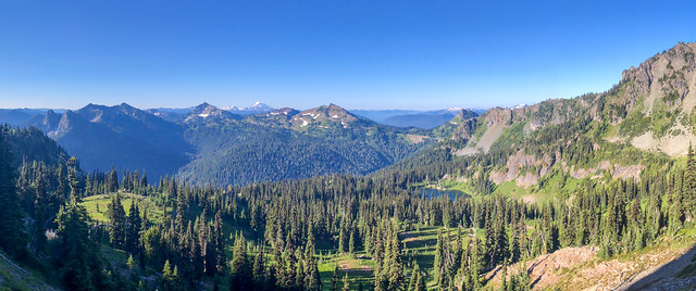
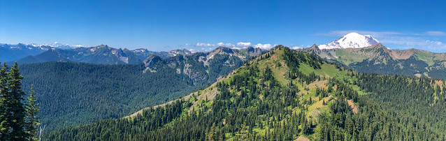
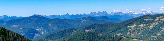
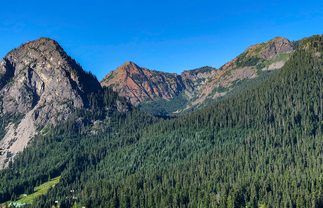
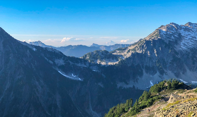
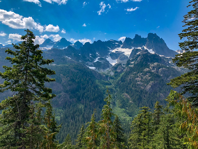
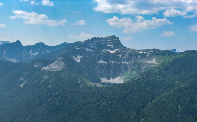
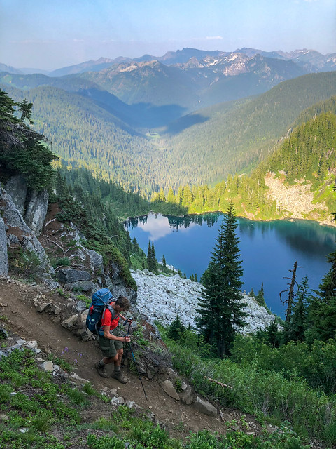
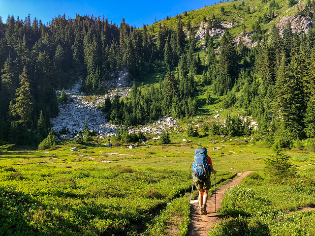
We also got a distant view of the peaks in Goat Rocks Wilderness, an area we really looked forward to being in. We are not alone in thinking Goat Rocks is the most scenic part of the PCT outside of the John Muir Trail through the Sierra Nevada. That morning we encountered a couple heading southbound who had just come through Goat Rocks. A question on our mind was how difficult would it be to get by Old Snowy, a 7,900 foot high peak. The PCT skirts a west facing slope below Old Snowy just above the Packwood Glacier but that section of trail is commonly covered by snow until very late in the season. There is a bypass over Old Snowy but depending on the amount of snow it can be tricky to negotiate. This couple reassured us that the bypass was no problem and that they had not needed their ice axes, a piece of equipment we had chosen not to carry. This was very good news for us.
Goat Rocks seen from the PCT within Mt Adams Wilderness in Washington State
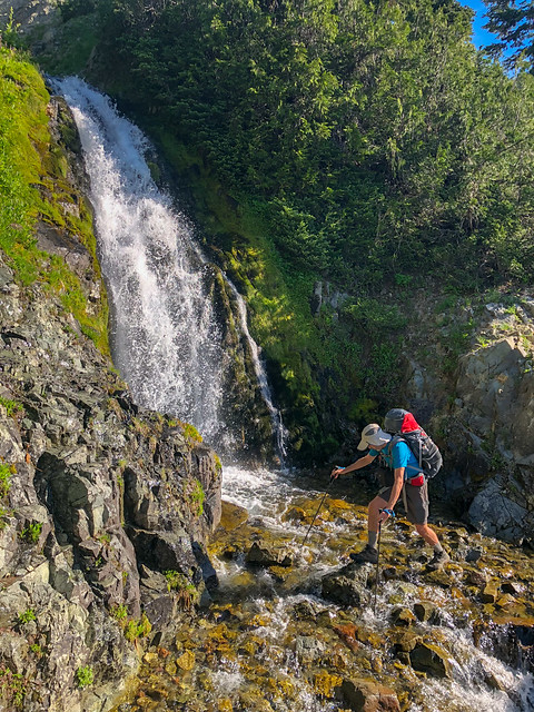
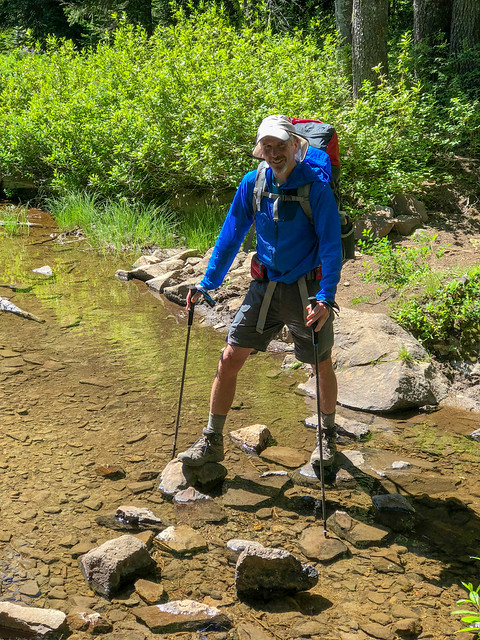
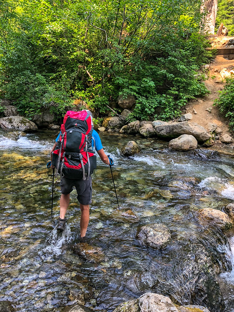
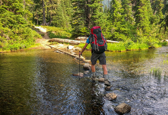
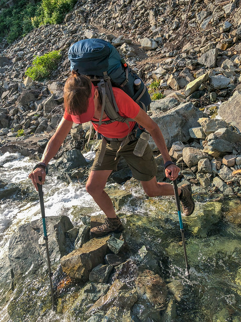
Later that day we reached Riley Creek, our first stream crossing of the trip. Neither of us had been willing to carry the extra weight of water shoes and we are also disinclined to try crossing barefoot. So, we took off our socks, removed our orthotics, put our boots back on and waded through the pleasantly cold water. Once out, we dried off our feet, squeezed what water we could out of our boots and put them back on over our dry (but not for long) socks. Neither of us like stream crossings. At worst, they can be dangerous, even deadly. At best, they just take up time. But on that day, it was time we simply did not have. We badly needed to make our miles to stay on schedule!
John crossing Riley Creek on the PCT within Mt Adams Wilderness in Washington State
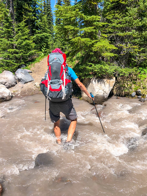
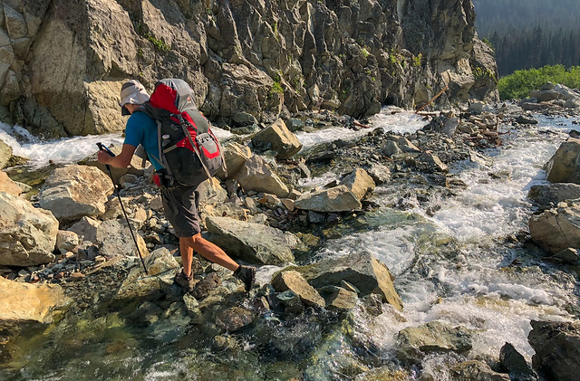
We had read about Riley Creek on Halfmile's app so we were prepared for it and once past it we believed we were done with stream crossings at least for that day. So we were unpleasantly surprised when we reached Adam's Creek. Halfmile had made no mention of it and it looked much more treacherous than Riley Creek. It was mid - day during a heat advisory so we figured that snow melt had caused a much heavier flow in a creek that hikers must normally be able to "rock hop" across. We spent valuable time looking for the safest place to cross which is challenging with glacial silt filled water. It is impossible to accurately gauge the depth, the strength of the current and the placement of rocks on the bottom. We made the best choice we could and John went across first.
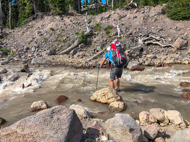
John crossing Adams Creek on the PCT within Mt Adams Wilderness in Washington State
He found the current to be quite strong and the water deeper than expected. Being the prince he is, John was willing to come back and carry my pack across for me. There is one theory about stream crossings that heavier is better but my balance is not as good as it could be and I was grateful to not be over balanced by my still heavy pack. The current was quite strong and I had to forcefully plant my poles to keep them from being pushed downstream. The flowing water caused them to vibrate. Also, looking down at the rushing water can be a bit disorienting to the point of causing vertigo. I moved carefully and deliberately trying not to give in to impatience or to lose focus.
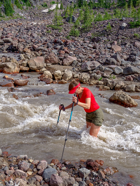
Jean crossing Adams Creek on the PCT within Mt Adams Wilderness in Washington State
It was a relief to be across without incident. Unfortunately, the mosquitoes continued to plague us and made good use of the times when we were seated and preoccupied with drying our feet and putting our socks and boots back on.
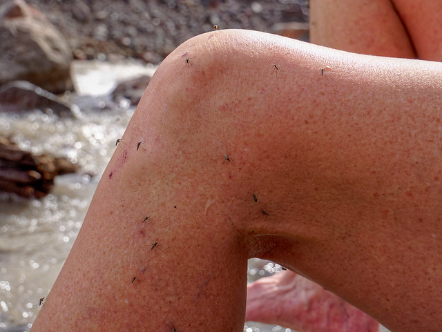
Mosquitoes on Jean's leg
But, the great thing about backpacking is the rewards can be great. The trials and tribulations are a small price to pay for the privilege of being in such a beautiful area. I was reminded of a term I learned from a great book, Your Money or Your Life, the "Wow Factor". The authors of the book suggest people should determine if an item has enough Wow Factor to justify it's purchase cost before buying it. While they were talking about financial costs the same principle can be applied to activities. Whereas the costs (the misery) of this backpack trip were high at times we both felt what we got in exchange was well worth it. For us, this trip had a high enough Wow Factor.
Jean (with Mt Adams) on the PCT within Mt Adams Wilderness in Washington State
We took a short break when we got to this spot. John made good use of his camera ...
Mt Adams seen from the PCT within Mt Adams Wilderness in Washington State
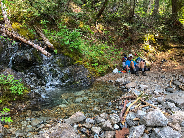
... while I sat by a nearby stream ...
Seen from the PCT within Mt Adams Wilderness in Washington State
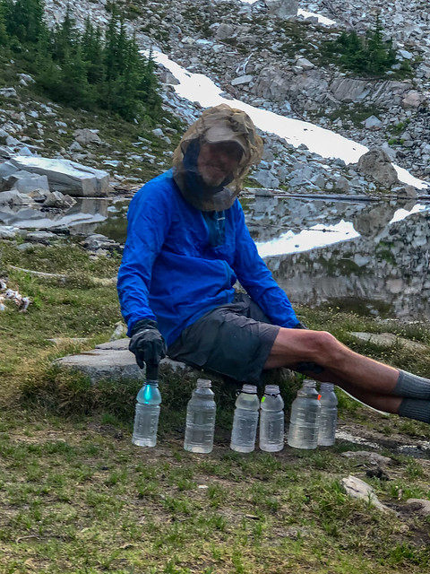
... and treated water with our SteriPen. The mosquitoes were voracious! This was the second summer we have both owned Patagonia Houdini wind shirts and they have become our favorite garment. It is not just good for wind as it also proved to be quite effective light weight protection from the bugs.
July 13 - 14.53 miles, 2066 feet gained, 1,661 feet lost, we camped near PCT mile 2,245.
July 13 - 14.53 miles, 2066 feet gained, 1,661 feet lost, we camped near PCT mile 2,245.
Seen from the PCT within Mt Adams Wilderness in Washington State
After breaking camp the next morning we started out hiking through the woods and the trail surface enabled us to cover miles quickly. Which was great because it soon became hot and buggy and the trail became steeper. We were disinclined to stop anywhere for very long and both just looked forward to getting to camp. Something we learned early on during this trip was to not be picky about campsites. As we were focused on "making our miles" rather than reaching a scenic spot we considered ourselves lucky if there was just someplace reasonably level, large enough for our tent and close to water near our mileage goal for the day. Our camp that night met the minimum requirements but it became our least favorite camp on the entire trip because of the swarms of mosquitoes. After pitching our tent we literally dove inside and spent the next 15 minutes or so killing the dozens of blood suckers that had come in with us. Fortunately, we have chosen to carry a spacious 3-person tent which enables us to bring all of our gear in the tent with us. We can also safely use our stove inside provided we are very careful. We only use it to heat water and neither of us moves while it is on. The risk of fire is just too great. We also made good use of a now empty Mylar zip-lock food bag as a "pee bag". Anything to keep from having to open that tent door!
July 14 - 13.69 miles, 1,753 feet gained, 1,843 feet lost, we camped near PCT mile 2,258.
The next morning we were awake early but were dismayed to discover the mosquitoes were too! It was hard to leave the protection of the tent but once out we packed quickly and headed up the trail. As we gained elevation ...
Seen from the PCT within Mt Adams Wilderness in Washington State
... we loved the growing views AND we happily left the mosquito swarms behind.
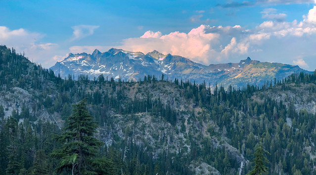
Mt Adams seen from the PCT within Goat Rocks Wilderness in Washington State
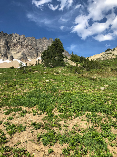
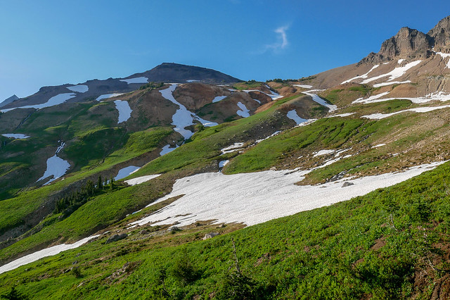
We had also entered Goat Rocks Wilderness and were delighted to be back! We had been there the previous summer (Trip Report) but smoke from wildfires obscured distant peaks and negatively impacted our breathing. However, this time the sky was clear.
Seen from the PCT within Goat Rocks Wilderness in Washington State
The wildflowers were gorgeous ...
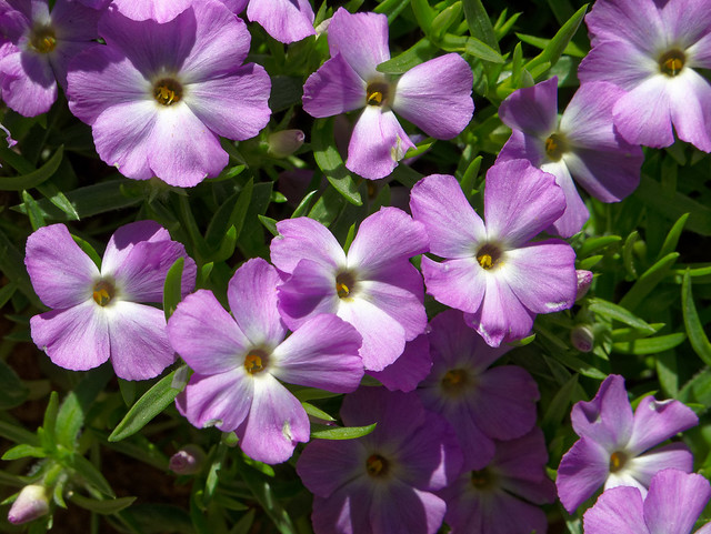
Phlox seen from the PCT within Goat Rocks Wilderness in Washington State
... and the colors brilliant.

Larkspur seen from the PCT within Goat Rocks Wilderness in Washington State
Higher up the patches of snow provided a refreshing "sponge bath" in the heat of the day (and toned down the itch from the worst of the mosquito bites).
Jean on the PCT in Goat Rocks Wilderness in Washington State
We continued quickly on the excellent trail surface ...
Seen from the PCT within Goat Rocks Wilderness in Washington State
... toward Cispus Pass.
Jean on the PCT in Goat Rocks Wilderness in Washington State
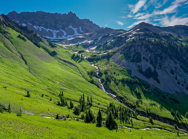
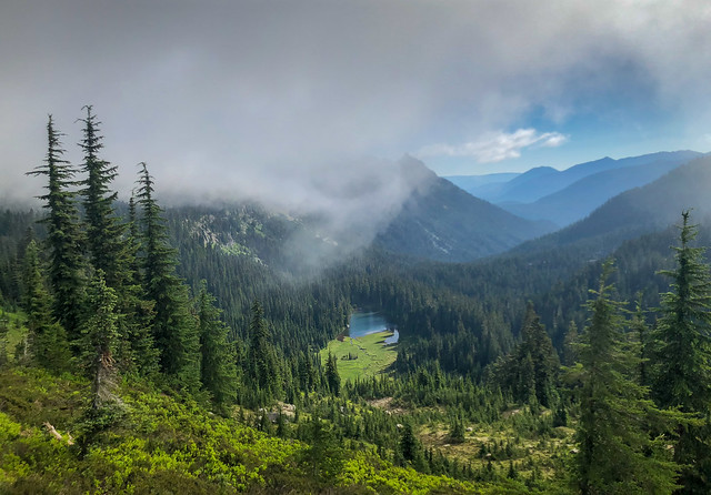
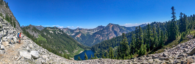
After crossing the pass we could see Cispus Basin ahead of us. It was a welcome sight as it was our destination for the day.
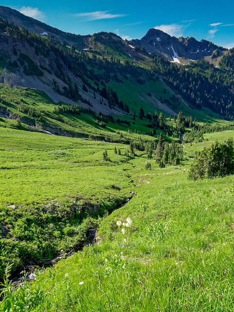
Cispus Basin within Goat Rocks Wilderness in Washington State
When we had backpacked here the previous summer we had camped up the slope behind the clump of trees visible in the center of the photo below. But to save time we decided to check out the campsites adjacent to the trail within the trees toward the bottom of the photo. However, it was still quite hot that day and we were disappointed with the lack of shade in the conveniently close campsites.
Cispus Basin within Goat Rocks Wilderness in Washington State
So we decided to go ahead and hike up to the shady site we had used last summer.
Cispus Basin within Goat Rocks Wilderness in Washington State
It is not far but it is steep.
Cispus Basin within Goat Rocks Wilderness in Washington State
While I put up the tent, John treated water. I had finally remembered my water-proof gloves which helped provide some additional protection from the relentless mosquitoes and flies.
John in our camp in Cispus Basin within Goat Rocks Wilderness in Washington State
We realized this could be one of our favorite campsites of the trip and decided it was well worth pulling up short for the day in order to stay there even if it meant we would have to do extra miles in the days to come. When we were here last summer we counted at least 48 Mountain Goats ...
... but this time there was not a single goat in sight. I was disappointed by that. However, I was so grateful for the clear skies and clean air.
Mountain Goats seen from our camp in Cispus Basin within Goat Rocks Wilderness in Washington State - August 2nd, 2017
... but this time there was not a single goat in sight. I was disappointed by that. However, I was so grateful for the clear skies and clean air.
Cispus Basin within Goat Rocks Wilderness in Washington State
That evening, while John went out to take pictures ...
Cispus Basin within Goat Rocks Wilderness in Washington State
... I retreated to the protection of our tent to rest.
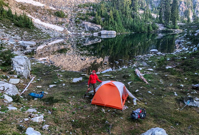
Our camp in Cispus Basin within Goat Rocks Wilderness in Washington State
I have to admit I reached a low point emotionally later that evening. My sternum continued to cause pain with certain unavoidable motions and I just felt worn down by it. I began to think it might be wisest for us to just stop and go home. However, I did not want to be the cause of our quitting a trip we had been planning for so long. So, later that evening, when John removed his boots and discovered the beginnings of a large blister on his heel, I found myself secretly hoping it would get worse and he would want to call it quits. Of course, this just made me feel worse to be wishing an uncomfortable injury on him. We ended up having a serious discussion about my level of pain. His position was he did not want to be the cause of my being so uncomfortable so the decision whether or not we continued to hike the PCT needed to be mine. He insisted he would be fine with which ever way it turned out. We planned to be at White Pass in two days to pick up our resupply box and we decided to take a rest day, a "zero day", there. It would then be entirely up to me to decide whether we continued hiking on the PCT this year or we made a phone call to get someone to come pick us up.
July 15 - 11.67 miles, 2,174 feet gained, 1,166 feet lost, we camped near PCT mile 2,269.
July 15 - 11.67 miles, 2,174 feet gained, 1,166 feet lost, we camped near PCT mile 2,269.
Our camp in Cispus Basin within Goat Rocks Wilderness in Washington State
We awoke to a beautiful morning! Things were looking up, John's blister was better and tape proved to be adequate protection and I was feeling more rested. In addition, the early morning views did much to strengthen my resolve.
Cispus Basin within Goat Rocks Wilderness in Washington State
We made our way down the steep slope back to the trail ...
Cispus Basin within Goat Rocks Wilderness in Washington State
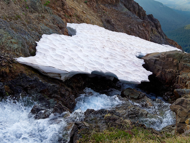
... and carefully made our way across the "snow bridge" well above the tracks made by hikers the previous day. The snow was rapidly melting in the high summer heat and neither of us wanted to break through to the water flowing beneath the snow.
Cispus Basin within Goat Rocks Wilderness in Washington State
We continued to follow the easy trail traversing Cispus Basin ...
Jean on the PCT through Cispus Basin within Goat Rocks Wilderness in Washington State
... past temporary streams ...
Cispus Basin within Goat Rocks Wilderness in Washington State
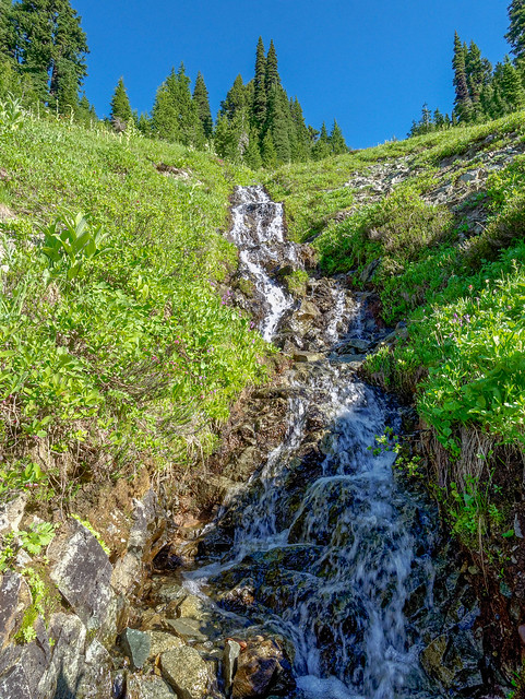
... and the perennial waterfall.
John on the PCT through Cispus Basin within Goat Rocks Wilderness in Washington State
We stopped briefly and looked back at Cispus Basin to where we had just been.
Cispus Basin within Goat Rocks Wilderness in Washington State
We also paused to look down the valley ...
Cispus Basin within Goat Rocks Wilderness in Washington State
... and to admire the wildflowers. This Western Anemone seed-head was in its adolescence. I knew later in the season the "hair" on the mature seed-heads would become longer and more flowing but this one had a definite "punk" look to it.
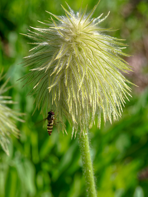
Western Anemone seen from the PCT in Washington State
What is amazing to me is that those tall flowing seed-heads originate from this short plant and nondescript flower.
Western Anemone seen from the PCT in Washington State
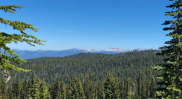
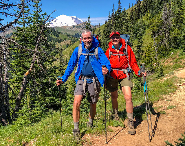
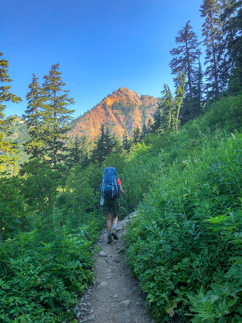
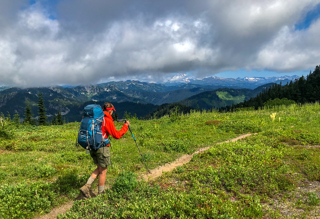
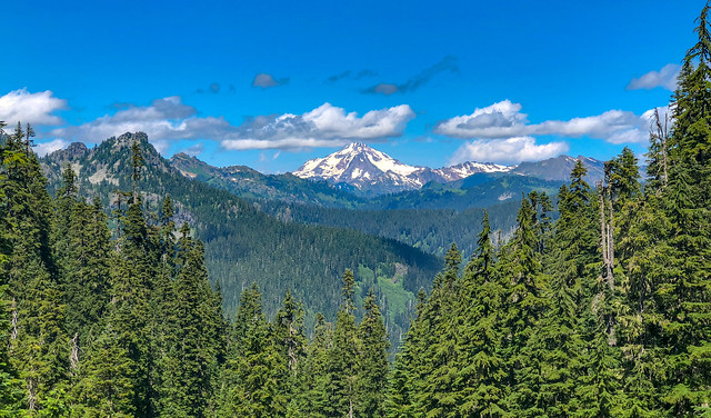
The farther north we went the farther behind we were leaving Mt Adams so we made a point of enjoying the views while they lasted. We talked about returning to the area in the future and doing a trip around Mt Adams.
Mt Adams seen from the PCT in Goat Rocks Wilderness in Washington State
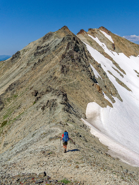
As we approached Old Snowy we began to wonder which way we would take to get around it. Would we have to take the longer, slower bypass that goes over the top? Or would we be able to stay on the PCT below it?
Jean on the PCT in Goat Rocks Wilderness in Washington State
We started encountering some snow patches and found it soft but well consolidated with recent boot tracks.
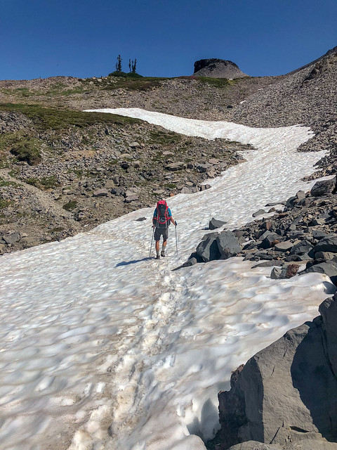
John on the PCT in Goat Rocks Wilderness in Washington State
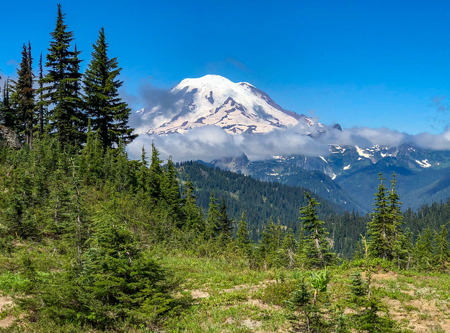
We were now being treated to great views of Mt Rainier (views which were non existent the previous summer).
Mt Rainier seen from the PCT in Goat Rocks Wilderness in Washington State
When we reached the junction with the bypass ...
... we decided to go ahead and stay on the PCT as it crossed the snow fields below Old Snowy.
Seen from the PCT in Goat Rocks Wilderness in Washington State
... we decided to go ahead and stay on the PCT as it crossed the snow fields below Old Snowy.
John on the PCT in Goat Rocks Wilderness in Washington State
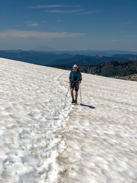
Again we found the snow soft but well consolidated with fresh tracks. Crossing snow always makes me nervous but we went slowly and carefully.
Jean on the PCT in Goat Rocks Wilderness in Washington State
While we got across without incident it was still a relief for me to be back on the rocky trail.
Jean on the PCT in Goat Rocks Wilderness in Washington State
It was such a joy to be there!
Mt Rainier seen from the PCT in Goat Rocks Wilderness in Washington State
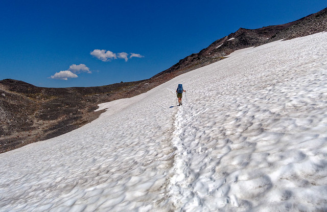
As we continued we discovered we were not yet done with snow slopes but as before, we were careful and had no issues.
John on the PCT in Goat Rocks Wilderness in Washington State
We finally left the snow behind (most likely for the remainder of the trip)...
Jean on the PCT in Goat Rocks Wilderness in Washington State
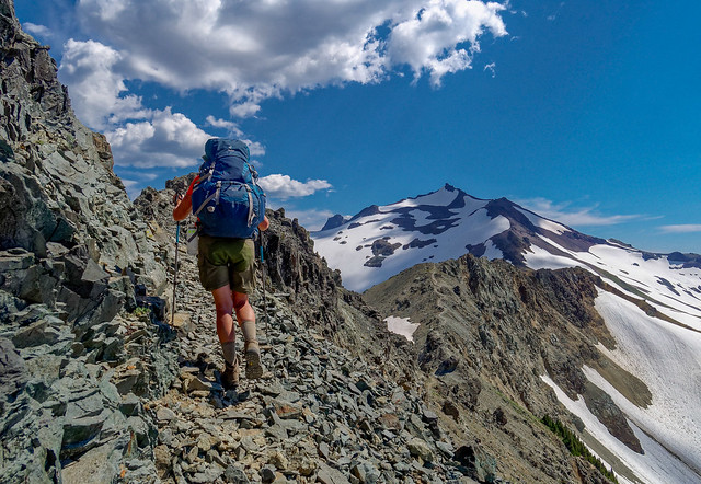
... and headed toward "The Knife Edge ".
Jean on the PCT in Goat Rocks Wilderness in Washington State
When I first heard we would cross a feature named "The Knife Edge" my overly active imagination conjured up visions of a dangerously narrow trail with extreme exposure on both sides. However, John had been across it before and reassured me it was no big deal.
Jean on the PCT in Goat Rocks Wilderness in Washington State
And he was right. It was even a bit windy but I felt perfectly secure on this rather blunt "knife".
Jean on the PCT in Goat Rocks Wilderness in Washington State
We paused briefly and looked back at Old Snowy, grateful to have gotten by it so easily.
Old Snowy seen from the PCT in Goat Rocks Wilderness in Washington State
I'm not sure what made us decide we needed to take a selfie at that moment as it had been 10 days since our last shower and it shows.
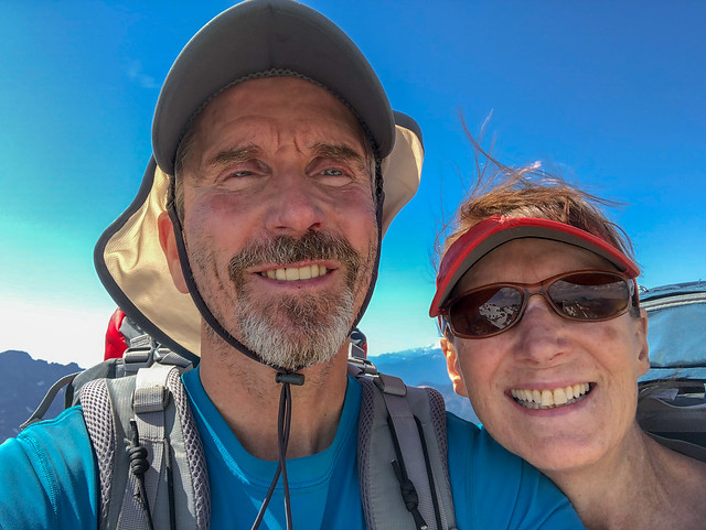
John and Jean on the PCT in Washington State
We needed to get to White Pass to pick up our food resupply the following day but there were still many miles between "here" and "there".
Jean on the PCT in Goat Rocks Wilderness in Washington State
John had been through this area before on a solo trip he did in 2014 while I was sidelined with a shoulder issue.
Goat Rocks Wilderness in Washington State
I had been sorely disappointed to miss that trip and had to console myself with looking at his photos.
Goat Rocks Wilderness in Washington State
As great as those photos are they are not an adequate substitute for how it feels to be there and see it in person.
Goat Rocks Wilderness in Washington State
The original plan that day was to stop very briefly to cook/eat supper and then continue on for a few more miles. Our hope was that the bugs would not make this too unpleasant for us. We headed to the spot John had camped in on his solo trip and when we got there we discovered it was breezy so bugs were not an issue at all. It caused us to linger over our supper enjoying the pure pleasure of just sitting outside in the cool shade, admiring the views without the torment we had endured on other occasions. Neither of us wanted to leave. We quickly checked Halfmile's app and determined we were 15 miles from White Pass. However, we were counting on getting something to eat at the Kracker Barrel Store and we knew they closed at 6:00 PM. So, if we made camp here it would be a challenge to get to White Pass before the store closed. It meant we should get up at 4:00 AM and be moving at first light.
Goat Rocks Wilderness in Washington State
We decided it was worth it. John went out to take photos while I set up the tent and then just rested. While this had been a short day the cumulative fatigue was still with me.
July 16 - 7.05 miles, 1,897 feet gained, 1,803 feet lost, we camped near PCT mile 2,276.
Our camp in Goat Rocks Wilderness in Washington State
The next morning was glorious!
Seen from the PCT within Goat Rocks Wilderness in Washington State
I was so happy we had decided to stop here for the night. I felt like we were playing "hooky" from the regular grind of hiking the PCT. This was the way we usually backpack, focused on the destination and the views from our camp rather than just on the miles.
Seen from the PCT within Goat Rocks Wilderness in Washington State
We realized this would most likely become our favorite campsite of the entire trip and we were right.
Our camp in Goat Rocks Wilderness in Washington State
We loved the view of the early morning sunlight reflecting off Mt Rainier!
Mt Rainier seen from the PCT within Goat Rocks Wilderness in Washington State
Needless to say, we were not on the trail at "first light" but we both felt well rested and optimistic we could get to White Pass in time.
John on the PCT in Goat Rocks Wilderness in Washington State
The time we had spent in Goat Rocks had not only strengthened my resolve, it had renewed my spirit.
Jean on the PCT in Goat Rocks Wilderness in Washington State
Despite being in a hurry we still took the time to stop and look around into the distance ...
Seen from the PCT within Goat Rocks Wilderness in Washington State
... and down around our feet.
Seen from the PCT within Goat Rocks Wilderness in Washington State
It was bittersweet leaving Goat Rocks behind. We had thoroughly enjoyed being there but we had been backpacking for 11 days without a shower and wearing the same clothes. We were also almost completely out of food so we were both looking forward to taking a day off in a little bit of civilization.
John on the PCT within Goat Rocks Wilderness in Washington State
While we knew this would probably be our favorite part of the entire trip, the PCT through Goat Rocks is now on our list of Favorite Backpack Trips, we also knew there was still so much for us to see in the days to come.
Mt Rainier seen from the PCT within Goat Rocks Wilderness in Washington State
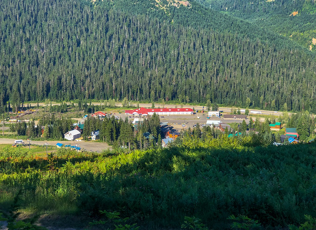
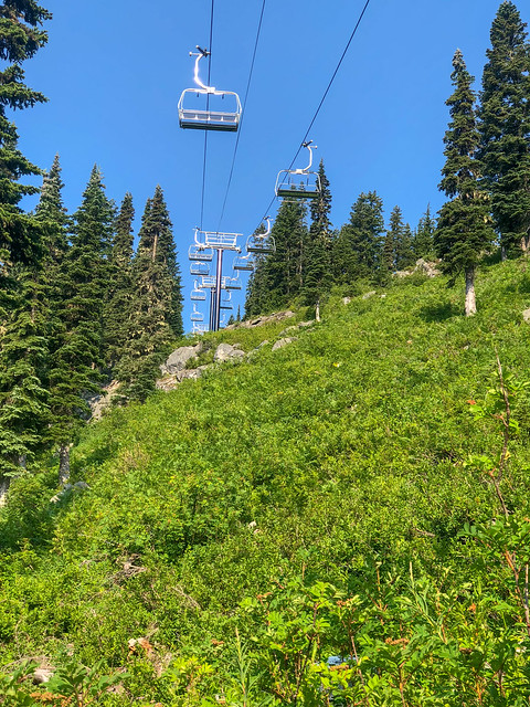
The previous day John had been able to contact White Pass Village and make a reservation for us. The woman he talked to, "Zippy", was very helpful and she described a short-cut we could take through the ski area chair lifts.
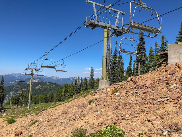
White Pass Ski Area in Washington State
Definitely not scenic and it would mean we did not hike every foot of the PCT but we were very pressed for time so we decided to take it. As luck would have it a fellow who works for the ski area happened upon us with his ATV. He didn't have room for us but he offered to haul our packs down to the Kracker Barrel. He strapped them on and took off down the slope. We briefly wondered if we would ever see our packs again but we needn't have worried. They were waiting for us when we got there. We picked up our resupply box and John went to check into our room while I grabbed something quick for supper. We had gotten there too late to order a pizza so we gorged on fried burritos instead. Not our normal fare but they weren't our usual backpacking food so they tasted delicious to us. Needless to say, the shower was heavenly!
July 17 - 15 miles, 2,475 feet gained, 4,132 feet lost, we stayed near PCT mile 2,292.
John in White Pass Ski Area in Washington State
We thoroughly enjoyed our first "Zero Day"! After a big breakfast of bacon and eggs (purchased the day before at the store) we headed back to the Kracker Barrel to use their washer and dryer. It was pretty disgusting to see what the wash water looked like. I would have washed our clothes twice but there were other grubby backpackers waiting to do their equally disgusting laundry.
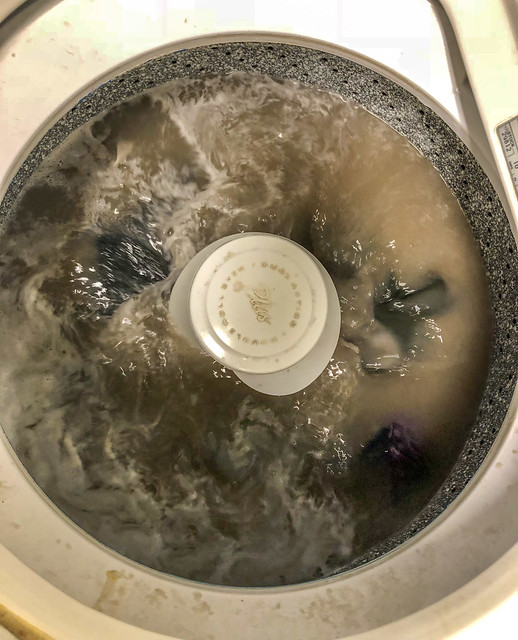
Doing laundry at the Kracker Barrel at White Pass in Washington State
The challenge for a backpacker is what do you wear while literally all of your clothes are in the laundry? The answer is rain gear! In the past we have relied on parkas and full side-zip rain pants but last summer we each got Sierra Designs Cagoules and rain chaps. Fortunately, the cagoule is long enough to provide adequate coverage, at least for me. John, who is taller (and has dangly parts), felt much less secure in his (especially when seated) so he soon retreated back to our room while I finished the laundry. Once it was done, I carried it and a pizza back to our room so we could gorge some more.
July 18 - 0 miles, 0 feet gained, 0 feet lost.
Jean waiting while doing laundry at the Kracker Barrel at White Pass in Washington State
The next morning would be decision time for me. With cell service I had been able to do a Google search on my sternum pain and determined I had bruised it on a rock when I fell. I read bruised sternums were most often caused by car accidents, hacking coughs and contact sports (I guess hitting a rock while backpacking could classify it as a "contact" sport). Treatment included rest, especially from the activity that caused it, and ice. I learned that even with treatment it would take weeks to heal. I discovered I could get in and out of the bed with little pain by rolling on my side and dropping my legs over the edge before pushing myself up into a sitting up. However, what I realized was if we were back to our motorhome I wouldn't be any better off than I was in our tent as our bed has a wall on both sides so in order to get in and out of it I have to sit up first and scoot to the end of the bed. I tried this maneuver in the bed and determined it was just as painful as moving around in our tent. I decided if I was going to hurt for weeks anyway I might as well spend it doing something I love. So, I made the decision we would keep going. As a concession, I allowed myself a regular dose of Ibuprofen so I bought more at the store. Then, early the next morning, we said good bye to White Pass and headed out again entering Section I - Highway 12 to Snoqualmie Pass
John and Jean at White Pass in Washington State
The weather was noticeably cooler and there were fewer bugs. Zippy had given John a can of insect repellent that a previous backpacker had left behind. Even if we didn't need it that day we were very happy to have it as the Kracker Barrel had been completely sold out of repellent.
John on the PCT in Washington State
The trail was mostly good as it went through the woods.
Seen from the PCT in Washington State
We needed to get across the Bumping River later that day and were gratified to see this log. John normally has much better balance than I do and has less trouble with logs such as this. However, he found that as the trunk narrowed toward the far end it started to vibrate under him and he found it quite disconcerting.
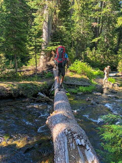
John crossing the Bumping River on the PCT in Washington State
I was apprehensive but John helped me out by sitting on the end helping to stabilize it. It's funny but in the photo it looks like such a nice big log but it sure didn't feel that way. I do find looking down at the flowing water can cause me to feel some vertigo and neither of us had fully adapted to our increased pack weight yet so I was quite happy to reach the other side safely.
July 19 - 15.94 miles, 2,167 feet gained, 1,741 feet lost, we camped near PCT mile 2,308.
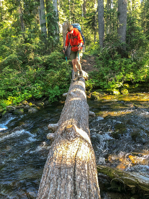
Jean crossing Bumping River on the PCT in Washington State
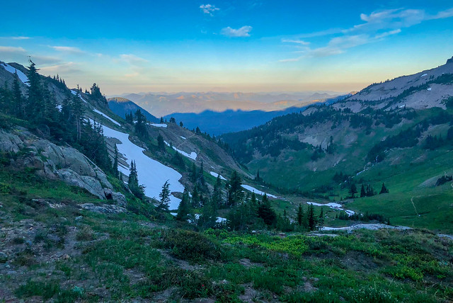
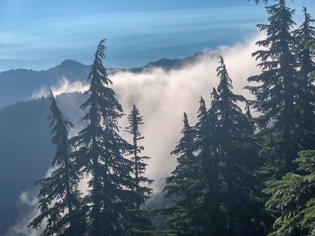
The next morning we awoke in a cold, damp, drippy, cloud.
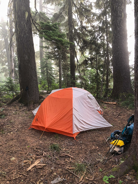
Our camp on the PCT in Washington State
While at White Pass we had sorted through our gear to see if we could lighten our load. I had taken out my long underwear bottoms and my warmest hat and mailed it home. I now questioned if that had been wise.
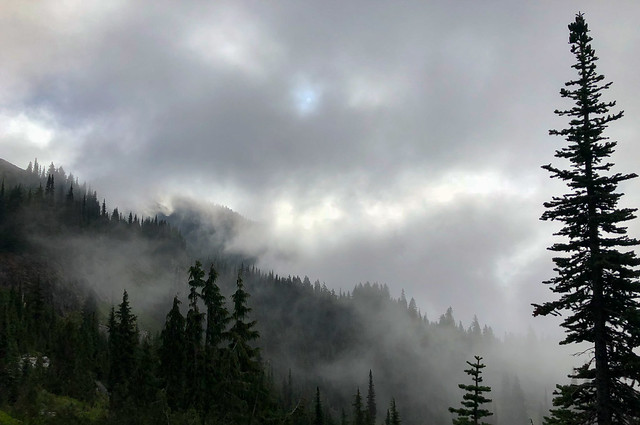
Seen from the PCT within William O Douglas Wilderness in Washington State
But as the day progressed we got glimpses of blue sky ...
Jean on the PCT within William O Douglas Wilderness in Washington State
... and it appeared the clouds were making an effort to lift.
Seen from the PCT within William O Douglas Wilderness in Washington State
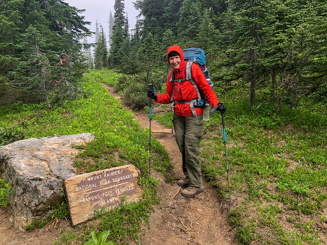
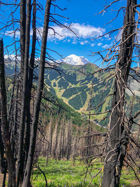
I was happy to reach the boundary for Mt Rainier National Park but it sure seemed like this tattered sign was not up to the task of welcoming us to Washington's premier national park.
Jean on the PCT within Mt Rainier National Park in Washington State
The clouds continued to dissipate ...
Mt Rainier seen from the PCT within Mt Rainier National Park in Washington State
... and we took a welcome break in the warm sunshine.
John on the PCT within Mt Rainier National Park in Washington State
We began to encounter some south bound PCT thru hikers ("SoBos"). They typically had started in late June or early July. As they could not enter the US from Canada what SoBos often do is start at Hart's Pass and hike north about 30 miles, tag the border and then backtrack.
Jean on the PCT within Mt Rainier National Park in Washington State
While we were at White Pass John had made the painful decision to mail his big camera home. He would now be dependent on his iPhone for photography. He has done this on only one backpack trip in the past, when we did Royal Arch Loop in Grand Canyon with our son, Dan. It is a challenging route and he was very motivated to reduce pack weight. Fortunately, Dan is quite strong and did not mind carrying his own camera. However, when John was editing all of our photos from that trip he tended to delete our iPhone photos in favor of the ones Dan had taken with his camera. While I understood John's rationale for not carrying such a heavy camera on a trip such as this, I knew when it came time for him to edit the photos he would not be happy with them. It is not that the iPhone takes bad photos, you just can't look at them too closely. But he edits and post processes all of his photos on a large monitor so every defect jumps out at him.
John on the PCT in Washington State
What had started out as a cold, dreary day turned out to be clear, sunny and almost warm.
Seen from the PCT in Washington State
We continued on and crossed Chinook Pass where we encountered a number of day hikers and weekend backpackers. We intended to camp at Sheep Lake but it is only 2 miles from Chinook Pass so we feared it would be crowded. Fortunately, we found a decent site away from other backpackers.
July 20 - 14.7 miles,3,315 feet gained, 2,323 feet lost, we camped near PCT mile 2,323.
John and Jean at Chinook Pass on the PCT in Washington State
After a chilly, windy night we packed up and headed out again.
John at Sheep Lake on the PCT in Washington State
The sky was crystal clear and sun was bright so we now found hiking in the cooler temperatures refreshing especially as we gained elevation.

Jean on the PCT in Washington State
Once again, we stopped to look back at where we had been not so long ago.
Seen from the PCT in Washington State
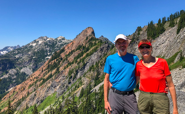
We reached a pass and asked a fellow to take our photo ...
John and Jean on the PCT in Washington State
... before we descended the other side and said good-bye to Mt Adams.
Mt Adams seen from the PCT in Washington State
As we continued north we knew we would also lose our views of Mt Rainier.
Mt Rainier seen from the PCT in Washington State
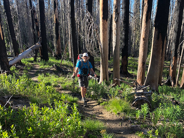
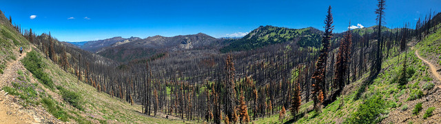
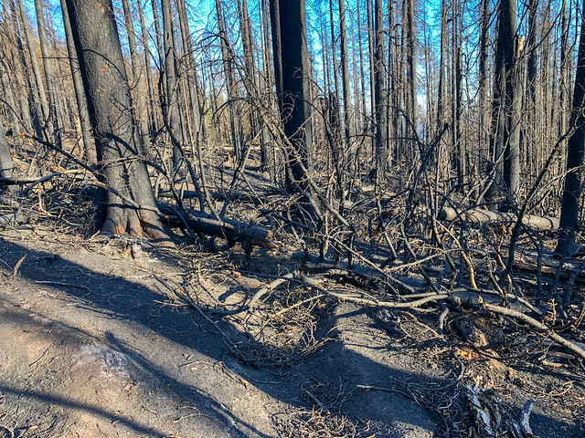
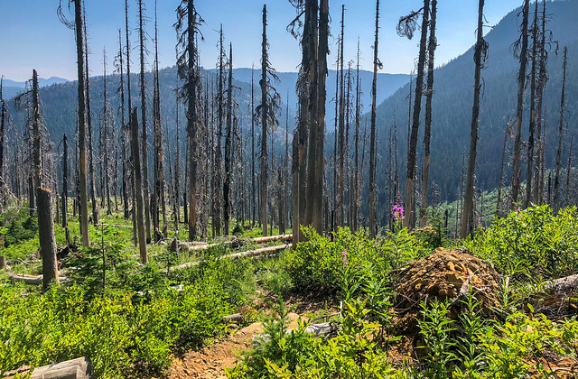
We then entered what is left of the forest after the Norse Peak Fire ravaged the area in 2017.
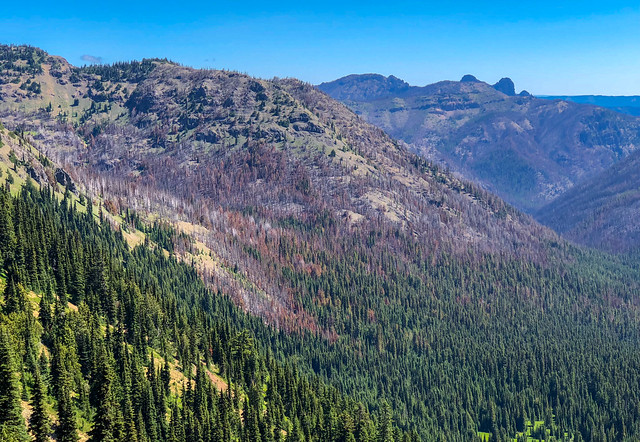
Seen from the PCT through Norse Peak Wilderness in Washington State
From what we could see of it in the distance it looked like firefighters were successful in protecting the popular Crystal Mountain Ski Area.
Crystal Mountain Ski Area seen from the PCT in Washington State
While we left some of our favorite mountains behind there were others to the north just beginning to come into view.
Seen from the PCT through Norse Peak Wilderness in Washington State
Wildflowers have a knack for coming back with a vengeance after an area has been ravaged by wildfire.
Penstemon seen from the PCT in Washington State
When we entered this burned area ...
Seen from the PCT through Norse Peak Wilderness in Washington State
... we did not yet know how extensive it was.
Seen from the PCT through Norse Peak Wilderness in Washington State
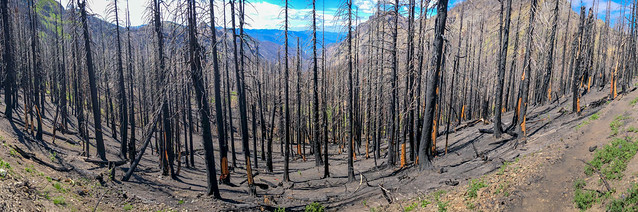
As this burn was only a year old trail crews had not yet been out to clear any of the many downed trees.
Seen from the PCT through Norse Peak Wilderness in Washington State
There is an eeriness walking through a recently burned area, it is like walking through a graveyard.
Jean on the PCT through Norse Peak Wilderness in Washington State
When we were up high enough to see in the distance it was disheartening to look out and see how far the burn extended.
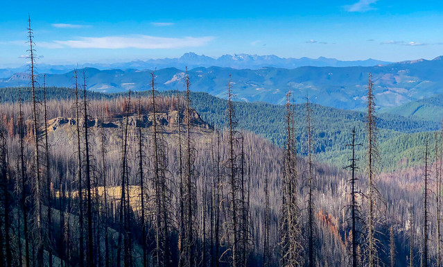
Seen from the PCT through Norse Peak Wilderness in Washington State
Late in the day we realized we did not have enough time, energy or daylight to get past this burn so we began looking for someplace suitable to camp. There is an added danger camping in a burn like we did. Many trees are unstable and could fall at any time but we were tired and out of time so it was a chance we had to take.
We awoke the next morning to complete silence. There was no early morning bird song to greet us, only a deathly quiet. Fortunately, we had found a patch of green we could pitch our tent on so our gear stayed relatively ash free. Once we were packed up we were more than happy to get going. We later talked to a solo backpacker, a Dutch woman named Marla, who had camped nearby in an established campsite. She said is was like camping in an ash tray as the slightest puff of wind blew ash and dust into her tent.
July 21st - 16.13 miles, 2,453 feet gained, 2,647 feet lost, we camped near PCT mile 2,239.

We awoke the next morning to complete silence. There was no early morning bird song to greet us, only a deathly quiet. Fortunately, we had found a patch of green we could pitch our tent on so our gear stayed relatively ash free. Once we were packed up we were more than happy to get going. We later talked to a solo backpacker, a Dutch woman named Marla, who had camped nearby in an established campsite. She said is was like camping in an ash tray as the slightest puff of wind blew ash and dust into her tent.
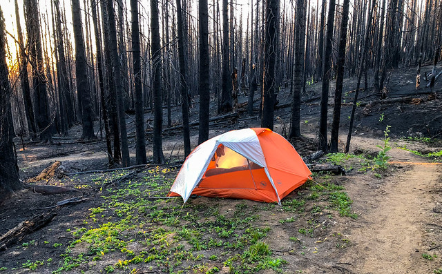
Our camp on the PCT through Norse Peak Wilderness in Washington State
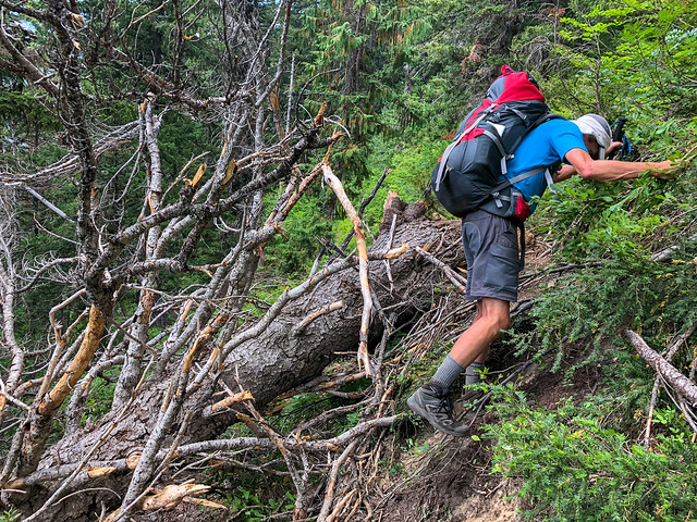
We began to encounter even more downed trees. What made it worse was the slightest touch left our skin and our clothing black from the charred wood. So, we needed to give all of the trunks and branches littering the trail a wide berth to prevent being covered in soot. It was tedious and time consuming.
Seen from the PCT through Norse Peak Wilderness in Washington State
Fortunately, this burn didn't last too much longer and we eventually began to see green once again.
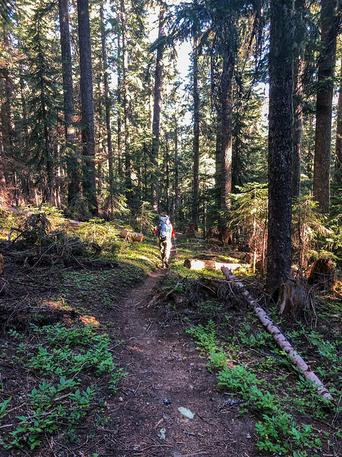
Jean on the PCT through Norse Peak Wilderness in Washington State
We finally reached the Urich Cabin. It is a popular stopping place and we could see several people lounging in chairs out front but we chose to stop by the nearby creek to fill up with water and eat lunch in solitude.
Urich Cabin seen from the PCT in Washington State
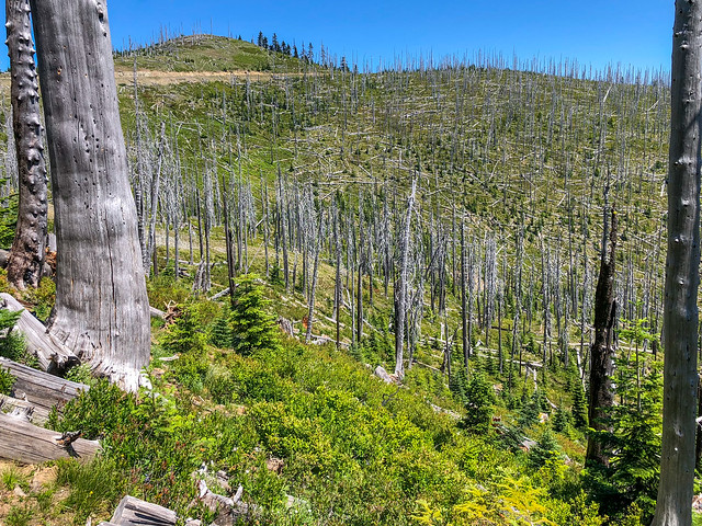
We then entered another burn, but not a recent one. A sign on the other side identified this as the "Falls Creek Burn" that was accidentally started by some loggers in July 1988. It was discouraging to realize that in this particular micro-climate the trees had not been able to achieve very much growth in the 30 years since this forest had burned. It made us wonder how long it would take the forest destroyed by the Norse Peak Fire to recover.
Seen from the PCT in Washington State
We then entered an area that had been clear-cut by loggers. It was another hot day and we sorely missed the shade of tall living trees and I have to say, it was an important educational experience for us. I remembered back to the beginning of the trip and on other trips we have done where we have been dismissive of "woodsy" portions of trails. After spending so much time hiking through dead trees, never again will I be critical of walking through a green, healthy forest because we have seen first hand just how much worse it can be.
Seen from the PCT in Washington State
We knew before we started this trip that the section of the PCT between White Pass and Snoqualmie Pass was the least scenic of all the sections in Washington State but the reality of walking through a fresh burn was worse than we had imagined. We really looked forward to being past it and in the mountains peeking at us from the distance.
Seen from the PCT in Washington State
Another challenge was there were, at times, larger gaps between water sources. Normally, when backpacking in the North Cascades one does not have to carry much water at any given time. We knew we needed to be flexible and were willing to cook our supper early in the day when we encountered water and then dry camp later that day. But on this day we simply needed to carry more water while hiking than we normally do in the Cascades and the heat and lack of shade made it that much harder on us to carry the additional weight.
On that same day we were faced with yet another new challenge. Toward the end of the day we reached where we had planned to camp only to find that all of the flat ground was already occupied by many thru hikers. We were too tired to continue much further and there was no guarantee the terrain would become any more cooperative so we then had to be creative. John scouted around in the woods and found a patch of not too sloped ground that was not too heavily covered in vegetation where we could pitch our tent. We discovered by placing our packs under the ends of our air mattresses we did not slide to the foot of our tent while we slept, at least not as much.
On that same day we were faced with yet another new challenge. Toward the end of the day we reached where we had planned to camp only to find that all of the flat ground was already occupied by many thru hikers. We were too tired to continue much further and there was no guarantee the terrain would become any more cooperative so we then had to be creative. John scouted around in the woods and found a patch of not too sloped ground that was not too heavily covered in vegetation where we could pitch our tent. We discovered by placing our packs under the ends of our air mattresses we did not slide to the foot of our tent while we slept, at least not as much.
July 22 - 17.41 miles, 2,806 feet gained, 3,434 feet lost, we camped near PCT mile 2,356.
Our camp on the PCT in Washington State
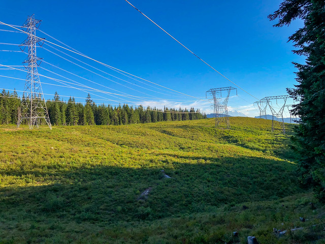
This section of PCT continued to go through clear cuts and past power lines. It really does not have much going for it other than connecting the PCT to the south with the PCT to the north.
Seen from the PCT in Washington State
It was another hot day and I took every opportunity to douse my head with cold water. We also soaked our shirts at times. Late in the day we were getting concerned about finding a suitable place to pitch our tent but another backpacker told us we would encounter an abandoned road not far from water. It was level but covered in sharp gravel. The bottom of our tent is a bit delicate so it suffered.
July 23rd -17.41 miles, 3,661 feet gained, 4,766 feet lost, we camped near PCT mile 2,374.
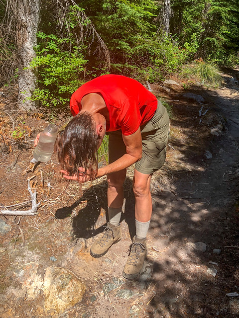
Jean cooling off on the PCT in Washington State
The next morning we hiked up the initially steep and sunny trail ...
John on the PCT in Washington State
... before it became shadier and passed alongside the lovely Mirror Lake. In the past, we would have stopped and taken a long break in such a scenic spot and John would have taken many photos. As it was we are lucky I was willing to stop just long enough to take my iPhone out of my pocket and take this one before hurrying to catch up with John who had continued walking. It was a clear indication to me he had not yet accepted his iPhone as his only camera and he was on a "photography strike".
Mirror Lake seen from the PCT in Washington State
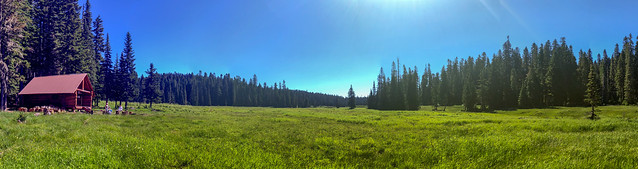
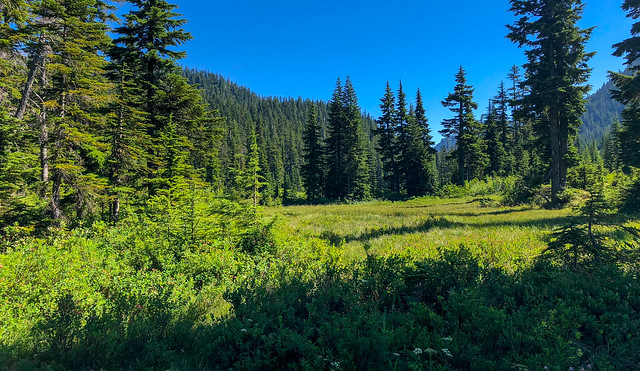
The trail leveled out as we hiked through Ollalie Meadows.
Seen from the PCT in Washington State
Normally, it would annoy me to see an interstate highway while backpacking but we were excited when we got our first view of I-90 as it represented a brief return to "civilization" and we were ready for it.
I-90 seen from the PCT in Washington State
As we descended toward the pass ...
John on the PCT in Washington State
... we were dismayed by the deterioration of the trail. We were tired and the steep loose rock and the thick brush really slowed us down.
John on the PCT in Washington State
But we could still enjoy the beauty around us such as this Foxglove.
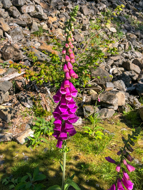
Foxglove seen from the PCT in Washington State
Intellectually we knew we were getting closer but it still seemed so far away.
I-90 seen from the PCT in Washington State
Finally, the Summit Inn came into view and we knew we were almost there. We arrived in time for supper and gratefully sank into the cushioned seats in the restaurant and devoured the menus with our eyes before placing our orders. Dinner consisted of steaks, baked potatoes (with extra butter, sour cream, cheese and bacon) with a green salad. It was practically an orgasmic experience!
July 24th - 16.6 miles, 3,344 feet gained, 4,380 feet lost, we stayed near PCT mile 2,390.
Summit Inn at Snoqualmie Pass seen from the PCT in Washington State
Zero Day - eat, shower, eat, sleep, repeat! We made good use of our day off at Snoqualmie Pass. Besides picking up our resupply box and Amazon delivery we made regular visits to the restaurant and took multiple glorious hot showers. As our next resupply was going to a motel in Leavenworth, where we planned another Zero Day, we needed to catch the Trailways bus at Stevens Pass in order to get there. After John ordered the bus tickets he was surprised to learn that we needed to have printed tickets with us as an email confirmation would not be accepted by the bus driver. Fortunately, the motel clerk was willing to print them out for us.
July 25th - 0 miles, 0 feet gained, 0 feet lost.
July 25th - 0 miles, 0 feet gained, 0 feet lost.
The next morning we were up early and, after another huge breakfast, we happily headed out again entering Section J - Snoqualmie Pass to Stevens Pass.
Jean on the PCT in Alpine Lakes Wilderness, Washington State
We were excited because we were going back to the mountains and would soon enter the stunning Alpine Lakes Wilderness.
Red Mountain seen from the PCT in Alpine Lakes Wilderness, Washington State
Looking back, we enjoyed the very distant view of Mt Rainier aware it could be our last.
Seen from the PCT in Alpine Lakes Wilderness, Washington State
Right before we reached the Kendall Katwalk we took a short lunch break. Other backpackers stopped there as well so it was easy to get someone to take our picture. I had a reason for wanting Red Mountain to be in the photo with us as it had a part in an essay I once wrote about coping with my fears (see "If I were King of the Forest").
John and Jean on the PCT in Alpine Lakes Wilderness, Washington State
But we had miles to go so we soon continued onto the "Katwalk". This can be a treacherous spot when there is still snow present but we were there late enough that snow was no longer a concern.
John on the PCT in Alpine Lakes Wilderness, Washington State
We love the aptly name Alpine Lakes Wilderness.
Seen from the PCT in Alpine Lakes Wilderness, Washington State
While mountains are our first love ...
Seen from the PCT in Alpine Lakes Wilderness, Washington State
... we certainly appreciate the colorful lakes scattered among the dramatic peaks.
Seen from the PCT in Alpine Lakes Wilderness, Washington State
Later in the day we got one last look at Mt Rainier ...
Seen from the PCT in Alpine Lakes Wilderness, Washington State
... but were compensated by our first look at Glacier Peak in the distance.
Seen from the PCT in Alpine Lakes Wilderness, Washington State
This proved to be a tough day for us not in terms of miles covered but in elevation gained, over 5,700 feet. In addition, our packs were back at their full weight.
Jean on the PCT in Alpine Lakes Wilderness, Washington State
The trail traverses a scree covered slope so the going was slow.
Jean on the PCT in Alpine Lakes Wilderness, Washington State
The views were great ...
Seen from the PCT in Alpine Lakes Wilderness, Washington State
... but we were losing light too quickly while still traversing the steep slope. I was tired so I began looking for a wide spot in the trail just in case we needed to stop and pitch our tent but there was nothing we could even consider using. So, as the sun disappeared, we got our headlamps out and kept going.
Seen from the PCT in Alpine Lakes Wilderness, Washington State
We finally reached a relatively flat area inhabited by a number of backpackers and a fellow even invited us to join their group and pitch our tent nearby. We expressed appreciation but continued on. We prefer our privacy and are willing to work for it. Locating suitable campsites after dark is not the easiest thing to do but we managed and I gratefully got inside my warm sleeping bag before making supper. It had been a very long day and I relished that moment when all chores are done and I can just lie down, zip up my bag and go to sleep.
July 26 - 14.3 miles, 5,771 feet gained, 3,621 feet lost, we camped near PCT mile 2,404.9.
The next morning we were up early (and got our first good look at our campsite). It warmed up quickly and the mosquitoes were out in full force. However, after getting our Amazon delivery we now had ...
Our camp on the PCT in Alpine Lakes Wilderness, Washington State
... head nets! We had some with us back in 2011 when we did the John Muir Trail but at that time I did not feel comfortable wearing them while hiking so I only wore mine when we took breaks. However, this time I was much more motivated and I quickly adapted to wearing it while walking. It was such a relief!
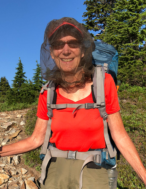
Jean on the PCT in Alpine Lakes Wilderness, Washington State
We had also ordered a new "frother", a small battery operated mixer. A significant number of our daily calories came from fat powders (such as butter, cream, MCT oil and "Fat Fuel Coffee"). We both really looked forward to our daily mid-morning "Chocolate Shake", a high fat/low carb concoction However, fat powders don't mix completely with stirring or shaking especially in cold water. So, we willingly carried the extra weight of a frother. However, the first one did not have a protective case and it had become bent. This one came with a case, not to mention distinctive Holstein Cow markings.
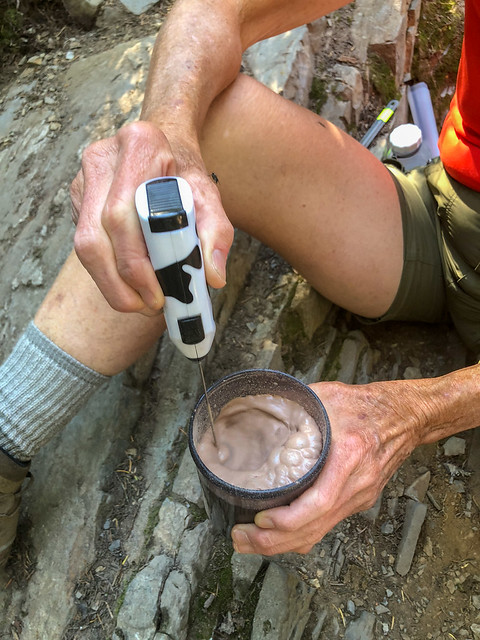
Our new frother
We descended quickly on the good trail ...
John on the PCT in Alpine Lakes Wilderness, Washington State
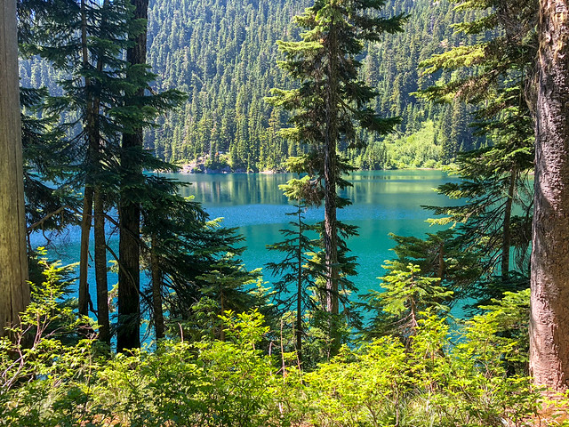
... passing the lovely Spectacle Lake ...
Spectacle Lake seen from the PCT in Alpine Lakes Wilderness, Washington State
... and Delate Falls.
Delate Falls seen from the PCT in Alpine Lakes Wilderness, Washington State
This was a popular stopping point for other backpackers so again it was easy to get someone to take our picture.
Jean and John on the PCT in Alpine Lakes Wilderness, Washington State
As we descended further we encountered another burned section. It became quite hot and we mourned the loss of shade.
Seen from the PCT in Alpine Lakes Wilderness, Washington State
But the abundant Fireweed, typically one of the first plants to colonize after a fire, was proof this forest had begun its slow recovery.
Fireweed seen from the PCT in Alpine Lakes Wilderness, Washington State
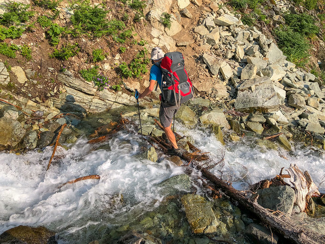
As we approached Lemah Creek we encountered a volunteer trail crew associated with the Washington Trails Association (WTA). We stopped to express our appreciation for their efforts as they labored in the extreme heat cutting through large downed trees with hand tools. We were told the bridge over Lemah Creek was out, something we had been aware of, but were also told the reason it had not yet replaced was due to "government bureaucracy". One of the volunteers said WTA had enough money and volunteers to replace it but they had not been able to obtain the necessary permission for a helicopter to enter the area and deliver the needed large timbers. I could not help but notice the bitterness in her voice. We again expressed our appreciation for their efforts before continuing on. When we reached the creek we removed our socks and orthotics before wading across the creek, resigned to wearing wet boots for the rest of the day.
John crossing Lemah Creek on the PCT in Alpine Lakes Wilderness, Washington State
After crossing the creek we began the long, hot, slow ascent through brush and over numerous downed trees.
John on the PCT in Alpine Lakes Wilderness, Washington State
We were dismayed by the poor condition of this premier trail but understood about the lack of funding available for regular maintenance and the unrealistic reliance on volunteer labor. It is an unfortunate reality that the pool of volunteers is most often made up of people who are older and retired as they are the ones who now have the necessary time to devote to it. But their willingness to work hard can not completely overcome their age and the difficulty of working with only hand tools. No one wants to hear the sound of chainsaws in wilderness areas but there are just some situations when we would willingly accept the noise to facilitate efficient trail maintenance and reduce wear and tear on hardworking volunteers. Given the large number of people now hiking the PCT it made sense to me that we should all be required to pay for the privilege and the funds could be used to maintain it.
John on the PCT in Alpine Lakes Wilderness, Washington State
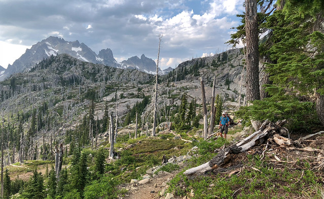
But, no matter what the challenges, we couldn't help but appreciate the views we were getting of mountains!
Seen from the PCT in Alpine Lakes Wilderness, Washington State
We had planned to go farther this day but were just too tired ...
Seen from the PCT in Alpine Lakes Wilderness, Washington State
... and we stopped about four miles short of our goal to camp by a small pond.
Our camp on the PCT in Alpine Lakes Wilderness, Washington State
Thanks to our head nets, our evening chores of pitching the tent and treating water were less of a battle.
July 27- 13.42 miles, 3,743 feet gained, 3,426 feet lost, we camped near PCT mile 2,418.
John in camp on the PCT in Alpine Lakes Wilderness, Washington State
The next morning we were up early and descended quickly on the good trail. The day warmed up quickly. Clouds formed in the sky and surprisingly the air felt more humid than we are accustomed to feeling in the mountains. We also heard some thunder in the distantance.
Jean on the PCT in Alpine Lakes Wilderness, Washington State
But it did not dampen our enthusiasm for the views which included Bear's Breast Mountain ...
Bear's Breast Mountain seen from the PCT in Alpine Lakes Wilderness, Washington State
... and Deep Lake.
Deep Lake seen from the PCT in Alpine Lakes Wilderness, Washington State
A common activity during the day was stopping to collect and treat water. We always appreciated it when the flowing water also provided us a cool breeze but it did cause us to sometimes take a longer break than we had intended.
John on the PCT in Alpine Lakes Wilderness, Washington State
We continued down the brushy trail until we reached the valley ..
Seen from the PCT in Alpine Lakes Wilderness, Washington State
... where we negotiated two easy stream crossings with well placed stepping stones.
John on the PCT in Alpine Lakes Wilderness, Washington State
We stopped short of another stream crossing. There was couple of thru hikers just ahead of us who planned to camp on the opposite side of the creek so we decided to not cross the creek and utilized an established campsite. However, had either of us checked our GPS before setting up the tent we may have opted to go just a bit further in order to be able to record a 19 mile day. Instead, we were just short of that. Oh well.
July 28 -18.99 miles, 3,321 feet gained, 4,2,31 feet lost, we camped near PCT mile 2,437.

Our camp on the PCT in Alpine Lakes Wilderness, Washington State
The next morning we continued down the good trail and soon reached what Halfmile describes as a "Large creek with a potentially difficult ford". Fortunately, we were able to talk to some SoBo backpackers who had just crossed it and they recommended that we first head upstream from the trail before crossing the first channel. We were then to walk down the rock bar in the center and cross the far channel lower down.
Seen from the PCT in Alpine Lakes Wilderness, Washington State
That proved to be excellent advice.
John on the PCT in Alpine Lakes Wilderness, Washington State
I had been apprehensive about this crossing and we had both removed our socks and orthotics just in case we were forced to wade through the water but the rocks were not slippery and "rock hopping" worked just fine.
John on the PCT in Alpine Lakes Wilderness, Washington State
A small but well placed tree got us both across the remaining channel with dry boots. In hindsight, we could have saved some badly needed time by not stopping to first remove our socks and then putting them back on but we had opted to be "safe" rather than risk being "sorry". We had also planned ahead in order to do this ford earlier in the day before daytime heat increased snow melt. I imagine getting across it was more of a challenge in late afternoon.
John on the PCT in Alpine Lakes Wilderness, Washington State
That day proved to be the hottest in the current "heat wave" and the mosquitoes were quite active.
Seen from the PCT in Alpine Lakes Wilderness, Washington State
But we continued to find those to be acceptable "prices to pay" for the privilege of being there for the views of mountains ...
Seen from the PCT in Alpine Lakes Wilderness, Washington State
... and alpine lakes.
Hyas Lake seen from the PCT in Alpine Lakes Wilderness, Washington State
We continued on but it was a hard day and my feet were feeling quite sore ...
Jean on the PCT in Alpine Lakes Wilderness, Washington State
... so when we reached an agreeable creek it seemed worth it to take the time to give them a cold soak. It struck me as funny that we had gone to a certain amount of time and trouble to keep our feet and footwear dry earlier in the day. In fact, during the heat of the day my feet actually prefer cold wet socks and boots and enjoy wet stream crossings. However, once the sun drops I know they will want the warmth and comfort of dry socks and boots. I have had five surgeries on my feet (four were all on the right) so I try my best to give my feet what they need so they are willing to continue doing all that I ask of them.

Jean's feet enjoying a very cold soak
We continued down the trail past Deception Lake, ...
Deception Lake seen from the PCT in Alpine Lakes Wilderness, Washington State
... past some small streams ...
Seen from the PCT in Alpine Lakes Wilderness, Washington State
... to Mig Lake where we camped for the night.
July 29th - 16.96 miles, 4,740 feet gained, 4,667 feet lost, we camped near PCT mile 2,454.
Our camp at Mig Lake on the PCT in Alpine Lakes Wilderness, Washington State
We got up especially early that morning, 4:00 AM, but it was already quite warm and the mosquitoes were out in full force.
Mig Lake seen from the PCT in Alpine Lakes Wilderness, Washington State
Our destination that day was Stevens Pass and we hiked as fast as we could because we had a bus to catch.
John on the PCT in Alpine Lakes Wilderness, Washington State
Fortunately the trail and terrain was cooperative ...
Seen from the PCT in Alpine Lakes Wilderness, Washington State
... and we knew we were getting close when we encountered the ski area.
Stevens Pass Ski Area seen from the PCT in Alpine Lakes Wilderness, Washington State
We arrived at Stevens Pass with an hour to spare. We waited in the hot sun hoping the driver knew to stop for us but we needn't have worried. The bus arrived promptly at 11:37 and pulled over to pick us up. We gratefully sank into the cushioned seats for the drive to Leavenworth.
Jean at Stevens Pass, Washington
Once in Leavenworth we had to walk a short distance to our hotel.
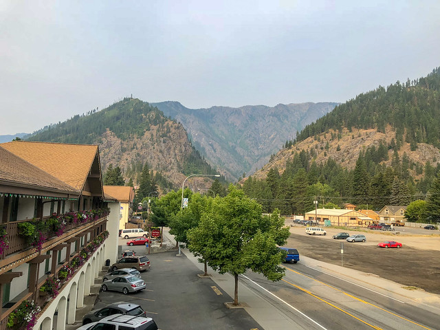
Leavenworth, Washington
After dropping off our gear we walked down to Kristall's Restaurant and Lounge for lunch. This restaurant had been a common stop for John on outings with the Seattle Mountaineers but I liked it because it was the closest to our motel. We made an important discovery at lunch that day, that sour cream on mashed potatoes is absolutely delicious! We then did the longer walk to the Post Office to retrieve our resupply box. It was quite hot in town and surprisingly fatiguing to walk on pavement. Once back in our room we made good use of the laundry services and the shower before returning to Kristall's for dinner.
July 30th - 7.37 miles, 1,652 feet gained, 2,261 feet lost, we had gotten off the trail near PCT mile 2,461.
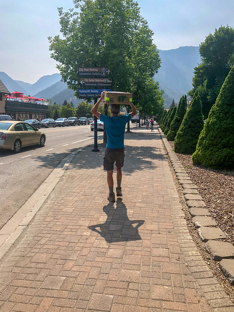
John carrying our resupply box in Leavenworth, Washington
The next day we had a few chores to do; organize our food and go to the grocery to buy more food. Not surprisingly, we had to make some adjustments to our daily "menu" as some food items in our resupply box were no longer palatable to us. But we could not afford to short ourselves on calories. We had both put on weight prior to the trip but that "buffer" was long gone. John was obviously having to tighten his belt to keep his pants up. I don't like wearing a belt under my pack's hip belt but I had packed a needle and thread so I could take the waistband of my shorts as necessary. I had done it twice. In addition, we needed to mend the floor of our tent and we began to question the wisdom of opting for one that was so delicate.
We also made good use of internet access for checking the weather forecast. Then John checked trail conditions to the north and learned of two fires blocking the PCT. One, the Bannock Lake fire, had a bypass over Cloudy Pass that would enable hikers to reach Stehekin. This was good news for us as that was the location of our next resupply box. However, there was another fire burning north of Rainy Pass and a section of the PCT was closed without a bypass. So, at that point we were uncertain if we could continue our trip beyond Stehekin. We would just have to wait and see.
We also made good use of internet access for checking the weather forecast. Then John checked trail conditions to the north and learned of two fires blocking the PCT. One, the Bannock Lake fire, had a bypass over Cloudy Pass that would enable hikers to reach Stehekin. This was good news for us as that was the location of our next resupply box. However, there was another fire burning north of Rainy Pass and a section of the PCT was closed without a bypass. So, at that point we were uncertain if we could continue our trip beyond Stehekin. We would just have to wait and see.
John organizing food and repairing our tent in Leavenworth, Washington
The next morning was a leisurely one as the bus that would take us back to Stevens Pass would not leave Leavenworth until about 1:00 PM. So, after we checked out of the motel we headed to Kristall's for a big breakfast. We lingered over it long enough that we could then order lunch. This was a first for both of us. It is truly amazing what our bodies can adapt to. That we can go from eating just enough calories on the trail to being able to gorge to excess when off without gastric upset is remarkable. We caught our bus and by 2:00 PM we were back on the trail in Section K - Stevens Pass to Rainy Pass.
Jean and John on the PCT in Henry M Jackson Wilderness, Washington State
Once again we headed up the trail ...
John on the PCT in Henry M Jackson Wilderness, Washington State
... and once again we adapted to the dramatic increase in our pack weight.
Jean on the PCT in Henry M Jackson Wilderness, Washington State
We enjoyed the cooler temperature and a noticeable lack of bugs. We camped that night by Lake Janus.
August 1st - 9.62 miles, 2,002 feet gained, 1,885 feet lost, we camped near PCT mile 2,471.
Seen from the PCT in Henry M Jackson Wilderness, Washington State
The next morning was cool and cloudy ...
Seen from the PCT in Henry M Jackson Wilderness, Washington State
... but as the day progressed the clouds lifted ...
Jean on the PCT in Henry M Jackson Wilderness, Washington State
... and we were treated to a view of Glacier Peak.
Glacier Peak seen from the PCT in Henry M Jackson Wilderness, Washington State
We then thoroughly enjoyed the crisp, clear air ...
John on the PCT in Henry M Jackson Wilderness, Washington State
... and the panoramic views.
Seen from the PCT in Henry M Jackson Wilderness, Washington State
As we approached Pass Creek, where we planned to camp that night, we encountered several horses grazing in the meadow. They were most likely pack horses which meant we could encounter a group of people camping with a lot of stuff. We are not fond of sharing the trail with horses for several reasons. Horses simply tend to damage trails and delicate meadows. They can foul water sources and fill the air with odors from manure and urine. They also enable more people to get into the backcountry without having had to work hard for it. In our minds, this may cause them to not value it as much as a backpacker does. When we arrived at Pass Creek our fears were realized by the sights of large tents, folding chairs and the sound of a large boisterous group of alcohol infused people. So, we quickly collected water and continued on and camped at a trail junction, not scenic or private but at least relatively level and blissfully quiet.
August 2nd - 15.71 miles, 4,021 feet gained, 3,857 feet lost, we camped near PCT mile 2,487.
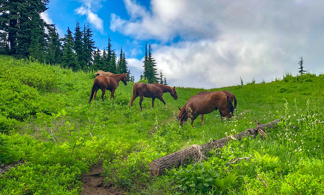
Seen from the PCT in Henry M Jackson Wilderness, Washington State
We knew there was rain in the forecast so were not surprised to wake up to a misty drizzle.
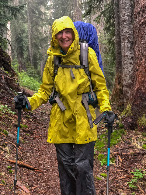
Jean on the PCT in Henry M Jackson Wilderness, Washington State
Finally, our cagoules got to be used for their intended purposes instead of just giving us something to wear while we did laundry.
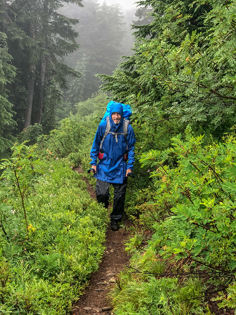
John on the PCT in Henry M Jackson Wilderness, Washington State
We occasionally got very brief glimpses of Glacier Peak through the clouds ...
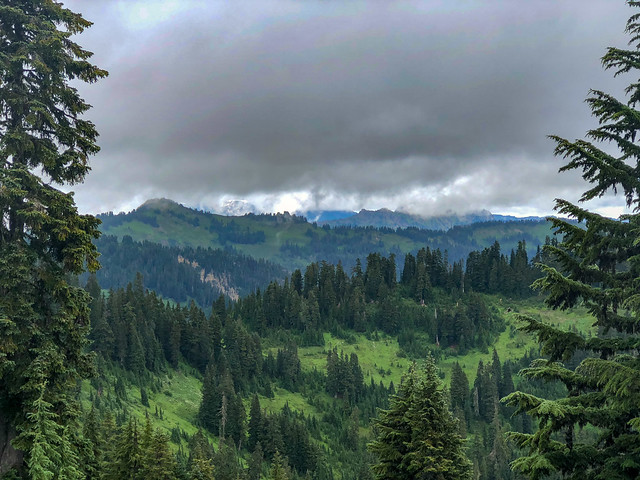
Seen from the PCT in Henry M Jackson Wilderness, Washington State
... and we paused only briefly by Lake Sally Ann ...
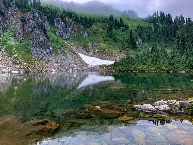
Lake Sally Ann seen from the PCT in Henry M Jackson Wilderness, Washington State
... before continuing on in the misty rain.
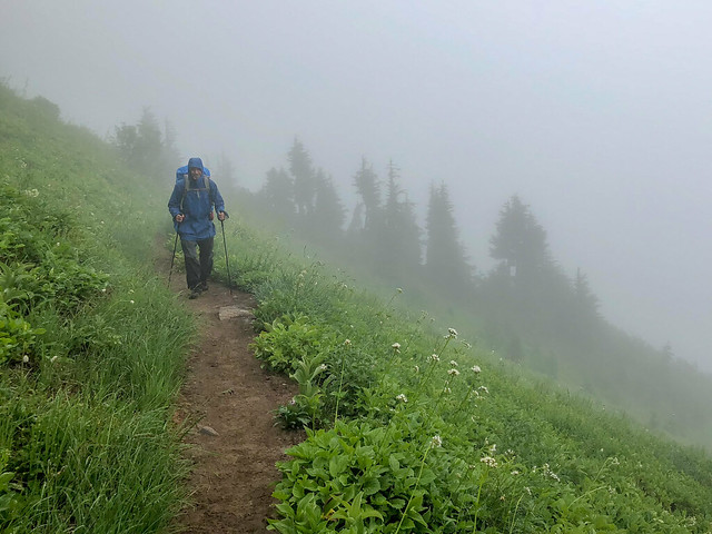
John on the PCT in Henry M Jackson Wilderness, Washington State
In the past we would have both resented the clouds and rain for blotting out views of our beloved mountains but in the "new normal" in the western states of an annual "fire season" we understood how essential the moisture was so we hiked through it without complaint.
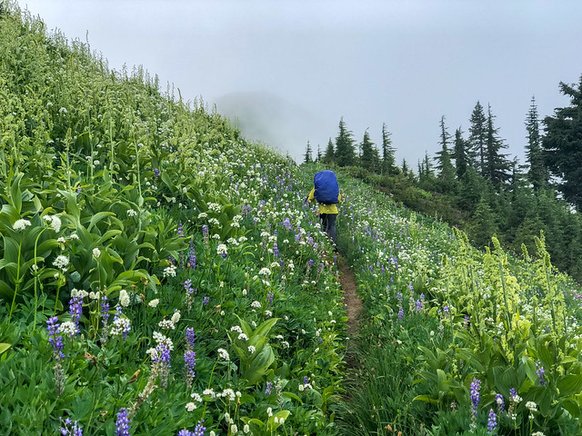
Jean on the PCT in Henry M Jackson Wilderness, Washington State
An unexpected treat for us was the beauty of copious water droplets resting on the wildflowers.
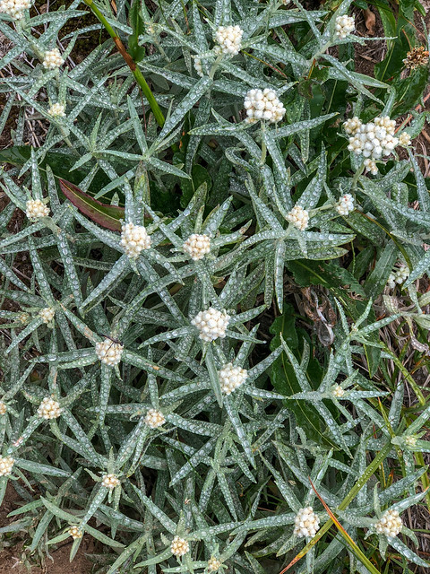
Pearly Everlasting seen from the PCT in Henry M Jackson Wilderness, Washington State
Fortunately, our iPhones were up to the task of such close photography. Even if John still had his camera with him it is unlikely he would have been willing to take the time to take it out of its dry bag on such a wet day.
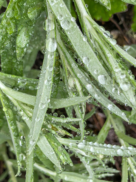
Seen from the PCT in Henry M Jackson Wilderness, Washington State
Normally, on a cloudy day we would make faster progress due to the lack of photo opportunities but the water droplets sparkled like jewels in the least bit of light.
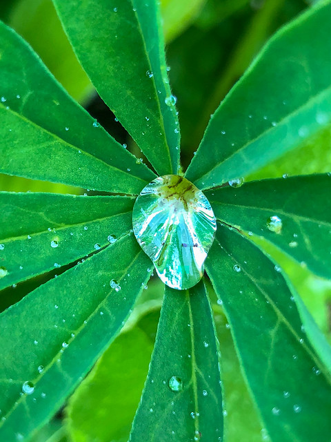
Lupine seen from the PCT in Henry M Jackson Wilderness, Washington State
We were more than willing to take some time to try to capture the stunning effect.
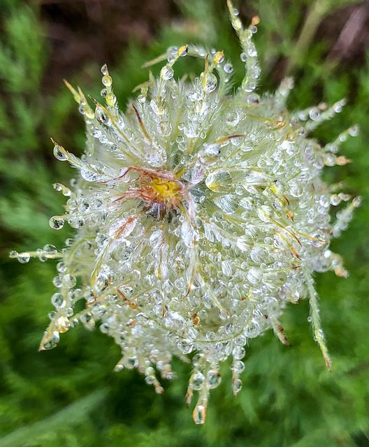
Western Anenome seen from the PCT in Henry M Jackson Wilderness, Washington State
We entered Glacier Peak Wilderness sometime that day. We had seen and heard a few marmots in the distance but none very close up ...
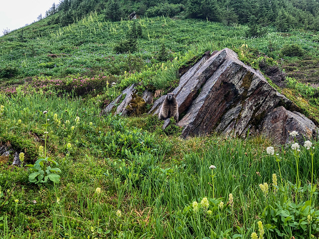
Marmot seen from the PCT in Glacier Peak Wilderness, Washington State
... until I happened upon this curious fellow ...
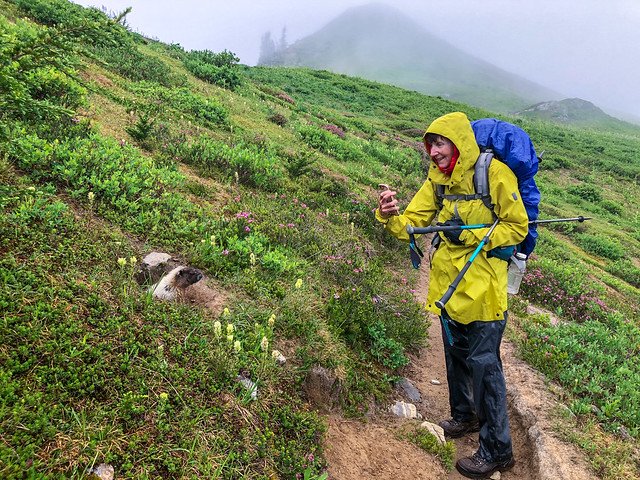
Jean and marmot on the PCT in Glacier Peak Wilderness, Washington State
... who posed for me. Later in the day the mist turned to windy, rain and the temperature dropped. We hiked well into the evening. We both felt cold but neither of us was willing to take the time to stop and put on more clothing. We finally made it over a ridge and dropped down far enough to find a suitable campsite. It was quite late and we were both chilled. But once inside our dry tent, in our warm bags with some hot food in our bellies we were able to warm up.
August 3rd - 15.84 miles, 4,383 feet gained, 3,157 feet lost, we camped near PCT mile 2,503.
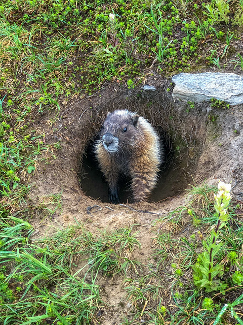
Marmot seen from the PCT in Glacier Peak Wilderness, Washington State
We were so happy to see clear skies the next morning!
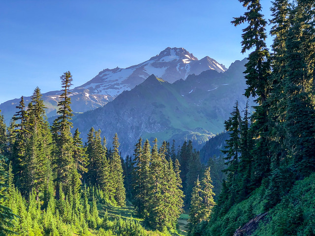
Glacier Peak seen from the PCT in Glacier Peak Wilderness, Washington State
But it took a while for the sun to dry off the vegetation so we wore our rain chaps well into the morning. We encountered a shallow stream but got across without trouble.
Jean on the PCT in Glacier Peak Wilderness, Washington State
However, later on we entered a wet area. It appeared that a stream somewhere above us had altered its course and was now just "running amok" through the woods completely unconstrained by banks or rocks.
Jean on the PCT in Glacier Peak Wilderness, Washington State
Rather than being able to step across a well defined creek we were forced to navigate through an extensive wet, muddy mess.
Jean on the PCT in Glacier Peak Wilderness, Washington State
The thick brush oftentimes made it more challenging and we were happy when we finally left it behind.
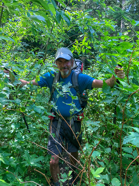
John on the PCT in Glacier Peak Wilderness, Washington State
When the roiling White Chuck River came into view we were unconcerned as Halfmile indicated there was a bridge.
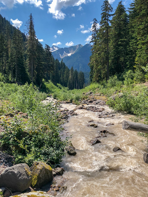
White Chuck River seen from the PCT in Glacier Peak Wilderness, Washington State
Well, technically there is still a bridge but it has definitely seen better days. It is broken in the middle and it will be lucky if it survives the spring snow melt next year.
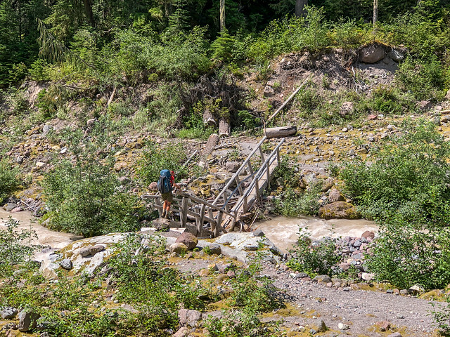
Jean crossing the White Chuck River on the PCT in Glacier Peak Wilderness, Washington State
Fortunately, previous hikers have piled up rocks in the low spot and the water level was not too high so we were able to get across without getting our boots wet.
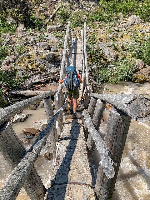
Jean crossing the Whitre Chuck River on the PCT in Glacier Peak Wilderness, Washington State
Later on, the day had turned cloudy again ...
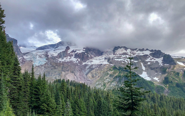
Seen from the PCT in Glacier Peak Wilderness, Washington State
... so we only got limited views of Glacier Peak.
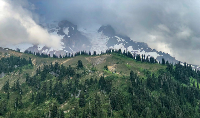
Glacier Peak seen from the PCT in Glacier Peak Wilderness, Washington State
As we made out way through a wooded section of trail we began to encounter more downed trees blocking the trail ...
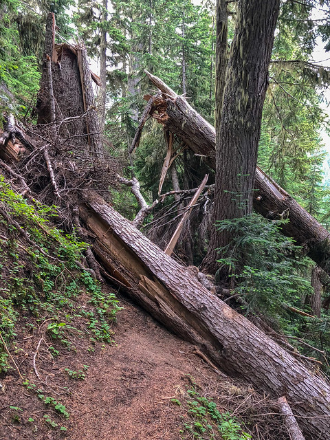
Seen from the PCT in Glacier Peak Wilderness, Washington State
... requiring us to take the steep, rough informal bypasses around them.

John on the PCT in Glacier Peak Wilderness, Washington State
None were especially difficult, they were just tedious and time consuming.
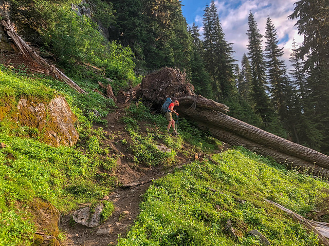
Jean on the PCT in Glacier Peak Wilderness, Washington State
We had intended to get as far as Mica Lake that day but, between being short of sleep and the more demanding trail conditions, we were both quite tired. So, when we reached Fire Creek...
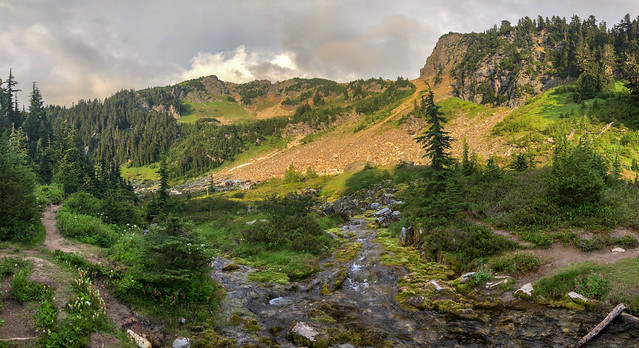
Fire Creek seen from the PCT in Glacier Peak Wilderness, Washington State
... and saw this lovely spot we decided stop early.
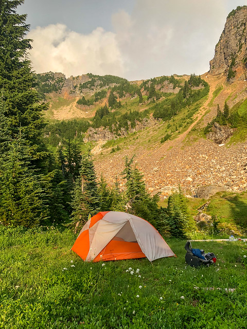
Our camp at Fire Creek on the PCT in Glacier Peak Wilderness, Washington State
While I crashed in the tent John took some photos of the beautiful golden evening light. During the night we heard some thunder and not long after we heard a helicopter pass overhead. We wondered if it carried fire crew members looking for potential fires started by lightning. In my half awake/half asleep daze I wondered how they would handle it if backpackers in the area needed to be evacuated. But then it was quiet so I went soundly to sleep.
August 4th - 12.3 miles, 3,603 feet gained, 3,768 feet lost, we camped near PCT mile 2,515.
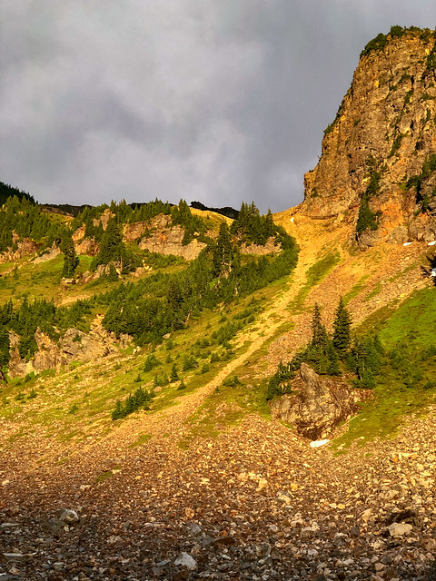
Seen from the PCT in Glacier Peak Wilderness, Washington State
We awoke the next morning feeling better rested than the previous morning. We had benefited both physically and emotionally from the shorter day, me to rest and John to take some time with his photography rather than just doing "snap and go".
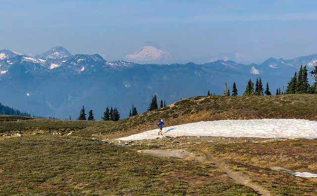
John on the PCT in Glacier Peak Wilderness, Washington State
While this trip and the schedule we needed to keep felt like a "job" we never lost sight of the "bigger picture", the views!
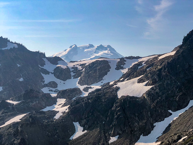
Glacier Peak seen from the PCT in Glacier Peak Wilderness, Washington State
After hiking a while we reached Mica Lake. It's a lovely spot and it would have been great to have camped there the previous night but it is a popular stopping place so we undoubtedly would have had to share it. And we would have arrived after dark and too tired to enjoy it so we knew we had made the best choice for us to stop early at Fire Creek.
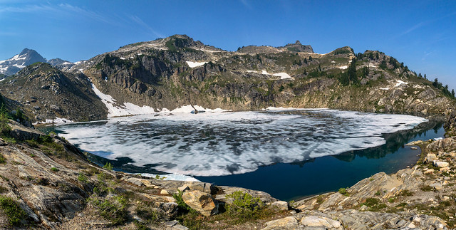
Mica Lake seen from the PCT in Glacier Peak Wilderness, Washington State
As we continued on we were dismayed to begin seeing the smoke and haze emanating from fires to the north of us. We could also smell smoke for the first time.
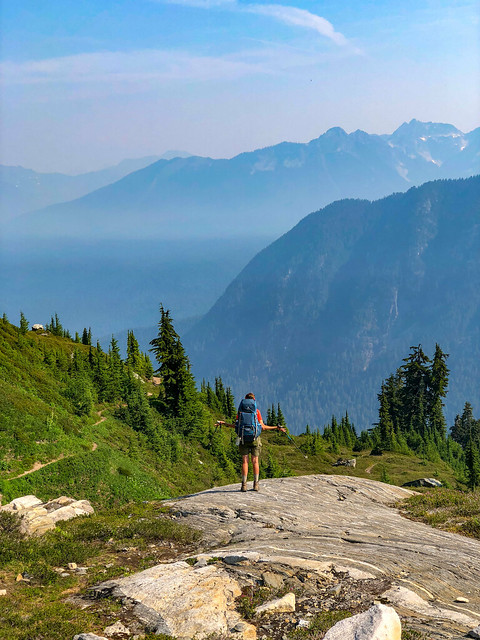
Jean on the PCT in Glacier Peak Wilderness, Washington State
Fortunately, visibility improved as we descended but we knew it was just a temporary reprieve.
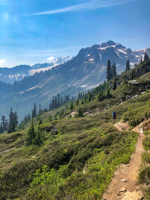
Jean on the PCT in Glacier Peak Wilderness, Washington State
So far, we had seen only one bear and that was very early on. The presence of relatively fresh scat was proof there were bears in the area. It could be they have just become adept at avoiding the multitude of backpackers on the PCT.
Bear scat seen from the PCT in Glacier Peak Wilderness, Washington State
It's funny, but when I look at the photos we took on this day it all looks quite pleasant. However, my notes state this day was hard as it was hot and the trail was steep and incredibly brushy. So I thought back and then, I remembered. It was bad. The fact I didn't take any photos is a clear indication of how frustrating it was and how unwilling I was to stop and record it. There was even a point where John had missed a switchback that was obscured by several downed trees and had gotten completely off the PCT. Fortunately, I was above him on the steep slope and saw him bushwhacking well below. I yelled down to him and got him headed back toward the trail. I then waited for him to catch up thinking we had best stick together for a while. I also wrote about our feelings of uncertainty. Even if the trail was open north of Stehekin I wondered if the air quality would be so bad it would be unhealthy for us to continue. We had not encountered any SoBo PCT thru hikers for many days nor did we have any cell service so we could not get any current intelligence about trail closures. At that point in time, the future of our trip was still completely up in the air.
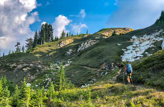
Jean on the PCT in Glacier Peak Wilderness, Washington State
But, we just kept going and as we rounded a ridge we began to get views of Glacier Peak again.
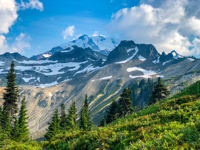
Glacier Peak seen from the PCT in Glacier Peak Wilderness, Washington State
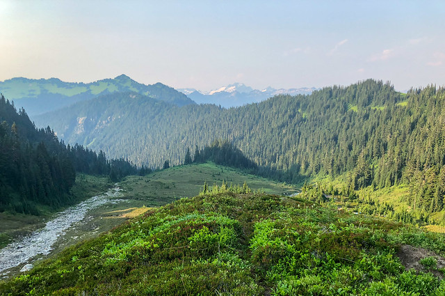
Seen from the PCT in Glacier Peak Wilderness, Washington State
Our plan had been to stop near water, cook/eat supper quickly and then hike a while longer. But when we reached this spot ...
Seen from the PCT in Glacier Peak Wilderness, Washington State
... we decided to make camp instead. We decided we deserved a scenic campsite and could probably afford to take another short day provided we could really make up some miles the few days. I have to admit, once again, we both felt like we were playing "hooky".
August 5th - 12.3 miles, 4,950 feet gained, 4,452 feet lost, we camped near PCT mile 2,528.
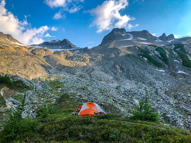
Our camp on the PCT in Glacier Peak Wilderness, Washington State
The next morning we were up early ...
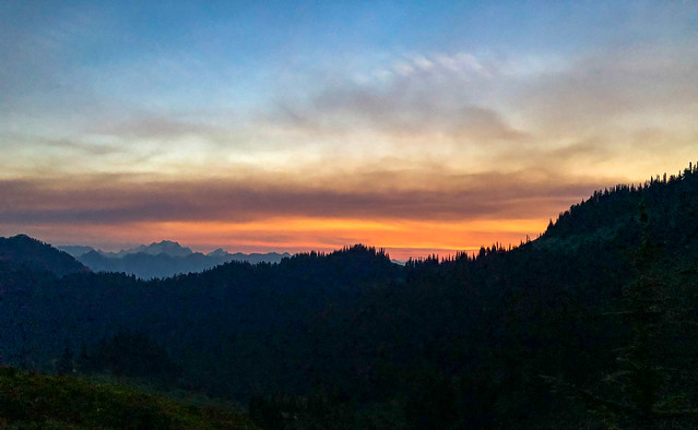
Seen from the PCT in Glacier Peak Wilderness, Washington State
... and the views reaffirmed we had made the right decision to come up short in order to camp in such a scenic spot.
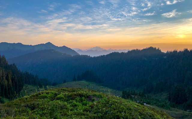
Seen from the PCT in Glacier Peak Wilderness, Washington State
The trail gently descended through meadows so we made good time.
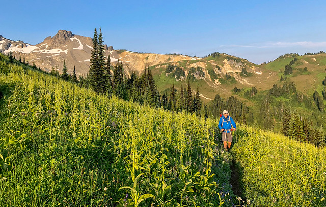
John on the PCT in Glacier Peak Wilderness, Washington State
While there was definitely some haze in the sky ...
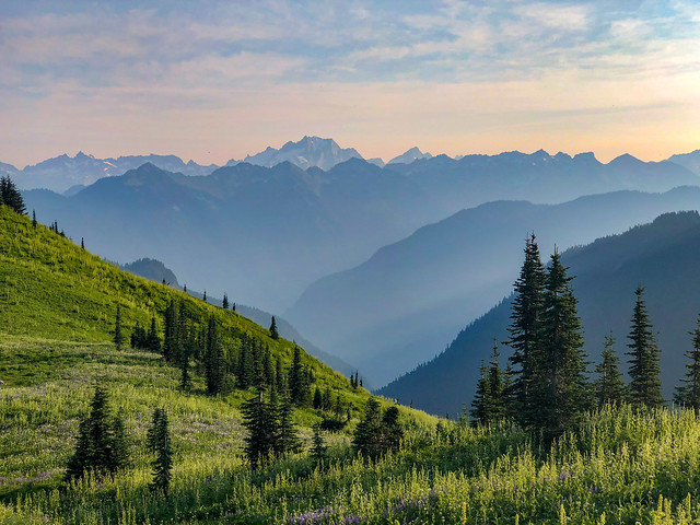
Seen from the PCT in Glacier Peak Wilderness, Washington State
... we could still thoroughly enjoy the views.
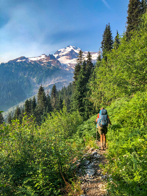
Jean on the PCT in Glacier Peak Wilderness, Washington State
We quickly descended to the valley floor and entered a thick old growth forest. While some of these giants had succumbed to natural forces ...
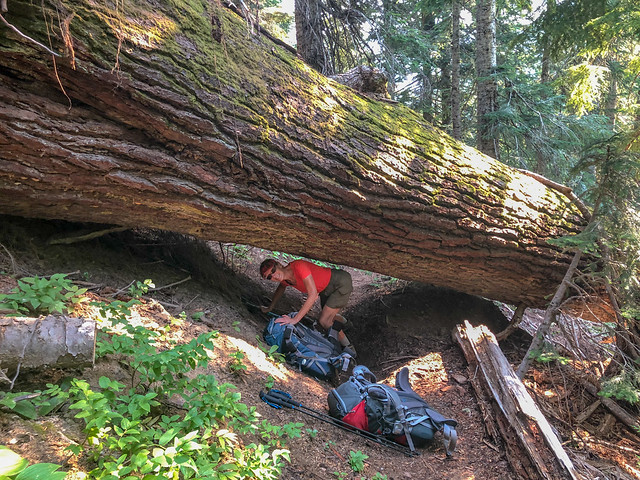
Jean on the PCT in Glacier Peak Wilderness, Washington State
... most were still standing. Unfortunately, our photographs didn't capture how it felt to be in their immense presence. We felt very tiny and insignificant.
John on the PCT in Glacier Peak Wilderness, Washington State
We finally encountered a SoBo thru hiker. However, "Airborne" was a member of an elite group of thru hikers. He was a "Yo-Yo", meaning he had started at the Mexico border, hiked the PCT all the way to the Canadian border before turning around to head all the way back to Mexico. Fortunately, he was willing to stop and talk with us for a few minutes as he was the first hiker we had encountered who had done the bypass over Cloudy Pass. He said the 11 mile section between the PCT and Holden Village wasn't too bad but he had nothing good to say about the 17 mile section between Holden Village and Stehekin. He had also hiked on the section of PCT north of Rainy Pass that was still closed due to fire. He was aware that was illegal but he obviously felt completing his goal was worth taking the risk. However, he told us the trail was fine, there was no smoke and in fact, the fire was contained and firefighters were packing up to leave the area. He thought all that remained was for Rangers to reopen the trail. This caused us to feel more optimistic about being able to complete the trip as planned. We continued on with lighter hearts as we approached the Suiattle River.

The Suiattle River seen from the PCT in Glacier Peak Wilderness, Washington State
We were impressed by the massive bridge built high over the Suiattle. The location of this relatively new bridge seemed to explain a mystery for us. John had noticed a discrepancy in PCT miles between Halfmile and Craig's PCT Planner. We thought it may have been a result of the trail being rerouted over this newer bridge. Perhaps the old bridge had washed out but it sure looked to us that this one was built to last. Good news for PCT hikers in the coming years!
August 6th - 18.29 miles, 4,435 feet gained, 5,594 feet lost, we camped near PCT mile 2,546.
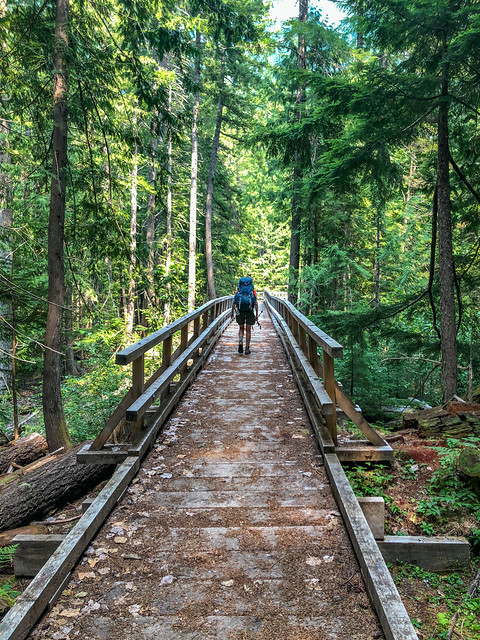
John crossing the Suiattle bridge on the PCT in Glacier Peak Wilderness, Washington State
We had camped that night in the woods at the Buck Creek Trail junction. The next morning the trail took us up and we got a parting view of Glacier Peak. I felt a bit short changed as Glacier had been obscured by clouds much of time when we could have had great views of it. But John assured me we could come back and spend more time in the area in the future. The trick would be to find the "magic window" of time between snow and wildfires.
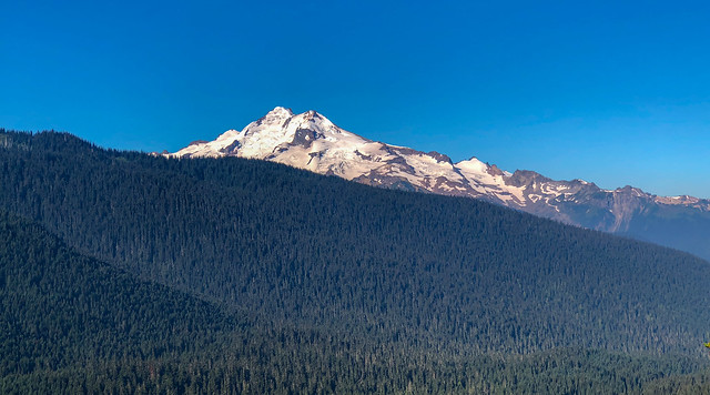
Glacier Peak seen from the PCT in Glacier Peak Wilderness, Washington State
When we reached this spot, PCT mile 2,550, it was time to get off the PCT ...
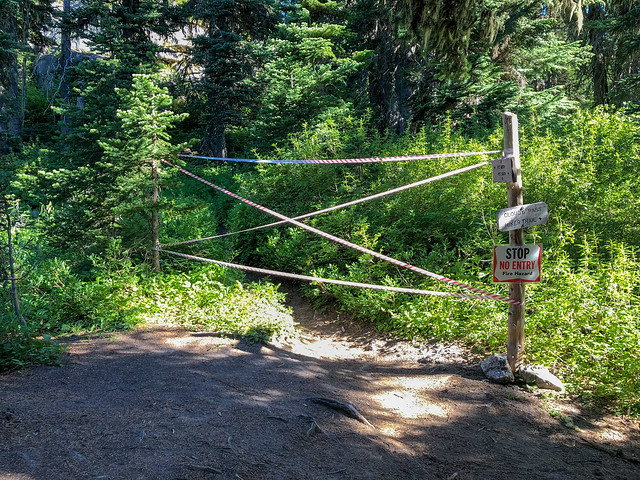
Seen from the PCT in Glacier Peak Wilderness, Washington State
... and take the fire bypass on the Hart Lyman Trail over Cloudy Pass.
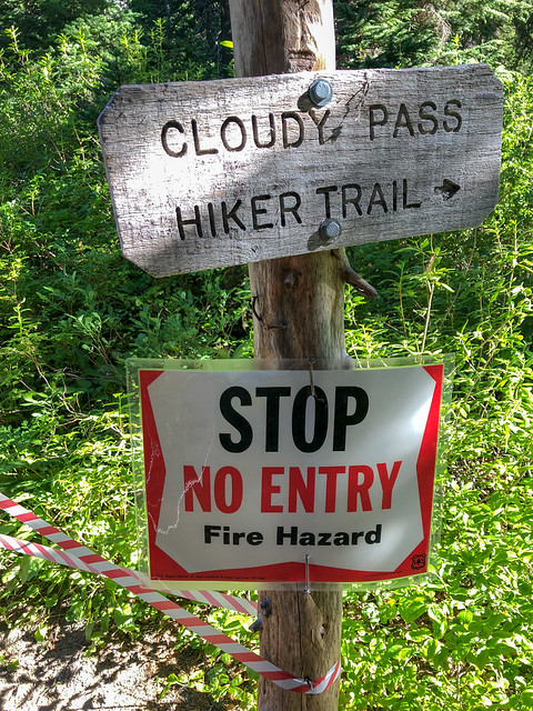
Seen from the PCT in Glacier Peak Wilderness, Washington State
The distance from this junction to the High Bridge Ranger Station on the PCT (in red on the map below) is 20 miles with a modest elevation gain of 1,817 feet. However, the bypass (in black) is 28 miles with much more elevation gain and loss on an unmaintained trail. It was a bit discouraging as we could ill afford the time needed to do the additional miles ...
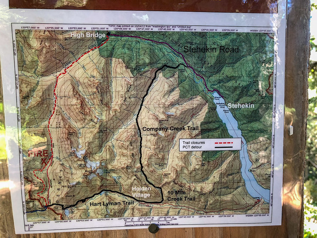
Seen from the PCT in Glacier Peak Wilderness, Washington State
... but on the other hand, we would have been grateful for any bypass that would enable us to get at least as far as Stehekin.
 \
\Jean on the Hart Lyman Trail in Glacier Peak Wilderness, Washington State
And I do have to say the hike over Cloudy Pass was gorgeous ...
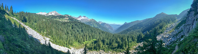
Seen from the Hart Lyman Trail in Glacier Peak Wilderness, Washington State
... and I loved this view of Lyman Lake!
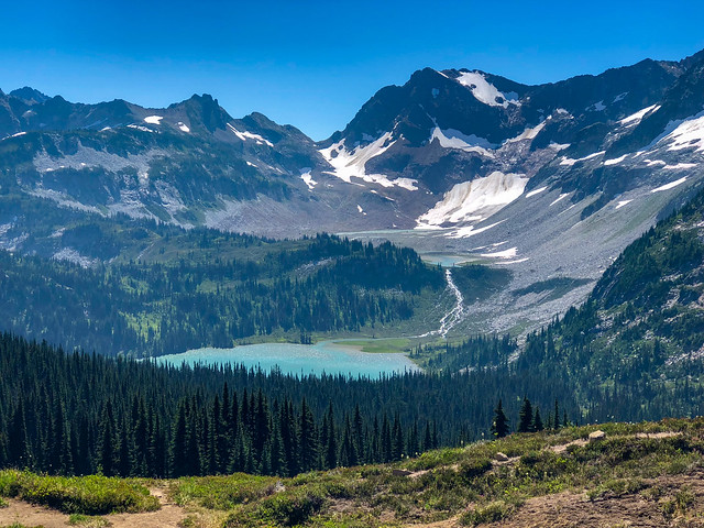
Lyman Lake seen from the Hart Lyman Trail in Glacier Peak Wilderness, Washington State
John had been in almost this exact spot when he did a solo backpack trip in September 2013 when I was sidelined with a broken wrist (Trip Report) and he took the below photo on that trip. Comparing the two photos really helps illustrate how much the angle of the sun, the cloud cover, etc affects what one sees. It reinforces the desire to return to beautiful locations in order to photograph them under varying conditions.
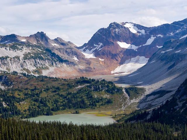
Lyman Lake seen from the Hart Lyman Trail in Glacier Peak Wilderness, Washington State
The trail down from Cloudy Pass was initially fast so we made good time.
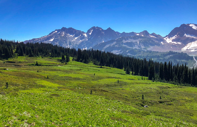
Seen from the Hart Lyman Trail in Glacier Peak Wilderness, Washington State
We loved seeing these waterfalls and wished we had more time and John's big camera and a tripod so he could photograph them properly and truly do them justice.
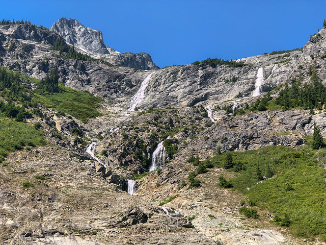
Seen from the Hart Lyman Trail in Glacier Peak Wilderness, Washington State
The wildflowers were also gorgeous; especially the Scarlet Paintbrush ...
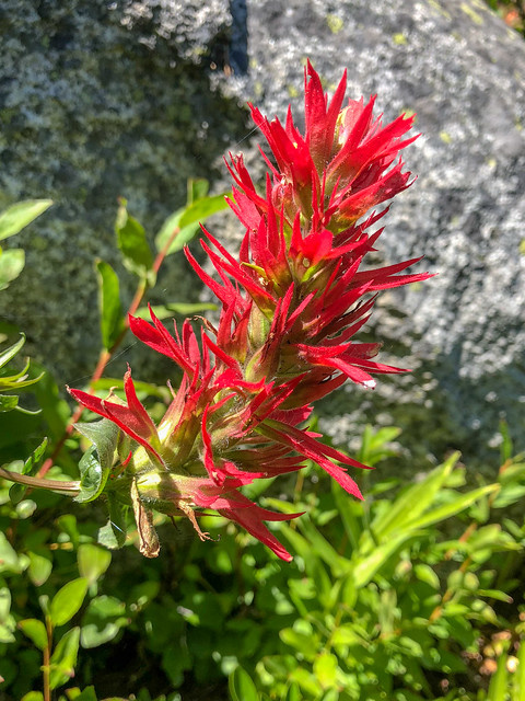
... and one of my personal favorites, Mountain Bog Gentian.
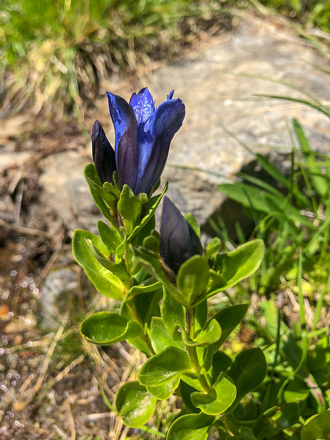
Seen from the Hart Lyman Trail in Glacier Peak Wilderness, Washington State
This bypass also took us by beautiful Hart Lake ...
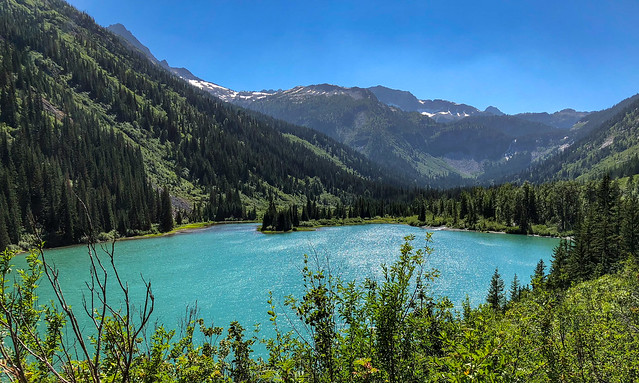
Hart Lake seen from the Hart Lyman Trail in Glacier Peak Wilderness, Washington State
... and a lovely cascading falls from its outflow.
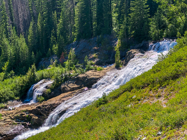
Seen from the Hart Lyman Trail in Glacier Peak Wilderness, Washington State
Then the trail deteriorated, becoming steep and brushy, obviously completely unmaintained. It made my knees very unhappy! Our destination for the day was Holden Village and we weren't sure what to expect. We had talked to a few hikers who said we could get a meal there and perhaps even a room for the night. One person described Holden Village as a "Lutheran Cult", not in a negative way but it did not reassure us. However, we were low on food and all we could do was keep walking in hopes of getting there in time for dinner. Because we were now off the PCT we could no longer rely on Halfmile to tell us our elevation gain or loss so we had to estimate it.
August 7th - 14.21 miles, ~2,000 feet gained, ~3,200 feet lost

Holden Village, Washington - Source of Image
Holden Village is unique and I can't even begin to adequately describe it. In a nutshell, it is a religious retreat located on the site of a former copper mining town situated in the mountains west of Lake Chelan. When we first arrived we were uncertain where to go but a helpful person directed us to the main building where we could check in. The friendly woman in the office encouraged us to head directly to the large, crowded dining room while she determined if they had a room available for us. We were completely overwhelmed by the large number of people, the chaotic activity and the cacophony of voices. We worked our way through the food line and loaded our plates with whatever they were serving; hot dogs, salad and potato chips. After dinner we learned they did have a room available. It was quite hot and the two-story dormitory style buildings are not air-conditioned so we moved through the evening in a hot, humid haze. We took showers and while I did laundry John did some badly needed repairs on his boots. Neither of us are at all religious so I did not feel like we "belonged" there but John is not shy like I am so he easily entered into conversations with other guests who seemed quite interested in us and what we were doing. Neither of us took photos as it just did not seem appropriate. If you want to know more about Holden Village you will need to go to their website.
While we were there we had a decision to make. We definitely needed to get to Stehekin to pick up our resupply but there were two options available to accomplish this. The first was we could continue hiking on the bypass for another 17 miles of steep and brushy trail, reported to be worse than what we had already done. As my knees were already sore I did not look forward to that option. Or, we could take a six-mile bus ride to Lucerne, which is essentially just a dock on Lake Chelan (lower R corner of photo below), where we could catch a boat to Stehekin.

I have to admit a bus and a boat sounded great to me but John initially rejected the idea. He had wanted to walk the entire way to Canada. However, I expressed concerns about my knees and my fears that the additional steep, brushy miles required by the bypass could jeopardize my ability to complete the trip. So, he reconsidered ...
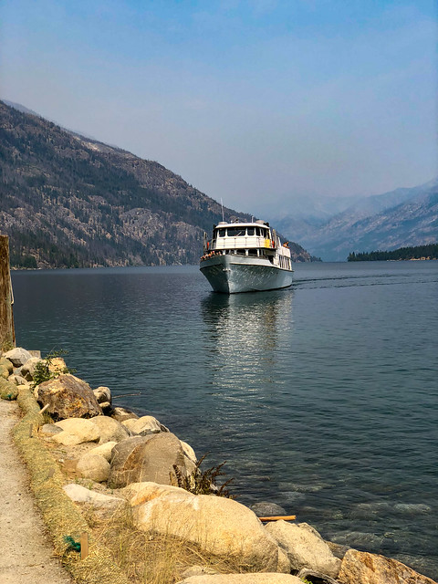
Seen from the Lucerne dock on Lake Chelan, Washington
... and we took the boat to Stehekin.
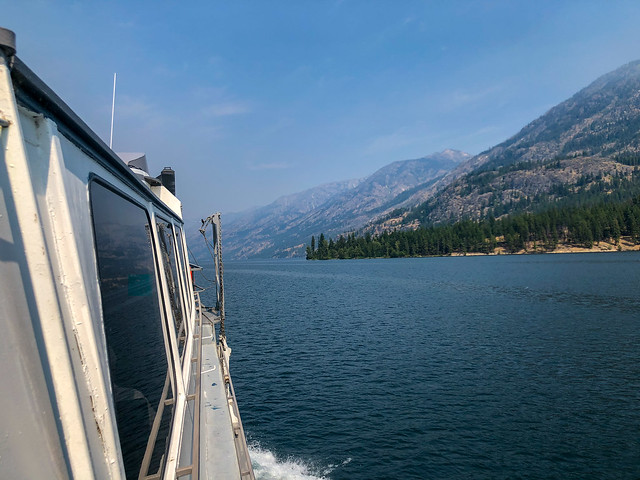
Seen from the boat on Lake Chelan, Washington
It was discouraging to see the thick smoke hanging over the lake. At this point, we were still uncertain if the PCT north of Rainy Pass would be open. If not, we would be forced to take the boat to Chelan the following day and ask someone to come get us. Then, hopefully, we could come back in September after both of our boys went home but that was not the ending we wanted. Fortunately, shortly after the boat docked at Stehekin John was able to talk to a Ranger and learned, to our great relief, that the PCT was then open all the way to the border! So, he got a permit for us to camp that night in North Cascades National Park.
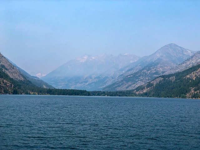
Seen from the boat on Lake Chelan, Washington
After eating lunch in a restaurant we walked down to the post office to retrieve our resupply box. The Post Master in Stehekin is quite a character. We talked to him briefly and he commented on the dramatic increase in the number of resupply boxes he was now handling compared to previous years. His office was overwhelmed by boxes and we wondered how he would ever find ours. However, after John mentioned he had put some bright green duct tape on the corners of our box, he knew exactly where it was located, under his desk.
The post office in Stehekin, Washington
We then found a nearby picnic table to use to organize the food from this, our last, resupply box. Later that evening we needed to catch a bus that would take us up to the High Bridge Ranger's Station in order to rejoin the PCT. We didn't have time for another sit down meal but we hit up the store for snacks and ice cream. We were both in good spirits because our decision to take the boat to Stehekin rather than do the 17 challenging miles of the bypass trail had put us solidly back on track for finishing the PCT on August 14th.
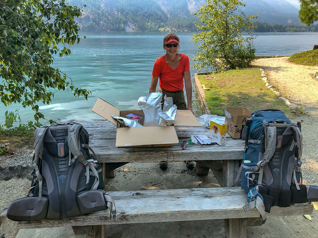
Jean in Stehekin, Washington
Once at High Bridge (PCT mile 2,569.42) we hoisted our heavy packs and headed out. It was still quite hot and my knees were hurting so it was slow going. In hindsight, the saggy bunk bed I slept in at Holden Village was not the best thing for my knees. In the tent I routinely place a stuff sack with my clothing in it under my knees to relieve pressure on them. Unfortunately, I had not even thought to do that in the funky bed. Live and learn!

Seen from the PCT in North Cascades National Park, Washington State
There are only a limited number of places to camp along the PCT in North Cascades National Park. Fortunately, we didn't have far to go but it had been a long, complicated day. It was dark before we reached our destination, the Group Camping area at Bridge Creek, but it was a relief to be completely on our own again.
August 8th - 5.03 miles, 1,217 feet gained, 688 feet lost, we camped near PCT mile 2,574.
August 8th - 5.03 miles, 1,217 feet gained, 688 feet lost, we camped near PCT mile 2,574.
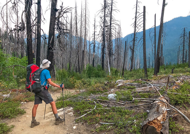
John on the PCT in North Cascades National Park, Washington State
We moved slowly the next morning. In daylight we could see we shared the Group Camp with a large number of teenage boys. We learned they were part of a YMCA Leadership program for male teens and we talked briefly to the young couple in charge. They were patiently waiting for these young guys to get their gear organized and packed but it looked like it was going to take a while. After a brief chat we finally got moving ourselves.
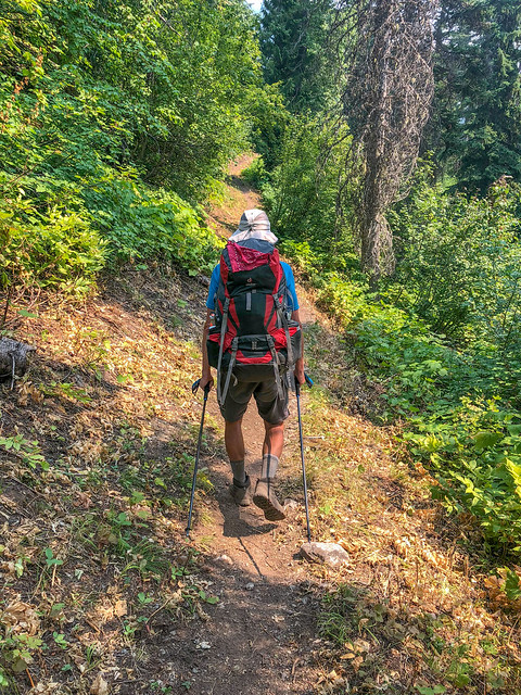
John on the PCT in North Cascades National Park, Washington State
The heat was incredible and we took every opportunity to soak our shirts. About mid-day we treated our feet to a long cold soak. Just as we were leaving we ran into Marla, the Dutch woman we had met in the area burned by the Norse Peak fire. We only talked briefly about our respective adventures before parting ways but in a way, it was like reconnecting with an old friend.
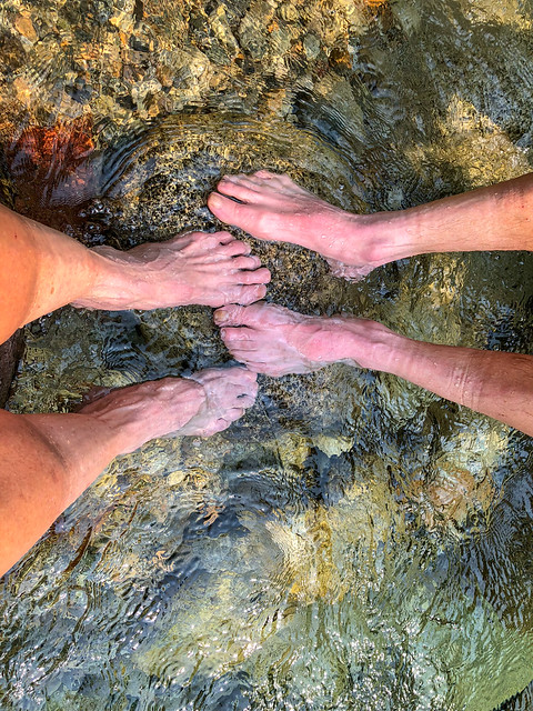
John's and Jean's feet getting a cold soak
We continued on and could not help but notice the smell of smoke in the air.
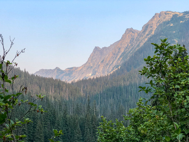
Seen from the PCT in North Cascades National Park, Washington State
Late in the day I was initially concerned when I saw this washed out bridge. I really didn't want to get my boots wet so late in the day ...
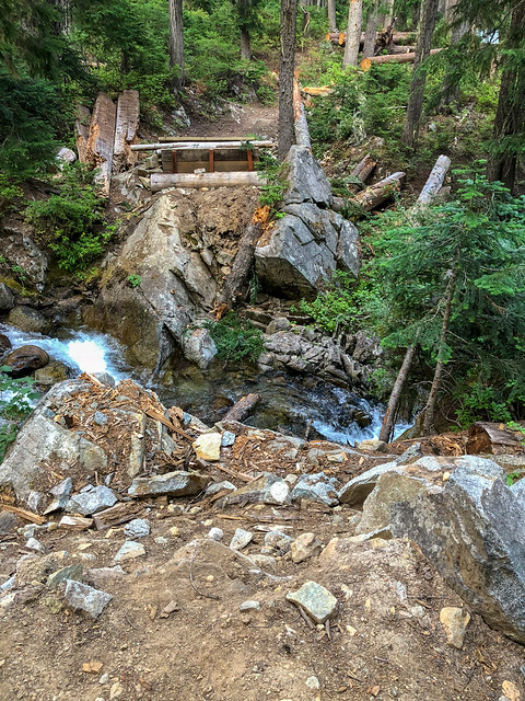
Seen from the PCT in the Okanogan-Wenatchee National Forest, Washington State
... but fortunately, by going upstream a bit we spied this nice big flattened log.
August 9th - 12.24 miles, 1,242 feet gained, 3,332 feet lost, we camped near PCT mile 2,586.
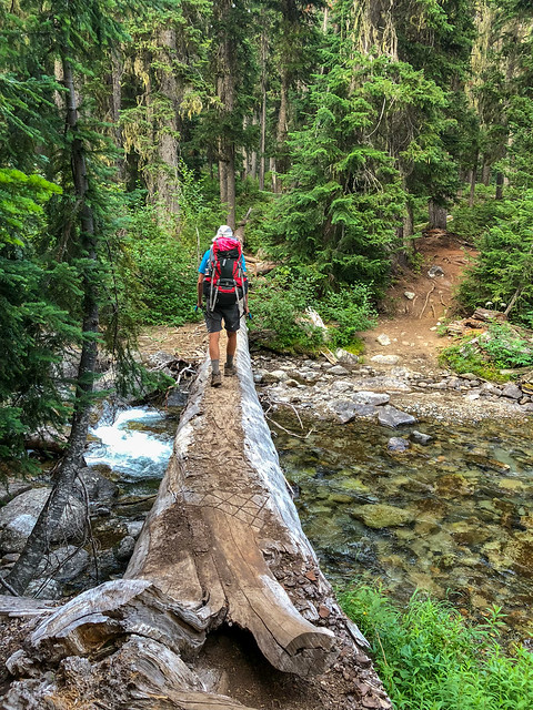
Seen from the PCT in the Okanogan-Wenatchee National Forest, Washington State
We were up early and resumed hiking where we crossed a creek using another log. Unlike the one we had encountered the previous evening this one was oddly tilted but at least it didn't vibrate when we were on it. We had heard traffic during the night ...
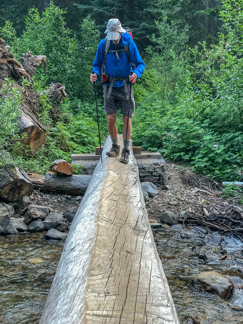
Seen from the PCT in the Okanogan-Wenatchee National Forest, Washington State
... so we knew we were not far from Rainy Pass.
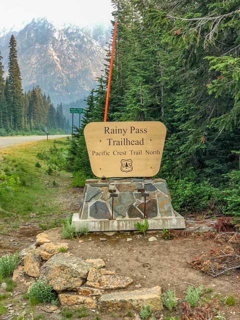
Seen from the PCT in the Okanogan-Wenatchee National Forest, Washington State
As we continued up the trail in Section L - Rainy Pass to Manning Park, BC ...
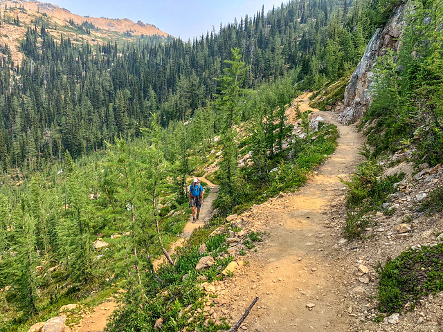
John on the PCT in the Okanogan-Wenatchee National Forest, Washington State
... we were now faced with the reality of what these last few days of our PCT trip would be like. Even though the trail was open and there was no active burn in the immediate area we were still seeing (and smelling) the result of other fires burning in the western US and Canada.
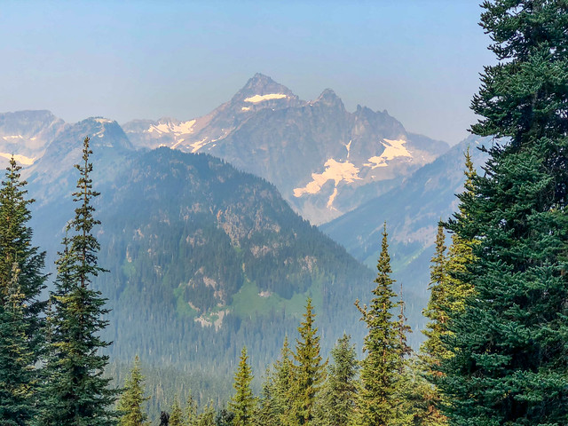
Seen from the PCT in the Okanogan-Wenatchee National Forest, Washington State
It was disheartening as we crossed Cutthroat Pass in the dense haze as we knew this was such a scenic area.
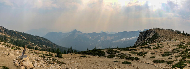
Cutthroat Pass seen from the PCT in the Okanogan-Wenatchee National Forest, Washington State
But, unfortunately, this has become the "new normal" for the western states.
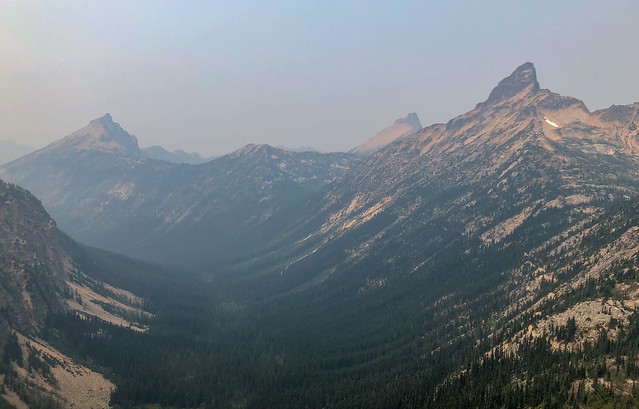
Seen from the PCT in the Okanogan-Wenatchee National Forest, Washington State
We had been relying on Halfmile's app to determine where our next source of water was located but he tended to be more conservative and earlier in the trip we often encountered seasonal streams not mentioned in his app But as it got later in the summer many of the seasonal streams were disappearing so we had begun to also consult Guthook which included more. On this particular day we experienced a first, a seasonal stream Guthook mentioned, and one we had been counting on for water, was bone dry. We only had about four miles to go to the next water so we weren't in danger of dehydration but it was uphill and quite hot so we both felt uncomfortably "dry".
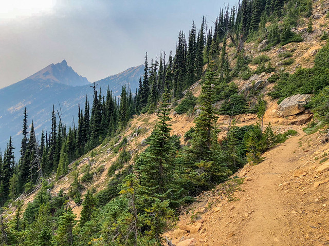
Seen from the PCT in the Okanogan-Wenatchee National Forest, Washington State
The next water indicated ended up being a tiny spring tucked high up in a jumble of rocks but we gladly took the time needed to collect it.
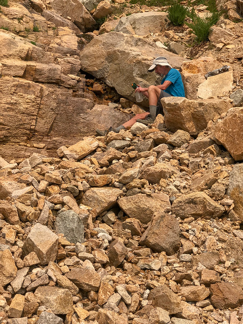
Seen from the PCT in the Okanogan-Wenatchee National Forest, Washington State
After filling up with water we continued the long trek over Methow Pass. We promised ourselves we would come back sometime in the future during the brief "window" of time between snow and fire season to see what we were obviously missing.
August 10th - 17.37 miles, 3,621 feet gained, 3,918 feet lost, we camped near PCT mile 2,603.

Seen from the PCT in the Okanogan-Wenatchee National Forest, Washington State
The next morning we were delighted to see a truly blue sky accentuated by genuine puffy white clouds.
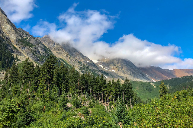
Seen from the PCT in the Okanogan-Wenatchee National Forest, Washington State
The temperature had dropped and we hiked in refreshing comfort.
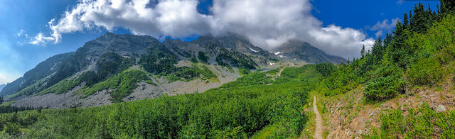
Seen from the PCT in the Okanogan-Wenatchee National Forest, Washington State
Later in the day the clouds continued to build and darken.
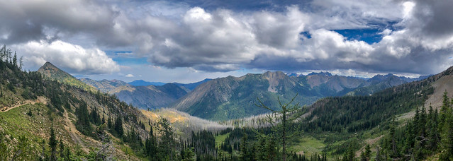
Seen from the PCT in the Okanogan-Wenatchee National Forest, Washington State
We assumed there could be rain in the forecast and it did drizzle a bit but it did not dampen our spirit. Compared to hiking in smokey heat this was shear pleasure.

Seen from the PCT in the Okanogan-Wenatchee National Forest, Washington State
This sign, the first we had seen indicating the distance to Canada, was a welcome sight. We continued the short distance to Hart's Pass where we planned to camp for the night. When we arrived it became obvious the small campground was quite full. Fortunately for us, a fellow who had already pitched his tent in one site had explored the area beyond it and determined there was another tent site situated in the trees and he invited us use it. We did so, gratefully.
August 11th - 16.54 miles, 3,643 feet gained, 2,192 feet lost, we camped near PCT mile 2,619.
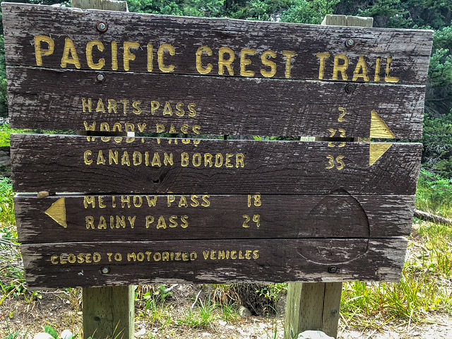
Seen from the PCT in the Okanogan-Wenatchee National Forest, Washington State
The night had been quite cold and damp so it was hard to leave the comfort of our sleeping bags and tent. But, we wanted to hurry up and finish so we got back on the trail and hiked out in the cloud enveloping the area.
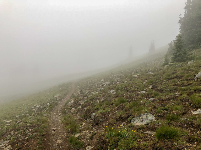
Seen from the PCT in the Okanogan-Wenatchee National Forest, Washington State
We wore our rain gear and while it did not actively rain the air was quite damp. When we stopped for our mid-morning chocolate shake we got out the stove to heat water and treated ourselves to hot cocoa. It did wonders to boost our spirits.
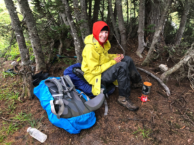
Jean taking a cocoa break on the PCT in the Okanogan-Wenatchee National Forest, Washington State
Later in the day it appeared the clouds were trying to lift.
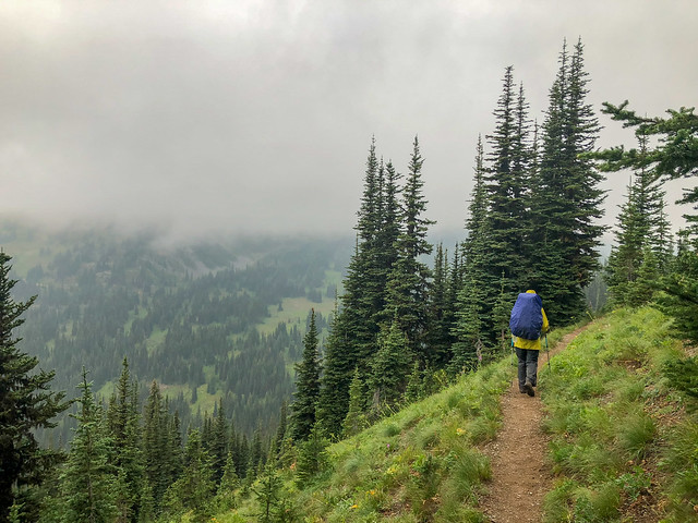
Jean on the PCT in the Okanogan-Wenatchee National Forest, Washington State
Once again our eyes were drawn to the beauty of thousands of gem-like water droplets displayed on the foliage ...
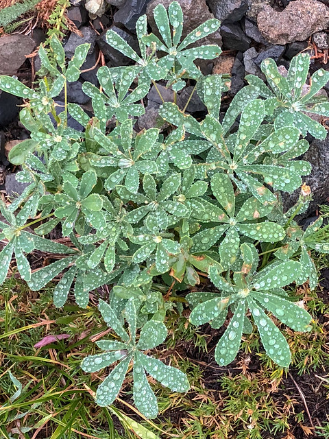
Lupine seen from the PCT in the Okanogan-Wenatchee National Forest, Washington State
... and seed-heads of wildflowers.
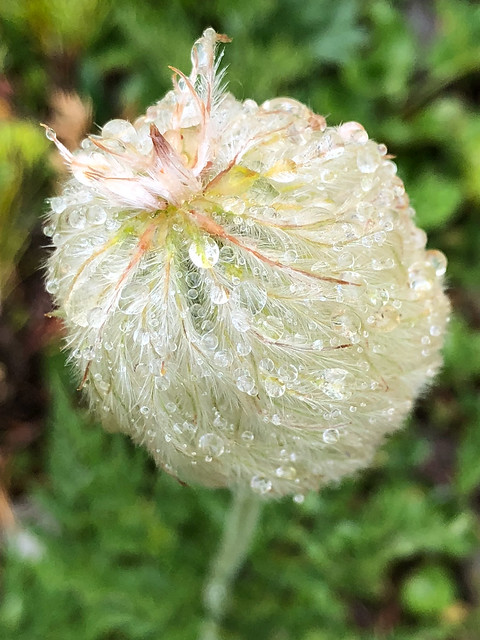
Anenome seen from the PCT in the Okanogan-Wenatchee National Forest, Washington State
Once again, we got to witness the spectacle of the sun reflecting in the droplets.
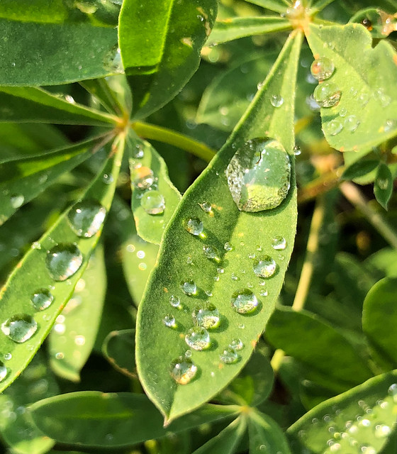
Seen from the PCT in the Okanogan-Wenatchee National Forest, Washington State
We didn't get as far as we had intended that day. As soon as John stopped just briefly to take a second look at a patch of dirt that was barely large enough for our tent he couldn't get me to budge another step. I was done in. It was our last night camped on the PCT in the US but it was not a comfortable night. It was the coldest we had experienced and the presence of nearby smoke was very irritating to our lungs.
August 12th - 15.32 miles, 3,058 feet gained, 3,286 feet lost, we camped near PCT mile 2,635.
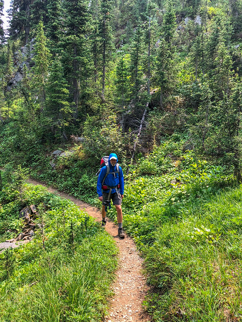
John on the PCT in the Pasayten Wilderness, Washington State
We were slow getting going the next morning. It was an interesting combination of our wanting to hurry up and be done with the whole thing and a weariness that caused me to just want to sit down and rest and encouraged John to stop and talk at length to anyone we encountered; other backpackers, rangers etc.
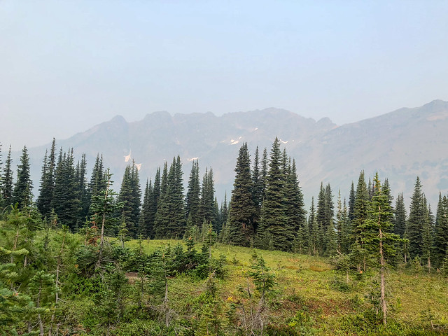
Seen from the PCT in the Pasayten Wilderness, Washington State
As we hiked in the haze that morning ...
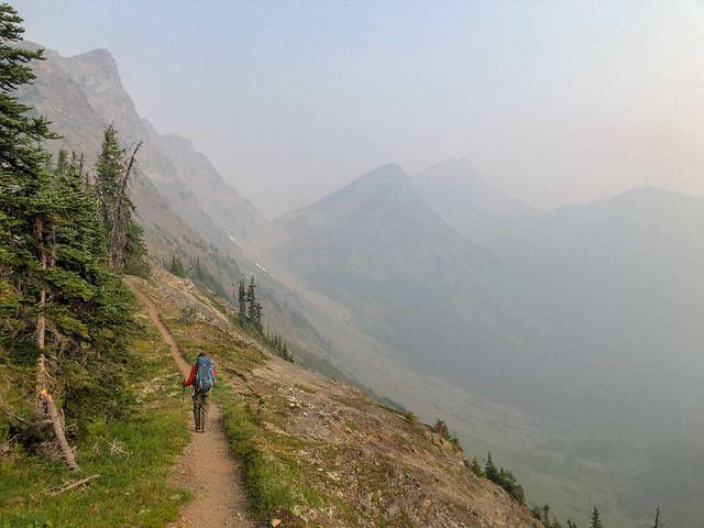
Jean on the PCT in the Pasayten Wilderness, Washington State
... we wondered about the current status of nearby fires. We later learned this section of PCT north of Rainy Pass was soon closed again due to new fire activity. It was only luck that placed us right smack in the middle of the very brief period of time when this section of the PCT was open.
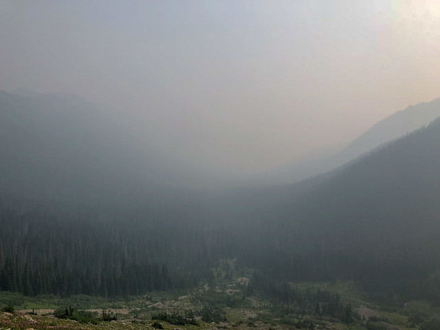
Seen from the PCT in the Pasayten Wilderness, Washington State
Fortunately for us something changed that day, perhaps the wind shifted, and the result was the air became much clearer. And the trail was quite good (for a while) so we made fast progress (for a while). Unfortunately, the trail deteriorated dramatically several miles before the border. It was canted sideways, slippery and often completely obscured by thick brush.
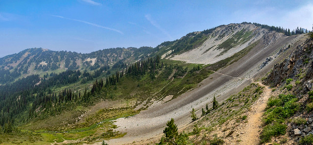
Seen from the PCT in the Pasayten Wilderness, Washington State
I have to say it was rather anticlimactic when we finally reached the nondescript break in the trees marking the US-Canadian border ...
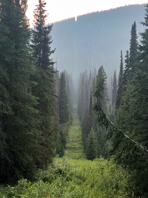
The US-Canadian border at Monument 78
... and calling this post a "Monument" seemed just a bit pretentious.

However, reaching the official northern terminus of the Pacific Crest Trail was a very satisfying experience. I was so happy we had pushed through all the "aches and pains" and had just kept putting one foot in front of another. As we weren't "thru hikers" I initially wasn't going to sign the logbook but then I thought "What the Hell"? Even though we had only completed a portion of this iconic trail we both felt quite proud of our accomplishment.

Jean at the US-Canadian border with Monument 78
However, reaching the official northern terminus of the Pacific Crest Trail was a very satisfying experience. I was so happy we had pushed through all the "aches and pains" and had just kept putting one foot in front of another. As we weren't "thru hikers" I initially wasn't going to sign the logbook but then I thought "What the Hell"? Even though we had only completed a portion of this iconic trail we both felt quite proud of our accomplishment.
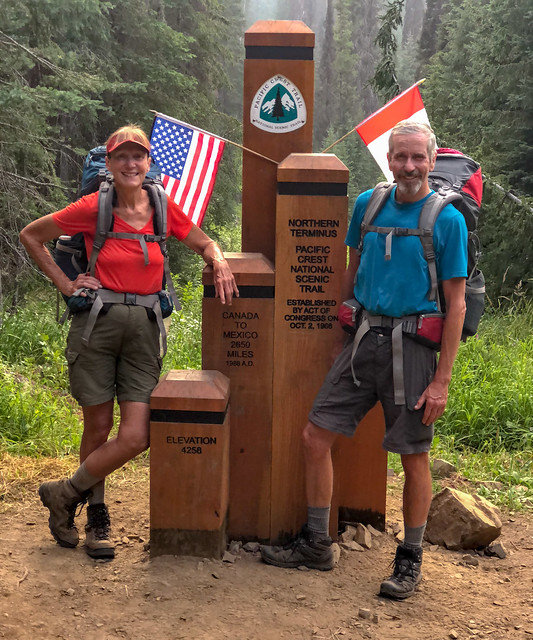
Jean and John at the northern terminus of the PCT
It was interesting being in this location, this "international" border. We knew once we crossed over into Canada it was illegal for us to re-enter the US at that location. The penalty for doing so included a $10,000 fine yet there was no big sign warning us about that. We had the necessary paperwork to allow us to enter Canada but there wasn't a sign mentioning the need for it. I almost wished there had been a Border Patrol agent there to welcome us but we left the US and walked into Canada without fanfare. We had a few more miles to go that day to reach a camping area. Once there, we kept walking past the multitude of vacant sites until we spied a single site on the opposite side of a creek. It was oddly fitting that a journey which began with our risking our lives crossing a bridge was ending with our needing to cross an oddly mangled bridge with jury-rigged supports. It made me long for a log or some rocks.
August 13th - 18.55, 3,413 feet gained, 4,581 feet lost, we camped near PCT mile 2,653
August 13th - 18.55, 3,413 feet gained, 4,581 feet lost, we camped near PCT mile 2,653
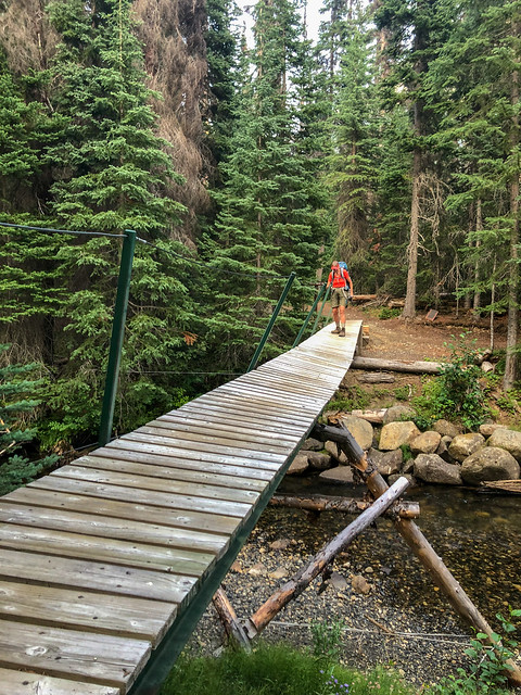
Jean in Manning Provincial Park, British Columbia in Canada
The next morning we continued on the trail that would take us to Manning Park Lodge. We arrived in time for lunch and proceeded to gorge ourselves at the restaurant before returning to our room and taking showers and naps. Back in Stehekin John had let his sister know we were on track to finish on August 14th as planned and he had contacted her earlier that day to verify she was coming up to meet us. She arrived before supper so we were able to replace our filthy backpacking clothes with clean "town clothes". Then it was back to the restaurant for more gorging! I knew I would not be able to keep eating like that for much longer but it was sure fun while it lasted!
August 14th - 4.87 miles, 338 feet gained, 146 feet lost, we slept in Manning Park Lodge.
Trip total - 505.55 miles, 111,597 feet gained, 107,905 feet lost.
All of our Pacific Crest Trail through Washington State photos are on Flickr.
August 14th - 4.87 miles, 338 feet gained, 146 feet lost, we slept in Manning Park Lodge.
Trip total - 505.55 miles, 111,597 feet gained, 107,905 feet lost.
All of our Pacific Crest Trail through Washington State photos are on Flickr.
After we completed this trip we were often asked if we had plans of doing any other sections of the PCT or Appalachian Trail but we said no. While we were glad to have done this we explained had no interest in doing another long hike. But that was several months ago. What I realize is long distance hiking is a bit like pregnancy and childbirth. Right after you go through it you can't imagine ever going through it again but after enough time has passed you forget all the hard stuff and only remember the joy. Well, enough time has passed and we have talked about the possibility of hiking the PCT through Oregon early next summer. However, we also want to go back to Mt Adams and Glacier Peak as well as the PCT north of Rainy Pass to see what we missed because of smoke. What we decide to do next will depend on many things including snow levels and the wildfire situation.
This next bit is just something Jean has been thinking about
Wilderness Lost
As far back as I can remember I have always loved being outdoors. I grew up in a small town in Kentucky and my grandmother, who lived just down the street from us, had a huge yard with a creek running through it. I spent hours playing in her yard and wading in the creek picking up rocks to see what lived underneath. While the Barbie dolls belonging to other little girls my age dressed up to go to parties mine explored jungles and went swimming in the Amazon River of my imagination.

The creek behind my grandmother's house 50 years later
Not far from her yard, a quarter of a mile at most, was a woods bisected by the same creek. One could get there by walking along the road behind her property and then following a dirt path through some tall grass, but I first discovered it by following the creek upstream from my grandmother's yard. My earliest memory of going into “the woods” was the trees and brush were so thick the only way to enter was by continuing to follow the creek and picking your way through the dense vegetation along its edge or wading through the water. Once inside I could imagine I was someplace no one else had ever been before. Unfortunately, I don't have any photos from that time but the one below is the closest I have found to match my memory of it.

Photo by williams19031967
I went there often because it was my refuge from a perplexing world and a troubled household. I felt safe there. Over time, some footpaths began to appear and I undoubtedly helped in their formation by breaking branches and trampling vegetation. It simply made it easier and faster for me to get to where I wanted to be and wading in the creek was not without perils; there were leeches and snakes. However, over time the character of the woods changed. It became more open with an elaborate network of well trodden trails. Our community was growing and I was obviously not the only kid exploring this woods. Unfortunately, as time went on more often than not I would retreat to the woods and encounter other children playing in what had previously been my secret places. But the worst was yet to come. By the time I reached my teen years my precious woods, my haven, was cut down and replaced by roads and nondescript houses. I had lost my personal wilderness and I was devastated.

Image from Google Maps
My need for being in "wild places" was then marginally met by occasional family day trips to Natural Bridge State Park in eastern Kentucky. We would take the short trail that passed notable features along the way such as Balanced Rock ...
Balanced Rock in Natural Bridge State Park, Kentucky - Photo by Easton Bay
... and went through Fat Man's Misery ...
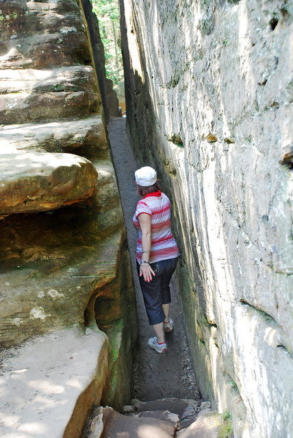
Fat Man's Misery in Natural Bridge State Park, Kentucky - Photo by Roig61
... until we got to the main attraction; Natural Bridge. While I loved walking on these trails these visits were too infrequent, too rushed and too laced with familial strife.

Natural Bridge in Natural Bridge State Park, Kentucky - Photo by Ken Thomas
"Progress" intruded here as well and a chair lift was built which enabled visitors to get to the top of Natural Bridge without having to walk on the trail. I just couldn't understand the point of it but, as my siblings got older and moved away, my family rarely went there anymore so it didn't really matter.

Sky Lift at Natural Bridge State Park, Kentucky - Source of Image
I was a freshman in college when I went on my first backpack trip. My then boyfriend took me on a weekend trip to Red River Gorge in eastern Kentucky and I loved it! Over the next couple of years (and the next couple of boyfriends) I got a few more opportunities to backpack in Red River Gorge.

I also got to backpack once in the Great Smoky Mountains. This was my first experience with sleeping in a shelter complete with a chain link fence and gate. Late in the evening the purpose of the fence became apparent when I saw my first Black Bear in the wild.

Backcountry shelter in Great Smoky Mountains National Park, Tennessee - Photo courtesy of Smoky Mountain Hiking Blog
In the fall of 1977 John and I left Louisville to head for Seattle. We did some backpacking along the way including a short trip in Yellowstone National Park in Wyoming. This was my first experience backpacking in "grizzly country" and I was nervous at first but soon got over it. It was thrilling to be in a place I had only read about and never allowed myself to hope I would ever see in person.

Jean on backpack trip to Shoshone Geyser Basin in Yellowstone National Park, Wyoming
We also did a short trip in the Mission Mountains in Montana. This was my first experience with being above "treeline" and I absolutely loved the expansive views! While I still loved forests and trees I soon realized the mountains were where I was meant to be!


Jean in the Mission Mountains, Montana
Once in Washington State we were kept busy with jobs, a house, Nursing School for me, and later, kids. While John did a few solo trips I did not go backpacking again until we felt our kids were big enough to do some shorter, easier trips.

John, Dan and Tom in Yellowstone National Park, Wyoming
Through the years we did more easy backpacking; with our kids and occasionally with some of their friends. But later on it was just the two of us again and we headed back to the mountains.


Our camp on Emerald Ridge in Mt Rainier National Park, Washington
John retired in late 2009 and then in April 2010, after we sold our house, we hit the road in our motorhome. In the almost nine years since then we have done quite a few backpack trips in the US as well as internationally.
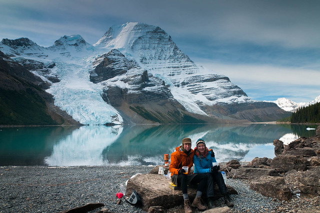
I don't remember when we first talked about backpacking the Pacific Crest Trail (PCT) but it must have been sometime after the book, Beyond Backpacking: Ray Jardine's Guide to Lightweight Backpacking, came out in 1999. This book helped launch the lightweight backpacking movement that enabled more backpackers to complete the 2,650 mile long trail in one season and we were intrigued. We learned that in order to complete the PCT in one season we would need to be capable of averaging at least 25 miles per day. However, I had been having a lot of knee pain due to arthritis so I had trouble visualizing myself maintaining that pace over the sometimes very challenging terrain day after day for months on end. John may have been capable of it but he was disinclined to do it alone.
John and Jean in Mt Robson Provincial Park, British Columbia
I don't remember when we first talked about backpacking the Pacific Crest Trail (PCT) but it must have been sometime after the book, Beyond Backpacking: Ray Jardine's Guide to Lightweight Backpacking, came out in 1999. This book helped launch the lightweight backpacking movement that enabled more backpackers to complete the 2,650 mile long trail in one season and we were intrigued. We learned that in order to complete the PCT in one season we would need to be capable of averaging at least 25 miles per day. However, I had been having a lot of knee pain due to arthritis so I had trouble visualizing myself maintaining that pace over the sometimes very challenging terrain day after day for months on end. John may have been capable of it but he was disinclined to do it alone.

Source of Image backpacker.com
However, as a "consolation prize" we decided to do the best of the PCT, the 211 mile long John Muir Trail (JMT) through the Sierra Nevada.
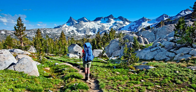
Jean on the John Muir Trail in Ansel Adams Wilderness, California
It was a great trip and remains at the top of our list of "Favorite Backpacking, Tramping and Trekking Trips".
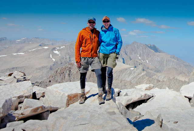
Later on we began to talk about the possibility of doing all five "sections" of the PCT within Washington State. We knew we could complete it with a series of shorter backpack trips but there was just something about doing all 504 miles in one continuous trip that appealed to both of us. However, it would be the biggest thing we had ever done, over twice as far as the JMT, and we would be 64 and 65 years old, over twice the age of the majority of backpackers we could encounter. But we decided to give it a go and if you read the trip report above you know we were successful.
Later on we began to talk about the possibility of doing all five "sections" of the PCT within Washington State. We knew we could complete it with a series of shorter backpack trips but there was just something about doing all 504 miles in one continuous trip that appealed to both of us. However, it would be the biggest thing we had ever done, over twice as far as the JMT, and we would be 64 and 65 years old, over twice the age of the majority of backpackers we could encounter. But we decided to give it a go and if you read the trip report above you know we were successful.
Jean and John at the northern terminus of the PCT
When we began the PCT through Washington we knew it would not be a "wilderness experience" as there has been a marked increase in the total number of people who are hiking on the PCT in recent years. In PCT nomenclature a "Thru Hiker" is one who intends to complete the entire trail in one season and a "Section Hiker" is one who is doing anything less than that.

A big advantage of our being section hikers was we could plan to be in Washington State before the vast majority of north bound thru hikers (AKA "NoBos") got there. This "bubble" of hikers is known as the "herd" (or the "hoard" depending on your attitude toward them). 50 permits are issued each day for those starting the PCT at the Mexico border and during "peak season" they are all taken.

Source of Image - pcta.org
And there has been a corresponding increase in those who are actually completing it.


Source of Image - pcta.org
A big advantage of our being section hikers was we could plan to be in Washington State before the vast majority of north bound thru hikers (AKA "NoBos") got there. This "bubble" of hikers is known as the "herd" (or the "hoard" depending on your attitude toward them). 50 permits are issued each day for those starting the PCT at the Mexico border and during "peak season" they are all taken.

Source of Image - pcta.org
So what has caused so many more people to head into the PCT in recent years? It doesn't appear to be the result of the groundbreaking book, Beyond Backpacking: Ray Jardine's Guide to Lightweight Hiking. It was surprising for us to learn that some of the ultralight backpackers on the PCT are completely unaware of Ray Jardine and his contribution to their current obsession. He and his wife Jenny first hiked the entire PCT in 1987 and his information now sounds dated and quaint. While they often cooked pots of cornmeal mush for their breakfast, modern day thru hikers may not even carry a stove. Where Ray and Jenny did about 25 miles per day thru hikers commonly cover 30, 35, 40 or more miles each and every day. Ray advocated taking regular breaks resting with one's feet propped up against a tree but many thru hikers may only stop once during the day in order to eat a quick lunch. Otherwise they move non stop throughout the day in order to make the required miles for the day.


Ray and Jenny Jardine on South Sister within Three Sisters Wilderness in Oregon in 1993
Granted, there are now many online resources available to help hopeful thru hikers plan a journey on the PCT such as PCTA.org, Postholer.com, Craig's PCT Planner, Halfmile's PCT maps. And apps such as Halfmile's iPhone app and Guthook's Pacific Crest Trail app provide easy and accurate ways to track their progress and plan upcoming days.

And for quite some time now I have been aware of the negative impact of "Social Media" has had on our "wild" places. Whereas, in pre-internet days gorgeous images were relegated to personal photo albums, books and calendars but now, photographs of our natural wonders are regularly posted on Facebook, Pintrist, Tumblr etc etc etc and shared countless times every day with innumerable people all over the world. This has caused some previously little known locations to achieve international "rock star" status. Places like Havasu Falls ...
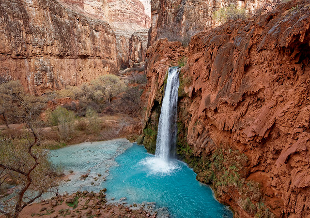
Havasu Falls within the Havasupai Indian Reservation, Arizona
... and the "Wave" are now on the "bucket lists" of people all over the world. But the PCT lacks that one iconic image so I don't know if Social Media can be given much of the blame for the increased popularity of the PCT.
The "Wave" within North Coyote Buttes, Arizona
One thing thought to be a big cause of this dramatic uptick of people attempting to hike the PCT is the 2012 book written by Cheryl Strayed, "Wild: From lost to found on the Pacific Crest Trail". Back in 1995 the author, who was not an experienced backpacker, decided on a whim to hike a portion of the PCT, 1,100 miles. In a nutshell, after being devastated by the death of her mother she allowed her grief to destroy her marriage (to a fellow who seemed like a really nice guy) and consoled herself with sex and drugs. As the story, goes she then found personal redemption on the PCT and this has apparently inspired others.

In 2014 it was made into a movie, "Wild", staring Reese Witherspoon. I read the book and tried to watch the movie but I have to admit I was really put off by her lack of preparation and her reliance on dumb luck and the kindness of strangers. I shared other's concerns that this would only encourage more inexperienced and ill-prepared backpackers to also attempt something way beyond their abilities and knowledge. And in fact, I have read that since "Wild" came out there has been an increase in the number of search and rescue operations needed along the PCT.

The term, the “Wild Effect”, has been used to describe the dramatic increase in hikers on the PCT. The Pacific Crest Trail Association has even embraced "Wild" as a marketing campaign called "Responsibly Wild" which is trying to educate the multitude of inexperienced backpackers to be good stewards of our precious backcountry by practicing "Leave No Trace" principals.


But there has to be something other than that driving people to hike the PCT. The vast majority of thru hikers we saw were typically under 30, very lean, solo and male. They all seem quite well prepared and extremely capable so I seriously doubted any of these guys had been inspired by Cheryl Strayed's bumbling journey. However, undoubtedly the "herd" would contain a larger proportion of ill prepared hikers but they would be the hikers most likely to be slowed (or stopped) by adverse conditions such as snow in the Sierra. And they would most likely be traveling at a slower pace so they were nowhere near Washington State when we were there. Ironically, Cheryl Strayed never intended to do the entire trail. She bypassed the Sierra completely because of snow and didn't even step foot into Washington State so she has never even seen the best parts of the PCT. I know she has her following but I just can't see her as a credible spokesperson for the PCT.
So if the "Wild Effect" is not completely responsible, what else has happened to cause such an intense increase in the number of people willing to endure the hardships of such a journey? Perhaps it is due to a phenomenon we have observed elsewhere, the dramatic increase in the level of physical fitness many individuals are achieving. What is taking place in Grand Canyon is a good example. In the recent years traversing the canyon from one rim to the other, AKA "Rim-to-rim" or simply "R2R" has found its way to many people's bucket list.
It is most commonly done on the "corridor trails"; North Kaibab, Bright Angel or South Kaibab Trails. In the past the most common way to do that was as a multi-day backpack trip. But permits are limited and in high demand so can be very challenging to obtain. However, more and more people are now choosing to do the 21 -23.5 mile long trip (depending which south rim trail is used) as a day trip. The Park Service is adamant that hikers should not attempt to get down to the river and back to the rim in just one day. I understand why they must take this position but we have chosen to ignore this advice on multiple occasions. We did "R2R" going down the North Kaibab Trail and up the Bright Angel Trail in one day back in 2011. We were in our late 50's at the time and reasonably fit. It was challenging and it took all day but we had no difficulty ...
It is most commonly done on the "corridor trails"; North Kaibab, Bright Angel or South Kaibab Trails. In the past the most common way to do that was as a multi-day backpack trip. But permits are limited and in high demand so can be very challenging to obtain. However, more and more people are now choosing to do the 21 -23.5 mile long trip (depending which south rim trail is used) as a day trip. The Park Service is adamant that hikers should not attempt to get down to the river and back to the rim in just one day. I understand why they must take this position but we have chosen to ignore this advice on multiple occasions. We did "R2R" going down the North Kaibab Trail and up the Bright Angel Trail in one day back in 2011. We were in our late 50's at the time and reasonably fit. It was challenging and it took all day but we had no difficulty ...
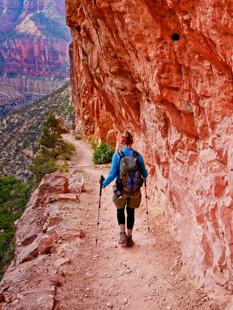
Jean on the North Kaibab Trail in Grand Canyon National Park, Arizona
... with one exception; trail runners, many trail runners. It was a Sunday in mid May and the first weekend the North Rim was open. We had slept in our car just outside of the park and got to the North Kaibab Trailhead at 5:30 AM. We immediately encountered a parade of passenger vans driving up and disgorging dozens of scantily clad trail runners. We were to learn that trail running R2R had become a "thing" and individuals and members of running groups were flocking to Grand Canyon. Fortunately, the majority of runners soon passed us and we could then hike in peace without the frequent calls of "excuse me", "coming through", "on your left" etc, etc. However, later that day we were bombarded by their counterparts who had started at the South Rim and were now insisting we step aside to let them pass. However, as they were now going uphill they were slower and were delaying us even more than the downhill runners had.

Trail runners in Grand Canyon National Park, Arizona - photo by Rick McCharles
Unfortunately, trail runners come with a "city park" mentality and are unaware of such things as "Leave no Trace" and the Park Service is now engaged in a constant battle with trail runners who are disinclined to pack out their own trash. The composting toilets along the way were not constructed to handle the shear number of people now waiting in long lines to use them. And apparently, some trail runners are refusing to even take the time wait in line for a toilet. Nor are they going way off the trail to answer their "calls of nature". Instead, they are leaving their excrement beside the trail or even right on it.
And they are no longer content with one crossing, one "R2R". Many are opting to turn around and head back the way they came or "R2R2R". For some, even this is not enough and are literally running laps in the canyon. This obsession has reduced this magnificent canyon to a piece of gym equipment. Their activity has turned these backcountry trails into busy, litter strewn thoroughfares where hikers and backpackers must constantly be on the alert to avoid being bumped or knocked down by a preoccupied runner trying to beat their "personal best". In my mind, it would be better if someone just created an elaborate program for a specialized treadmill with virtual reality goggles to enable runners to get their R2R "fix" without negatively impacting those who still want to enjoy the experience of being within the canyon in peace and quiet.
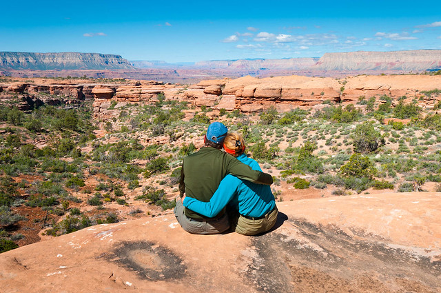
John and Jean on the Esplanade along the Thunder River Trail in Grand Canyon National Park, Arizona
But when it comes to the PCT there must be more to it than just people being more physically fit. It is one thing to take a day to run back and forth across Grand Canyon. It is quite another to devote months to hike from Mexico to Canada. Typically the PCT thru hikers we talked to were either just out of college or between jobs (not to mention being between relationships) This makes sense as it would be challenging for someone with a job and family to be in a position to take that much time away from their responsibilities.
And none seemed to have much in the way of plans for their future. To us, as parents of two 30 something men, they seemed directionless in terms of their lives. But, on the trail they were very focused with a definite goal in mind. They began each and every day knowing exactly what they needed to do and they ended their days with a sense of accomplishment and concrete evidence of their achievement. This is definitely something John and I can understand as we have experienced it ourselves. There is an addictive simplicity to backpacking. Once you do all the pre-trip planning; organizing your food, packing your gear etc, all that is left is the Zen-like activity of simply putting one foot in front of the other.
And none seemed to have much in the way of plans for their future. To us, as parents of two 30 something men, they seemed directionless in terms of their lives. But, on the trail they were very focused with a definite goal in mind. They began each and every day knowing exactly what they needed to do and they ended their days with a sense of accomplishment and concrete evidence of their achievement. This is definitely something John and I can understand as we have experienced it ourselves. There is an addictive simplicity to backpacking. Once you do all the pre-trip planning; organizing your food, packing your gear etc, all that is left is the Zen-like activity of simply putting one foot in front of the other.
Jean on the PCT through Goat Rocks Wilderness in Washington State
While it can sometimes be daunting to look ahead and see how much further you still need to go there is an intense feeling of accomplishment and personal satisfaction that comes from stopping and looking back at where you were earlier in the day, earlier in the week, even earlier in the month.
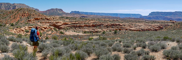
I was also reminded of something Clay Christensen, an academic and business consultant, has described in his book, How will you measure your life?, as well as in this 20 minute video. He talks about the human pursuit of achievement and our inclination to aggregate things in order to measure our success. He says this need to add things up is because humans have "limited minds". He states that we instinctively and unconsciously allocate our time and energy to "whatever activities in our life that gives us the most immediate evidence of achievement". He goes on to say that quite often it is our career that provides us with that sense of achievement whereas investments in family don't pay off for a very long time. If that is true then perhaps these young individuals, as they don't have "careers", may be trying to meet this human need by thru hiking the PCT. This activity does provide them with all sorts of data that can be aggregated and where "success" can be measured such as how low their base pack weight is or how many miles did they cover in one day.
And while most thru hikers seem to be hiking solo this does not mean they are alone and without a community. What we observed was thru hikers place less importance on scenic campsites and they are much more comfortable with group camping situations (whereas we always prefer solitude and are willing to walk farther to find it). Their time in camp could provide them with their prime opportunities to see how they compare to others. Other opportunities come during the day when they sign-in to the many logbooks located at prominent trailheads along the entire length of the PCT. There are also extensive online communities, such as the "PCT Class of 2018" Facebook Group, that enable like minded individuals to connect with each other and share their stories and compare their data.

Jean on the Thunder River Trail in Grand Canyon National Park, Arizona
I was also reminded of something Clay Christensen, an academic and business consultant, has described in his book, How will you measure your life?, as well as in this 20 minute video. He talks about the human pursuit of achievement and our inclination to aggregate things in order to measure our success. He says this need to add things up is because humans have "limited minds". He states that we instinctively and unconsciously allocate our time and energy to "whatever activities in our life that gives us the most immediate evidence of achievement". He goes on to say that quite often it is our career that provides us with that sense of achievement whereas investments in family don't pay off for a very long time. If that is true then perhaps these young individuals, as they don't have "careers", may be trying to meet this human need by thru hiking the PCT. This activity does provide them with all sorts of data that can be aggregated and where "success" can be measured such as how low their base pack weight is or how many miles did they cover in one day.
And while most thru hikers seem to be hiking solo this does not mean they are alone and without a community. What we observed was thru hikers place less importance on scenic campsites and they are much more comfortable with group camping situations (whereas we always prefer solitude and are willing to walk farther to find it). Their time in camp could provide them with their prime opportunities to see how they compare to others. Other opportunities come during the day when they sign-in to the many logbooks located at prominent trailheads along the entire length of the PCT. There are also extensive online communities, such as the "PCT Class of 2018" Facebook Group, that enable like minded individuals to connect with each other and share their stories and compare their data.

So, I have spent way too much time trying to understand why there are so many more people going into the backcountry. But what I now realize is it doesn't really matter why because it still adds up to the same thing; the loss of solitude and a true "wilderness experience" for us. Granted, this is not a new phenomenon. After all, people have been flocking to the Appalachian Trail (AT) for many years. To help minimize the impact on the environment by so many people about 250 stone shelters have been constructed along the AT. However, these are now quickly filled and the multitude of remaining backpackers must set up their tents on any patch of level ground they can find.

Backpackers camping near Cold Spring Shelter on the Appalachian Trail in North Carolina - Source of Image
While it was slower in coming the unfortunate reality is the PCT is now also being "loved to death". Here is what the Pacific Crest Trail Association has to say about it.
"Concentrations of hikers starting at the Mexican border in spring have significantly increased and impacts to fragile desert resources are a concern... Real, negative impacts are noted". Highlighting two:
- Improper disposal of human waste is a problem on the PCT
- Social campfires in Southern California, where wildland brushfires start easily and spread all too close to homes
We have witnessed examples of this behavior. In the past when I would duck behind a rock or tree to answer a "call of nature" I occasionally encountered a single wad of used toilet paper. I would use a baggie to pick it up and then pack it out. Unfortunately, as the years have passed, I have been encountering much more TP as well as piles of unburied human waste. It has become too much. I don't like leaving the paper behind but on a long backpack trip I am reluctant to carry the additional weight and bulk of all of the used TP I am now seeing.

We have read accounts where a single mismanaged campfire can quickly evolve into a wildfire of catastrophic proportions and we have witnessed first hand the carelessness of some who go into the backcountry. Many years ago John and I were on a day hike to Lake Ingalls, a lovely area within Washington's Alpine Lakes Wilderness. We were doing it as a loop and late in the day we were heading out toward Longs Pass. As we hiked we began smelling smoke and when we reached a large, vacant horse camp the smell became quite intense so we stopped to investigate. What we found was the remains of a campfire that had been built in the duff under an evergreen tree and had not been completely extinguished. By the time we found it, the smoldering embers extended to an area at least ten feet in diameter. Only luck had prevented it but bursting into flame and spreading quickly. We used large chunks of bark as shovels to try to clear a perimeter and a Mylar "space bag" to haul water from a nearby creek. We spent a couple of hours working nonstop to ensure it was completely out before hiking the rest of the way out in darkness. I shutter to imagine what would of happened had we not been there.

Jean dousing an unattended fire near Lake Ingalls in the Alpine Lakes Wilderness Area in Washington State
Our summer travel plans have not always been impacted by wildfires. In 2011, when we did the John Muir Trail, we lucked out. It had been a high snow year in California so fires were not an issue. There was an abundance of mosquito and biting flies that summer but that was a very small price to pay to be able to see distant peaks and breathe the air.
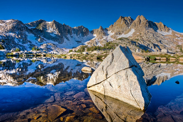
Chief Lake along the John Muir Trail in the John Muir Wilderness, California
However, in 2012 fires in Montana, Wyoming and Colorado plagued our travels.
View from "Photographer's Point" in Wind River Range within Bridger National Forest, Wyoming
Through careful trip planning (and luck) summer wildfires did not impact our travels again until 2016 when we visited Crater Lake National Park. We hoped to see what we had seen in 2010; clear blue skies reflected in the crystal clear water.
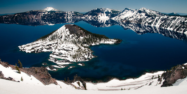
What we saw this time was quite different due to smoke from the Bybee Fire burning west of the lake.
Crater Lake National Park, Oregon in 2010
What we saw this time was quite different due to smoke from the Bybee Fire burning west of the lake.
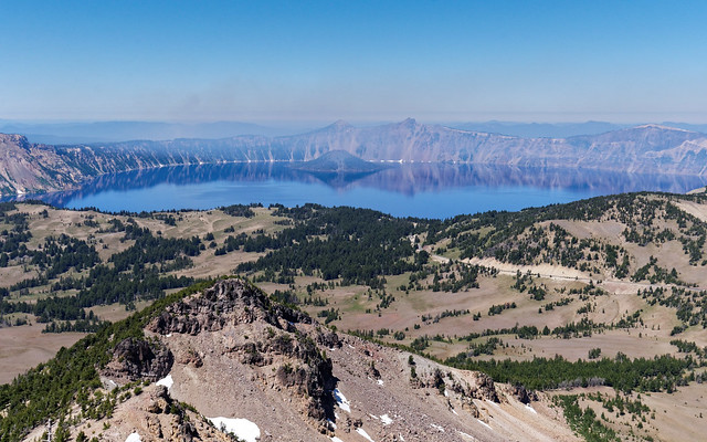
Crater Lake National Park, Oregon
2017 was high snow year in Washington State which would normally mean it would also be a low fire year. However, an early heat wave and record breaking high temperatures combined with an uncommon arid summer led to an abundance of dry vegetation which provided fodder for numerous wildfires in the western US and Canada. It was a challenge for us to find anywhere in the state to go backpacking and our trip to Goat Rocks Wilderness last summer was quite a disappointment. Smoke made breathing difficult as we gained elevation. When we got above treeline, rather than seeing Mt St Helens, Mt Adams and Mt Rainier in the distance, all we could see was a dense haze. When we started our PCT hike through Washington this past summer I so hoped Goat Rocks would be smoke free ...
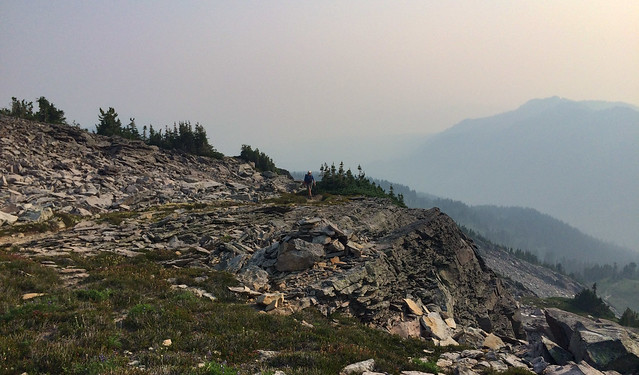
John on the PCT in Goat Rocks Wilderness, Washington in 2017
... and it was! But sadly, north bound PCT hikers behind us were not so lucky. We later learned the section of PCT south of White Pass through Goats Rocks was closed due to the Miriam fire.
Mt Rainier seen from the PCT in Goat Rocks Wilderness, Washington
While on the PCT this past summer we also passed through the devastation caused by last year's Norse Peak fire.


Source of Image
While I had read about this fire nothing could have prepared me for the experience of spending so many hours walking through it. It was like being in a graveyard and deathly quiet. There was no birdsong or the sounds of wind rustling through leaves, only the occasional creaking of the skeletal remains of a once majestic forest.
Jean on the PCT through Norse Peak Wilderness in Washington State
Hiking the PCT north from Highway 20 this past summer was bittersweet. On one hand, I was happy that the trail was open and we could complete our goal of hiking the PCT from Oregon to Canada in one continuous trip. But on the other, it was completely demoralizing to look out and see thick haze obscuring what I knew were stunningly beautiful mountains. Something we did not know at the time was that this section of trail was closed again shortly after we completed it.
Jean on the PCT in the Pasayten Wilderness, Washington State
Unfortunately, wildfires are becoming more commonplace in the western US and Canada. But rather than this being a "new normal" I have read this may in fact be a "stepping stone" to a future we hate to imagine. This realization is devastating to me. But John and I are heading toward the end of our lives and we know we have been incredibly fortunate in all of the opportunities we have had to go into the backcountry. If, for whatever reason, we never go into the backcountry again we now have enough photographs and memories to last us for the rest of our lives.
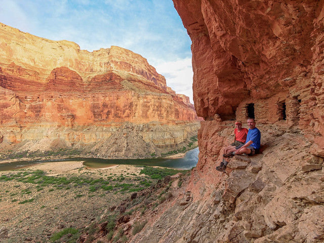
But what about younger people? What does their future in the backcountry look like? Take for example our son, Dan. He used to live in the Vancouver/Portland area and loves the Columbia River Gorge. In the past he spent many hours hiking the extensive network of extraordinarily scenic trails. He has been living in Pittsburgh since early 2012 but he will soon be relocating. He could now live anywhere in the US but he wants to get back to Vancouver, Washington because of the gorge.
Jean and John at the Nankoweap Granary in Grand Canyon National Park, Arizona
But what about younger people? What does their future in the backcountry look like? Take for example our son, Dan. He used to live in the Vancouver/Portland area and loves the Columbia River Gorge. In the past he spent many hours hiking the extensive network of extraordinarily scenic trails. He has been living in Pittsburgh since early 2012 but he will soon be relocating. He could now live anywhere in the US but he wants to get back to Vancouver, Washington because of the gorge.
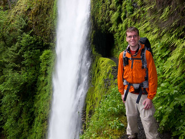
Dan and Tunnel Falls along the Eagle Creek Trail in Columbia River Gorge, Oregon
We knew this has been his plan so it was difficult to tell him last fall about the devastation caused by the Eagle Creek Fire. This destructive blaze was started by a teenage boy setting off fireworks in the canyon during a burn ban. A year later, 135 miles of trails in the area are still closed, some with no timeline for reopening.


But we are not ready to hang up our hiking boots just yet. We are still maintaining a "bucket list" including some international destinations such as Tasmania ...

Cradle Mountain seen from the Overland Track in Tasmania - Source of photo
... and Iceland. Granted, these popular destinations will be crowded but we accept that some destinations are worth it.

Kirkjufellsfoss waterfall, Iceland - Source of photo
During our PCT hike we decided we definitely want to go back and do trips around Mt Adams and Glacier Peak. We also want to return to Cutthroat Pass and the Pasayten Wilderness when the air is clear so we can see what we missed. We would also love to revisit "The Enchantments" within the Alpine Lakes Wilderness Area but that will depend on our ability to obtain a coveted permit.
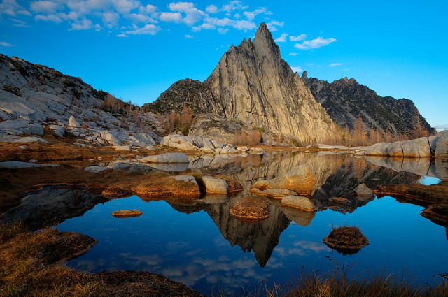
Prusik Peak and Gnome Tarn within "The Enchantments" in Alpine Lakes Wilderness, Washington State
While we will always prefer solitude we can still choose to visit overly popular areas but we can avoid some of the crowds by going at less popular times of year.
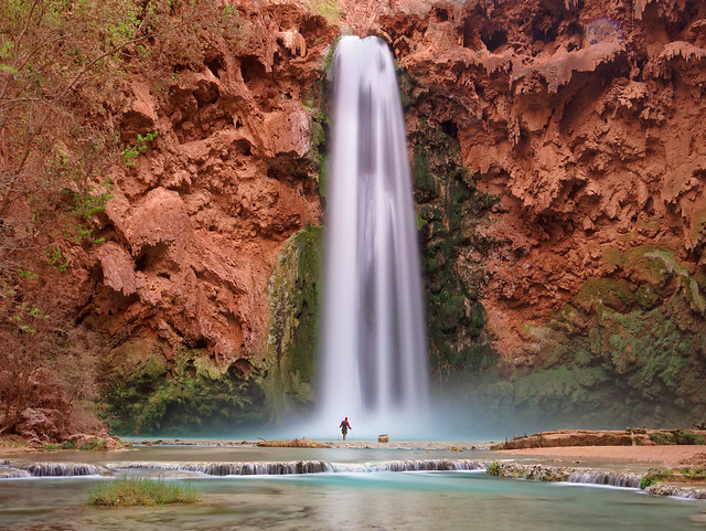
Jean and Mooney Falls within the Havasupai Indian Reservation in Arizona
We can also still hike on popular trails as a part of a larger trip but we can arrange to be there at less busy times of the day.
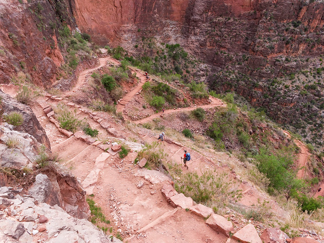
Jean on the Bright Angel Trail in Grand Canyon National Park, Arizona
Most importantly, we can still find the solitude we so crave by simply being willing to venture further off "the beaten path".

Jean on the Tuckup Route Grand Canyon National Park, Arizona
After all, we know it is still possible to hike on an official named trail/route in Grand Canyon National Park and not see another soul for days at a time. Not to mention the many remote unofficial routes we have yet to explore!

Jean in Tuckup Canyon within Grand Canyon National Park, Arizona
Yes, many things have changed since our first backpack trips back in the 70's. Global Climate Change is continuing unchecked, there has been irreparable damage done to our environment and governmental protections for our wild places have been weakened under the current administration. But fortunately there is still some peace and quiet, some solitude, some wilderness left for those who are willing to do what is necessary to find it.
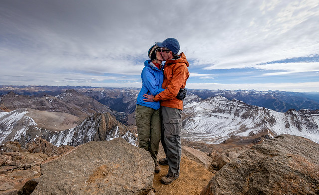
Jean and John on the top of Mount Sneffels (14,150 ft) in the Mount Sneffels Wilderness, Colorado


