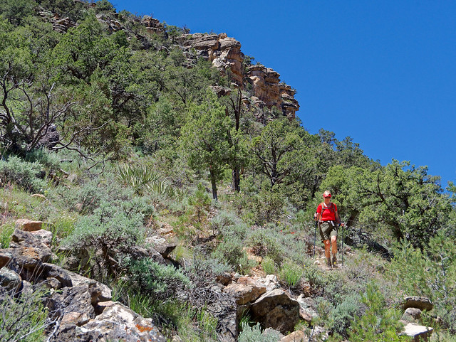
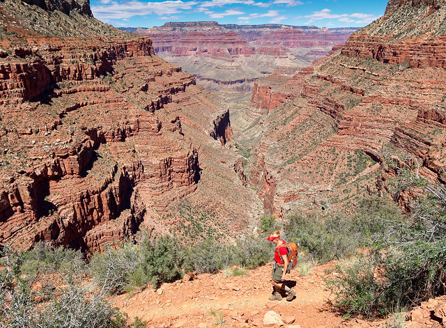
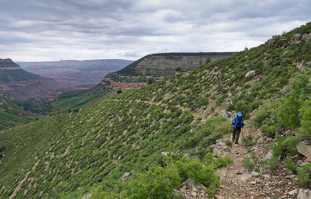
Last summer definitely was not a typical one for us. For a variety of reasons we didn't do any backpacking. We did a lot of day hiking which is great. Your pack is small and light, you can hike faster plus you get to take a shower at the end of the day. However, it just isn't the same as that feeling of self reliance and independence one has when backpacking. Day hiking usually can't provide the same level solitude that is possible when backpacking. There aren't the same opportunities to watch the light show as the sun goes down and the stars come out. And nothing can compare to that feeling of expectation when you first wake up in the early dawn in the backcountry. So after hoisting a fully loaded pack for the first time in over 18 months and stepping onto the trail at the beginning of our first backpack trip this spring all I could think was "Now this is more like it!"
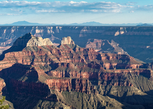
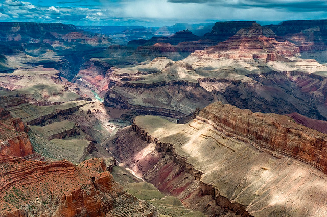
Where we have been - Grand Canyon National Park, Arizona
4/28 - 5/29 2017
In this post:
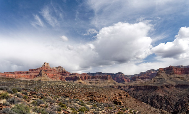
Grand Canyon National Park - South Rim
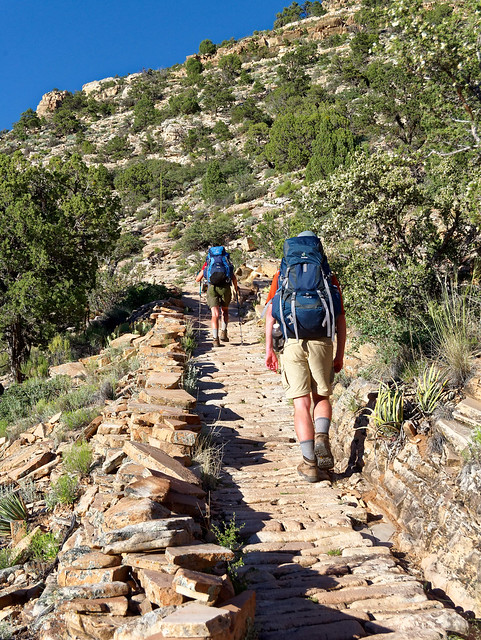
- Day hikes on the New Hance, Waldron, Grandview, South Kaibab, Tonto and Bright Angel Trails
- Backpack trip - 4 days/3 nights on the Hermit Trail to Hermit Rapids and Monument Creek
- Backpack trip - 6 days/5 nights on the North Bass Trail
- Day hikes on the Uncle Jim, Ken Patrick, Widforss and Point Imperial Trails
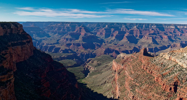
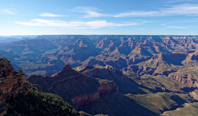
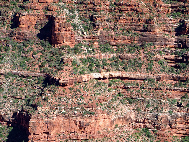
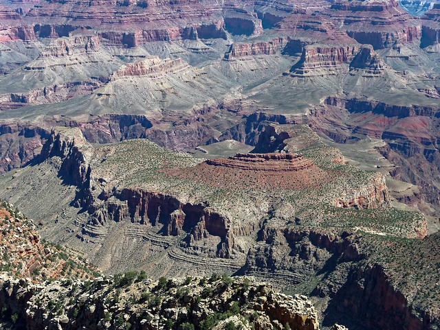
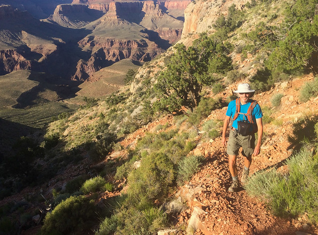
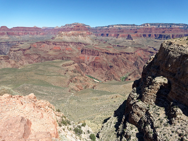
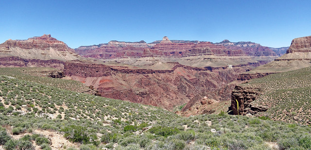
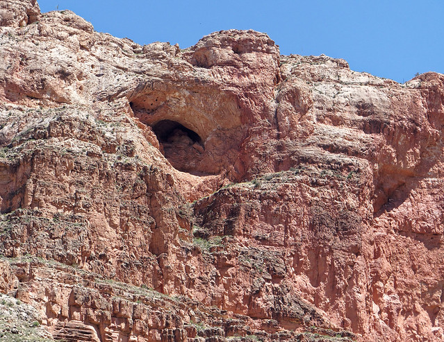
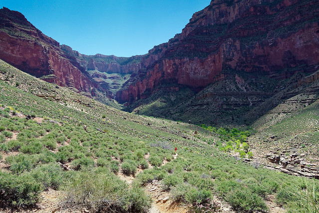
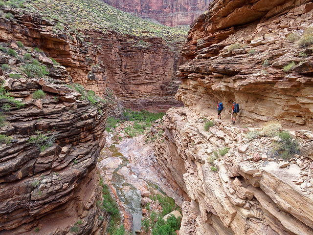
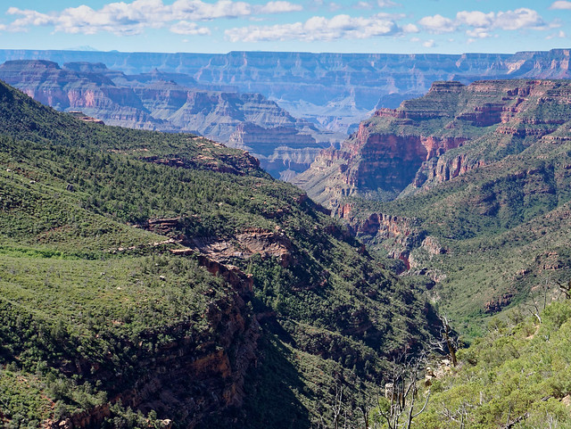
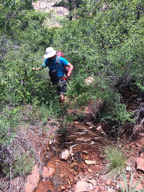
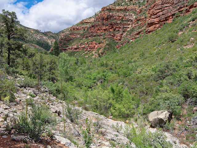
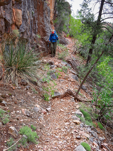
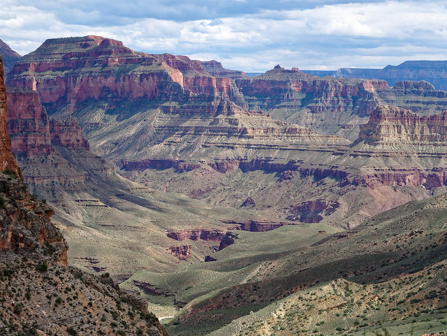
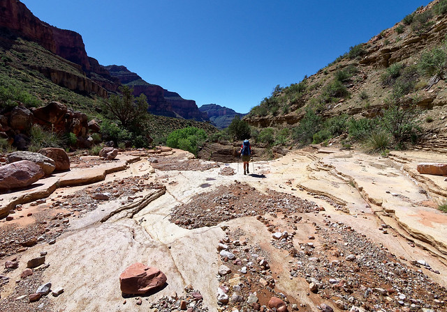
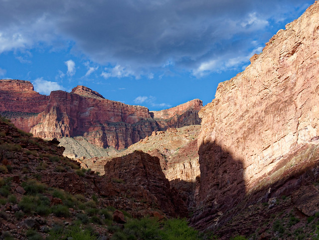
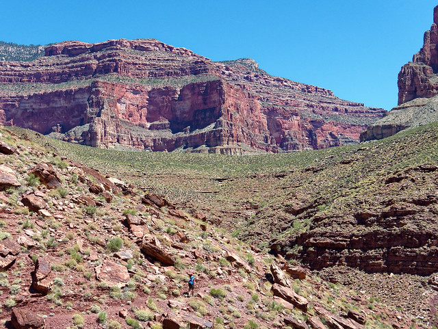
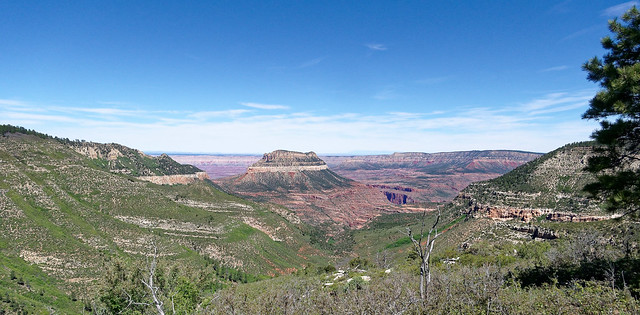
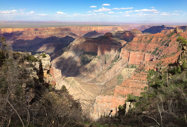
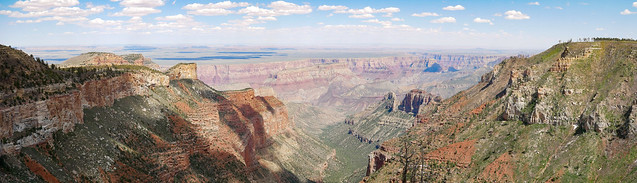
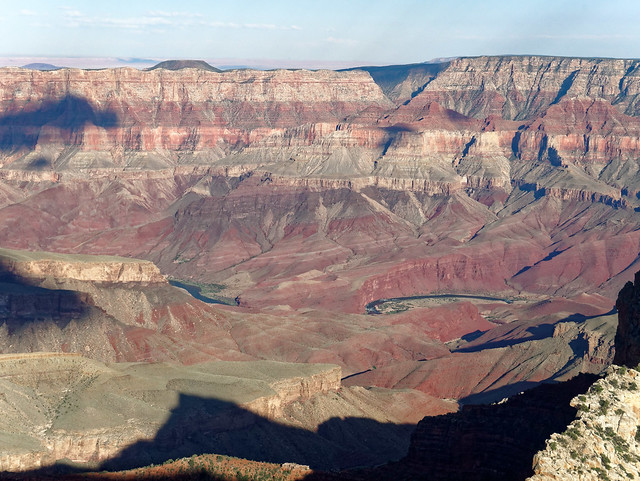
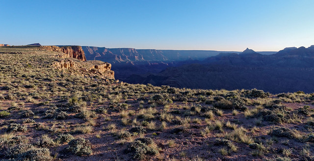
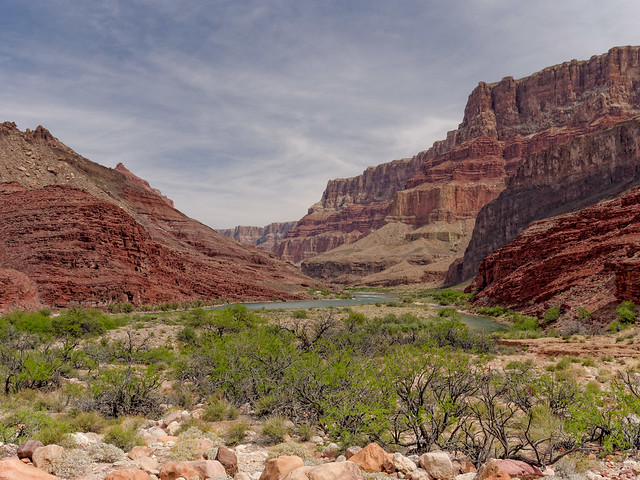
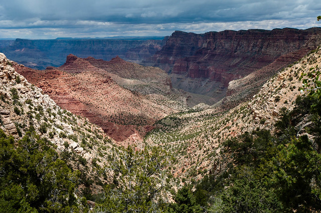
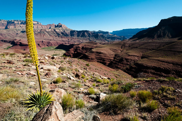
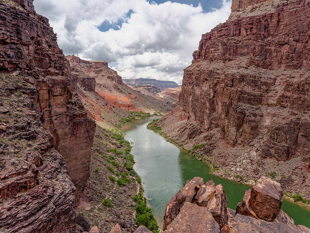
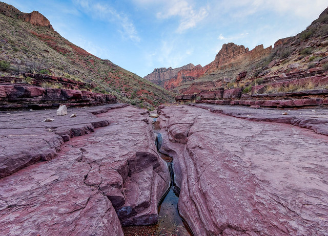
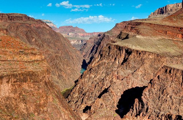
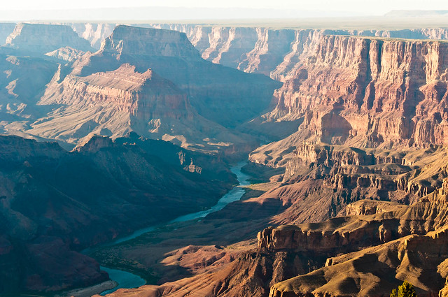
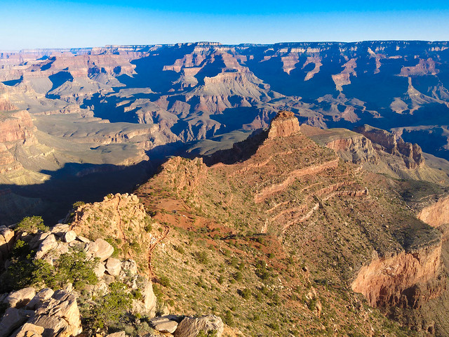
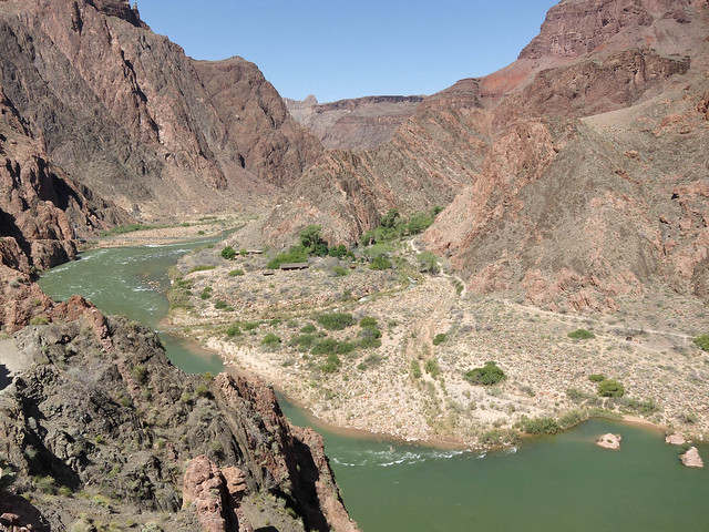
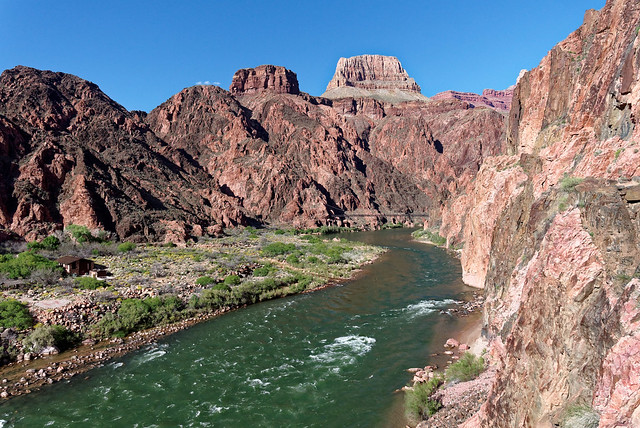
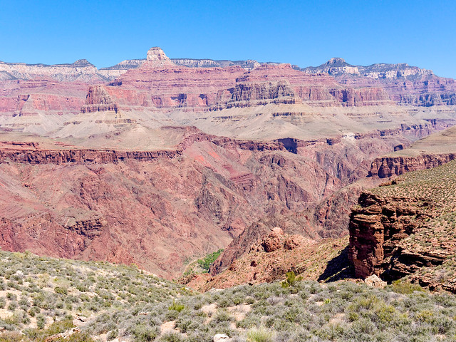
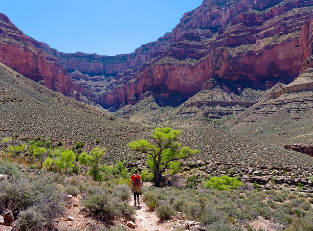
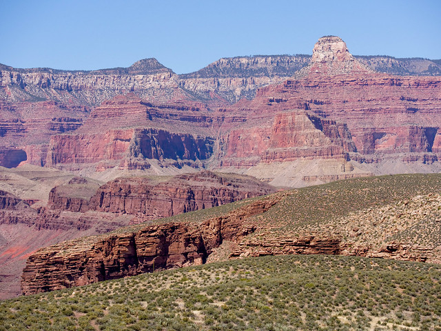
The first we did was a short one. Our goal was just to "work out the kinks" from our respective travel; Dan on a plane from Pittsburgh, John and I driving our motorhome. Our preference is to avoid crowds which is not easy at Grand Canyon so we hiked down the New Hance Trail a few miles. John and I have hiked up this trail but this was the first time we have started it from the rim. The trail initially takes you through some woods but once you reach the rim the views are immediate and outstanding.
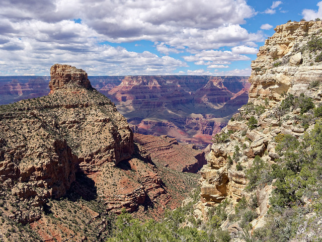
Seen from the New Hance Trail in Grand Canyon National Park, Arizona
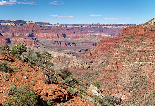
The following day John and Dan did a short "photo" hike on the Rim Trail. They had views of places we would be in subsequent days including looking down Indian Garden Creek and out to Plateau Point ...
Seen from the Rim Trail in Grand Canyon National Park, Arizona
... as well as Cedar Ridge and O'Neill Butte adjacent to the South Kaibab Trail.
Seen from the Rim Trail in Grand Canyon National Park, Arizona
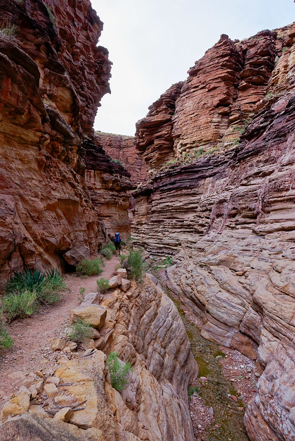
The next day hike we began a hike on the Waldron Trail. Getting to this remote trailhead was an adventure in itself. John and I had been there before so we knew the way however, this time we encountered a "Road Closed" sign. We could have driven around it but we prefer to be in "good standing" with the Park Service so we avoid breaking any rules. We then drove to the Backcountry Office where a ranger told John to just go ahead and drive around the sign. John asked for some written proof that we had permission but he declined. If questioned we at least we had this ranger's name even if he didn't want us to use it. Once at the trailhead we headed out on the wooded trail. It eventually breaks out of the trees and begins to lose elevation ...
Seen from the Waldron Trail in Grand Canyon National Park, Arizona
... dropping into the Hermit Basin ...
Seen from the Waldron Trail in Grand Canyon National Park, Arizona
... providing expansive views.

Seen from the Waldron Trail in Grand Canyon National Park, Arizona
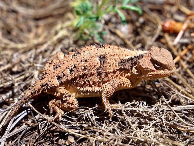
Along the way we saw possibly the most brilliantly colored lizard we have ever seen. He (or she) seemed quite content to be admired by us.
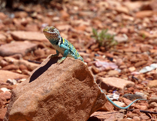
Seen from the Waldron Trail in Grand Canyon National Park, Arizona
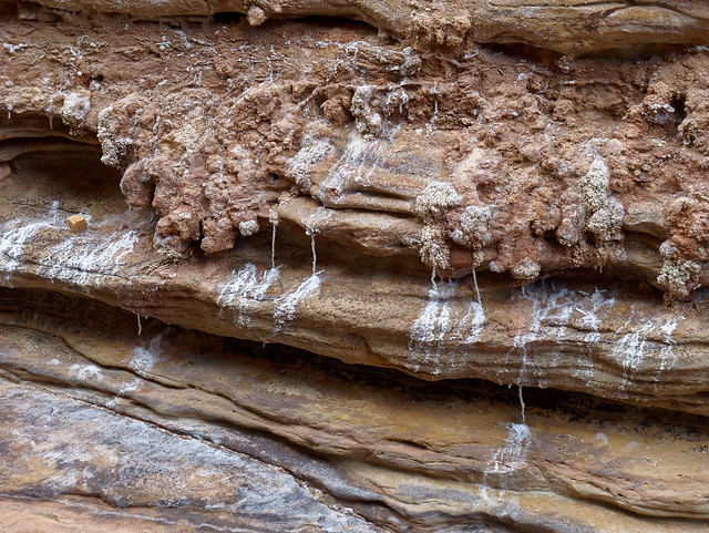
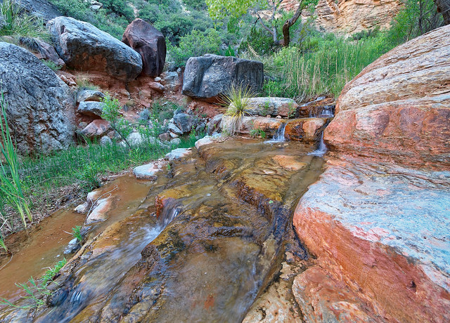
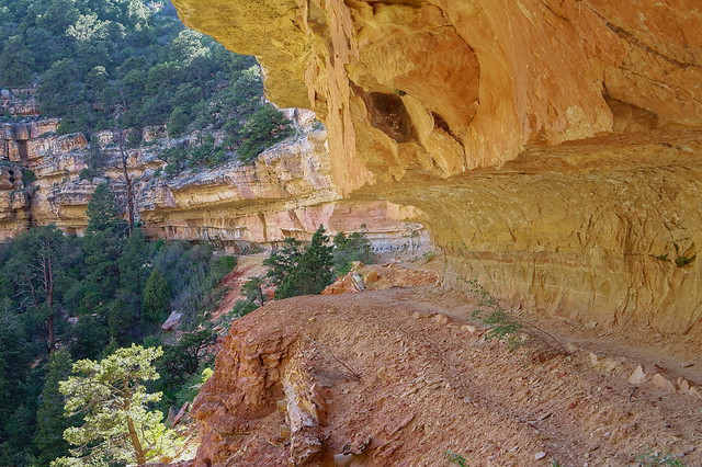
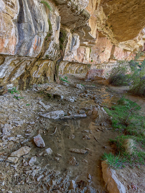
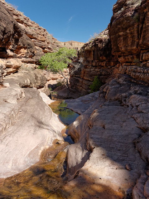
After a short hop on the Hermit Trail we headed to Dripping Springs and were happy to have this popular destination to ourselves. We spent quite some time there enjoying the cool shade.
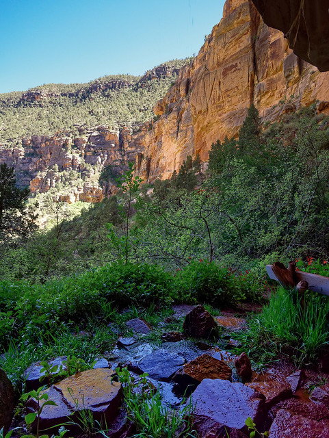
Dripping Springs in Grand Canyon National Park, Arizona
We then hiked out on the Boucher Trail and enjoyed the views across Hermit Canyon.
Seen from the Boucher Trail in Grand Canyon National Park, Arizona
Including seeing the Hermit Trail and the Santa Maria Springs Rest House (center of photo below).
Seen from the Boucher Trail in Grand Canyon National Park, Arizona
We had intended to hike all the way to below Yuma Point for views across the Tonto Platform and over to the North Rim.
Seen from the Boucher Trail in Grand Canyon National Park, Arizona
However, between our delayed start and the long break we took at Dripping Springs we had squandered too much time. We are no strangers to hiking out after dark but we chose not to this time.
Seen from the Boucher Trail in Grand Canyon National Park, Arizona
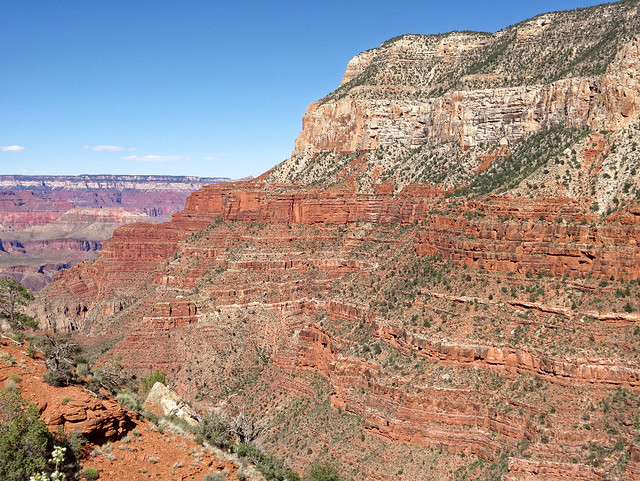
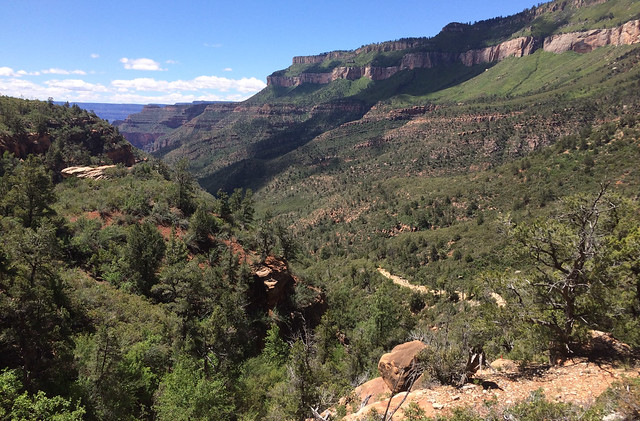
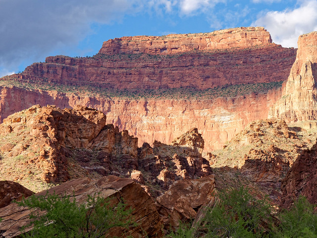
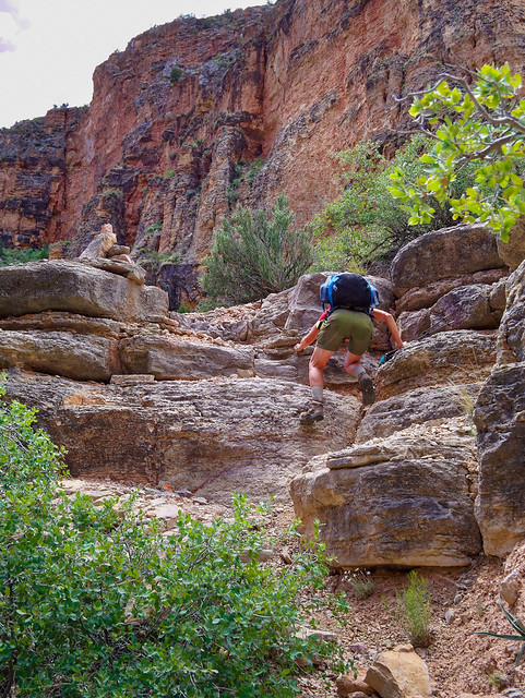
Two days later we hiked down the Grandview Trail ...
Seen from the Grandview Trail in Grand Canyon National Park, Arizona
... to Horseshoe Mesa.
Seen from the Grand View Trail in Grand Canyon National Park, Arizona
Once down to the neck of the mesa we headed toward the side trail that would take us down to Cottonwood Creek. Previously we had only hiked up this side trail and my memory was that after I had done it I announced I never wanted to hike down it. However, I have to say it was nowhere near as bad as I imagined it would be. There were far more switchbacks than I remembered.
Seen while hiking toward Cottonwood Creek in Grand Canyon National Park, Arizona
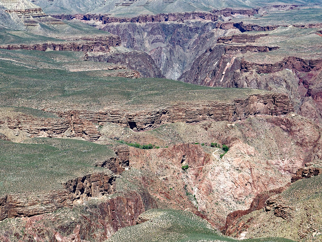
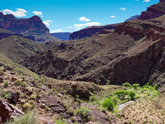
Once down in Cottonwood Creek Canyon the trail moderates. This is a popular destination for backpackers and we have camped there before.
Seen while hiking to Cottonwood Creek in Grand Canyon National Park, Arizona
After passing through the camping area we continued down Cottonwood Creek ...
Seen while hiking down Cottonwood Creek in Grand Canyon National Park, Arizona
... where the canyon deepens ...
Seen while hiking in Cottonwood Creek in Grand Canyon National Park, Arizona
... and becomes more narrow. It is definitely well worth taking the time to explore some.
Seen while hiking in Cottonwood Creek in Grand Canyon National Park, Arizona
However, we had miles to go so we forced ourselves to turn around and headed back up canyon to the junction with the Tonto Trail.
Seen while hiking in Cottonwood Creek in Grand Canyon National Park, Arizona
We then took the Tonto east and hiked around the base of the western arm of Horseshoe Mesa.
Seen from the Tonto Trail in Grand Canyon National Park, Arizona
We then hiked up to the top on a trail up the east side of the west arm. Of the three trails to the top of Horseshoe Mesa this is considered to be the easiest as it has far more switchbacks than the trails from Page Spring or from Cottonwood Creek.
Hiking up to Horseshoe Mesa in Grand Canyon National Park, Arizona
There are great views to be had from the end of either arm of Horseshoe Mesa.
However, as we had spent so much time in Cottonwood Creek we couldn't spend much time on the mesa as we wanted to get out at a reasonable hour. In fact the above photo was taken on a previous trip. As it was we still had to use headlamps while hiking back up a portion of Grandview.
Seen from Horseshoe Mesa in Grand Canyon National Park, Arizona
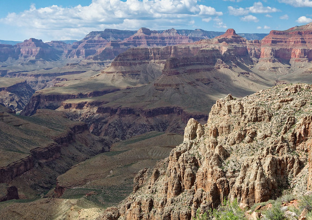
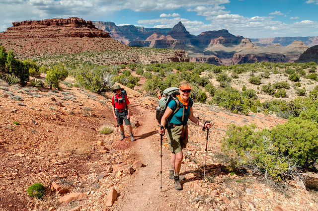
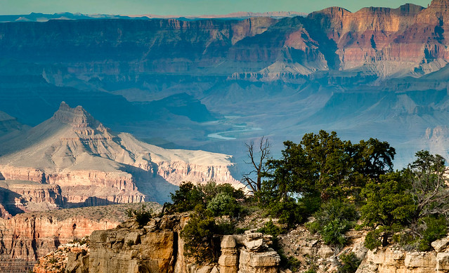
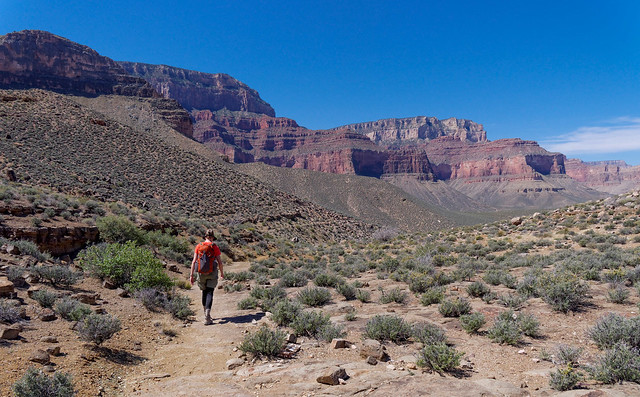
The last conditioning day hike we planned to do was going down South Kaibab and up the Bright Angel Trail. While we have done this iconic trail many times this was Dan's first hike down it. But we always enjoy the classic view of Cedar Ridge and O'Neill Butte.
Seen from the South Kaibab Trail in Grand Canyon National Park, Arizona
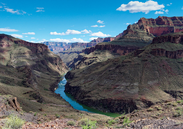
Further down we could see the Tonto Platform below ...
Seen from the South Kaibab Trail in Grand Canyon National Park, Arizona
... as well over to Indian Garden Creek Canyon and Plateau Point. If you look closely you can even see a bit of the Bright Angel Trail.
Seen from the South Kaibab Trail in Grand Canyon National Park, Arizona
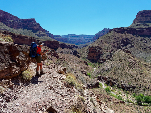
It was going to be quite hot that day, over 100 degrees at Phantom Ranch. We had already decided to avoid the crowds and not go all the way to river. John and I have been there and Dan wasn't interested. Instead we planned to hike the Tonto Trail across to Indian Garden and do the short hike out to Plateau Point. So it would not be quite as hot, perhaps only in the 90's. Part way down South Kaibab we encountered two Rangers who were quizzing every hiker about their plans. The one we spoke with seemed quite concerned about our plan to hike on the Tonto. She said that it was not a trail like South Kaibab, she called it "sketchy" and "hard to follow". While it is true the Tonto is not a "super highway" like South Kaibab but we knew from experience this segment is anything but "sketchy" and "hard to follow".
Seen from the Tonto Trail in Grand Canyon National Park, Arizona
We tried to reassure her by telling her we have done every trail south of the river (including all of the Tonto) as well as much north of the river. I recounted the only time we have ever lost the Tonto was leaving Garnet Canyon (at the Tonto's western terminus) in the dark. The Tonto is truly "sketchy" out there so we stopped and made camp. However, the next morning we discovered we had camped literally right next to it. So I guess technically we have never really lost the Tonto. I thought this ranger was actually making a mistake by telling hikers this was a "sketchy" trail as it might lead less experienced hikers to seek out other portions of the Tonto, or other less defined trails and routes that are truly "sketchy" thinking they would all be this easy.
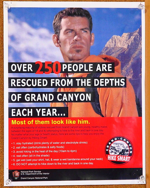
Despite all we said she was not convinced and asked "but have you done it when it was this hot?" Yes, I said. But she still seemed reluctant to let us go and I was approaching getting a bit annoyed with her. But I reminded myself that she doesn't know us and what we are capable of. And I have to acknowledge we don't look all that impressive especially when compared to the "hiker" pictured in my favorite "You're Gonna Die!" poster.
I continued to try to reassure her; we had plenty of water and salty snacks as well as electrolyte capsules so she finally let us go. We immediately enjoyed the solitude after the intensity of the South Kaibab.
Seen from the Tonto Trail in Grand Canyon National Park, Arizona
One view we got was of Phantom Ranch. While it looked peaceful to us we knew what a zoo it could be.
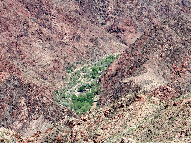
Phantom Ranch seen from the Tonto Trail in Grand Canyon National Park, Arizona
We planned to take a break at Pipe Spring and knew we were getting close when we saw a few trees. We were able to refill our water bottles, douse our shirts, our heads as well as bandannas to wear around our necks. It really helps.
Seen from the Tonto Trail in Grand Canyon National Park, Arizona
We did fine despite the heat so we were more than able to completely enjoy everything we saw.
Seen from the Tonto Trail in Grand Canyon National Park, Arizona
We also planned to take a long break at Indian Garden and knew we were getting close when we saw more trees.
Seen from the Tonto Trail in Grand Canyon National Park, Arizona
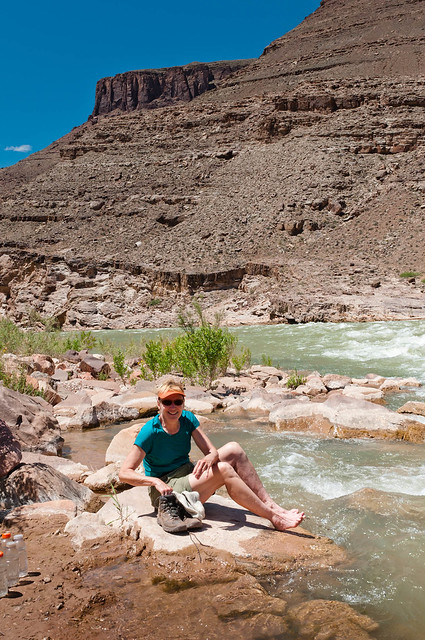
There are two thermometers at Indian Garden; one in the sun and one in the shade. Most people like to photograph the one in the sun. While it looks much more impressive it is also inaccurate. On that day it read well over 100 degrees. However, the one in the shade registered a mere 96 degrees. After a break (with more dousing) we did the short hike out to Plateau Point for great views down to the river ...
Seen from Plateau Point in Grand Canyon National Park, Arizona
... and up to the rim.
Seen from Plateau Point in Grand Canyon National Park, Arizona
Granted we didn't get as much elevation gain (and loss) on any of our day hikes as we would have had we gone to the river ...
Dan at Plateau Point in Grand Canyon National Park, Arizona
... but it was adequate and we all felt fit enough for our backpack trip.
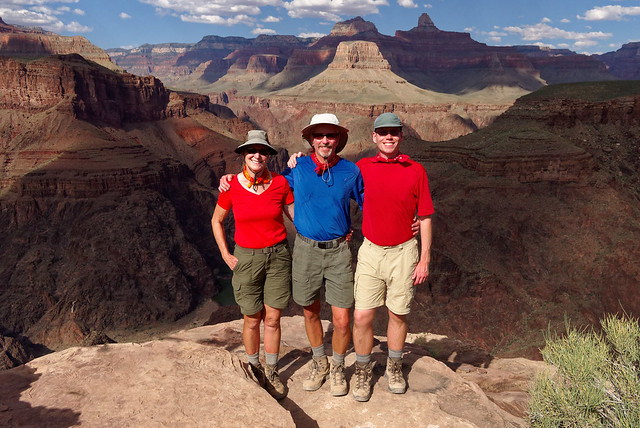
Jean, John and Dan at Plateau Point in Grand Canyon National Park, Arizona
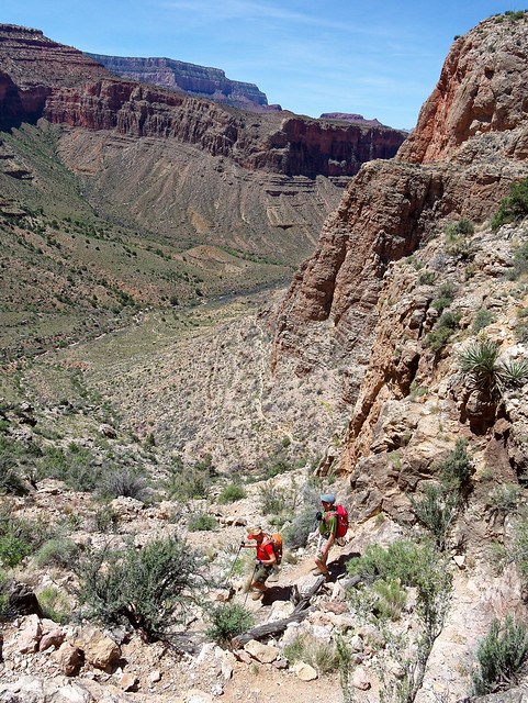
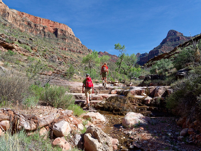
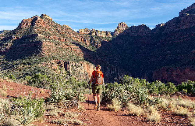
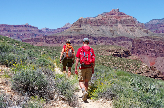
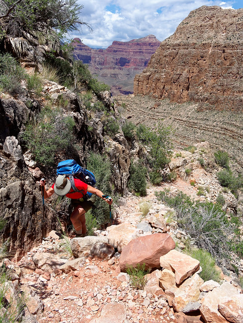
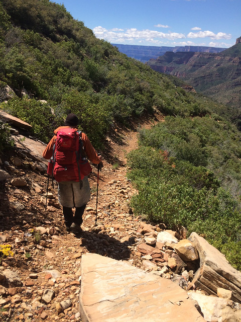
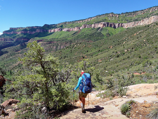
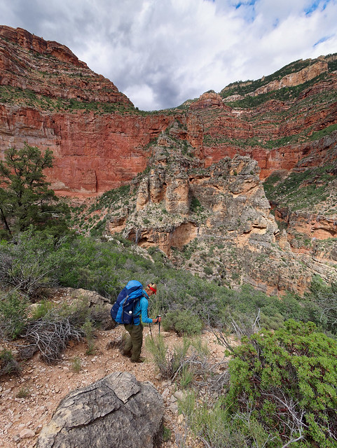
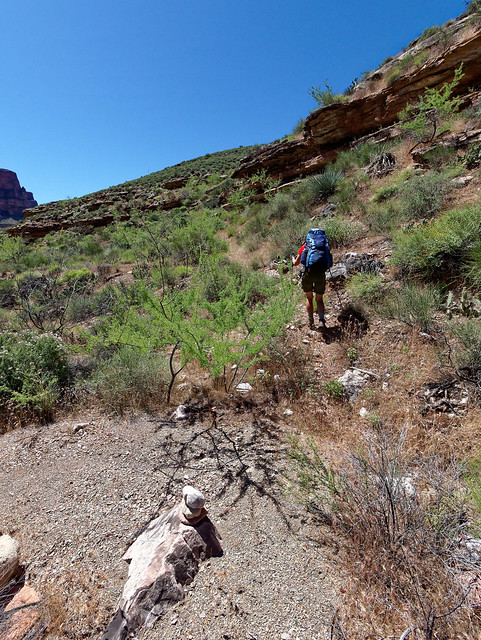
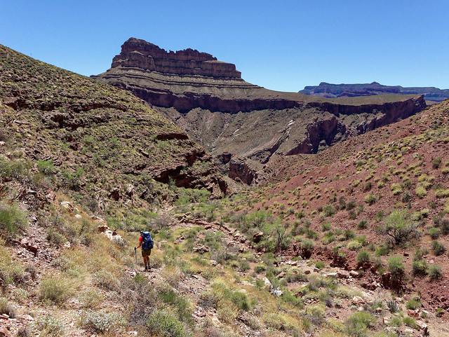
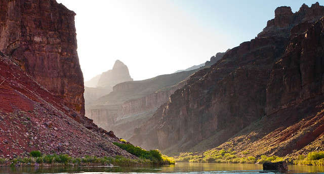
Dan has backpacked in Grand Canyon before having done Tanner/Escalante/Grandview with us in 2011. However, we decided to do something more relaxing this time. We would be out 4 days/3 nights first hiking down the Hermit Trail to camp by Hermit Rapids. The following day we would take the Tonto Trail over to Monument Creek where we would camp for two nights before hiking out on the Hermit. Interestingly we had previously received a letter from the Park Service expressing concern about our "aggressive" itinerary.
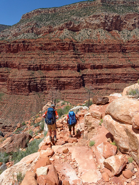
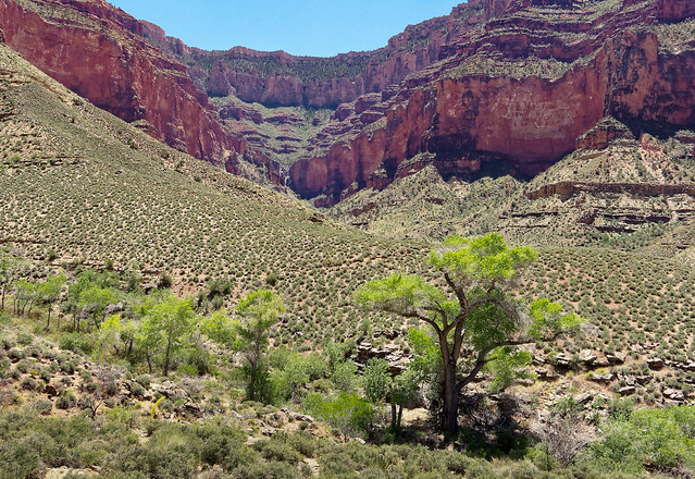
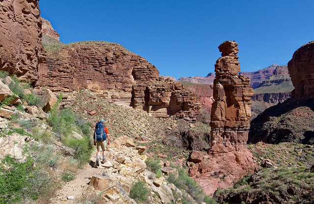
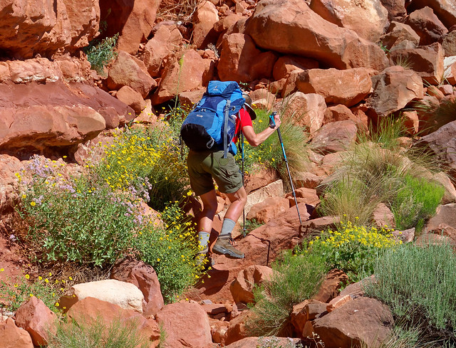
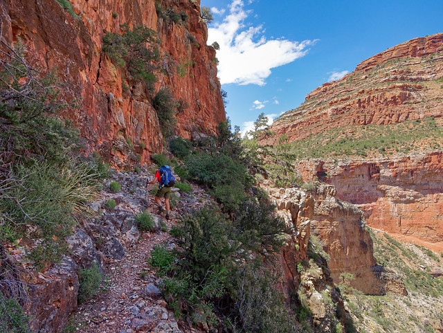
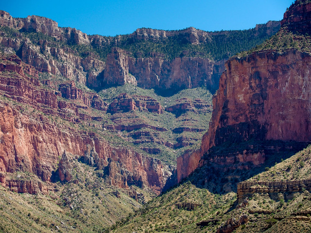
Seen from the Hermit Trail in Grand Canyon National Park, Arizona
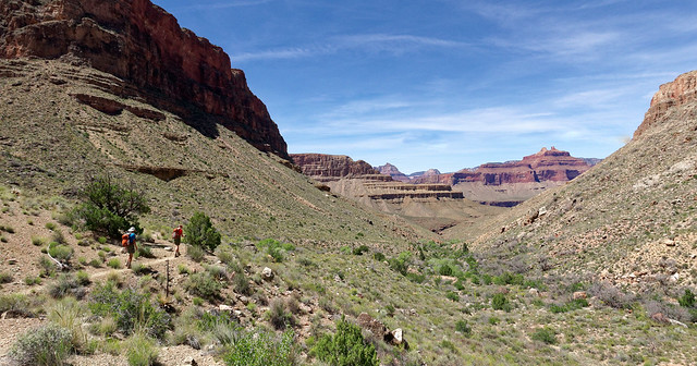
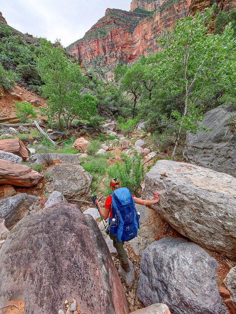
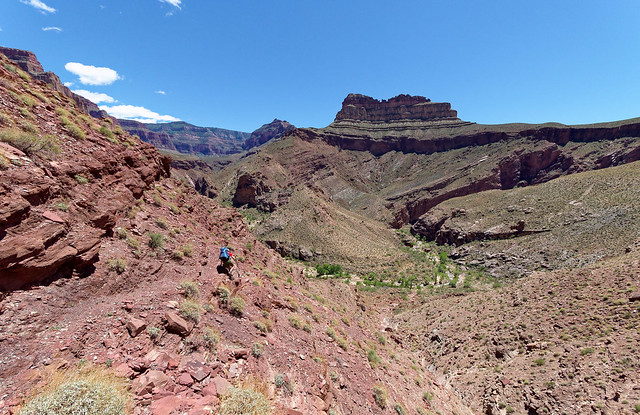
We had a great hike that first day ...
Seen from the Hermit Trail in Grand Canyon National Park, Arizona
... and enjoyed the expansive views we got as the trail descended.
Seen from the Hermit Trail in Grand Canyon National Park, Arizona
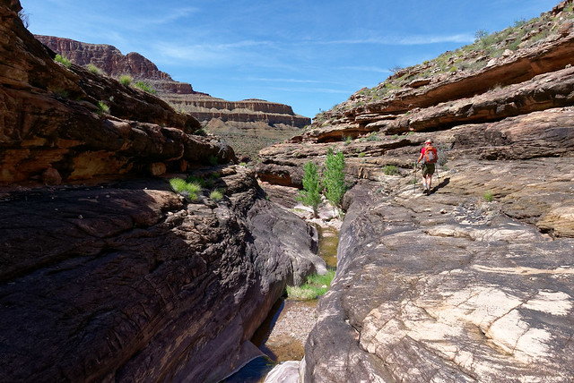
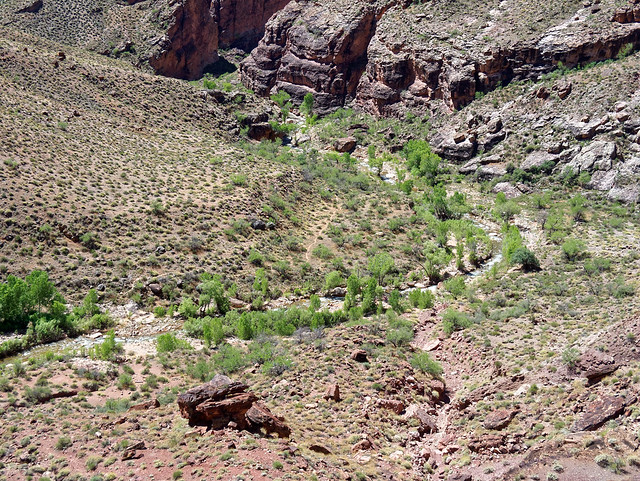
We bypassed Hermit Camp and took the side trail into Hermit Creek Canyon as we were headed to the rapids.
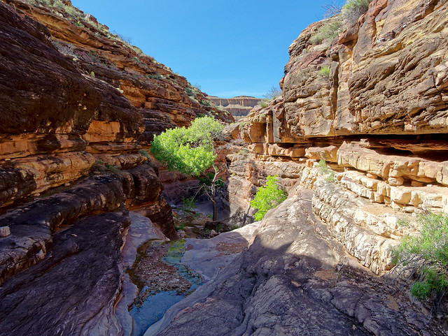
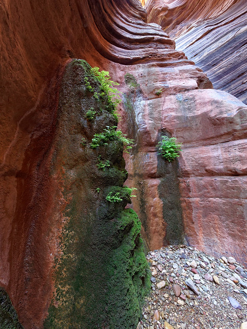
Hermit Creek Canyon in Grand Canyon National Park, Arizona
Hermit Creek Canyon is one of our favorite places in Grand Canyon ...
Hermit Creek Canyon in Grand Canyon National Park, Arizona
... due to the lovely delicate salt crystal sculptures.
Hermit Creek Canyon in Grand Canyon National Park, Arizona
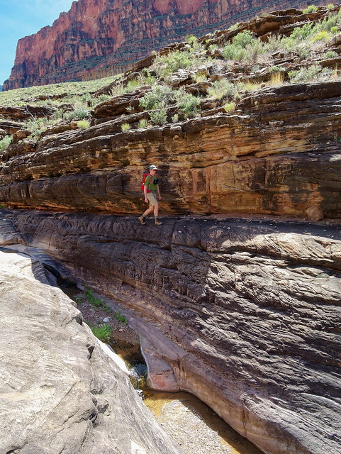
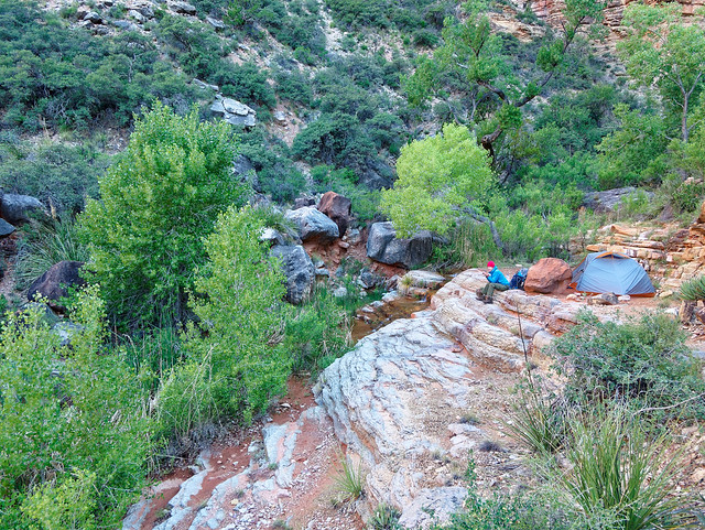
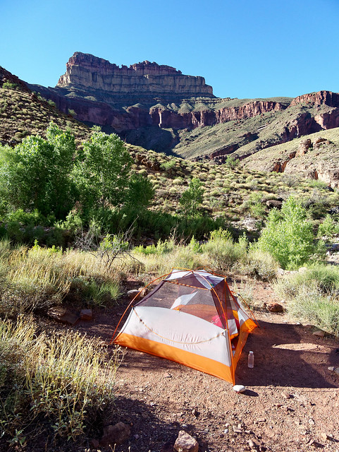
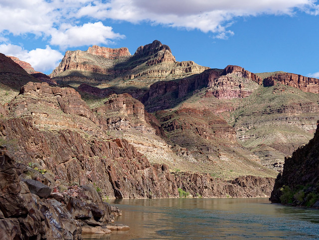
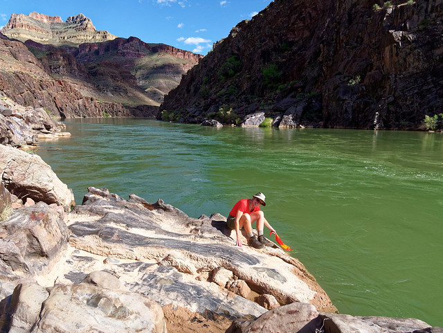
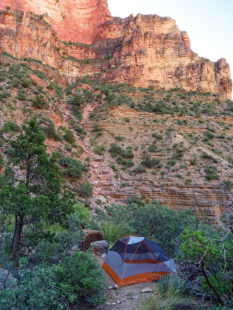
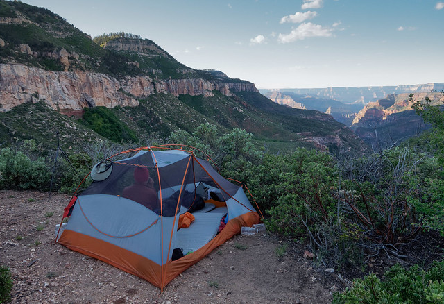
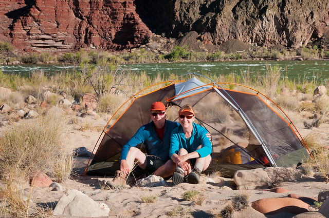
There are at least two well developed campsites next to Hermit Creek shortly before the river and John and I have used one before. However, we prefer another site located downstream a bit and up next to the rocks. There was plenty of room for both tents as well as a spacious "kitchen". We had been told by another backpacker it had been quite windy along the river the evening before but the air was calm so we were unconcerned. However, we did put the flys on both tents. The wind did pick up during the night and we all received a light dusting of sand that snuck under the edge of the tent flys.
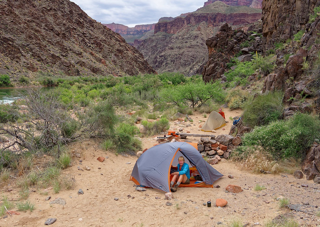
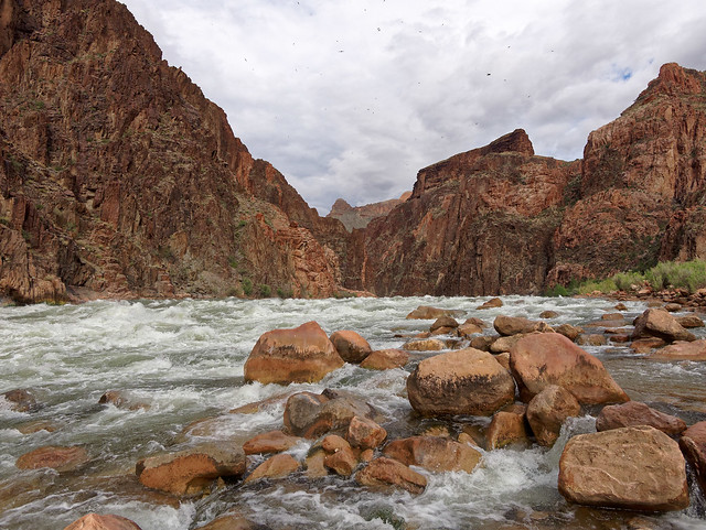
At Hermit Rapids in Grand Canyon National Park, Arizona
The next day was cloudy and windy. There was a chance of rain in the forecast but we had experienced what is known as "Arizona Rain", meaning it falls but it mostly evaporates before it reaches very far into the canyon.
Hermit Rapids in Grand Canyon National Park, Arizona
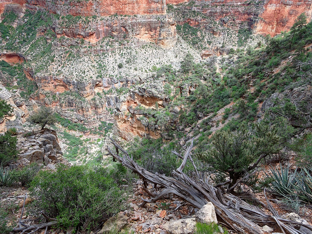
We began our hike up Hermit Canyon and when it did start to rain we were initially unconcerned.
Hermit Creek Canyon in Grand Canyon National Park, Arizona
However, it rained harder and lasted longer than we had ever experienced in the canyon. It wasn't "Arizona Rain", it was "Pacific Northwest Rain" which we were all too familiar with but not really prepared for. We hurried toward the ledge we has hiked under on our way to the river the day before and hunkered down to wait it out. We ended up spending several hours there. None of us really had enough clothes to be comfortably warm while still being a bit wet. An indication at how demoralized we were is the fact that none of us thought to take any photos. The photo below was taken the day before but it is the same spot. After eating our morning snack and then our lunch I got out the stove and heated water for hot lemonade. It did wonders for our spirits. Unfortunately, something I didn't think about was making hot water bottles. It wasn't until right before we left that I added some hot water to knock the chill off of my drinking water. John got a hold of my now comfortably warm water bottle and quickly stuffed it in his parka.
Hermit Creek Canyon in Grand Canyon National Park, Arizona
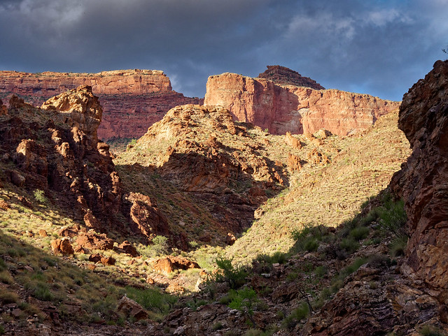
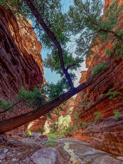
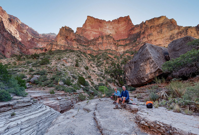
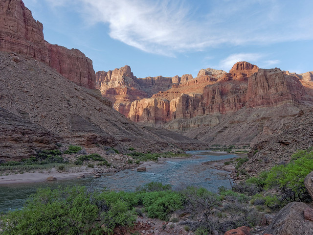
Finally the rain stopped and we headed the rest of the way out of Hermit Canyon to the Tonto Trail. We only had four easy miles to go so our long break did not cause any concern. And there was plenty of time to photograph the beautiful clouds.
Seen from the Tonto Trail in Grand Canyon National Park, Arizona
Such low clouds below the rim was something we had never seen during any of our previous trips in Grand Canyon.
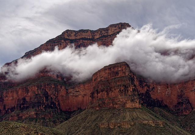
Seen from the Tonto Trail in Grand Canyon National Park, Arizona
The sight of them more than made up for getting so wet and cold earlier.
Seen from the Tonto Trail in Grand Canyon National Park, Arizona
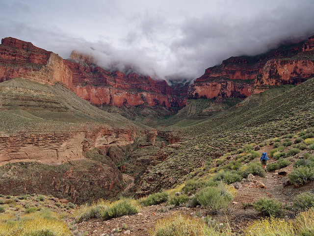
Later on the sun came out and we could finally shed our parkas. As we approached our destination we passed the side trail for Granite Rapids and when the Monument came into view we knew we were very close to where we would camp.
Seen from the Tonto Trail in Grand Canyon National Park, Arizona
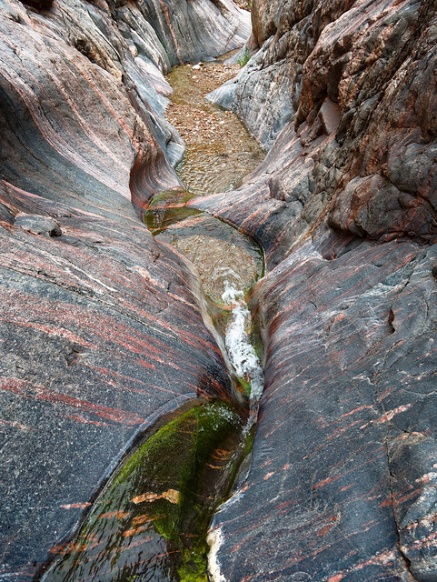
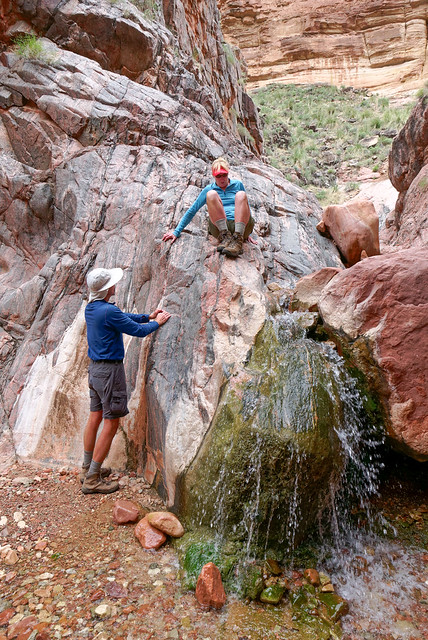
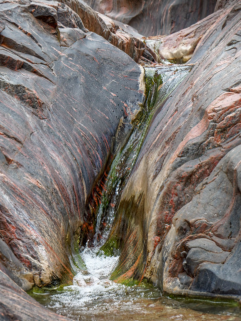
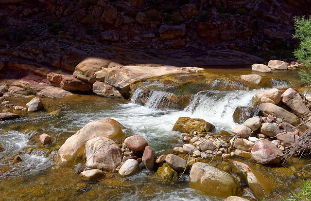
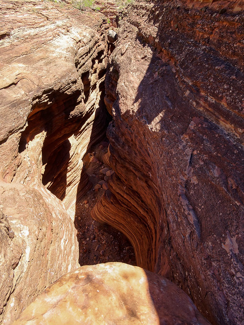
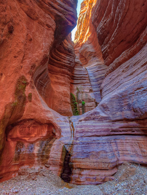
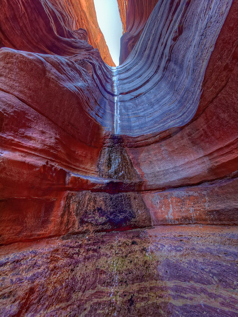
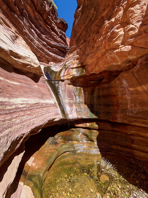
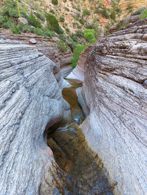
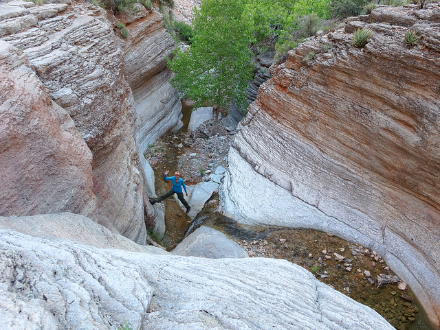
The next day we did a little exploring down Monument Creek. Something that does not seem to be common knowledge is that Monument Creek flows through a lovely little slot canyon. We would not have known about it the first time we camped there if another backpacker had not told us about it. We have since talked to other backpackers who have stayed at Monument Creek (or planned to) who knew nothing about it. To get to it you simply take the side trail, signed "Creek", that is immediately down canyon from the last campsite then head downstream.
Monument Creek in Grand Canyon National Park, Arizona
Granted it is not the most dramatic slot canyon in the world but we think it is quite attractive.
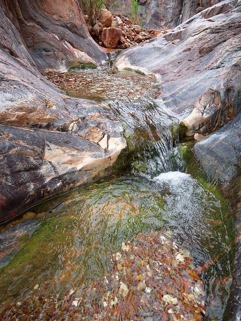
Monument Creek in Grand Canyon National Park, Arizona
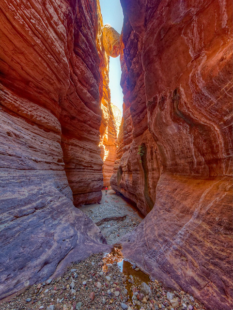
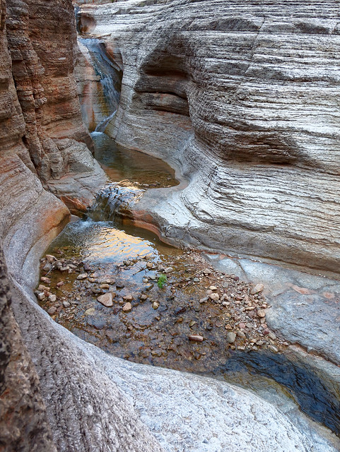
For the most part it is a simple matter to go through it ...
Monument Creek in Grand Canyon National Park, Arizona
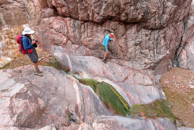
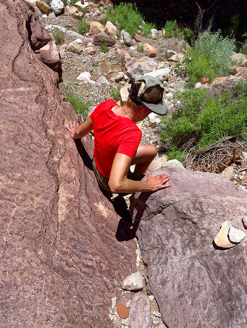
... although we made it harder for ourselves because none of us wanted to get our boots wet and none of us had brought water shoes.
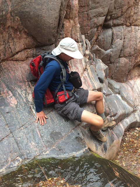
Monument Creek in Grand Canyon National Park, Arizona
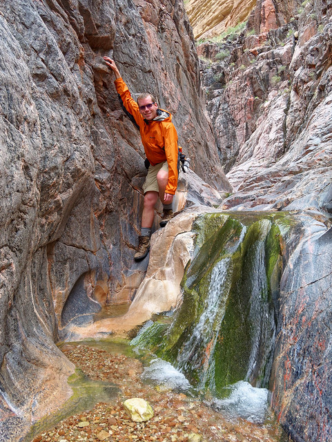
Fortunately, we are all taller than average (at 5'8" I'm the shortest) ...
Monument Creek in Grand Canyon National Park, Arizona
... and were successful at staying out of the water. Although it was touch and go for me at times.
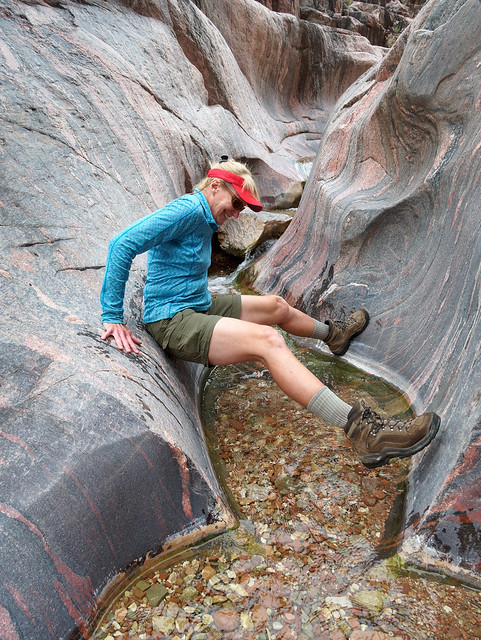
Monument Creek in Grand Canyon National Park, Arizona
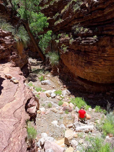
This little canyon is only 1/4 of a mile in length but we spent quite a bit of time in it while both John and Dan took copious photos (like father like son).
Monument Creek in Grand Canyon National Park, Arizona
This was my favorite part of this trip. It is so much fun; like being a kid on a playground.
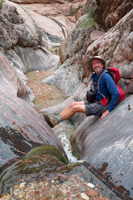
Monument Creek in Grand Canyon National Park, Arizona
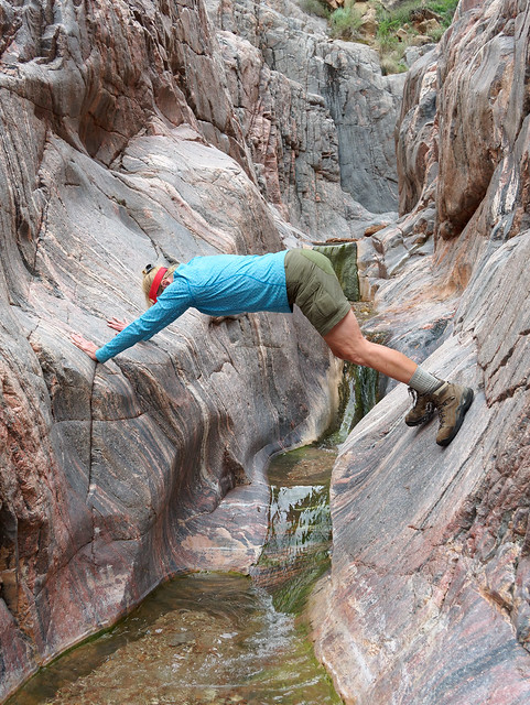
However, John and I are all too aware of our own mortality (and how breakable we are). Whereas, Dan jumped down some of the obstacles we were a bit more cautious.
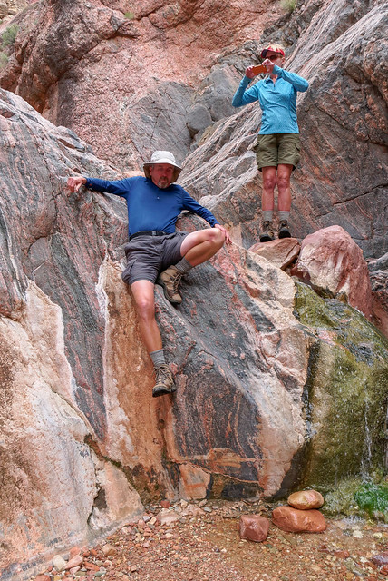
Monument Creek in Grand Canyon National Park, Arizona
Usually when I am in a situation where I need John's assistance we don't have a another photographer available to capture the moment. Even if I don't need his help John is (generally) wise enough to not take photos of me in undignified positions. But Dan doesn't hesitate. Had this maneuver turned out badly no doubt we would have a photographic record of it.
Monument Creek in Grand Canyon National Park, Arizona
I would encourage backpackers camped at Monument Creek (or those who are just passing through) to explore this little slot canyon. Depending on your height or your ability you might want to bring water shoes or you might need to just be willing to get your boots wet. It would be worth it to feel like a kid again.
Monument Creek in Grand Canyon National Park, Arizona
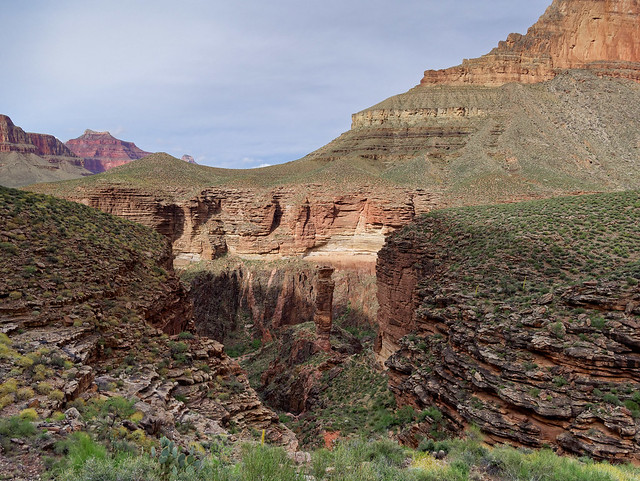
This little canyon ends quite near the base of the Monument. The easiest way back to camp is to continue down canyon until you encounter a wide gully on the left and head up the Granite Rapids side trail back to the Tonto.
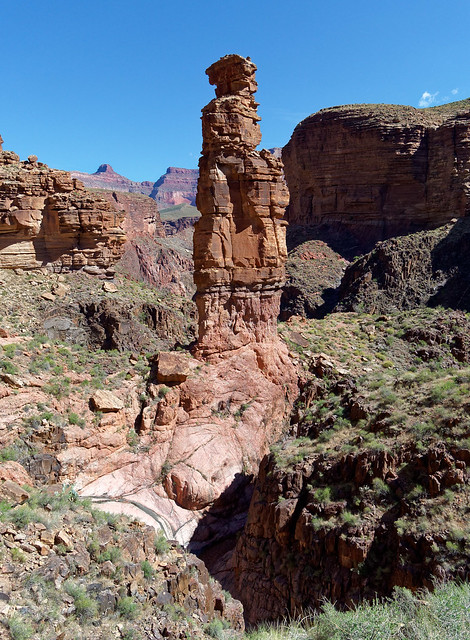
The Monument in Grand Canyon National Park, Arizona
When we got back to camp we were soon joined by a Backcountry Ranger. He stopped by to compliment us on our "clean camp". Well, we do know better than to leave anything remotely edible visible or accessible. And we know from personal experience Ravens in Grand Canyon are adept at opening zippers on packs and pulling items out in search of food. So all of our gear was hidden within our tents and the flies completely closed and all of our food was stored in a nylon food bag encased in an "Outsak", a large pouch made from sturdy metal mesh. At night it would have been suspended from John's tripod but he had taken it with him so we had left our food bag sitting on a rock.
It looked undisturbed but when I went to get our lunch out I noticed a few small holes in the bottom of the nylon bag and one bag of John's morning Tang had been just barely punctured. I examined the bottom of the Outsak and noticed it had been mangled a bit. Earlier we had noticed a rather plump ground squirrel keenly observing us. Undoubtedly, after we had left earlier he launched a determined (and most likely painful) attack on our food but was unsuccessful except for getting just the smallest taste of some Tang. It must have been quite a disappointment. After eating lunch we headed back up the Tonto Trail to the side trail and hiked down canyon ...
Monument Creek Canyon in Grand Canyon National Park, Arizona
... to Granite Rapids. We saw several suitable campsites but all were unoccupied. For backpackers seeking more solitude than is available at Monument Creek this would be a worthy destination.
Granite Rapids in Grand Canyon National Park, Arizona
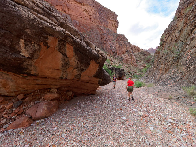
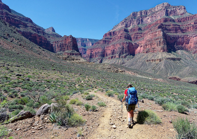
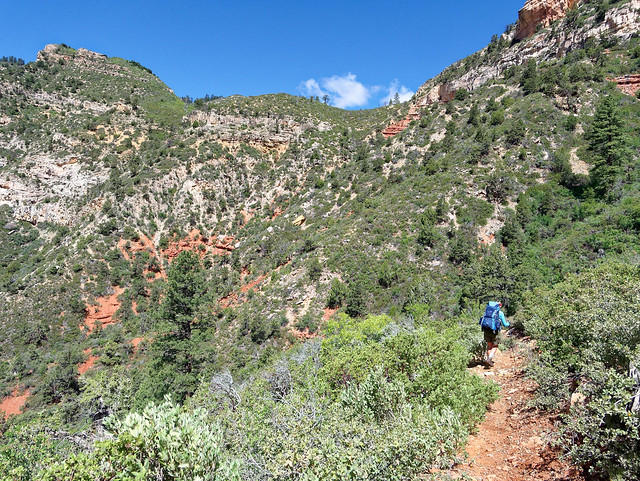
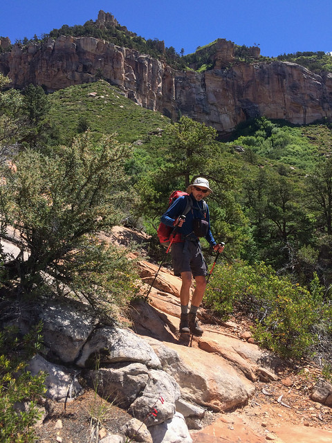
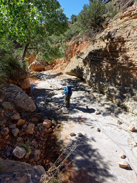
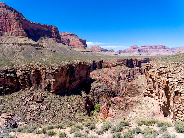
The next day we headed out on the Tonto toward the Hermit Trail.
Seen from the Tonto Trail in Grand Canyon National Park, Arizona
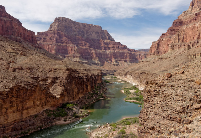
From the Tonto Trail we could see Hermit Rapids where we had camped the first night.
Seen from the Tonto Trail in Grand Canyon National Park, Arizona
We could also see up to the rim ...
Seen from the Tonto Trail in Grand Canyon National Park, Arizona
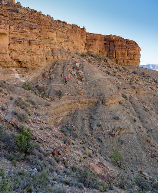
... but to get there we first had to get up the "Cathedral Stairs" ...
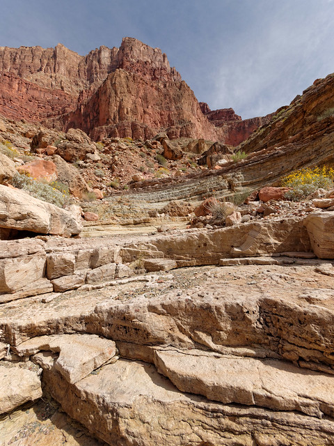
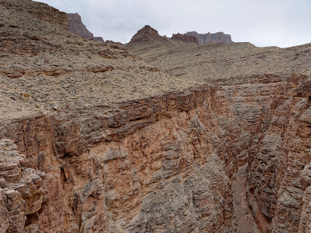
Seen from the Hermit Trail in Grand Canyon National Park, Arizona
... as well as negotiate the rougher sections of this otherwise well maintained and (relatively) easy trail.
Seen from the Hermit Trail in Grand Canyon National Park, Arizona
Of course hiking within Grand Canyon isn't always about "the expansive views". The cactus were blooming ...
Seen from the Hermit Trail in Grand Canyon National Park, Arizona
... and the "locals" were inquisitive.
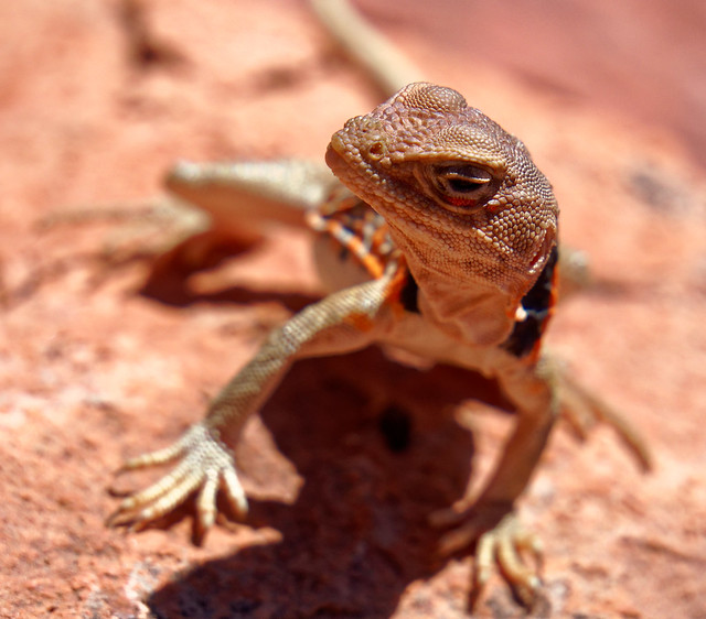
Seen from the Hermit Trail in Grand Canyon National Park, Arizona
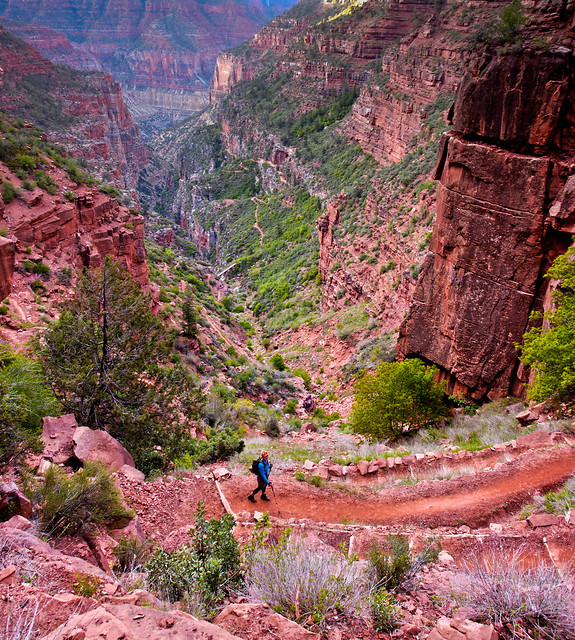
Once we hit the "corduroy rip - rap" we knew we were getting close to the top. We all thought it had been a great trip and we weren't even all the way back before we started talking about what backpack trip we should do with Dan next spring. We are thinking about Royal Arch Loop or Nankoweap. Or both! All of our photos from this backpack trip are on Flickr.
Seen from the Hermit Trail in Grand Canyon National Park, Arizona
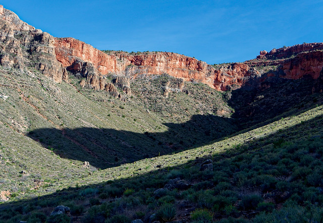
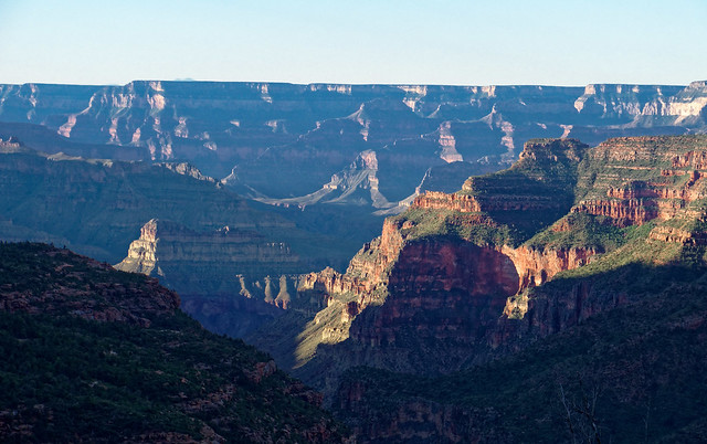
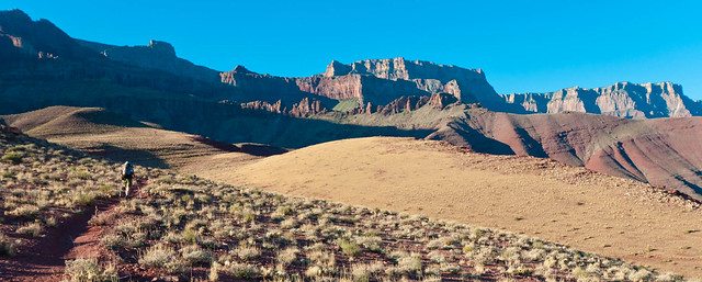
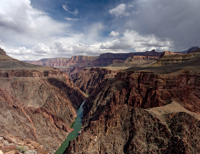
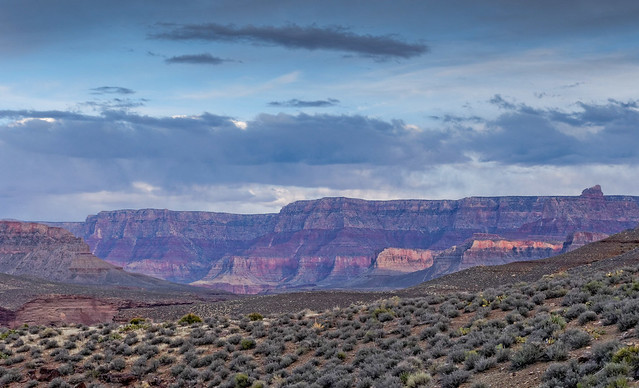
After Dan left we headed to the North Rim. We have wanted to do the North Bass Trail (North Bass Trail.Description) for a while. However, North Rim trails are tough because the North Rim doesn't open until May 15th and by then it is really heating up within the canyon. Another complication is the Swamp Point Road to the North Bass Trailhead is usually blocked by many downed trees after the long winter. The Park Service may not get it cleared until late May or even early June. Typically those who want to hike North Bass try to obtain permits for October. Any earlier it is still too hot but any later, as winter is on its way, driving out from the trailhead may require the use of a chainsaw to clear newly downed trees.
As a consequence October permits are in high demand and difficult to get and we have been unsuccessful. Since we were already planning to be at Grand Canyon in early May we decided to try to get a mid May permit for North Bass. And we did! Our permit was for 5 days/ 4 nights and the plan was to camp somewhere along White Creek the first and fourth nights and at Shinumo Creek the second and third. On the layover day we would hike down to the river.
However, shortly before we were due to start we got an email from the Park Service stating the road to the trailhead would be closed until late in the month. We were disappointed but not surprised. We then had two options; bag the trip and try again for October or walk the additional 8 miles each way on the road to and from the trailhead. We decided to give it a go and walk the road. In hindsight we should have extended our permit an additional night (or two) to accommodate the additional 16 miles. But you know what they say about hindsight.
Our plan now was to camp at Muav Saddle, located about a mile down the trail below the rim, the first night. Fortunately there was reported to be a spring located about 1/4 mile further down the trail. As we would be camped much higher with colder night time temperatures than we originally planned we took warmer sleeping bags and more clothing. In addition there was a 50% chance of rain in the forecast so we took full rain gear (pack cover, parka, light weight rain kilt and gaiters). As a result our packs were going to be heavier than we are accustomed to carrying in the canyon but at least we wouldn't need to carry copious amounts of water at any given moment.
We had driven to the gate the day before to make sure there weren't any issues getting at least that far. Although we had to drive around a couple of downed trees (as others had obviously done before) and encountered a bit of mud none of it was anything our Jeep Cherokee Trailhawk couldn't easily handle.
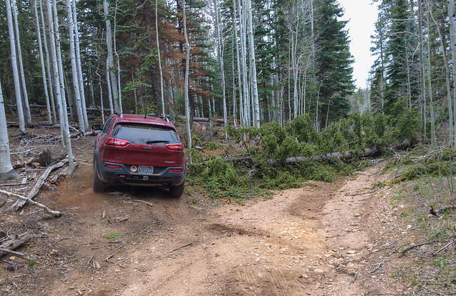
Swamp Point Road in Grand Canyon National Park, Arizona
The next morning we returned to the gate and set out. It was chilly, so chilly there were a few snow flurries. But at least it wasn't raining.
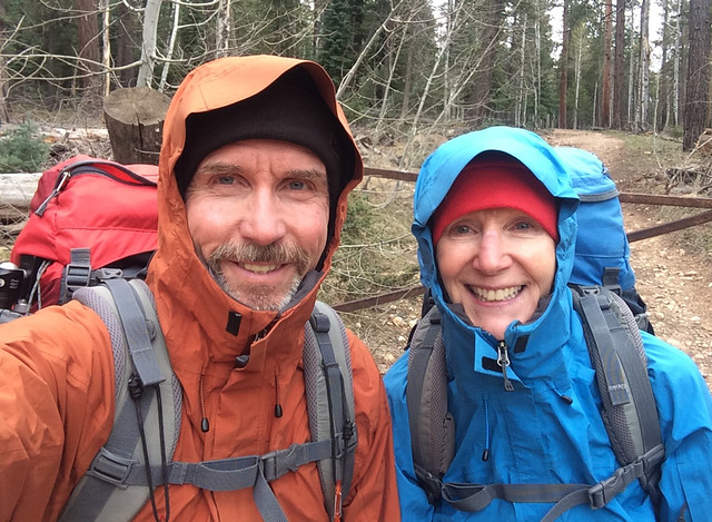
Swamp Point Road in Grand Canyon National Park, Arizona
The walk along the road was uneventful and most of the downed trees, John counted 45 in all, were not too much trouble to go over or around. There were some thorny shrubs we needed to carefully avoid but we remained unscathed for the most part. There had been another car parked at the gate so we were concerned there could be contention for the one tent site at Muav Saddle we had read about. However, before long we saw a fellow hiking toward us from the opposite direction. Apparently he had been part of a group that had cached some food in five gallon buckets for a trip they did last fall and he was there to retrieve the now empty buckets.
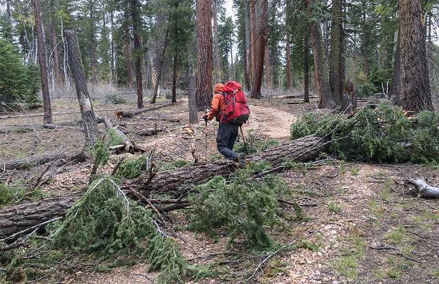
Swamp Point Road in Grand Canyon National Park, Arizona
Once we reached the actual trailhead we happily headed down the trail. Every step we did without rain was a blessing ...
Seen from the North Bass Trail in Grand Canyon National Park, Arizona
... and in fact it did not begin to even sprinkle until we were nearing Muav Saddle.
Seen from the North Bass Trail in Grand Canyon National Park, Arizona
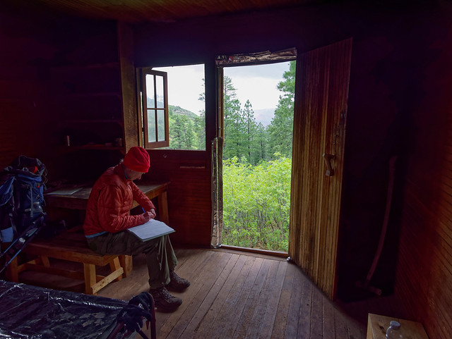
There is an old ranger patrol cabin at Muav Saddle. As there is a concern about Hanta Virus it is not recommended that backpackers sleep inside it. But we thought, if necessary, it would be okay to just cook and eat supper in it. Once we reached the cabin it started raining in earnest and we were very grateful for the shelter.
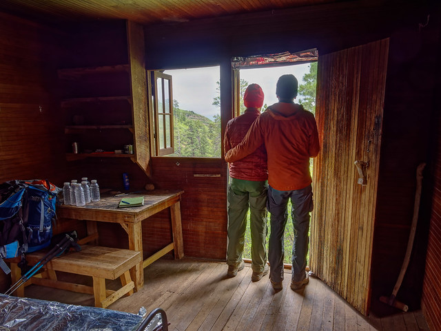
The patrol cabin at Muav Saddle in Grand Canyon National Park, Arizona
When the rain, alternating with hail, continued we began to dread the prospect of setting our tent up in the rain and risk getting any of our gear wet so early in the trip and while it was still so chilly. So we decided to sleep in the cabin. We first moved the two cots out of the front room and then carefully swept the floor (with the very funky handmade "broom" we found in a corner) avoiding kicking up any dust or breathing very much.
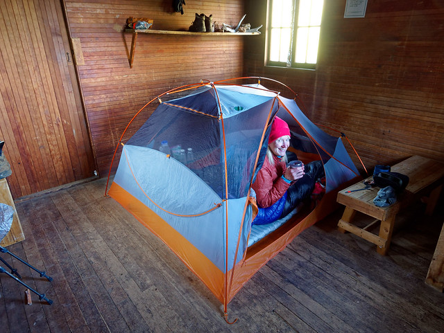
The patrol cabin at Muav Saddle in Grand Canyon National Park, Arizona
The next morning was cold but the sky was clear and blue. The rain had frozen into beautiful glittering drops of ice on the leaves of the shrubs surrounding the cabin. We had intended to get an early start but have always struggled to move very fast when cold. In the past when we knew we would face very high temperatures in the canyon we have arisen before the sun and been on the trail very early but it was just so luxurious to sit in my sleeping bag to eat my breakfast and drink a hot cup of tea. Just as we finally did get packed up and ready to go two other backpackers showed up. We soon learned this adventurous young couple, Lindsey and Gabriel (marmots adventures ) were doing the ambitious "Hayduke Route". They were quite interesting and it was easy for John to enter into a long (and time consuming) conversation with them. One reassuring thing we learned was that Lindsey had studied small mammals and had some knowledge about Hanta Virus. She said it was probably not an issue unless we had prolonged exposure and impaired immune systems.
Seen from the North Bass Trail in Grand Canyon National Park, Arizona
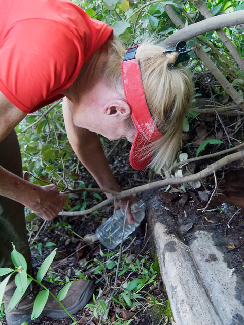
It was approaching 10 AM before we finally got going. However, we needed to collect and treat more water (we use a SteriPen). Like I said the spring is located down the trail about 1/4 of mile. What you first see doesn't look like much of anything, just a few drips. However, tucked beneath some branches to the left there appears to be an old low concrete retaining wall with a groove carved into it where a very narrow stream of water flows out of it. By positioning the mouth of my water bottle just right (we use 1 liter Gatorade bottles) I could get a liter in about 30 seconds without much grit or vegetation. I presume this would be normal during the spring but I don't know if it flows this well in the fall.
Seen from the North Bass Trail in Grand Canyon National Park, Arizona
At this point we were both still bundled up (the above photo was taken days later on our hike out) including wearing our rain kilts and gaiters because of the wet brush along portions of the trail .
Seen from the North Bass Trail in Grand Canyon National Park, Arizona
Our goal was to reach Shinumo Creek. John had read an account of a group (whose members were not so young) who had gotten all the way to the creek in one day from the trailhead so we thought it was within our reach. We had also read the Park Service has done quite a bit of work on the trail and we then were making good progress. The sun warmed things up enough we could shed garments.
Seen from the North Bass Trail in Grand Canyon National Park, Arizona
We did encounter some brush and mud ...
Seen from the North Bass Trail in Grand Canyon National Park, Arizona
... but it didn't last long and things opened up again so we were optimistic.
Seen from the North Bass Trail in Grand Canyon National Park, Arizona
I was remembering past reports I had read of how challenging North Bass is but I thought the Park Service must have fixed everything because this seemed pretty easy by Grand Canyon standards.
Seen from the North Bass Trail in Grand Canyon National Park, Arizona
I realize now that I somehow mentally "blocked out" any negative parts of the more recent trip reports I had read ...
Seen from the North Bass Trail in Grand Canyon National Park, Arizona
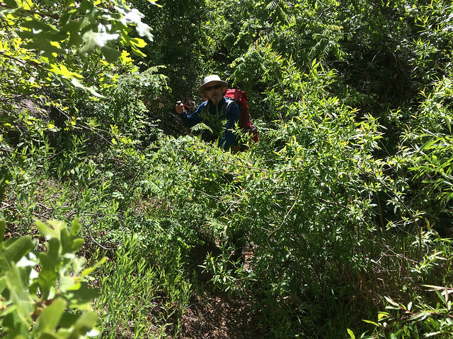
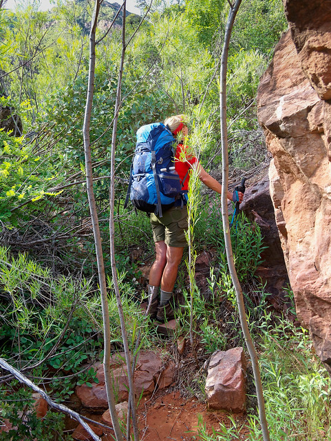
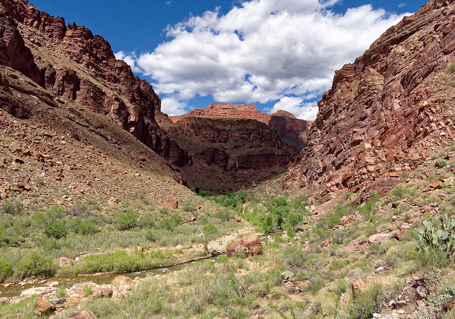
... and it took me by surprise when the trail dropped down into White Creek Canyon and we became engulfed in vegetation. We are no strangers to vegetation in the canyon but North Bass is one of the more historic trails in the park but at this point it didn't seem like a "trail".
Seen from the North Bass Trail in Grand Canyon National Park, Arizona
It wasn't even what I would call a "route". The vegetation is so thick that finding the way was sometimes a matter of a process of elimination. Can't go this way, can't that way, so I guess it has to be this other way. We periodically got reassurance we were going the right way by the presence of a sketchy track or an infrequent cairn. Needless to say it was very slow going, much slower than we had anticipated.
Seen from the North Bass Trail in Grand Canyon National Park, Arizona
In addition to the thick willows we also became well acquainted with a type of holly with spiky leaves as well as Mexican Locust which sports thorns up to an inch in length. We probably should have heeded the advice of others and worn long pants and long sleeves (We at least were both wearing good eye protection). However, with the sun out it had become quite warm and humid in the thicket and I am still subject to hot flashes and I am willing to endure some pain and loss of blood in order to remain cooler.
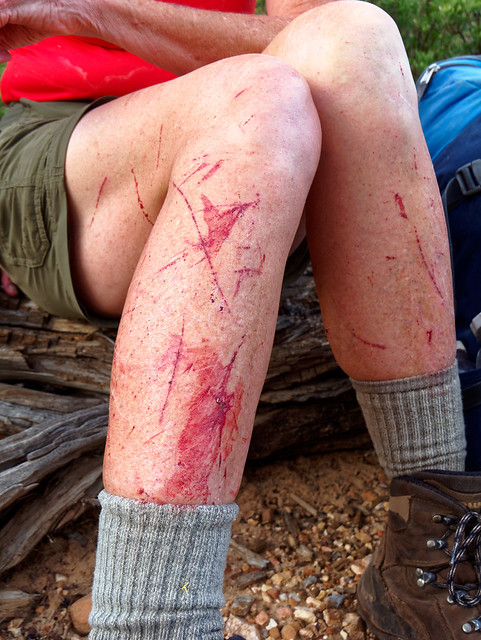
Seen from the North Bass Trail in Grand Canyon National Park, Arizona
We later talked with a Backcountry Ranger and he expressed his desire to spend a week down there "clearing things out" but unfortunately it is not a priority for the Park Service. The budget is just too tight. Needless to say we rejoiced when the vegetation finally thinned out ...
Seen from the North Bass Trail in Grand Canyon National Park, Arizona
... and we began to make faster progress.
Seen from the North Bass Trail in Grand Canyon National Park, Arizona
We left White Creek behind ...
Seen from the North Bass Trail in Grand Canyon National Park, Arizona
... as we headed up above the Redwall for a long traverse. It was a bit disheartening to see White Creek so far below us knowing we had to get back down to it.
Seen from the North Bass Trail in Grand Canyon National Park, Arizona
But the trail across the Redwall is quite good and we felt like we were making really good progress ...
Seen from the North Bass Trail in Grand Canyon National Park, Arizona
... and we were thrilled with the views we were getting.
Seen from the North Bass Trail in Grand Canyon National Park, Arizona
However, it was time to get back down to White Creek ...
Seen from the North Bass Trail in Grand Canyon National Park, Arizona
... and that meant heading down the infamous "Redwall Descent". It is quite steep and loose in places and once again our pace slowed dramatically. While I've read very negative descriptions of this portion of the North Bass there wasn't anything we hadn't encountered before on trails within Grand Canyon. One just has to be careful. With the help of trekking poles I was able to avoid slipping and landing on my butt.
Seen from the North Bass Trail in Grand Canyon National Park, Arizona
Still it was a relief to finally reach the bottom of the Redwall Descent and be hiking down White Creek again.
Seen from the North Bass Trail in Grand Canyon National Park, Arizona
Not long after this we both came to the realization we would not make it as far as Shinumo Creek that day. But we were uncertain how much farther we should try to go. We had hiked about a mile from the bottom of the descent along White Creek, which at that point had a good flow in it, when the trail led out of the creek bed to bypass a pour-off. John wanted to continue for at least another hour so we headed up the bypass. However, we had read that White Creek goes underground at intervals so we didn't know how far it would be before we would encounter more water. But we also didn't really want to carry enough water for the night and morning as it would really slow us down.
Seen from the North Bass Trail in Grand Canyon National Park, Arizona
Then, not long after we had left the creek, it began to sprinkle. Between the hard rain we endured on the Hermit Trail the previous week and the rain and hail we had the previous night I became concerned about being caught in a downpour not knowing how far we were to a campsite or water. So we decided to backtrack to the creek where we had seen a level spot adjacent to it. We quickly set up our tent and once inside we discussed our situation. The conclusion we came to was in order for us to complete the trail and get all the way to the river we needed to add a day to our trip. We decided to day hike to the river the following day, camp at Shinumo Creek the following night (our third night), get back to where we were the fourth night and camp at Muav Saddle the final night. Once this decision was made we both felt much more relaxed. We got out our remaining four days worth of food and divided it up to now cover five.
Seen from the North Bass Trail in Grand Canyon National Park, Arizona
The next morning we continued down the creek. In about another mile we saw a cairn for the bypass around another pour-off. This area has some very attractive ledges and John noted there was a small campsite tucked in the trees. We decided we would camp there on our way out as it was scenic and photogenic.
Seen from the North Bass Trail in Grand Canyon National Park, Arizona
We traversed this bypass for about a half of a mile ...
Seen from the North Bass Trail in Grand Canyon National Park, Arizona
... before dropping back into White Creek. The creek was still flowing at this point but soon went underground not to be seen again by us that day. We continued down the drainage until shortly before reaching the pour - off at the mouth of Redwall Canyon and the way to Tapeats Gorge.
Seen from the North Bass Trail in Grand Canyon National Park, Arizona
At this point backpackers have two options; continue down the drainage, drop down into Tapeats Gorge and follow White Creek to Shinumo Creek. Or they can take the Tonto Bypass which the NPS restored to it's "historic alignment" in 2005. We wanted to see Tapeats Gorge and John would undoubtedly want to do some photography. However, as we wanted to hike to the river that day, we took the Tonto Bypass to save time. We would have to save Tapeats Gorge for the following day.
Seen from the North Bass Trail in Grand Canyon National Park, Arizona
Once on the Tonto Bypass it was a real treat to hike fast and cover so much territory so quickly.
Seen from the North Bass Trail in Grand Canyon National Park, Arizona
I am partial to the Tonto Platform for its expansive views.
Seen from the North Bass Trail in Grand Canyon National Park, Arizona
We had read this stretch could be quite hot but there was a cool breeze that day so the warm sun actually felt good.
Seen from the North Bass Trail in Grand Canyon National Park, Arizona
The descent from the bypass takes some time but there are no real route finding issues going down. We were happy to see Shinumo Creek, our destination, not far in the distance.
Seen from the North Bass Trail in Grand Canyon National Park, Arizona
When we saw the creek from above we had noticed a well worn track on the opposite side and assumed this was the way we needed to go to reach the river.
Seen from the North Bass Trail in Grand Canyon National Park, Arizona
After setting up our tent we unloaded as much of our gear as possible and prepared to day hike to the river.
Seen from the North Bass Trail in Grand Canyon National Park, Arizona
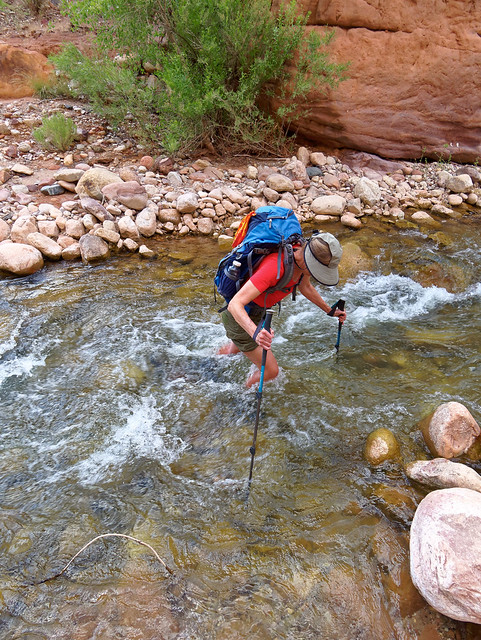
We had read it was necessary to cross Shinumo Creek five times and knew this early in the season the water level could be high and the current strong.
Seen from the North Bass Trail in Grand Canyon National Park, Arizona
We both brought running shoes to wear in the water but I decided to keep my boots on. I had discovered the rocks were quite slippery and my feet have many "issues". John did wear his trail running shoes but found they were barely adequate foot and ankle protection. Fortunately the water was clear enough to see the bottom but it was still tricky finding secure footing.
When we started out we immediately crossed the creek to the track we had seen from above but we had not walked far before we encountered a large boulder requiring us to cross back. In hindsight we realized it hadn't been necessary to cross to the other side so quickly. We could have stayed on the same side as our camp and walked downstream. This way is longer and there is no obvious track through the vegetation and gullies. The other way is shorter but adds two additional creek crossings. We came back the longer way but I can't say one is better than the other.
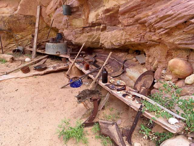
Before long we reached "Shinumo Camp". The items left behind by previous canyon explorers are now considered to be "artifacts" and it is illegal to remove any of them. Perhaps I lack the proper appreciation for "canyon history" but I am more inclined to think of these "artifacts" as junk that mars the the natural beauty of the area and it should have been hauled out a long time ago.
Seen from the North Bass Trail in Grand Canyon National Park, Arizona
I can't help but wonder if the gear and trash that some modern day backpackers have left behind, like this bucket found at Deer Creek, could one day achieve the status of being "artifacts".

Photo by James Franklin
We continued down the canyon crossing the creek when necessary. I didn't even try to keep track of how many times.
Seen from the North Bass Trail in Grand Canyon National Park, Arizona
The deepest water we encountered was about mid thigh but most was no more than mid calf. The current was brisk and trekking poles were very helpful.
Seen from the North Bass Trail in Grand Canyon National Park, Arizona
The trail to the river leaves the creek and climbs over a ridge gaining 700 feet ...
Seen from the North Bass Trail in Grand Canyon National Park, Arizona
... before taking you to the river.
Seen from the North Bass Trail in Grand Canyon National Park, Arizona
We followed a track down to the river ...
Seen from the North Bass Trail in Grand Canyon National Park, Arizona
... and took the opportunity to wet our bandannas as it was now quite warm.
Seen from the North Bass Trail in Grand Canyon National Park, Arizona
One sight we did not see was the remnants of the orchard and garden that William Wallace Bass had planted along Shinumo Creek near the river. We just didn't have enough daylight left to look for it.
Seen from the North Bass Trail in Grand Canyon National Park, Arizona
It was getting late and our hope was to get back to camp before dark.
Seen from the North Bass Trail in Grand Canyon National Park, Arizona
But we love to be out at this time of day, during the "Golden Hour" when the angle of the sun is lower. We got back to camp just before dark.
Seen from the North Bass Trail in Grand Canyon National Park, Arizona
The next morning turned hot very early so we packed up quickly. An option we considered was hiking up Shinumo Creek to White Creek and up through Tapeats Gorge. However, we had read there were more creek crossings involved and now carrying full packs we both felt the need to wear our boots and neither of us wanted to get them wet (mine had mostly dried out over night). So we headed back toward the Tonto Bypass. There are multiple tracks leaving Shinumo Creek and the most obvious one leads up the creek. The way back to the bypass was initially unclear. I was lured up a gully by some errant cairns but John found the real track farther to the left so I scrambled over to where he was.
Seen from the North Bass Trail in Grand Canyon National Park, Arizona
It was warmer than it had been the previous day when we headed across the Tonto Bypass but still not brutally hot.
Seen from the North Bass Trail in Grand Canyon National Park, Arizona
After dropping down from the bypass we went down canyon the short distance to the entrance of Tapeats Gorge.
Seen from the North Bass Trail in Grand Canyon National Park, Arizona
We didn't find the down climb difficult ...
Tapeats Gorge in Grand Canyon National Park, Arizona
... and even if we were carrying fully load packs I don't think we would have needed a rope as some recommend.
Tapeats Gorge in Grand Canyon National Park, Arizona
It is just a short distance to see the most notable features; the "Grotto"...
Tapeats Gorge in Grand Canyon National Park, Arizona
... and the "Chockstone" (to get an idea of the scale look for me below it).
Tapeats Gorge in Grand Canyon National Park, Arizona
John, with a little help from me, ...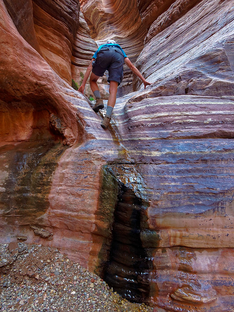
Tapeats Gorge in Grand Canyon National Park, Arizona
... was able to get up in the Grotto ...
Tapeats Gorge in Grand Canyon National Park, Arizona
... and take more photos of this unusual feature.
Tapeats Gorge in Grand Canyon National Park, Arizona
While exploring more I found a small side canyon with this lovely little falls and pool.
Tapeats Gorge in Grand Canyon National Park, Arizona
We walked down Tapeats Gorge for nearly a half mile before encountering several downed trees and we decided to turn around. We felt we had seen the best of it ...
Tapeats Gorge in Grand Canyon National Park, Arizona
... so we were content to head back up the canyon and climb back out.
Tapeats Gorge in Grand Canyon National Park, Arizona
I felt quite relaxed as we headed up White Creek. We had achieved our objective to get all the way to the river, John had time to take lots of photos of Tapeats Gorge and we knew where to get water as well as where we were going to camp that night.
Seen from the North Bass Trail in Grand Canyon National Park, Arizona
We love doing "loop" hikes but an advantage to "out and back" trips is once you turn around there are no surprises. So we felt comfortable spending a leisurely morning in our camp. We considered it to be one of our all time favorite campsites. It was a treat to set up our "kitchen" ...
Seen from the North Bass Trail in Grand Canyon National Park, Arizona
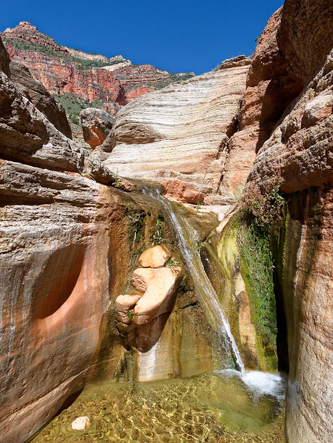
... right next to where White Creek has formed beautiful curves ...
Seen from the North Bass Trail in Grand Canyon National Park, Arizona
... and waterfalls.
Seen from the North Bass Trail in Grand Canyon National Park, Arizona
I did a little exploring and found a way to get to the bottom of the canyon ...
Seen from the North Bass Trail in Grand Canyon National Park, Arizona
... and John soon joined me. Another advantage to our leisurely morning was by that time the sun was now shining on this waterfall.
Seen from the North Bass Trail in Grand Canyon National Park, Arizona
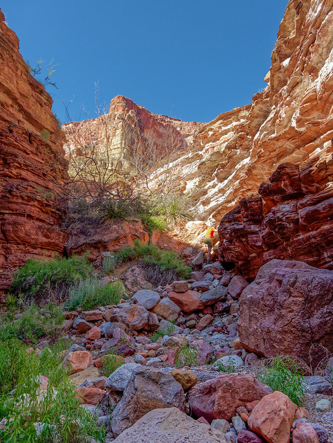
But all good things must come to an end and we reluctantly left this lovely area. After about two miles we reached the bottom of the "Redwall Descent" ...
Seen from the North Bass Trail in Grand Canyon National Park, Arizona
... which was now a steep ascent.
Seen from the North Bass Trail in Grand Canyon National Park, Arizona
Once above the Redwall we stepped up our pace. However, we didn't hesitate to stop to allow time for John to photograph wildflowers ...
Seen from the North Bass Trail in Grand Canyon National Park, Arizona
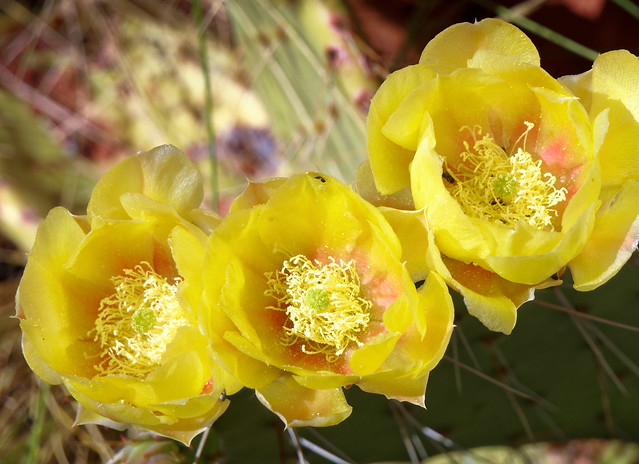
... and cactus blossoms.

Seen from the North Bass Trail in Grand Canyon National Park, Arizona
We also took a bit of time to locate Butchart's Natural Bridge however we were both disinclined to find a way to scramble down to it as others have done.
Seen from the North Bass Trail in Grand Canyon National Park, Arizona
Of course we knew at some point we would once again encounter the brushy creek bed ...
Seen from the North Bass Trail in Grand Canyon National Park, Arizona
... and I heaved a great sigh before heading into it.

Seen from the North Bass Trail in Grand Canyon National Park, Arizona
It seemed longer heading up it than it had going down it. John's theory was that the vegetation "flows" downstream having been pushed by the creek when it flooded so we were now going against the "current". It was a great relief to finally be out of it. The rest of the way back to Muav Saddle was uneventful. Although I had one concern. What would we do if someone else was camped in the only spot at the saddle that is large enough (and flat enough) for our ample tent. I really didn't want to camp in the cabin again.
Seen from the North Bass Trail in Grand Canyon National Park, Arizona
However, there was no one else there and it was a delight to wake up in the morning in such a scenic spot.
Seen from the North Bass Trail in Grand Canyon National Park, Arizona
And unless someone had crossed the river from South Bass we were still the only people within North Bass Canyon. It was quite a privilege to have had this entire canyon to ourselves.
Seen from the North Bass Trail in Grand Canyon National Park, Arizona
One option hikers have from Muav Saddle is to take a side trail out to Powell Plateau but we passed on the opportunity.
Seen from the North Bass Trail in Grand Canyon National Park, Arizona
There is a log book in the patrol cabin that contains some interesting reading. Most of the entries seem to have been written by individuals who only day hiked to the cabin. But one entry initially really concerned me ...
Patrol cabin at Muav Saddle in Grand Canyon National Park, Arizona
... as it sounded like a serious suicide note.

From Muav Saddle we headed up to Swamp Point and once back on the rim we took a long break.
Seen from the North Bass Trail in Grand Canyon National Park, Arizona
I got out the map and realized we could see across to ...
Seen from the North Bass Trail in Grand Canyon National Park, Arizona
... to the Tapeats Amphitheater, the Esplanade, Bridger's Knoll and the general direction of the Bill Hall Trail, the way we had taken to Thunder River six years ago.
Seen from the North Bass Trail in Grand Canyon National Park, Arizona
John took advantage of the cell service we had (from the South Rim) and downloaded some news podcasts to listen to on the hike out. The road seemed longer than on the way in as there is a slight incline. But we appreciated the fact that the Park Service had made great headway in clearing downed trees. In addition on our drive out we also noticed the Forest Service had cleared the trees we had previously driven around. We were happy to have finally been able to hike this trail but we looked forward to returning to our motorhome and some "creature comforts" like adequate food. All of our North Bass Trail backpack trip photos are on Flickr.
We have been working on a project to hike every named trail/route within the park but the debate we have had is determining what defines a "named trail/route". I wanted to stick with those the NPS has printed trail descriptions. However, John is more compulsive about it that I am. He thinks we should do any that are described in an NPS publication (we are limiting ourselves to official "named" routes as there must be countless unofficial routes that require differing levels of abilities and nerve).
So while at the North Rim there were several day hikes we wanted to do. The first we planned to do was the 10 mile long Ken Patrick Trail from the North Kaibab Trailhead to Point Imperial. In preparation we had left our Jeep there the day before. From the campground it was a short walk to the (incredibly congested) North Kaibab trailhead parking lot and past the mule paddock to the beginning of the Ken Patrick Trail. We had hiked along through the woods for awhile before it became obvious we were no longer on the Ken Patrick. We had somehow gotten on the Uncle Jim Trail. This is a much shorter trail but it does have a great view of Bright Angel Canyon. Visitors can also get there on mules which hardly seems worth it given how short and easy the trail is.
Seen from the Uncle Jim Trail in Grand Canyon National Park, Arizona
On our way back we looked closely and found where we got off the Ken Patrick Trail There is a spot where the trail does a small loop, perhaps to accommodate the mules in some way, where an unsigned trail branches off. We hadn't seen it before as it is camouflaged by downed trees. We figured this must be the way we should have gone. So the following day we returned and proceeded to climb over and under the many downed trees. Sometimes route finding was a bit of a challenge.
Seen from the Ken Patrick Trail in Grand Canyon National Park, Arizona
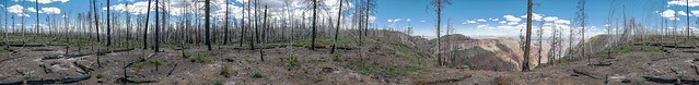
Other parts of the trail were quite easy as they go through portions of the forest that burned in 2000. Aspen trees were working hard to make a comeback but it is a slow process in this harsh environment.
Seen from the Ken Patrick Trail in Grand Canyon National Park, Arizona
The trail drops down through an area known as the "Icebox" which was the location of a CCC camp in the past. I can only imagine how it got its name. After crossing this meadow ...
Seen from the Ken Patrick Trail in Grand Canyon National Park, Arizona
... the trail climbs up and switchbacks across loose dirt often covered by downed trees. At one point while climbing over several crisscrossed trees I tripped and fell backwards head down across one rough barked tree. Fortunately, my only injuries were a scraped elbow and a bruised dignity. John wisely avoided getting out his camera as I got myself out of my undignified posture. Once to the top of this slope the trail then skirted the canyon's edge so we finally had some views. We also got to hike through some intense wind.
Seen from the Ken Patrick Trail in Grand Canyon National Park, Arizona
The best views from the Ken Patrick Trail are just a short distance from Point Imperial so no one should feel compelled to do what we did and hike this "trail" in its entirety.
Seen from the Ken Patrick Trail in Grand Canyon National Park, Arizona
We were later told by a ranger at the campground that the Park Service has not cleared downed trees on this trail for two years. They don't encourage people to hike it which is why they removed the sign at the junction with the Uncle Jim Trail. Perhaps this is also due to a shrinking budget but it is a shame as the trail is named after a National Park Ranger who was shot and killed while making a traffic stop in Point Reyes National Seashore in California.
Seen from the Ken Patrick Trail in Grand Canyon National Park, Arizona
The next trail we did was the Widforss Trail. Hiking this trail was a delightful contrast to the Ken Patrick. The easy trail through the woods is wide and clear and provides some "peek-a-boo" views along the way.
Seen from the Widforss Trail in Grand Canyon National Park, Arizona
Not to mention the expansive views from Widforss Point (including seeing buildings on the South Rim).
Seen from the Widforss Trail in Grand Canyon National Park, Arizona
A special treat was seeing a Short-Horned Lizard. We had previously seen some small ones on the Ken Patrick Trail. I initially thought they were young horned toads that hadn't completely lost their tails. Unfortunately, I couldn't get a good look at any of them as they were "camera shy". However, this fellow was not. Although his facial expression seemed to indicate what he thought of our traipsing through his home.
Seen from the Widforss Trail in Grand Canyon National Park, Arizona
Later that day we walked a short ways on the Transept Trail.
Seen from the Transept Trail in Grand Canyon National Park, Arizona
The next day John headed back to Point Imperial and hiked to the east. Point Imperial is one of the access points for the Nankoweap Trail. However, when we did the Nankoweap two years ago we accessed it by the Saddle Mountain Trail. A big advantage to that is you don't have to wait until the North Rim opens in mid May to do it.
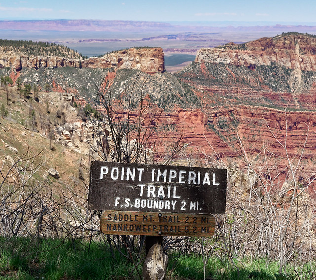
Seen from the Point Imperial Trail in Grand Canyon National Park, Arizona
I believe the section of the Nankoweap affectionately known as the "endless traverse" is located roughly across the middle from the left side of photograph below. Also Marion Point is visible in the middle to the right of the grey "mushroom" shaped rock in the foreground.
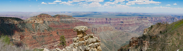
Seen from the Point Imperial Trail in Grand Canyon National Park, Arizona
After providing expansive views of Nankoweap Canyon ...
Seen from the Point Imperial Trail in Grand Canyon National Park, Arizona
... the Point Imperial Trail passes through more of the aftermath of the 2000 fire ...
Seen from the Point Imperial Trail in Grand Canyon National Park, Arizona
... which contains some oddly attractive fire sculpted trees.
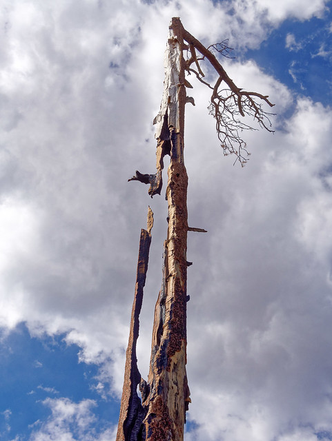
Seen from the Point Imperial Trail in Grand Canyon National Park, Arizona
His last stop was Cape Royal first doing the short walk to the view of Angels Window.
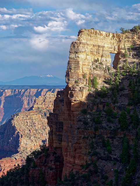
Angels Window in Grand Canyon National Park, Arizona
He also did the short walk ...
Seen from the trail to Cliff Spring in Grand Canyon National Park, Arizona
... to Cliff Spring
Seen from the trail to Cliff Spring in Grand Canyon National Park, Arizona
From Cape Royal one can see Freya Castle ...
Freya Castle in Grand Canyon National Park, Arizona
... and Wotans Throne (as well as Horseshoe Mesa way in the distance across the river).
Wotans Throne in Grand Canyon National Park, Arizona
Something we love about looking down into the canyon from the rim is seeing places we have been before. The beach at Cardenas Creek is visible toward the left in the photograph below. We camped near it when Dan backpacked the Escalante Route with us in 2011. From Cardenas the Escalante begins a traverse that is well above the river. The Unkar Creek Rapids and the Unkar Delta are visible along the river toward the right of the photo.
Seen from Cape Royal in Grand Canyon National Park, Arizona
In total we spent about a month in Grand Canyon National Park and we accomplished all that we had planned so we were content to hit the road again. However, we plan to return in the late winter/early spring next year to continue working on our goal to hike every named trail/route in the park. Our next stop was Navajo National Monument which I will write about next time.
This next bit is just something Jean has been thinking about.
I’ve grown accustomed to the canyon's face
What the phrase, "I've grown accustomed to your face", means to me is that affection and love didn’t happen all at once, that it took time for it to grow. That is exactly how it happened for me. I’m not talking about John, that was love at first sight. Rather, I am talking about my relationship with Grand Canyon National Park. I was born and raised in Kentucky and my earliest memory of Grand Canyon was seeing the illustrations in "Brighty of the Grand Canyon" (by Marguerite Henry) before I could even read the words. To me it looked like a place that could not exist in reality.

When I got older I, of course, saw actual photographs of Grand Canyon but I never allowed myself to hope I would ever actually see it with my own eyes.

But that changed when I met John. It was 1975 and he was working in Louisville. He is originally from Chicago but after graduating from college he had spent the summer traveling throughout the western US and loved it. Therefore, he intended to relocate somewhere there in the not too distant future. Long story short, when he left Kentucky in 1977 to move to Seattle, I went with him.

John and Jean in Olympic National Park, Washington
After arriving in Washington State we were kept busy with jobs, school for me, a house and eventually children so we didn’t do much traveling beyond flying back east to see family. However, in 1989 we loaded up our new travel trailer and took a trip to the southwest US and one of the first places we visited was Grand Canyon National Park.
While there, John and a friend did a long day hike down the South Kaibab Trail to the river and up the Bright Angel Trail. However, I didn’t get the opportunity to hike below the rim. I had my hands full with our two young boys (aged four and not quite two) as well as my mother-in-law. While John was out hiking, Grandma, Dan, Tom and I rode the shuttle along the rim getting out at every viewpoint squashed within the intense crowds. I found it very stressful.
The boys were cranky and bored because I wouldn't allow them to do what they normally did outside; run around, climb on things, and play with sticks and rocks. I was afraid I would lose them in the crowd. Or worse, over the edge. I had wanted to walk between some of the viewpoints so the boys could run around some but Grandma didn't want to and I felt obligated to stay with her. So I just didn’t feel like I was actually there. It was like I was still just looking at postcards and photographs in books.

Jean and Tom in Grand Canyon National Park, Arizona
Then in 2009 John and I took our new motorhome on its “maiden voyage”. Our primary objective was a backpack trip down Buckskin Gulch and the Paria River (which was great!). We did another in Zion National Park. However, as John was still working, our remaining time was very limited so we made only a brief stop at Grand Canyon’s North Rim. We hiked a short way down the North Kaibab Trail, only as far as Roaring Springs. I was excited to be going below the rim for the first time but I have to admit I was disappointed. There are none of the "classic" views of the main canyon itself as the trail goes down through Roaring Springs Canyon, a more intimate side canyon. Don’t get me wrong, it is a beautiful hike, but I still didn’t feel like I was getting to know the real Grand Canyon.
Jean on the North Kaibab Trail in Grand Canyon National Park, Arizona
In April 2010, after John retired and we sold our house, we hit the road in our motorhome. Our primary destination for that first travel season was going up through BC, Yukon and Alaska. However, in early 2011 we headed to the southwest US planning to spend some time in Grand Canyon. Our son Dan would be visiting us and John planned a backpack trip to do with him. As we prefer more solitude, he had no trouble deciding to avoid the extremely popular (and crowded) “corridor trails”; Bright Angel, South Kaibab and North Kaibab. So he researched the lesser traveled trails, made a plan and obtained a permit. We would descend into the canyon on the Tanner Trail, follow the Colorado River downstream along the Escalante Route and hike out of the canyon on the Tonto and Grandview Trails.
While I was really excited about seeing our son and I love backpacking, I realized I was not looking forward to this particular backpack trip. Here's why. The National Park Service (NPS) provides excellent trail descriptions and I read the ones for our planned trip. John soon dubbed these write ups as “Worry Papers” because they made me worry. In my defense, the NPS Tanner Trail Description says things like “The trail is unmaintained and ranks as one of the most difficult and demanding south side trails ...The trail is narrow, badly eroded and can be difficult to follow ... The Redwall descent is nasty ... a serious fall is a real possibility…” and “…missteps should be avoided at all costs…”.

It is recommended for experienced canyon backpackers only. While we were experienced backpackers, we frequented forests and mountains where water is abundant, temperatures are cooler and potential issues include stream crossings, hypothermia and encounters with bears, situations we knew how to cope with. I had no idea what to expect from the canyon. We also received a form letter from the NPS that stated that trips such as the one we had planned too often "result in injury and occasionally even death". So, yeah, I was a bit apprehensive.
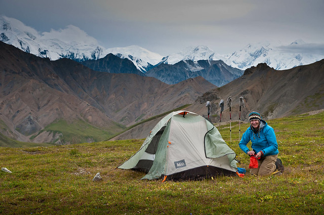
Jean in camp on Eielson Pass in Denali National Park, Alaska (Mt Eielson Loop Trip Report)
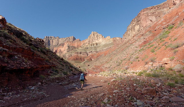
But I have learned I can trust John’s judgement so I was willing to give it a go. We started down the steep loose Tanner Trail about noon and my arthritic knees complained ... a lot.
Jean on the Tanner Trail in Grand Canyon National Park, Arizona
Then, as we descended further, I began to be distracted by the views we were getting and I started to believe I could get to like this place.
Seen from the Tanner Trail in Grand Canyon National Park, Arizona
However, that attitude faltered some after we encountered parts of the trail that the "Worry Paper" referred to. It was after dark when we finally reached the river so I was unable to appreciate our surroundings and without any distractions, I became focused on my sore knees again. That night, I questioned the value of the effort it took to get there.
Seen from the Tanner Trail in Grand Canyon National Park, Arizona
However, waking up the next morning …
John and Jean in campsite on Tanner Beach by the Colorado River in Grand Canyon National Park, Arizona
Jean on the Escalante Route in Grand Canyon National Park, Arizona
... I realized that everything I had done, everything I had to endure was worth it. I accepted it as the price that had to be paid for the privilege of being there. I was in love!
Jean and the Colorado River along the Escalante Route in Grand Canyon National Park, Arizona
Since that first backpack trip John and I have done 18 more overnight trips in the canyon and have spent 73 nights camped out. We have hiked all of the official named trails and routes within the park (list of our Trip Reports and day hikes and Collection of Photo Albums).
For those who have not had the opportunities we have had I invite you to let me take you on a "photo tour" so you can see some of the amazing beauty we have seen. If you want to know more about what is involved in hiking specific trails or routes and to see more photos, I have included links to the pertinent Trip Report(s) as well as the Grand Canyon National Park Service trail descriptions.

To begin, imagine you are looking at a map of Grand Canyon. Starting from the east (and south of the Colorado River) the first trail indicated is the Cape Solitude Trail (Cape Solitude Trip Report). The road to access this trail is located near Desert View and the east entrance of the park.
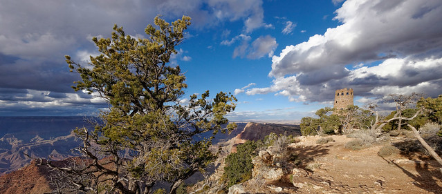
Desert View Watchtower in Grand Canyon National Park, Arizona
This is a little used trail that lives up to its name. It offers views that are unique in the park where one is neither looking down on something or up at something. Rather, one is looking out, seemingly forever, for much of the hike.
Jean on the Cape Solitude Trail in Grand Canyon National Park, Arizona
The trail seems like it will continue this way forever until you begin to see the edge of a side canyon in the distance.
Seen from the Cape Solitude Trail in Grand Canyon National Park, Arizona
However, it are still miles before you reach the end at the very edge ...
Seen from the Cape Solitude Trail in Grand Canyon National Park, Arizona
... of Grand Canyon and look down. The first thing you see is the Colorado River.
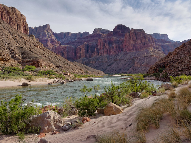
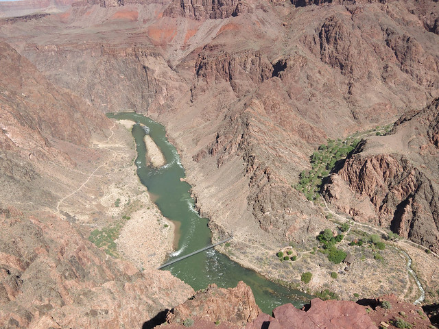
The Colorado River seen from the Cape Solitude Trail in Grand Canyon National Park, Arizona
But by continuing further you see the highlight of the trip, the confluence of the Colorado and Little Colorado Rivers.
Confluence of the Little Colorado River and the Colorado River in Grand Canyon National Park, Arizona
The Little Colorado is typically a lovely light turquoise due to high concentrations of manganese in the water.
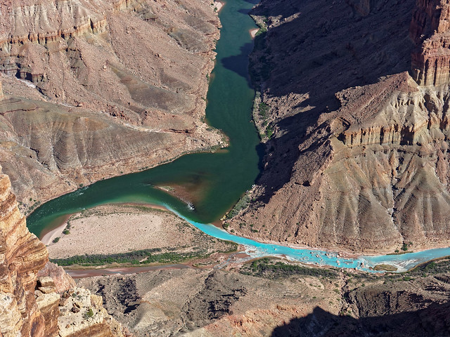
Confluence of the Little Colorado River and the Colorado River in Grand Canyon National Park, Arizona
One can hike to the confluence on the Beamer Trail (Tanner/Beamer/Escalante/New Hance Trip Report and NPS Beamer Trail Description). This trail follows the Colorado River upstream, initially flat ...
Seen from the Beamer Trail in Grand Canyon National Park, Arizona
... becoming higher where it skirts the cliffs ...
Seen from the Beamer Trail in Grand Canyon National Park, Arizona
... and negotiates countless side canyons.
Seen from the Beamer Trail in Grand Canyon National Park, Arizona
The trail does eventually drop down ...
Seen from the Beamer Trail in Grand Canyon National Park, Arizona
... taking you back toward the river.
Seen from the Beamer Trail in Grand Canyon National Park, Arizona
By continuing up the trail a short ways you will see the Beamer Cabin as well as ...
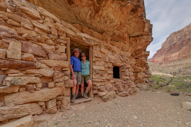
John and Jean at the Beamer Cabin in Grand Canyon National Park, Arizona
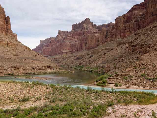
The confluence of the Colorado River and the Little Colorado River in Grand Canyon National Park, Arizona
After rain the Little Colorado can become a muddy red but when it is running clear the color is surreal and has to be seen to be believed.
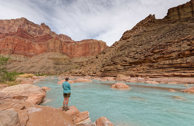
Jean at the Little Colorado River in Grand Canyon National Park, Arizona
To access the Beamer Trail one must first descend into the canyon. This is most commonly done from the Tanner Trail (Tanner/Escalante/Tonto/Grandview Trip Report and Tanner/Beamer/Escalante/New Hance Trip Report, the NPS Tanner Trail Description). From the trailhead on the South Rim, great views start early ....
Seen from the Tanner Trail in Grand Canyon National Park, Arizona
... and continue the deeper you get into the canyon.
Seen from the Tanner Trail in Grand Canyon National Park, Arizona
Views from the Tanner are outstanding ..
Seen from the Tanner Trail in Grand Canyon National Park, Arizona
... especially later in the day when the angle of the sun is lower.
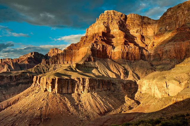
Seen from the Tanner Trail in Grand Canyon National Park, Arizona
The Tanner ends at the river. In addition to accessing the Beamer Trail you can also travel downstream on the Escalante Route (Tanner/Escalante/Tonto/Grandview Trip Report and Tanner/Beamer/Escalante/New Hance Trip Report, the NPS Escalante Route Description). The Escalante crosses large areas of open country...
Jean on the Escalante Route in Grand Canyon National Park, Arizona
... providing great views ...
Seen from the Escalante Route in Grand Canyon National Park, Arizona
... all along the way.
Seen from the Escalante Route in Grand Canyon National Park, Arizona
The Escalante Route also skirts the edge of Seventy-Five Mile Canyon ...
Jean on the edge of Seventy-Five Mile Canyon while hiking the Escalante Route in Grand Canyon National Park, Arizona
... before descending to the bottom of this intimate side canyon.
John and Jean in Seventy-Five Mile Canyon along the Escalante Route in Grand Canyon National Park, Arizona
Views from the Escalante never disappoint no matter if you are looking down at the river...
The Colorado River seen along the Escalante Route in Grand Canyon National Park, Arizona
... or up to the rim.
Seen from the Escalante Route in Grand Canyon National Park, Arizona
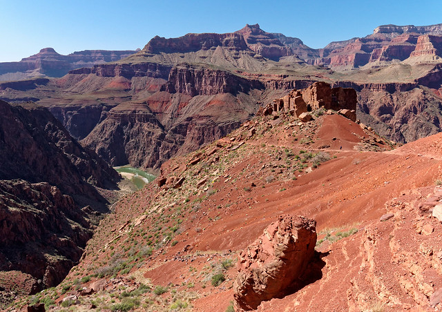
The Escalante Route ends at Red Canyon and intersects with two trails. The first is the New Hance Trail. If you begin your hike at the New Hance Trailhead (on the South Rim) you initially hike through some woods but once you reach the rim you will be rewarded with immediate views.

Seen from the New Hance Trail in Grand Canyon National Park, Arizona
But lets say you used the New Hance Trail to complete a loop as we did (Tanner/Beamer/Escalante/New Hance Trip Report and NPS New Hance Trail Description). In that case you will first hike up a creek bed ...
Jean on the New Hance Trail in Grand Canyon National Park, Arizona
... of colorful ...
Seen from the New Hance Trail in Grand Canyon National Park, Arizona
... and beautifully sculpted rock.
Seen from the New Hance Trail in Grand Canyon National Park, Arizona
The trail then begins its climb out of the canyon and up to the rim. The higher you get the more expansive the views.
Seen from the New Hance Trail in Grand Canyon National Park, Arizona
When ascending any trail in the canyon it is important to pause periodically and look back ...
Seen from the New Hance Trail in Grand Canyon National Park, Arizona
... and marvel at the distance you have come.
Seen from the New Hance Trail in Grand Canyon National Park, Arizona
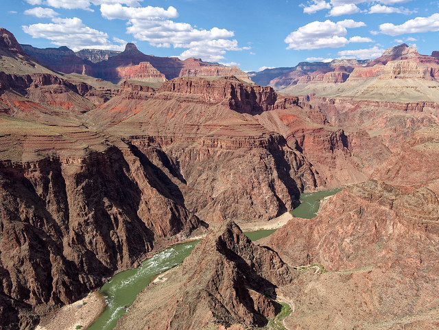
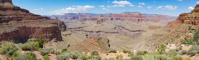
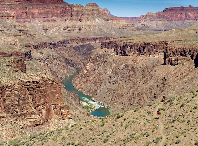
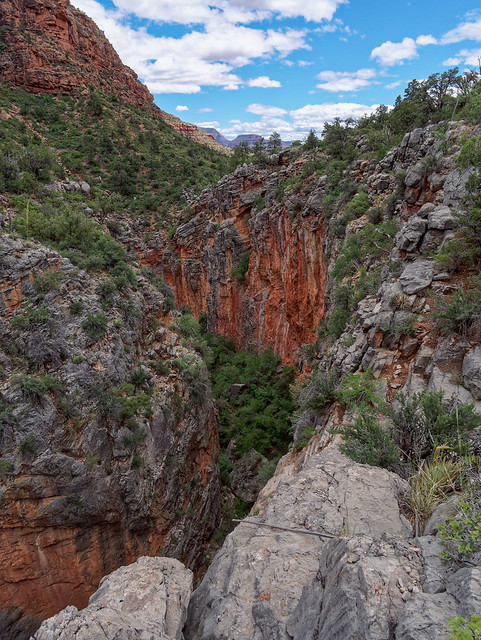
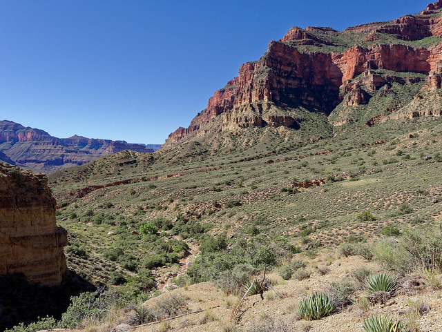
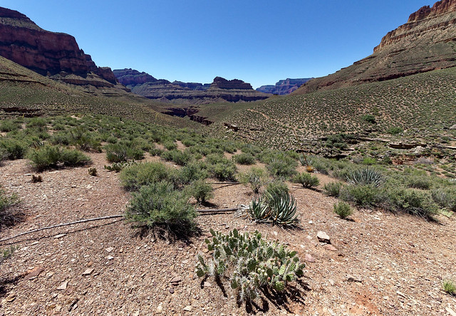
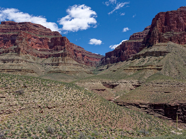
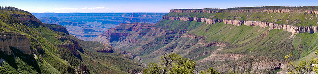
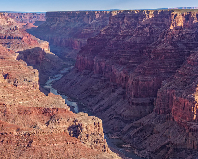
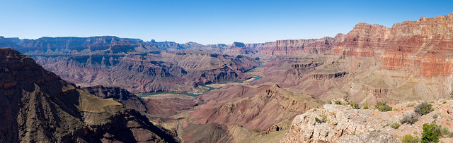
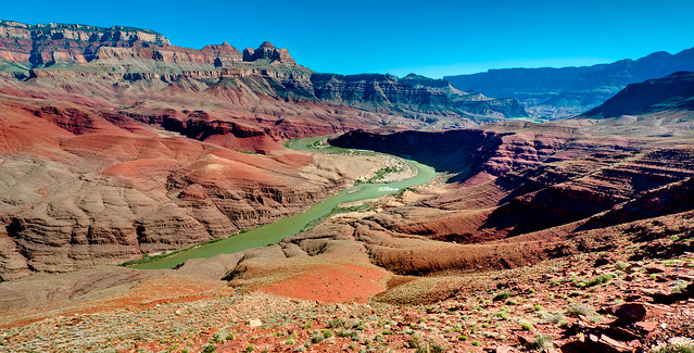
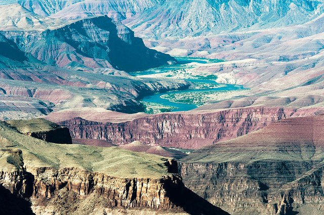
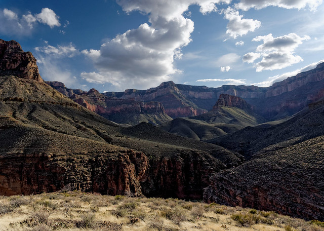
Back in the canyon - From the Escalante there is also the option to continue down river on the Tonto Trail. The Tonto is a trans-canyon trail that runs the length of the "Tonto Platform", a shelf situated roughly halfway between the South Rim and the Colorado River. It is nearly 70 miles long and this chart shows all of the Tonto Trail Distances between intersecting trails.
Seen from the Tonto Trail in Grand Canyon National Park, Arizona
Continuing west, the Tonto first intersects the Grandview Trail (Tanner/Escalante/Tonto/Grandview Trip Report and the NPS Grandview Trail Description) which will ultimately take you back to the South Rim.
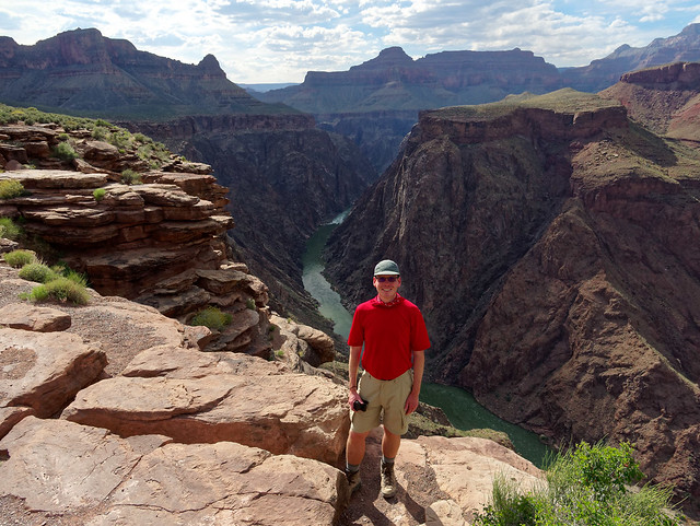
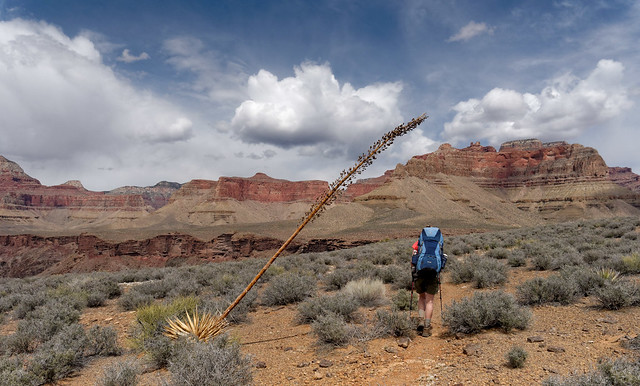
Dan and Jean on the Tonto Trail in Grand Canyon National Park, Arizona
However, this scenic trail enables day hikers and backpackers to access a notable feature in the park, Horseshoe Mesa, named for its unique shape.
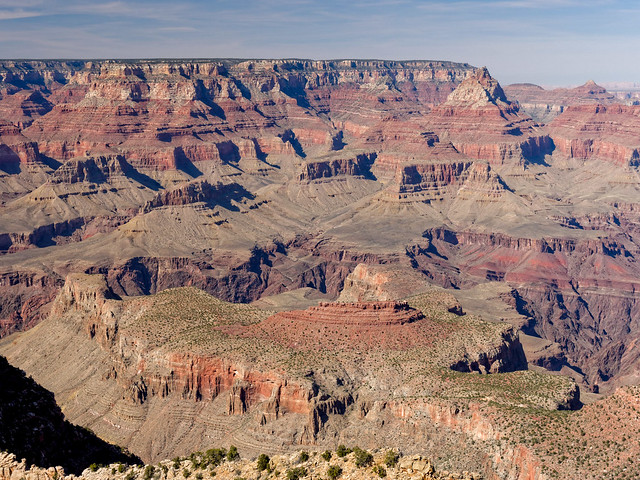
Horseshoe Mesa seen from the Grandview Trail in Grand Canyon National Park, Arizona
Most people begin their hike on the Grandview from the trailhead on the South Rim ...
Seen from the Grandview Trail in Grand Canyon National Park, Arizona
... and views of the canyon from this trail don't disappoint.
Seen from the Grandview Trail in Grand Canyon National Park, Arizona
Every trail provides its own unique views ..
Seen from the Grandview Trail in Grand Canyon National Park, Arizona
... and part of the magic of Grand Canyon is how changing light can create entirely different views from similar locations or angles.
Seen from the Grandview Trail in Grand Canyon National Park, Arizona
Once down to Horseshoe Mesa it is worth the time and effort to hike out to the end of one (or both) of the "arms". You could also consider exploring "Cave of the Domes", something we have not yet done. However, if you approached Horseshoe Mesa from below on the Tonto Trail there are three ways to get up to the mesa; from Page Spring (east side), from Cottonwood Creek (west side) and from the east side of the western arm.

Seen from the east arm of Horseshoe Mesa in Grand Canyon National Park, Arizona
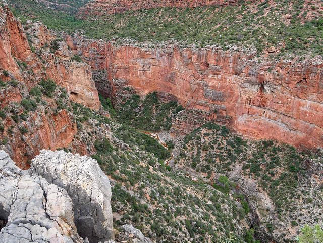
If you continue to hike to the west on the Tonto you will go around the base of Horseshoe Mesa (South Kaibab/Tonto/Grandview Trip Report and NPS Tonto Trail: Grandview to South Kaibab Description).
Horseshoe Mesa seen from the Tonto Trail in Grand Canyon National Park, Arizona
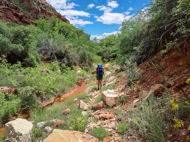
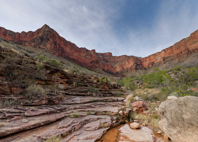
Once all the way around you will encounter Cottonwood Creek, a popular area to camp. Cottonwood Creek flows down a lovely side canyon ...
Cottonwood Creek in Grand Canyon National Park, Arizona
Seen while hiking down Cottonwood Creek in Grand Canyon National Park, Arizona
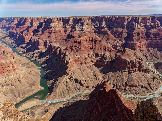
From Cottonwood Creek one can continue to travel west on the Tonto Trail. I don't believe the Tonto receives its fair share of respect. Most park visitors only see the canyon from the rim and most day hikers and many backpackers seem to be hyper focused on getting to the river. However, I think the Tonto offers the best of both worlds. It provides expansive views up to the South Rim, ...
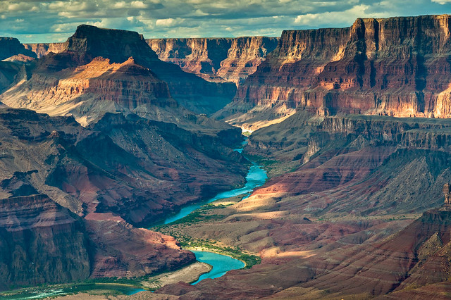
Seen from the Tonto Trail in Grand Canyon National Park, Arizona
... down to the river ...
The Colorado River seen from the Tonto Trail in Grand Canyon National Park, Arizona
... as well as across to the North Rim.
The North Rim seen from the Tonto Trail in Grand Canyon National Park, Arizona
Perhaps best of all it provides solitude, something that is hard to find on many of rim to river trails.
Jean on the Tonto Trail in Grand Canyon National Park, Arizona
A characteristic of the entire Tonto is it zig-zags around beautifully convoluted side canyons ...
Seen from the Tonto Trail in Grand Canyon National Park, Arizona
... and crosses attractive creek beds.
Lonetree Creek along the Tonto Trail in Grand Canyon National Park, Arizona
By continuing west on the Tonto the next trail encountered is the South Kaibab Trail. As most people hike down the South Kaibab let us begin at the trailhead up on the South Rim. The South Kaibab is one of the popular and heavily used “corridor” trails that goes from the rim to the river (NPS South Kaibab Trail Description). As you descend ...
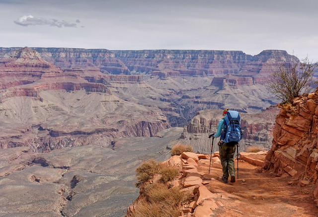
Jean on the South Kaibab Trail in Grand Canyon National Park, Arizona
... you will be treated to some of the most expansive views of all of the "rim to river trails".
Seen from the South Kaibab Trail in Grand Canyon National Park, Arizona
These views continue ...
Seen from the South Kaibab Trail in Grand Canyon National Park, Arizona
... all the way to the river.
The Colorado River seen from the South Kaibab Trail in Grand Canyon National Park, Arizona
Once at the river you have two choices. One option is to cross the river via the "black bridge"...
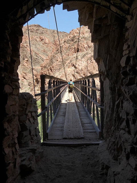
The "Black Bridge" in Grand Canyon National Park, Arizona
... and head to Phantom Ranch, Bright Angel Campground or the North Kaibab Trail.
The Colorado River seen from the South Kaibab Trail in Grand Canyon National Park, Arizona
However, for this part of the narrative we will stay south of the river. From the South Kaibab you can take the short River Trail which will intersect the Bright Angel Trail (which I will talk about in a moment).
The Colorado River in Grand Canyon National Park, Arizona
Back at the South Kaibab Trailhead on the rim - This is also the location of the beginning of another trail worth mentioning - the Rim Trail. This easy and very accessible trail, which runs along the rim, begins just west of the South Kaibab Trail ...
Seen from the Rim Trail in Grand Canyon National Park, Arizona
...and continues as far as Hermit Rest with viewpoints along the way.
Seen from the Rim Trail in Grand Canyon National Park, Arizona
Now back in the canyon - Let's say from the junction of the Tonto Trail with the South Kaibab Trail you did not hike down to the river or up to the rim. By continuing west on the Tonto Trail from the junction with the South Kaibab Trail you will once again experience blessed solitude ...
Jean on the Tonto Trail in Grand Canyon National Park, Arizona
... and expansive views.
The North Rim seen from the Tonto Trail in Grand Canyon National Park, Arizona
You can even see Phantom Ranch.
Phantom Ranch seen from the Tonto Trail in Grand Canyon National Park, Arizona
Continuing west on the Tonto you will encounter Pipe Creek Canyon ...
Pipe Creek Canyon seen from the Tonto Trail in Grand Canyon National Park, Arizona
... and will eventually cross Pipe Creek where the trees provide some welcome shade.
Jean on the Tonto Trail approaching Pipe Spring in Grand Canyon National Park, Arizona
Great views continue, of the South Rim ...
The South Rim seen from the Tonto Trail in Grand Canyon National Park, Arizona
... as well as the North Rim.
The North Rim seen from the Tonto Trail in Grand Canyon National Park, Arizona
The Tonto Trail next intersects the Bright Angel Trail at Indian Garden, a veritable oasis in the desert. When you start seeing the many trees you know you are getting close.
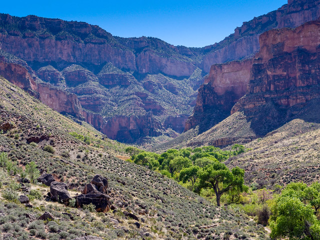
Approaching Indian Garden from the Tonto Trail in Grand Canyon National Park, Arizona
The Bright Angel Trail (NPS Bright Angel Trail Description), another of the rim to river "corridor" trails, is undoubtedly the most popular and heavily used trail in the park by hikers, backpackers and a more recent phenomenon, trail runners. The rest houses, the availability of water and shade are definite assets on this well maintained trail. If you began your hike from the rim on the Bright Angel Trail you are immediately rewarded with views down Indian Garden Creek Canyon, across Plateau Point all the way across the river and up into Bright Angel Creek Canyon on the other side.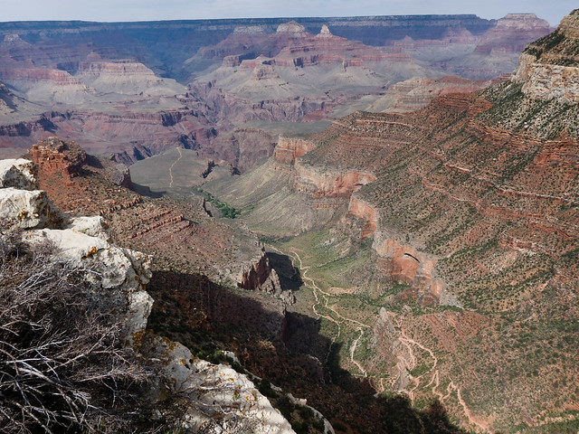
Bright Angel Trail in Grand Canyon National Park, Arizona
Views can be quite beautiful especially in low angled evening light.
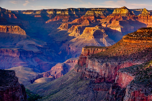
Seen from Bright Angel Trail in Grand Canyon National Park, Arizona
By continuing down the Bright Angel Trail you will pass through Indian Garden ...
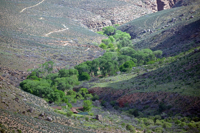
Indian Garden in Grand Canyon National Park, Arizona - Photo by Grand Canyon National Park Service
... down countless switchbacks ...
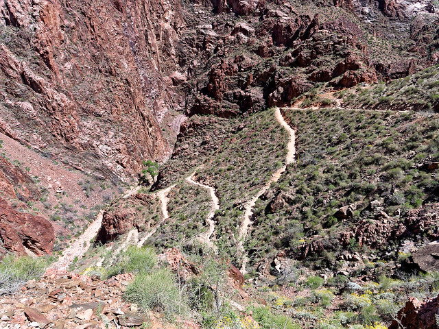
Seen from Bright Angel Trail in Grand Canyon National Park, Arizona
... until you reach the Colorado River.
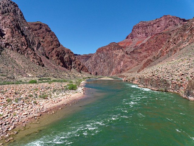
The Colorado River in Grand Canyon National Park, Arizona
From here you have the same options you had from South Kaibab only this time you would cross the "Silver Bridge" to get to Phantom Ranch, Bright Angel Campground and the North Kaibab Trail which I will get to later.
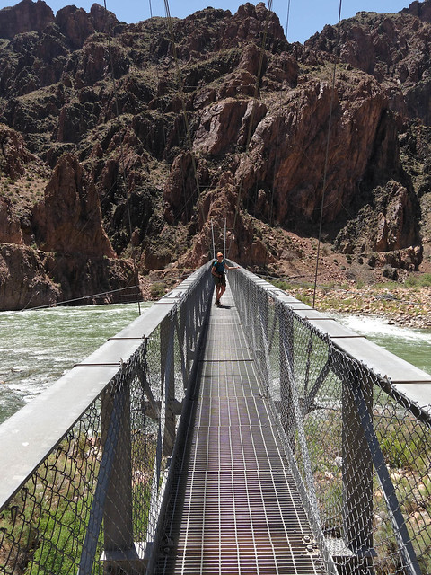
The "Silver Bridge" in Grand Canyon National Park, Arizona
But back at Indian Garden - From here, it is well worth doing the short side trip out to Plateau Point (left of middle in the photo below).

Seen from Bright Angel Trail in Grand Canyon National Park, Arizona
Once there you will be treated to views of the North Rim and the Colorado River both upstream ...
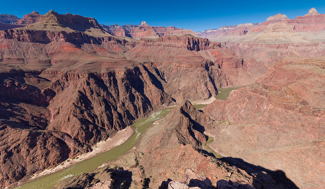
The Colorado River seen from Plateau Point in Grand Canyon National Park, Arizona
... and down.
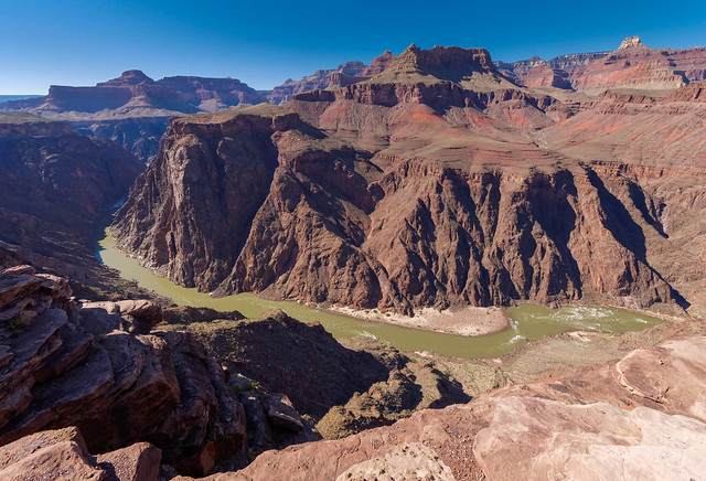
The Colorado River seen from Plateau Point in Grand Canyon National Park, Arizona
Not to mention views back up to the South Rim.
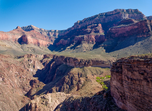
The South Rim seen from Plateau Point in Grand Canyon National Park, Arizona
However, by continuing west on the Tonto Trail from Indian Garden you quickly leave the trees and people behind. To me, one of the best things about hiking on the Tonto is how it forces you to see just how insignificant we humans are. It is a valuable lesson in humility and a humbling experience.
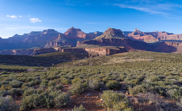
Seen from the Tonto Trail in Grand Canyon National Park, Arizona
There are always great views up to the South Rim ...
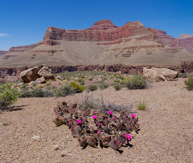
Seen from the Tonto Trail in Grand Canyon National Park, Arizona
... as well as when the Tonto takes you close enough to the edge to see down to the river.
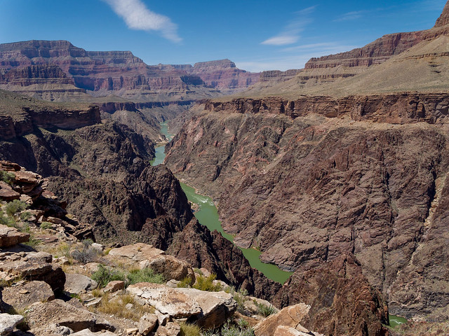
The Colorado River the Tonto Trail in Grand Canyon National Park, Arizona
This section of the Tonto takes you to Monument Creek, a popular area to camp (Bright Angel/Tonto/Hermit Trip Report and NPS Tonto Trail: Bright Angel to Hermit Trail Description). From Monument Creek a notable side trip (or a worthy destination) is Granite Rapids. These rapids are most easily reached from the Tonto by a side trail that intersects the Tonto a short distance west of Monument Creek camp.
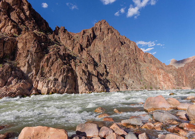
However, to me the best part of being at Monument Creek is exploring the short but lovely slot canyon that Monument Creek flows through.
The slot canyon near the Monument Creek Trail in Grand Canyon National Park, Arizona
To get there simply take the side trail, located just down canyon from the last campsite, marked by a sign that simply says "Creek".
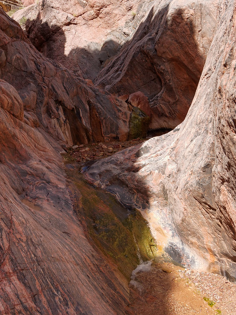
The slot canyon near the Monument Creek Trail in Grand Canyon National Park, Arizona
Once exiting the short slot "The Monument” comes into view. From there you can continue down canyon all the way to Granite Rapids or return to Monument Creek camp via the Granite Rapids side trail which you will encounter a bit farther down canyon. Look for it in a large drainage to your left.
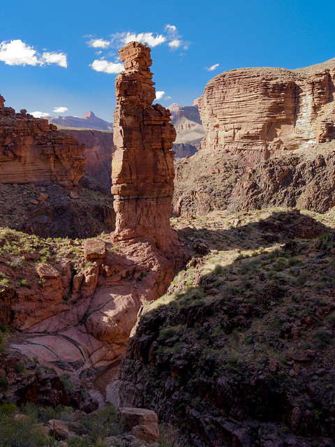
The Monument in Grand Canyon National Park, Arizona
Continuing west on the Tonto you leave the Monument behind ...
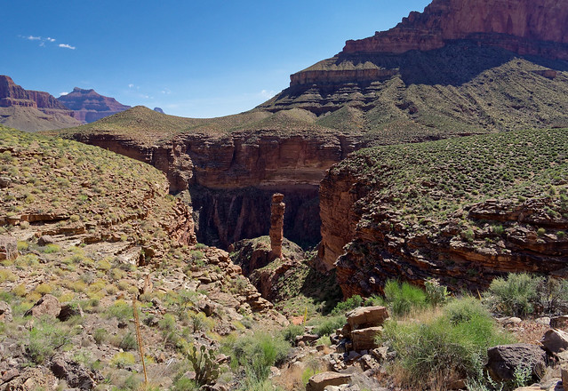
The Monument in Grand Canyon National Park, Arizona
... and return to the Tonto Platform for views which include down to the river and Hermit Rapids.
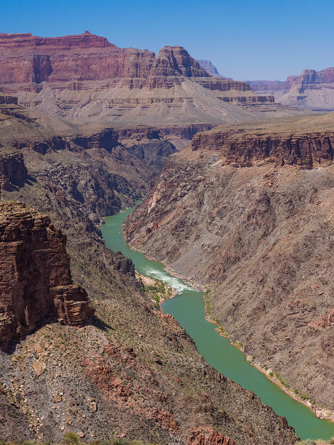
Hermit Rapids seen from the Tonto Trail in Grand Canyon National Park, Arizona
The next trail you will encounter is the Hermit Trail. The trailhead for this popular trail is on the South Rim at Hermit's Rest.
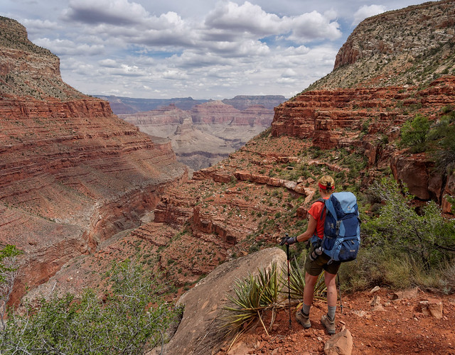
Jean on the Hermit Trail in Grand Canyon National Park, Arizona
From Hermits Rest this trail initially takes you down through a relatively narrow side canyon before passing ...
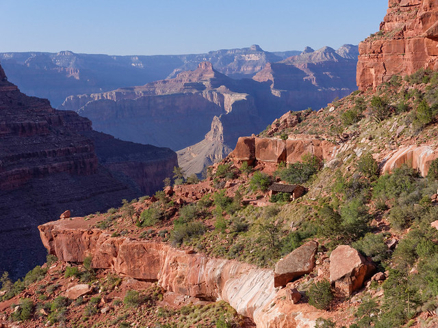
Seen from the Hermit Trail in Grand Canyon National Park, Arizona
... the rest house at Santa Maria Spring which provides a welcome respite from the sun.
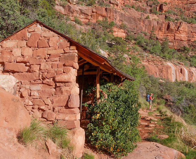
The rest house at Santa Maria Spring on the Hermit Trail in Grand Canyon National Park, Arizona
The canyon then begins to open up ...
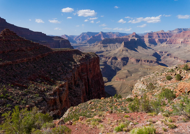
Seen from the Hermit Trail in Grand Canyon National Park, Arizona
... and views become more expansive. You can look down the length of Hermit Creek Canyon.
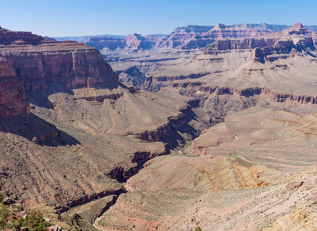
Hermit Creek Canyon seen from the Hermit Trail in Grand Canyon National Park, Arizona
By continuing down the Hermit Trail you will reach Hermit Camp, a well developed camping area where many backpackers choose to stay. If you do, be sure to allow enough time to day hike down Hermit Creek Canyon ...

Hermit Creek Canyon in Grand Canyon National Park, Arizona
... to see the unique display of mineral formations.
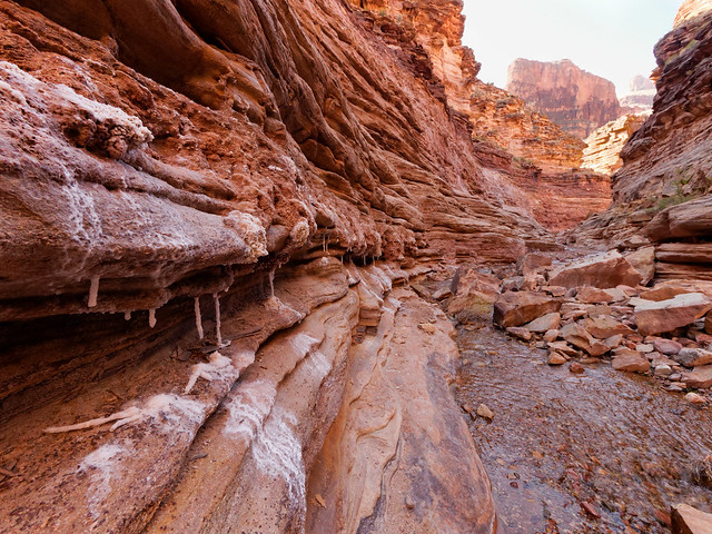
Crystals in Hermit Creek Canyon in Grand Canyon National Park, Arizona
Some are quite delicate.
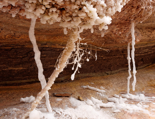
Crystals in Hermit Creek Canyon in Grand Canyon National Park, Arizona
As you approach the river the canyon opens ups ...
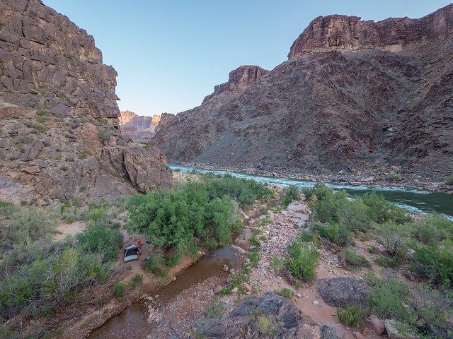
Our camp site at Hermit Rapids in Grand Canyon National Park, Arizona
... and you see Hermit Rapids.
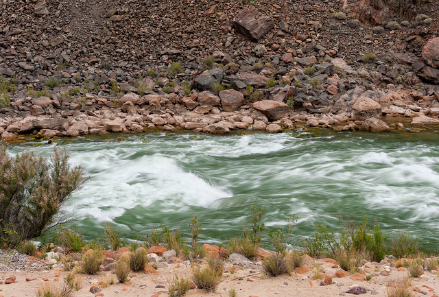
Hermit Rapids in Grand Canyon National Park, Arizona
In our opinion, it is well worth the effort to backpack the few extra miles and camp by the river.
Hermit Rapids in Grand Canyon National Park, Arizona
The Hermit Trail also provides access to two other trails; the Dripping Springs Trail and the Waldron Trail. Hiking to Dripping Springs is commonly done as a day hike.
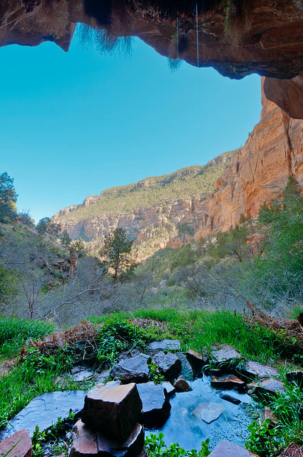
Dripping Springs in Grand Canyon National Park, Arizona
I don't know how many hikers realize this but the Dripping Springs Trail does not actually end there. By continuing beyond the spring this trail becomes a more rugged and brushy route...
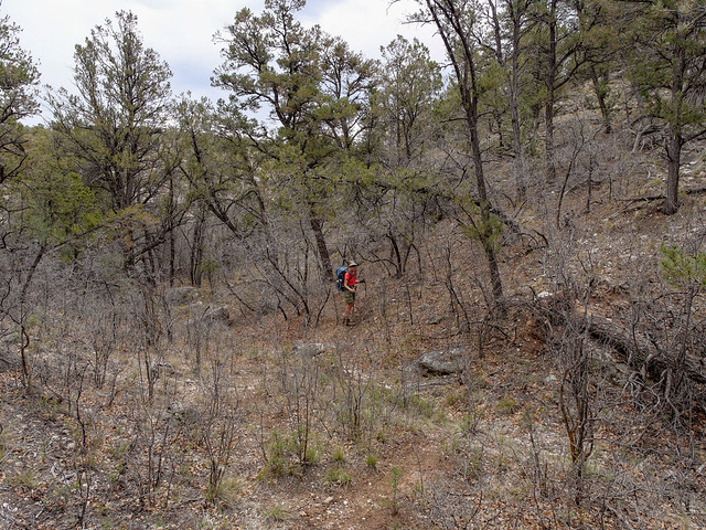
Jean on the Dripping Springs in Grand Canyon National Park, Arizona
... that is best used, perhaps even only used, to access the route to Eremita Mesa.
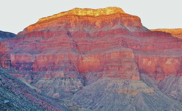
Eremita Mesa in Grand Canyon National Park, Arizona
The other trail off of the Hermit is the Waldron Trail which offers some attractive views as well as some welcome solitude for canyon hikers looking for something less strenuous.
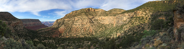
Seen from the Waldron Trail in Grand Canyon National Park, Arizona
But back in Hermit Canyon - From Hermit Camp the Tonto continues west. As is common all along the Tonto the trail circumvents many interesting side canyons, in this case Travertine Canyon.
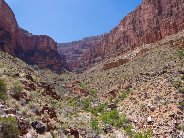
Travertine Canyon seen from the Tonto Trail in Grand Canyon National Park, Arizona
You will again be treated to the sweeping views which are common from the Tonto.
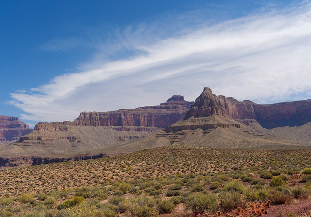
Seen from the Tonto Trail in Grand Canyon National Park, Arizona
The next trail the Tonto intersects is the Boucher Trail (Hermit/Tonto/Boucher Trip Report and NPS Boucher Trail Description).

Seen from the Boucher Trail in Grand Canyon National Park, Arizona
The trailhead for the Boucher is actually off of the Dripping Springs Trail.
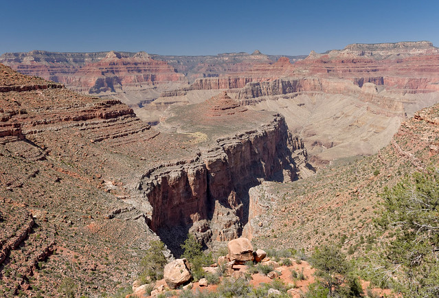
Seen from the Boucher Trail in Grand Canyon National Park, Arizona
It is unusual for a trail that goes all the way to the river but does not also ascend all the way up to the rim.
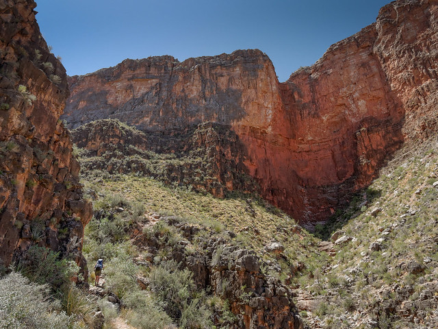
Jean on the Boucher Trail in Grand Canyon National Park, Arizona
The Tonto and the Boucher share the same trail for a short distance and by continuing west ...
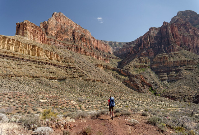
Jean on the Boucher Trail in Grand Canyon National Park, Arizona
... you will soon reach Boucher Creek. As is the case with Hermit Creek, backpackers can camp here and day hike down the creek to the river. However we believe it is more enjoyable to continue down the creek ...
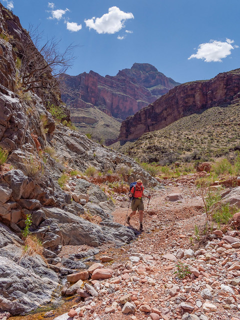
Jean on the Boucher Trail in Grand Canyon National Park, Arizona
... and camp ....
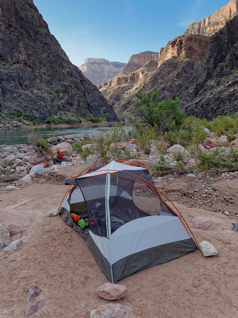
Our camp by Boucher Rapids in Grand Canyon National Park, Arizona
... by Boucher Rapids.
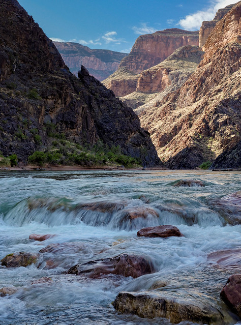
Boucher Rapids in Grand Canyon National Park, Arizona
From the junction with the Boucher Trail the Tonto Trail continues west for nearly 29 miles before it intersects with another trail. This trail may be more commonly backpacked west to east (West Tonto from South Bass to Hermit Rest Trip Report and NPS Tonto Trail: Boucher Trail to South Bass Trail Description) but for consistency, this narrative will continue westward.
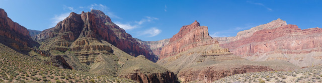
South Rim seen from Boucher Canyon in Grand Canyon National Park, Arizona
As always from the Tonto the views include the North Rim, the Colorado River, ...
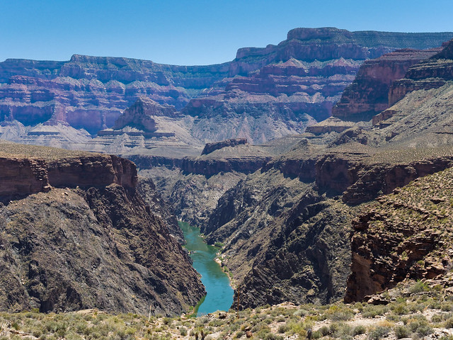
Seen from the Tonto Trail in Grand Canyon National Park, Arizona
... the South Rim, numerous side canyons ...
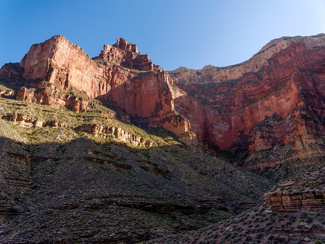
Serpentine Canyon in Grand Canyon National Park, Arizona
... as well as the broad Tonto Platform itself.
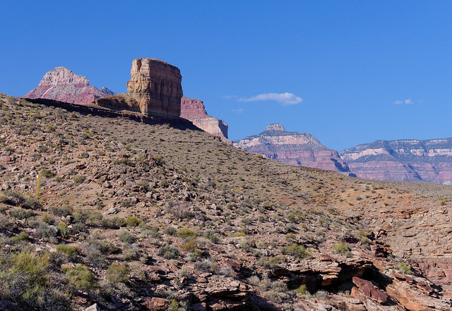
Seen from the Tonto Trail in Grand Canyon National Park, Arizona
This area of the canyon is often referred to as "The Gems" as many of the side canyons bear names such as "Ruby" ...
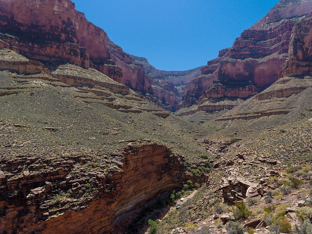
Ruby Canyon in Grand Canyon National Park, Arizona
... and "Turquoise".
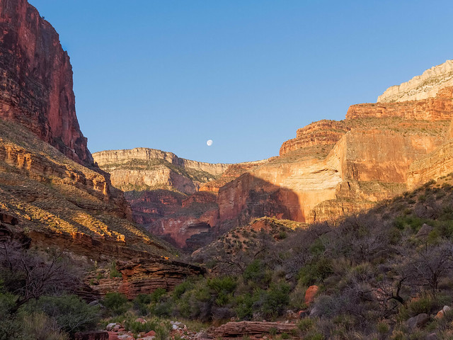
Turquoise Canyon in Grand Canyon National Park, Arizona
Each side canyon offers opportunities for more exploration, some routes more "sporty" than others.
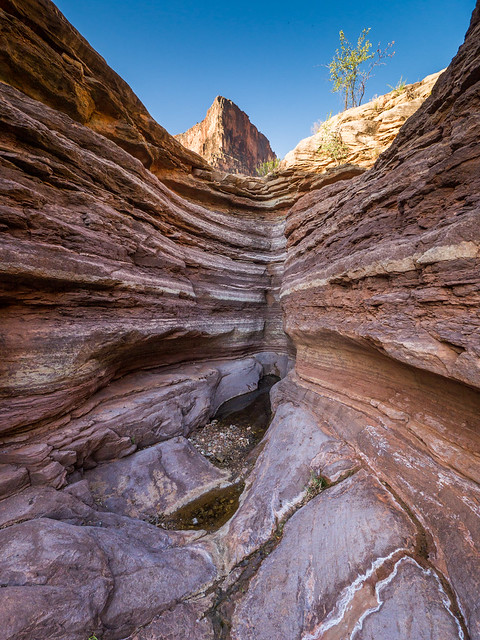
Turquoise Canyon in Grand Canyon National Park, Arizona
Again, part of the beauty of the Tonto is the way it shows us just how insignificant we truly are. This section also forces one to be truly self reliant.
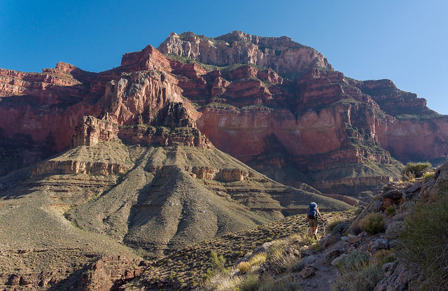
Jean on the Tonto Trail in Grand Canyon National Park, Arizona
The next trail the Tonto intersects is the South Bass Trail (NPS Trail Description). The trailhead is on the South Rim...
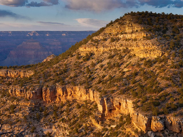
Seen from the South Bass Trail in Grand Canyon National Park, Arizona
... and the views come early ...
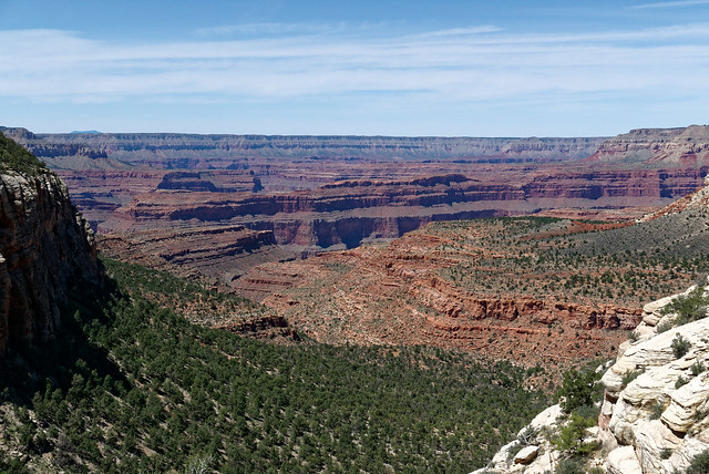
Seen from the South Bass Trail in Grand Canyon National Park, Arizona
... and keep building ...
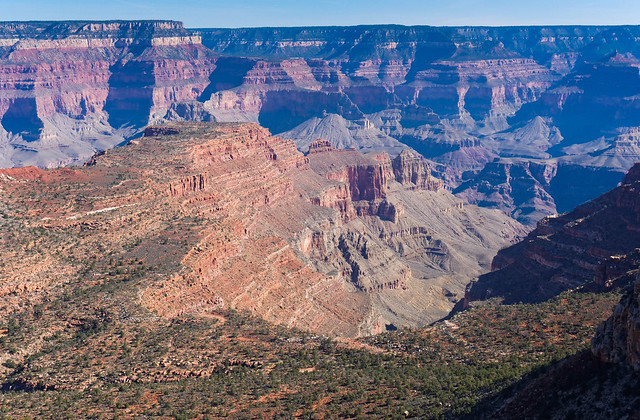
Seen from the South Bass Trail in Grand Canyon National Park, Arizona
... and stay with you ...
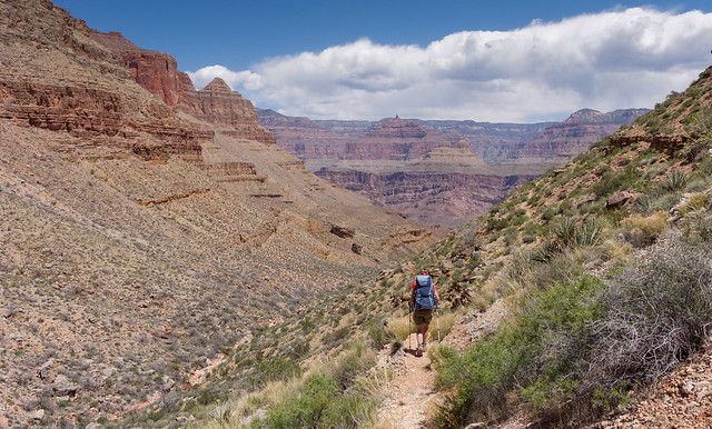
Jean on the South Bass Trail in Grand Canyon National Park, Arizona
... all the way ...
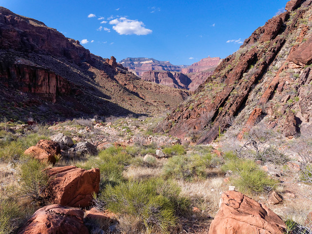
South Bass Canyon in Grand Canyon National Park, Arizona
... down the canyon ...
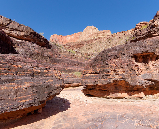
South Bass Canyon in Grand Canyon National Park, Arizona
... until you reach the river ...
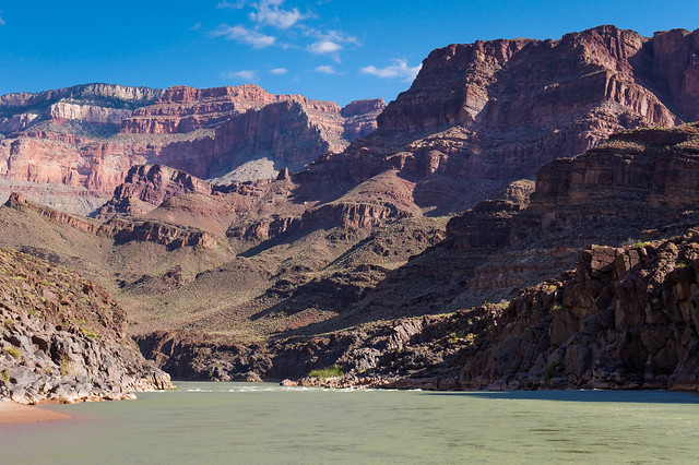
The Colorado River at the mouth of South Bass Canyon in Grand Canyon National Park, Arizona
... and South Bass Beach.
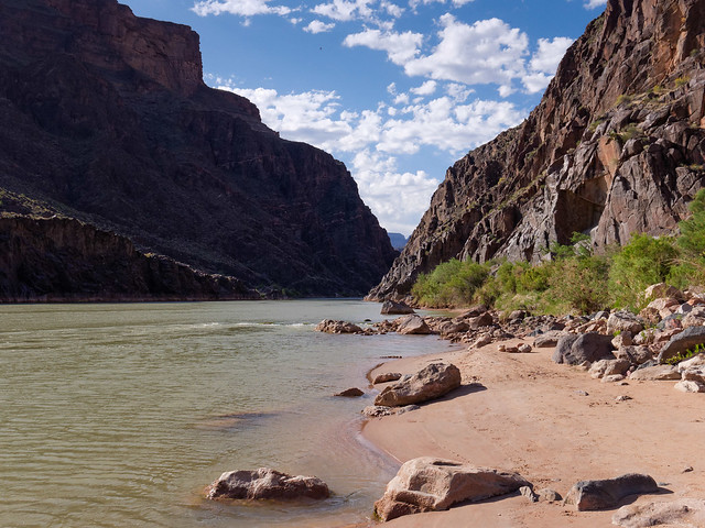
South Bass Beach in Grand Canyon National Park, Arizona
Back to the Tonto - From the junction with the South Bass Trail the Tonto Trail continues west. I know I sound like a "broken record" but I never tire of views from the Tonto; whether it is up to the South Rim, ...
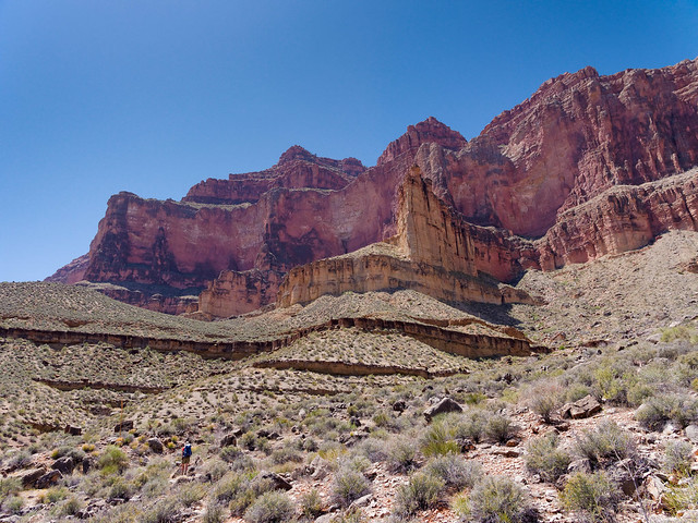
Seen from the Tonto Trail in Grand Canyon National Park, Arizona
... over to the North Rim, ...
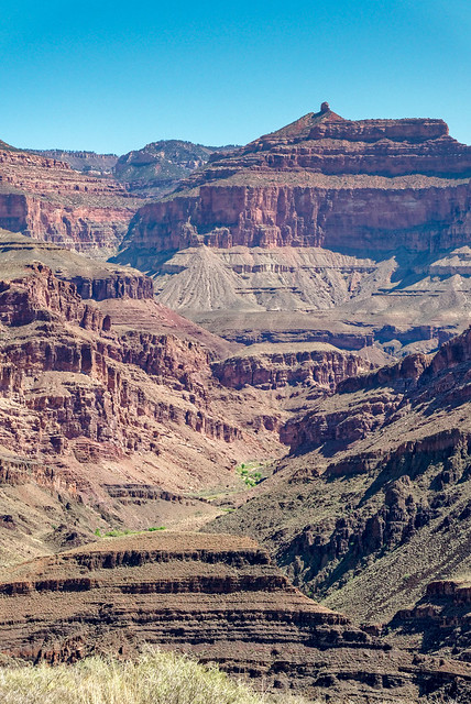
Seen from the Tonto Trail in Grand Canyon National Park, Arizona
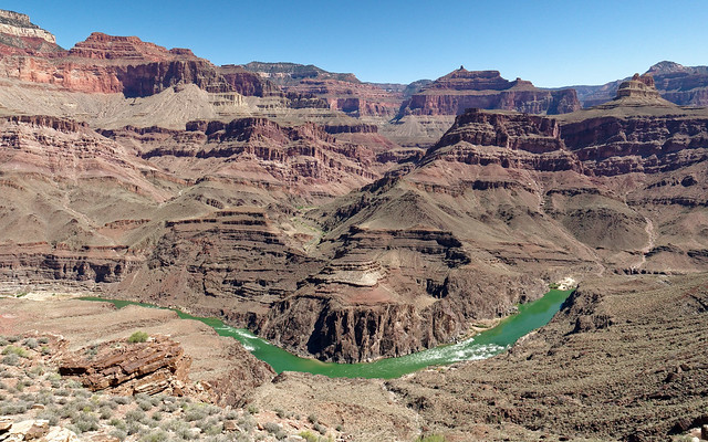
Seen from the Tonto Trail in Grand Canyon National Park, Arizona
... up the side canyons...
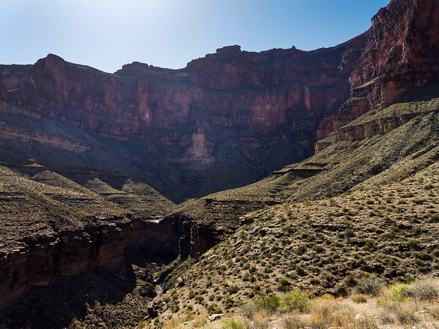
Copper Canyon seen from the Tonto Trail in Grand Canyon National Park, Arizona
... not to mention what I can see down around my feet.
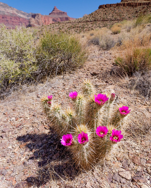
Seen from the Tonto Trail in Grand Canyon National Park, Arizona
The western terminus of the Tonto Trail is at Garnet Canyon.
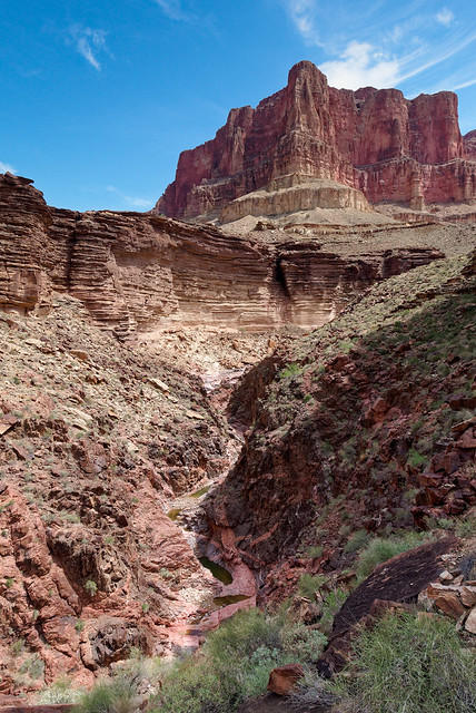
Garnet Canyon in Grand Canyon National Park, Arizona
An informal route connects this end of the Tonto to a very scenic and popular route, the Royal Arch Loop. However, this route is most often done in a "clockwise" direction due to a 20 foot rappel along the route. While it is true some have climbed up it, I believe most choose the more conventional clockwise direction and descend the rock face. We have done it twice (April 2013 Trip Report, April 2018 Trip Report and NPS Royal Arch Loop Description).
The Royal Arch Trailhead is at a junction with the South Bass Trail on the Esplanade ...
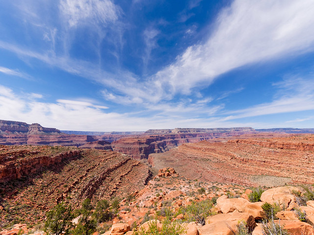
The Royal Arch Loop in Grand Canyon National Park, Arizona
... which initially provides easy hiking.
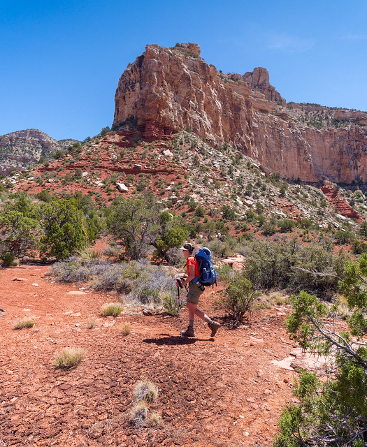
The Royal Arch Loop in Grand Canyon National Park, Arizona
It then drops down into Royal Arch Canyon ...
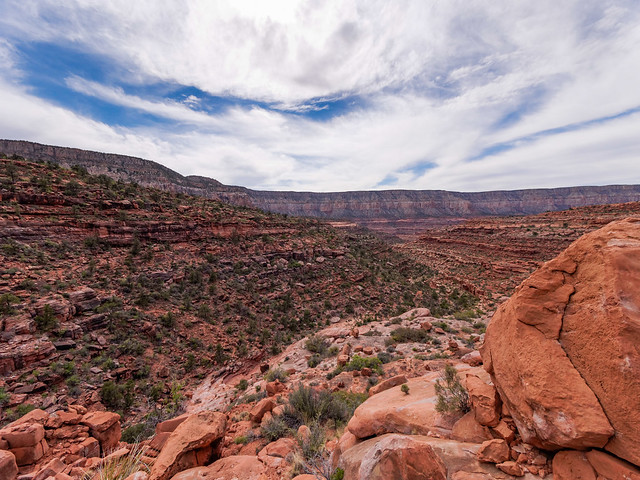
The Royal Arch Loop in Grand Canyon National Park, Arizona
... and follows the creek bed ...
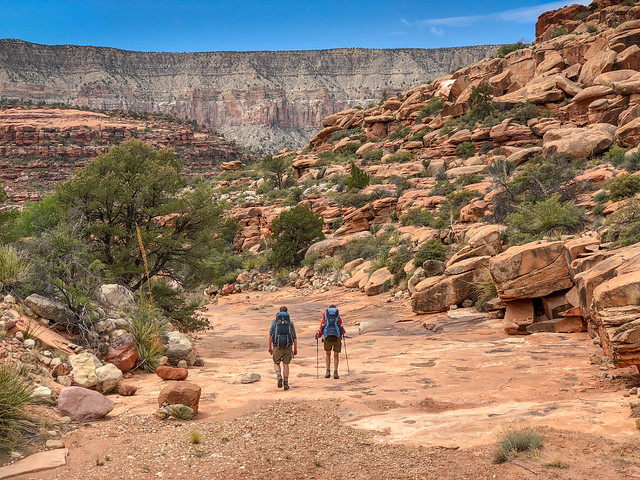
The Royal Arch Loop in Grand Canyon National Park, Arizona
...with only minor minor obstacles.
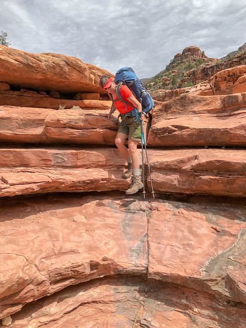
The Royal Arch Loop in Grand Canyon National Park, Arizona
Along the way you will bypass a large pour-off. While some choose to descend via the "sporty" route on the left (which includes the "Ledge of Death") we did the easier route on the right ...
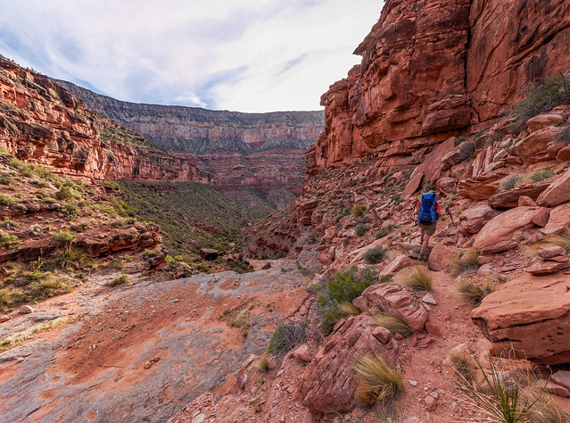
The Royal Arch Loop in Grand Canyon National Park, Arizona
... to reach the canyon floor.
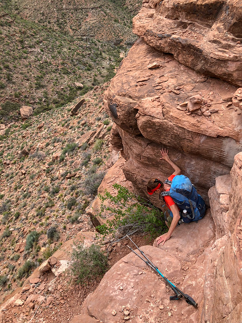
The Royal Arch Loop in Grand Canyon National Park, Arizona
As you continue down the canyon ...
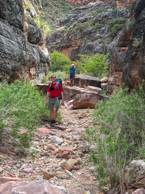
The Royal Arch Loop in Grand Canyon National Park, Arizona
... you will periodically encounter obstacles.
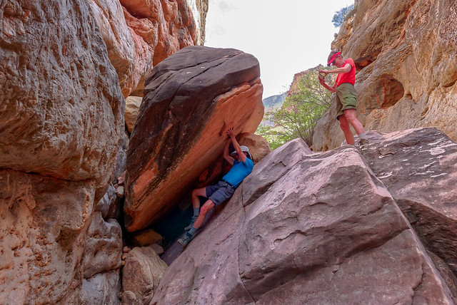
The Royal Arch Loop in Grand Canyon National Park, Arizona
Continuing to follow the creek down the canyon you will pass a large cairn on the right for a trail that exits the creek bed for the continuation of the loop. But first you will want to continue down all the way to Royal Arch.
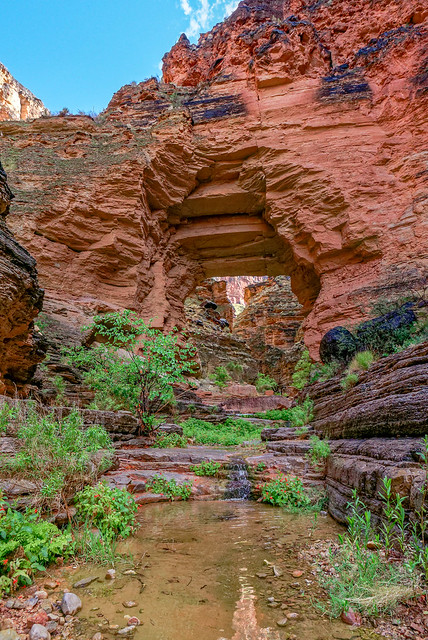
Royal Arch in Grand Canyon National Park, Arizona
Below the arch is an impressive monolith.
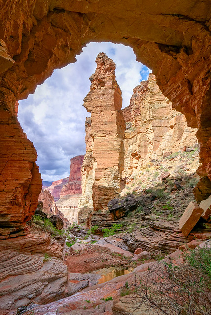
Seen from Royal Arch in Grand Canyon National Park, Arizona
This is a popular place to stop for a break as well as camp. Either way, you must backtrack to the cairn marking the continuation of the loop. The trail initially climbs out of Royal Arch Creek Canyon ...
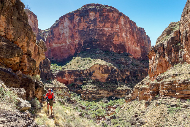
Seen from the Royal Arch Loop in Grand Canyon National Park, Arizona
... providing views back down to it as well as growing views of the river both downstream ...
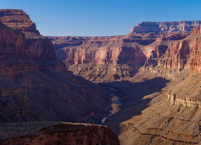
... and upstream as well as Toltec Beach, a common destination for the day.
Seen from the Royal Arch Loop in Grand Canyon National Park, Arizona
... and upstream as well as Toltec Beach, a common destination for the day.
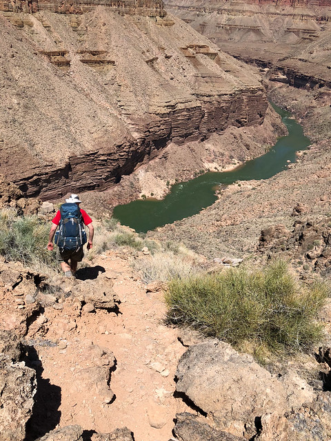
Seen from the Royal Arch Loop in Grand Canyon National Park, Arizona
But between "here" and "there" is a rock face requiring a 20 foot rappel and some down climbing.
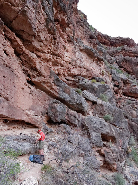
Jean on the Royal Arch Loop in Grand Canyon National Park, Arizona
Toltec Beach ...
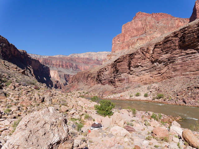
... is the location of the informal trail that will take you downriver ...
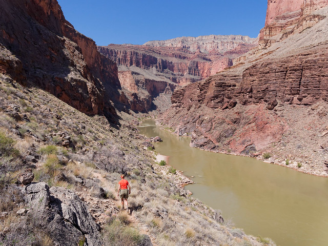
Toltec Beach in Grand Canyon National Park, Arizona
... is the location of the informal trail that will take you downriver ...
Jean on the route to Elves Chasm in Grand Canyon National Park, Arizona
... to where Royal Arch Creek flows into the river. and the stunningly beautiful, Elves Chasm. This is an extremely popular stopping place for rafters but if you time it right and get to Elves Chasm between groups ...
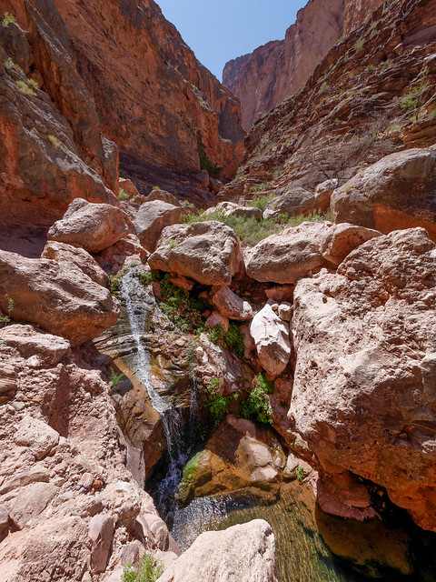
Seen on the route to Elves Chasm in Grand Canyon National Park, Arizona
... it is paradise and the urge to "skinny dip" is impossible to resist for some although the water is breathtakingly cold!.
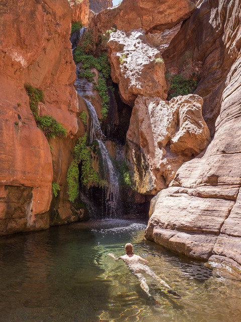
Jean at Elves Chasm in Grand Canyon National Park, Arizona
To complete the Royal Arch Loop you would take the informal route from Toltec Beach to Garnet Canyon. Along the way you will encounter a lovely side canyon that sparkles with quartz and mica in the pink and black rock of the deep Vishnu Schist layer.

Grand Canyon National Park, Arizona
After leaving Garnet Canyon you are now on the Tonto Trail.

Jean on the Tonto Trail in Grand Canyon National Park, Arizona
The Tonto continues east until it reaches South Bass Canyon. From here you can either take the short steep side trail down to the bottom of South Bass Canyon and eventually, to South Bass Beach. Or you can continue on the Tonto back to the South Bass Trail to ascend out of the canyon.

Seen from the Tonto Trail in Grand Canyon National Park, Arizona
The Royal Arch Loop is the most westerly named trail/route within Grand Canyon National Park that is south of the Colorado River but before this narrative moves to the North Rim I need to mention a particularly popular iconic location in Grand Canyon. While it is not located within Grand Canyon National Park it is a place every backpacker should visit at least once.
I am referring to Havasu Canyon in the Havasupai Indian Reservation and home to the blue green waters of Havasu Creek. This stunningly beautiful creek forms a series of water falls on its way to the Colorado River; Havasu, Mooney and Beaver being the most notable. While we were there we also hiked down canyon to the confluence of Havasu Creek and the Colorado River (trip report and photos).

Beaver Falls in the Havasupai Indian Reservation, Arizona
This narrative will now shift to the North Rim where I will begin this "tour" in the eastern portion of the park and again travel in a westerly direction. The most easterly North Rim trail is the South Canyon Trail (South Canyon Trip Report and NPS South Canyon Trail description). From the trailhead you can see down South Canyon for quite a ways.
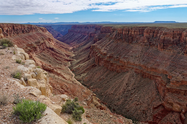
South Canyon in Grand Canyon National Park, Arizona
This trail quickly drops to the bottom of the canyon ...
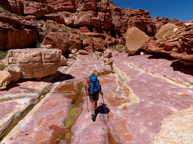
Jean on the South Canyon Trail in Grand Canyon National Park, Arizona
... with the occasional bypass ...
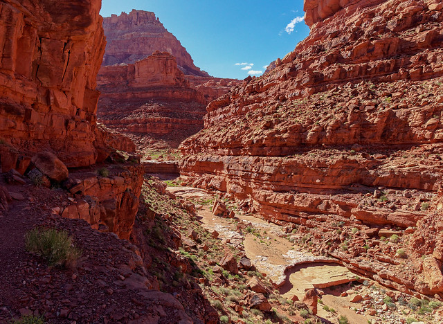
Within South Canyon in Grand Canyon National Park, Arizona
... before returning to the the canyon floor.

Jean on the South Canyon Trail in Grand Canyon National Park, Arizona
A final bypass will take you to your first view of the river, ...
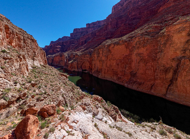
The Colorado River seen from near the mouth of South Canyon in Grand Canyon National Park, Arizona
... a view that is so unlike any of the other views we have had. The flat green water perpendicular to the imposing vertical Redwall seems so straight, so constructed, so unnatural ...
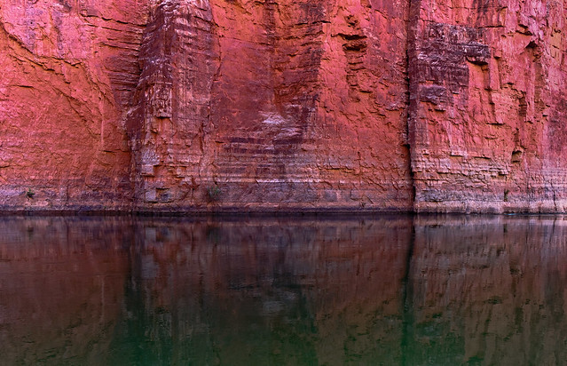
The Colorado River seen from near the mouth of South Canyon in Grand Canyon National Park, Arizona
... but so impressive.
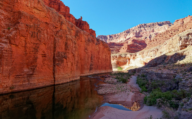
The Colorado River seen from near the mouth of South Canyon in Grand Canyon National Park, Arizona
If one hikes downstream it is possible to reach Vasey's Paradise. We did not do this and I have read, between the Poison Ivy and the sloped rock, it is tricky.
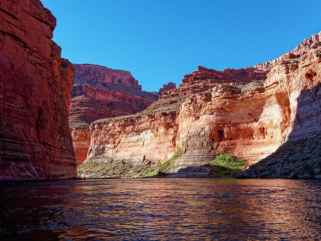
span style="font-size: x-small;">Looking toward Vasey's Paradise on the Colorado River near South Canyon in Grand Canyon National Park, Arizona
Those on boats have a much easier way to see it.
a href="https://www.flickr.com/photos/treasure_island_museum/7330607094" title="P8060213 by Anne Schnoebelen, on Flickr">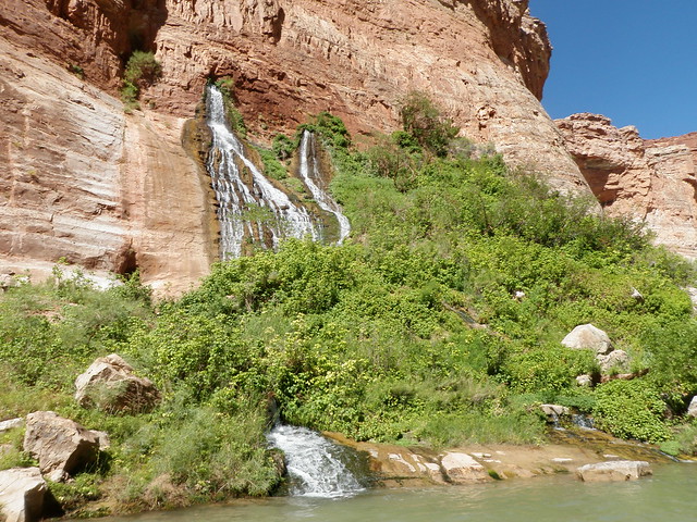
Vasey's Paradise seen from down stream of South Canyon in Grand Canyon National Park, Arizona
The next trail in this journey through the park is the Nankoweap Trail (Nankoweap Trail Trip report and NPS Nankoweap Trail Description). There are two access points for the Nankoweap Trail; from Point Imperial which is within the National Park boundary and Saddle Mountain which is not
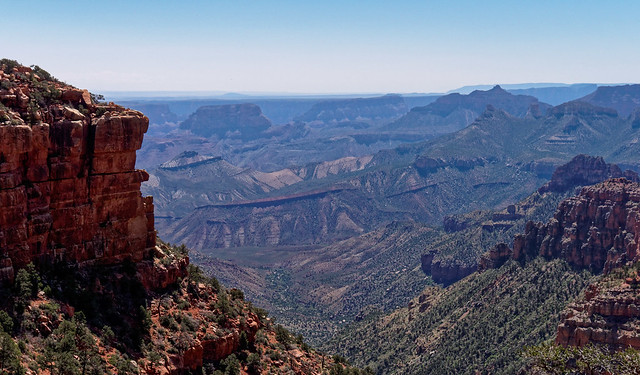
Seen from the Nankoweap Trail in Grand Canyon National Park, Arizona
No matter where you start before long you reach the potion of the trail affectionately known as the "Endless Traverse".
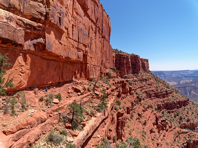
Jean (little blue dot to the left) on the Nankoweap Trail in Grand Canyon National Park, Arizona
The trail continues toward Marion Point ...
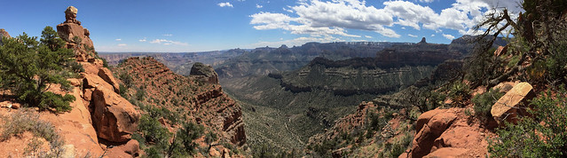
Seen from the Nankoweap Trail in Grand Canyon National Park, Arizona
... and beyond it ...
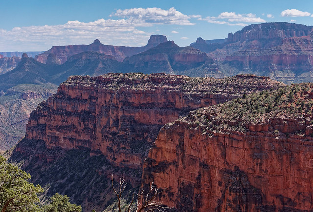
Marion Point seen from the Nankoweap Trail in Grand Canyon National Park, Arizona
... as the traverse continues toward Tilted Mesa.
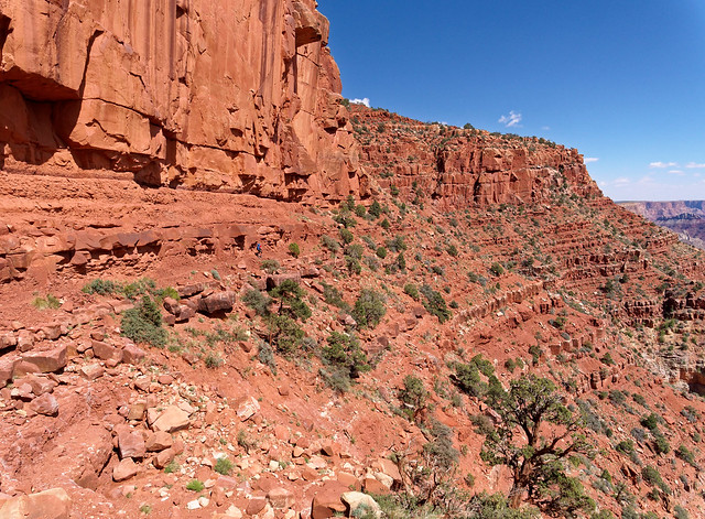
Seen from the Nankoweap Trail in Grand Canyon National Park, Arizona
Once at Tilted Mesa the trail begins a steep descent ...
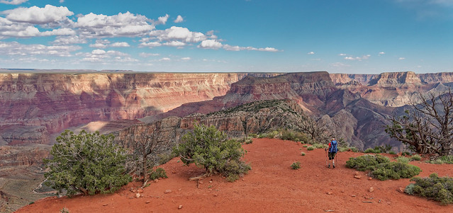
Jean on the Nankoweap Trail in Grand Canyon National Park, Arizona
... providing expansive views of Nankoweap Creek Canyon.
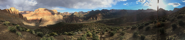
Seen from the Nankoweap Trail in Grand Canyon National Park, Arizona
It is a great place to be during the magic of the "Golden Hour" late in the day.
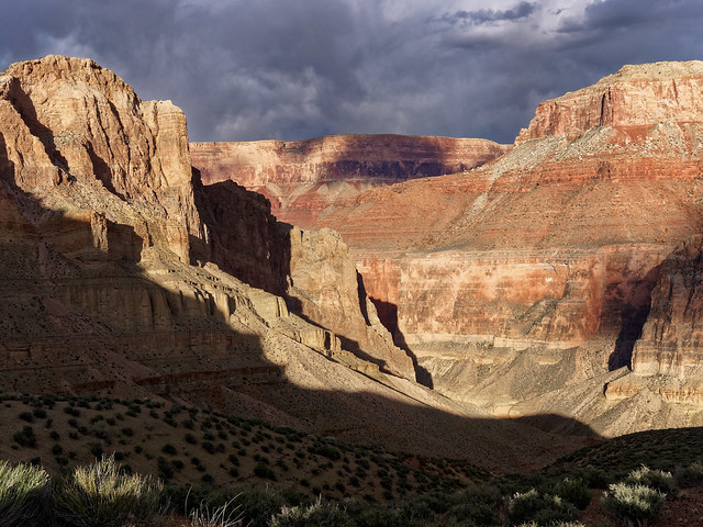
Seen from the Nankoweap Trail in Grand Canyon National Park, Arizona
Once to the bottom of the canyon the trail follows ...
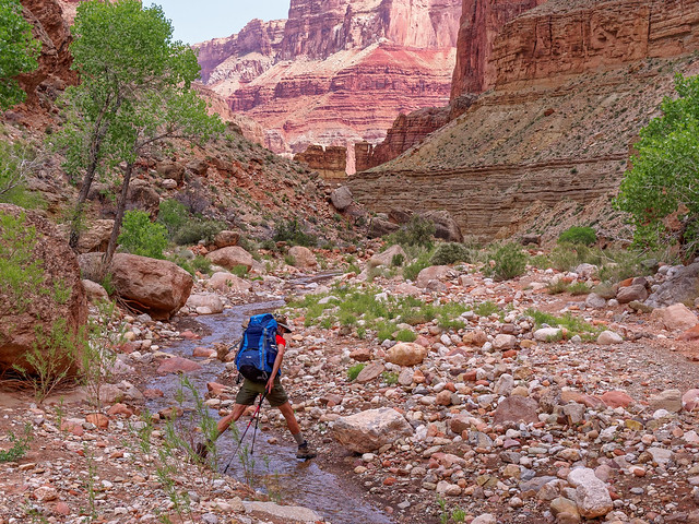
Jean on the Nankoweap Trail in Grand Canyon National Park, Arizona
... Nankoweap Creek downstream ...
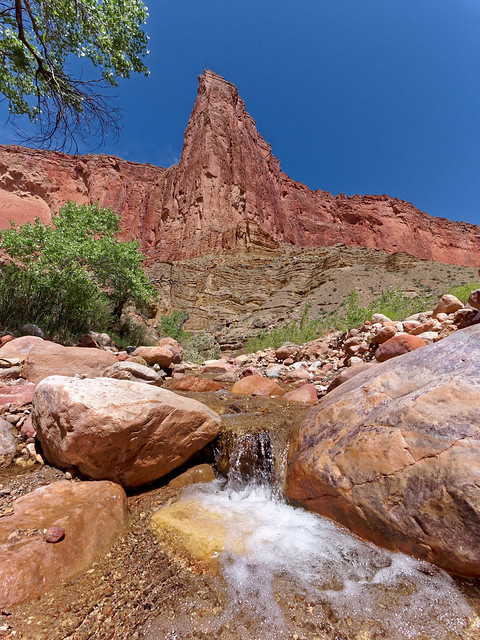
Nankoweap Creek in Grand Canyon National Park, Arizona
... to the Colorado River.
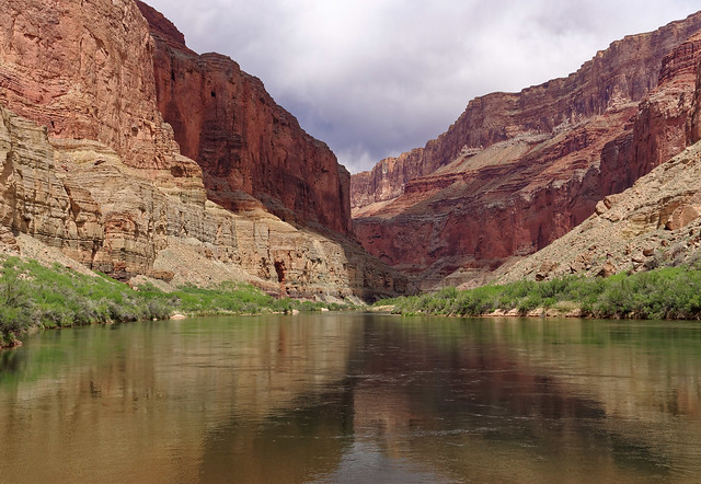
The Colorado River in Grand Canyon National Park, Arizona
However, the most popular spot is located high up in the rock face ...
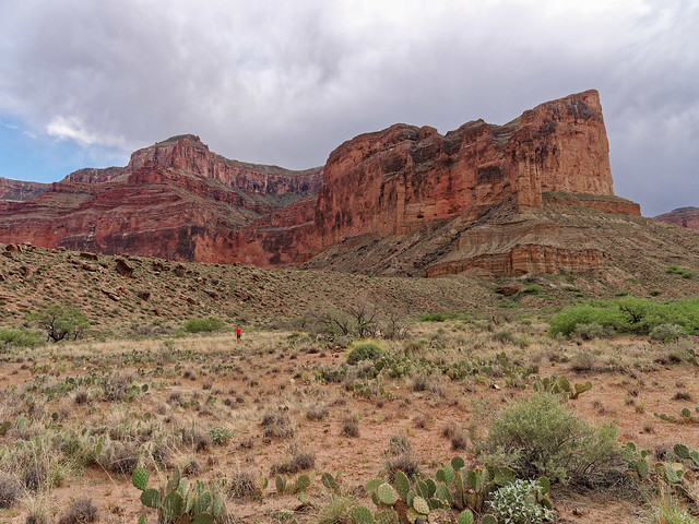
Jean on the route to the Nankoweap Granaries in Grand Canyon National Park, Arizona
... the Nankoweap Granary which was constructed by the Ancestral Puebloans who once occupied the area.
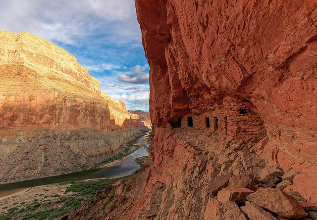
The Nankoweap Granary n Grand Canyon National Park, Arizona
I know survival must have been a struggle for these hardy people but I believe they would have also found this view to be awe inspiring.
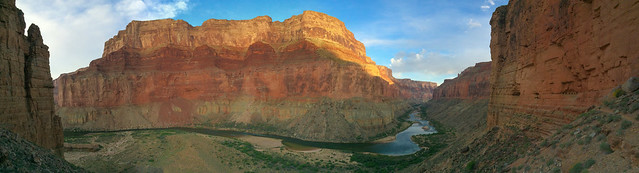
Seen from the Nankoweap Granary n Grand Canyon National Park, Arizona
An option for backpackers is to also do a short day hike up the Little Nankoweap Canyon.
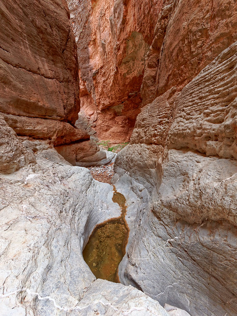
Little Nankoweap Canyon n Grand Canyon National Park, Arizona
Back on the rim - By continuing west in the park you will encounter several trails on the North Rim that don't descend into the canyon. From Point Imperial one can hike east for views across to the Nankoweap Trail ...
Seen from the Point Imperial Trail in Grand Canyon National Park, Arizona
... and down Nankoweap Creek Canyon.
Seen from the Point Imperial Trail in Grand Canyon National Park, Arizona
From Point Imperial you can also hike to the west on the Ken Patrick Trail for sweeping views of Bright Angel Canyon.
in Grand Canyon National Park, Arizona
A short drive will get you to Cape Royal and short hikes will get you to a view of Angels Window ...
Angels Window in Grand Canyon National Park, Arizona
... as well as to ...
Seen from the trail to Cliff Spring in Grand Canyon National Park, Arizona
... the intimacy of Cliff Spring
Seen from the trail to Cliff Spring in Grand Canyon National Park, Arizona
From Cape Royal one can also see Freya Castle ...
Freya Castle in Grand Canyon National Park, Arizona
... and Wotans Throne.
Wotans Throne in Grand Canyon National Park, Arizona
A longer drive to the North Kaibab parking lot will take you to the access point for four trails. By walking toward the east (and just past the mule paddock) you will see the trailhead for the Ken Patrick Trail. Most of this trail is no longer maintained and I can't recommend hiking it in its entirety. Fortunately the best views are seen just a short distance west of Point Imperial. However, the Ken Patrick will enable you to get to the short Uncle Jim Trail and this view of Bright Angel Canyon.
Bright Angel Canyon in Grand Canyon National Park, Arizona
In addition, by continuing a bit further on the Ken Patrick you will encounter the trailhead for the Old Bright Angel Route.
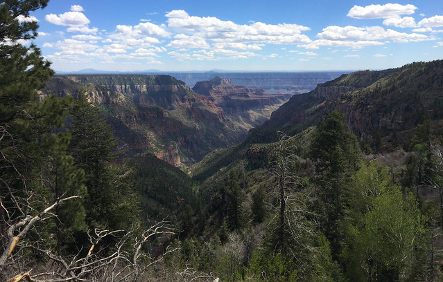
Bright Angel Canyon in Grand Canyon National Park, Arizona
This unmaintained route intersects the North Kaibab Trail at Roaring Springs. We have not done this trail yet but I did come across this album of photos if you want to see what it is like.

Old Bright Angel Trail photo by Adrian Jantzi
Undoubtedly the most popular trail from the North Rim, and designated as one of the three "corridor trails", is the North Kaibab Trail (NPS North Kaibab Trail Description). Perhaps the most iconic hike to do in Grand Canyon is referred to as "Rim to Rim" (or simply R2R). That is it starts on either rim, crosses the canyon and ends 24 miles later at the other rim. While many choose to do it as a multi day backpack trip it is becoming increasingly common to be done in one day either as a day hike or as a trail run (we opted to do it as a day hike). The North Kaibab first descends into Roaring Springs Canyon ...
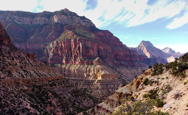
Roaring Springs Canyon seen from the North Kaibab Trail in Grand Canyon National Park, Arizona
... and you will see Roaring Springs in the distance.
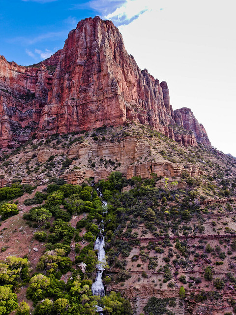
Roaring Springs seen from the North Kaibab Trail in Grand Canyon National Park, Arizona
The North Kaibab continues down Bright Angel Canyon.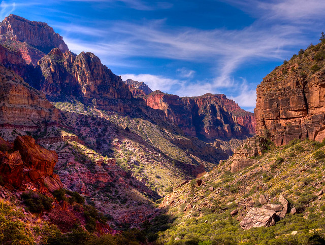
Bright Angel Canyon seen from the North Kaibab Trail in Grand Canyon National Park, Arizona
Further down the trail a notable side trip is to see Ribbon Falls ...
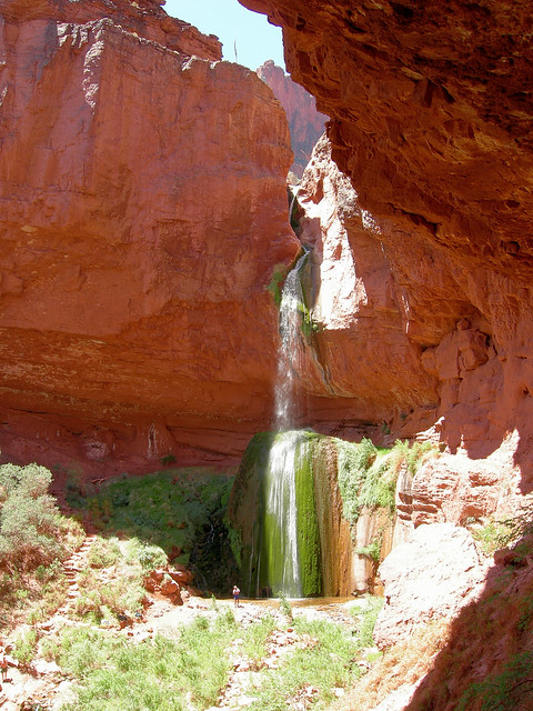
Ribbon Falls in Grand Canyon National Park, Arizona - Photo by Alan English
... and Upper Ribbon Falls
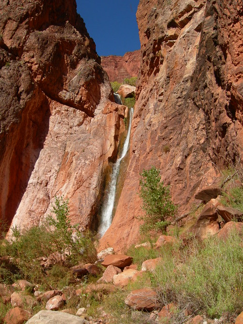
Upper Ribbon Falls in Grand Canyon National Park, Arizona - Photo by Alan English
Continuing down the trail one will reach a very popular destination ...
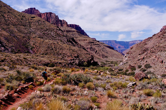 J
JJean on the North Kaibab Trail in Grand Canyon National Park, Arizona
... Phantom Ranch (especially the canteen for a well earned break and cold drink).
Phantom Ranch in Grand Canyon National Park, Arizona
But backing up a bit - shortly before the North Kaibab Trail reaches Phantom Ranch you will encounter the trailhead for the Clear Creek Trail (South Kaibab/Clear Creek/Bright Angel Trip Report and NPS Clear Creek Trail Description). However, this trail is more commonly accessed from the South Rim. Not only is the South Rim open all year (unlike the limited season on the North Rim) providing more opportunities, both the South Kaibab and Bright Angel Trails are shorter and have less elevation loss than the North Kaibab. The Clear Creek Trail is unusual for North Rim Trails as it traverses the Tonto Platform.
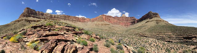
Seen from the Clear Creek Trail in Grand Canyon National Park, Arizona
What can I say about the views from the Tonto Platform that I haven't already said?
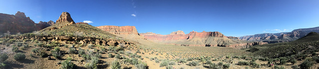
Seen from the Clear Creek Trail in Grand Canyon National Park, Arizona
The trail continues to Clear Creek Canyon.
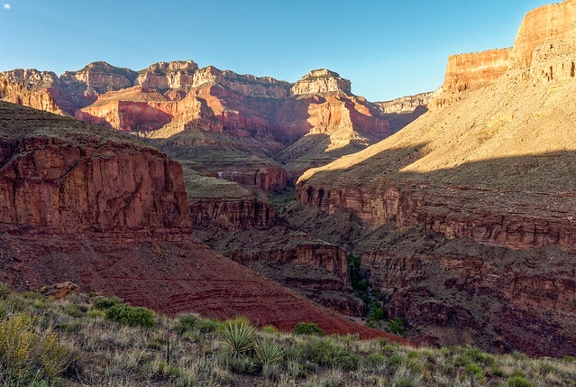
Seen from the Clear Creek Trail in Grand Canyon National Park, Arizona
The designated camping area is by the creek. From there backpackers have the option to hike down the canyon all the way to the river.
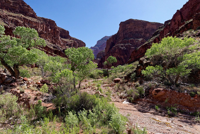
Clear Creek Canyon in Grand Canyon National Park, Arizona
We did not do this but if we had I know John would have spent a lot of time photographing Clear Creek Falls.
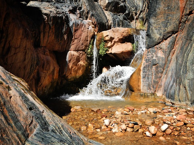
Clear Creek Falls in Grand Canyon National Park, Arizona - Photo by Theilr
Instead we opted to hike up the canyon as we wanted to see this granary.
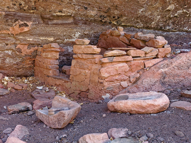
Granary in Clear Creek Canyon in Grand Canyon National Park, Arizona
Seeing the grinding stones I tried to put myself in the place of one of the women who used these "common household implements". I almost felt one of them had just gotten up and would soon return with more corn to grind. In reality it was probably an arduous task but I like to imagine it was a group activity and the monotony broken by much laughter.
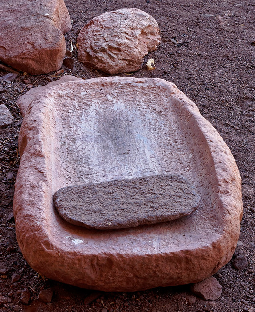
Grinding stone at the granary in Clear Creek Canyon in Grand Canyon National Park, Arizona
Another popular destination on this hike is seeing Cheyava Falls, the highest falls in the park. Unfortunately, we were there (April 2015) after several dry years and the falls was dry. However, after a wet winter it can start flowing again.
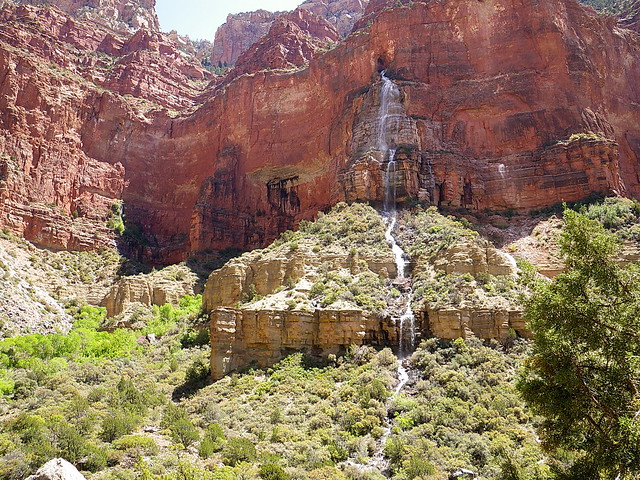
Cheyava Falls in Grand Canyon National Park, Arizona - Photo by Alan English
Back on the rim - A short walk on the easy Transept Trail, located within the heart of North Rim services, provides excellent views such as this.
SSeen from the Transept Trail in Grand Canyon National Park, Arizona
Further west the Widforss Trail is a lovely wooded trail that offers periodic"peek-a-boo" views into Bright Angel Canyon along the way ...
Seen from the Widforss Trail in Grand Canyon National Park, Arizona
... as well as a sweeping view from Widforss Point.
Seen from the Widforss Trail in Grand Canyon National Park, Arizona
Continuing west on the rim the next trail is the North Bass Trail (North Bass Trail Trip Report and NPS North Bass Trail.Description). This trail starts at the remote Swamp Point which provides an outstanding view down much of the length of North Bass Canyon.
Seen from the North Bass Trail in Grand Canyon National Park, Arizona
After hiking down the trail a short ways you will reach the Muav Saddle. This is the location of an abandoned patrol cabin.
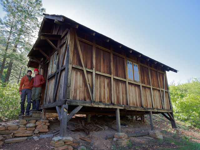
Old patrol cabin at Muav Saddle on the North Bass Trail in Grand Canyon National Park, Arizona
From the Muav Saddle the trail makes its long descent down the canyon.
Seen from the North Bass Trail in Grand Canyon National Park, Arizona
It initially travels down White Creek ...
Seen from the North Bass Trail in Grand Canyon National Park, Arizona
... bypassing it at times most notably when it makes a long traverse across the Redwall while the creek continues its descent well below.
SSeen from the North Bass Trail in Grand Canyon National Park, Arizona
The trail will rejoin White Creek at the bottom of the Redwall Descent.
Seen from the North Bass Trail in Grand Canyon National Park, Arizona
After completing the Redwall descent you will walk down White Creek ...
Seen from the North Bass Trail in Grand Canyon National Park, Arizona
... until it enters a narrow channel ...
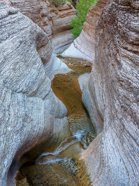
Seen from the North Bass Trail in Grand Canyon National Park, Arizona
... and drops over waterfalls.
Seen from the North Bass Trail in Grand Canyon National Park, Arizona
So you will once again take a bypass ...
Seen from the North Bass Trail in Grand Canyon National Park, Arizona
... before rejoining the now dry creek bed.
SSeen from the North Bass Trail in Grand Canyon National Park, Arizona
Before long you will encounter Tapeats Gorge. While the official North Bass Trail does not go this way it is possible to reach Shinumo Creek by hiking through it. Or you can do what we did and take some time to explore it as a side trip.
Seen from the North Bass Trail in Grand Canyon National Park, Arizona
The most notable features; the Chockstone ...
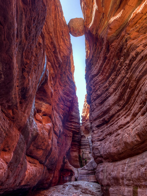
Tapeats Gorge in Grand Canyon National Park, Arizona
... and the Grotto are located just a short distance from the entrance of the gorge.
Tapeats Gorge in Grand Canyon National Park, Arizona
Rather than continuing down Tapeats Gorge we chose to take the official route, the Tonto Bypass. And you should know by now how much I love the Tonto!
Seen from the North Bass Trail in Grand Canyon National Park, Arizona
Later on the North Bass begins its descent toward ...
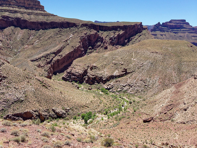
Seen from the North Bass Trail in Grand Canyon National Park, Arizona
... Shinumo Creek. By following the creek downstream ...
Shinumo Creek in Grand Canyon National Park, Arizona
... and then crossing a sizable bypass you will descend down to the trail's end ...
Seen from the North Bass Trail in Grand Canyon National Park, Arizona
... and the Colorado River.
The Colorado River seen from the North Bass Trail in Grand Canyon National Park, Arizona
Back up at Muav Saddle - From the North Bass Trail you could also do the short hike out onto Powell Plateau. We have not done this but I found this album of photos which shows that views include this one of the North Bass Trail.

If you start at Monument Point on the Bill Hall Trail you will be treated to views that include Bridger's Knoll.
Bridger's Knoll in Grand Canyon National Park, Arizona
This trail is 2.5 miles shorter than the Thunder River Trail but it is also steeper and includes a 15 foot down climb.
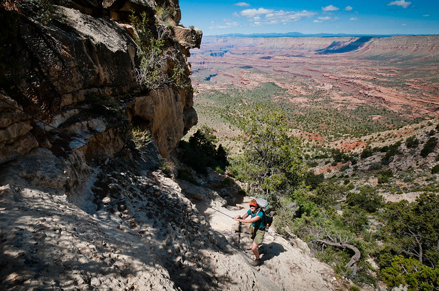
Jean on the Bill Hall Trail in Grand Canyon National Park, Arizona
If you begin at Indian Hollow on the Thunder River Trail your first views are expansive.
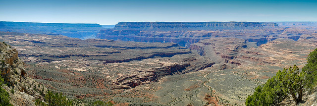
Seen from the Thunder River Trail in Grand Canyon National Park, Arizona
While this trail is longer and the overall grade is much more gradual, it is still steep at the switchbacks in between long traverses.
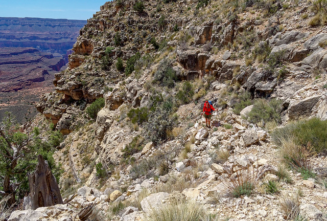
Seen from the Thunder River Trail in Grand Canyon National Park, Arizona
Both trails drop you down to...
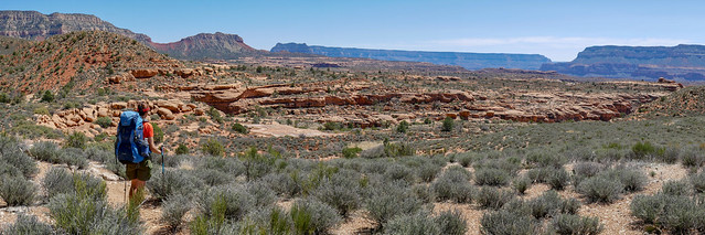
Jean on the Thunder River Trail in Grand Canyon National Park, Arizona
... the broad expanse of the Esplanade.
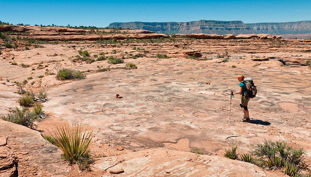
Jean on the Thunder River Trail in Grand Canyon National Park, Arizona
The Thunder River Trail then drops steeply ...
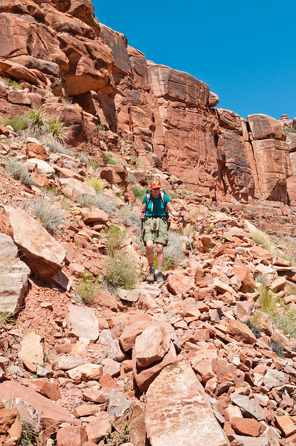
Jean on the Thunder River Trail in Grand Canyon National Park, Arizona
... toward the broad expanse of Surprise Valley.
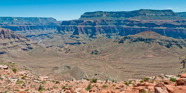
Surprise Valley in Grand Canyon National Park, Arizona
Once in Surprise Valley the Thunder River Trail intersects the Deer Creek Trail. Which direction you go depends only on personal preference. Those who do as we di and continue east on the Thunder River Trai will eventually be treated to views of Thunder River as it shoots dramatically out of the tall vertical face.
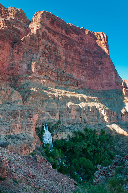
Thunder River in Grand Canyon National Park, Arizona
At only 1/2 mile long it is one of the shortest rivers in the US. It somehow does not seem right that such a magnificent, albeit short, river should flow into a mere creek.
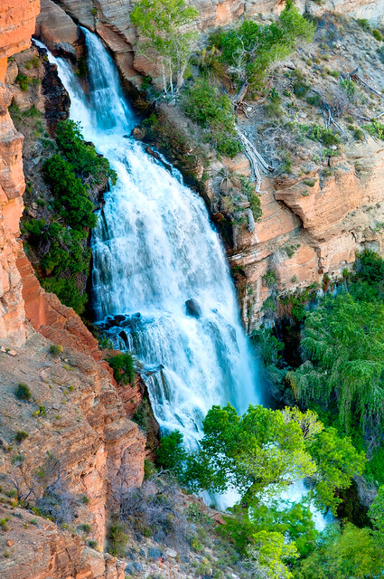
Thunder River in Grand Canyon National Park, Arizona
But Tapeats Creek is no ordinary creek and perhaps it should be elevated to "river" status. Personally I think it is worthy. The trail crosses Tapeats Creek to the other side for easy walking before crossing back. However, unless the level of the creek is quite low it may be better to take the informal trail that stays west of the creek. It is important to remember that hikers have died crossing this creek.
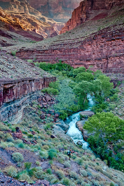
Jean on the route down Tapeats Creek in Grand Canyon National Park, Arizona
By following Tapeats Creek downstream you will reach the Colorado River. From here you can take and informal route down the river ...
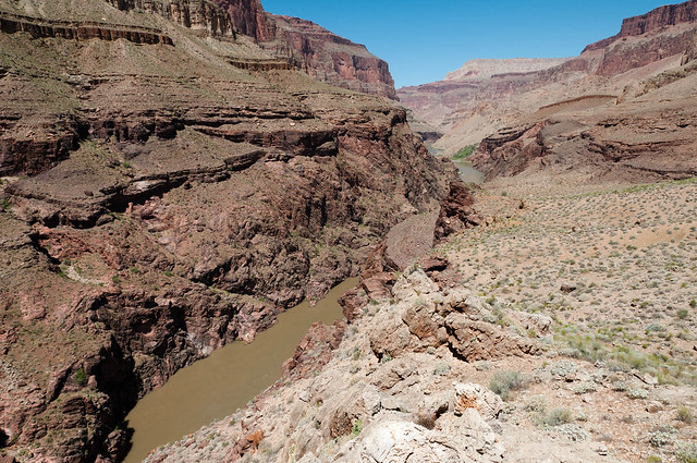
The Colorado River in Grand Canyon National Park, Arizona
... to Deer Creek Canyon.
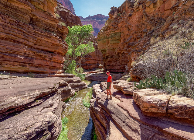
Jean in Deer Creek Canyon in Grand Canyon National Park, Arizona
Deer Creek is an incredibly beautiful narrow canyon of intricately sculpted rock.

Deer Creek Canyon in Grand Canyon National Park, Arizona
By continuing down through Deer Creek Canyon ...
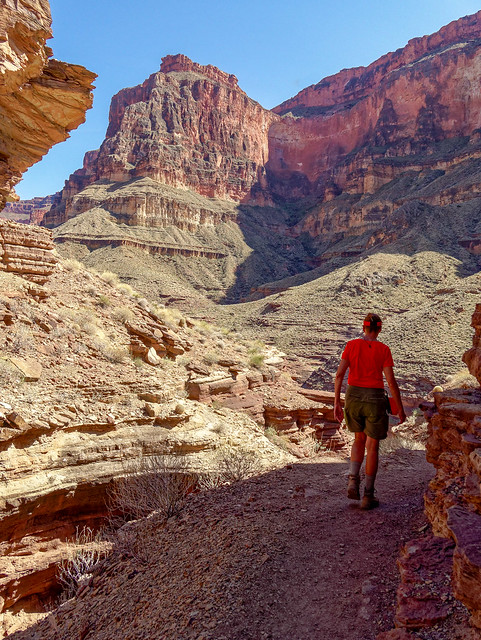
Jean in Deer Creek Canyon in Grand Canyon National Park, Arizona
... the Colorado River will soon come into view.
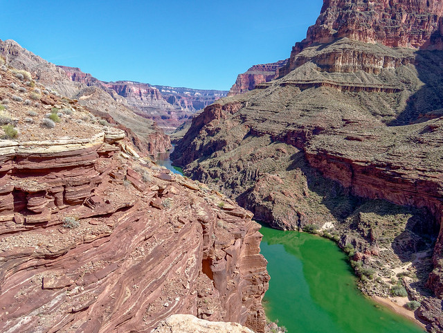
Colorado River in Grand Canyon National Park, Arizona
By taking the route down toward the river ...
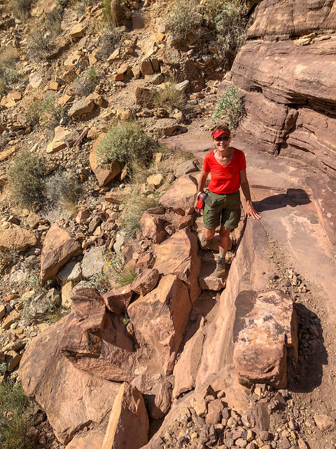
Jean on the route to Deer Creek Falls in Grand Canyon National Park, Arizona
... you can get to the base of Deer Creek Falls.

Deer Creek Falls in Grand Canyon National Park, Arizona
From Deer Creek Canyon, the Deer Creek Trail follows the creek upstream and crosses it ...
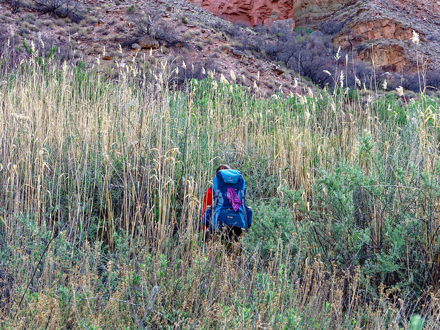
Jean on the Deer Creek Trail in Grand Canyon National Park, Arizona
... before it makes its steep ascent ...
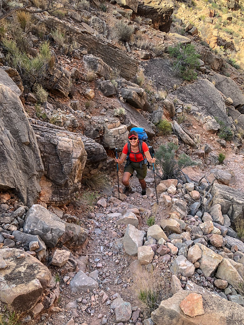
Jean on the Deer Creek Trail in Grand Canyon National Park, Arizona
... to Surprise Valley where it intersects with the Thunder River Trail where you will continue your ascent.
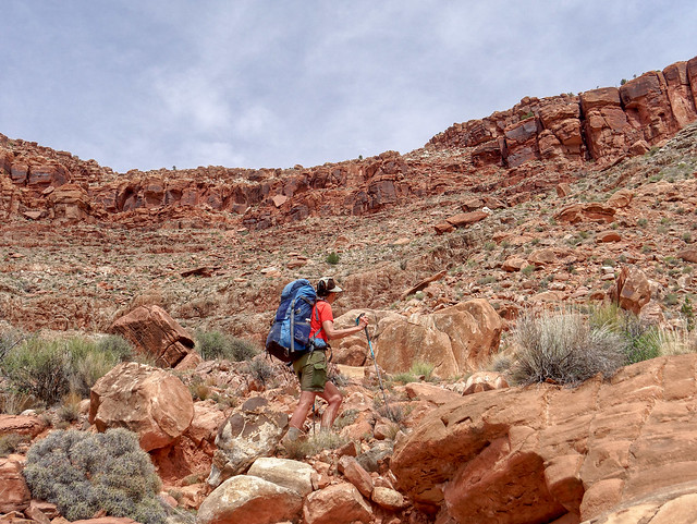
Jean on the Deer Creek Trail in Grand Canyon National Park, Arizona
You will then cross the broad expanse of the Esplanade once again before returning to the rim.

Esplanade in Grand Canyon National Park, Arizona
By continuing west, the next named trail one encounters in Grand Canyon National Park is the Tuckup Trail at its eastern trailhead at 150-Mile Canyon (Tuckup Trail/east Trip Report, Tuckup Trail/west Trip Report and the NPS Tuckup Trail Description). This remote trail is not a "trail" or even a "route" in the usual sense. It is more of a "concept". It is also a great opportunity for experienced canyon backpackers to take off the "training wheels" and gain experience in canyon navigation. We felt it was our introductory lesson in becoming "canyon explorers".
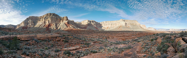
Seen from the Tuckup Trail in Grand Canyon National Park, Arizona
The actual distance is largely unknown as it depends on one's route but it is thought to be about 60 miles from 150-Mile Canyon to Toroweap.
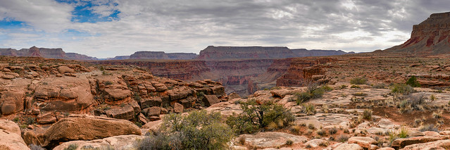
Seen from the Tuckup Trail in Grand Canyon National Park, Arizona
Challenges include navigational issues getting around or across the numerous side canyons backpackers encounter.
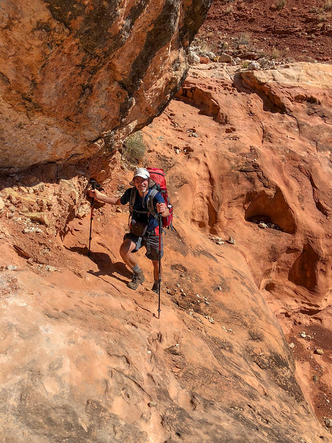
Backpackers must quickly learn to "read the canyon".
Seen from the Tuckup Trail in Grand Canyon National Park, Arizona
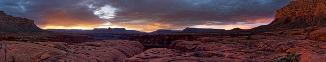
Seen from the Tuckup Trail in Grand Canyon National Park, Arizona
A huge challenge is the lack of reliable water. One must time their trip with the weather as recent precipitation is necessary to replenish the life giving potholes.
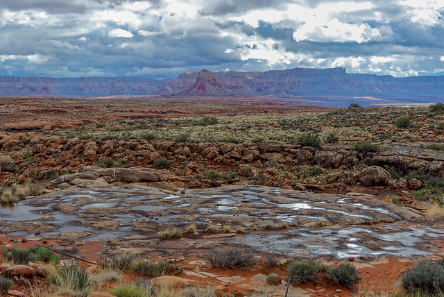
Seen from the Tuckup Trail in Grand Canyon National Park, Arizona
Backpackers must also learn where to look for potholes and how to recognize them in the distance. Do you see the pothole in the photo below? (a hint, it is near the middle). If not then click on the photo to go to Flickr and click on the photo again to zoom in. Now do you see it?
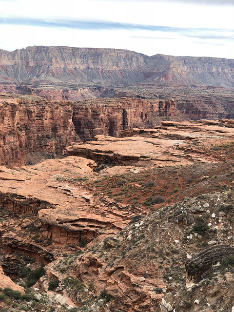
Seen from the Tuckup Trail in Grand Canyon National Park, Arizona
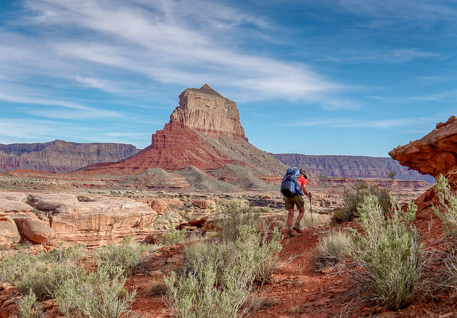
Seen from the Tuckup Trail in Grand Canyon National Park, Arizona
... the Tuckup Trail offers an excellent introduction in off-trail travel.

Seen from Seen from the Tuckup Trail in Grand Canyon National Park, Arizona
We first started talking about hiking every named trail/route in Grand Canyon National Park back in 2013. One issue was determining which source of information we should use to determine whether or not something is a "named trail/route". I initially thought we would limit it to any trail the NPS has trail descriptions for. There are 21 listed although the Tonto Trail gets three. However, John thought we should do all trails/routes described in NPS publications; trail descriptions, brochures, newspapers and maps which included several rim trails. I then noticed there were some trails indicated on maps we hadn't considered such as the Old Bright Angel Trail. There are also some "double tracks" (abandoned service roads) on the North Rim that fortunately John does not feel a need to do.
At this point in time our criteria is to include all trails/routes described in NPS publications and I am happy to say we achieved our goal on April 8th 2018 when we hiked the section of the Thunder River Trail from Indian Hollow to the junction with the Bill Hall Trail.
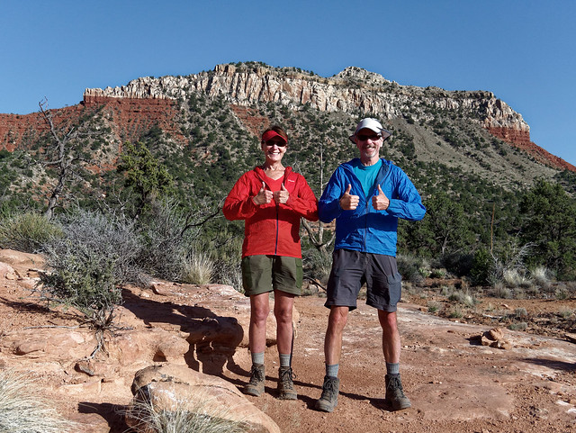
Mission Accomplished! Jean and John on the Thunder River Trail in Grand Canyon National Park, Arizona
So what's next now that we have completed our goal? At (nearly) 66 and 67 we have to realize we have a limited number of "backpacking seasons" left in us and we want to make the most of them. Unless it is with our son or part of a bigger trip we are disinclined to revisit most of the named trails/routes within the National Park anytime soon. Fortunately, there is so much of the surrounding area we have not yet seen; Kaibab National Forest, Grand Canyon - Parashant National Monument, the list goes on. We plan to explore some of the more remote areas using some of the "unofficial routes" around Grand Canyon. However, we will need to choose carefully and keep our physical limitations as well as our lack of canyoneering experience in mind.
The Grand Canyon National Park Service website states when visiting Grand Canyon for the first time that hikers "... tend to react to the experience in one of two ways, either they can't wait to get back, or they swear they will never do it again". Well, I have always known I am different than "most people" and it took me over 20 years from the first time I saw Grand Canyon to truly love it and feel like I can't wait to go back.
Since that first backpack trip down the Tanner Trail I have never once questioned whether or not being in the canyon was worth the effort it took to get there (and out again). I am so grateful to have had the time and the opportunities to allow my feelings to grow because the canyon has become a very important part of our backcountry life. And it will remain so as long as we can continue to hoist packs on our backs and keep putting one foot in front of the other.

Jean and John on the Royal Arch Loop in Grand Canyon National Park, Arizona


No comments:
Post a Comment