The original intent of this blog was to chronicle our travels so our friends and family would know where we were. But it hasn’t worked out that way as we don’t post photos and update the blog in a timely manner. In addition posts have included trips we did prior to hitting the road; Tanzania, Nepal and Patagonia. This post begins by covering with what we did back in February and March of 2014 while traveling down the Oregon and California Coasts. I’ve already written about what we did in April and May when we visited Grand Canyon and Utah as well as the trip we took to Peru in June and July. This post resumes in August and what we did in Washington State. To make things even more confusing I’ll throw in a photo or two taken in California in between our time in Grand Canyon and Peru as well as some photos taken at Christmas. So we are really out of order but I don't think it matters.
Where We've Been – Oregon Coast, California and Washington State
Assorted dates between 2/27/2014 and 1/1/2015
In this post:
Oregon
California
- Sightseeing in Jedidiah Smith Redwoods Forest
- Backpack trip - 3 days/2 nights on “The Lost Coast Trail” in Sinkyone Wilderness State Park
- Dayhiking in the King Range National Conservation Area
- Dayhiking in San Jacinto Wilderness
- Backpack trip - 4 days/3 nights on the Deer Park Loop in Olympic National Park
- Backpack trip - 5 days/4 nights from Mt Adams through Goat Rocks
- Backpack trip - 3 days/2 nights in Mt St Helens National Volcanic Monument
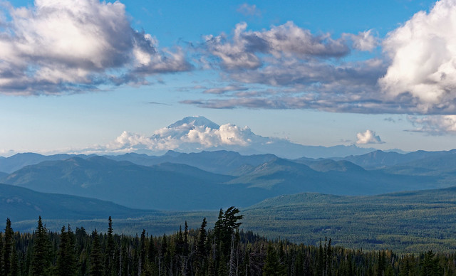
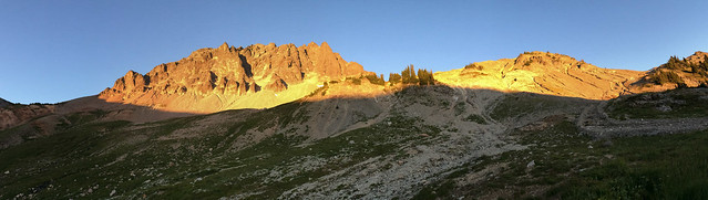
After spending the winter in the wet grey Pacific Northwest (while I recovered from complicated wrist surgery) we were happy to finally be back on the road. We traveled at a leisurely pace down the Oregon Coast. Along the way we did the short dayhike to the top of Neahkahnie Peak.
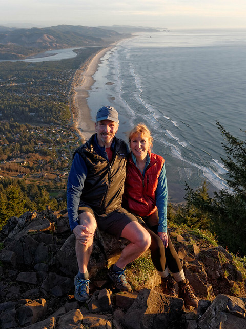
John and Jean on Neahkahnie Peak, Oregon
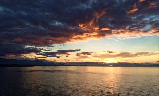
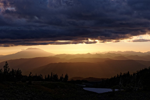
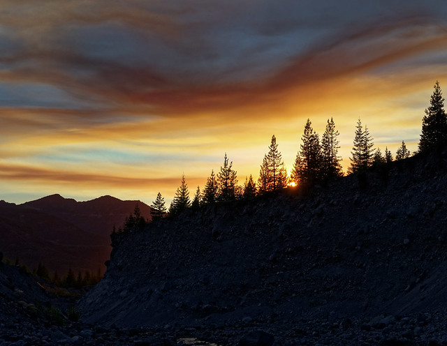
We had gotten a late start, not unusual for us, but the advantage was that we got to enjoy the sunset so it was worth taking the risk we would hike out in the dark.
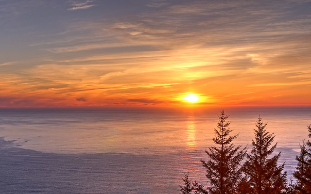
Sunset over the Pacific Ocean seen from Neahkahnie Peak, Oregon
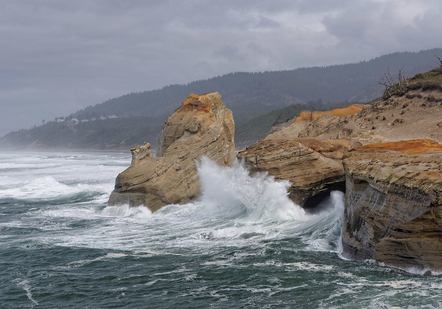
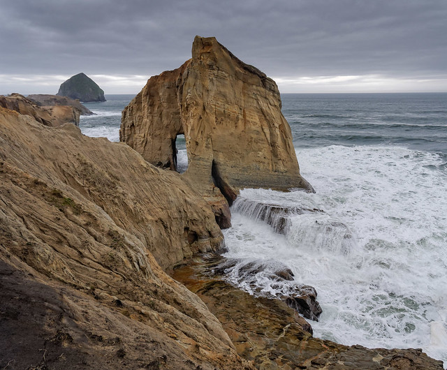
We also did some dayhiking at Cape Kiwanda State Natural Area.
Cape Kiwanda State Natural Area, Oregon
We love this part of the Oregon coast, it's rugged like our favorite parts of the Washington coast. All of our photos taken at Cape Kiwanda are on Flickr.
Cape Kiwanda State Natural Area, Oregon
As we continued south we stopped to view some of the lighthouses along the way including the Yaquina Head Lighthouse, …
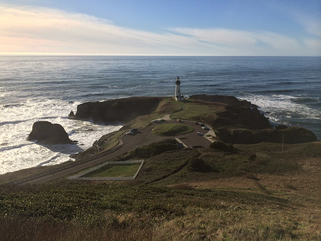
Yaquina Head Lighthouse, Oregon
… the Haceta Head Lighthouse, …
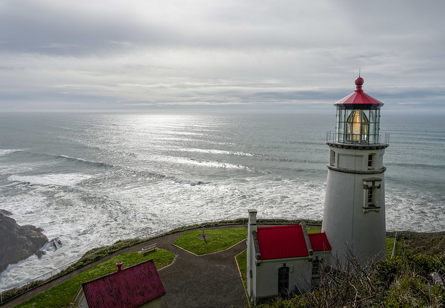
Haceta Head Lighthouse, Oregon
… the Coquille River Lighthouse …
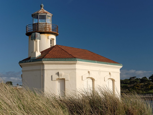
Coquille River Lighthouse, Oregon
… and the Cape Blanco Lighthouse.
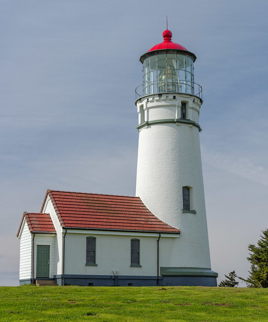
Cape Blanco Lighthouse, Oregon
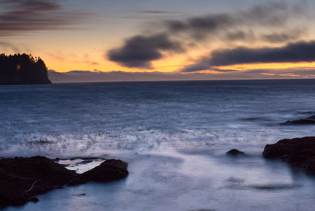
In between the lighthouses we thoroughly enjoyed the beaches ...
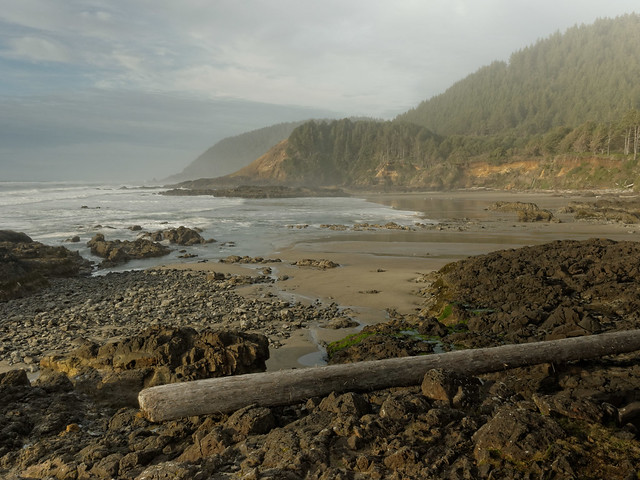
Seen while driving down the Oregon coast
... and views of the dynamic ocean. All of our photos of lighthouses and beaches are on Flickr.
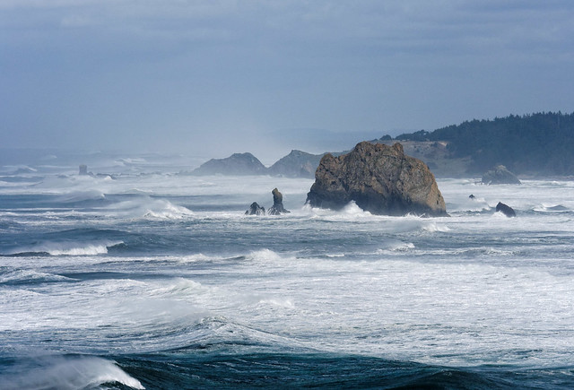
Seen while driving down the Oregon coast
We also visited the Oregon Coast Aquarium in Newport where we saw creatures both great …
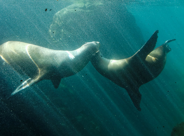
California Sea Lions at the Oregon Coast Aquarium in Newport, Oregon
… and small. All of our Oregon Coast Aquarium Photos are on Flickr.
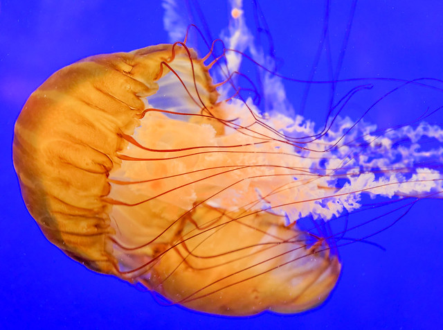
Jellyfish at the Oregon Coast Aquarium in Newport, Oregon
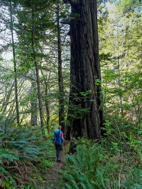
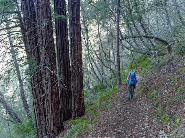
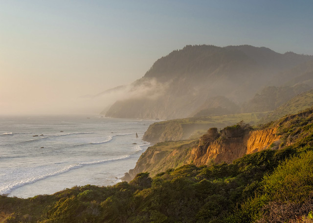
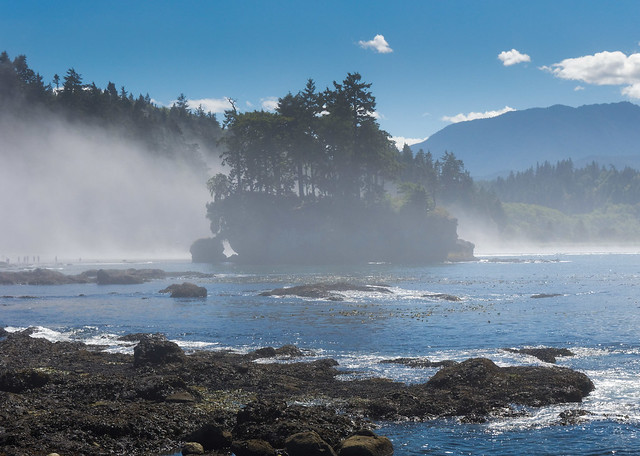
Once in California we made a short stop in the Jedidiah Smith Redwoods State Park.
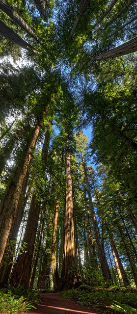
Jedidiah Smith Redwoods State Park, California
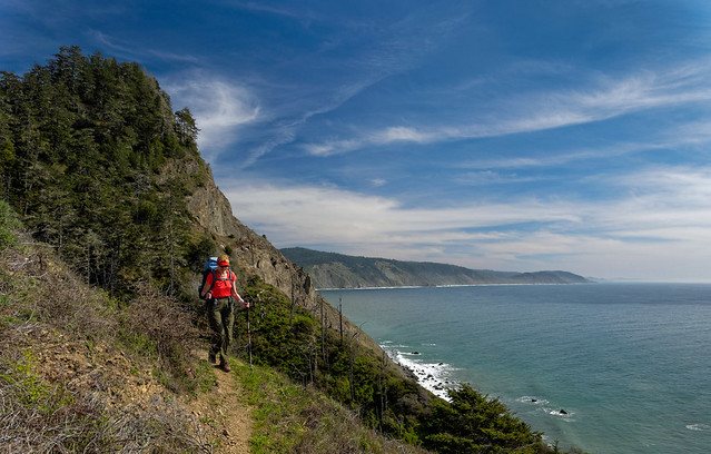
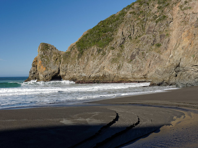
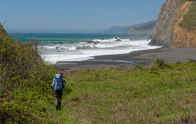
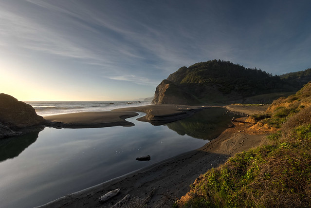
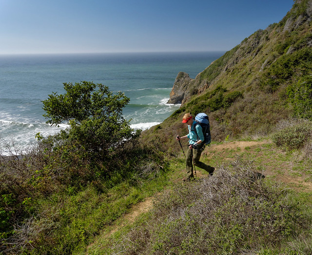
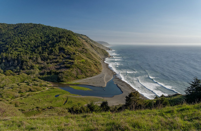
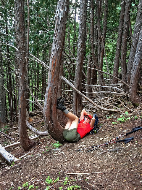
There is a backpack trip we have wanted to do for a long time, California's "Lost Coast Trail". It is one of the few areas along the California coast that is not accessible by roads and highways. The rugged nature of the area simply made it too difficult to develop so Highway 1 veers inland around it. We would have preferred to do it as a through hike but unfortunately the access roads to trailheads are too narrow and winding for us to get our motorhome down in order to self shuttle. Our plan was to do two out and back trips. For the first we started at the Usal Campground located near a beach. The trail climbed out of the valley to cross a headland ...
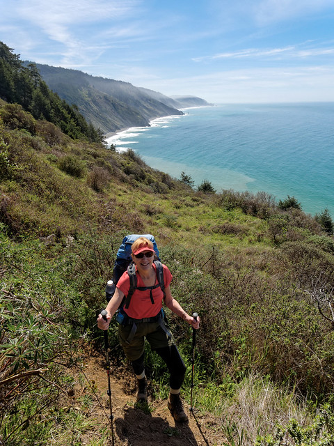
Jean on the Lost Coast Trail in Sinkyone Wilderness State Park, California
... where we were treated to the first of many great views.
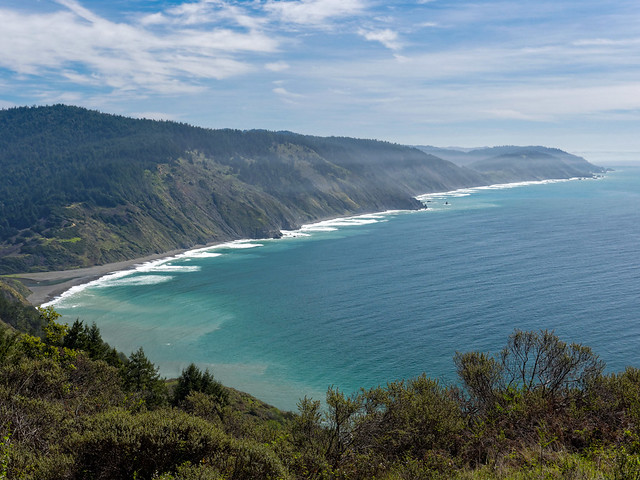
Seen from the Lost Coast Trail in Sinkyone Wilderness State Park, California
The trail was reasonably good with only a few sections of steep loose dirt and thick vegetation. But we thoroughly enjoyed sights of wildflowers including poppies, iris, and lupine. At intervals the trail must cut inland to circumvent deep gullies. It goes through forest and as we passed firs and ferns it felt similar to hiking on trails in the Pacific Northwest. However, it was drier and there were Redwoods.
Jean on the Lost Coast Trail in Sinkyone Wilderness State Park, California
Crossing headlands before dropping down into gullies also felt familiar. However, where headlands on Washington's Olympic Coast are about 200 feet high the headlands one must cross on this trail are between 600 and 1,100 feet high,
Jean on the Lost Coast Trail in Sinkyone Wilderness State Park, California
The effort to get to the top of yet another headland was well worth it. While standing on top taking in the views we got some brief opportunities to see whales spouting in the distance. Unfortunately it wasn't feasible to get a photo.
Seen from the Lost Coast Trail in Sinkyone Wilderness State Park, California
We continued up and down passing the huge trees wondering when we would reach our destination for the day, Little Jackass Creek.
Jean on the Lost Coast Trail in Sinkyone Wilderness State Park, California
We had only hiked 7.5 miles that day but it felt like more between the accumulated elevation gain (and loss) plus the fact that it was our first backpack trip of the year. We had considered camping closer to the beach but it was quite windy so we looked for a more sheltered location and we were moderately successful.
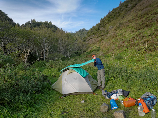
John blowing up air mattresses at our camp at Little Jackass Creek in Sinkyone Wilderness State Park, California
John, of course, spent some time on the beach taking photographs.
Beach at Little Jackass Creek in Sinkyone Wilderness State Park, California
The next morning we climbed out of the valley, ...
Seen from the Lost Coast Trail in Sinkyone Wilderness State Park, California
... through the forest ...
Jean on the Lost Coast Trail in Sinkyone Wilderness State Park, California
... and over the headland. There is a definite "rhythm" to this trail.
Seen from the Lost Coast Trail in Sinkyone Wilderness State Park, California
We only had 4.5 miles to our next camp on Jackass Creek (whoever named these creeks lacked imagination). The area is referred to as "Wheeler Camp" and is the site of a former company town built for logging back in 50's. One can see evidence of the town as a few foundations and fire places remain.
Jean approaching Jackass Creek in Sinkyone Wilderness State Park, California
As we had hiked such a short distance we decided to dayhike further on the trail.
Jean on the Lost Coast Trail in Sinkyone Wilderness State Park, California
We hiked for about an hour and a half before turning around. Our reward was a few peek – a boo views through the trees.
Seen from the Lost Coast Trail in Sinkyone Wilderness State Park, California
Once we got closer to our camp we had to wait a bit before cooking supper as there were two elk passing right our camp. Once again we avoided camping near the beach and had sought out a more protected spot but the wind was not an issue that night.
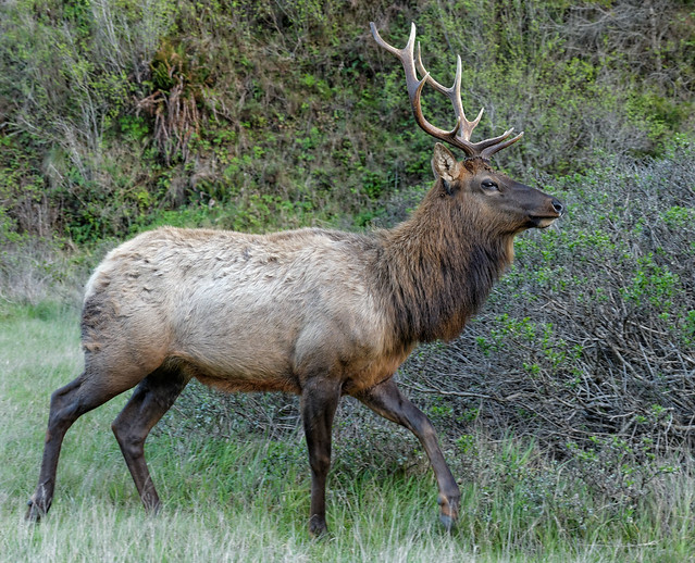
Elk in our camp at Jackass Creek in Sinkyone Wilderness State Park, California
John spent time photographing the beach in the lovely changing evening light.
Seen from the Lost Coast Trail in Sinkyone Wilderness State Park, California
There were more elk nearby.
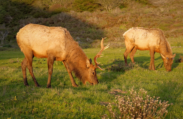
Elk in Sinkyone Wilderness State Park, California
It only took a few low clouds to create a beautiful sunset.
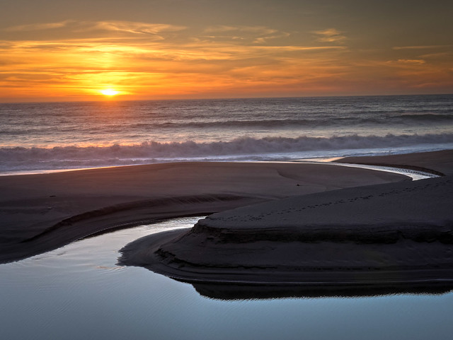
Seen from the Lost Coast Trail in Sinkyone Wilderness State Park, California
We weren't the only ones enjoying the sunset. John was surprised by the sight of an elk walking to the shoreline and gazing out to the horizon.
Elk watching the sunset seen from the Lost Coast Trail in Sinkyone Wilderness State Park, California
The next day we would hike all the way out, a total of 12 miles.
Jean on the Lost Coast Trail in Sinkyone Wilderness State Park, California
The weather was great, sunny but not too hot.
Seen from the Lost Coast Trail in Sinkyone Wilderness State Park, California
One advantage at doing an out and back trip is you know what to expect on the way back.
Jean on the Lost Coast Trail in Sinkyone Wilderness State Park, California
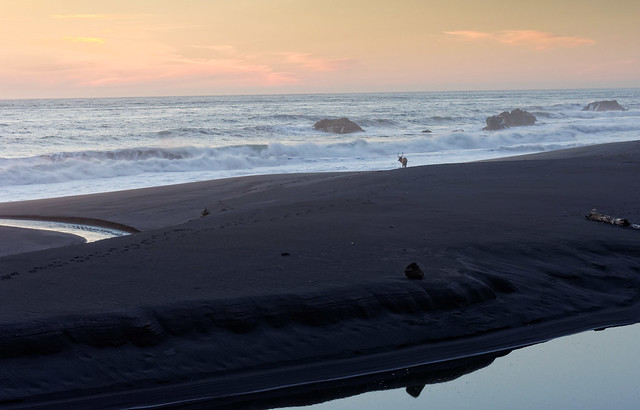
We had stopped to take in the view and some movement below caught our eye. We first saw two elk (visible to the the right) but then we saw a surprising sight, three bears (visible to the left). They seemed equally curious at first but the elk appeared to be more assertive and the bears soon ran down the slope.
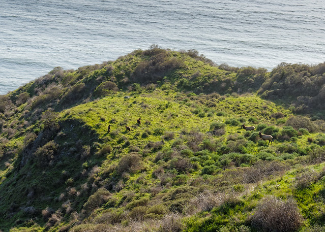
Three bears and two elk seen from the Lost Coast Trail in Sinkyone Wilderness State Park, California
It was a long day and we were happy to cross that last headland but there is always something special about that first backpack trip of the season especially one done so early in the year. All of our photos taken on this backpack trip are on Flickr.
Seen from the Lost Coast Trail in Sinkyone Wilderness State Park, California
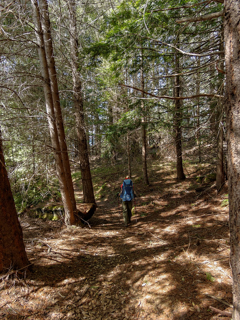
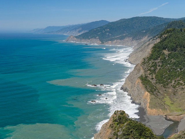
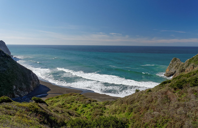
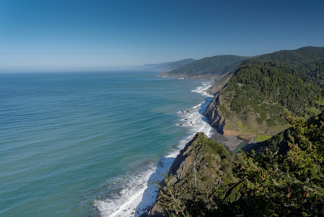
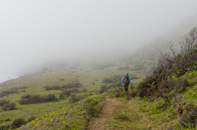
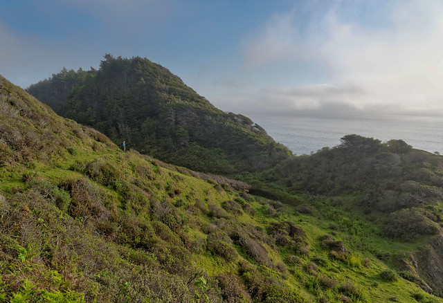
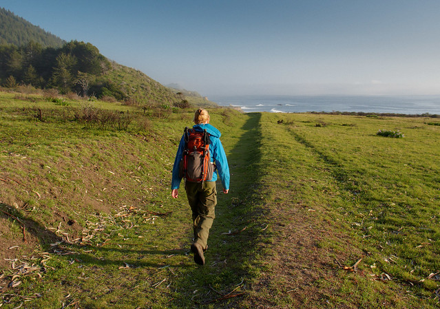
We had originally thought we would complete the Lost Coast Trail as another out and back backpack trip but the weather would be changing so we dayhiked it instead.
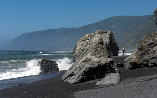
Seen while hiking in the King Range National Conservation Area, California
It is a lovely coast and the weather started out great.
Jean hiking in the King Range National Conservation Area, California
But as the day went on the fog rolled in.
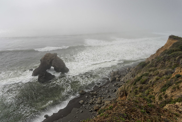
Seen while hiking in the King Range National Conservation Area, California
I have never been to Scotland but I wondered if it was anything like this.
Jean on the Lost Coast Trail in the King Range National Conservation Area, California
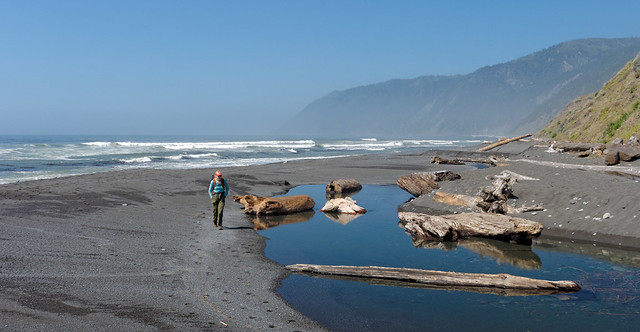
We hiked as far as this creek ...

Seen while hiking in King Range National Conservation Area, California
... before heading back and crossing the inevitable headlands.
Jean on the Lost Coast Trail in the King Range National Conservation Area, California
We had hiked out of the fog and into the golden evening light. As we continued I began to hear a musical sound that seemed completely out of place. I thought it was my imagination until John heard it too.
Jean on the Lost Coast Trail in the King Range National Conservation Area, California
As we hiked it got louder until we finally encountered this fellow playing an accordion. We have seen people backpack with some interesting stuff but this was a first.
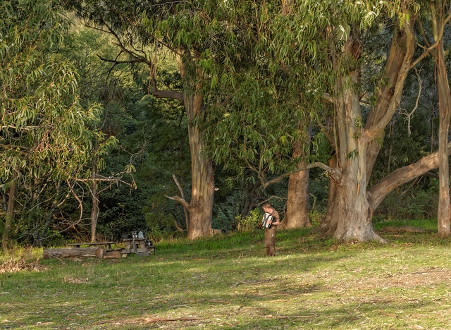
Accordion player on the Lost Coast Trail in the King Range National Conservation Area, California
All of our photos taken on these dayhikes are on Flickr.
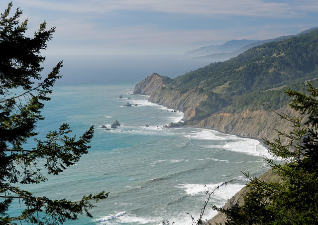
Seen from the King Range National Conservation Area, California
We stopped near Santa Cruz to see our friends, Matt and Lisa and were treated to a “Flightseeing” trip over Big Sur.
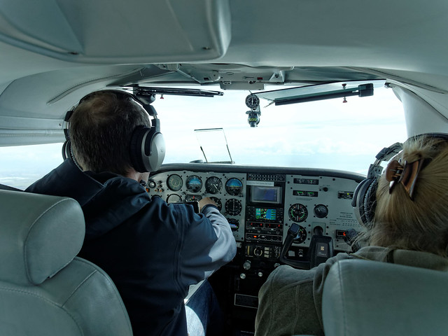
"Flightseeing" over Big Sur, California
I've seen a lot of agricultural areas from the sky but this has to be the most artistic. The seemingly haphazard arrangement created an attractive mosaic.
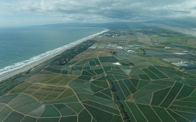
Seen while "Flightseeing" over Big Sur, California
It was fun to see Highway 1 from the air and remember the bike trip from Seattle to San Fransisco that we did in 1999.
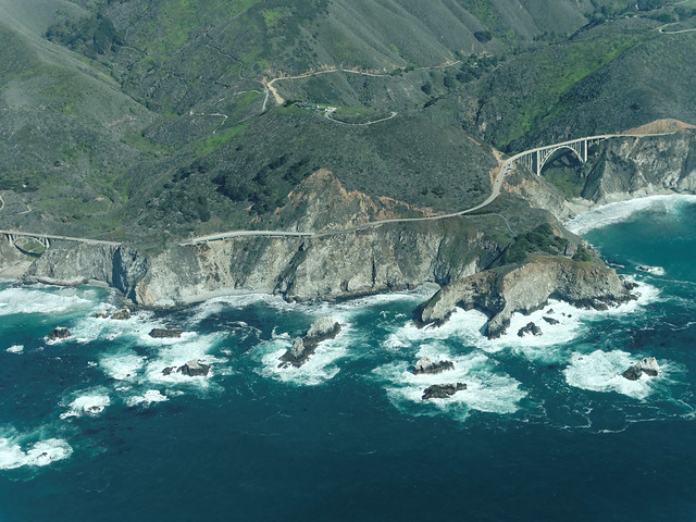
Seen while "Flightseeing" over Big Sur, California
By watching closely we periodically saw whales near the surface.
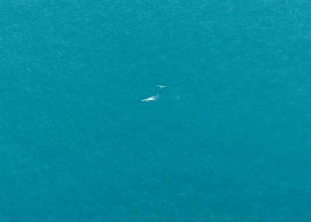
Whales seen while "Flightseeing" over Big Sur, California
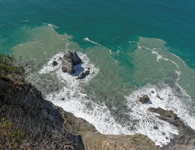
It is almost impossible to see but there are abandoned structures, fences and sea lions on the rocks below. All of our "flightseeing" photos are on Flickr.
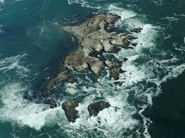
Seen while "Flightseeing" over Big Sur, California
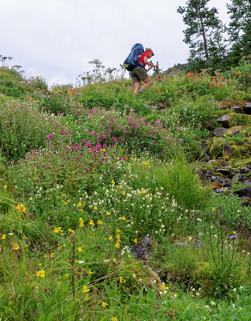
At this point in time we headed to Arizona and Utah where we spent April and May hiking, backpacking and were treated to a visit by our sons; trips I have already written about. This post continues in early June when we went to Idyllwild, California in order to live and hike at higher elevations in preparation for our upcoming trip to Peru. We did some dayhiking on the Deer Springs Trail to “Suicide Rock” for a view of Lily Peak.
John and Jean on Suicide Rock in San Jacinto Wilderness, California
... and the surrounding valley.
San Jacinto Wilderness, California
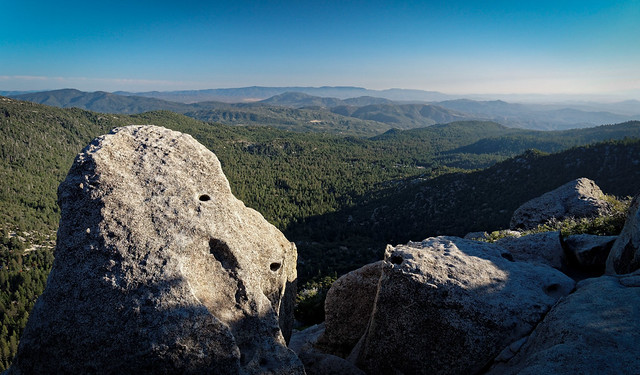
We also did a dayhike to the Tahquitz Look Out.
Tahquitz Lookout in the San Jacinto Wilderness, California
Which provided us with yet another great view.
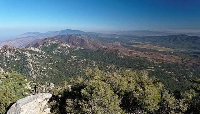
San Jacinto Wilderness, California
In addition we dayhiked on the Fuller and Marion Peak Trails ...
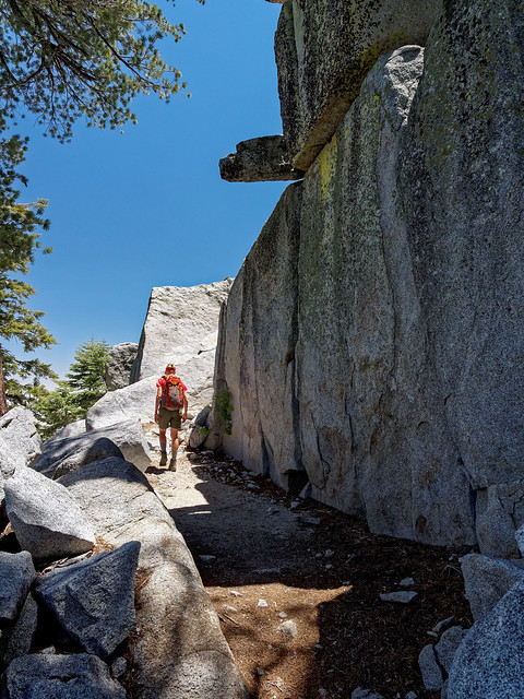
Jean on the trail to San Jacinto Peak in San Jacinto Wilderness, California
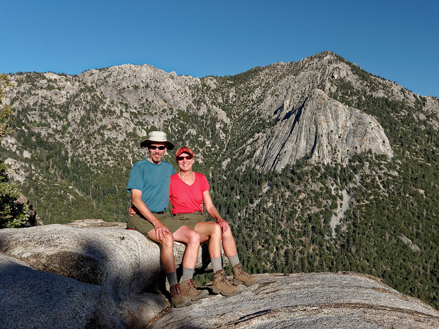
... to the top of San Jacinto Peak.
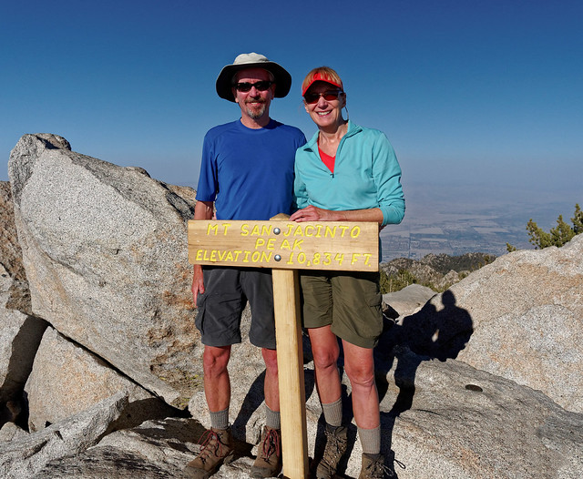
John and Jean on San Jacinto Peak (10,834 feet).in San Jacinto Wilderness, California
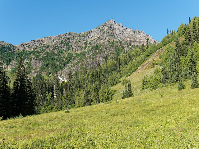
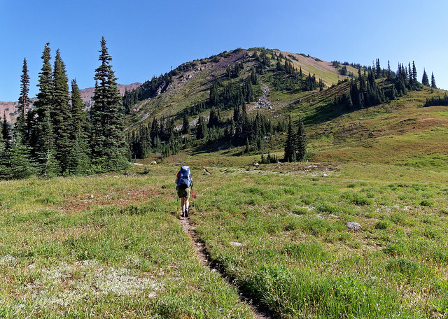
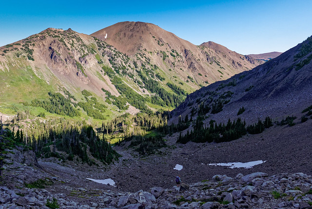
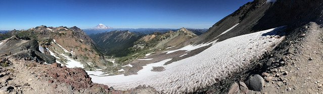
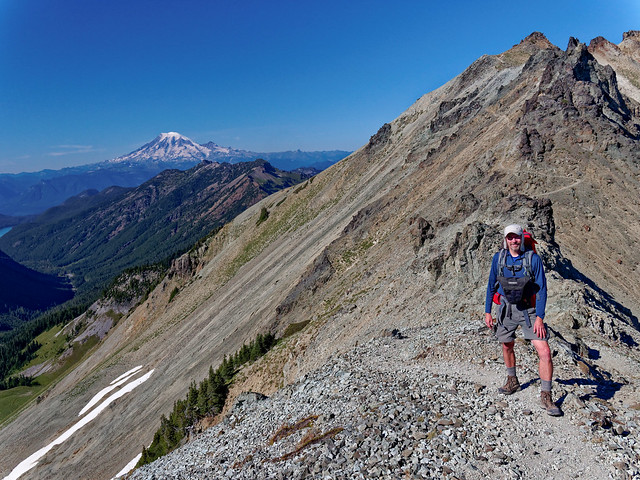
We spent the remainder of June and the first part of July in Peru doing the Inca Trail to Machu Picchu and the Mt Ausangate circuit. After resting up from our trip to Peru (and recovering from the respiratory infections we acquired while there) we had planned to do some backpacking in the Sierras. However, a family issue led us to quickly drive up to Washington State (it is so great to have that flexibility!). As August is perhaps the best time to be there we took the opportunity to do some backpacking.
We did a 4 day/3 night in Olympic National Park on the Deer Park Loop. While we had done some hiking in Peru neither of us had carried any significant weight for any elevation gain or loss since the trips we did in Grand Canyon the previous April. The trails on the east side of the Olympic Mountains are notorious for being steep so I had some apprehension about our lack of conditioning going into this trip. Unfortunately that apprehension was not misplaced. The first day of the trip required us to descend 3,200 feet in the first 4 miles and my knees complained. We encountered another backpacker who reassured us that stream crossings would not be an issue. This first day the trail crossed back and forth over the Grey Wolf River and most of the bridges were substantial logs with railings.
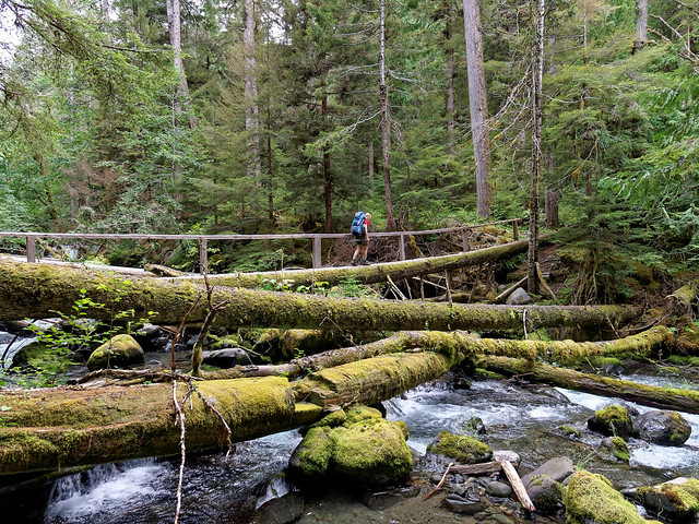
Jean crossing the Grey Wolf River on the Deer Park Loop in Olympic National Park, Washington
We camped the first night in the woods. The next day we continued along the river for a time and I was a bit anxious crossing one of the bridges. While it looked safe enough it exhibited a definite vibration as John crossed it ahead of me. I've never felt anything quite like it. I felt like the log was alive and that it was messing with me.
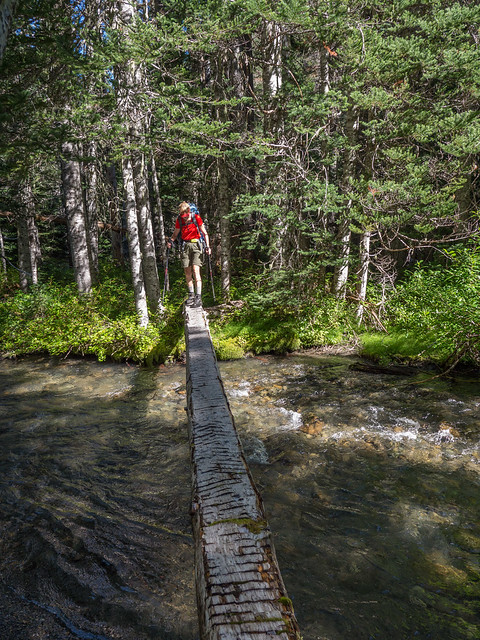
Jean crossing the Grey Wolf River on the Deer Park Loop in Olympic National Park, Washington
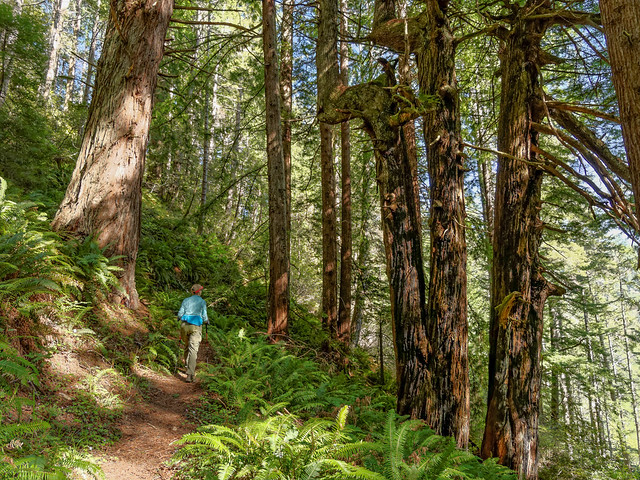
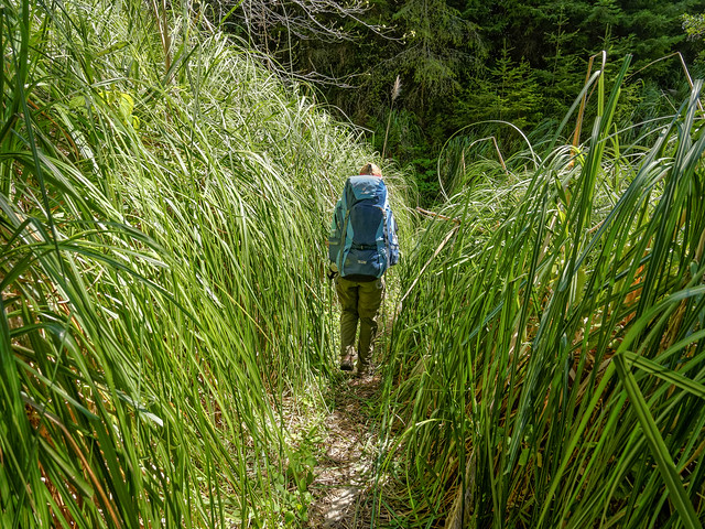
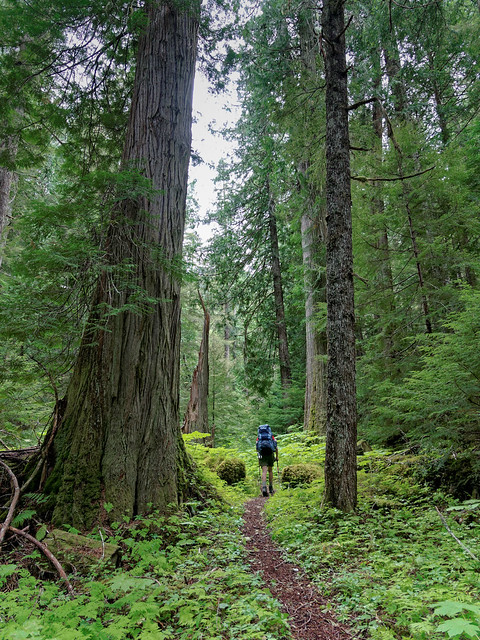
We were happy to be hiking in the Pacific Northwest again especially as the weather was so good. We thoroughly enjoyed hiking through the lush forest.
Jean on the Deer Park Loop in Olympic National Park, Washington
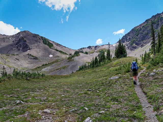
But we love seeing mountains so we were not sorry to begin the climb to Gray Wolf Pass.
Jean on the Deer Park Loop in Olympic National Park, Washington
We always enjoy views from passes and the one from Grey Wolf Pass is no exception.
Grey Wolf Pass on Deer Park Loop in Olympic National Park, Washington
We then did the long descent into the Dosewallips River Valley ...
Jean on the Deer Park Loop in Olympic National Park, Washington
... enjoying more great views along the way.
Seen from the Deer Park Loop in Olympic National Park, Washington
We camped that night on the Dosewallips River.
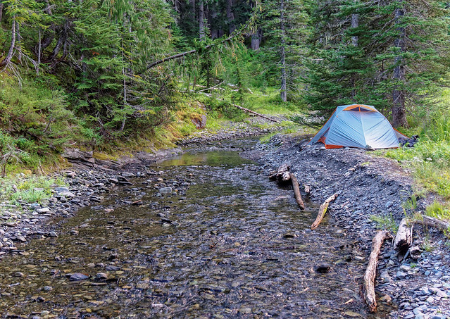
Our camp on the Dosewallips River on the Deer Park Loop in Olympic National Park, Washington
The next day we headed up ...
Seen from the Deer Park Loop in Olympic National Park, Washington
... to Lost Pass.
Seen from the Deer Park Loop in Olympic National Park, Washington
We enjoyed hiking through the high meadows ...
Jean on the Deer Park Loop in Olympic National Park, Washington
... as well as seeing the views ...
Seen from the Deer Park Loop in Olympic National Park, Washington
... including this one of Mt Olympus
Mt Olympus seen from the Deer Park Loop in Olympic National Park, Washington
The next pass we hiked over was Cameron Pass.
View from Cameron Pass seen from the Deer Park Loop in Olympic National Park, Washington
Once over the top we could look down into the valley below.
View from Cameron Pass seen from the Deer Park Loop in Olympic National Park, Washington
We were treated to the sight of patches of brilliant color within the familiar green and grey.
Seen from the Deer Park Loop in Olympic National Park, Washington
After crossing the valley we entered the woods and began the long climb up to the next pass. We had read that there could be downed trees that we would need to go over or around. However, the trail had been recently cleared so we had no trouble (except for the steepness). I felt the need for a break but there was a distinct lack of level ground to stretch out on and put my feet up.
Jean taking a break while hiking the Deer Park Loop in Olympic National Park, Washington
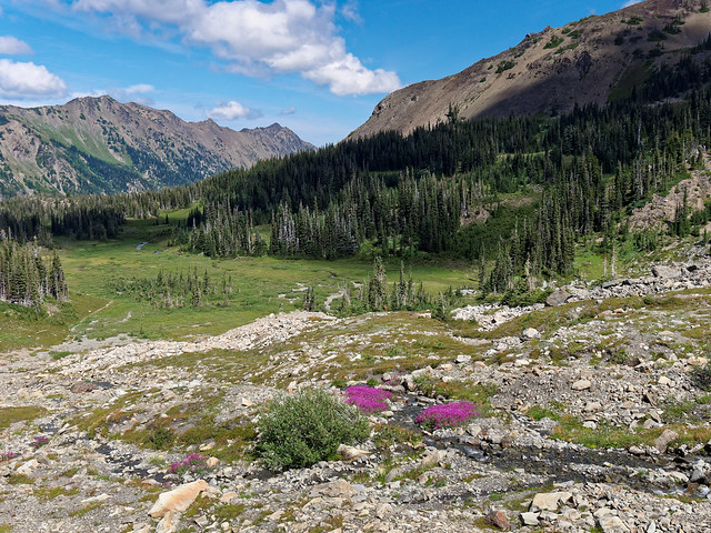
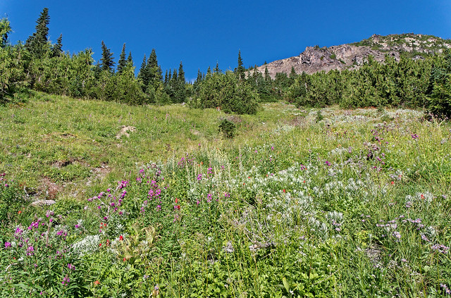
We continued on and eventually got out of the woods and back into high meadows. The wildflowers were gorgeous.
Jean on the Deer Park Loop in Olympic National Park, Washington
The next pass was Grand Pass and where we would camp for the night.
Approaching Grand Pass on the Deer Park Loop in Olympic National Park, Washington
I wish I had a nickel for every time I've written about the great view or used the words beautiful, lovely and gorgeous. If we are going to visit places such as this then I need to expand my vocabulary.
View from Grand Pass on the Deer Park Loop in Olympic National Park, Washington
We camped that night on Grand Pass. There is a well established, but more exposed, site well off to the left but it was occupied so we made do with a smaller site just visible to the left within the low trees. There was a tarn not too far on the other side of the pass where John was able to get water.
Jean fixing supper near our camp (left) on Grand Pass on Deer Park Loop in Olympic National Park, Washington
We were treated to a lovely sunset ...
Seen from Grand Pass on the Deer Park Loop in Olympic National Park, Washington
... and the morning brought more expansive views.
Seen from Grand Pass on the Deer Park Loop in Olympic National Park, Washington
We were visited by a very inquisitive deer. She was probably hoping to be fed or impatiently waiting for us to leave so she could seek out salts from human urine deposits.
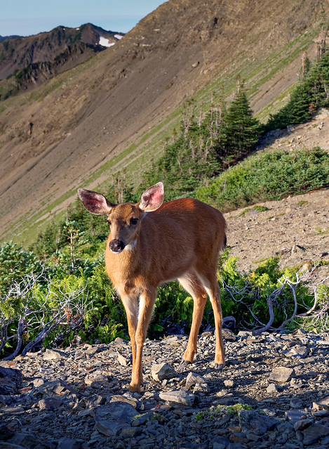
Deer in our camp on Grand Pass on the Deer Park Loop in Olympic National Park, Washington
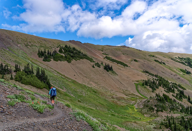
After breaking camp we headed down the other side of the pass to the next valley ...
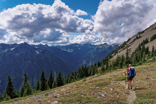
Jean on the Deer Park Loop in Olympic National Park, Washington
... passing streams ...
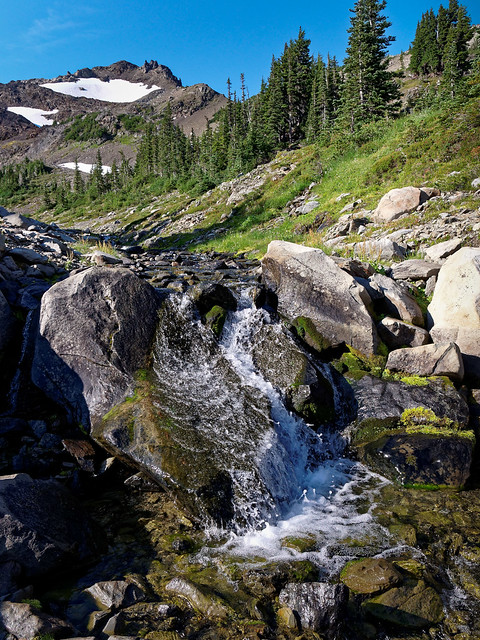
Seen from the Deer Park Loop in Olympic National Park, Washington
... and meadows along the way.
Seen from the Deer Park Loop in Olympic National Park, Washington
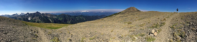
We did the final climb up toward Obstruction Point. As there is a parking lot and trailhead at Obstruction Point we were not surprised to encounter day hikers. Once there we knew we had at least another 7 miles to go to get back to Deer Park but the grade would be more gradual than we had encountered the preceding days of the trip. We started the long traverse and it kept going ...
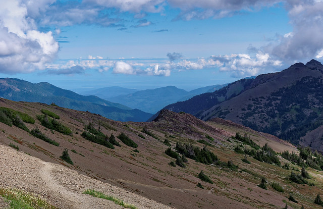
Seen from the Deer Park Loop in Olympic National Park, Washington
... and going ...
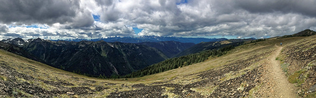
Seen from the Deer Park Loop in Olympic National Park, Washington
... and going.
Jean on the Deer Park Loop in Olympic National Park, Washington
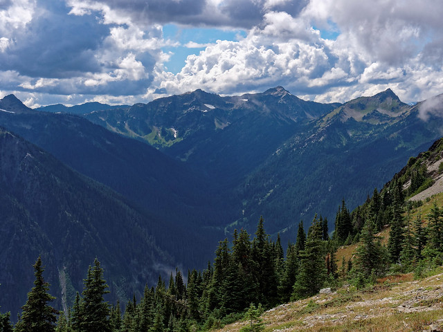
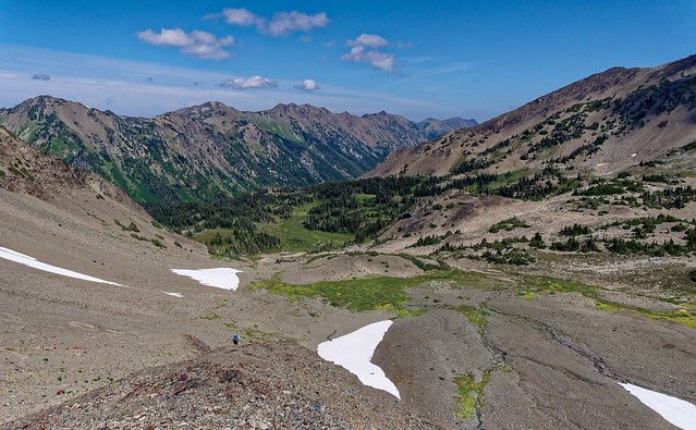
Anytime we began to think of it as tedious all we had to do was look toward Grand Valley
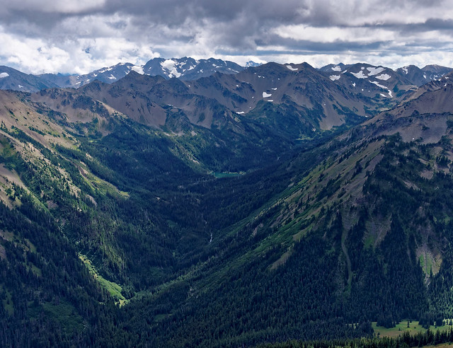
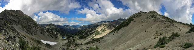
Grand Valley seen from the Deer Park Loop in Olympic National Park, Washington
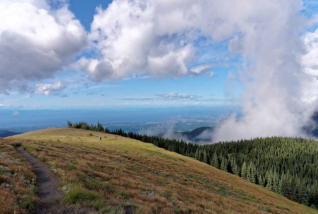
We began to get views of Sequim, Dungeness Spit, the Strait of Juan De Fuca as well as all the way to Canada.

Sequim, Washington seen from the Deer Park Loop in Olympic National Park, Washington
We were tired but we just kept putting one foot in front of the other and finally reached the parking lot. All of our photos taken on this backpack trip are on Flickr.
Jean on the Deer Park Loop in Olympic National Park, Washington
We also took advantage of our time in Washington to see our son Tom. Happily our son Dan was able to come from Pittsburgh for a visit so we did a little trip to the Olympic Peninsula with them. We first spent a few days at Salt Creek Recreation Area.
Salt Creek Recreation Area, Washington
Once again some low clouds increased the beauty of the evening sky.
Salt Creek Recreation Area, Washington
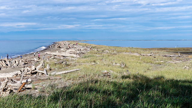
We then spent a few more days at Dungeness Wildlife Refuge.
Dungeness Wildlife Refuge, Washington
This was one of our favorite places to take our boys when they were young. We used to spend hours building forts with the abundant drift wood.

Dan and Tom at Dungeness Wildlife Refuge, Washington
While we love sunshine and clear blue skies we can always appreciate clouds that help create gorgeous reflections ...
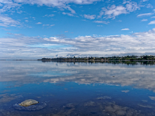
Dungeness Wildlife Refuge, Washington
... and dramatic sunsets.
Dungeness Wildlife Refuge, Washington
We also did a day hike in Olympic National Park. While we hadn't planned to come up to Washington State this summer I have to say that I am extremely happy we did.
Olympic National Park, Washington
Since the previous March I had been doing my best to ignore some pain and loss of range of motion in my left shoulder. However, as we were back in Washington State and I had the time I decided to see a doctor. He believed I had a rotator cuff tear and ordered physical therapy and no backpacking. So once again John did some solo trips. The following is his account of his adventures.
Since Jean couldn't go backpacking I decided to do two solo trips replicating one day trail runs that I had done years ago. When I was still working, long distance trail runs were a more expedient way than backpacking to see lots of country. However, you are always running, so the runs are not really compatible with photography. Now that I'm retired I've got the time and I really do like being out early and late in the day as it enables me to take the time to photograph during the prettiest times of day.
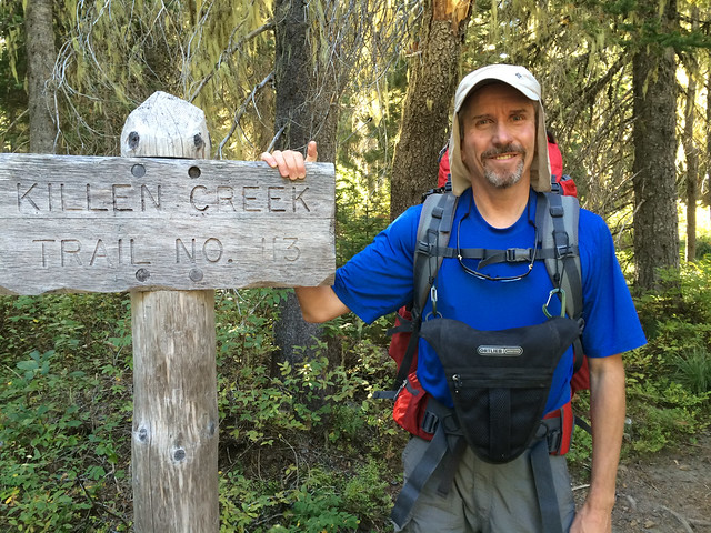
The first trip started up Killen Creek at 4,600 feet and doesn't really follow Killen Creek, ...
John beginning his backpack trip from Mt Adams through Goat Rocks, Washington
... but heads through meadows up the northwest side of Mt Adams.
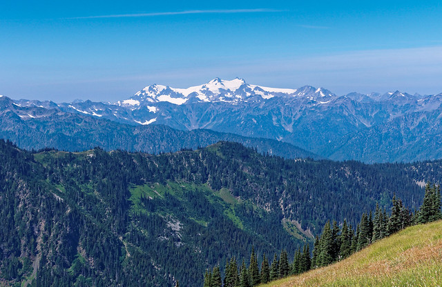
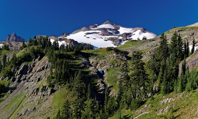
Mt Adams seen on backpack trip from Mt Adams through Goat Rocks, Washington
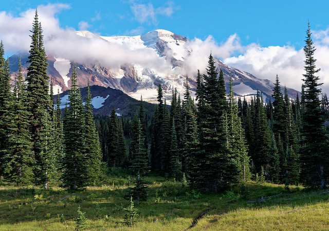
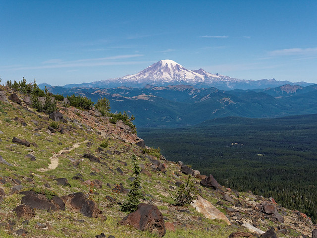
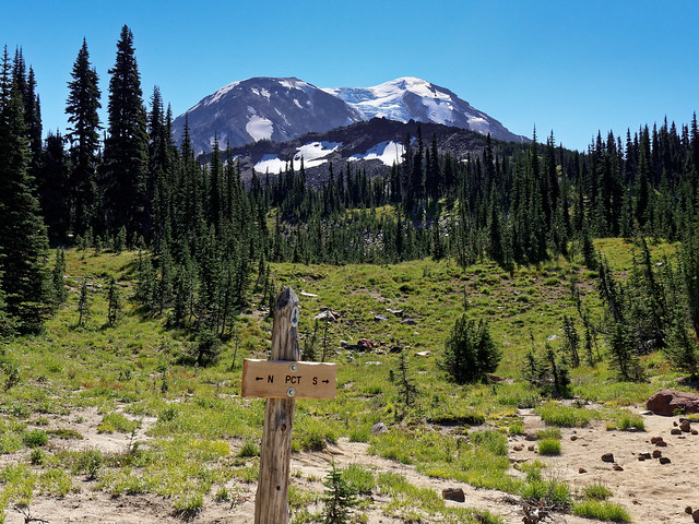
The Killen Creek Trail ends at the Pacific Crest Trail (PCT) at 6,100 feet. The unmaintained trail to the High Camp heads quickly up after crossing the PCT. Views of Mt Rainier ...
Mt Rainer seen on backpack trip from Mt Adams through Goat Rocks, Washington
... and Mt St Helens grew as I climbed.
Mt St Helens seen on backpack trip from Mt Adams through Goat Rocks, Washington
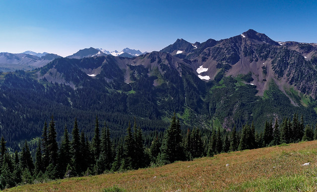
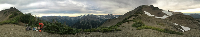
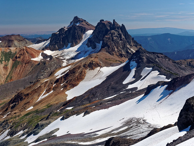
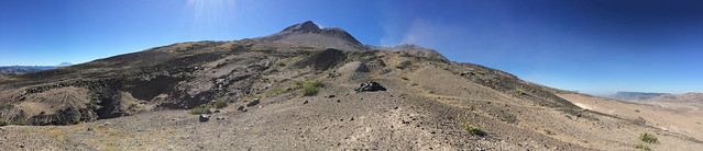
I finally arrived at the Mt Adams High Camp (6,900 ft) with finely weathered wind swept trees and spectacular views of Goat Rocks. It will take another two days to get as far as I can see now. I truly love seeing a destination so far away and knowing that I'll be there soon with just my feet moving me one step after another.
Goat Rocks seen on backpack trip from Mt Adams through Goat Rocks, Washington
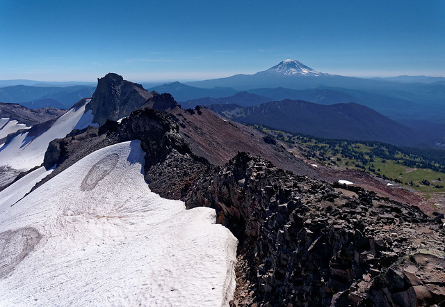
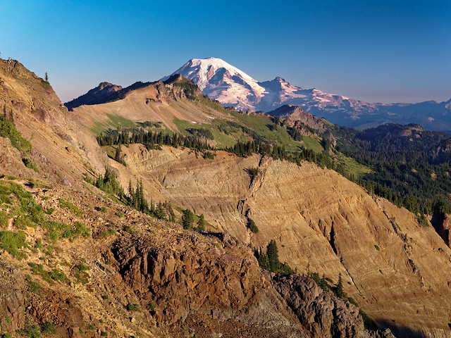
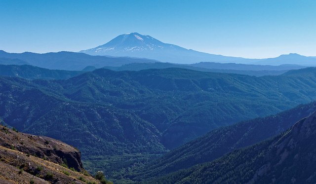
One of the best views of Mt St Helens is from Mt Adams. I'll be walking around Mt St Helens in another week.
Mt St Helens seen on backpack trip from Mt Adams through Goat Rocks, Washington
My night at the High Camp was an adventure in being sandblasted. I tightened my sleeping bag breathing hole as tight as possible and actually slept fairly well. The next morning I decided to sleep in until the wind died down. Everything in my tent was heavily coated in sand and it took a while to clean up. It's a spectacular camp with an intimate view of Mt Adams and panoramic views of Mt St Helens, Mt Rainier and the Goat Rocks. I'll be seeing all three volcanoes simultaneously for the next three days - wow!
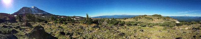
Mt Adams, Mt St Helens and Mt Rainier seen on backpack trip from Mt Adams through Goat Rocks, Washington
I retraced the trail ...
Mt Rainier seen on backpack trip from Mt Adams through Goat Rocks, Washington
... back down to the PCT.
Mt Adams seen on backpack trip from Mt Adams through Goat Rocks, Washington
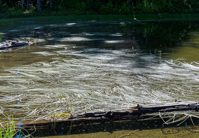
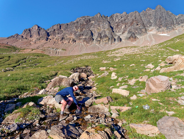
After overnighting in a woodsy camp on the PCT and passing by lovely grass filled ponds, ...
Seen on backpack trip from Mt Adams through Goat Rocks, Washington
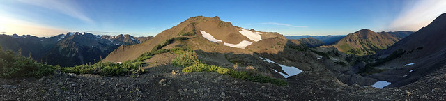
... I crested a ridge for my first close up views of the Goat Rocks just south of Cispus Pass. Mt Gilbert is the high point of Goat Rocks, though it is not too prominent on the massive ridge, at least not from down here.
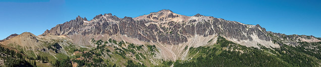
Gilbert Peak seen on backpack trip from Mt Adams through Goat Rocks, Washington
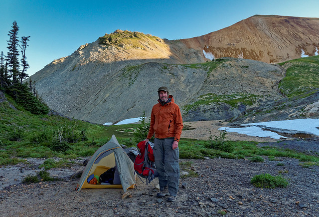
Just past Cispus Pass is Cispus Basin.
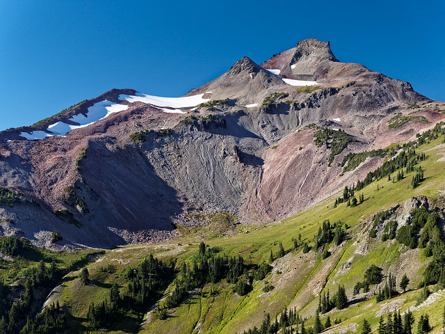
Cispus Basin seen on backpack trip from Mt Adams through Goat Rocks, Washington
This was my home for the evening. I couldn't have asked for better.
Goat Rocks seen on backpack trip from Mt Adams through Goat Rocks, Washington
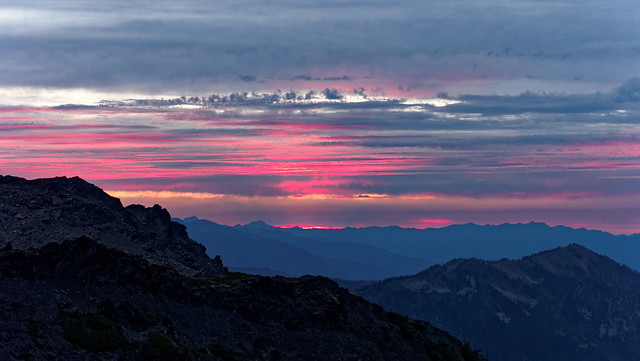
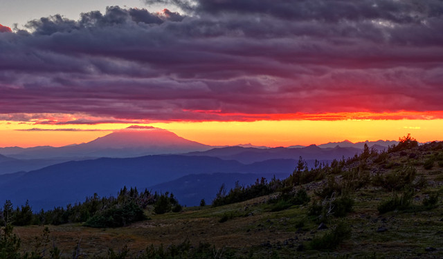
As the sun set again on Mt St Helens ...
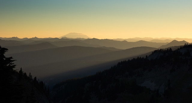
Mt St Helens seen on backpack trip from Mt Adams through Goat Rocks, Washington
... the last daylight quickly flowed over the Goat Rocks above Cispus Basin.
Goat Rocks seen on backpack trip from Mt Adams through Goat Rocks, Washington
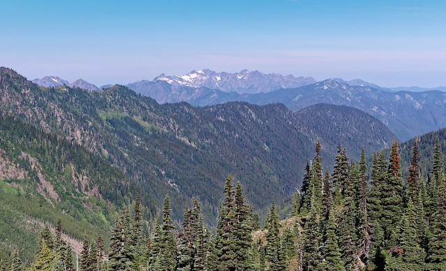
Day four covered the PCT from Cispus Basin to just below Elk Pass. I'm covering this stretch on a weekend when many of the PCT thru hikers are finishing up the hike from Mexico to Canada. The weekend has brought out many backpackers from Seattle and Portland as well, so the trail is actually pretty crowded. The PCT thru hikers are in kind of a hurry at this point trying to cover the last 300 miles into Canada before any snow hits. They are also trying to quickly get to their next resupply at White Pass. The end is in sight so they are a focused, yet festive, crowd. It seems to be the consensus that this is the prettiest stretch of the PCT north of the John Muir Trail in California. Where else do you get such spectacular sustained close views of three volcanoes at the same time? OK, maybe just two and a half since Mt St Helens blew in 1980.
Mt Rainier peeks out on the PCT from the shoulder of Old Snowy Mt. The PCT continues past the short snow crossing to the right. There is also a bypass trail if snow conditions are bad.
Mt Rainier seen on backpack trip from Mt Adams through Goat Rocks, Washington
I climbed to the top of Old Snowy Mt and looked back at Mt Adams where I had camped just above the forest on the ridge on the right side. There is about a day of woodsy walking between Mt Adams and Goat Rocks.
View from Old Snowy Mt of Mt Ives and Mt Adams seen on backpack trip from Mt Adams through Goat Rocks, Washington
After lounging for a while on Old Snowy Mt, I continued on ...
View from Old Snowy Mt of Mt Ives seen on backpack trip from Mt Adams through Goat Rocks, Washington
... to the airiest part of the PCT in Washington State. You can see the trail winding to the north behind me.
John with Mt Rainier while on backpack trip from Mt Adams through Goat Rocks, Washington
I camped just below Elk Pass next to some very cool snow bridges ...
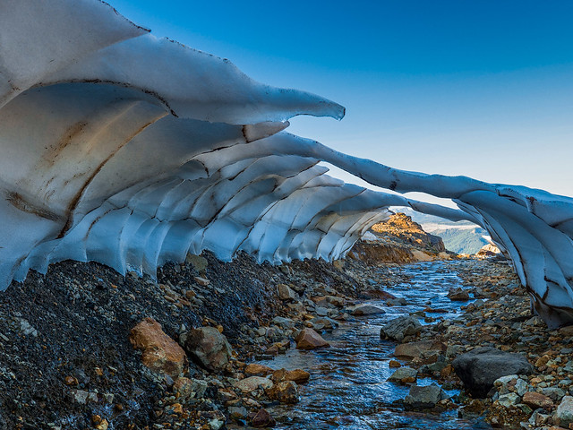
Seen on backpack trip from Mt Adams through Goat Rocks, Washington
... located on one side of my tent ...
John at camp while on backpack trip from Mt Adams through Goat Rocks, Washington
... and a great evening view of Mt Rainier on the other. One of the best things about backpacking is that it enables you to be in gorgeous spots late in the day ...
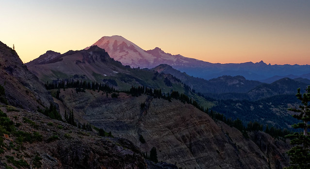
Mt Rainier seen on backpack trip from Mt Adams through Goat Rocks, Washington
... as well in the morning.
Mt Rainier seen on backpack trip from Mt Adams through Goat Rocks, Washington
The PCT dropped down into the woods for a while after one last view of Old Snowy Mt.
Old Snowy Mt seen on backpack trip from Mt Adams through Goat Rocks, Washington
The PCT then climbed back up to the ridge top. Lucky for me as I could text Jean to let her know she could pick me up in a few hours at White Pass. This is Shoe Lake just before the trail drops down to White Pass. There were some trail angels at White Pass with beer and oranges for the thru hikers but I hadn't earned that. Better yet, Jean, my angel, arrived about 10 minutes after I got back to the highway. All of the photos from this backpack trip are on Flickr.
Shoe Lake seen on backpack trip from Mt Adams through Goat Rocks, Washington
My next trip around Mt St Helens duplicated a solo trail run I did in 2002. Trail running at that time was not as common as today. The trail was in very rough condition, especially on the west side. I read one trip report and had a very funky map of the route. I camped at the trailhead at June Lake on the south side and ran counter clockwise around the mountain to take advantage of sunrise and sunset for photos. Little did I know the problems this decision would cause.
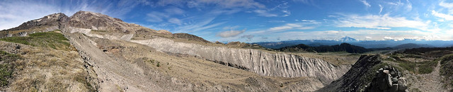
I made good time running until I hit the west side. The South Toutle river and beyond was a mess with a terrifically eroded canyon. Progress was slowed dramatically. What I hadn't really noticed on my internet map were the lava fields. When I got to the first one I finally appreciated what they were. There are about four or five of the lava fields ranging from one quarter to nearly one mile across. I hit the first one with good light, the second with fading light and the remainder in full darkness. A constructed trail is not really possible across the lava so the USFS put in tall posts about every hundred yards (or more) apart. You scramble across the large chunks of lava from post to post. Great in the daylight, but nearly impossible after dark. Needless to say my progress slowed to a near crawl as I tried to see the slightest evidence of foot prints or even disturbed dust with a pathetically weak headlamp. I had resigned myself to sleeping in my mylar bivy bag, but I pressed on and stumbled back to my van about midnight - whew!
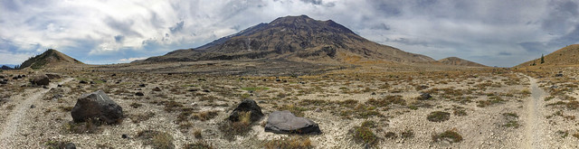
On this backpacking redo I really wanted to see so much of the trail that I missed the first time. This time I started at Windy Point on the northeast corner of the mountain, but I walked in the same counter clockwise direction. This worked out best for water and camps. I would take three days to do the circuit and I had a good weather window. Mt St Helens is so unique with the vastness of the destruction and amazing way that nature so quickly fills that vacuum. In 1980, the north side of the mountain was completely blown out. Wikipedia describes the whole dynamic extraordinarily well. It's one thing to read about it. It's quite another to walk through all of the changes.
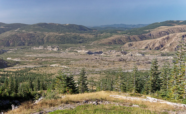
The first view of Spirit Lake is from an old road that turns into a trail and starts down toward the Pumice Plain. It would take most of the day to cross the Pumice Plain on the north side of the mountain.
Spirit Lake seen on backpack trip around Mt St Helens in Mt St Helens Volcanic National Monument, Washington
Before I dropped down onto the Pumice Plain I had this nice view of Mt Adams. I had camped at High Camp (straight ahead just above timberline at the lowest snow fields) just a week ago on the first night of my Mt Adams - Goat Rocks trip. Small world.
Mt Adams seen on backpack trip around Mt St Helens in Mt St Helens Volcanic National Monument, Washington
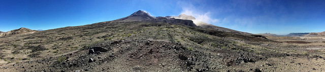
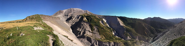
This panorama shows Mt St Helens from the northeast with Mt Adams on the left horizon. The Mt St Helens summit is in the center, the Pumice Plain is on the right and the trail heads around a ridge into Loowit creek and the falls.
Seen on backpack trip around Mt St Helens in Mt St Helens Volcanic National Monument, Washington
Loowit Falls drains the crater.
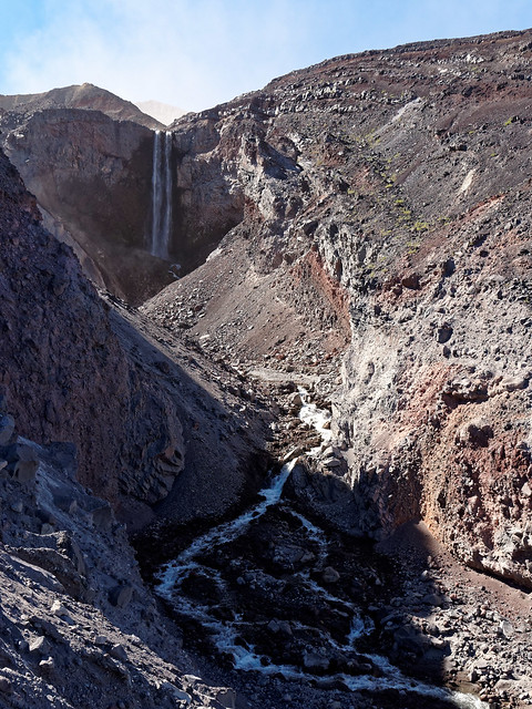
Loowit Falls seen on backpack trip around Mt St Helens in Mt St Helens Volcanic National Monument, Washington
This panorama shows the falls on the left, the Pumice Plain in the middle and Spirit Lake to the far right.
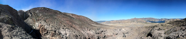
Loowit Falls and Spirit Lake seen on backpack trip around Mt St Helens in Mt St Helens Volcanic National Monument, Washington
As I moved slowly across the Pumice Plain past Loowit falls the desolation continued. As far as I could tell, the apparent smoke rising from the gully above is more blowing dust rather than steam. It is very windy.
Mt St Helens in Mt St Helens Volcanic National Monument, Washington
The blowing dust really etches the numerous gully edges.
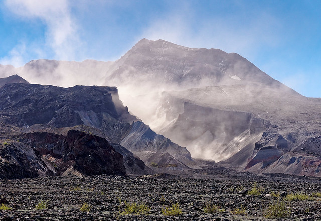
Mt St Helens in Mt St Helens Volcanic National Monument, Washington
This is the heart of the Pumice Plain. The trail heads west and then turns south a bit left of center on the far ridge. I encountered my first trail runners going sensibly clockwise around the mountain near here. The runners would have been done in a couple of hours.
Pumice Plain seen on backpack trip around Mt St Helens in Mt St Helens Volcanic National Monument, Washington
Looking up Castle Creek to Mt St Helens.
Seen on backpack trip around Mt St Helens in Mt St Helens Volcanic National Monument, Washington
Looking north toward Castle Creek.
Seen on backpack trip around Mt St Helens in Mt St Helens Volcanic National Monument, Washington
Looking up the South Fork of the Toutle toward Mt St Helens.
South Fork of the Toutle River seen on backpack trip around Mt St Helens in Mt St Helens Volcanic National Monument, Washington
This panorama shows the plateau that I crossed just north of the South Fork of the Toutle River. I'll drop down the very loose pumice slope to set up my camp right on the river. Always a lot of up and down going around a big mountain.
South Fork of the Toutle River seen on backpack trip around Mt St Helens in Mt St Helens Volcanic National Monument, Washington
Exploring the South Fork of the Toutle near my camp.
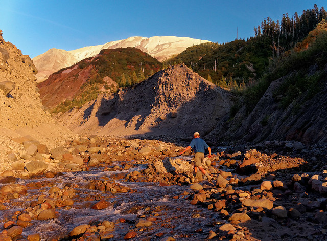
John and South Fork of the Toutle River while on backpack trip around Mt St Helens in Mt St Helens Volcanic National Monument, Washington
Amazing clouds and sunset to the west. Same color ...
South Fork of the Toutle River seen on backpack trip around Mt St Helens in Mt St Helens Volcanic National Monument, Washington
... highlighting Mt St Helens and coloring the South Fork of the Toutle River.
South Fork of the Toutle River seen on backpack trip around Mt St Helens in Mt St Helens Volcanic National Monument, Washington
On day two there were more of these gullies to cross as I headed south around the west side of Mt St Helens. These are messy crossings, but not difficult. Some even have rope to help hikers up or down.
Seen on backpack trip around Mt St Helens in Mt St Helens Volcanic National Monument, Washington
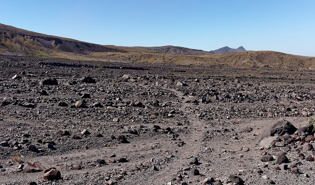
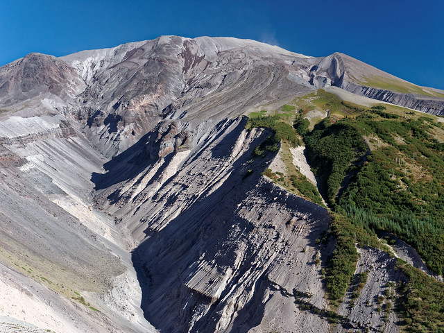
Looking straight up the west side of Mt St Helens. Grasses and trees are coming back 34 years after the eruption.
Seen on backpack trip around Mt St Helens in Mt St Helens Volcanic National Monument, Washington
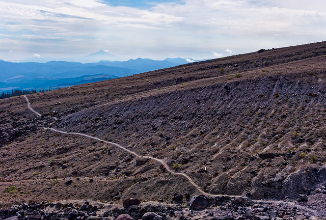
These posts are used to navigate the lava fields. Much better in the daylight. Mt Hood is hazily visible just right of center on the horizon.
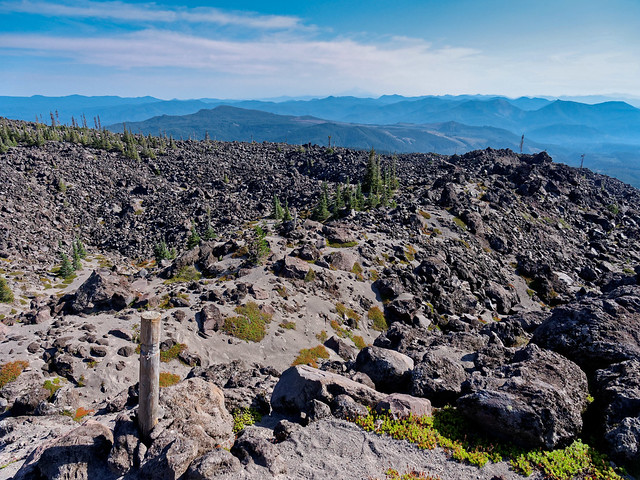
Lava fields seen on backpack trip around Mt St Helens in Mt St Helens Volcanic National Monument, Washington
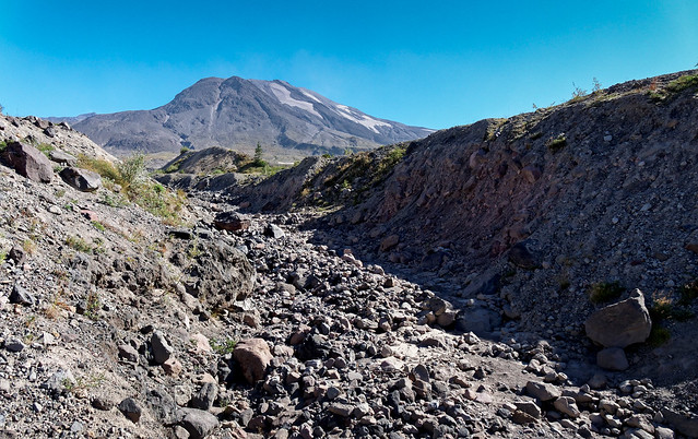
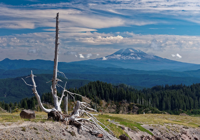
I finally rounded Mt St Helens enough to bring Mt Adams back into view.
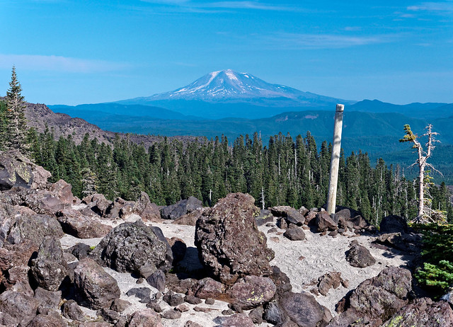
Lava fields seen on backpack trip around Mt St Helens in Mt St Helens Volcanic National Monument, Washington
After camping at Swift Creek there were still more lava fields to cross on day three. I can't begin to imagine how I crossed this after dark with a pitiful LED headlamp. Must have been youthful enthusiasm, I was just shy of the half-century mark. Seems youthful now.
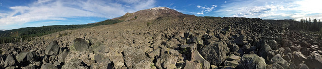
Lava fields seen on backpack trip around Mt St Helens in Mt St Helens Volcanic National Monument, Washington
Starting to head up the east side with Mt Adams clearly in view.
Mt Adams seen on backpack trip around Mt St Helens in Mt St Helens Volcanic National Monument, Washington
Looking over the Muddy River drainage south toward Mt Hood.
Mt Hood seen (in the distance) on backpack trip around Mt St Helens in Mt St Helens Volcanic National Monument, Washington
Snag and Mt Adams near Muddy River.
Mt Adams seen on backpack trip around Mt St Helens in Mt St Helens Volcanic National Monument, Washington
Finally some bright color in a mostly monochromatic landscape.
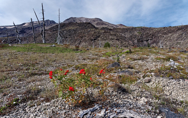
Seen on backpack trip around Mt St Helens in Mt St Helens Volcanic National Monument, Washington
"Zen garden" on the Plains of Abraham.
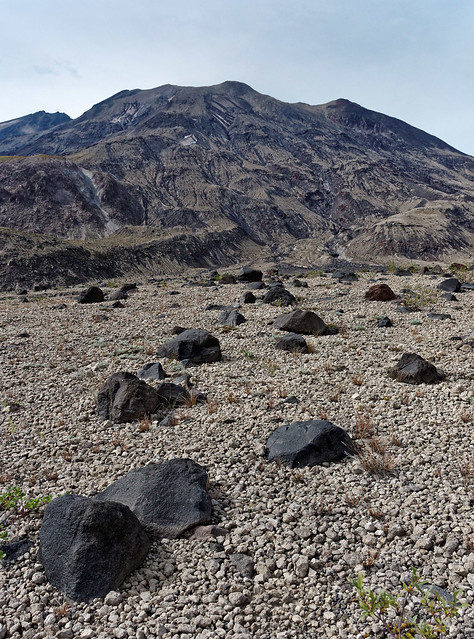
Plains of Abraham seen on backpack trip around Mt St Helens in Mt St Helens Volcanic National Monument, Washington
Plains of Abraham with Windy gap on the far right. Nearly done.
Plains of Abraham seen on backpack trip around Mt St Helens in Mt St Helens Volcanic National Monument, Washington
The last stairs back down to the access road.

Seen on backpack trip around Mt St Helens in Mt St Helens Volcanic National Monument, Washington
When I ran this trail in 2002 I didn't see a single soul In fact I didn't really see the last quarter of the trip because I covered it by headlamp. After seeing that section in daylight I have no idea how I made it. I think slowly was the answer. Much better this time around. I saw maybe ten trail runners going clockwise and getting the lava fields out of the way early. The trail conditions are much better now so it's much faster. I saw about 20 backpackers total for three days. There is some limited mountain biking allowed on the northeast side, but I didn't see any riders. Mt St Helens is remarkably uncrowded for such an accessible area and this was on a weekend. The recent geological drama is unsurpassed for North America. What a wonderful trip! All of the photos from this backpack trip are on Flickr.
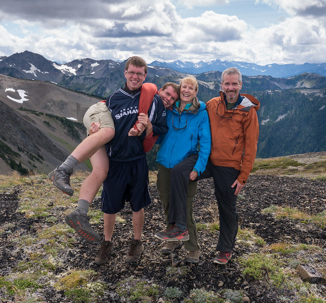
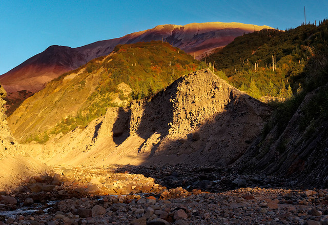
In mid October we left the Pacific Northwest and headed to California. Rather than drive down the coast as we had done the previous spring we decided to stay more inland. Surprisingly John did not take a single photograph! After that our sons joined us for the holidays and we had a great time; hiking, playing games and eating too much.
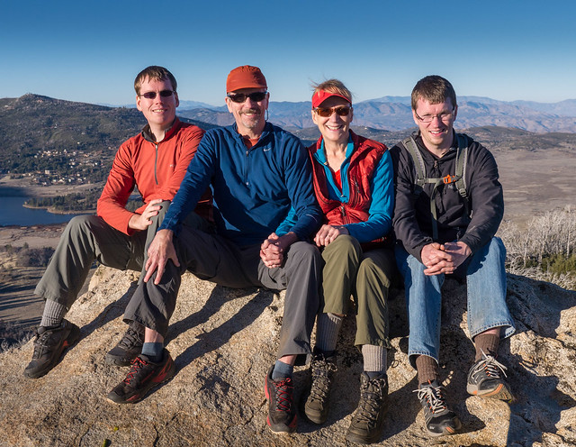
Dan, John, Jean and Tom on Stonewall Peak, California
Our new health insurance allows us to obtain medical care in other states so we decided if I (Jean) had to have surgery again that we would prefer to not spend another winter in the Pacific Northwest. So once in California I saw a surgeon who diagnosed a “frozen shoulder” rather than the dread rotator cuff tear (apparently a result of having had my wrist in a splint/cast so long and not using that arm). I had surgery in December and have regained full range of motion and no pain. I’m a little annoyed because if the first surgeon had given me an accurate diagnosis then I could have gone backpacking with John. Oh well.
We have spent the past winter in southern California where temperatures have been about 10 degrees above normal at times. While the eastern US was being hit with snow and frigid temperatures we were walking around in shorts wearing sunscreen. We are extremely grateful to be retired and mobile because we now have the option of not having to spend the summer here. We will soon be off to Grand Canyon National Park where we will continue working on our goal to hike every trail in the park.
This next bit is just something Jean has been thinking about
Good Intentions
I’ve had an interest in intentional communities for many years. Wikipedia states that "an intentional community is a planned residential community designed from the start to have a high degree of social cohesion and teamwork. The members of an intentional community typically hold a common social, political, religious, or spiritual vision and often follow an alternative lifestyle. They typically share responsibilities and resources".

Photo courtesy of the Fellowship of Intentional Communities
My interest began in 1976 when I first heard about a commune near Summertown, Tennessee called simply "The Farm". Reading their book, "Hey Beatnik!" got me excited, so excited that I went for a visit. I was attracted by the fact that everyone shared values and worked together. They were all vegans, a philosophy I believed in, and everyone took a “vow of poverty”, which appealed to my minimalistic nature (besides, I was already poor). I also enjoyed it because it was a working farm, a place I thought I had always wanted to live. But what drew me in the most was the strong sense of community and I was so taken with the whole thing that I decided to move there. Therefore, once I got back to Louisville I quit my job and got rid of most of my few possessions.

Members of The Farm working in the fields. Photo courtesy of The Farm
However, I was very disappointed to learn that they were not accepting new members but I was told of a small "satellite” Farm near Columbia, Kentucky so I went there. I was quickly accepted as a member and the 29 other residents soon felt like family. I enjoyed working in the large garden and skinny dipping in the nearby river. I took my turn cooking dinner for all of the members and helped watch the children. There was a strong spiritual component to living on The Farm that I admit I was less interested in. In fact, the only thing I remember about it now is that marijuana was referred to as "sacrament". I hadn’t smoked much marijuana before; I just didn’t care for it. But I decided that if I had to smoke a little dope to fit in then I could do that. Basically they were good people trying to live gently and cooperatively on the earth. I was happy ... with one exception, John wasn't there. He was still living in Louisville. While our relationship had not progressed beyond being very good friends, I missed him terribly. So after living on the Kentucky Farm for only a few months I left and moved back to Louisville. But the story ends happily with the beginning of my long term relationship with John and within a few months we started living together.

John and Jean (1977) in Louisville, Kentucky
I still had an interest in intentional communities and fantasized about the possibility of our living in one sometime in the future. About that time I read Walden Two by B.F. Skinner and it made a huge impression on me. In a nutshell it is about a fictitious rural community of about 1000 people who live cooperatively and happily together. I recently reread it and while I can see what got me excited about it back then there are definitely aspects described in the book that I am now uncomfortable with, many stemming from the reliance on “behavioral engineering”. There is also no mention of the possibility of residents being able to take off and spend weeks each year backpacking. But what still appealed to me was how the residents all willingly worked together to make Walden Two a nice place to live.

This got me thinking about The Farm and I wondered how they were doing. I had long since heard that the Kentucky Farm had disbanded and the property had been sold but I hoped the Tennessee Farm was alive and well. However, I learned that it had gone through some major changes. It went through a period referred to as “the changeover” after a recession in the early 80’s increased economic burdens and there was fear of losing the land to creditors. Each adult Farm member was then required to contribute financially toward the annual budget and operating expenses for the community. By 1985 the population dropped from about 1,200 to around 250. I have to admit I am not surprised that they found their idealistic lifestyle unsustainable. But it saddened me to hear of the painful changes they went through because I knew their intentions were only good. However, there is a proverb that states “The road to hell is paved with good intentions”.


Jean and John with Dan and Tom in Kent, Washington
As was common for our time we barely knew our neighbors and we accepted it as normal for American society. But I had a nagging fear as I had read about the importance of community in one’s life and of some long term benefits. We both obviously wanted to enjoy the best health and longest high quality life possible so I couldn’t help but feel like we were missing an important component. It was no better after John retired and we began our current lifestyle, living and traveling full-time in a motorhome. It could be said we acquired a community of sorts with other full-time RVers but our contact with our fellow travelers is very limited and the fact is that there is rarely anyone nearby who we can call upon during a time of crisis.
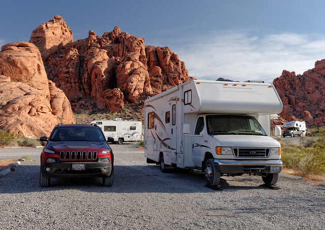
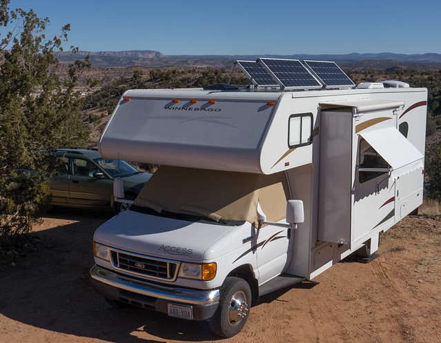
Our motorhome in Valley of Fire State Park, Nevada
I tried to push this concern to the back of my mind but not long ago I read the introduction in Outliers, a book by Malcolm Gladwell, which explained something called “The Roseto Effect”. This phenomenon, named for Roseto, Pennsylvania, is where the people (of Italian decent) in the community experienced a reduced rate of heart disease. “This was the 1950s, years before the advent of cholesterol lowering drugs and aggressive measures to prevent heart disease. Heart attacks were an epidemic” (page 3). Despite the fact that the Rosetans' indulged in many eating, drinking and smoking habits that were not conducive to good health, most of them were dying of old age. In addition “there was no suicide, no alcoholism, no drug addiction, and very little crime” (page 5). Researchers could not find any diet, exercise, genetic or regional components to attribute these qualities to. Their conclusion was that it was the close knit community of Roseto itself that enabled the inhabitants to enjoy not only a high quantity of life but a high quality of life as well.

Roseto, Pennsylvania - source of photo
I got curious and through a little internet searching I found this interesting abstract, “Social Relationships and Health: A Flashpoint for Health Policy”. It begins by stating “Social relationships - both quantity and quality - affect mental health, health behavior, physical health, and mortality risk.” A post titled “Social Ties are good for your health” on a Stanford University sponsored site, “Be Well @ Stanford”, was equally interesting. It begins with “We may all know that relationships with friends and family add immensely to the quality of life. But did you also know that such social ties can help us live longer?”
We would love to receive these benefits of “community” but how can we get them? It seems impossible while we are still traveling. But what about in the future? Something that is in the back of our minds is the knowledge that there will come a day when we will no longer travel full-time and will want to settle down. As we travel we have thought we should look at the communities we pass through and consider whether or not it could be a place where we might feel comfortable living sometime in the future. But I admit we haven’t looked very hard as we don’t care to spend time in more urban settings and our preference is to seek out more remote areas away from people.
Our campsite off Cunningham Creek Road in Colorado
When we first hit the road we became members of “Escapees RV Club”, an organization founded in 1978 to support people living and traveling full-time in an RV. They provided such services as a mail forwarding service and assistance obtaining a domicile. Escapees has also helped establish a network of “SKP” RV parks across the country where members can obtain discounted rates and are provided with opportunities for obtaining a long term site.

Image courtesy of Escapees
These include several which are co - ops where members contribute their time and energy to help maintain the park. One of our earliest experiences with a SKP RV co - op was at the one located in Chimicum Washington; Evergreen Coho SKP RV Co Op. We spent several weeks there after returning from our four months in New Zealand and Australia getting caught up with our respective computer work. As we walked around I was taken with the community “feel” of the place. All of the other members greeted us warmly and seemed fully engaged in community activities and using the facilities. While using the WiFi in the Clubhouse I was amused by the group of vibrant seniors practicing a play they would be performing. There were also organized games and social events. And almost everywhere we looked we saw members happily volunteering their time and working together to maintain the park. Being there reminded me of what I liked so much about “Walden Two”.

Evergreen Coho SKP RV Co - Op’s Landscape Committee in Chimicum, Washington
Photo courtesy of Dennis L. Haven
We were quite taken with the fact that it was a co - op and that volunteering was an expectation. I know from personal experience that one can feel a great sense of satisfaction by volunteering and I was pleasantly surprised to learn that there are definite health benefits to volunteering especially for older individuals. I came across an Issue Brief titled “The Health Benefits of Volunteering: A Review of Recent Research" that was put out by the Corporation for National and Community Service. The key findings state that “Older volunteers are most likely to receive greater health benefits from volunteering than younger volunteers. These benefits include improved physical and mental health and greater life satisfaction.” Being part of a co - op community in the future is appealing to us. However, as we hope to continue traveling for a number of years yet it is easy to avoid putting any time and energy into finding one. We have more interest in finding a “winter base”, somewhere warm and sunny where we can rest up from traveling, get caught up with photo editing and blog writing before beginning another season of adventures.
Enjoying the sun in Cottonwood, Arizona during the winter of 2013
We have kept that in mind while traveling in the southwest this past year. While staying at a campground in Idyllwild, California John got talking to a fellow who asked if we were Escapees members. Upon learning that we were he proceeded to encourage us to visit Jojoba Hills SKP RV Co - Op near Temecula in southern California. So we did.

The Clubhouse at Jojoba Hills RV Co-Op in Aguanga, California. Photo courtesy of Jojoba Hills
The park has 283 sites with about 500 members. On the surface it looks like a well appointed and meticulously maintained high end RV resort. The physical facility includes a pool, a well stocked library, a wood shop, a fitness room, an art center and Pickleball courts to name just a few of the amenities. There are an abundance of actives and social events and members are exceptionally generous with their time and their talents. Classes include water color painting, line dancing, yoga and water aerobics. The list goes on and all are taught by volunteers from within the park.

The pool at Jojoba Hills RV Co-Op in Aguanga, California. Photo courtesy of Jojoba Hills
Most importantly Jojoba Hills far and above exceeds any of the other SKP parks in its sense of community. Literally everyone waves when you are walking or driving through the park. People regularly sit out on their patios ready to engage in conversation with passersby. There are committees for nearly everything, many of which deal with the maintenance of the park such as Landscaping and the Road Crack Crew. However, several deal with “maintaining” the members including committees to welcome those who are new, provide “Sunshine” to those who need emotional support and even one to help members when it is time to move on to a more assisted living environment.

Landscape Committee at Jojoba Hills RV Co-Op in Aguanga, California. Photo by Kent Neveu
During our first visit we were given a tour that lasted three hours and we heard a great deal about its history. We learned that it was built almost exclusively by volunteer labor, an impressive feat. We were told that many of the founders of the park were World War II veterans and I was reminded of a book by Tom Brokaw, The Greatest Generation. Wikipedia describes this generation as those “who grew up in the United States during the deprivation of the Great Depression, and then went on to fight in World War II, as well as those whose productivity within the war's home front made a decisive material contribution to the war effort.”. In the book, Brokaw wrote, "it is, I believe, the greatest generation any society has ever produced." He states that these men and women fought not for fame and recognition, but because it was the "right thing to do."
I was also reminded of our interactions with people in New Zealand. Kiwis essentially believe that they have a nice country and that it is up to them to work together to keep it that way. This is an attitude that, in my opinion, is now in short supply in our country. Too many of us seem to view the troubles of others as “not my problem” and their own troubles in terms of “who can I blame?” Some of us have developed a dominant “me first” attitude and view any attempt to work toward a common good as an attack on our “freedoms” and a quest to take away our “liberty”. I don’t want to believe that any of us are intentionally damaging the fabric of what creates a good sense of “community”. I’m sure if I talked to any given individual I would find that their intentions are good. But if that proverb, “The road to hell is paved with good intentions”, is to be believed then having good intentions is simply not enough. We need to think about the consequences of our actions, or perhaps even more important, our inactions. We need to look toward a common good and then be willing to do the hard work that is necessary to achieve it.

Some of the remaining founders at the 25 anniversary party in November 2014. Photo by Don Schultz
The original intent of SKP Parks was to provide Escapees members with economical places to stay while they saved up money in order to travel more. But the founders of Jojoba Hills went beyond that intent. So far beyond that even the Escapees organization thought Jojoba Hills overextended themselves. However, the founding members not only had good intentions but the willingness to do what was necessary no matter how hard it was. Subsequent members have been inspired by their efforts and have continued their legacy.

Map of Jojoba Hills SKP RV Co - Op in Aguanga, California. Image courtesy of Jojoba Hills
We recently became members of Jojoba Hills RV Co - Op and will use it as our winter base. We have also decided that we have found what we are looking for in terms of a future community we may choose to settle down and grow old in. My fantasy of our being a part of an intentional community has become a reality! But we have many more years (we hope) before we are ready to stop traveling. In the meantime we’ll spend the winter here having a lot of fun engaging in various activities such as going out with the hiking group …

The Jojoba Hills Hiking Group in “The Slot” at Anza-Borrego Desert State Park, California. Photo by Nancy Procter
… and playing Pickleball.

John competing in the annual Jojoba Hills Pickleball Tournament in Aguanga, California. Photo by Don Schultz
However, we do need to accept that there is a non financial “cost” involved in staying here and we have every intention to “pay” our fair share when we are here. But we need to do more than merely have good intentions. We need to “put our money where our mouth is”. So sometimes we must pass on doing what is fun and contribute our time ...

Jean working on the Landscape Committee at Jojoba Hills RV Co-Op in Aguanga, California.. Photo by Kent Neveu
... and our energy to help maintain the park.

John on one of the shed roof replacement teams at Jojoba Hills RV Co-Op in Aguanga, California.. Photo by Kent Neveu
In addition we need to be involved in the government of the park. We need to be informed about issues facing us and it is our responsibility to participate in decision making. So sometimes we need to spend some of our precious time reading documents, attending forums and membership meetings. Most importantly we need to vote in elections. In addition we need to consider the possibility of running for a seat on the board if the need arises. It seems to me that lessons learned at Jojoba Hills have broader applications. It boils down to if we want to have a nice community, a nice society, a nice country then we need to have much more than “good intentions”. We all need to be willing to work together to make it that way.

Meeting at Jojoba Hills SKP RV Co - Op in Aguanga, California. Photo by Don Schultz
One member we met on our first visit described Jojoba Hills this way "It’s like a commune except everybody works". As one who had lived on a commune I jokingly said that there must be less dope smoking. But after thinking about it later I realized that I could be wrong about that. After all, medical marijuana is legal in California and physical issues which it can be dispensed for include Alzheimer’s, cancer, chronic pain, glaucoma and arthritis. As everyone at Jojoba Hills is over the age of 55 I wonder if one of my contributions could be to drive to town to pick up everyone’s prescriptions at the dispensary. Oh yeah, I better pick up some Doritos on the way home.


No comments:
Post a Comment