Prior to our hitting the road there was something I frequently heard from an acquaintance after telling them about our plans to sell our house and live fulltime in a motorhome. They would quickly say something like “Oh yeah, you’re going to be Snowbirds”. They would then proceed to tell me about their retired relatives who live in some northern state and drive their motorhome to some RV Resort in some southern state for the winter. I admit that at the time it bothered me because I didn't think we fit the stereotype. That said, I must confess that we are spending this winter in sunny Arizona and will probably do so again in the future so I suppose that by a broader definition we are “Snowbirds”. However, while we are doing so much traveling I prefer to think of ourselves as "Nomads".
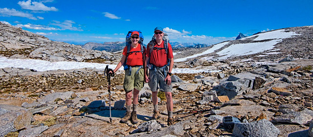
Jean and John on Donahue Pass (11,056 feet) along the John Muir Trail in Ansel Adams Wilderness, California
Where we have been – A variety of places in Utah, Colorado and Arizona
9/17 2012 – 2/18 2013In this post:
- Sightseeing - Dinosaur National Monument, Utah
- Dayhikes – Near Ouray in the San Juan Mountains, Colorado
- Dayhike - Mt Sneffels in the San Juan Mountains, Colorado
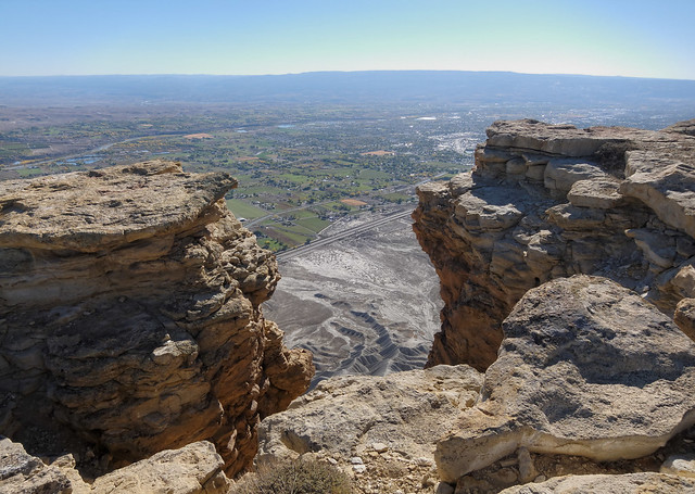
- Dayhikes – Colorado National Monument, Colorado
- Dayhikes - Black Ridge Canyons Wilderness, Colorado
- Dayhike – Fisher Towers, Utah
- Dayhike - Arches National Park, Utah
- Dayhike – Grand Canyon National Park, Arizona
- Dayhikes - Coconino National Forest, Arizona
We first stopped at Dinosaur National Monument in Utah. We both felt a bit nostalgic as we could remember being there with our kids back in 1995 and how excited they were to see real dinosaur bones.
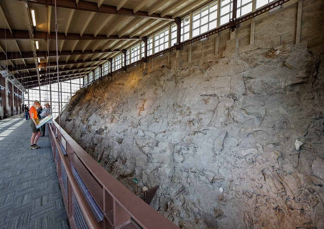
Jean in the Quarry Exhibit Hall in Dinosaur National Monument, Utah
The Quarry Exhibit Hall contains an impressive collection of bones that have been carefully partially excavated from a huge slab of stone including this intact Camarasaurus skull.
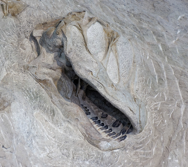
Camarasaurus skull on display in the Quarry Exhibit Hall in Dinosaur National Monument, Utah
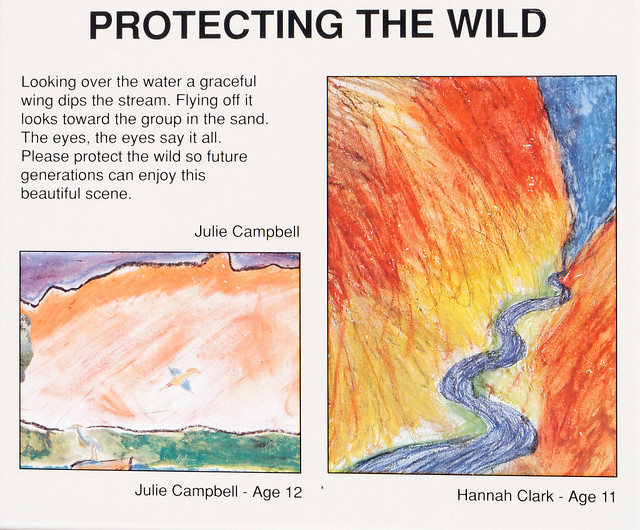
We also did the short nature trail called "Desert Voices". "Nature Trails" commonly have informative signs but what sets this trail apart is that the extensive collection of signs include some with inspirational quotes, such as this one by Jean Dorst, ...
_______________________________________________________________________________
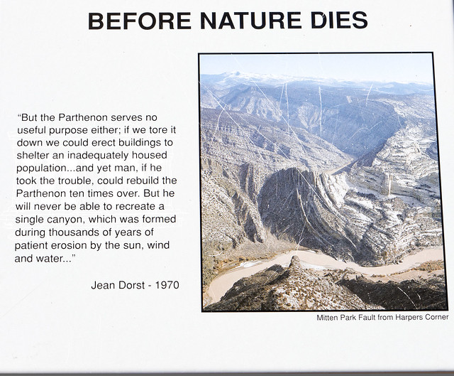
Sign seen on the Desert Voices Trail n Dinosaur National Monument, Utah
... as well as several that have been beautifully written and illustrated by school children.
_______________________________________________________________________________
___________________________________________________________________________________________
Sign seen on the Desert Voices Trail n Dinosaur National Monument, Utah
Sign seen on the Desert Voices Trail n Dinosaur National Monument, Utah
We also did the driving "Tour of the Tilted Rocks" because Dinosaur National Monument isn't just about the "dino bones".
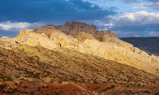
Seen while driving through Dinosaur National Monument, Utah
A short side trail takes you by some impressive petroglyphs created by members of the Freemont culture who inhabited the area over 700 years ago.
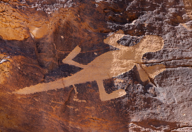
"Lizard" petroglyph seen in Dinosaur National Monument, Utah
The driving tour ends at the former homestead of Josie (Basset) Morris. Josie was a fascinating eccentric, self sufficient woman with a colorful past that included five husbands, bootlegging, poaching and cattle rustling (as well as an alleged relationship with Butch Cassidy) . She lived on this site until she was almost 90. Unfortunately a horse caused her to slip on some ice and she broke her hip.
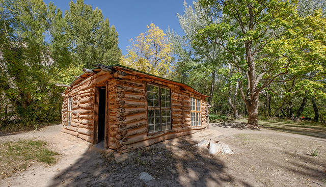
Josie Morris's cabin located within Dinosaur National Monument, Utah
Our visit to Dinosaur National Monument ended with views of this fantastic sunset. All of our Dinosaur National Monument photos are on Flickr.
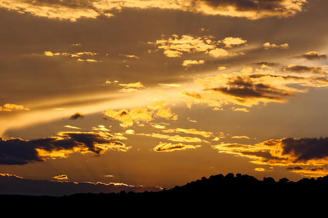
Sunset over Dinosaur National Monument, Utah
We then drove to Ouray in Colorado. This quaint former mining town is nestled within a deep valley of the San Juan Mountains. We were there after "tourist season" so it was quite calm. As I was still monitoring a chronic knee issue that got aggravated on our last backpack trip in the Wind River Range in Wyoming we first did some easy dayhiking to test it out ...
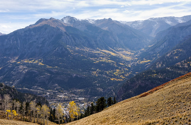
Ouray, Colorado
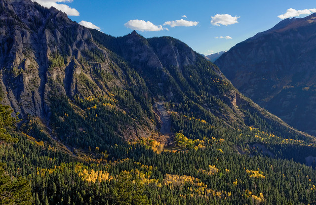
... on the Bridge of Heaven Trail ...
Jean on the Bridge to Heaven Trail outside of Ouray, Colorado
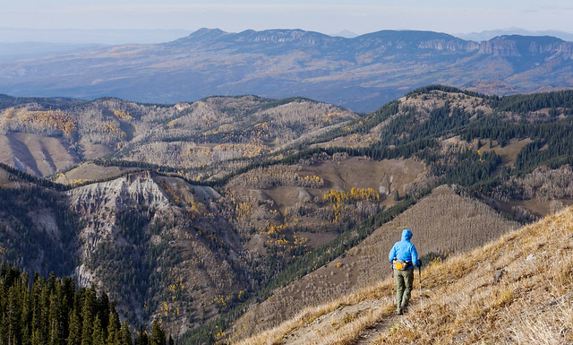
... as well as the Upper Cascade Falls Trail (so far so good). All of our photos of these dayhikes are on Flickr.
View from the Upper Cascades Trail outside of Ouray, Colorado
Once my knee seemed sufficiently healed we decided to hike to the top of Mt Sneffels (14,158 ft) in the San Juan Mountains. We were able to drive reasonably close so we only had to gain about 3,000 feet. The trail starts out easy but this kind of gradual ascent is always a warning that the bulk of the elevation gain will come over a short distance. It was cold and windy so we did the hike up with our parkas on and occasionally we even had to put our hoods up.
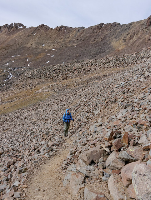
Jean on the trail up Mt Sneffels within Uncompahgre National Forest, Colorado
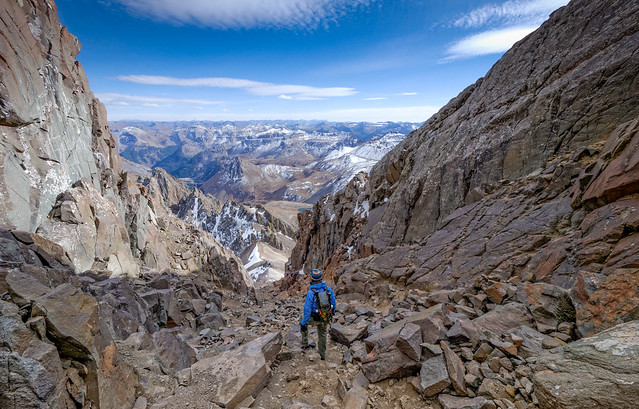
Unfortunately, right when it gets to the steep part the trail becomes a “route” and we had to pick our way up the loose scree. Occasionally we would spot what appeared to be a track and we'd work our way over to it only to have it peter out before long. I'm not a fan of hiking up steep, loose rocks especially since I can't help thinking about how much I'll hate coming back down it.
Jean on the route up Mt Sneffels within Uncompahgre National Forest, Colorado
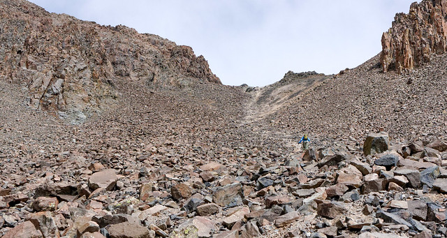
Once we reached the pass the route the rest of the way up was not clear. We could see that the main gully branched into two separate ones and we were uncertain about which to take. However, we encountered a couple coming down who told us to take the gully on the left. So we did.
The left gully, a potential route up Mt Sneffels within Uncompahgre National Forest, Colorado
However, we later learned that this was bad advice. The grade got steeper and the rocks got looser (not to mention that the oxygen got thinner) the farther up we went.
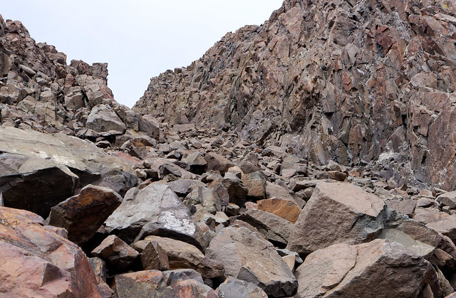
Jean on route up the wrong gully (left-hand side) to the top of Mt Sneffels within Uncompahgre National Forest, Colorado
But we persevered and eventually made it to the rock just below summit. It was a nice change of pace to be on rock that didn't insist on sliding under your feet as well as having something solid to grab onto. I have often thought that crawling is an underrated mode of transportation for adults.
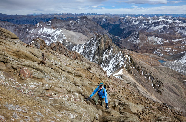
Jean on the route nearing the top of Mt Sneffels within Uncompahgre National Forest, Colorado
Of course it was all worth it when we reached the summit and got the big payoff of a stunning 360 degree view which included surrounding mountains ...
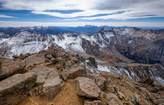
View from the summit of Mt Sneffels within Uncompahgre National Forest, Colorado
... as well as the expansive plain in the distance. The wind was even cooperative enough to die down a bit while we were up there.
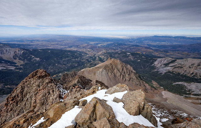
View from the summit of Mt Sneffels within Uncompahgre National Forest, Colorado
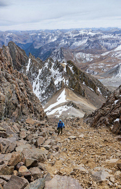
Then came the fun part, getting back down. Fortunately we now knew that we should take the other gully down and that we needed to find a feature known as the "V notch" and then go through it. Once through the notch the route immediately drops to the left.
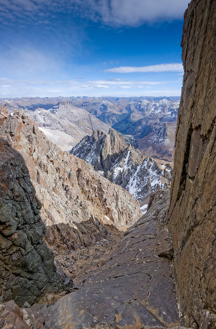
The view from the "V notch" on the route down from top of Mt Sneffels within Uncompahgre National Forest, Colorado"
I can definitely say that this way down was better. But compared to the way we went up that is not necessarily saying very much. The going was still a bit rough and very slow (which of course is better than going down a steep rocky slope very fast). All of our photos taken in the San Juan Mountains are on Flickr.
Jean on the correct route heading down Mt Sneffels within Uncompahgre National Forest, Colorado
We left Ouray soon after and headed to Grand Junction to visit some good friends, Wes and Theo. It is our good fortune that they are now spending about half of the year away from their other home in the Florida Keys. In addition to feeding us and letting us watch the presidential debates on their big screen TV, they showed around “their neighborhood” which includes the Colorado National Monument and the Black Ridge Canyons Wilderness.
We first did the Lower Monument Canyon Trail in Colorado National Monument, a gorgeous easy hike. I had always associated Colorado with the grey mountains we have seen on our dayhikes to mountains such as Handies Peak and Mt Sneffels When I expressed surprise that Utah allows Colorado to have such stunning red rock formations I was reminded that Utah's red rock country sits on the "Colorado Plateau", a huge area that is home to 10 National Parks (including Canyonlands, Arches and Grand Canyon) and 17 National Monuments (including Grandstaircase - Escalante and Natural Bridges). I obviously owe Colorado a big apology and more respect.
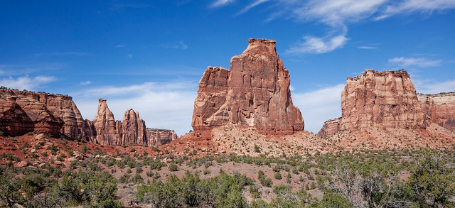
Independence Monument seen from the Lower Monument Canyon Trail in Colorado National Monument, Colorado
We also did a short hike up the No Thoroughfare Canyon Trail ...
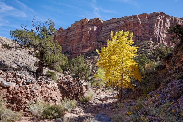
Seen from the No Thoroughfare Canyon Trail in Colorado National Monument, Colorado
... and on the Devils Kitchen Trail. All of our Colorado National Monument photos are on Flickr.
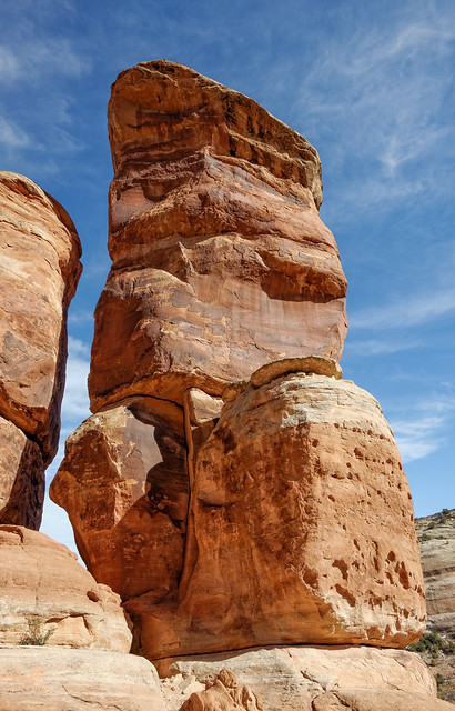
Seen from the Devils Kitchen Trail in Colorado National Monument, Colorado
We then did some hiking in the Black Ridge Canyons Wilderness. We appreciated our Subaru's 4 wheel drive and higher clearance to get us to to the trail heads for the two hikes we did. Rattlesnake Canyon is a hidden gem that contains nine natural arches, second only to Arches National Park for concentration of arches in the US.
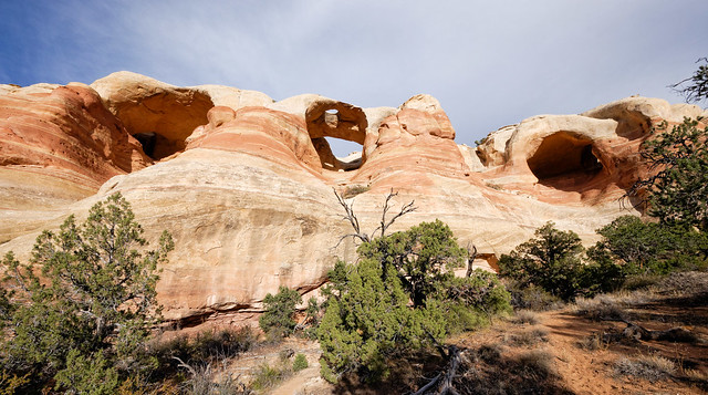
Bridge Arch, center, (AKA Hole-in-the-Bridge Arch) in Rattlesnake Canyon within the Black Ridge Canyons Wilderness, Colorado
Many can be reached by an easy trail, one of the most impressive being East Rim Arch (sometimes referred to as Akiti Arch).
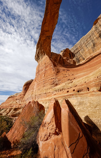
East Rim Arch (AKA Akiti Arch) in Rattlesnake Canyon within Black Ridge Canyons Wilderness, Colorado
This hike is essentially an "out and back" trail although we have read that some make it into a "loop hike" by climbing through Cedar Tree Arch (sometimes referred to as Rainbow Arch).
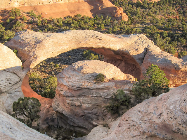
Seen from the overlook above - Cedar Tree Arch in Rattlesnake Canyon within the Black Ridge Canyons Wilderness, Colorado
When we saw Cedar Tree Arch from below it did look like we could have climbed up through it but definitely not down it. However, we were with friends and chose to take the long way back. Besides, it's an easy trail (that is until time to climb back out of the canyon) and you get to see the many arches again.
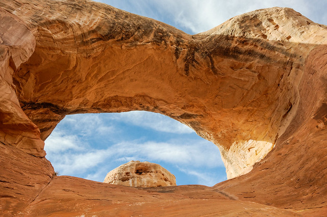
Seen from below - Cedar Tree Arch (AKA Rainbow Arch)in Rattlesnake Canyon within the Black Ridge Canyons Wilderness, Colorado
Our next hike was to Mee Canyon which is also within Black Ridge Canyons Wilderness. This trail is mostly straight forward with only occasional route finding issues as it drops into the canyon. We had read that the route involves crawling through a small arch and climbing down a ladder as well as crossing a narrow ledge.
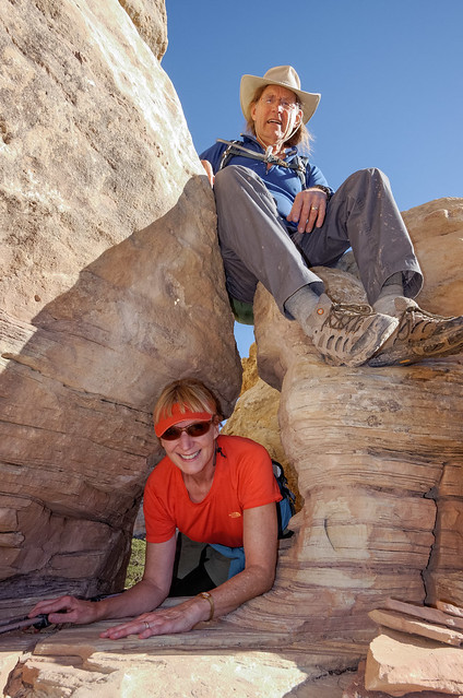
Being someone who is afraid of heights and has lousy balance I was a bit apprehensive about that. However, it really wasn’t too bad. There is pretty much just one spot where the ledge runs out and you have to commit to stepping across a wide gap to a big rock before climbing down. Although, I felt a little self conscious as I had not one but two cameras pointed at me.

Jean on "the ledge" and John with his camera in Mee Canyon within Black Ridge Canyons Wilderness, Colorado. Photo courtesy of Wes Pratt
We also had to go through a feature known as the “Keyhole” ...
Jean and Wes at the "Keyhole" in Mee Canyon within Black Ridge Canyons Wilderness, Colorado
... as the trail continued to drop to the canyon floor.
Jean on the trail in Mee Canyon within Black Ridge Canyons Wilderness, Colorado
Our objective was to reach what was reported to be an impressive “undercut”, a feature merely called “The Alcove”. We had some route finding issues as the bottom of the canyon was quite brushy and we weren’t really sure what we were looking for. We hoped we wouldn’t just accidentally pass by it but we needn’t have worried because we definitely knew it when we found it.
Calling this feature “The Alcove” does not accurately describe it. The thing is immense! It is more “cave” like than the open, airy alcoves we encountered while backpacking in Utah’s Coyote Gulch, for example the one in this photo, but the opening is unlike any cave we have ever seen.
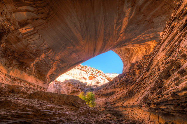
Mee Canyon Alcove within Black Ridge Canyons Wilderness, Colorado
What is hard to visualize is that each of these photos is showing less than half of the opening to this feature. In the photo above you can just make out the huge rubble pile to the right that runs down the center of the alcove. A stream flows deeply into the feature (I’ve read it is anywhere between 100 – 300 feet deep) before turning sharply around the rubble pile.
The photo below shows the other side of the alcove with the rubble pile now on the left and the stream flowing back out. To get an idea of the scale of this place you have to look closely for the teeny tiny figure of Wes standing above the stream off to the right (if you can't make him out then look at this photo on Flickr and hover over it so a small box appears identifying his location).
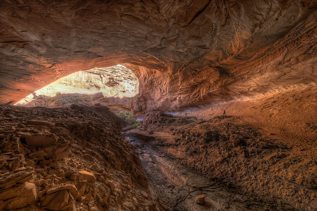
Wes (toward the right) in the Mee Canyon Alcove within Black Ridge Canyons Wilderness, Colorado
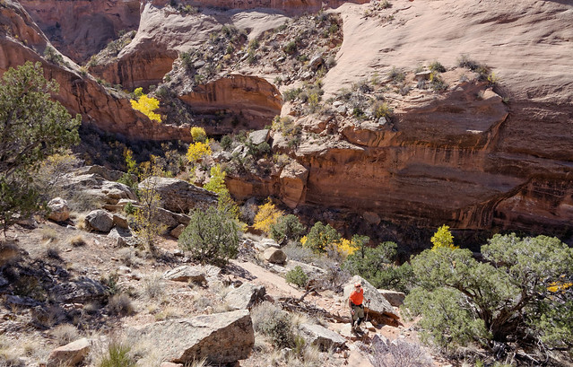
We headed back on trail through the brush but at least it was easier to find our way out.
Wes on the trail in Mee Canyon within Black Ridge Canyons Wilderness, Colorado
Since this is and "out and back" hike we retraced our steps which meant we would now be climbing up to the narrow ledge. The advantage is that I’d be getting past the scary part, stepping across the gap to the narrowest part of the ledge, first.
Jean crossing back over the "ledge" on the Mee Canyon Trail within Black Ridge Canyons Wilderness, Colorado
We went back up the ladder and through the small arch. One of the many great things about having a friend along on a hike is we get action shots with both of us in them (including a rare view of John's rear end). All of our Black Ridge Canyons Wilderness photos are on Flickr.

John and Jean on ladder in Mee Canyon within Black Ridge Canyons Wilderness, Colorado. Photo courtesy Wes Pratt
While in the area John and I did a conditioning hike up Mt Garfield located just outside of Grand Junction. The trail starts out quite steep ...
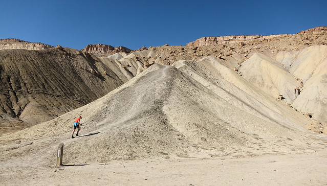
Jean starting up Mt Garfield near Grand Junction, Colorado
... but partway up some other hikers pointed out a small band of wild horses. Apparently Mt Garfield is adjacent to the Little Book Cliffs Wild Horse Area.
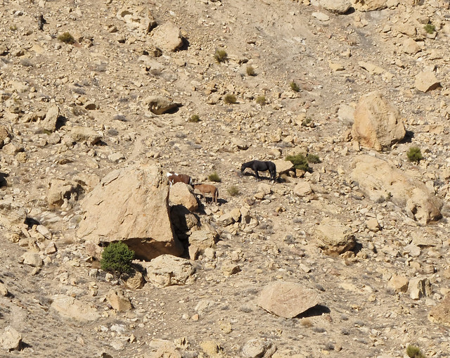
Wild Horses seen from the Mt Garfield Trail outside of Grand Junction, Colorado
Once at the top we enjoyed some great views of Grand Junction and the surrounding area.
View of Grand Junction from the top of Mt Garfield outside of Grand Junction, Colorado
After leaving Colorado we continued slowly making our way south and reentered Utah where we did a short hike to the Fisher Towers.
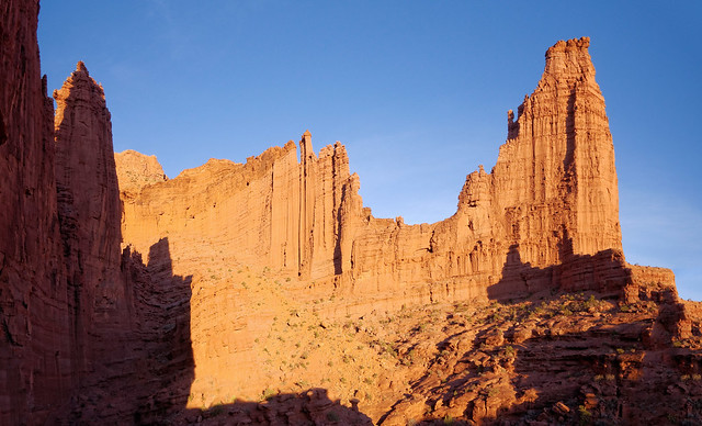
The "Titan" in the Fisher Towers, Utah
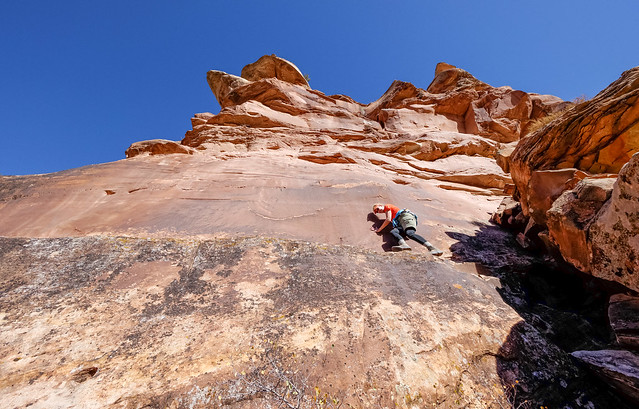
This area is extremely popular with rock climbers. In the photo below the spire at the top is known as the "Cork Screw". Believe it or not there are two climbers on the “Cork Screw”, one sitting on the top and one partway down on the right. You can just barely see them in the Original Size of this image. If needed you can view this photo on Flickr and hover over the image so the small boxes appear and identify their location. All of our Fisher Tower photos are on Flickr.
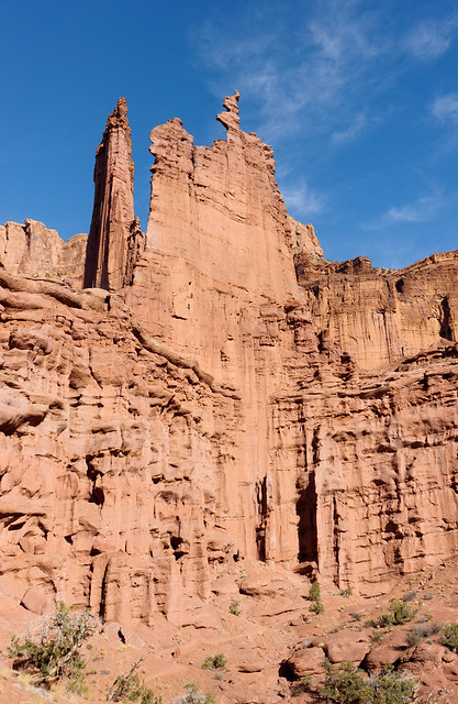
"Cork Screw" in the Fisher Towers, Utah
We then spent about two weeks in Moab. John was still editing and post processing photos from our backpacking trips in Montana (he hadn't even started on the ones taken on our two trips in the Wind River Range). It felt a bit odd to be so close to Arches National Park and not spend a lot of time there but we have been there on several occasions in the past on vacations with our kids and feel we know the park quite well.
However, we did enter the park to do a little sight seeing and hiking. Arches National Park has made most of the notable features quite accessible to visitors and a short walk and a brief climb will get you under the impressive Double Arch.
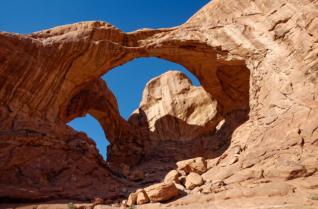
Double Arch in Arches National Park, Utah
We also did the Devil’s Garden loop past Landscape Arch, reported to be the longest natural arch in the world, the span having been measured to be about 290 feet. We first saw this arch in 1989 when there was still a trail that went underneath the arch and up and around on the slope behind it. However, the Park Service closed it in 1991 after three slabs sandstone (ranging from 30 - 70 feet long) fell from the thinnest section of the arch. I'm certainly grateful we weren't in the "wrong place at the wrong time" to witness any of those events from below.
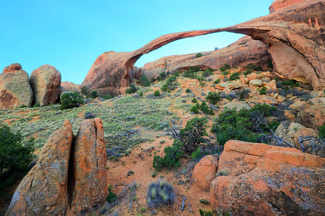
Landscape Arch in Arches National Park, Utah
I was surprised to learn that Kolob Arch , in Utah’s Zion National Park, is considered to be the second longest arch with a reported span about 287 feet. We have seen Kolob Arch (seen in this photo taken on a backpack trip in Kolob Canyon) and it just doesn't look very impressive. The problem is that you can’t get close enough to it so the scale is quite deceptive and there is a rock face directly behind it. I do feel badly for not giving it more respect at the time.
We continued on the trail and were surprised to discover that Wall Arch had collapsed. It was disconcerting because I can remember sitting directly under it eating lunch with our kids. The next arch we stopped at was Navajo Arch. We've been here several times before and each time I've been happy that the trees under it are still alive and continuing to grow.
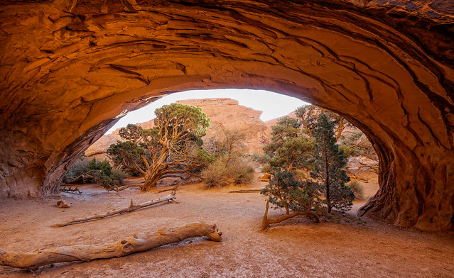
Navajo Arch in Arches National Park, Utah
The last arch we stopped at was Double O Arch. It's not the end of the trail but it was getting late so we decided to head back. Even so we did end up needing our headlamps. It turned out to be a good thing that we were out that late as we happened across a couple without headlamps who were picking their way very slowly down the rocky portion of the trail in the dark. All of our Arches National Park photos are on Flickr.
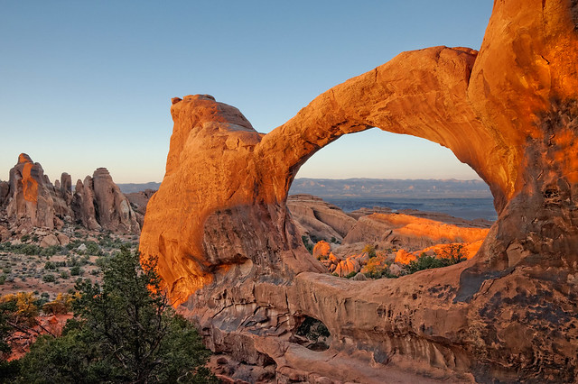
Double O Arch in Arches National Park, Utah
We then headed for Arizona. I flew to South Carolina soon after to help one of my sisters after bilateral knee replacements (she did great). While I was gone John’s sister Elizabeth came for a visit. They took a day trip to visit Taliesin West, a Frank Lloyd Wright house in Scottsdale, Arizona.
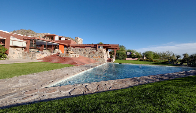
Taliesin West, a Frank Lloyd Wright house in Scottsdale, Arizona
An added bonus was a sculpture garden filled with some amazing pieces done by an extremely talented artist by the name of Heloise Crista.
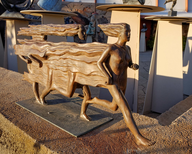
"Coming into the Present" by Heloise Crista on display at Taliesin West, a Frank Lloyd Wright house in Scottsdale, Arizona
However, the highpoint of her visit was a trip to Grand Canyon National Park, someplace she has never been. They hiked some of the easy Rim Trail which never disappoints visitors with views into the canyon ...
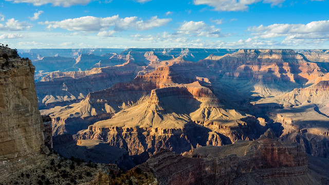
Grand Canyon seen from the Rim Trail in Grand Canyon National Park, Arizona
... as well as dramatic views of features on the rim such as the Desert View Watchtower.
The Desert View Watchtower seen from the Rim Trail in Grand Canyon National Park, Arizona
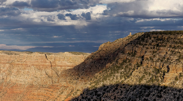
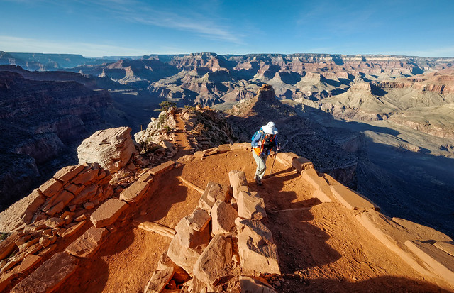
However, for the best views one has to drop below the rim so the highlight of their trip was a dayhike they did partway down the South Kaibab Trail.
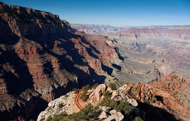
Seen from the South Kaibab Trail in Grand Canyon National Park, Arizona
This trail is the best constructed of all trails within the park having been built by Park Service with ample switchbacks rather than being a former “miner’s trail” that is steeper and much more rugged.
Elizabeth on the South Kaibab Trail in Grand Canyon National Park, Arizona
That said, there are no “easy” trails in or out of the canyon. Being a mountain in reverse one always has to conserve enough energy to hike back up and the altitude can also have a negative effect for anyone not acclimated. John and Elizabeth hiked as far down as the unfortunately named “Skeleton Point” which is located three miles and 2,000 feet below the rim. We are both quite proud of John’s big sister for how well she handled the altitude (7, 200 feet) and the elevation loss on a dirt trail with some loose rock, none of which she is accustomed to. We are especially proud of her for hiking back to the rim, regaining those 2,000 feet at altitude, and she did it all with a smile on her face! I know from personal experience that it is not an easy thing to do.
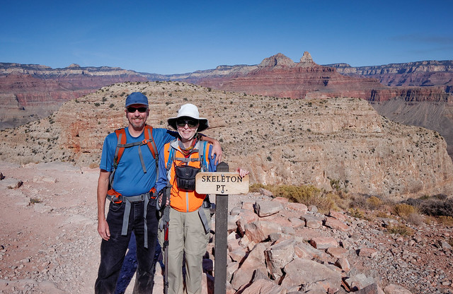
John and Elizabeth at Skeleton Point on the South Kaibab Trail in Grand Canyon National Park, Arizona
I arrived home on Thanksgiving Day in time for dinner with John and Elizabeth. This was the first Thanksgiving we have not spent with our sons, Dan and Tom. However, they were both coming to visit over Christmas and New Years. This would be the third Christmas since we sold our house and began traveling fulltime. We spent the first two in western Washington near our boys, Tom in Seattle and Dan in Vancouver. However, last February Dan landed his “dream job” as Senior Electrical Engineer with Carnegie Robotics and he relocated to Pittsburgh, Pennsylvania.
We had decided to spend the winter in Arizona and made arrangements for the boys to stay in a small cabin in the campground we had been staying. We had a great time. Primarily we did what we usually do when we get together; eat too much and play games to excess. While we still enjoy a good game of “Settlers of Catan” John and I have been trying to become acceptably proficient at “Dominion".
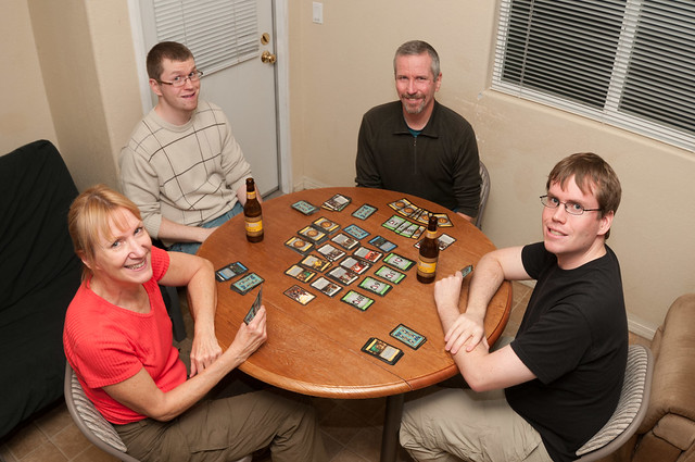
Jean, Tom, John and Dan playing Dominion in Cottonwood, Arizona
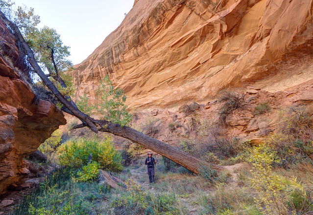
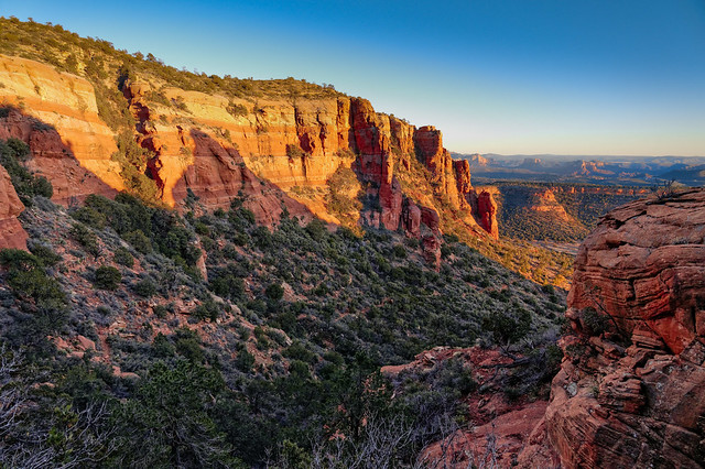
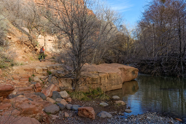
While the weather was not as warm as we had hoped it was frequently sunny and far better than what either would have had at their respective homes. We did some dayhiking in the nearby Coconino National Forest, first on the Wet Beaver Creek Trail ...
Tom on the Wet Beaver Creek Trail in Coconino National Forest, Arizona
... which continues up to the unexpected openness of the Mogollon Rim.
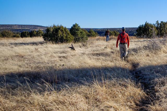
Tom and Dan on the Mogollon Rim in Coconino National Forest, Arizona
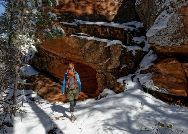
After Tom left John, Dan and I did a dayhike on West Fork of Oak Creek Trail. The western US was experiencing unusually cold temperatures and we were at a higher elevation so we really shouldn't have been surprised by the snow. But it wasn't too deep and it did make a nice contrast to the red rock.
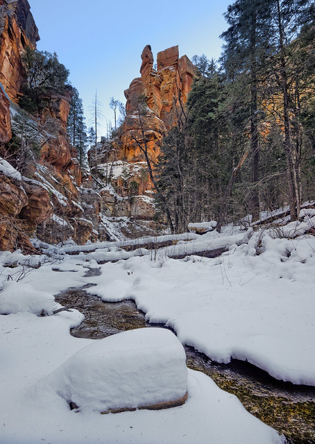
Seen on the West Fork of Oak Creek Trail in Coconino National Forest, Arizona
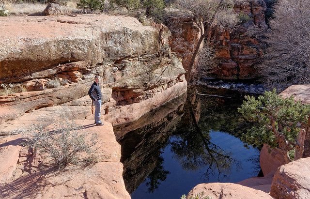
John and Dan also did a dayhike up Sycamore Canyon to Parson Spring.
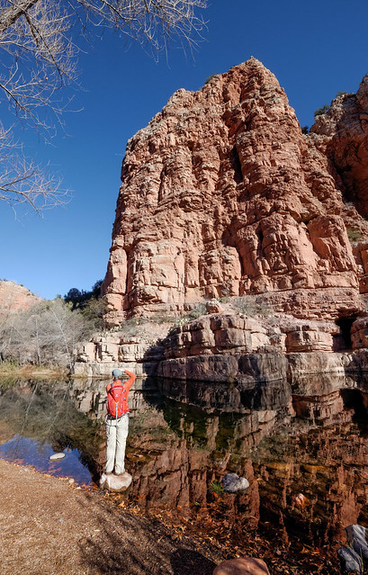
Dan taking photo (like father like son) in Sycamore Canyon within Coconino National Forest, Arizona
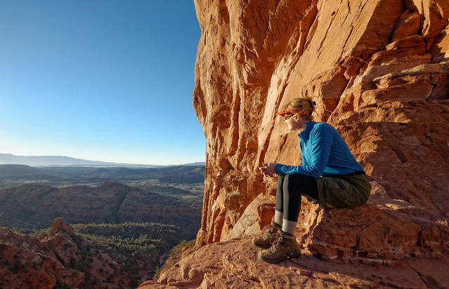
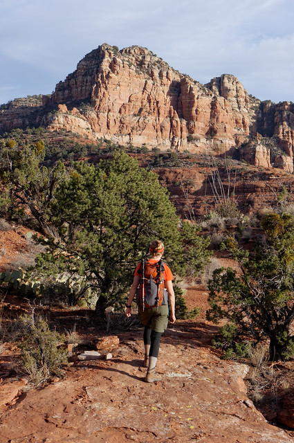
After Dan went home John and I did some dayhiking to Cathedral Rock. Being so close to Sedona this is an extremely popular short hike and can be quite crowded on weekends.
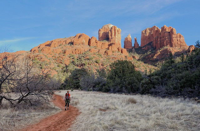
Jean on the trail to Cathedral Rock in Coconino National Forest, Arizona
We went three times. The first time we took the conventional way up. It was a Sunday but we were there late enough in the day that I didn't have to wait too long to get this popular "photo op" spot to myself.
Jean at Cathedral Rock in Coconino National Forest, Arizona
John had read about an alternate way down. We found what looked to be an established trail through the brush in the gully below the "patio" like gap in the spires, the spot where most people stop before turning around and return the way they came up. However, it soon became sketchy. We considered backtracking but we had gotten a late start and we would soon lose our light and we knew we could get back to a main trail this way so decided to tough it out and put up with the brush.
The gully in the middle is NOT the way down from Cathedral Rock in Coconino National Forest, Arizona
The next time we took the trail that leads to the backside of the feature. The trail became a well marked route once we started climbing some rocks. However, we eventually lost that but were able to pick our way around and ended up at the "patio" and we went down the conventional way.
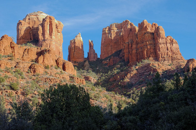
Cathedral Rock in Coconino National Forest, Arizona
The third time we took the conventional way up again and wanted to see if we could find the "official" back way down but we apparently had gotten it right before and we essentially retraced our previous back way route down.
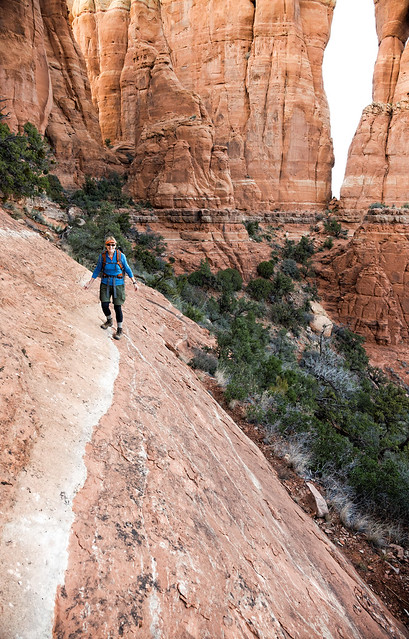
Jean on the route around the backside of Cathedral Rock in Coconino National Forest, Arizona
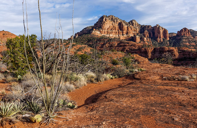
The Coconino National Forest is an incredibly rich area with a multitude of hiking trails including the Bear Mountain Trail ...
Seen from the Bear Mountain Trail in Coconino National Forest, Arizona
... and the Boynton Canyon Trail.
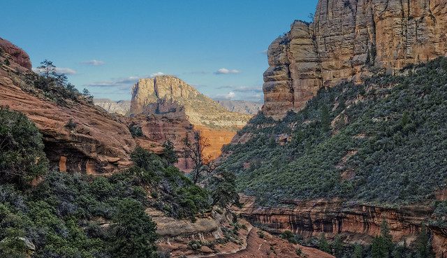
Seen from the Boynton Canyon Trail in Coconino National Forest, Arizona
Temperatures were still chilly and there was still snow at higher elevations especially in dark canyons. We encountered the most snow on the Loy Canyon Trail ...
Jean on the Loy Canyon Trail in Coconino National Forest, Arizona
... but we eventually gained enough elevation to see more of the canyon. However, we had gotten a late start (again) and decided to turn around before seeing if the trail went any higher.
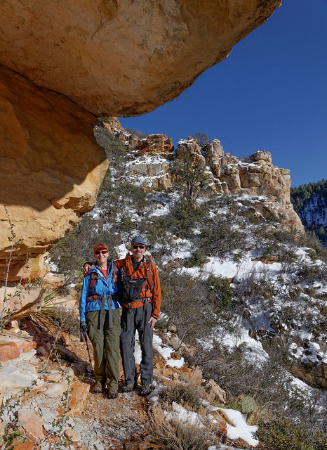
Jean and John on the Loy Canyon Trail in Coconino National Forest, Arizona
We also planned to do a hike on the West Clear Creek Trail but we didn't get very far. We had gotten a late start (do you see a pattern here?) and encountered a stream crossing. While we both had sandals with us we came up with multiple excuses (the stream was too deep and rocky for just sandals, it was getting late, the water was really cold etc) so we turned back. There is a 13 mile loop hike that we'd like to do but we definitely need to bring water shoes and start earlier. We are so happy the days are getting longer. With our retired mentality we need all of the daylight we can get. All of our Coconino National Forest dayhike photos are on Flickr.
Jean on West Clear Creek Trail in Coconino National Forest, Arizona
While we’ve enjoyed taking it easy we are both getting anxious to do some real hiking and some backpacking. In April we plan to head to Grand Canyon National Park where we plan to do some backpacking. Ahhh ...carrying a big pack, eating freeze dried food, no showers and sleeping on the ground ... we can't wait!
This next bit is just something that Jean has been thinking about.
Losing Our Balance
Several years ago I started using trekking poles when I began having trouble with my knees especially when hiking down steep trails.
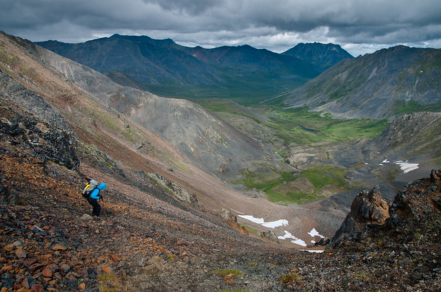
Jean descending Glissade Pass in Tombstone Territorial Park, Yukon
I have also found them helpful hiking up steep trails.
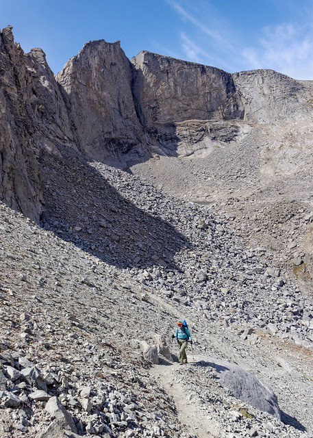
Jean ascending to Hailey Pass in the Wind River Range with Bridger National Forest, Wyoming
Trekking poles have proven to be quite useful in helping me to maintain my balance when crossing streams ...
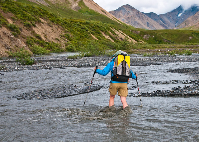
Jean crossing Crystal Creek in Denali National Park, Alaska
… as well as snow slopes.
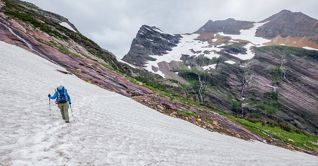
Jean on the Gunsight Pass Trail in Glacier National Park, Montana
When we go into the backcountry we accept a certain amount of risk and have been in plenty of situations where if either of us were to stumble and fall it could easily lead to serious injury, even death. While we have encountered trails that are so well constructed and maintained that we call them “Super Highways” …
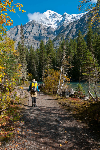
Mt Robson Provincial Park in British Columbia, Canada
… we have also been faced with routes so treacherous that I call them “Ain’t No Ways” (right before John says “Come on Jean”).
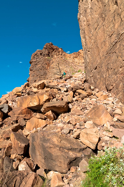
Jean descending on the Escalante Route in Grand Canyon National Park, Arizona
Fortunately, neither of us has gotten hurt because when we are in these high risk situations we are both especially careful and we both pay very close attention to what we are doing. That doesn’t mean that neither of us has ever slipped, stumbled or even fallen while hiking. Sometimes trail conditions are slippery with loose rock, mud or ice. Other times we have been hiking in growing darkness because we were reluctant to take the time to get our headlamps out. Still other times we were just really tired.
However, I fall far more often than John does because my sense of balance is simply not as good as his and I lack his “catlike” reflexes. What is embarrassing is the fact that the vast majority of my stumbles and falls have occurred while we were on easy dry flat trails in broad daylight. It would seem that my trekking poles should have helped me to regain my balance in these instances.
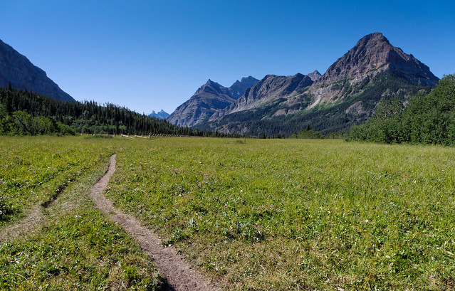
The Belly River Trail in Glacier National Park, Montana
Well, they would if I had been using them correctly at the time. While I have accepted that there are times when it is essential that I use my trekking poles I have resisted using them when hiking on flat, easy trails. I have the worst combination of insecurity and vanity. Using trekking poles on flat trails made me feel like I was using a cane or even a walker. I thought they made me look “old” and I didn’t like it.
So, early on I developed bad habits of being very careless in my handling of my trekking poles when we were on flat easy trails. I either casually swung them together, not paying attention to where they touched down, or simply carried them in one hand, that is if they weren’t still attached to my pack.
Jean on the trail to Cathedral Rock in Coconino National Forest, Arizona
When I stumbled and fell I would get up as quickly as I could, brush the dust off and hope that no one had seen me, especially John.
But then something happened on the first day of our three week backpack trip on the John Muir Trail. This was a “trip of a lifetime” for us. The trail through Tuolumne Meadows in Yosemite National Park is flat and easy so we were moving at a fast pace. And true to form, I was being sloppy with my trekking poles Unfortunately I had both of them behind me when I tripped over a rock and fell forward. Normal human reflexes would have enabled me to get my hands out in front of me to break my fall but my trekking poles prevented me from doing that. I have a vivid memory of seeing a rock rushing toward my face and it scared me. I am well aware that people can and do die from freak head injuries sometimes.
But I was really lucky. Once I got over the initial shock we determined that the only injury I had sustained was a small bump and a minor cut to my forehead. So I got back up. But instead of brushing myself off and starting down the trail again I just stood there, fuming. I was furious with myself because I had just remembered something that had happened nearly two years before.
We were on our first day of a backpack trip to one of our favorite places, an area appropriately known as “The Enchantments” located within the Alpine Lakes Wilderness in Washington State. A small brushy tree had fallen across the trail but otherwise the trail was easy and my legs are long so I didn’t pay much attention to it as I stepped over it. However, one of my bootlaces got snagged by a branch and I fell forward. Unfortunately I was unable to break my fall because at that moment I happened to have both of my trekking poles behind me. I saw a rock rushing toward my face and it scared me because I was well aware that people can and do die from freak head injuries sometimes.
But I was lucky as all I sustained was a small bump and a minor cut on my forehead so I picked myself up, brushed the dust off and continued up the trail. I realized that I needed to be more careful because it occurred to me that it would be a very good idea to avoid falling on my face again. I decided that I should alternate my poles so I would always have one pole ahead of me and so they could help me to keep my balance when I stumble. And I was much more careful for the rest of the trip. We completed it without incident and had a great time.
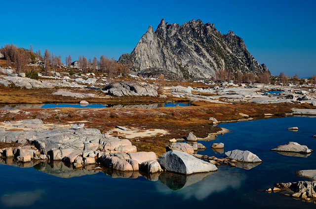
Prusik Peak within “The Enchantments” in the Alpine Lakes Wilderness, Washington
So, there I was on that first day hiking the John Muir Trail, furious at myself because I realized that my carelessness, my failure to learn from my past mistake, my ridiculous vanity, had put this long awaited and much anticipated backpack trip at risk. We were delighted to have been able to obtain a permit for our first choice of dates and start location. We considered ourselves extremely lucky that it was a high snow year and forest fires were unlikely to be a problem. Most importantly we were thankful that we were both in good health and decent physical condition. We were both well aware that if we had to postpone this trip for any reason that there were no guarantees that these ideal conditions could ever be duplicated in the future, especially our good health.
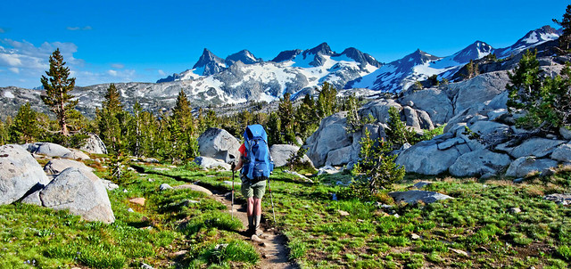
Marie Lake within the John Muir Wilderness, California
I eventually calmed down enough to continue down the trail. Fortunately, I had remembered something else, something I had once read; “Blame deals with the past and what can’t be changed. Responsibility deals with the future and what can”. So I asked myself “What future do I want right now?” The answer was easy. I wanted to complete the John Muir Trail.
Jean on the John Muir Trail within Ansel Adams Wilderness, California
I then asked myself “What can I do to increase the probability that I will achieve this goal?” Well, for starters, I could stop falling on my face and hitting my head on rocks. It was very easy to figure out (again) what I needed to do first, I could decide (again) to consistently use my trekking poles properly. I knew (again) that if I always alternated them then most likely I would have one in front of me and would have a much better chance of regaining my balance when I stumbled.
This required me to first give up my vanity. I forced myself to accept the fact that compared to most backpackers I am old and I’m going to look it whether I used poles or not. I needed to break my bad habits and change my behavior permanently and I am happy to report that I was successful. Not only did we complete the John Muir Trail without incident but I have not fallen on my face (or hit my head on a rock) since then!
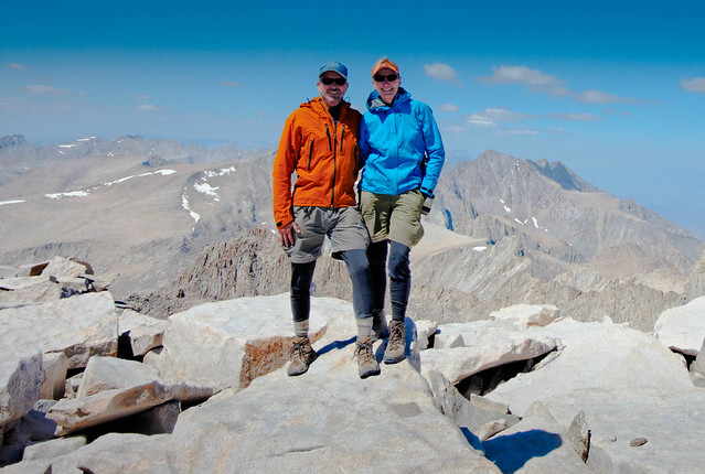
John and Jean at the end of the John Muir Trail on the summit of Mt Whitney, California
Of course not losing one’s “balance” is a good idea beyond backpacking. It can serve as a guiding principle in many, if not all aspects, of one’s life; diet, exercise, work, personal relationships, the list goes on. We have only to look around us to see that “Mother Nature” is a master at maintaining balance; between light and dark, cold and heat, life and death, that list goes on. “Natural Selection” has enabled stronger individuals to survive and procreate which enables the species to be strengthened and helping it to adapt to changing environments.
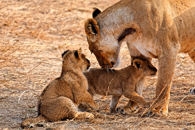
Lioness and cubs in Serengeti National Park, Tanzania
On the other hand, we humans, through the wonder of our big brains (and greedy nature), have evolved in such a way that our survival is no longer dependent on our strength or our ability to adapt to our changing environment. We developed techniques that enabled us to adjust our immediate environment to suit us. Advancements in science and technology have enabled us to circumvent other “Laws of Nature” and we were no longer ruled by “Survival of the Fittest”.
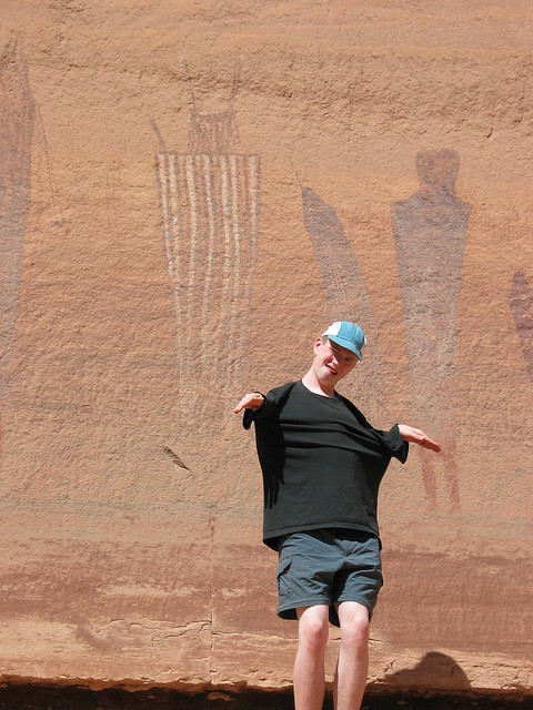
Tom and the “Harvest Scene”, a pictograph in the Maze District of Canyonlands National Park, Utah
We, as a species, have very effectively disrupted the natural balance and the consequences are many but the one that I’ve been thinking about most recently is the severe negative impact this loss of balance has had on our environment. In a gross over simplification, increased carbon emissions combined with worldwide forest devastation has led to Global Climate Change that has resulted in a noticeable recent increase in “natural” disasters; extensive forest fires, deadly droughts, record temperatures (both high and low) and destructive super storms.
While many individuals have been concerned about this issue for quite some time the fact remains that far too many of us are still firmly rooted in denial. Some of us refuse to believe the data or to see the obvious evidence. Others have begun to acknowledge the validity of some of the data but simply dismiss the idea that humans have had any part in creating the problems. Still others tout the fact that the planet has had major shifts in climate warming patterns in the past and this is just another “natural” event that we can’t do anything about.
I think that as a species, we have been stumbling and “falling on our face”. I believe that we are rapidly approaching our collective “John Muir Trail moment” where we “fall on our face” and finally realize what we are in danger of losing. We need to get angry enough at ourselves that we are ready to make permanent changes to our behavior. However, we need to get past blame and move on to responsibility and ask ourselves “What kind of future do we want?
Obviously, that is a huge question and the answer will be complicated. Where our environment is concerned what John and I want is for future generations to have the same opportunities that we have had. To see blue skies ...
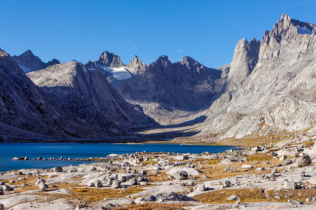
Titcomb Basin in the Wind River Range, Wyoming
… rather than only those clouded by smoke and pollution.
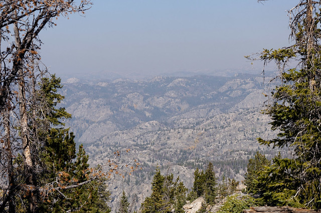
Wind River Range, Wyoming
We want them to see how clear water really is …
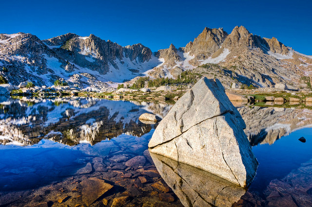
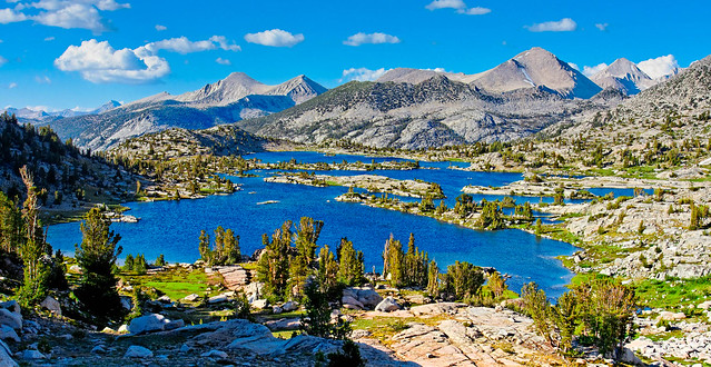
Chief Lake in the John Muir Wilderness, California
… instead of how filthy it has become.
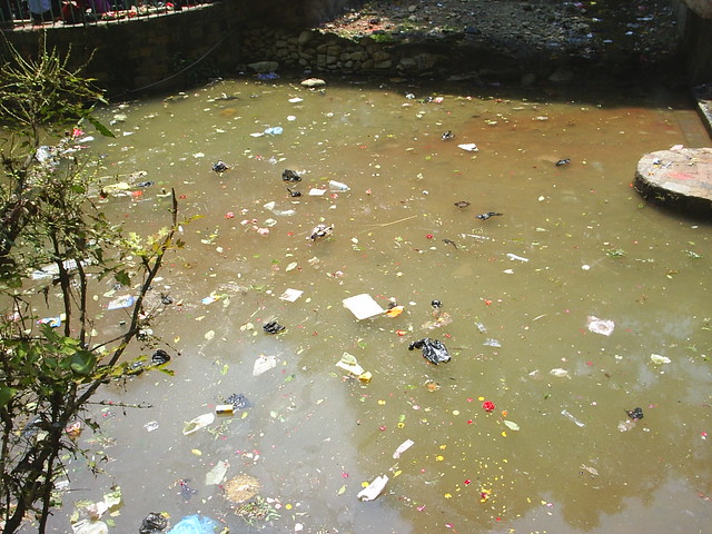
Polluted Water at Dakshinkali Temple in Nepal - Photo courtesy of Anil Raut
We want our future generations to see glaciers …
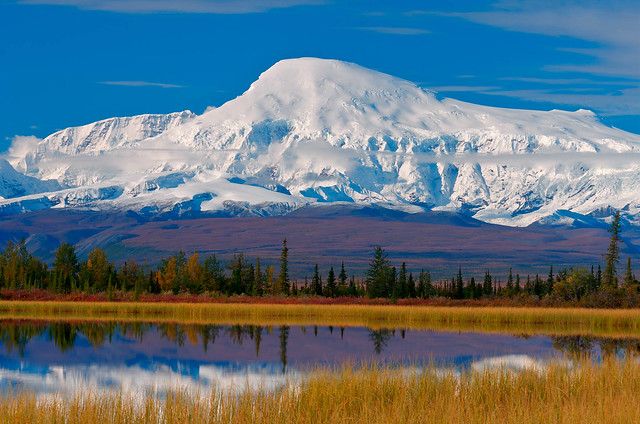
Mt Sanford in Wrangell – St Elias National Park, Alaska
… rather than leaving them to only imagine what it looked like before they all melted.
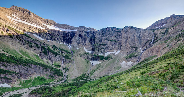
Swift Current Headwall in Glacier National Park, Montana
We want them to see trees that are still green …
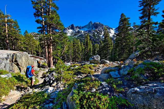
Jean on the John Muir Trail in Ansel Adams Wilderness, California
… in stead of forests full of dead trees; killed by insects ...
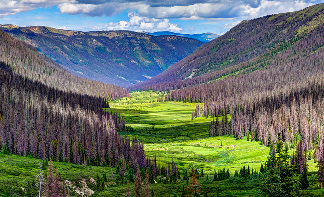
A Spruce forest being decimated by Spruce Bark Beetles in the Weminuche Wilderness Area, Colorado
… or destroyed by fire.
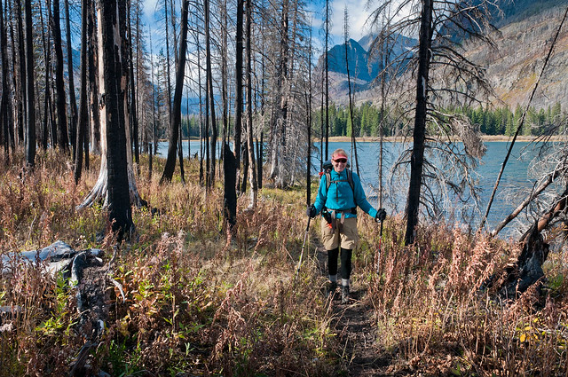
Burned forest by Red Eagle Lake in Glacier National Park, Montana
We want them to be able to see the incredible diversity of our wildlife. Not just in aquariums ...
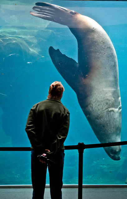
Woody, an endangered Steller Sea Lion in Sea Life Center in Seward, Alaska
… wildlife preserves ...
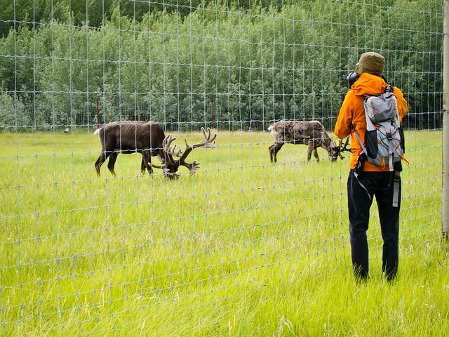
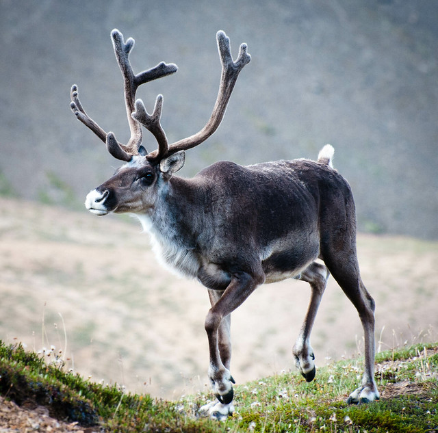
Caribou at the Yukon Wildlife Preserve, Yukon
… and zoos.
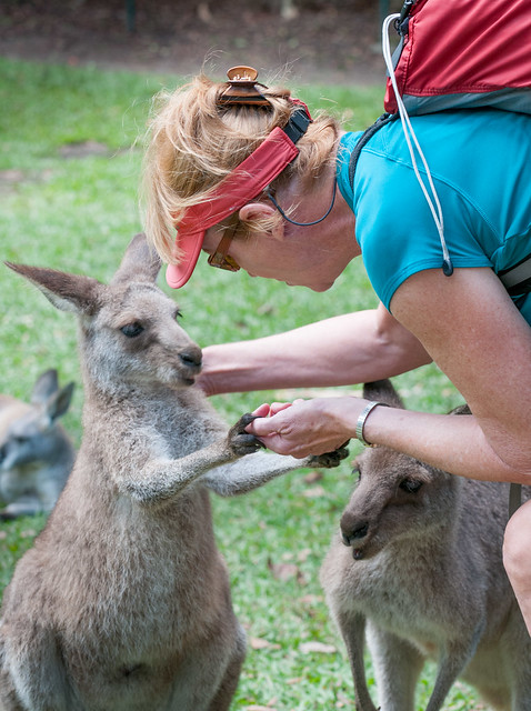
Wallaby in the Australia Zoo in Queensland, Australia
We want our future generations to be able to see wildlife in their natural habitat from our oceans, …
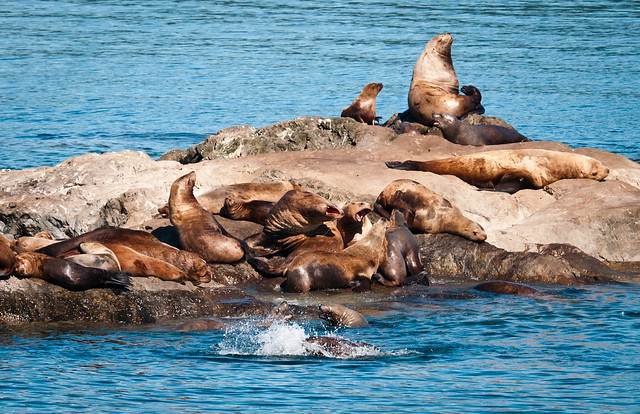
Endangered Steller Sea Lions in Prince William Sound, Alaska
… and forests ...
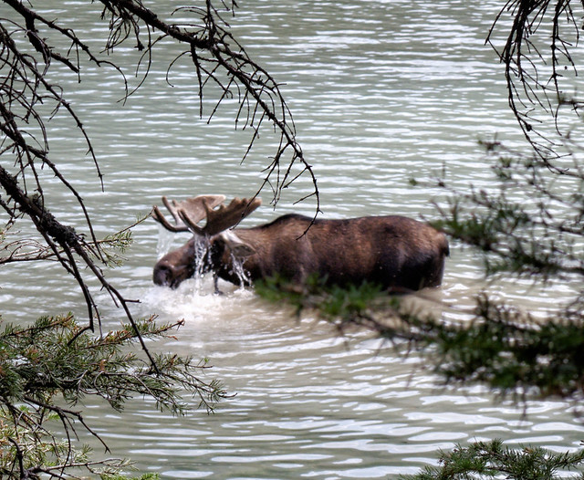
Bull Moose browsing in Glenns Lake in Glacier National Park, Montana
...to the lowlands …
Caribou in Denali National Park, Alaska
… as well as in our mountains.
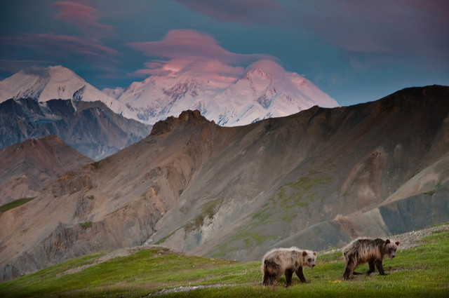
Grizzly cubs, our early morning visitors through our camp, in Denali National Park, Alaska
I realize that the question “What kind of future do we want?” has countless facets that go beyond only environmental issues and there are no simple answers to any of them. But I believe we need to be thinking seriously about them now because, as a species, we are “falling on our face” and “hitting our heads on rocks” with increasing frequency. We need to realize that what we are putting at risk is the future of our children and their children.
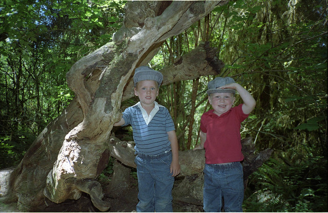
Dan and Tom in the Hoh Rainforest within Olympic National Park, Washington
That brings us to the next question; “What can we do to increase the probability that we can achieve our goals?” “Earth 2100: the Final Century of Civilization?” is a film that portrays a possible future that many scientists see for us if we don’t change our behavior now. There is a wealth of information regarding steps we could all take. I don’t want to feel helpless or hopeless so I choose to believe that the same big brains that got us into this mess will be able to figure ways to help us get out of it.
The way I see it is if I can get past my vanity, my fear of looking “old”, and finally learn enough from my mistakes to make a lasting change in my behavior so I stop falling on my face, then maybe, just maybe there is real hope for the future of human civilization.
Jean on the Titcomb Basin Trail in the Wind River Range, Wyoming


3 comments:
As usual, the photos are fabulous, and the commentary especially well-done, particularly the last part.
Awesome planet, Marvelous pictures, Lucky people
Magnificent...
Post a Comment