This will be our fourth “backpacking season” since we first hit the road in April 2010. But compared to the previous three years this summer feels different. We are so relaxed. We are completely comfortable in our "nomadic" lifestyle. Looking back to our first summer on the road in 2010 we felt a bit anxious. Everything was still new and exploring Canada and Alaska involved quite a bit of challenging driving. The summer of 2011 was spent preparing for backpacking the John Muir Trail. We had tasks to accomplish and and a "schedule" to follow. Much of the the summer of 2012 was spent resting up and catching up from the four months we spent in New Zealand and Australia. This summer we are off to a great start! We've already done three backpack trips in Grand Canyon and are now planning to spend the next three or four months in Washington State. We are off tomorrow to begin a trip on the Wonderland Trail in Mt Rainier National Park. We've traded sand for snow and dry creek beds for treacherous stream crossings. What more could we want?
Where we have been – Grand Canyon National Park and Organ Pipe Cactus National Monument in Arizona
2/18 - 5/1 2013
In this post:
- Dayhikes -within Coconino and Coronado National Forests, Arizona
- Dayhikes - Organ Pipe Cactus National Monument, Arizona
- Cave tours - Kartchner Cave State Park, Arizona
- Dayhike - South Kaibab, Tonto and Bright Angel Trails
- How to obtain Backcountry Permits
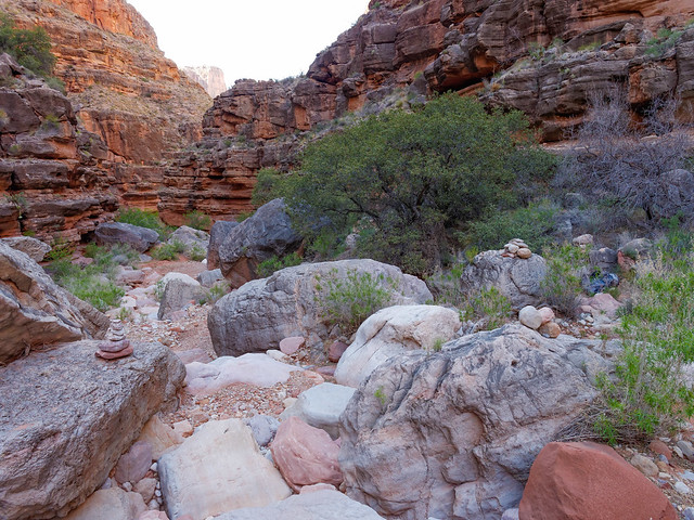
- Backpack trip - 3 day/2 night from the Bright Angel Trailhead to Hermit Rest
- Backpack trip - 5 day/4 night on the "Royal Arch Loop" including "Elves Chasm"
- Backpack trip - 7 day/6 night on the West Tonto Trail from South Bass Trailhead to Hermit Rest
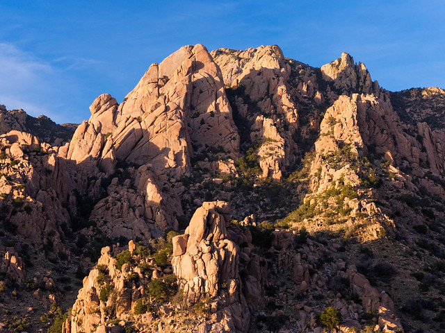
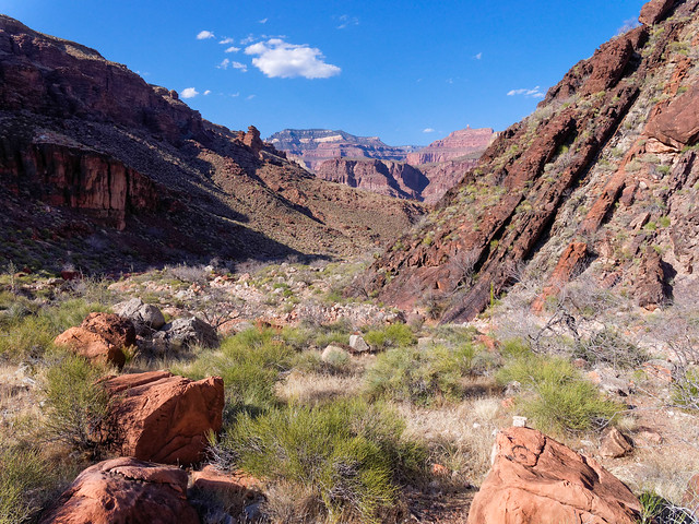
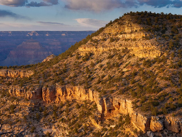
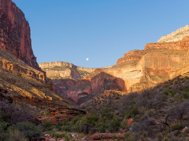
Seen on dayhike to Bear Mountain in Coconino National Forest, Arizona
... and on the Secret Mountain Trail, both in Coconino National Forest.
Boynton Canyon see from the Secret Mountain Trail in Coconino National Forest, Arizona
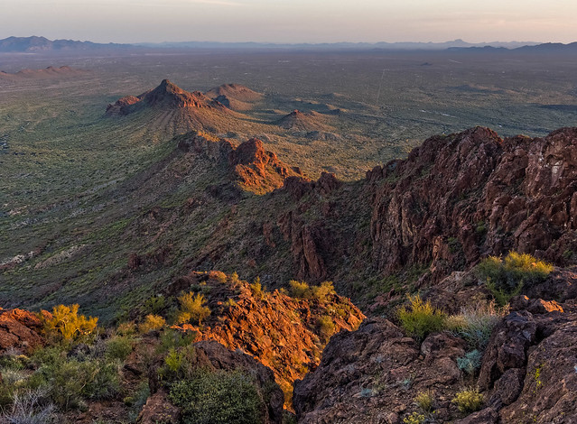
We also did a dayhike to Cochise Stronghold in Coronado National Forest ...
Cochise Stronghold in Coronado National Forest, Arizona
... as well as the Vulture Peak Trail near Wickenburg, Arizona. All of our photos from these dayhikes in Coconino National Forest, Coronado National Forest and the on Vulture Peak Trail are on Flickr.
Vulture Peak Trail near Wickenburg, Arizona
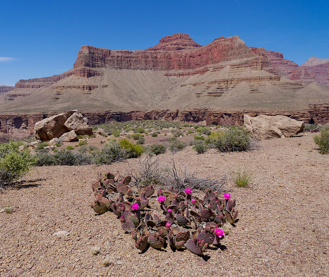
In mid March we headed to Organ Pipe Cactus National Monument. The park is the only place in the United States where the unusual Organ Pipe Cactus grows wild.
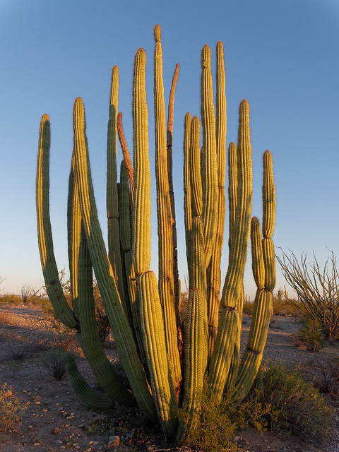
Organ Pipe Cactus in Organ Pipe Cactus National Monument, Arizona
John took this opportunity to practice a new photographic technique where his iPhone enabled him to see what his camera "saw" even though it was on a tripod stuck in the middle of a spiny cactus. In addition it enabled him to use "focus stacking" to obtain an image that is in focus across all planes.
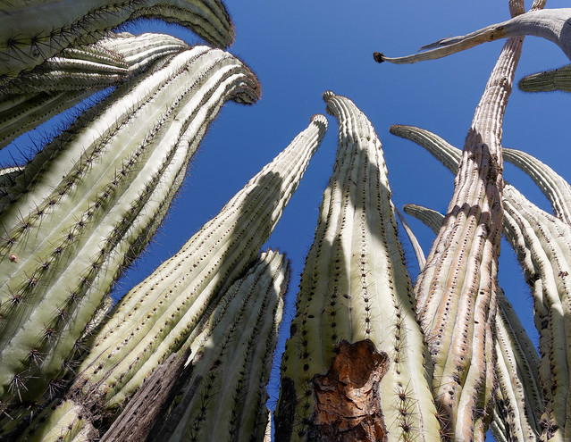
Organ Pipe Cactus in Organ Pipe Cactus National Monument, Arizona
We did some dayhiking and Arch Rock was a definite highlight. The trail starts out easy but becomes more challenging, more of a scramble, the closer one gets to the arch. As is our habit, we got a late start that day. While it gives us the advantage of being pretty places when the sun goes down it does require us to hike (and scramble) out after dark.
Arch Rock in Organ Pipe Cactus National Monument, Arizona
Something worth noting is that Organ Pipe Cactus National Monument is adjacent to the Mexico border and after dark one can see the city lights of Sonoyta in the distance. It is also an area where undocumented folks cross the border illegally including "drug mules". We were told that these individuals typically do not want to be seen and generally aren't a problem. However, occasionally some hopeful immigrants can be seen sitting on the side of the road because, for whatever reason, their plans fell through and they are looking for a ride back home. We were told if we saw someone sitting by the road that it would be a kindness to drop off a bottle of water a short distance away and then let a Ranger know where they are.
Organ Pipe Cactus National Monument, Arizona
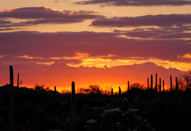
The desert is a great place to see beautiful skies. We thoroughly enjoyed this gorgeous sunset as well as the rare opportunity to see the PANSTARRS Comet. All of our photos from Organ Pipe Cactus National Monument are on Flickr.
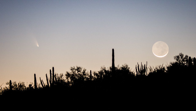
PANSTARRS Comet seen 3/12/13 from Organ Pipe Cactus National Monument, Arizona
While in the southern part of the state we also visited Kartchner Caverns State Park. Photography is not permitted on tours of the caverns but you can get some idea of what it is like by looking a the park's photo gallery which includes photos of formations such as delicate "soda straws". The history is too involved to be adequately covered here but it is a story that renewed our faith in our "fellow man" (or at least a few of them). The sole objective of the two young men who discovered it, Gary Tenen and Randy Tufts, and the Kartchner family who owned the property was to protect the resource from exploitation and destruction. The state legislature was convinced to make it a state park and purchased the property. Then the Kartchner family donated significant funds to develop the caverns in such a way to best protect the formations inside. Before construction began all major commercial caverns throughout the country were visited in order to learn what not to do. The precautions they have taken are remarkable. If you are ever in southeast Arizona it is well worth a visit.

"The Big Room" in Kartchner Caverns State Park, Arizona
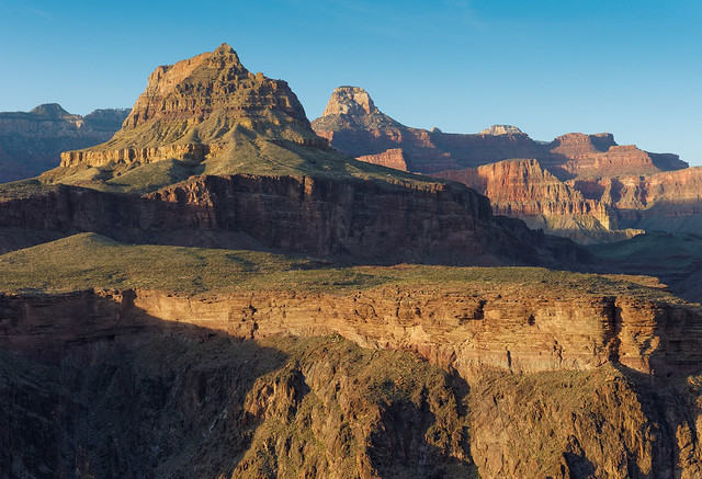
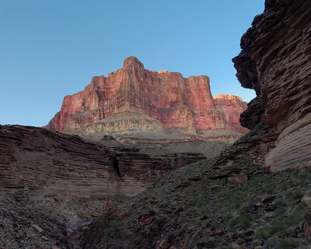
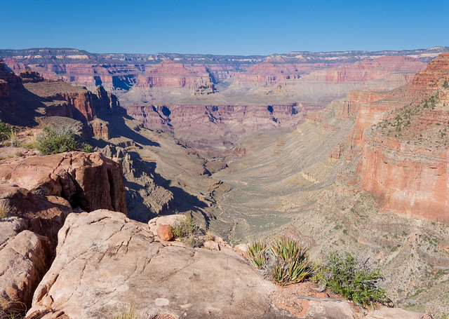
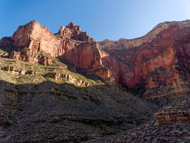
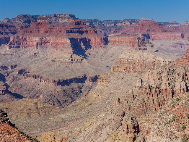
We then headed to Grand Canyon National Park where we planned to do quite a bit of backpacking. Hiking and backpacking in Grand Canyon can be challenging. It’s a mountain in reverse with the potential of blistering temperatures at the “summit” (the canyon) and the hardest part, the ascent, coming at the end. Unfortunately too many casual hikers are lured into the canyon by the cooler temperatures on the rim and easy downhill trails but they are totally unprepared for the increased heat in the canyon (20 degrees higher than the rim), the steepness of the uphill trails and the altitude (~7,000 feet for the south rim and ~8,000 feet for the north. Trailheads are marked by prominent signs with dire warnings about the dangers of heat exhaustion, heat stroke, the number of heat related emergencies the Park Service responds to each year etc.
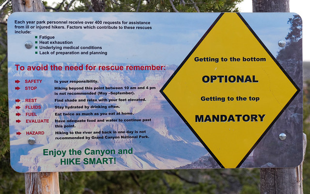
Trailhead warning sign in Grand Canyon National Park, Arizona
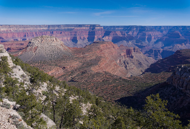
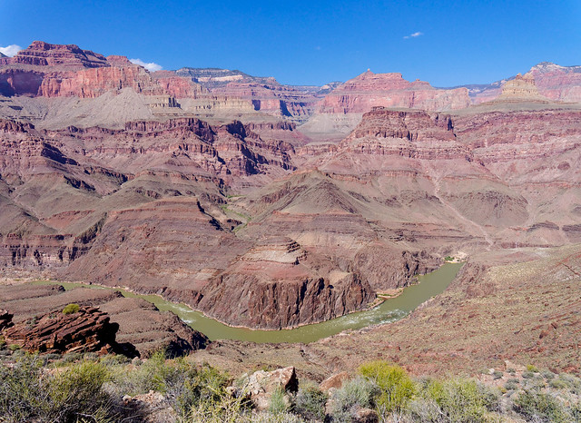
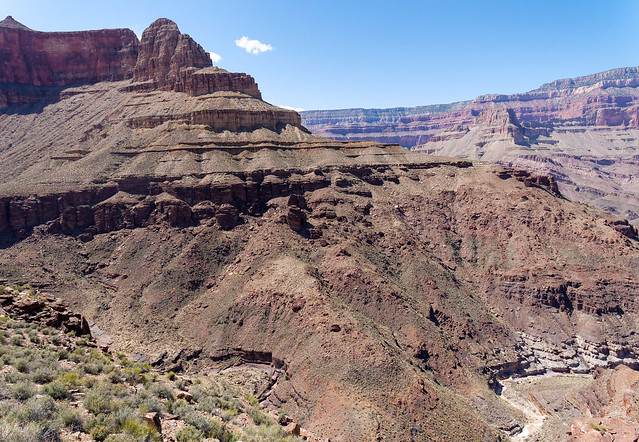
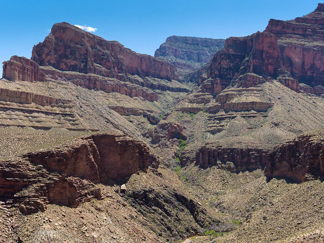
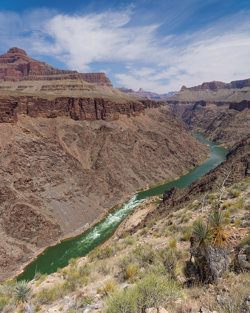
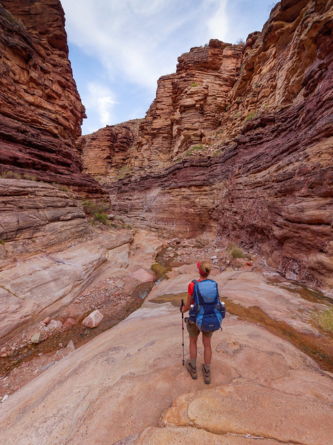
Our objective while in the park was to hike the 95 mile long Tonto Trail. It runs along the Tonto Platform, the "bench" that separates the inner gorge from the upper canyon between Red Canyon to the east and Garnet Canyon to the west. It is recommended for "experienced canyon hikers" only. I'm not sure exactly how that is defined but I am assuming it means you have done more than backpack on the "Corridor Trails". All I know is that we have earned that distinction having done Tanner to Grandview and Thunder River to Deer Creek on a previous trip.
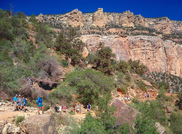
It was unrealistic to try to do the entire Tonto in one trip so we planned to do it in pieces. We began with a conditioning dayhike down the South Kaibab Trail to the Tonto Trail and back up the Bright Angel Trail. Early one morning we joined the crowd and took the "Hiker's Express shuttle bus" to the South Kaibab Trailhead (no parking available at trailhead). Once on the trail it took a while for the crowd to thin out, some getting ahead of us, some lagging behind. And inevitably we had to pull over to allow a mule train coming up from Phantom Ranch to pass.
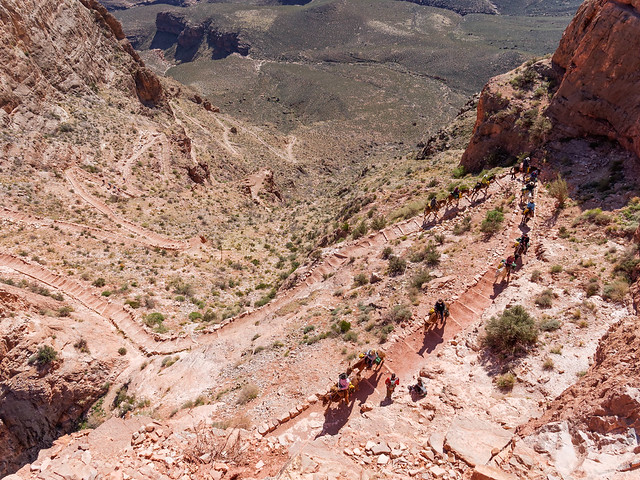
Tourists on mules coming up the South Kaibab Trail in Grand Canyon National Park, Arizona
However, the views from the South Kaibab Trail do make it well worth the effort despite the crowds and the mules.
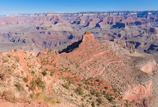
Seen from the South Kaibab Trail in Grand Canyon National Park, Arizona
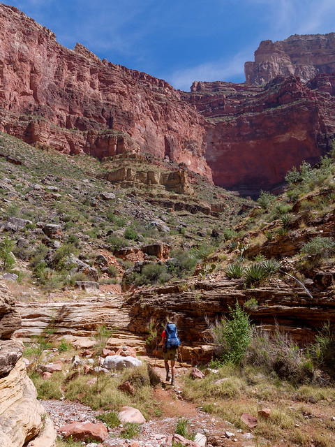
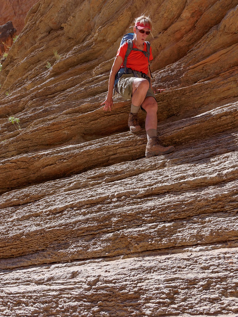
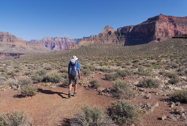
Those hikers on the South Kaibab Trail who are willing to do a lot of miles usually choose to go all the way to the Colorado River and back up the Bright Angel Trail (been there, done that). However, we opted to cut off, after hiking 4.4 miles, onto the Tonto Trail. It not only provided us with a decent workout without abusing our knees it also helped us to achieve our overall goal.
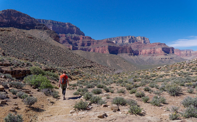
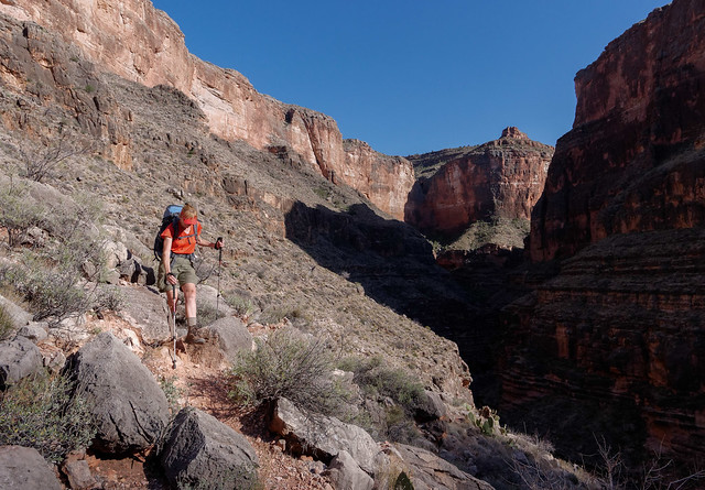
Jean on the Tonto Trail in Grand Canyon National Park, Arizona
Other than a Park Ranger who passed us early on we didn't see another person until we reached Indian Garden, after 4.5 miles, situated on the Bright Angel Trail.
Approaching Indian Garden from the Tonto Trail in Grand Canyon National Park, Arizona
While at Indian Garden we decided to take the 1.5 mile long trail out to Plateau Point for views of the Colorado River ...

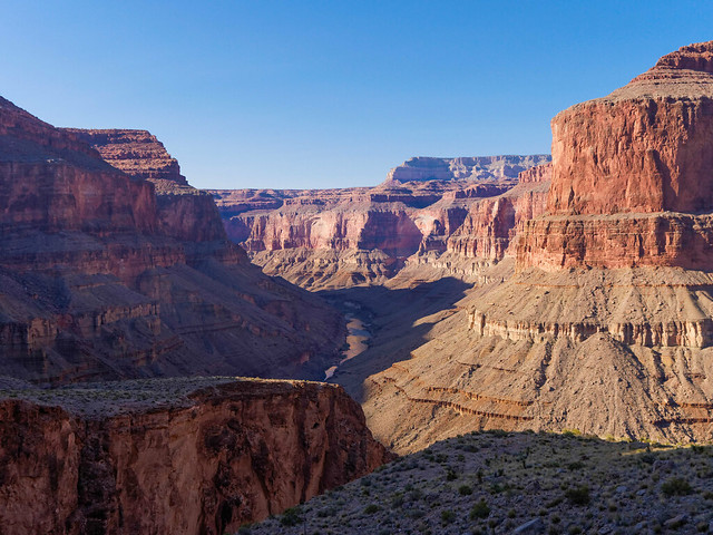
The Colorado River seen from Plateau Point in Grand Canyon National Park, Arizona
... before heading up the last 4.8 miles on Bright Angel Trail to the rim. Photos from this (and other dayhikes) are on Flickr.
The South Rim seen while heading back up the Bright Angel Trail in Grand Canyon National Park, Arizona
Achieving our goal to hike the entire Tonto Trail was complicated. Obtaining permits was going to be the biggest issue as we had not reserved any in advance. Details on the permitting process is available on the NPS website but is excerpted below.
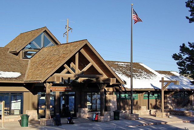
Applying for Permits:So on multiple mornings John joined numerous hopeful backpackers at the Backcountry Information Center. He spent quite a bit of time talking to Backcountry Rangers and pouring over the map to figure out how best to accomplish our goal.
The furthest in advance permit requests are accepted and considered by the Backcountry Information Center is the first of the month, four months prior to the proposed start month. To obtain a backcountry permit for the dates and use areas/campsites of your choice, ensure your request arrives at the Backcountry Information Center on the first day it will be accepted (but not before). Faxing is strongly recommended. Popular use areas/campsites fill up the first week of the first month they become available for permit requests.
Last Minute Permits for Corridor Campgrounds:
A limited number of last minute walk-up permits are available at the South Rim and/or North Rim Backcountry Information Center for Corridor Campgrounds (Indian Garden, Bright Angel, and Cottonwood Campgrounds)... Last minute permits are issued by the Backcountry Information Center...
Waitlist::
You can stop by the Backcountry Information Center at any time during open hours and request a waitlist number. This number is valid for the following morning and will be used to determine priority of service. At 8:00 a.m. Backcountry Information Center staff will call waitlist numbers. When your turn comes you can request a permit, exchange your number for a new waitlist number good for the following day, or simply ask questions. You may participate in the waitlist for as many consecutive days as is convenient.
Following is an example showing how the waitlist can be used to secure a lower number for the next day and increase your chances of obtaining your desired permit...
Last minute permit and waitlist example:
- Day 1, Tuesday: You come to the Backcountry Information Center at 11 a.m. and request a permit for Bright Angel on Wednesday night and Indian Garden on Thursday night. No permits are available. You join the waitlist for the next day and are assigned #10.
- Day 2, Wednesday: You return at 7:59 a.m. Unfortunately by the time Backcountry Information Center staff reaches your waitlist number, all Corridor Campground permits have been assigned. You exchange today's waitlist number for tomorrow's waitlist number; you are #2.
- Day 3, Thursday: You return at 7:59 a.m. You obtain a permit for Bright Angel on Friday night and Indian Garden on Saturday night, hiking out Sunday morning.
John came up with a sensible plan for us to do it in four backpack trips; one short and easy, followed by two longer and more challenging and finishing with another short and easy. However we later decided to postpone the last one until fall. The remaining three would take us over most of the Tonto, from the western end at Garnet Canyon to the junction with the Bright Angel Trail.
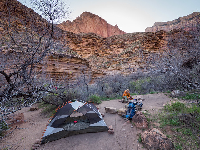
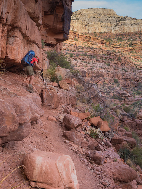
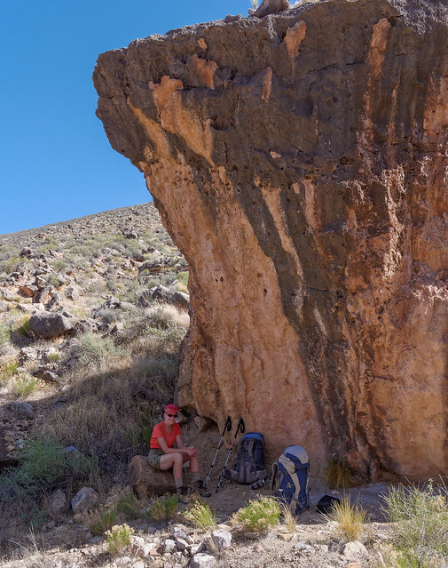
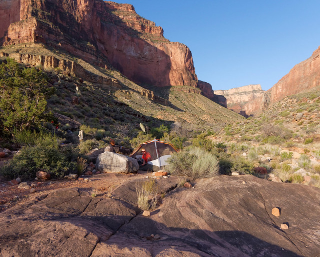
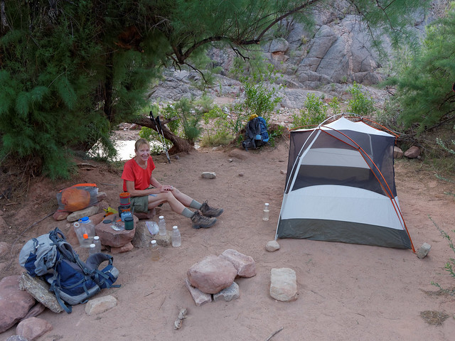
The first would be a short 3 day/2 night "warm up" from the Bright Angel Trailhead to Hermit Rest (trail description). John had been able to obtain a permit for the Monument Creek Campground early on and we were extremely lucky to obtain a last minute permit for the single campsite at Horn Creek (located on the Tonto Trail 2.5 miles west of Indian Garden).
Prior to starting this trip John parked our Subaru at Hermit Rest where we would come out. The road is closed to private vehicles with the exception of backpackers. The advantage was that we wouldn't have to worry about being out in time to catch a shuttle. We parked our motorhome in the parking lot by the Backcountry Information Center. As we didn't have that far to go, just over seven miles, we didn't start down until mid afternoon. The hardest part of this trip was heading down the Bright Angel Trail and having to fight our way through the hordes of people struggling to get back up it. But we would be on it for only 4.8 miles.
Hikers on Bright Angel Trail in Grand Canyon National Park, Arizona
Eventually, as it grew later and we got lower, the crowds thinned out considerably.
Jean on Bright Angel Trail in Grand Canyon National Park, Arizona
However, as we approached Indian Garden we felt exceptionally fortunate to have been able to get a permit for Horn Creek. Indian Garden is more like a city park; complete with shelters, picnic tables, …
Indian Garden Campground on the Bright Angel Trail at Grand Canyon National Park, Arizona
... drinking fountains and toilets, not to mention lots of people. There was a definite "party atmosphere" emanating from the camp; not exactly our idea of a "backcountry experience".
Indian Garden Campground on the Bright Angel Trail at Grand Canyon National Park, Arizona
However, we did stop long enough to eat a quick supper and load up with water because we would not have access to safe water until we reached Monument Creek the following evening. While there is water at Horn Creek it is radioactive and therefore unsafe to drink. After eating we moved on to the solitude that the Tonto Trail can provide.

Jean on the Tonto Trail in Grand Canyon National Park, Arizona
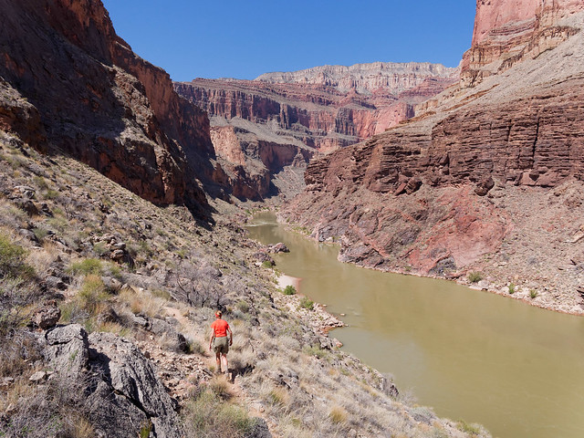
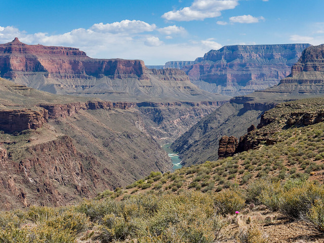
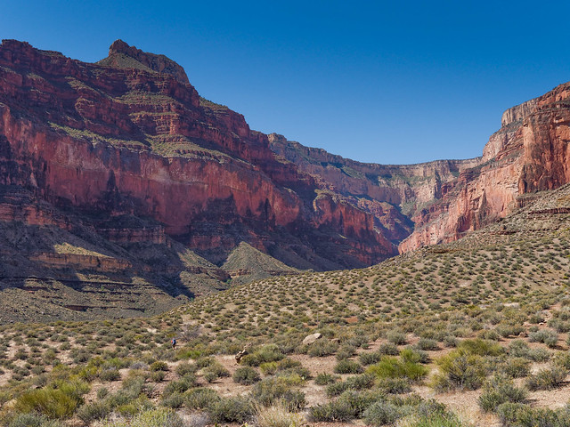
I don't think the Tonto Trail gets its due respect. There is certainly nothing wrong with the views that tourists get from the rim and rafters get from the river. However, the Tonto Trail offers the "best of both worlds" with views up toward the rim ...
See from the Tonto Trail in Grand Canyon National Park, Arizona
... as well as down to the river.

The Colorado River seen from the Tonto Trail in Grand Canyon National Park, Arizona
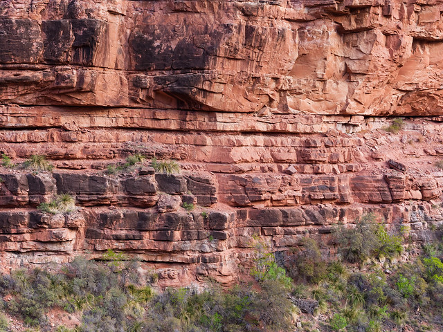
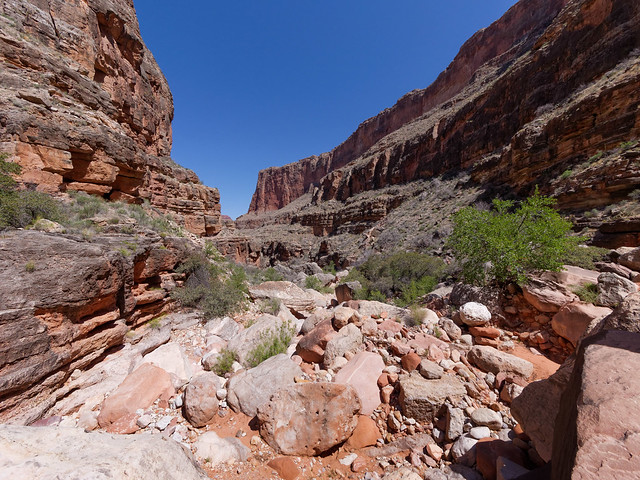
While the Tonto Platform is a desert it is most certainly not barren or without color.
Tonto Trail in Grand Canyon National Park, Arizona
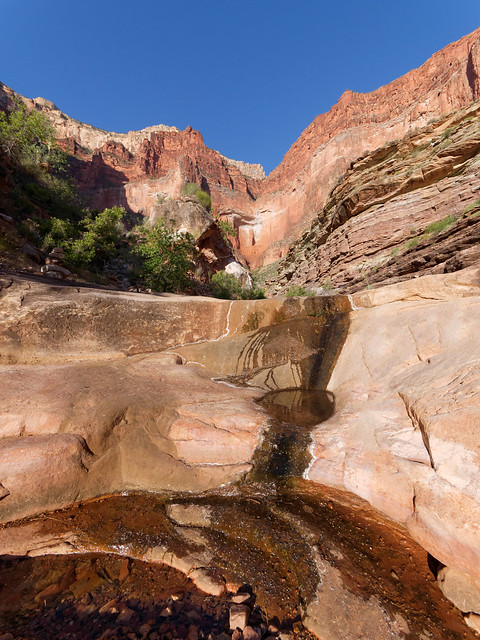
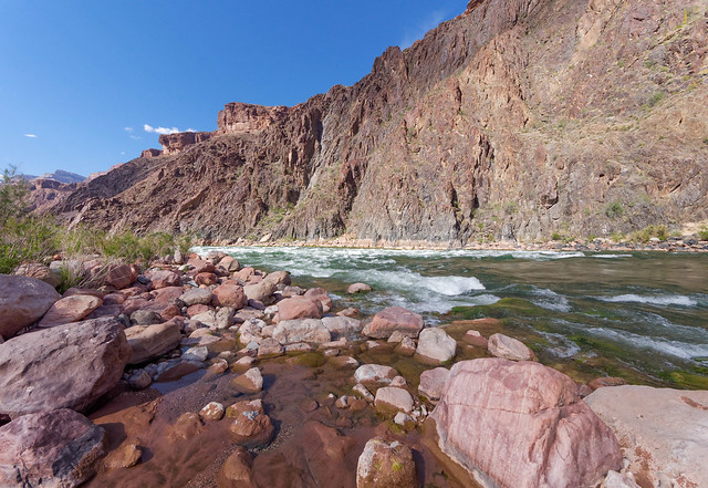
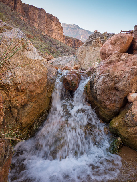
We hiked 2.5 miles and reached our camp at Horn Creek shortly before dark. The single site is well developed and the "kitchen" area even includes some stone "furniture". As it happened, that day was the third anniversary of our moving out of a house and beginning our fulltime travels. It just seemed so fitting to celebrate our "freedom" camped in such a lovely and private spot.
Horn Creek in Grand Canyon National Park, Arizona
Despite the fact that the water in Horn Creek is radioactive there were still quite a few tadpoles living in it. It makes one wonder what they will be like once they become frogs. I'm just as happy that we won't be there long enough to find out.
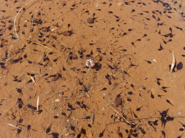
Tadpoles in Horn Creek in Grand Canyon National Park, Arizona
All along the Tonto are side canyons formed by creeks that feed into the main canyon and the trail on the map "zigzags" noticeably as it circumvents each one, Salt Canyon in this case.
Jean in Salt Creek Canyon in Grand Canyon National Park, Arizona
There is a camp at Salt Creek as well as some water in the creek. But it apparently lives up to its name and the water is considered by most to be undrinkable. However, later in the trip we encountered backpackers heading east on the Tonto who were planning to camp; some at Salt Creek and some at Horn Creek. In both cases they were planning to drink the water.
Salt Creek on Tonto Trail in Grand Canyon National Park, Arizona
Had we been forced to do this trip in the opposite direction and camp at Monument Creek the first night and Horn Creek the second we would have carried enough water from Monument Creek to carry us through until we reached Indian Garden. Carrying large quantities of water is not uncommon while backpacking on the Tonto Trail and is something we would need to do on trips we planned to do after this one.
Looking up at South Rim in Grand Canyon National Park, Arizona
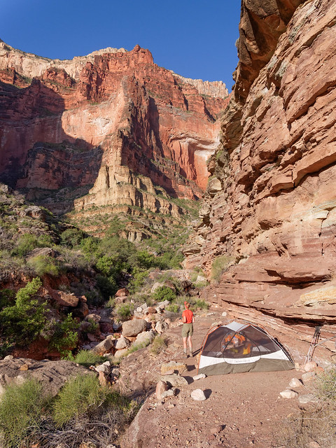
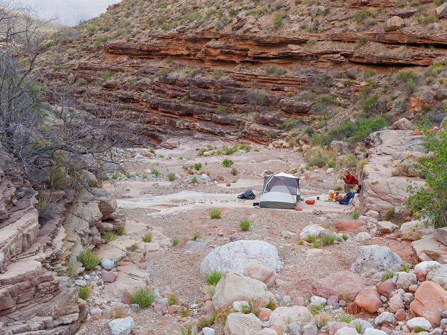
Later in the day we reached the edge of Monument Canyon and could see the Monument Creek Camp below. It was 8.2 miles from Horn Creek to here. We were prepared for a more "social" camp, hopefully not as bad as Indian Garden but certainly more so than our camp at Horn Creek.
Looking down at Monument Creek Camp in Grand Canyon National Park, Arizona
However, we were pleasantly surprised as we were able to get the site highest up in the canyon. In addition, surprisingly the camp wasn't fully booked so no one needed to camp nearby.
Our camp at Monument Creek in Grand Canyon National Park, Arizona
That evening John did the short hike down Monument Trail toward the river ...
Monument Creek Canyon in Grand Canyon National Park, Arizona
... to see Granite Rapids
Granite Rapids in Grand Canyon National Park, Arizona
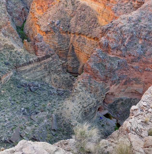
The next day after leaving camp and heading toward the junction with the Tonto Trail we did a side trip down the Monument Creek slot canyon (watch for the sign to the creek). We left our backpacks behind as it is a short hike, only .25 miles.
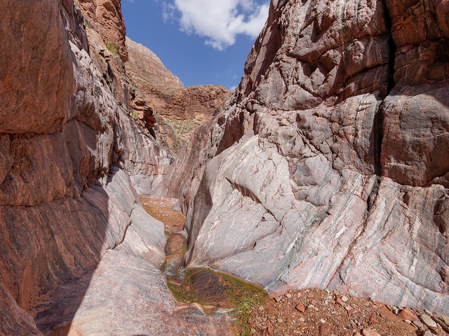
Monument Creek slot canyon in Grand Canyon National Park, Arizona
We both hoped to keep our boots dry and most of the time it was a simple matter ...
Monument Creek slot canyon in Grand Canyon National Park, Arizon
... however there were times when a little "bridging" was necessary.
Monument Creek slot canyon in Grand Canyon National Park, Arizona
Once we reached the bottom of the slot canyon we could then see the formation that gave the creek its name, the "Monument".
The Monument in Grand Canyon National Park, Arizona
There is a pretty obvious "social trail" that will take you out of the creek bed up to the Monument.
Jean with the "Monument" in Grand Canyon National Park, Arizona
We then climbed out of the canyon to head back onto the Tonto Trail where we backtracked a bit to retrieve our packs. We were able to look back and get a view of where we had just been.
Looking down at Monument Creek in Grand Canyon National Park, Arizona
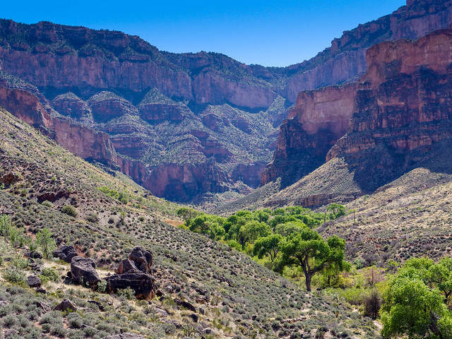
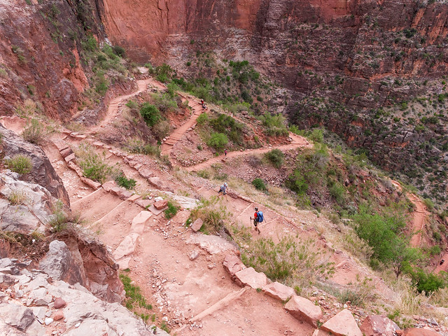
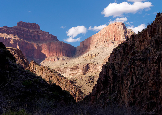
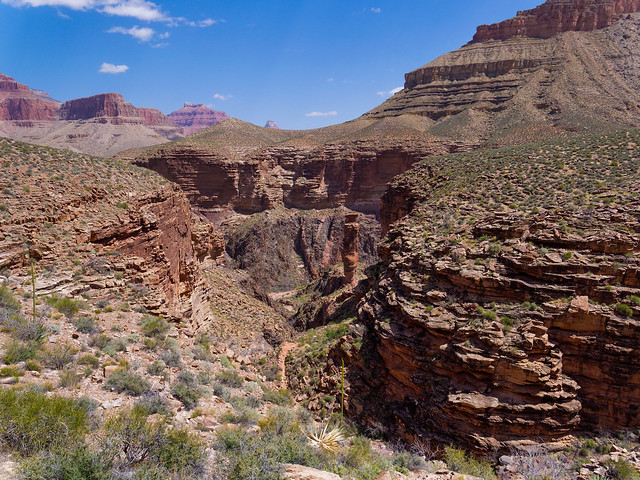
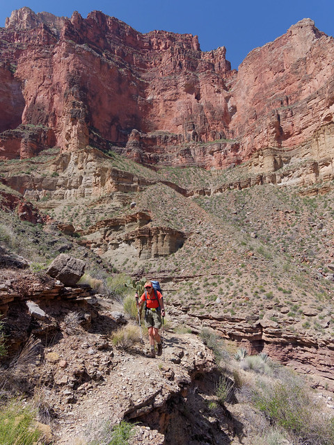
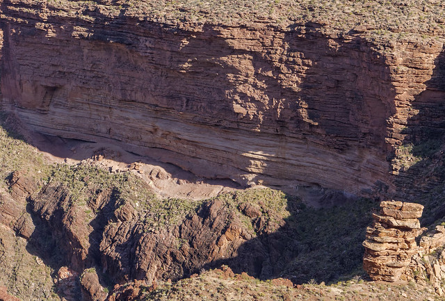
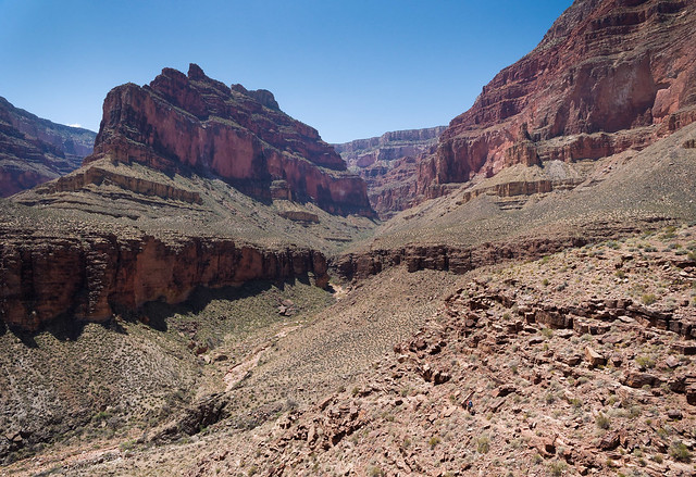
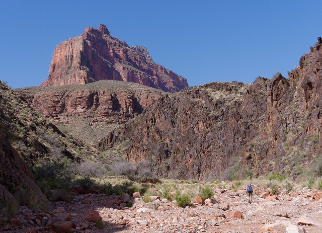
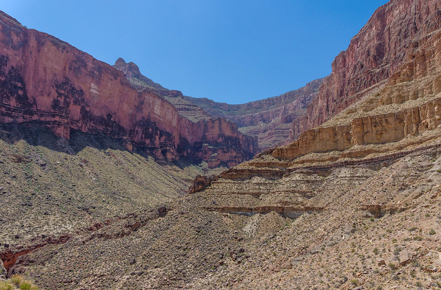
We continued on the Tonto Trail for 2.3 miles (from our camp) until we turned off onto the Hermit Trail and began our 9.3 mile final climb out of the canyon. Looking back, we could see across Hermit Canyon (to the left in the photo) to where the Tonto Trail continues and where we would be coming from in a little over two weeks toward the end of our next trip.
Hermit Canyon seen from the Hermit Trail in Grand Canyon National Park, Arizona
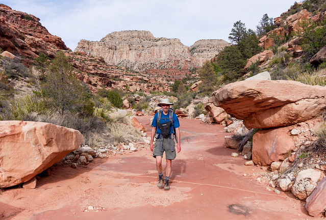
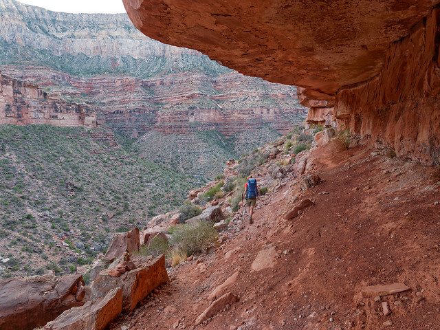
Like all trails out of the canyon, the Hermit Trail can be really steep and rugged in places. There is a part known as the "Cathedral Stairs" that some backpackers we encountered who were headed downhill complained bitterly about but for us it was just slow going. However, for the most part, the Hermit Trail is is quite good with a more gradual grade.

The Hermit Trail in Grand Canyon National Park, Arizona
It was extremely windy the evening we were heading up. I couldn't keep my hat on as the brim would get pushed down over my face. Fortunately for John his hat did the opposite.
John on the Hermit Trail in Grand Canyon National Park, Arizona
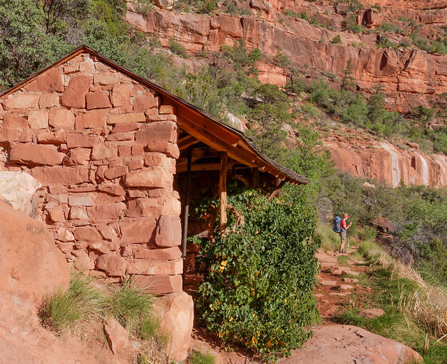
When we were here two years ago we had dayhiked a portion of the Hermit Trail from Hermit Rest as far as the rest house at Santa Maria Spring ...
Santa Maria Spring rest house seen from the Hermit Trail in Grand Canyon National Park, Arizona
... so once we reached this land mark we knew we didn't have too much farther to go. We were plenty tired when we got to the parking lot and were happy to see our car. While this was an easy trip we felt it was enough of a "warm up" and we were looking forward to our next trips. All of our photos from this backpack trip are on Flickr.

John taking a break in the Santa Maria Spring rest house on the Hermit Trail in Grand Canyon National Park, Arizona
Once we got back to our motorhome we went back to Trailer Village, a campground in the park. We had three days before heading out again; this time to do 5 days/4 nights on the Royal Arch Loop which is considered to be one of the more challenging in the park. To quote the NPS description of the Royal Arch Loop:
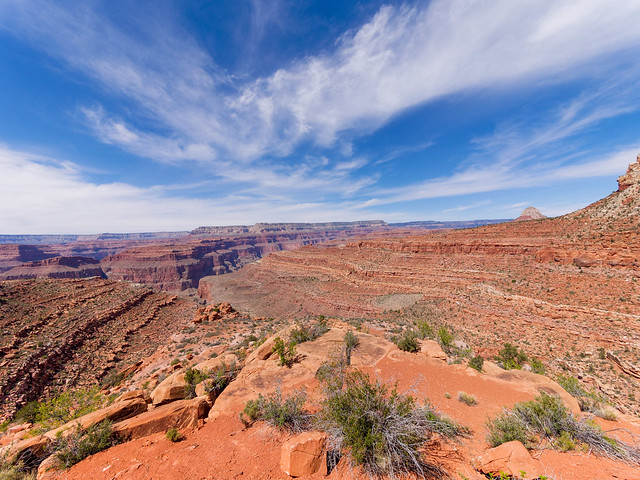
This trip starts and ends at the South Bass Trailhead which is about 30 miles from Grand Canyon Village. One issue is that the road out to the trailhead is dirt and impassable when wet. It is badly rutted and high clearance vehicles are recommended (for more info). Once again we left our motorhome parked in the parking lot near the Backcountry Information Center. We didn't have any trouble getting to the trailhead with our Subaru although it did take us over an hour and a half to get there."The Royal Arch Loop is appropriate for experienced canyon hikers only, walkers who have paid their dues and acquired the appropriate wilderness skills, whose experience allows proper rigging of rappel anchors, and who can easily and safely rope down vertical cliffs. For such people the Royal Arch Loop offers a top drawer canyon adventure, replete with more natural beauty than humans can absorb. For those lacking the required skill and judgment this hike offers about a million ways to get into serious trouble in a remote part of the Grand Canyon".
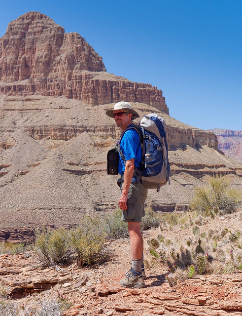
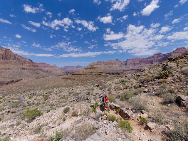
Seen from the South Bass Trailhead in Grand Canyon National Park, Arizona
We wanted to get an early start so we chose to sleep in our car at the trailhead. It was quite cold that night and it wasn't easy getting started that morning but we were looking forward to dropping into the canyon and warmer temperatures. The South Bass Trail intersects the Royal Arch Route on the Esplanade (an intermediate level between the rim and the Tonto Platform) after 1.7 miles ...
Jean on the South Bass Trail in Grand Canyon National Park, Arizona
... before it begins dropping into Arch Canyon.
Royal Arch Route in Grand Canyon National Park, Arizona
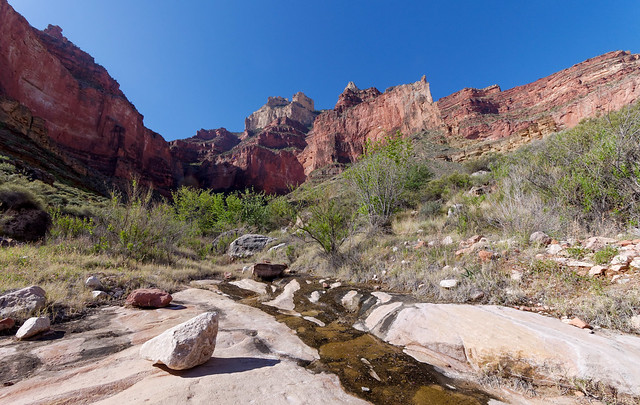
The route, which from the junction is 12.3 miles to Royal Arch, continues down the canyon where Arch Creek sometimes runs. Apparently there are times when one must do some wading on this route but it was not an issue for us.
John in Arch Canyon in Grand Canyon National Park, Arizona
Arch Creek is the only source of water and we were under the impression that we would encounter running water by the end the day. So we passed several potholes by. Each contained water of varying clarity and all were inhabited by frogs in various stages of development from tadpoles to full grown frogs who croaked loudly and often.
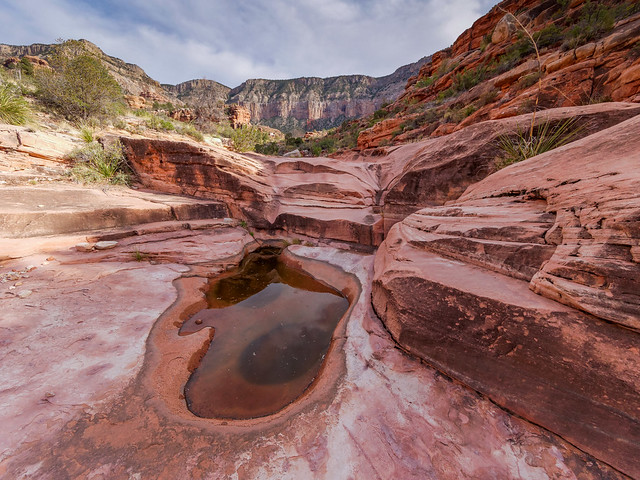
Pothole/frog pond in Arch Canyon seen from the Royal Arch Route in Grand Canyon National Park, Arizona
As the route continues down the canyon it comes to a large pour-off. There are two ways around it. We had read that it was best to take the one to the right.
Jean on the Royal Arch Route in Grand Canyon National Park, Arizona
The other route to the left, takes one along some very narrow ledges (running across the photo below about halfway up from the bottom) as well as a gap that must be crossed.
Alternate route past the pour-off on the Royal Arch Route in Grand Canyon National Park, Arizona
We've read accounts by people who have taken the "airy" route so we were quite content to take the "easy" way down.
Jean on the Royal Arch Route in Grand Canyon National Park, Arizona
Although there were places that made my knees unhappy ...
Jean on the Royal Arch Route in Grand Canyon National Park, Arizona
... in more than one way.

John on the Royal Arch Route in Grand Canyon National Park, Arizona
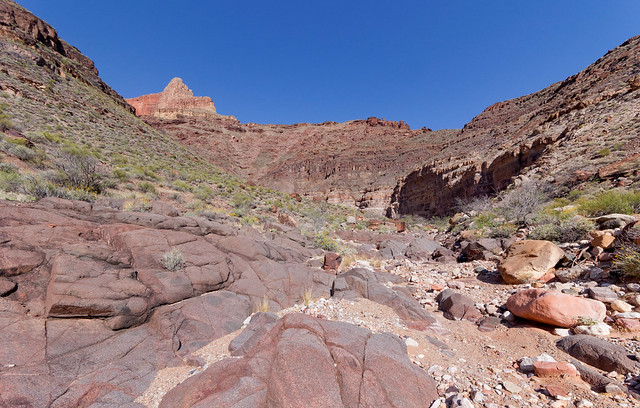
The way down the canyon was slower than we had hoped. It is quite rocky and periodically blocked by boulders. While John's legs were long enough and his knees strong enough to get over them unaided I needed occasional assistance. Sometimes I needed to grab his arm to pull myself up. Other times he placed his foot high up on a boulder so I could set my foot on it before pushing off. It became obvious we would not make it all the way to Royal Arch that day. 14 miles in one day in Grand Canyon is oftentimes an overly ambitious goal.
Royal Arch Route in Grand Canyon National Park, Arizona
Late in the day we became anxious about reaching that running water we had heard tell about. We were now regretting having passed up so many pot holes (frogs or no frogs) as we hadn't seen one for a while. Once it got dark we were really concerned. Hiking after dark on trails is not a problem for us but this route was much harder. John did figure out that we could find water by listening for frogs. At one point we could hear them in the distance but unfortunately they were located far up a side canyon blocked by boulders too dangerous to climb by headlamp. So we continued on.
Finally, we started hearing a single "frog song" down the canyon and fortunately the pot hole he called home had enough water to share. It did taste a bit "froggy" but wasn't too bad as long as you didn't look at it too closely. We use a SteriPEN water purifier after pouring the water through a strainer. There are times in the Grand Canyon when a filter would be nice but what we had was adequate. Lucky for us there was room for our tent nearby as we discovered the next morning that the route below us would have been more than we should have attempted after dark.
Royal Arch Route in Grand Canyon National Park, Arizona
I don't know how far we went that first day, probably at least 10. The next morning we continued down the canyon. Sometimes the route was easy ...
Royal Arch Route in Grand Canyon National Park, Arizona
... and other times, not as much.
Royal Arch Route in Grand Canyon National Park, Arizona
We did eventually encounter that running water but it looked less appealing than the "froggy" water we were lucky enough to have found to drink the previous night.
Royal Arch Route in Grand Canyon National Park, Arizona
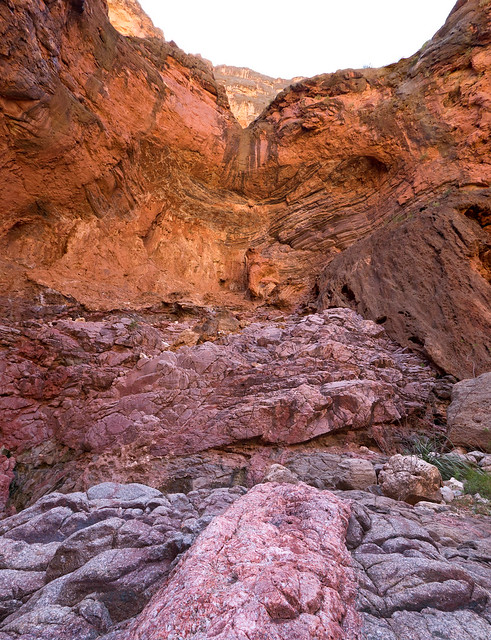
We continued down the canyon past the junction with the trail that climbs out of the canyon. Of course one of the highlights of the route is Royal Arch (I'm in the photo for scale). It is one of only two natural arches in the park (although technically it is a natural bridge as it was formed by water running through it). It is a popular place to camp and we wouldn't have minded getting this far the night before but that was an unrealistic (and unnecessary) goal. We did get there in time to eat lunch.
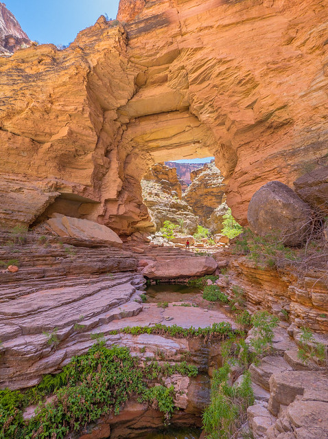
Jean under Royal Arch in Grand Canyon National Park, Arizona
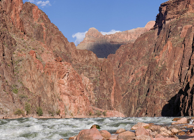
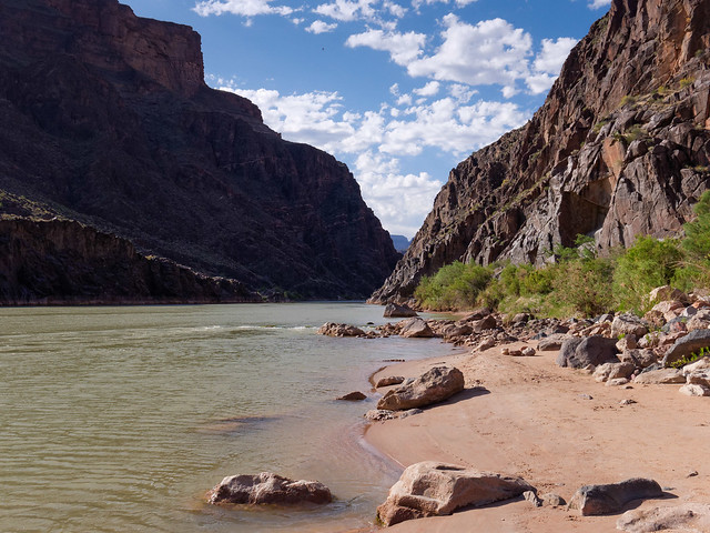
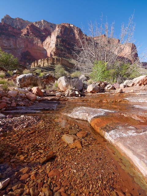
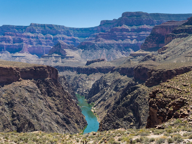
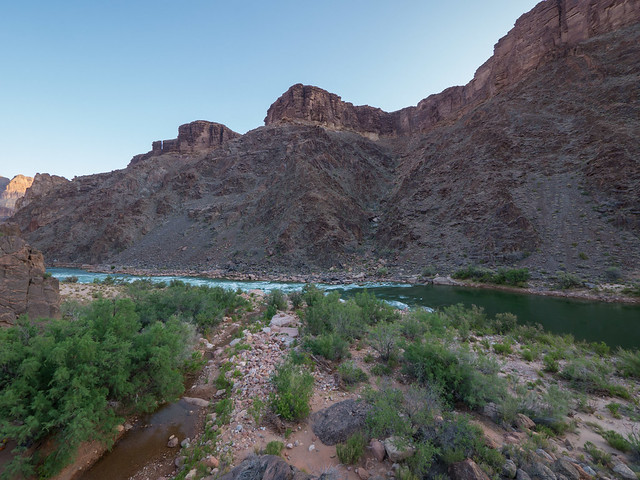
Arch Creek is actually flowing here and we thoroughly enjoyed the colder water (with not even a hint of "frog"). By going through the arch you can see down the canyon a short ways but it is impassable not far below. However we would be seeing the outflow of Arch Creek into the Colorado River on the following day.
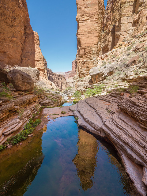
Arch Creek below Royal Arch in Grand Canyon National Park, Arizona
While at Royal Arch we encountered a group of six backpackers (all in our age range) who had started the day at Point Huitzil (more info) and took a much shorter way down into the canyon. They did say the route is "airy" in places and they ran a hand line along portions. I have read that one of the challenges is to find the place where one enters a feature I've heard referred to as the "key hole" This video shows hikers going up this feature.
After leaving Royal Arch we needed to backtrack a bit to the well marked junction with the trail.
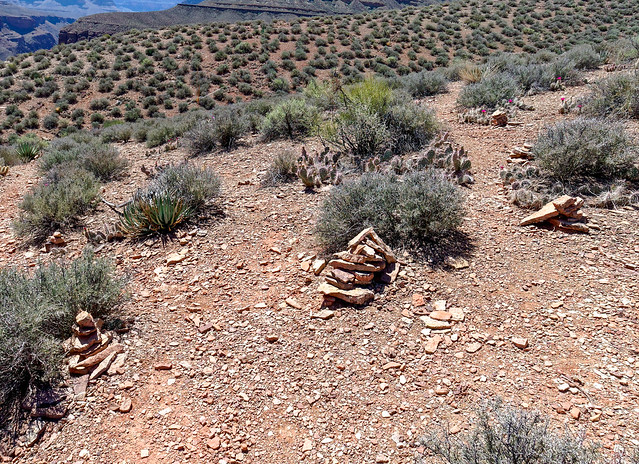
Cairns seen on Royal Arch Route in Grand Canyon National Park, Arizona
We needed to go 3 more miles to our next camp at Toltec Beach. So we then continued on the Royal Arch Route out of the canyon ...
Royal Arch Route in Grand Canyon National Park, Arizona
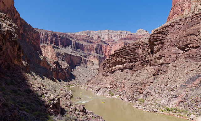
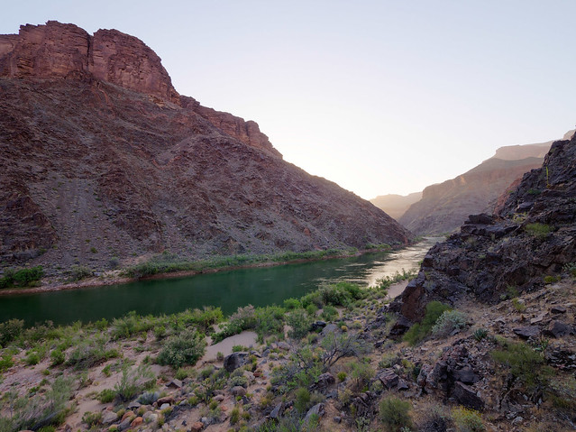
... where we got our first views of the river ...
Colorado River seen from the Royal Arch Route in Grand Canyon National Park, Arizona
... as well as a view down into Arch Canyon looking down at the top of Royal Arch (lower right). If you look closely you can see a blue tarp belonging to one of the six folks we had encountered earlier.
Looking down on Royal Arch from the Royal Arch Route in Grand Canyon National Park, Arizona
One of the things that makes the Royal Arch Loop challenging is the need to do a 20 foot rappel down a rock face. John has done a fair amount of climbing in his past and we had all the necessary gear; harness, rope and webbing. While he has rappelled before, I have not so I was a bit anxious about it. Intellectually I knew it would be far easier than some of what I had already done but I still wasn't looking forward to taking that first step. However, it wasn't bad once I leaned back and "committed to the rope". It was then a simple matter to walk down. There was a knotted rope left behind but anyone planning to do this route should not count on there being anything there. We were more than happy to have brought what we needed to descend safely.
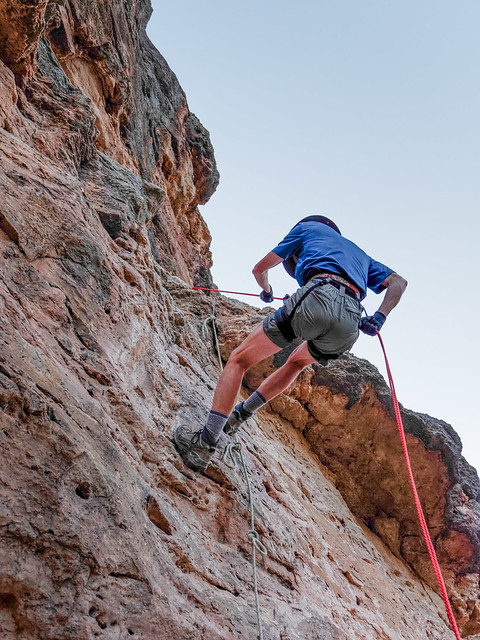
John doing the rappel on the Royal Arch Route in Grand Canyon National Park, Arizona
Once off of the rappel there was still a fair amount of down climbing to be done. The white box in the photo below marks the portion that must be rappelled.

Jean below the rappel on the Royal Arch Route in Grand Canyon National Park, Arizona
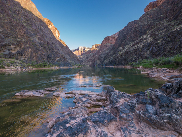
Once down the rock face we continued down toward the river and Toltec Beach where we would camp that night.
Our campsite on Toltec Beach seen from the Royal Arch Route in Grand Canyon National Park, Arizona
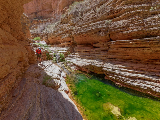
The next morning we did the short dayhike, about1.5 miles, down the river to see another highlight of the Royal Arch Loop, Elves Chasm. We headed down the river and found multiple routes/social trails, some close to the river, some higher. We discovered that some are better than others but most will get you there.
Jean on the route to Elves Chasm in Grand Canyon National Park, Arizona
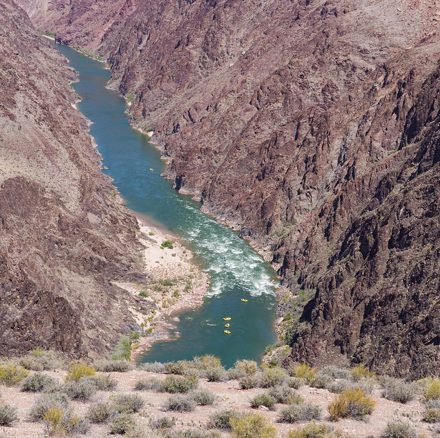
Elves Chasm is a popular stopping point for rafters so we knew it was possible that we would encounter rafters there. While we weren't too surprised when several boats floated past us it was still disheartening to see them pull up at the beach below it.
Rafters on the Colorado River in Grand Canyon National Park, Arizona
When we encountered this large alcove we decided to take a lengthy break in the cool shade in hopes the rafters would have left Elves Chasm by the time we got there.
Alcove seen from the route to Elves Chasm in Grand Canyon National Park, Arizona
And they had! We quickly made our way up the canyon before any more showed up. We followed Arch Creek up stream ...
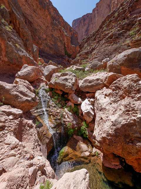
Arch Creek in Grand Canyon National Park, Arizona
... until we reached Elves Chasm. This is such a special place with the lovely waterfall, the ferns and the pool. We felt so fortunate to have it all to ourselves.
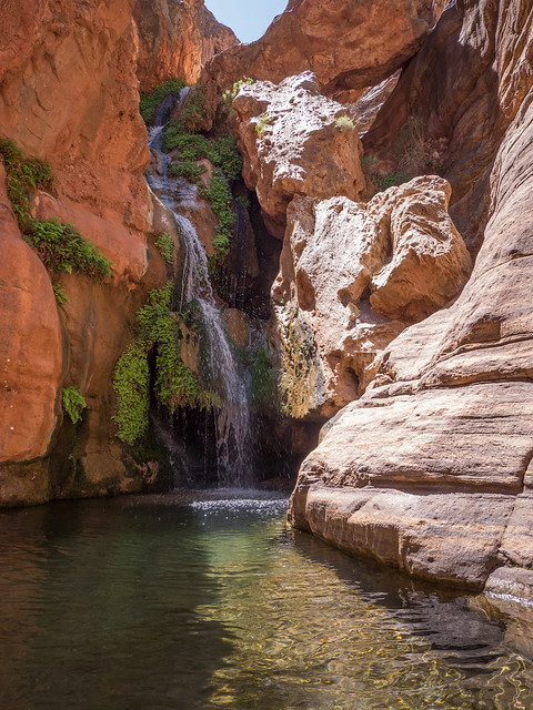
Elves Chasm in Grand Canyon National Park, Arizona
We have read that there is a way to climb up above the waterfall but that it is quite dangerous. Fortunately we didn't have enough time to be tempted to do some exploring. Instead we contented ourselves, each in our own way, John by taking photographs and me by taking a little swim. But not for long as the water was unbelievably cold!
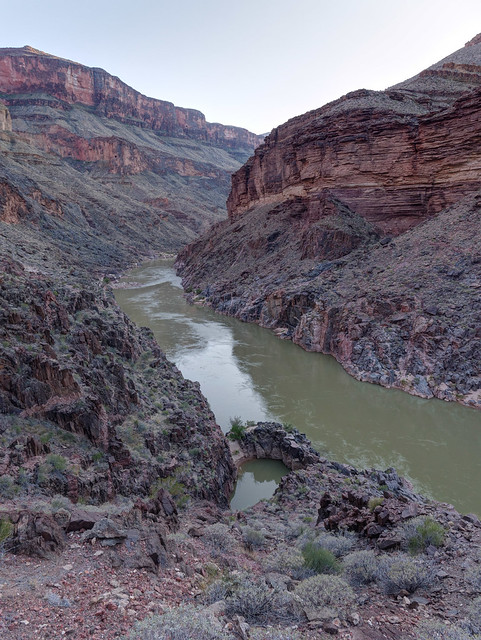
The Colorado River seen from the Royal Arch Route in Grand Canyon National Park, Arizona
The route continues climbing up through Garnet Canyon. Our plan was to continue hiking after dark making use of the cooler temperatures. We figured once we got up to the Tonto Platform, and the beginning of the Tonto Trail, that it would be no problem.
Seen from the Royal Arch Route in Grand Canyon National Park, Arizona
However, once there the cairns stopped (very few suitable rocks) and the trail disappeared in the light of our headlamps so we looked for someplace to put up our tent. It is about 13 miles from Toltec Beach to South Bass Canyon and we figured we had covered about 3 that evening so we weren't worried about making it to our camp at South Bass Beach the next day.
Our campsite on the West Tonto Trail in Grand Canyon National Park, Arizona
The next morning we started looking around for the trail and were surprised to discover that we had put up our tent just a few feet off of it. However, even in full daylight this portion of the Tonto Trail is "sketchy" at best.
Jean (just barely seen in the distance) on the West Tonto Trail in Grand Canyon National Park, Arizona
Once again we enjoyed expansive views from the Tonto looking up at the South Rim, ...
Jean on the West Tonto Trail in Grand Canyon National Park, Arizona
... down to the river ...
The Colorado River seen from the West Tonto Trail in Grand Canyon National Park, Arizona
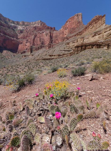
... and the colorful desert in between.
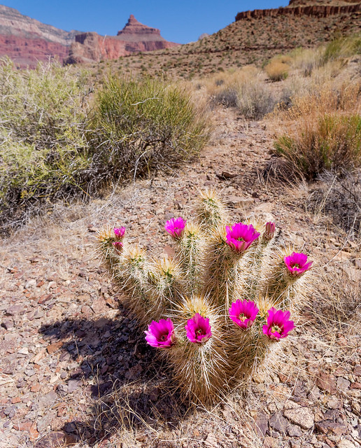
Hedgehog Cactus on the West Tonto Trail in Grand Canyon National Park, Arizona
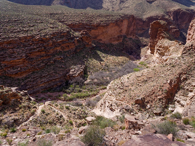
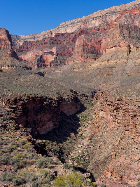
We also encountered some of the numerous side canyons, common along the Tonto Trail, that open into the main canyon. The Tonto Trail circumvents each one, Copper Canyon in this case.
Copper Canyon seen from the West Tonto Trail in Grand Canyon National Park, Arizona
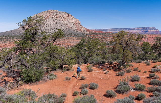
Our destination for the day was the South Bass Beach located at the mouth of Bass Canyon and there are two ways to get there from the Tonto Trail. Tyndall Dome serves as a landmark for when one needs to choose which trail to take.
Tyndall Dome seen from the West Tonto Trail in Grand Canyon National Park, Arizona
One way is to continue on the Tonto Trail around Bass Canyon to the junction with the South Bass Trail. The other is to take a shorter, but steeper side trail. The junction with this trail is right where the Tonto makes its sharp turn away from the river. The photo below was taken from the opposite side of Bass Canyon (while beginning our next trip) and is looking back toward Tyndall Dome. The blue arrows illustrate the Tonto Trail (above) and the South Bass Trail (below). The shorter side trail is illustrated by the red arrows. John and I had both intended to take the side trail but we had gotten separated. I got ahead of him (he had stopped to take more photos) and did take the shorter side trail. However, John apparently got on a "social trail" that angled away from the river and headed toward the junction of the Tonto with the South Bass Trail so he missed the junction with the shorter side trail. Either way is fine and some may prefer to take the longer more gradual trail. However, I've got bad knees and didn't find the shorter steeper route particularly difficult.

Tyndall Dome, the Tonto Platform and Bass Canyon in Grand Canyon National Park, Arizona
Both trails will eventually get you to the South Bass Trail where it heads down Bass Canyon toward the Colorado River ...
Bass Canyon seen from the South Bass Trail in Grand Canyon National Park, Arizona
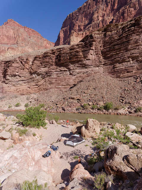
... and South Bass Beach. We made camp on a surprisingly secluded dune not far above the river.
South Bass Beach on the Colorado River in Grand Canyon National Park, Arizona
The next morning we headed back up the South Bass Trail through Bass Canyon. It is 7.8 miles to the trailhead.
Bass Canyon seen from the South Bass Trail in Grand Canyon National Park, Arizona
As we headed up the South Bass Trail we would periodically stop and look back. We both really enjoy the feeling of satisfaction that we get when looking back to where we had been just a few hours earlier. Once back at the trailhead we got in our Subaru and headed back to pick up our motorhome. All of our photos from this backpack trip are on Flickr.
Seen from the South Bass Trail in Grand Canyon National Park, Arizona
Once we got back to our motorhome we again went back to Trailer Village. This time we only had two days to prepare for our next trip which would be our most challenging yet; 6 days/5 nights on the West Tonto Trail from the South Bass Trailhead and Hermit Rest (NPS Tonto Trail distances). To quote the NPS description of this portion of the Tonto Trail:
"This segment of the Tonto Trail is notorious, regarded by canyon experts as the most difficult and potentially dangerous section of this long transcanyon trail system. Main reason: It is almost 30 rough, unmaintained miles from the permanent water in Boucher Creek to the South Bass trailhead and throughout that entire stretch there are no reliable water sources near the Tonto Platform level. None. Another thing: Once started, hikers are committed. The complete lack of bail-out routes to the rim between Boucher and South Bass means the only possibility for help is at the end of the trek. Combine these factors with the usual selection of Tonto Trail hazards (such as narrow, eroding trails, numerous passages near the brink of sizable cliffs, and a notable lack of shade) and it all adds up to a serious undertaking".
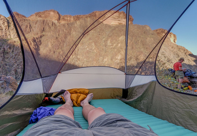
There was one decision we struggled to make before leaving; to take our tent fly or not. It was still quite chilly at night up on the South Rim but we knew we would not need it once we were down on the Tonto Trail. As there would be days when we carried a lot of water our preference was to leave any non essential gear at home. However, since the fellow giving us a ride was only available in the evening we arranged for him to take us the evening before our trip was to begin. Early the next morning would have worked better for us but we were happy he could take us at all. This would add another night out and we weren't certain we would have enough time to drop low enough into the canyon for the nighttime temperatures to be warm enough for us to go without the tent fly. We decided to take it especially after glancing outside and seeing that it had started snowing.
Seen from the South Bass Trail in Grand Canyon National Park, Arizona
Seen from the South Bass Trail in Grand Canyon National Park, Arizona
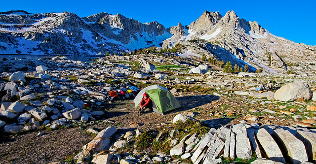
We made it as far as the Esplanade at the junction of the South Bass Trail and the Royal Arch Route and camped there. It is 1.7 miles from the trailhead. It was pretty chilly that night and we appreciated having the tent fly with us but once I stuffed it and put it in my pack the next morning I knew it would not be coming out for the rest of the trip.
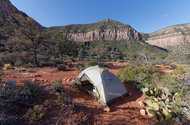
Our campsite on the Esplanade in Grand Canyon National Park, Arizona
We continued down the South Bass Trail to the junction where we got onto the Tonto Trail. It is the nature of hiking in Grand Canyon that there will be a certain amount of hiking on some trails more than once. After having hiked the upper portion of the South Bass Trail for the third time in eight days we were happy to now be covering new territory.
John on the West Tonto Trail in Grand Canyon National Park, Arizona
One thing that we found interesting was looking across to the other side of Bass Canyon and the scene of our misadventure (described below) just four days back while doing the Royal Arch Loop (described above).
Bass Canyon seen from the West Tonto Trail in Grand Canyon National Park, Arizona
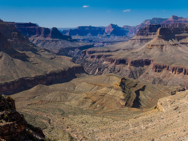
We also enjoyed looking back and seeing the broad expanse of the the Tonto Platform that we had already covered on our previous trip.
The Tonto Platform and the Colorado River seen from the West Tonto Trail in Grand Canyon National Park, Arizona
Serpentine Canyon seen from the West Tonto Trail in Grand Canyon National Park, Arizona
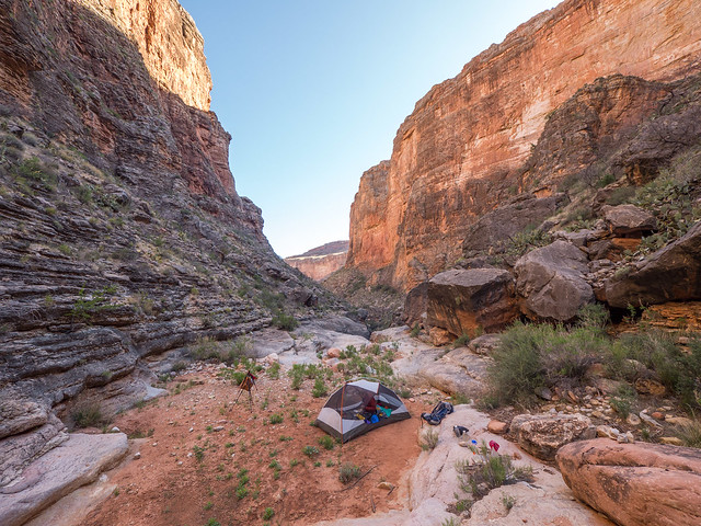
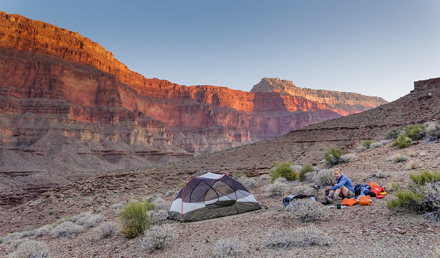
However, there was still plenty of water in Serpentine Creek and we set up our camp on an adjacent ledge.
Our camp in Serpentine Canyon while on the West Tonto Trail in Grand Canyon National Park, Arizona
The creek is home to countless frogs and we were serenaded all night. Most didn't sound like the "deeper voices" of the frogs we had heard in Arch Canyon. Instead theirs were higher pitched and often "sang" in harmony with the occasional "soloist". The entire "performance" was quite lovely.
Serpentine Creek seen from the West Tonto Trail in Grand Canyon National Park, Arizona
The next day happened to be my 59th birthday and I couldn't imagine a better place to wake up.
Our camp in Serpentine Canyon while on the West Tonto Trail in Grand Canyon National Park, Arizona
Jean hiking out of Serpentine Canyon while on the West Tonto Trail in Grand Canyon National Park, Arizona
The day turned quite hot. It was just after 8:00 AM when we left camp but we realized that an earlier start would have been a good idea. While the Tonto Trail is notable for its lack of shade ...
Seen from the West Tonto Trail in Grand Canyon National Park, Arizona
... we did at times encounter rocks and ledges that provided us with a welcome spot to take breaks. We know from personal experience that, given the orientation of the canyon, there is typically more shade on trails from the South Rim than on those originating from the North Rim.
Seen from the West Tonto Trail in Grand Canyon National Park, Arizona
We also discovered that shade was usually available within the side canyons we encountered. Ruby Canyon provided us with a wonderfully shady spot ...
Jean in Ruby Canyon while backpacking the West Tonto Trail in Grand Canyon National Park, Arizona
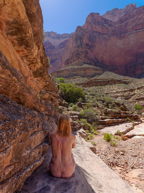
... and we realized that it was unlikely that any other backpackers would be passing through so we both removed our shirts. Well, one thing led to another and we both ended up naked and stretched out on the delightfully cool rock. Now, this was the way for a post menopausal woman to celebrate her birthday! The challenge now is to figure out how to top this for my 60th.
Jean taking a break in Ruby Canyon while backpacking the West Tonto Trail in Grand Canyon National Park, Arizona
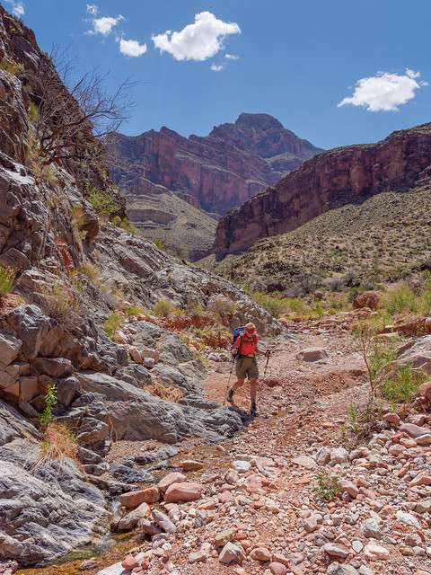
But all good things must come to an end and we needed to get going again. We needed to ration our water and had determined that we could drink ten ounces each hour. Our goal was to find a shady spot so we could take regular breaks. It worked out that we typically hiked for an hour and rested for an hour. We were supposed to eat something at each break. John was able to do this but I completely lost my appetite after our early lunch.
Jean on the West Tonto Trail in Grand Canyon National Park, Arizona
Our destination for the day was Turquoise Canyon and I was quite tired and a bit discouraged by the time we reached it. We had gone 10.6 miles that day.
Turquoise Canyon seen from the West Tonto Trail in Grand Canyon National Park, Arizona
Once we set up camp and it started to cool down I had hoped to get my appetite back but I didn't. Even after drinking my allotted ten ounces of water my mouth felt like it was full of cotton and I couldn't even think about trying to chew something.
Our camp in Turquoise Canyon seen from the West Tonto Trail in Grand Canyon National Park, Arizona
Prior to this trip we had checked the board in the Backcountry Information Center that listed the status of backcountry water. One must keep in mind that water reports are never current as they are provided by backpackers several days later. The last report on Turquoise Creek was over a month old. In addition, just because there was some water in a few potholes in the morning there is no guarantee that it will still be there later that same day.

Water status board in the Backcountry Information Center in Grand Canyon National Park, Arizona
While we knew that there was a possibility of some water in Turquoise Creek we weren't willing to stake our lives on it. However, as soon as we arrived John hiked up the canyon and discovered a small shallow puddle and was able to get nearly a gallon out of it. As soon as I heard that I chugged another 20 ounces and it made all the difference in the world! I was able to eat all of.my day food as well as my supper, I got some energy back and my mood improved immediately. As much as I enjoyed being naked in Ruby Canyon this puddle of water was the best birthday present I could have received! It will now be even more challenging to top this experience next year.
What's left of Turquoise Creek in Turquoise Canyon in Grand Canyon National Park, Arizona
John checked the puddle the next morning and discovered it had not been replenished so we very likely got the last water from Turquoise Creek for the season (fortunately there were no tadpoles or frogs in evidence so I didn't have to feel guilty for destroying their home). Even if there hadn't been any water at Turquoise Canyon we would have both been okay. However it was a good learning experience for me to discover how much better some additional water can make me feel when I'm a little dehydrated. We left Turquoise Canyon confident that we had enough water to not only survive but to feel good as well. We continued on toward our next camp at Slate Canyon which has a reliable water source.
Turquoise Canyon seen from the West Tonto Trail in Grand Canyon National Park, Arizona
But first we needed to cross more of the expansive Tonto Platform ...
John on the West Tonto Trail in Grand Canyon National Park, Arizona
... as well as circumvent more side canyons including Agate Canyon and the lovely Sapphire Canyon.
Slate Canyon seen from the West Tonto Trail in Grand Canyon National Park, Arizona
As we approached Slate Canyon we noticed an obvious trail running below the canyon wall. We wondered why it was there but on closer inspection we wondered if we were seeing a ruin. At the far right of the trail just inside the shadow is what we think is the small rectangular opening into a structure. It appears to us to be similar to those we have seen at Mesa Verde; a "grainery" which were used by native people to store food (a larger image). We could be wrong as I have not found any information about it but it could be just one of those "best kept secrets".
Seen from the West Tonto Trail in Grand Canyon National Park, Arizona
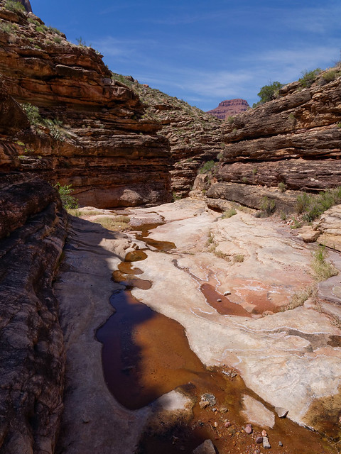
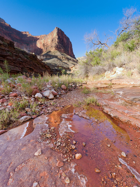
We continued up the canyon until the trail crossed the wash. Even though we had been told that Slate Creek was a reliable source of water the first thing I did when I got there was drop my pack and hike up the canyon. The wash was bone dry for about the first five minutes but I began to feel reassured when I encountered wet sand, then small puddles followed by deeper potholes. After about ten minutes up the canyon I found flowing water!
Slate Creek seen from the West Tonto Trail in Grand Canyon National Park, Arizona
I happily headed back down and set up our camp while John got water. We had gone 9.3 miles that day. We had then completed the most notorious portion of the Tonto West Trail and the remaining two camps on this trip would both be on the river so water would no longer be a concern.
Our camp in Slate Canyon seen from the West Tonto Trail in Grand Canyon National Park, Arizona
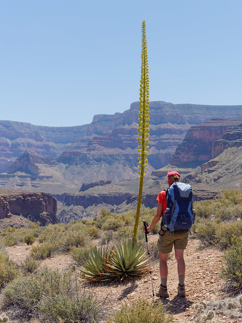
The next morning found us back on the Tonto Platform with it s varied vegetation, such as this "Century Plant", ...
Jean on the West Tonto Trail in Grand Canyon National Park, Arizona
... as well as familiar great views of the Colorado River. I have to admit that if all of our photos taken while hiking the Tonto Trail were mixed up we would both have trouble saying where they were taken or even which trip they were taken on. I have heard that some hikers find the Tonto "boring". However, we never seem to tire of being within its vastness and enjoying the solitude.
The Colorado River seen from the West Tonto Trail in Grand Canyon National Park, Arizona
Our destination for the day was the mouth of Boucher Canyon at the Colorado River but first we had to get around Topaz Canyon.
Topaz Canyon seen from the West Tonto Trail in Grand Canyon National Park, Arizona
Even once Boucher Canyon came into view we knew it would still take awhile to hike further up the canyon and reach the junction with the Boucher Trail.
Boucher Canyon seen from the West Tonto Trail in Grand Canyon National Park, Arizona
Once down in Boucher Canyon we saw evidence that many people choose to camp near the trail junction. There was plenty of water in Boucher Creek but we still preferred to continue down the canyon toward the river.
Seen from Boucher Trail in Grand Canyon National Park, Arizona
We arrived at the beach early in the day, having gone only 6.7 miles that day, and it was still in full sun and quite hot. The photo below was taken the following day looking down at the beach and Boucher Rapids. We were a bit concerned that the beach would be crowded as it is a popular stopping place for rafters to camp because they need so much space to set up their huge camps.
Rafters on the Colorado River at Boucher Creek in Grand Canyon National Park, Arizona
So rather than go down the river to the large beach we went up stream a short way, climbed up toward the canyon wall and found a suitable site up in the rocks above the river that was beginning to get some shade from the canyon wall (in the above photo it's the sandy patch above the river in the rocks that is farthest upstream from the beach).
View from our tent at Boucher Creek in Grand Canyon National Park, Arizona
However, it didn't sound like any rafters were camped below us. In fact we weren't aware of anyone else camped there which was surprising because it is easily accessible to less experienced canyon backpackers. But perhaps they all stayed up at the camp near the trail junction. Whatever the reason, that evening we thoroughly enjoyed the views of Boucher Rapids below us ...
Boucher Rapids on the Colorado River in Grand Canyon National Park, Arizona
... as well as the calmer water above us in unexpected solitude.
Colorado River at Boucher Creek in Grand Canyon National Park, Arizona
The next morning we hiked back up the Boucher Trail, ...
Seen from the Boucher Trail in Grand Canyon National Park, Arizona

... and back to the Tonto Platform. During the day we encountered the first people we had seen in four entire days; a couple who were doing the loop that begins and ends at Hermit Rest.
Seen from the West Tonto Trail in Grand Canyon National Park, Arizona
Once again we had views of the Colorado River ...
The Colorado River seen from the West Tonto Trail in Grand Canyon National Park, Arizona
... and had to circumvent another side canyon; this time it was Travertine Canyon.
Travertine Canyon seen from the West Tonto Trail in Grand Canyon National Park, Arizona
Along the way we encountered creatures such as this female Desert Collared Lizard.
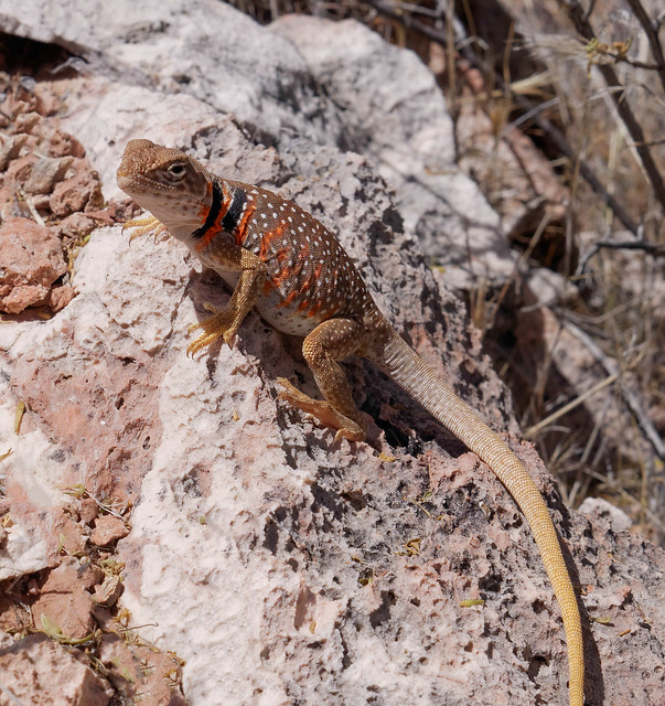
Desert Collared Lizard seen from the West Tonto Trail in Grand Canyon National Park, Arizona
We continued to make use of any shady spot we encountered although we decided it would be a good idea to get back in the habit of keeping some of our clothes on as we were approaching "civilization".
John taking a break on the West Tonto Trail in Grand Canyon National Park, Arizona
Looking up we could see Pima Point which is not far from Hermit Rest, our destination for the next day and the end of this trip.
Hermit Rest seen from the West Tonto Trail in Grand Canyon National Park, Arizona
We finally reached Hermit Canyon and as we began our descent ...
Hermit Canyon seen from the West Tonto Trail in Grand Canyon National Park, Arizona
... we got an excellent view of the well developed Hermit Creek Camp complete with "streets" and a composting toilet. The sight of so much "civilization" was a bit of a shock for us and we hoped to find less of it by the river where we planned to camp that night.
Hermit Creek Camp in Grand Canyon National Park, Arizona
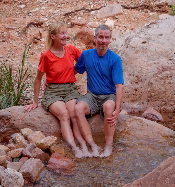
However, once down to Hermit Creek we did take a lengthy break. We felt as though we had just encountered an oasis after days spent in the Sahara. We luxuriated in the clear cold water; drinking our fill and soaking our feet at the same time. It was wonderful!
Jean and John at Hermit Creek in Grand Canyon National Park, Arizona
Now completely refreshed we continued on our way down Hermit Canyon toward the river but we weren't prepared for how attractive this canyon is. As the late afternoon light was poor we planned to allow for enough time in the morning for John to take photos on our way out.
Jean in Hermit Canyon in Grand Canyon National Park, Arizona
We found a fine camp site next to Hermit Creek just above the river. According to our map we had gone 8.8 miles that day. We were aware of only one other party who also planned to camp there but they continued down the river. We were once again pleasantly surprised at the solitude we had in an area that is very accessible to less experienced canyon backpackers. For some unknown reason most choose to stay in the "city" of Hermit Creek Camp.
Jean in our camp by Hermit Creek at the Colorado River in Grand Canyon National Park, Arizona
Once again we enjoyed views of rapids below us; Hermit Rapids in this case, ...
Hermit Rapids on the Colorado River in Grand Canyon National Park, Arizona
... as well as the calmer waters of the river above us.
The Colorado River at Hermit Creek in Grand Canyon National Park, Arizona
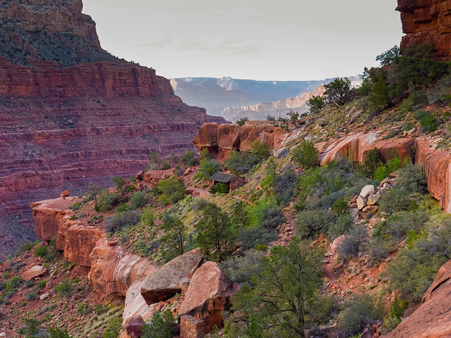
The next morning we headed back up the lovely Hermit Creek ...
Hermit Creek in Grand Canyon National Park, Arizona
... to the surprising collection of "Salt Sculptures" ...
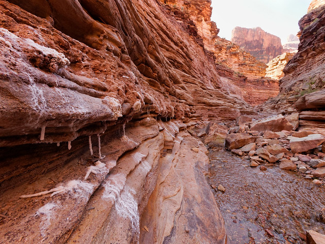
Salt formations seen in Hermit Canyon in Grand Canyon National Park, Arizona
... including some that were quite delicate.
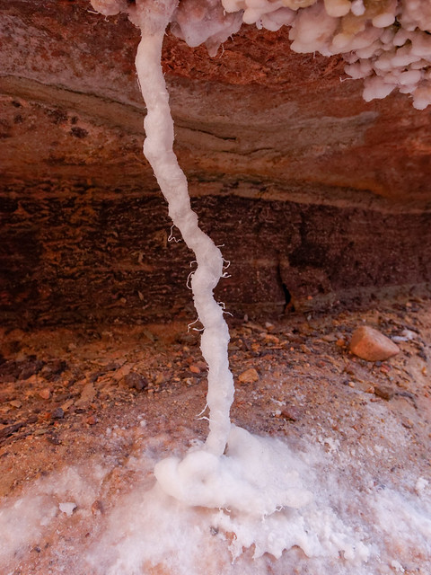
Salt formations seen in Hermit Canyon in Grand Canyon National Park, Arizona
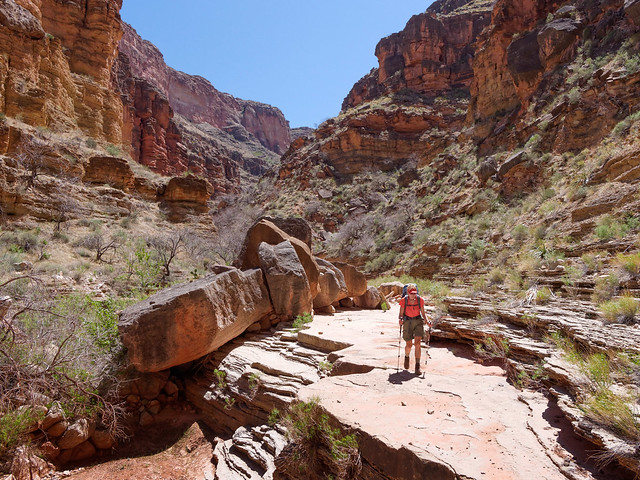
Once we left the canyon we got onto the Hermit Trail to make the long hot ascent, 9.7 miles, back to the rim.
Jean on the Hermit Trail in Grand Canyon National Park, Arizona
This trail was quite familiar to us as we had done it when finishing up our backpack trip from the Bright Angel Trailhead to Hermit Rest two weeks earlier. As always we found great satisfaction looking back at where we have been.
Seen from the Hermit Trail in Grand Canyon National Park, Arizona
And as before, once we reached the Santa Maria Spring rest house ...
Santa Maria Spring rest house in Grand Canyon National Park, Arizona
... we knew we didn't have far to go especially once we reach the impressive sections of labor intensive but incredibly durable "corduroy riprap" trail. Once again we climbed into our car and drove back to pick up our motohome before heading to the campground. And once again we were grateful for the convenience of our lifestyle and the luxury of hot showers, home cooked food and a soft bed.
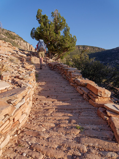
Jean on the Hermit Trail in Grand Canyon National Park, Arizona
Thinking back on this trip we have both come to the surprising conclusion that this is one of our "Top Five" favorites and it has some stiff competition . It is topped only by the John Muir Trail , our trek up the Khumbu Valley in Nepal and the Mt Eielson Loop in Denali National Park in Alaska. But we both find it difficult to find the words to explain why we enjoyed it so much. The trail itself is not hard as there is relatively little elevation change. But ensuring that one has enough water does require planning and carrying a heavier pack at times. As good as John's photographs are I don't even think they truly capture the experience.
So I will try to explain. Backpacking on the Tonto Trail is predominately a "visceral" experience that causes one to greatly appreciate simple pleasures like tepid water. The heat and the sun can be brutal and it teaches one to appreciate the lightest breeze and sliver of shade. The lack of a "bailout" trail helps strengthen one's mental toughness. Upon completion one feels a great sense of accomplishment and experiences an increase in self confidence.
However, I think the main reason we enjoyed it so much was the utter solitude. We both understand the importance of National Parks having well developed areas that are accessible and attractive to tourists; roads, parking lots, visitor centers, hotels, restaurants, gift shops etc etc etc. However, we really dislike being around the inevitable crowds. And here it was, peak season in this incredibly popular National Park but we went four days and covered a lot of territory without seeing a single other person. We felt as though we had the entire park to ourselves and it just doesn't get any better than that. All of our photos from this backpack trip are on Flickr
On the Hermit Trail in Grand Canyon National Park, Arizona
We still had one section of the Tonto Trail left to complete, the portion between Grandview Trail and the South Kaibab Trail. However, that will have to wait because once we got home from this trip we learned we needed to head back to Washington State for a family matter. However, we plan to return!
This next bit is just something that Jean has been thinking about.
You are so lucky!
Not long ago while backpacking in Grand Canyon National Park we encountered a young couple. We were finishing up a great seven day trip on the West Tonto Trail as they were just beginning a shorter backpack trip. Three days was all they could fit into their short vacation away from their jobs and they were envious of us after hearing that this was our third backpack trip in the park that month. Not having had much contact with other people for many days we took this opportunity and talked at them, speaking enthusiastically about the joys of living and traveling fulltime in a motorhome. But especially about all of the great opportunities we’ve had to backpack in western North America. When they were finally able to peel themselves away from us and continue on their way the young woman cheerfully said in parting, “You are so lucky” and we happily agreed with her.
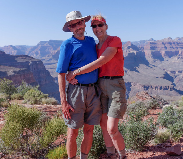
John and Jean in Grand Canyon National Park, Arizona
However, this reminded of a time many years ago when another young woman had said the very same thing to me. But at that time it had really annoyed me. It was back in 1988 when our two boys attended a local co-op preschool. Dan was three and Tom was 18 months old. This young woman had two similarly aged children enrolled as well. Both of her kids were quite active and she frequently complained about the small size of the two bedroom apartment that she, her husband and their two children lived in. One morning she overheard me telling another mom that we had just purchased a four bedroom house with a huge backyard that was perfect for our two boys.

Dan, pool and Slip n' Slide in our backyard in Kent, Washington
She looked at me and said “You are so lucky” before quickly walking away. It irritated me, not because of what she said but how she said it. The tone of her voice, combined with the sullen look on her face, seemed to imply that I had been given something that she sorely wanted but had been unfairly withheld from her. I didn't think it was “luck” that enabled us to buy that house as “luck”, by one definition, is “success or failure apparently brought by chance rather than through one’s own actions”. So saying that we have what we have because of “luck” discounts our long history of good planning and hard work combined with frugal living and patience.
For example, John and I both had college degrees, marketable skills and good jobs. I was 25 when we got married and we waited until we were financially comfortable before having children. I was 31 when I left my job just prior to Dan’s birth. Whereas, she and her husband had nothing beyond high school diplomas and she was only 18 when an unplanned pregnancy led to their getting married. So no, I don’t think it was “luck” that put us into such a great house while her family was stuck in a small apartment and heavily in debt. I’m reminded of a quote by Thomas Jefferson; "I am a great believer in luck, and I find the harder I work, the more I have of it."
That said, we are well aware that we have been exceptionally lucky in ways that we have had no control over. For example, we were both born in the US. I’ve already written a bit about some of the many benefits that we are grateful for. We are especially fortunate to live on such a large and geographically diverse continent with extensive protected lands and well developed roads that enable us to drive to them, not only in our car but our motorhome as well.
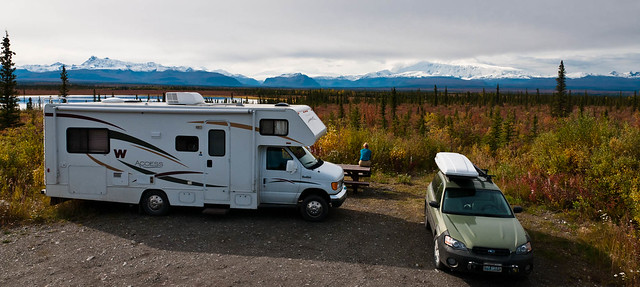
Our campsite just off of the Nabesna Road in Wrangell – St Elias National Park, Alaska
As much as we loved exploring New Zealand …
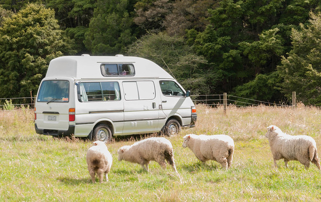
Freedom camping at Waipu Cave on New Zealand's North Island
… and visiting Nepal …
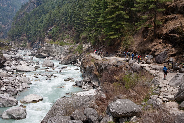
The Nepalese version of a “highway”
… we simply could not live and travel in those beautiful countries in the same luxurious way that we do in the US. Nor could we see such a wide variety of terrain.
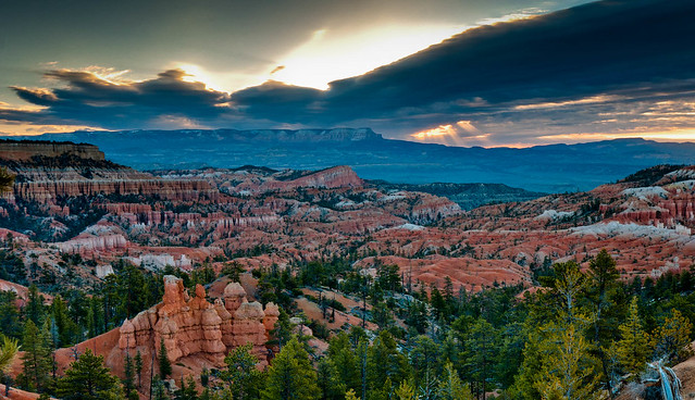
Sunrise over Bryce Canyon National Park, Utah
In addition we are quite lucky to have been born when we both were. For example, John just missed being drafted for the Vietnam War and I was born after great strides had been made toward equality for women (I do like being able to vote). And we have lived most of our lives enjoying the benefits of a strong economy. We will also (hopefully) be gone before being severely impacted by Global Climate Change and our extremely polarized political climate. The list goes on.
We have also been lucky in that we have not been particularly unlucky. Let’s face it, “Shit Happens” but for some unknown reason it has not yet “happened” to us. We have never experienced any on the long list of tragic events; natural disasters, serious accidents, incurable disease, untimely death, to name a few (not to mention the extensive list of “unnatural” disasters starting with war and gun violence). I can’t even begin to imagine how it feels to live through any of the tragedies that countless people all over the world have been forced to.
Some try to explain away such tragedies as “God’s Will” or “Karma” stemming from their belief that there is a higher power guiding these events. That there must be a good reason for it, that it is part of “God’s plan” but we are simply too ignorant to comprehend just what that good reason might be. I have long thought that if there was a “higher power” deciding the what, when and where of these tragedies then he/she is just not being fair. Why should it be happening to so many innocent, even “God fearing” people, while unrepentant Pagans like us are left unscathed?
Jean and John in Grand Canyon National Park, Arizona
Others talk of things as “meant to be”, that it is “fate, our “destiny” but doesn’t that imply that there is still something guiding the events of our lives? I really don’t like the idea that something beyond me is acting like a “puppet master” and pulling my “strings” (I have some serious "trust issues"). I prefer to believe in “Natural Selection” as well as the “Survival of the Fittest” and that “Shit” happening (bad luck) is simply a part of our natural world and that it is completely random.
But I also believe that there are choices we can make and actions we can take that may help us to avoid being hit by random tragedy, not living in a tornado prone area for example. At the very least we can try to increase the probability that we will survive what might happen to us. For example, we can try to prevent some diseases with a healthy lifestyle as well as have sense enough to take actions such as wearing seat belts. While in the backcountry we can also make a point to get off of the summits of 14,000 foot peaks in Colorado ...
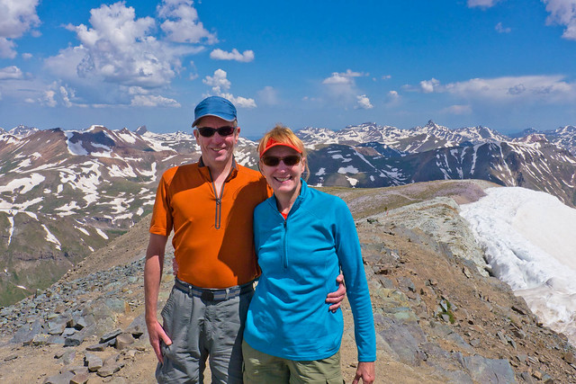
John and Jean on the summit of Handies Peak (14,058 ft) in Colorado
… before the all too common afternoon thunder and lightning storms move in.
A storm rapidly moving in over Handies Peak, Colorado
In addition there are actions that we can take to try to mitigate our potential losses. For example, after disasters (tornadoes, earthquakes, tsunamis, wildfire etc), TV reporters regularly interview survivors who have just lost all of their possessions. All too often these unfortunate individuals express the most grief for the loss of irreplaceable items with family photographs being at the top of the list. Therefore we have scanned all of our print photos. These, along with all of our digital images, are stored on a regularly updated hard drive that lives in John sister’s apartment. We strongly recommend this same procedure to anyone who would also grieve the loss of irreplaceable precious photographs.

John and Dan welcoming Tom to the world minutes after his home birth
But if “Shit” truly “happened” in a random fashion then, statistically speaking, John and I would have at the very least received our “fair share” of bad luck by now. This got me wondering if some people are in fact, luckier than others and it reminded me of a book, The Luck Factor, by Richard Wiseman. The basic premise, based on the results of a ten-year scientific study, is that to a large extent people do make their own “luck”. He contends that people make their own luck through four basic principles. That lucky people are skilled at creating and noticing chance opportunities. They make lucky decisions by listening to their intuition. They also create self-fulfilling prophesies via positive expectations. Finally they adopt a resilient attitude that transforms bad luck into good. Looking back I can remember examples of our “good luck” where it now appears that we had been following some of his principles.
There was the time back in early 1993 when we really wanted to buy a VW camper. We had been looking for a used one in good condition but the problem was that people who had them tended to love them so much they had trouble letting go of them. We just couldn’t find one. Until one evening when John took a wrong turn on his way home. He was not unfamiliar with the area and he has a great sense of direction so this mistake was surprising. However, this wrong turn, his “bad luck”, took him right by a used car lot that had a fine looking 1984 VW Westfalia camper sitting in the parking lot. A few days later “Max” became a valued member of our family who took us on many great family trips throughout the western US.

"Max" at Lava Beds National Monument, California
And then there was the time when we were shopping for a motorhome. We wanted something practical; short enough to fit into most campsites, with enough storage for all of our outdoor gear and with a subdued interior. All of which is now rare in our ostentatious “super size me” culture. We had been looking for years before we finally found the perfect one. A local dealer had one on the lot. It had already been sold but he let us look inside. We were so excited because it immediately felt like "home" to both of us. However, we soon learned that this particular model had been discontinued and our local dealer was unable to order one for us.
But John didn’t give up. Apparently another trait of lucky people is that they are willing to expend more effort because they expect to be lucky. This in turn increases the probability that they will be lucky. So he got online and did an extensive nationwide search. What he discovered was that there were still six new ones left in the country and one of them was sitting on a lot in Pasco, located in eastern Washington. AND it just so happened to have the exact interior that we wanted; light cabinets, vinyl floor and “dirt” colored upholstery. We immediately bought it over the phone and drove “Sandy” home the following weekend.
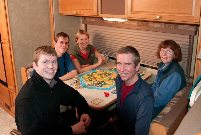
Tom, Dan, Jean, John and his sister, Elizabeth playing "Settlers of Catan" in our subdued home
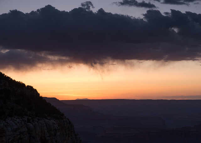
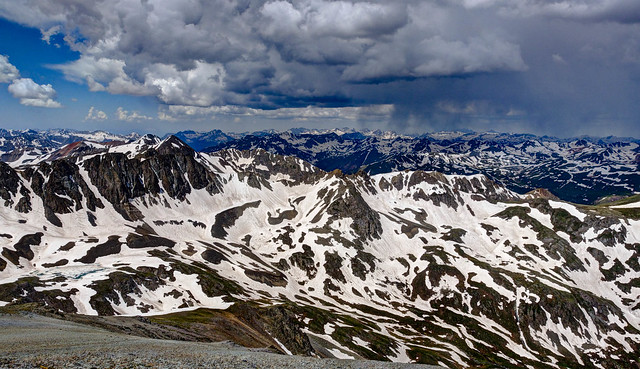
Storm moving in over the Esplanade in Grand Canyon National Park, Arizona
John had been able to obtain a permit for the Monument Creek Campground but we also needed a permit to stay a reasonable distance between it and the Bright Angel Trailhead. Water is a big issue on the Tonto Trail so we also wanted to stay somewhere not too far from a reliable water source. Indian Garden seemed to be the only possibility as the Park Service does hold back a few permits each day for campgrounds along the “corridor” and these are made available on a “first come, first serve” basis each morning. So bright and early every morning numerous hopeful backpackers line up at the Backcountry Information Center in order to obtain a “waitlist number”. This number determines when they get their turn to talk to one of the backcountry rangers and try for those few permits still available. OR one can use their “waitlist number” to get their name higher on the wait list for the following morning.
We weren’t looking forward to staying in the Indian Garden Campground as it is more like a city park complete with shelters, picnic tables, …
Indian Garden Campground on the Bright Angel Trail at Grand Canyon National Park, Arizona
… drinking fountains and toilets, not to mention lots of people. It is just not our idea of a “backcountry” experience.
Indian Garden Campground on the Bright Angel Trail at Grand Canyon National Park, Arizona
Our preference would be to stay at the single site at Horn Creek located on the Tonto Trail two and a half miles west of Indian Garden. However, in peak season there was virtually no chance that it would be available. So we resigned ourselves and decided to feel “lucky” if we were able to obtain one of the elusive Indian Garden permits. Unfortunately, the day before we hoped to start our trip there were already several others ahead of John on the wait list as he had gotten there later than he had intended the previous morning. So by the time it was his turn he wasn’t surprised to learn that Indian Garden was already full for the night we wanted. But then the ranger said, with obvious surprise, that Horn Creek had just become available exclaiming that “Horn Creek is never available when Indian Garden is full”. Needless to say John immediately took it.
The best explanation we have is that whoever had previously held the permit for Horn Creek for that particular date had just given it up; perhaps they decided they preferred to stay at Indian Garden and had been able to get a spot. It could very well have been the person who was immediately ahead of him on the wait list. So if John had gotten to the Backcountry Information Center as early as he had wanted to the previous morning then he would have been higher on the wait list this morning. OR if he had gotten there a moment later then he would have been even lower on the list. Either way, he most likely would have missed that brief moment in time when Horn Creek was available for our desired night. All I can say is that we considered ourselves to be extremely lucky to be able to stay in such a scenic and wonderfully private spot.
Horn Creek in Grand Canyon National Park, Arizona
Wiseman states that the more luck people have the higher their expectations are for the future which, in turn, increases the probability that they will continue to be lucky. He says that lucky people are happy and optimistic whereas unlucky people feel anxious and depressed. Research and personality tests show that unlucky people are generally much more tense and anxious and that anxiety disrupts a person’s ability to observe and notice the unexpected. I have to admit that I have spent too much time in my life feeling tense and anxious …
Jean and John crossing Grewingk Creek while backpacking in Kachemak Bay State Park, Alaska
… but fortunately for me, John is capable of being optimistic in nearly all circumstances.
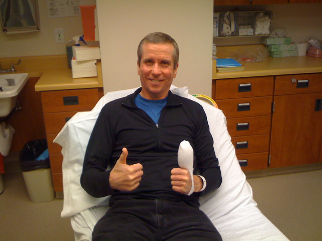
John in the ER in Klamath Falls Oregon (it's a long story)
Wiseman also states that lucky people are outgoing and observant. Therefore they have many more chance encounters than unlucky people, each of which could bring a lucky opportunity. Well, I’m pretty shy and frequently avoid approaching strangers. Fortunately John is not and he commonly seeks out opportunities to talk to others. That reminds me of the time when we were waiting for a fellow to vacate a site in a campground in Zion National Park. While he finished packing John asked what he had done in the park and he proceeded to describe his recent hike to “The Subway”, a unique slot canyon in the park.
"The Subway" within Zion National Park, Utah
He explained how the route involves crisscrossing the Left Fork of North Creek several times and highly recommended wearing “dry pants” and canyoneering boots as the water levels were quite high due to recent snow melt (not to mention quite cold). Most importantly he told us where to rent them. It proved to be sound advice.

Jean and one of many crossings of the Left Fork of North Creek on the way to "The Subway" in Zion National Park, Utah
So we went and had a great time!
Jean in "The Subway" within Zion National Park, Utah
Perhaps the most profound of all of Wiseman’s four principles is that “lucky” people are resilient and have a knack for transforming bad luck into good. This is also not a new concept and there are many variations on the theme; that obstacles (incidents of “bad luck”) which appear in our path are simply opportunities for us to learn valuable lessons. “When the student is ready the teacher will appear” is a popular saying that is often attributed to a Buddhist Proverb. “Good judgment comes from experience, experience comes from bad judgment” is a quote that is attributed to multiple individuals as is “When life hands you lemons then make lemonade”. However, my favorite related quote is one by John Wooden, “Things turn out best for the people who make the best of the way things turn out”.
A disclaimer – As I have no personal experience with any of the tragic chance events previously mentioned, I am uncertain that I could find anything remotely positive after experiencing such extreme loss. However, the news is full of remarkable individuals who have done just that. I am completely in awe of the parents of the children who died in Sandy Hook Elementary School in Newtown, Connecticut and their ongoing efforts to reduce gun violence.
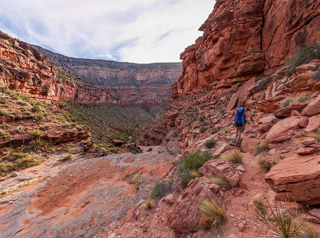
Rather, the “bad luck” I am referring to are those times where things just don’t go as planned and cause us inconvenience, annoyance, worry, injury etc. This reminds me of a recent situation that John and I had while backpacking in Grand Canyon National Park. We were doing the Royal Arch loop and the second to our last day out was spent hiking on a portion of the West Tonto Trail (which runs along the Tonto Platform, the bench in the Grand Canyon that is situated between the Colorado River and the South Rim). It was quite hot, the sun was brutal and shade was almost nonexistent but this did not prevent John from making frequent stops to take photos.
Seen from the West Tonto Trail in Grand Canyon National park, Arizona
I learned a long time ago that patience is essential when hiking with a photographer and normally I would just sit and wait for him. I’ve gotten really good at it.

Waiting patiently … again … this time while backpacking in Glacier National Park, Montana
However, there are situations where I don’t wait, for example when I’m getting too cold. Even so, it feels as though we have an invisible “tether” connecting us. I’m generally not comfortable getting too far ahead of him and it is not uncommon for me to backtrack. On this particular day it was just too hot so, rather than wait for him and get really grumpy, I continued hiking until I came to a large rock or a ledge that was casting enough shade so I could wait more comfortably. I knew that John would eventually catch up and join me in the shade where we would eat a snack and enjoy the ten ounces of water we were allowed each hour (we had to ration our water until we got to camp by the Colorado River later that day). This procedure was repeated at intervals throughout the day.
Jean enjoying some shade on the West Tonto Trail in Grand Canyon National Park, Arizona
Our destination was South Bass beach on the Colorado River. When the Tonto Trail reaches Bass Canyon it turns sharply, heading directly away from the river for over a mile, in order to circumvent the canyon. It descends gradually and crosses the South Bass Trail before continuing around the canyon. In order to get to the beach via the South Bass Trail one must make a sharp “U” turn at the junction and head down the canyon wash back toward the river, essentially “backtracking” below the Tonto for nearly two miles.
However, there is a much more direct way indicated on the map that is at least two miles shorter. A steep side trail veers off of the Tonto Trail right where it makes its sharp turn away from the river. Once down in the wash it too intersects the South Bass Trail but about a mile closer to the beach and this was the trail we planned to take. Tyndall Dome, to the south of the Tonto, serves as a prominent landmark ...
Tyndall Dome seen from the West Tonto Trail in Grand Canyon National Park, Arizona
... and I knew that once I passed it that I should watch closely for the junction.
Seen from the West Tonto Trail in Grand Canyon National Park, Arizona
As I was well ahead of John at that point I was the first to arrive at the junction. John once told me (after he had accidentally got way ahead) that the best thing to do when separated from one’s hiking companion and a trail junction is encountered that the person in the lead should stop and wait for the other person to catch up. I also knew if I didn’t wait for him that he would worry about whether or not I had taken the correct trail because my poor sense of direction is legendary. I can get lost anywhere; campgrounds, parking lots, you name it. I even got lost once after venturing a short distance from our camp just off the John Muir Trail to attend to a “call of nature”. It took me over 30 minutes to find my way back to our tent.
Jean at camp (before getting lost) near Chief Lake while backpacking on the John Muir Trail in John Muir Wilderness, California
So I was going to wait right at the junction. However, the sun was still quite hot and there was no shade so I looked around and I spied a shallow gully with some shrubby plants a short way down the side trail. I was able to carve out a spot with just a bit of shade. As I would be out of sight from the junction I considered leaving my pack there. But I was concerned about it being carried off by the canyon’s notorious Ravens so left it nearby me just off the side trail in plain view of the junction. In addition, I wrote my initials (in large letters) in the dirt at the junction and drew an arrow pointing to where I was waiting. I was confident that once John caught up that it would be impossible for him to miss me so I got comfortable and began to wait. I even dosed off because I’m really good at that too.
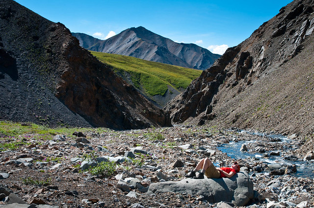
Waiting patiently … again … this time while backpacking in Denali National Park, Alaska
When I awoke I was uncertain how much time passed but it seemed that John should have caught up by then. Standing back at the junction I went from feeling perplexed to being concerned which led to an intense inner debate. My “rational self” had trouble believing that John had gotten lost, something that is next to impossible on the Tonto. All you have to do is keep the South Rim on one side and the river on the other.
One possibility was that he had somehow managed to miss the junction but it seemed unlikely as he’s the one with the great sense of direction and he had the map as well as a GPS with him. I then considered other possibilities; he had dropped some essential piece of gear and he went back to find it (been there, done that) or he had become completely absorbed with photographic opportunities created by the changing light (ditto). Or he encountered another hiker and got talking, something he is quite good at especially if it involves photography (ditto, ditto).
However, my “emotional self” got really wound up and started playing the “what if?” game and conjured up a wide array of possibilities all within the broad category of “ What if he got hurt?” Unfortunately my “rational self” got overruled and my hyperactive imagination shifted into “overdrive”. I've already written about my ability to imagine the worst possible scenario for any given situation. Granted the Tonto does not have narrow sloped sections covered in “ball bearing rock” adjacent to steep drop offs ...
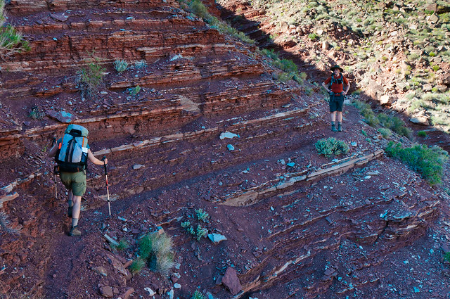
Jean on the Escalante Route while backpacking in Grand Canyon National Park, Arizona
… nor is it steep and rocky, potentially hazardous conditions not uncommon on other trails and routes in Grand Canyon.
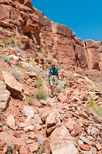
Jean descending a rough part of the Thunder River - Tapeats Creek Trail in Grand Canyon National Park, Arizona
However, the desert on the Tonto Platform is full of plants and animals determined to hurt you; cacti, agave, yucca, rattlesnakes, scorpions etc. And, even though John has an excellent sense of balance and “catlike” reflexes he typically doesn’t watch where he puts his feet so he can miss such things as rattlesnakes coiled under shrubby plants by the trail. In addition, as a photographer he is easily distracted. He had, in fact, stumbled over a rock and fallen earlier that same day because he was “gawking” at the scenery. Despite the fact that he has never suffered an injury in the backcountry that prevented him from hiking out that doesn’t mean he is invincible. While he does carry a “PLB” (Personal Locator Beacon) he must be alert and oriented in order to use it.
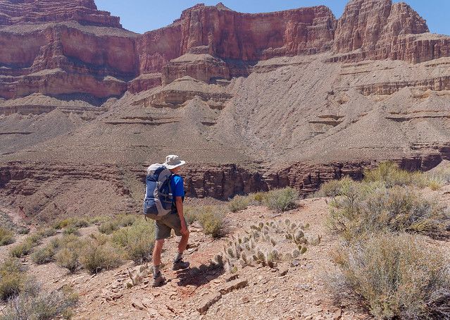
John on the West Tonto Trail in Grand Canyon National Park, Arizona
Two scenarios tumbled around in my overly anxious mind and I wasted way too much time trying to decide what to do. If he had missed the junction then he should backtrack so I ought to wait right where I was. However, this was an unusual circumstance because there was an alternate way to the river and given his aversion to backtracking, he may have simply continued on taking the longer way around to camp. Even if I also took the longer way it would be next to impossible for me to catch up unless he stopped. Therefore, in this situation the best thing for me to do would be to take the shorter side trail and head to camp while it was still light out.
But the scenario that was the most compelling was the one that involved his being somewhere behind me injured badly enough that he was unable to continue hiking. In that case I should go look for him especially as I knew he was as low on water as I was. We’d both be okay through the cool of the night but once the sun came up it would be a different story. I finally came to the conclusion that, no matter how unlikely, I needed to prove to myself that John wasn't hurt. I determined that there was enough daylight remaining that I could spend one hour looking for him before I needed to start down the trail to the river.
Before leaving the junction, just in case he did backtrack to look for me, I wrote my initials in the dirt, this time using small rocks (more visible than scratching in the dirt), with an arrow indicating my direction. I backtracked, walking as fast as I could, for 30 minutes which should have gotten me close to where I had last seen him. All along the way I blew my emergency whistle but the wind had really picked up so I knew it was unlikely that it could be heard very far away. After 30 minutes and no John I turned around and headed back to the junction. I then changed the direction of the arrow to indicate that I was then headed down toward the river. My best hope was that John had accidentally taken the long way around and that he was at that moment sitting on the beach waiting for me.
Not surprisingly the side trail off of the Tonto was steep and rocky, typical for the Grand Canyon, but route finding was no problem; the clear trail became a well cairned route and boot prints were numerous. However, I was greatly relieved when I reached a broad wash at the bottom of Bass Canyon as the way became much easier and I was able to move faster.
Bass Canyon in Grand Canyon National Park, Arizona
I reached the river just before dark. Once on the beach I talked to two fellows camped nearby and I was so relieved to hear that John had made it safely to the river. He had somehow missed the trail junction but by the time he realized it he decided it would be faster to continue on the long way around rather than to backtrack. He, knowing I was also low on water, had assumed that I would not wait very long at the junction before heading down the side trail to the river.
However, my relief turned to concern because John was no longer there. Not finding me at the river he had become very worried so he soon loaded up with water and headed back up the trail to look for me. His plan was to go up the side trail and then take the long way around again. I became more concerned after hearing that John had mentioned that he was tired from the additional miles he had already done. But what really worried me was this. Given the approximate time he had left the beach then he would have been heading up the side trail within the same time period when I was coming down. So why hadn’t we run into each other?
I felt helpless knowing that a tired John carrying a heavy pack was hiking around in the Grand Canyon in the dark. But there was nothing for me to do but wait. I set up the tent, spread out my sleeping bag, ate my last Power Bar and treated some water with my emergency iodine tablets. Not the most comfortable camp as John had the air mattresses, the rest of the food and the SteriPEN water purifier. Of course he couldn't cook because I had the stove/pot, the cups and the spoons.
I decided that if he didn't show up during the night then my plan was to be back on the trail at first light and look for him. I did my best to get comfortable without my beloved air mattress but was grateful to be on sand rather than rough rock. Thankfully I managed to go to sleep. Then, shortly before midnight, I was awakened by a frantic voice, John’s voice, outside the tent saying “Jean, are you in there? Are you okay?!?” We were both so relieved and happy to see each other. We each gave our account of our “misadventure” but were too tired and drained to make much sense of anything. So after eating a very late supper we went to sleep.
The next morning as we hiked out we tried to figure out what had gone wrong the previous day. Even if we took the time and energy to backtrack I doubt we’d learn why or how he had missed what I thought was an obvious junction. Perhaps he just spaced out and blew past the junction failing to notice that he had passed Tyndall Dome (not to mention my “note” in the dirt) and that he was now heading away from the river rather than toward it. For some unknown reason the side trail was not on the GPS (and for some unknown reason he didn’t consult the map that was readily accessible in his pocket).
Jean on the West Tonto Trail in Grand Canyon National Park, Arizona
We had also encountered spots where there were conflicting cairns where other hikers had apparently decided that they knew a better way. So it is possible that John ended up on one of these “social” trails that takes a more direct route toward the junction between the Tonto and South Bass Trails and completely bypasses the junction with the side trail. The fact is that some backpackers headed for South Bass Beach actually prefer to take the longer more gradual Tonto Trail down from the Tonto Platform (illustrated by the blue arrows) and backtracking down the wash rather than the steeper side trail (illustrated by the red arrows). We talked to six such individuals later that same day.
Tyndall Dome, the Tonto Platform and Bass Canyon in Grand Canyon National Park, Arizona
John's route illustrated in blue, Jean's route in red
John's route illustrated in blue, Jean's route in red
But that still didn’t explain how we missed each other when he was backtracking to look for me. So we again went over the events of the previous evening. After John left the beach and headed back up Bass Canyon he didn’t see the cairns marking the junction with the side trail that led back up to the Tonto Trail. It was not too surprising as the area is quite rocky so cairns are far less visible. So he continued up the canyon and eventually encountered four individuals camping in the wash. He talked to them for several minutes explaining that his experienced but “directionally challenged” wife was missing. They helped him locate the side trail and he headed up it, frequently whistling and shouting my name.
After the sun went down the moon provided enough light for him to hike without his headlamp. Which is not a bad idea because our experience has been that route finding after dark can actually be easier by moonlight rather than the narrow beam of a headlamp. When he reached the Tonto Platform he encountered what he believed was the junction with the Tonto Trail but he thought it looked “sketchy”. If he was in fact at the official trail junction then he could have easily missed the “message” I left for him because it would be less visible by moonlight than if he had been using his headlamp. So he continued back on the Tonto Trail once again taking the long way around Bass Canyon before returning to the beach. If I didn’t turn up by morning his plan was to activate the PLB.
Meanwhile … after I descended the steep portion of the side trail and reached the wash the previous evening I did hear indistinct male voices coming from somewhere up the canyon. I stopped briefly to listen but I was pretty sure that I didn’t pick up John’s voice. I considered trying to locate whoever was up the wash but I was concerned about getting to the beach before dark. However, due to my innate shyness compounded by my anxiety, even if there had still been plenty of daylight I'm not sure that I would have sought them out. It just didn't occur to me that they could have been any help.
The most plausible explanation we have for our not running into each other is this. John was up the canyon talking to the folks camping in the wash (about 100 yards above the junction) at approximately the same time I was coming off of the steep part of the trail and heading down the wash. If that had been the case then he didn’t even start up the side trail until after I had come down it. Even though he had been whistling and shouting my name at regular intervals before and after he talked to those campers he had stopped during the time he spent near them which happened to be the period of time when I was within earshot.

How we must have missed each other at the junction between South Bass Trail and side trail in Bass Canyon in Grand Canyon National Park, Arizona
Just sounds like a bit of bad luck doesn’t it? Well, as “lucky people” we choose to not see it that way. The truth about the above situation is that neither of us was truly in any real danger at any point in time because there were other people out there, we both had easy access to water and we were less than eight miles from the trailhead. However, given our preference for backpacking in more remote areas, it is possible, even likely that we could find ourselves in a similar, but far more dangerous situation.
So we’ve been looking back at the chain of events and the choices that each of us made in order to learn what we can from this experience. For instance I need to do a better job controlling my anxiety so I am better able to make good decisions in a more timely fashion. I also need to overcome my shyness in such situations and be willing to actually talk to strangers. In addition, I now know that John’s well honed navigational skills and his good sense of direction are not infallible. John might consider remembering his own advice that the lead person waits at the junction. John might also consider not relying on his GPS when the trail we want is not even on it. In that case he might then consider taking out the map and looking at it.
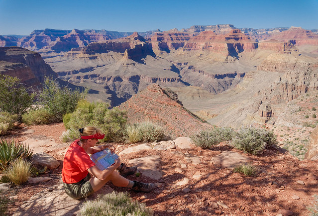
Jean checking the map while backpacking in Grand Canyon National Park, Arizona
In addition we both need to do a better job getting into each other’s “head” and imagine what the other person would do, not what personally seems the most “logical” to ourselves. At the very least we can use the information we have acquired over the nearly 36 years that we have been together. For example, I know that John has an aversion to backtracking and will avoid it when there is a safe alternative. John knows how quickly I can jump into “what if?” mode and worry excessively about his safety. He should also know that I am patient and will wait for him far longer than he thinks is reasonable. We can’t really know just how this misadventure will benefit us in the future; all I do know is that someday, somewhere, somehow we will consider ourselves very lucky to have had it.
I have one more story that describes a situation from my past where, despite everything I said before, the outcome of this story almost seems to have been “meant to be”. There were simply too many situations where a slight change in the choices made by any one of several individuals would have led to a far different ending. It begins May 1973 when “less than optimal” events resulted in my dropping out of college at the end of my freshman year. After returning to Louisville (and incurring the wrath of my “disappointed” parents) I got a job at a hamburger joint as a night shift waitress. However, one night after I had worked there for several weeks, I got really pissed off at my boss and walked out (long story). The next day an old high school friend, Jane, begged me to drive her to a local mall because she wanted to see about getting her portrait taken. It sounded stupid to me but I thought what the Hell, I’ve got nothing better to do. So I drove her to the mall.
I got bored waiting for her to talk to the photographer so I started walking around. I never enjoyed “recreational shopping” so I didn’t go into any stores. That is until I came across an appealing store with a country store motif that sold “health foods”. I became curious, went in and started talking to the woman behind the counter. After learning that she was the owner I jokingly asked her if she ever needed someone to work for her. Well, it just so happened that she was looking for someone so I applied on the spot. And, despite my not having any applicable experience and that my only recent work experience was the job I just quit, she hired me! Apparently, what cinched it was something she had read in a book, Linda Goodman’s Sun Signs, which indicated that my being a "Taurus" meant that she would not find a more loyal employee. I loved that job and I learned a great deal about nutrition which led to lifelong healthy eating habits which undoubtedly have contributed to my excellent health. Most importantly, Theo my new boss, became a lifelong friend.
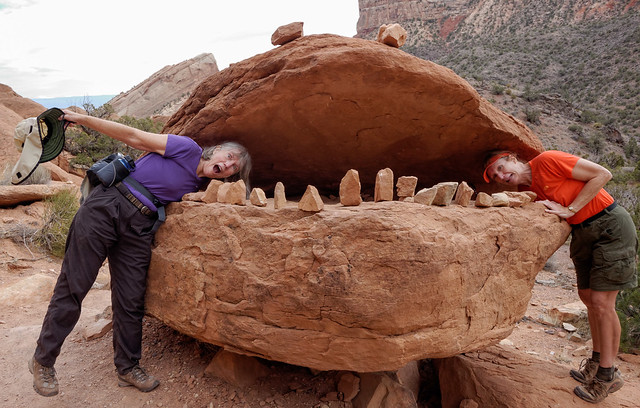
Theo and Jean hiking on the Monument Canyon Trail in Colorado National Monument, Colorado in October 2012
Through my job I met a fellow named Stan. He was a nice guy and we had a lot in common. However, we never went beyond being more than “friends with benefits”, because for me there was just “something” missing. One day he told me about a guy he had recently met at the tennis courts in the city park near his apartment. Not long after that I got to meet him as well. His name was John and the rest, as they say, is history.
Well … not exactly. When I first met John (summer 1975) I learned that he was originally from Chicago and had been working in Louisville for about six months. He talked enthusiastically about how he had spent the previous summer, after graduating from college, exploring the western US and that his intent was to relocate somewhere in the west as soon as he could.

John somewhere in Montana, 1974
We had a lot in common and enjoyed each other’s company. While it was “love at first sight” for me, for John …well, there was just something missing. Over the next several months we became very close friends and I kept hoping that, given enough time, we could find what was "missing" and become something much more. But I gave that up once John started making definite plans to quit his job and move to Washington State in order to return to college and study photography. About two months before he planned to leave I went to live on a farm commune in the southern part of the state. I just needed to get away. However, just prior to leaving town John had some bad luck. His 1964 Dodge van, his trusty traveling companion “Tubby”, died.

“Tubby” and John in Chicago, 1974
He concluded that he couldn’t afford a new vehicle as well as go back to school so he kept his job and didn’t leave town. Meanwhile, down on “The Farm” the day after I learned that he would not be leaving the state, a couple living at the same commune found out that they needed to immediately drive to Louisville to help a family member. Just as they were preparing to drive off I felt compelled to go with them. I quickly grabbed a few processions and climbed into the back of the station wagon wedging myself between kids and suitcases.
Once back in town I was delighted to be able to get my old job at the Health Foods store back as Theo had just fired my replacement for theft. John and I spent more time together and we did became something more. In January of 1977 he asked me to move in with him and this time when he made new plans to leave Louisville to relocate to the Seattle area I was part of them. And this time as they say, the rest is history.

Jean and John right before leaving John's parent's house in Chicago to head west
So what should I believe? That our getting together was “meant to be" or that I am just extraordinarily lucky? I suppose that if John and I hadn't gotten together that we would both have had fine lives. But I can't imagine a life that is better than the one I have. Maybe some things are "meant to be", I don't know. All I can be sure of is that, yes I am most certainly lucky and I have been for my entire life. Thanks to the choices made by so many individuals beginning with my parents.

Ray and Marcia Horton
Their original plan was to have only four children ...

Linda, Ray, Robin, and Laurel in 1954
… so I am extremely lucky that they were irresponsible when it came to using birth control.

Robin, Laurel, Linda, Ray, Mom and Jean in 1956
I’m lucky that my boss at the restaurant was such a jerk. I’m lucky that Jane was so persistent and pressured me into driving her to the mall. I’m lucky I overcame my shyness and talked to Theo. I’m lucky that Stan chose that particular day to go to the tennis courts. But most of all I am lucky that Tubby chose to “die” before getting John to Washington State...

Tubby somewhere in Colorado, 1974
… because I owe everything that I have experienced since then to that single event. Moving to Washington State with John, …

John and Jean in Olympic National Park, Washington 1978
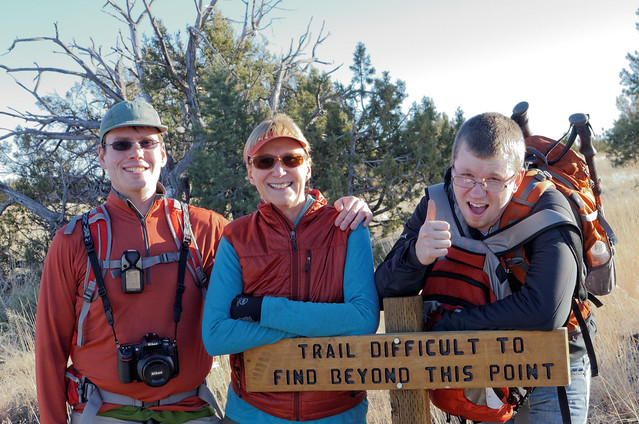
Dan, Jean and Tom on the Mogollon Rim in Coconino National Forest Arizona
… and especially being able to live as I do now, traveling the world with the love of my life.
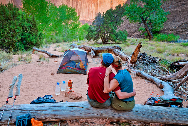
Our campsite on backpack trip through Coyote Gulch in Grand Staircase - Escalante National Monument, Utah


2 comments:
Stunning photos and commentary. Looking forward to some Washington shots. This is a very special state....Bob
Dear Jean,
I'm finally getting around to reading your Grand Canyon blog, and it was certainly worth the wait! I'm glad you and John are having such a great time fulfilling your dream! You are so lucky!
Laurel
Post a Comment