Like many people, at the beginning of the New Year we found ourselves reflecting on the previous year. Last year at this point in time we had just arrived in
New Zealand to begin our three month “adventure in paradise” (to be followed by one month in Australia) and it was definitely a trip of a lifetime. It was the highlight of 2012 and we consider ourselves to be
extremely fortunate to have had this experience.
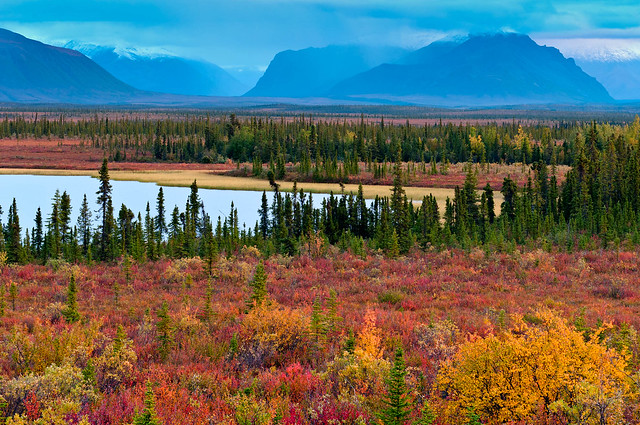
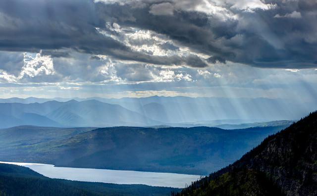
We also found ourselves thinking about the preceding years and other great trips we have done, especially since we first started living and traveling fulltime in our motorhome back in April 2010. The highlight of our first year on the road was the three months we spent in
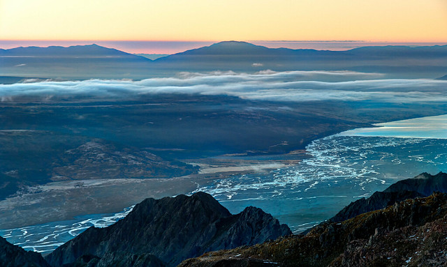
Canada and
Alaska and in 2011 it was the three weeks we spent backpacking on the
John Muir Trail in California.
So what’s next for us? At this point in time we plan to spend the upcoming summer in our “home” state (our domicile), Washington State. We are considering either hiking the portion of the Pacific Crest Trail that bisects the state from north to south or doing the portion of the Pacific Northwest Trail that crosses Washington State from east to west. You can be sure that John will take plenty of photos and I’ll have too much to say about it.
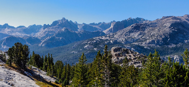
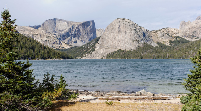
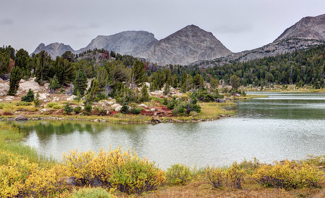
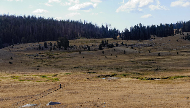
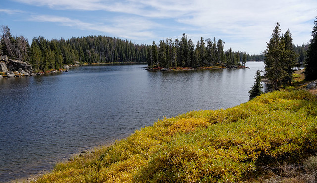
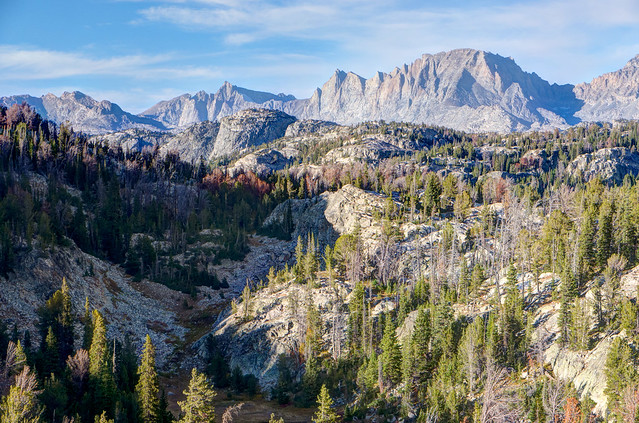
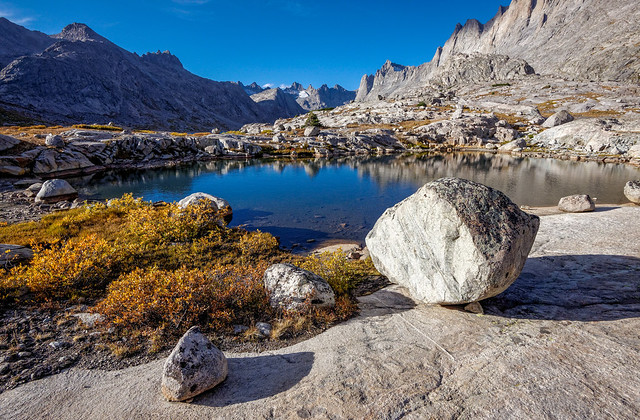
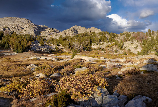
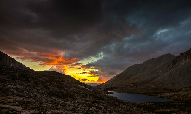
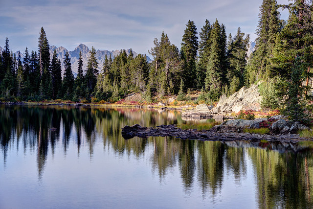
Where we have been - Wind River Range in Wyoming
9/3 - 17 2012
In this post:
We have wanted to visit Wyoming's
Wind River Range for a long time especially the Cirque of the Towers. The Wind
River Range is such a large area and it can accommodate a large number of backpackers without the “crowded feeling” of a National Park. However, the Cirque of the Towers is the best known area, it is especially popular with rock climbers, and is relatively accessible being only about 9 miles from the Big Sandy Lake Campground. With this in mind we decided to wait until Labor Day to start this trip in hopes the crowds would decrease. We also watched the weather forecast very carefully as it is not called the
Wind River Range for nothing.
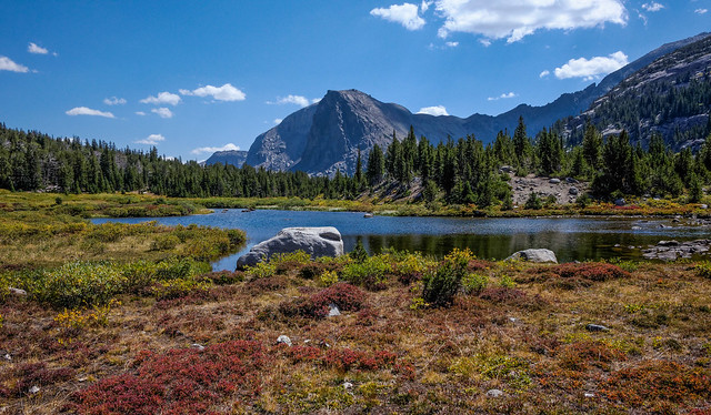
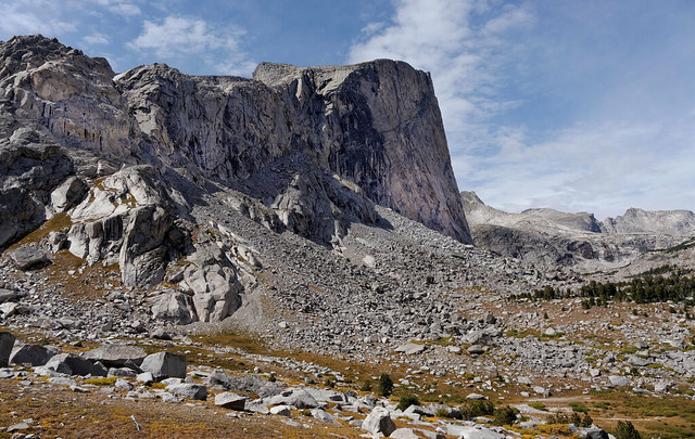
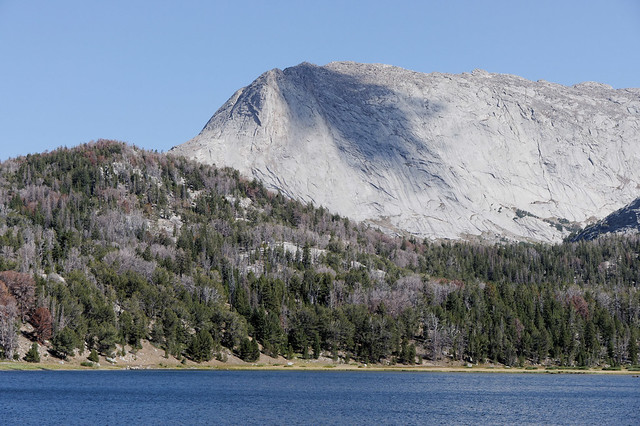 |
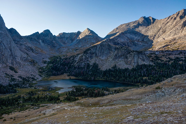
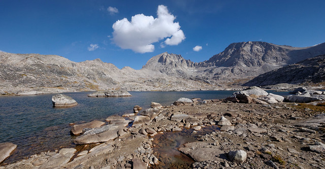
| Haystack Mountain and Big Sandy Lake within the Wind River Range in Bridger National Forest, Wyoming |
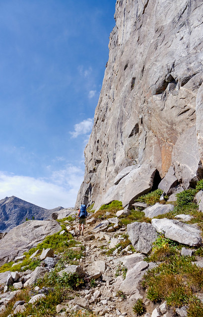
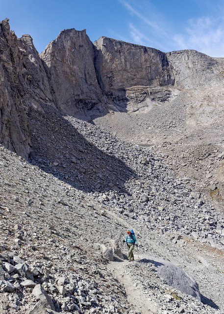
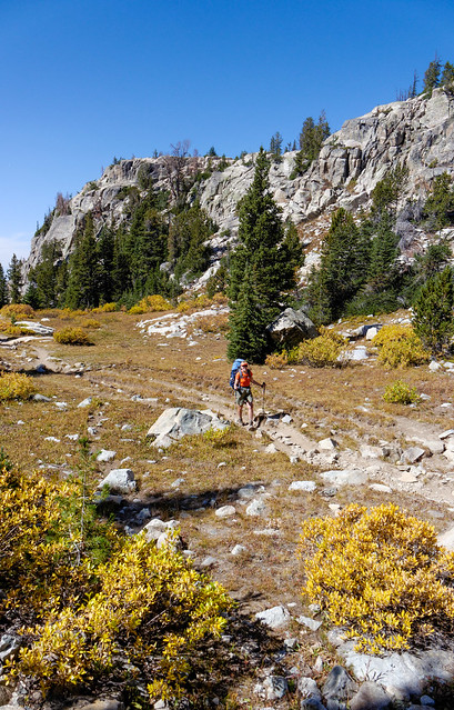
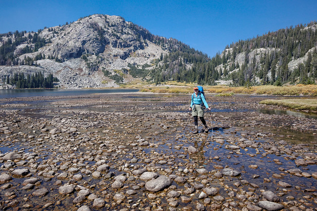
The trail is relatively flat for the first seven miles until it begins the steep ascent to Jackass Pass. Apparently this pass is also known by the nondescript name of “Big Sandy Pass” but at the time "Jackass" just seemed more descriptive.
 |
| Jean on trail to Jackass Pass within the Wind River Range, Wyoming |
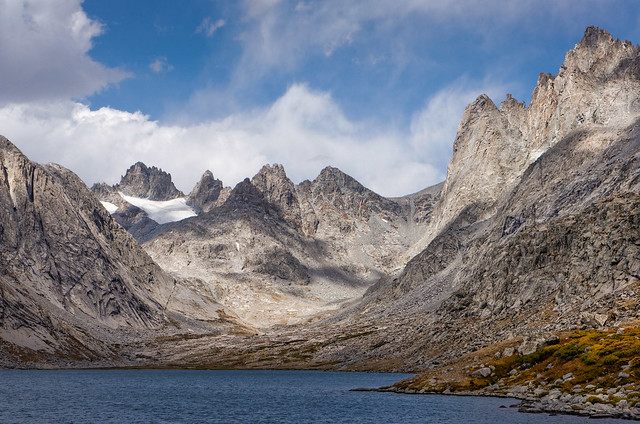
Once we reached the pass we began getting views of some of the notable peaks within the Cirque of the Towers.
 |
| Jean (lower right) approaching the Cirque of the Towers; Watchtowers, Overhanging Tower, Wolfs Head and Pingora Peak |
We could also look back at Arrowhead Lake at the base of Warbonnet Peak
 |
| Looking back at Arrowhead Lake, Warbonnet Peak within the Wind River Range, Wyoming |
As we descended from the pass we could see Lonesome Lake in the distance where many backpackers tend to gravitate
. This area has suffered from gross overuse in the past and camping is prohibited within a quarter mile of the lake.
 |
| Lonesome Lake within the Wind River Range, Wyoming |
We found a private site to pitch our tent not far below the pass and well above Lonesome Lake. This made it easier for John to get out reasonably early for some great photo opportunities. Such as this gorgeous reflection of the Watchtowers, Wolfs Head and Pingora Peak in an unnamed tarn …
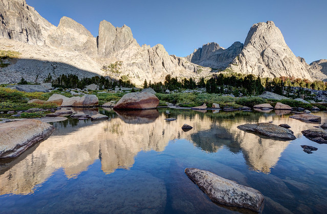 |
| Watchtowers, Wolfs Head and Pingora Peak within the Cirque of the Towers within the Wind River Range, Wyoming |
… as well as Warbonnet and Pylon Peak.
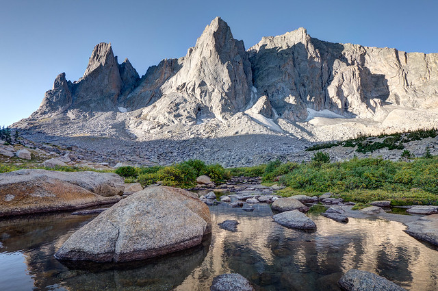 |
| Warbonnet and Pylon Peak within the Cirque of the Towers within the Wind River Range, Wyoming |
The outflow from Hidden Lake creates a beautiful waterfall that is apparently unnamed which doesn't seem quite fair.
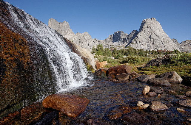 |
| Watchtowers, Wolfs Head, Pingora Peak and Hidden Lake outflow within the Cirque of the Towers |
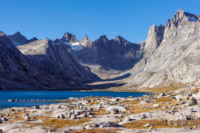
We reluctantly left the area as we believed the Cirque of the Towers would be the highlight of the trip but it was nearly noon and we had miles to go. However, I soon came to realize that it wasn't possible to have one’s eyes open in the Wind River Range and not see something beautiful. As we crossed Lizard Head Meadows we enjoyed the view of Mitchell Peak …
 |
| Mitchell Peak and Lizard Head Meadows within the Wind River Range, Wyoming |
… as well as the unusual Lizard Head Peak and the North Popo River.
 |
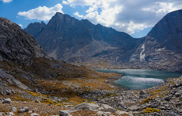
Lizard Head Peak, North Popo River with Cirque of the Towers in the distance within the Wind River Range, Wyoming
|
The trail then climbed steadily toward Lizard Head Plateau and provided different views of Lizard Head Peak as well as Bear Lake below it.
 |
| Lizard Head Peak and Bear Lake in the Wind River Range, Wyoming |
The wind picked up significantly while we continued on the Lizard Head Trail across the broad plateau. I have seen it referred to as "Lizard Head Pass" but it seemed too long and broad to us to be a true “pass”.
 |
| Jean on the trail crossing Lizard Head Pass within the Wind River Range, Wyoming |
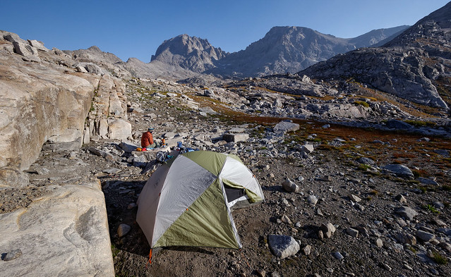
Our leisurely start that day was now working against us as we needed to reach water before stopping for the night. We also hoped to find a tent site that was a bit sheltered from the wind. We were uncertain how far below the plateau/pass we would have to drop before locating a suitable spot. Well, if necessary we could always use headlamps and keep going. It wouldn't be the first time (nor would it be the last). Fortunately, we found a spot not far below the plateau/pass somewhat protected from the wind by some larger rocks and not far from a water source.
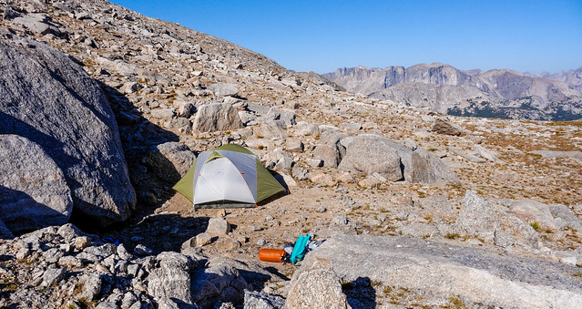 |
| Our campsite below Lizard Head Plateau within the Wind River Range, Wyoming |
It was quite cold that night and neither of us looked forward to the inevitable need to get up and pee. However, the sky was clear and the stars amazingly bright. The Moon was not many days past "full" and still capable of illuminating the entire area. The moonlight removed what little color there was and turned everything a cold grey. It looked and felt the way I could imagine it would look and feel like to be on the surface of Moon.
The next morning was still cold, despite the sunshine, and still windy. The evening before I had done a little “excavating” in a large crack in a rock in a moderately successful attempt to shelter from the wind while we cooked and ate supper. I had hoped we wouldn't need it for breakfast but were once again grateful for it.
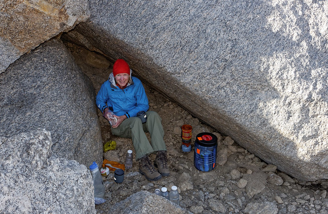 |
Jean hunkered down in some rocks at our campsite below Lizard Head Plateau within the Wind River Range, Wyoming
|
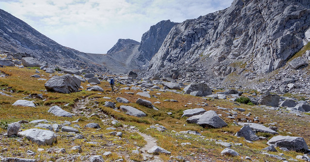
We continued on to the Bears Ears Trail toward the Moss Lake Trail. After the austere beauty of the Lizard Head Trail we looked forward to seeing some green.
 |
Valentine Lake (L) and Dutch Oven Lake (R) seen in the distance within the Wind River Range, Wyoming
|
The trail dropped down into some open trees and took us past Dutch Oven Lake.
 |
| Dutch Oven Lake within the Wind River Range, Wyoming |
We then took the Valentine Mountain Trail which provided us with great views of the Chess Range in the distance.
 |
Chess Range within the Wind River Range, Wyoming
|
The trail continued to drop taking us through denser woods ...
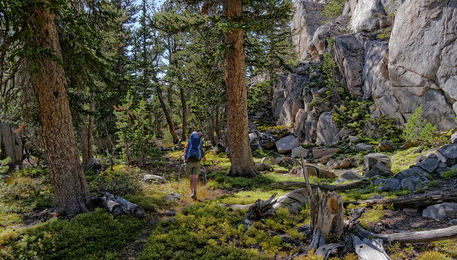 |
| Jean on the trail within the Wind River Range, Wyoming |
... and across the South Fork of the Little Wind River where we rejoined the Bears Ears Trail toward Grave Lake.
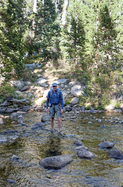 |
| John crossing the South Fork of the Little Wind River within the Wind River Range, Wyoming |
We set up camp reasonably close to Grave Lake but far enough away from others camping in the the area which is apparently popular with hunters and fishermen.
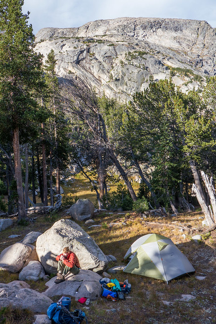 |
| Our campsite at Grave Lake within the Wind River Range, Wyoming |
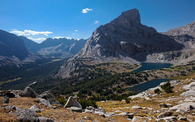
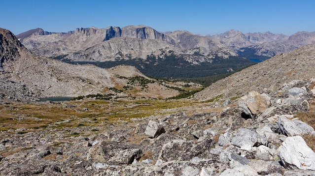
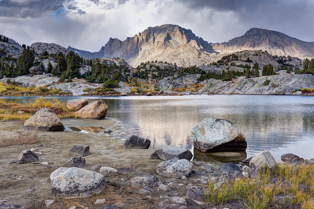
The next day we continued on the trail as it skirted the lake and joined the Hailey Pass Trail. We could see Mt Hooker, the angular peak to the left in the photo below, in the distance and we knew that the trail would go through Hailey Pass just to the left of it.
 |
| Mount Hooker, Grave Lake Dome (Pilot Knob) and Grave Lake within the Wind River Range, Wyoming |
It can be a bit daunting to see something so far in the distance knowing that you have to get there and then continue on for several more miles. But experience has taught us that if we just keep putting one foot in front of the other we can generally reach our goal.
 |
| Jean on the Hailey Pass Trail above Grave Lake within the Wind River Range, Wyoming |
The trail to Hailey Pass climbs steadily out of the trees, through meadows and back to the austerity of higher elevation. Something we really enjoy about backpacking is the variety of terrain we encounter throughout each and every day.
 |
Approaching Hailey Pass within the Wind River Range, Wyoming
|
We also enjoy the sense of satisfaction that comes from looking back and seeing just how far we have come
.
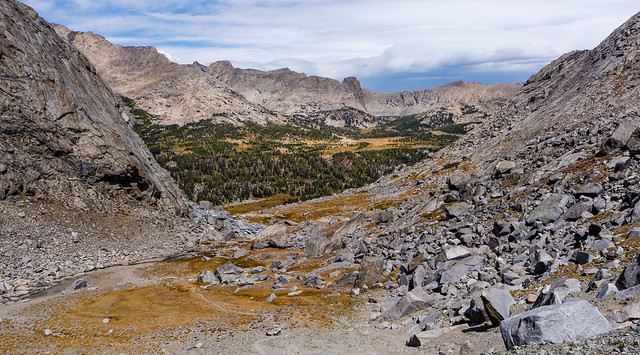 |
Looking back toward Grave Lake from Hailey Pass within the Wind River Range, Wyoming
|
After having seen Mt Hooker in the distance it was interesting to be this close as it looks much less angular from the trail to the pass than it did when we saw it from Grave Lake that morning.
 |
Mt Hooker seen from the Hailey Pass Trail within the Wind River Range, Wyoming
|
The last half mile or so to the pass is steep with loose rocks and pathetic switchbacks, not my favorite sort of trail, but at least it is short and we won't have to go back down this way.
 |
| Jean on the trail approaching Hailey Pass within the Wind River Range, Wyoming |
After crossing the pass the trail first skirts Twin Lakes ...
 |
Twin Lakes seen from Hailey Pass within the Wind River Range, Wyoming
|
... before dropping back toward meadows and forest.
 |
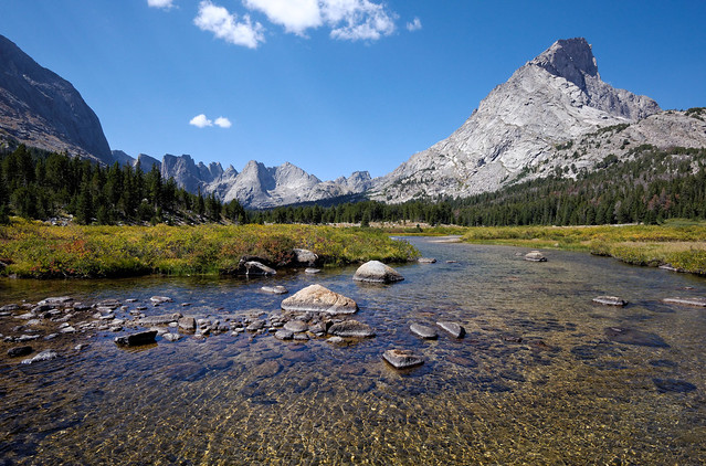
| Approaching Skull Lake within the Wind River Range, Wyoming |
We joined the Pyramid Lake Trail just past the unfortunately named Skull Lake.
 |
| Skull Lake within the Wind River Range, Wyoming |
We continued on the trail through the broad open meadow and under gathering clouds ...
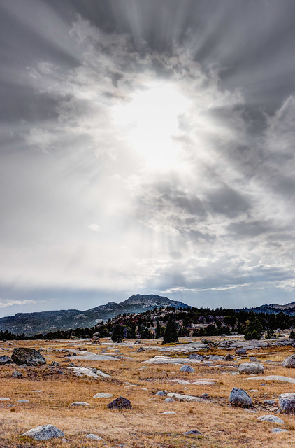 |
| Within the Wind River Range, Wyoming |
... to the lovely Marms Lake where we planned to camp for our last night out.
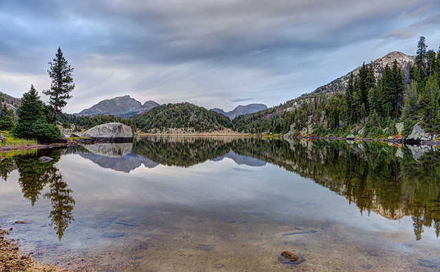 |
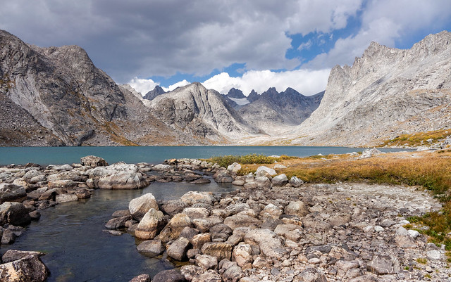
| Marms Lake within the Wind River Range, Wyoming |
The weather encouraged us to put on our rain gear and seek a more sheltered spot before cooking and eating dinner.
 |
| Campsite Marms Lake within the Wind River Range, Wyoming |
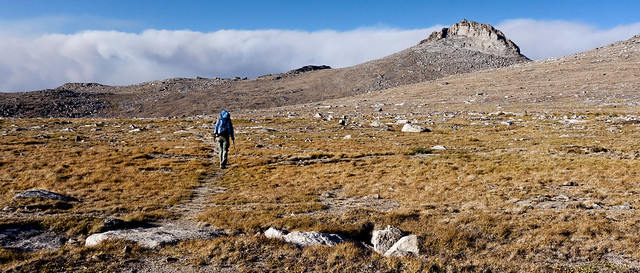
The next day was mostly clear as we headed out toward the Freemont Trail. We are both "mountain people" at heart but can appreciate the contrast that open meadows provide.
 |
| Jean on the Freemont Trail within the Wind River Range, Wyoming |
We were disheartened when we looked back at the mountains. Smoke from one (or more) of the countless forest and prairie fires that was plaguing the American West had created a haze that threatened to obscure them.
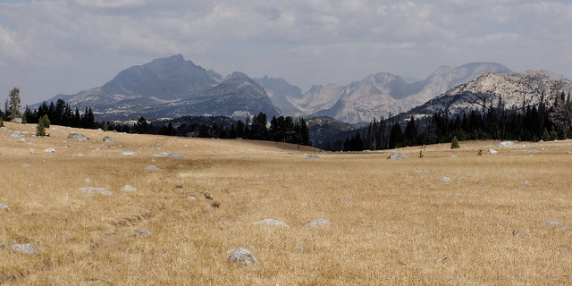 |
| Smoke from forest fires obscuring the distant mountains within the Wind River Range, Wyoming |
However, all things considered, we know we have nothing to complain about on our first and undoubtedly not our last visit to the Wind River Range.
All of our photos from this backpack trip are on Flickr.
 |
| Pylon Peak, Watch Towers, Wolfs Head and Pingora Peak Cirque of the Towers within the Wind River Range, Wyoming |
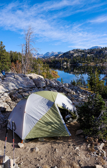
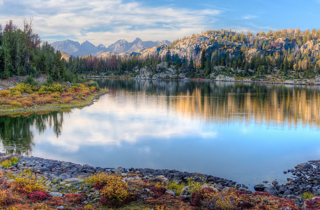
After returning home, cleaning up and getting our gear put away we started making plans for another backpack trip. We watched the weather forecast and a week later we started another 5 day/4 night backpack trip in the Wind River Range within Bridger National Forest, Wyoming.
We started at Elkhart Park on the Pole Creek Trail but took the the side trail to the right and past some very attractive lakes including Miller Lake ...
 |
| Miller Lake within the Wind River Range, Wyoming |
... and Sweeney Lake.
 |
| Sweeney Lake within the Wind River Range, Wyoming |
At the next trail junction we took a short side trip over to the appropriately named "Photographer's Point" (we could have gotten here faster if we had stayed on the Pole Creek Trail but where's the fun in that?).
 |
| The view from "Photographer's Point" within the Wind River Range, Wyoming |
The trail continued to be easy but the views of the mountains gave a "look at things yet to come".
 |
| Mountains coming into view from the meadow within Wind River Range, Wyoming |
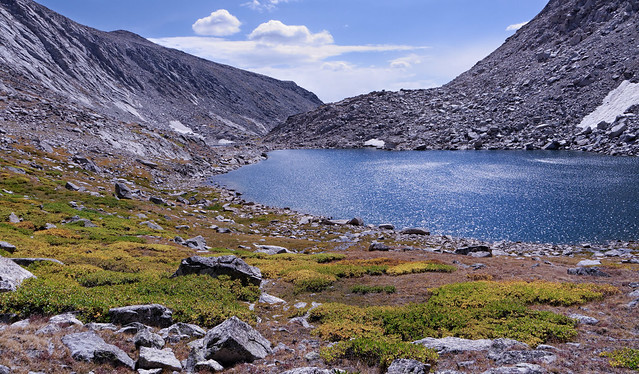
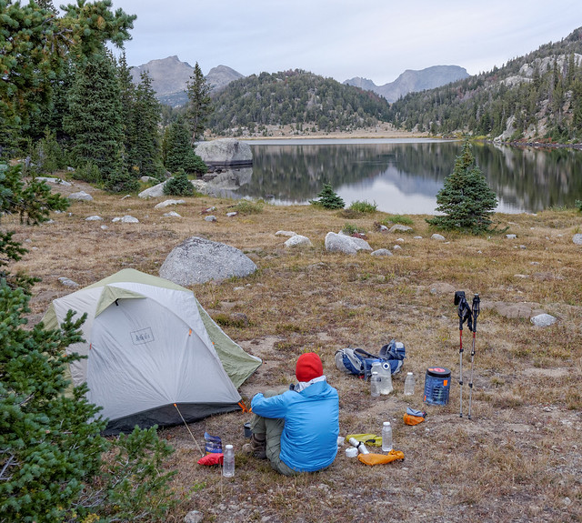
We decided to stop for the night at the lovely Hobbs Lake ...
Hobbs Lake within Wind River Range, Wyoming
... and found a fine campsite that included a "rock with a view" for our "kitchen/dining room".
 |
| Campsite at Hobbs Lake within the Wind River Range, Wyoming |
We were now getting some great views of mountains ...
 |
View from Hobbs Lake area within the Wind River Range, Wyoming
|
... as well as of the changing "moods" of Hobbs Lake. It's funny, we always talk about how much we want to see mountains and can forget how much we enjoy seeing the many lakes located within them.
Hobbs Lake within the Wind River Range, Wyoming
The next morning we continued on toward Indian Basin, our destination for the day.
 |
Seen from the Indian Pass Train within the Wind River Range, Wyoming
|
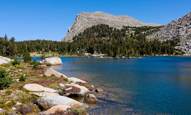
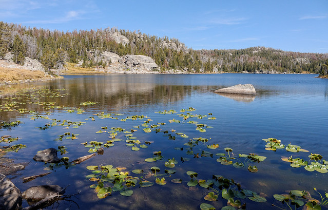
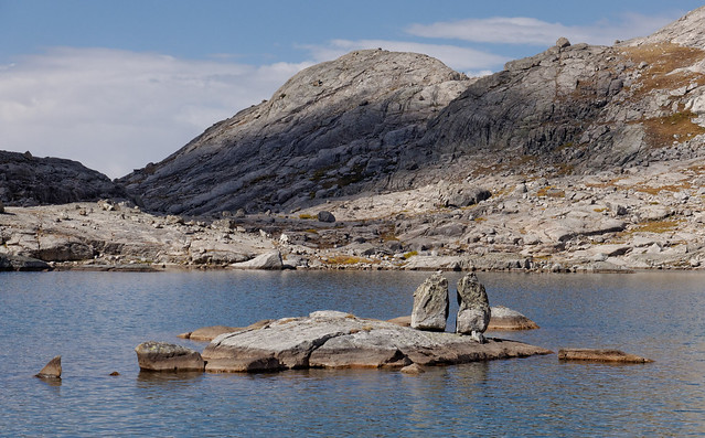
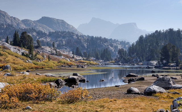
We passed Island Lake on the way. This was apparently a common spot for backpackers to camp as it is easy to dayhike to Indian Basin and Titcomb Basin. However, we prefer to camp closer to such scenic areas in order to be there for late evening and early morning light which tends to be better for photography.
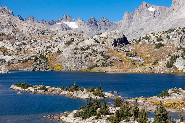 |
| Island Lake within the Wind River Range, Wyoming |
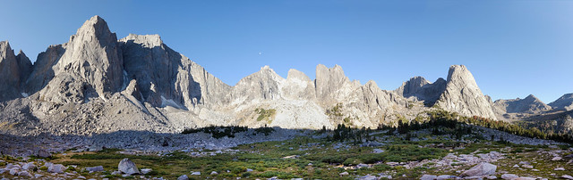
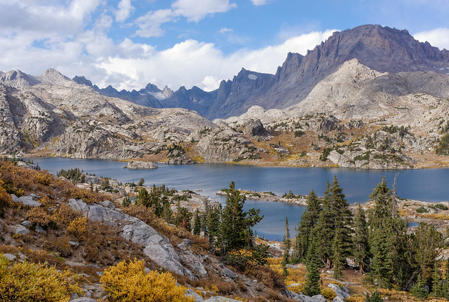
So we continued on toward Indian Basin and had a decision to make when we reached the junction with the Titcomb Basin Trail. We could either continue on or take a side trip to Titcomb Basin. We had planned to go there the following day but the weather forecast we had seen before starting this trip indicated the weather would begin deteriorating in the next few days. However, the weather was good at that moment so we decided to take the time and do a side trip to Titcomb Basin.
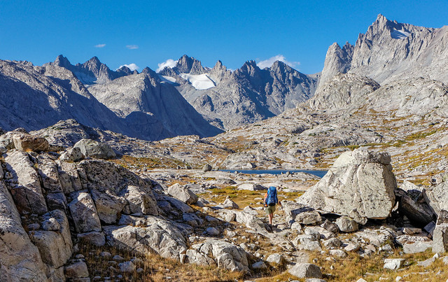 |
| Jean on the trail to Titcomb Basin within the Wind River Range, Wyoming |
And I believe we definitely made the right decision!
 |
| Titcomb Lakes and Titcomb Basin within the Wind River Range, Wyoming |
The late afternoon light created a veritable "light show" with shadows moving quickly across the basin highlighting different facets of the jagged mountains as it went.
 |
Titcomb Lakes and Titcomb Basin within the Wind River Range, Wyoming
|
We then headed back to the Indian Pass Trail toward Indian Basin to look for a place to camp.
 |
Indian Basin within the Wind River Range, Wyoming
|
We felt lucky to find a place that was sheltered from the wind although we had to do a bit of excavating before putting up our tent. It is our preference to use established sites but we had only seen one and it was immediately adjacent to the trail.
 |
| Our campsite near Indian Basin within the Wind River Range, Wyoming |
The next morning we continued up into Indian Basin, first crossing this nearby stream.
 |
| Indian Basin within the Wind River Range, Wyoming |
Before long we began getting views of the basin ...
 |
| Indian Basin within the Wind River Range, Wyoming |
... and the unnamed lakes within.
 |
| Indian Basin within the Wind River Range, Wyoming |
However, the angle of the morning light and orientation of Indian Basin was not the best for photography. It may have been quite good the previous evening and perhaps we should have come straight here. But a photographer cannot be in more than one place at one time so a choice always has to be made. I still believe we had made the right one this time.
 |
| Indian Basin within the Wind River Range, Wyoming |
So we headed out and decided to revisit Titcomb Basin on our way ...
 |
| Titcomb Lakes and Titcomb Basin within the Wind River Range, Wyoming |
... and it was once again the right decision and well worth the time and effort.
 |
| Titcomb Lakes and Titcomb Basin within the Wind River Range, Wyoming |
The weather forecast proved accurate because it took a decided turn for the worst while we headed back to the trail toward Island Lake.
 |
| Wind River Range, Wyoming |
The weather was wet and windy, bad enough that we put on rain pants as well as parkas, something we really prefer to avoid while actively hiking.
 |
| Wind River Range, Wyoming |
Fortunately the squall proved to be temporary and we eventually shed our outer garments. We once again passed Island Lake but under more subdued lighting conditions this time.
 |
| Island Lake within the Wind River Range, Wyoming |
Not far past Island Lake we turned right on the Highline Trail. We knew we had to lose significant elevation to reach our destination for the day which sounds easier than it ended up being. I found the trail a bit annoying as every time we lost some elevation we would go round a bend in the trail only to see it climb again. Once we finally descended into the valley and crossed the bridge at Freemont Crossing we looked for a spot to make camp.
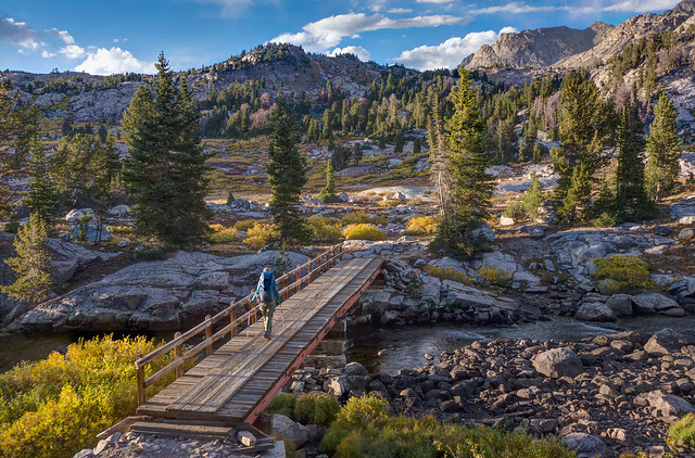 |
| Jean on the bridge at Freemont Crossing within the Wind River Range, Wyoming |
We set up camp in time to be able to enjoy the sight of the dark clouds moving in ...
 |
Clouds moving in over our campsite in the Wind River Range, Wyoming
|
... and the subsequent colorful sunset. We were also treated to the howling of either wolves or coyotes. I really want to believe they were wolves as we used to be able to hear coyotes from our suburban house (and once read about a coyote that got trapped in an elevator in downtown Seattle) so coyotes just don't seem as "wild" to me as wolves.
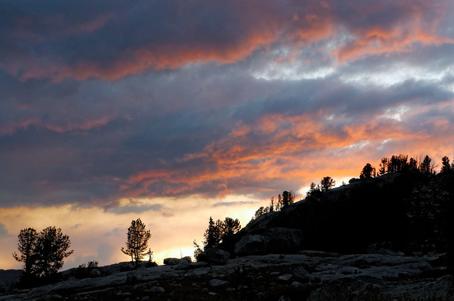 |
| Sunset over our campsite in the Wind River Range, Wyoming |
What we didn't realize was we had set up our tent in a "frost pocket" and awoke to a tent and fly covered in tiny ice crystals. It was a race to get our sleeping bags stuffed before the sun started melting the frost and getting everything wet. The other thing we hadn't realized was that a minor slip I had on the trail the evening before had apparently stressed one of my knees enough that it was now intermittently quite painful.
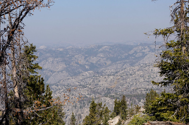
We had planned to take the Highline Trail to the Pine Creek Canyon Trail and be out another two nights but that now seemed out of the question. Fortunately, we were at a location where we could shorten the trip to only 12 miles so we decided to try to hike all the way out. I was unhappy about having to shorten our trip. However, we couldn't ignore the fact that the sky was becoming noticeably hazier, undoubtedly due to distant forest fires so maybe it was time to head home.
 |
| Smoke from distant forest fires beginning to obscure the mountains within the Wind River Range, Wyoming |
We had two options for getting out. My knee wasn't looking forward to backtracking on the trail we had come in on the day before with its tedious ups and downs. So we decided to go the other way that would take us by Lost Lake. This trail doesn't appear on all maps including ours but John had seen it on others so he drew it in (which I admit didn't instill confidence in me). It did take a few false starts to actually get on the right trail where it branches off from the Highline Trail but we finally found it. It was well enough defined after that, at least as far as "The Big Water Slide".
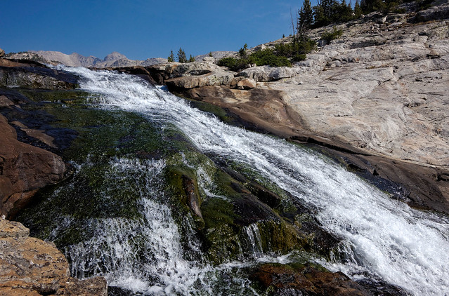 |
Big Water Slide within the Wind River Range, Wyoming
|
However, once past the Big Water Slide the trail became less distinct but we found our way to Lost Lake without too much trouble. After that was another story as the lake is surrounded with a network of crisscrossing "social trails" and it was confusing trying to find the one that would take us back to the main trail.
 |
| Jean crossing the outflow of Lost Lake within the Wind River Range, Wyoming |
Several times we thought we had it only to lose it again. According to the GPS we were really close to the trail so we decided to do a little bushwhacking rather than backtracking too much. My knee wasn’t particularly happy about it but it’s amazing what three Naproxen tablets can do. We finally found the trail but the navigation challenges had chewed up too much time as well as reduced my resolve. So we decided to stay out another night and ended up back at Hobbs Lake in the same spot we stayed our first night.
 |
| Our campsite at Hobbs Lake on our fourth and last night out within the Wind River Range, Wyoming |
The hike out proved uneventful (with the help of three more Naproxen). Although we did encounter a group of heavily armed hunters heading in. They asked if we had seen any bears and seemed relieved to hear that we hadn't. We had been aware that there are bears within the Wind River Range and had come prepared. We kept our food in a bear canister and both of us kept bear spray with us constantly. We also didn't take beef jerky, fish products or anything else that might prove particularly attractive to a bear. I was really grateful that these hunters were on their way in while we were on our way out as I didn't relish the idea of being too close to anyone who is carrying out large chunks of a bloody carcass through "bear country".
We stopped by "Photographer"s Point" on the way out and were dismayed by the smokey haze now obscuring the distant mountains ...
 |
| The view from Photographer's Point on our last day within the Wind River Range, Wyoming |
... and we are so grateful to have had the clear skies that we did for most of this trip. All of our photos from this backpack trip are on Flickr.
 |
The view from Photographer's Point on our first day within the Wind River Range, Wyoming
|
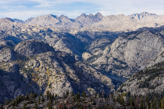
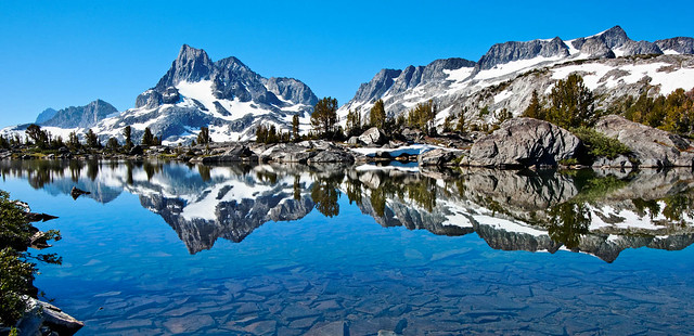
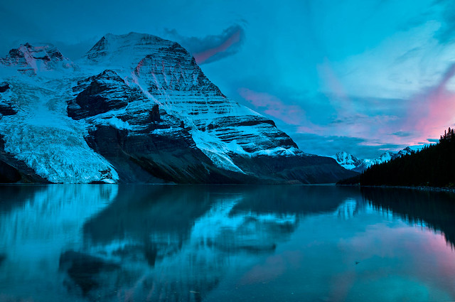
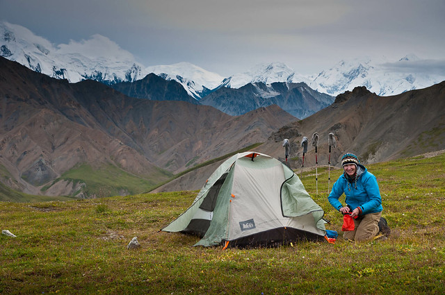
We had thought we would do one last trip in Wind River before leaving Wyoming however my knee issue squelched that plan. But that may have been unrealistic as the weather was getting colder and the days were getting shorter. However, smoke from forest fires continued to be an issue and could have prevented another trip. I was disappointed as it seemed that our "backpacking season" was so short this year, about seven weeks. We had slept out only 20 nights which was less than half of what we did in 2011 (which included 21 nights on the John Muir Trail).
 |
Jean and John on Donahue Pass along the John Muir Trail in Ansel Adams Wilderness, California (September 2011)
|
But then I remembered that we had not one but two "backpacking seasons" in 2012. How could I have forgotten about the 20 nights we spent out while tramping in New Zealand last February and March? When we add those experiences to the five backpack trips we did this summer in Montana and Wyoming then we can't help but see that we had another outstanding year!
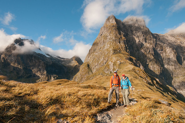 |
| John and Jean in front of Mt Balloon on Mackinnon Pass while on the Milford Track in Fiordland National Park, New Zealand (March 2012). |
This next bit is just something that Jean has been thinking about.
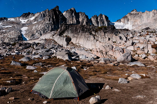
The Art in Backpacking
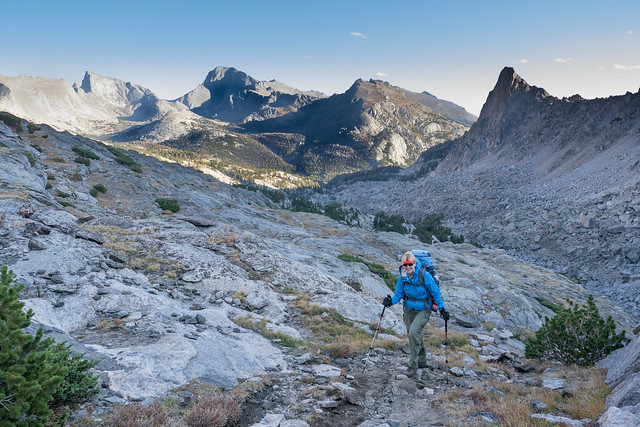
We love to backpack but when I tell that to someone who is not a backpacker it is not unusual for them to look at me like I am crazy. They can’t figure out why anyone, much less a 58 year old woman with bad knees, would willingly carry a heavy pack over rough trails for miles and miles only to sleep on the ground at the end of the day.
 |
| Jean on the John Muir Trail in Sequoia National Park, Wilderness, California |
I don’t know if I can ever make them understand how much we enjoy the sense of independence and self sufficiency; how free we feel. There is also the sense of satisfaction and accomplishment that we both enjoy upon achieving a goal such as reaching a challenging mountain pass. How can I explain the fact that we both glory in our personal strengths; in mind as well as body, when overcoming adversity.
I’ve already written a bit about our “backpacker mentality”, however, it isn’t essential for non backpackers to understand any of that because carrying the pack, hiking on trails and sleeping on the ground is only a means to an end, not the end itself.
Our campsite in the Weminuche Wilderness Area, Colorado
The fact is that the primary reason we backpack is our love of “art”. However, most museums, art galleries, performance halls and theaters are located within large cities; surrounded by traffic, crowded with people and filled with noise. As a consequence we find it is nearly impossible to find the quiet and the solitude that we need to fully appreciate the efforts of the artist.
Jean and a few others viewing the Mona Lisa at the Louvre in Paris, France
Fortunately for us, the works by our favorite artists are not found anywhere in cities. They are displayed in the “Natural World”; our planet's "Museum", where "Mother Nature" is the "Curator". The “works” it contains were all created by the original “Masters” such as “Water” and “Wind”. From the beginning of time, human artists have studied their works and received inspiration from them. These natural creations represent an infinite variety; of colors, textures and shapes so the following collection of photos will serve, at best, as a brief overview.
Perhaps the “works” people are the most familiar with are the colors which, quite literally, represent all of the colors of the rainbow.
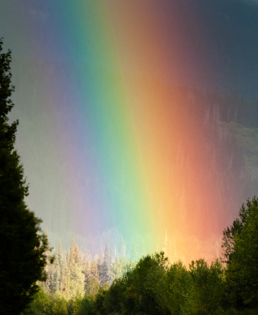 |
| Rainbow seen from the Cassiar Highway in Yukon, Canada |
From warm yellows and oranges…
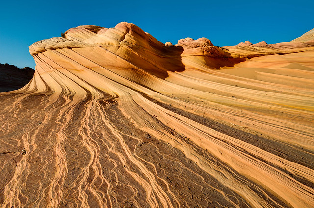 |
The “Second Wave” in the North Coyote Buttes within the Paria Canyon-Vermilion Cliffs Wilderness, Arizona
|
… to cool blues and greens.
 |
| Middle Fork of the Kings River seen along the John Muir Trail in Kings Canyon National Park, California |
Some colors can appear to be sizzling hot …
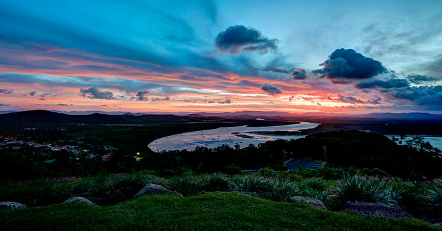
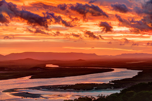 |
| Sunset over the Endeavor River overlooking Cooktown within Queensland, Australia |
… or frosty cold.
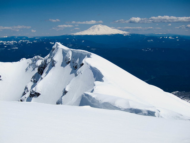 |
| Mt Adams in the distance seen from the summit of Mt St Helens in Mt St Helens National Park, Washington |
Colors can be intense …
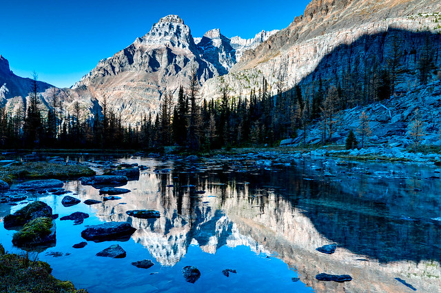 |
| Near Lake O'Hara in Yoho National Park, British Columbia |
… as well as subtle.
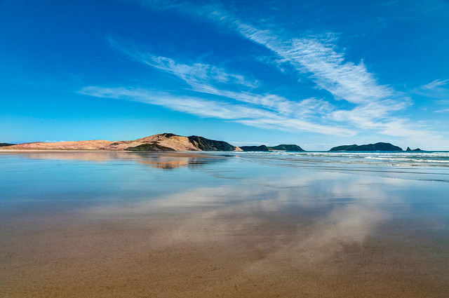 |
| Te Werahi Beach in Te Paki Recreation Reserve at Cape Reinga, New Zealand |
Colors can also be deep ...
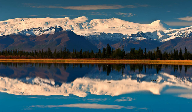 |
| Wrangell Mountains in Wrangell – St Elias National Park, Alaska |
… or appear much more muted.
 |
| Mokowanis Lake in Glacier National Park, Montana |
Colors are combined in countless unique combinations in the "Natural World". Blue skies and green grass is the common theme that we are well familiar with ...
 |
| Sunset over the Endeavor River overlooking Cooktown in Queensland, Australia |
... but the sky is not always blue ...
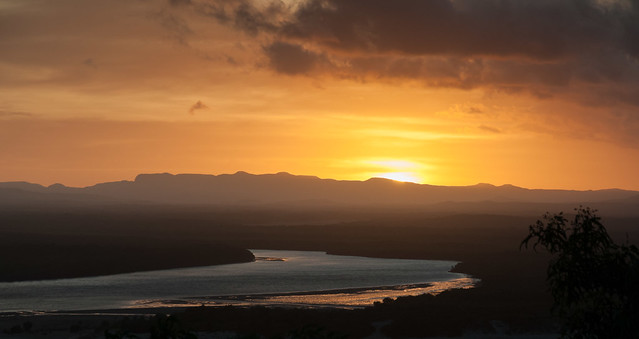 |
| Sunset over the Endeavor River overlooking Cooktown within Queensland, Australia |
... just as the ground is not always green.
 |
| Storm moving in over the Wrangell Mountains within Wrangell – St Elias National Park, Alaska |
There are also "works" exhibiting a wide assortment of textures contained within this "Museum" ranging from smooth as glass, …
 |
| Banner Peak seen from the John Muir Trail in the Ansel Adams Wilderness, California |
… to rippled ...
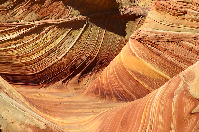 |
| “The Wave” in North Coyote Buttes within the Paria Canyon-Vermilion Cliffs Wilderness, Arizona |
... and rough.
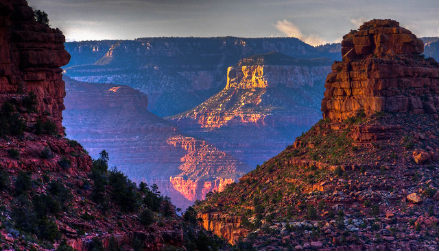 |
| Sunset over Grand Canyon seen from the Bright Angel Trail in Grand Canyon National Park, Arizona |
In addition there is great diversity exhibited in the form and scale of many "works of art" displayed in the "Natural World" and items within this “collection” can be angular, ...
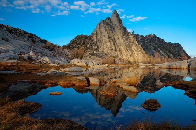 |
| Prusik Peak and Gnome Tarn within "The Enchantments" in Alpine Lakes Wilderness, Washington State |
… or gently curved.
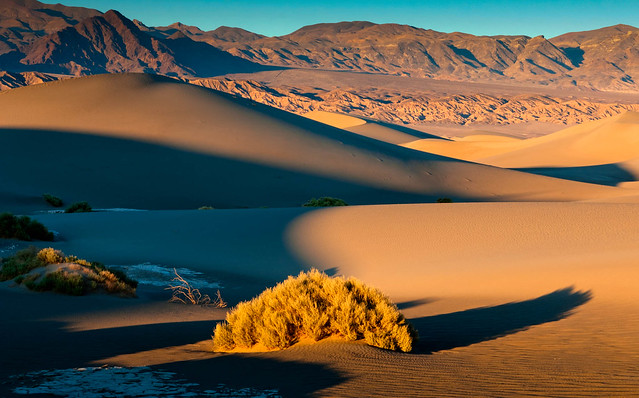 |
| Mesquite Flat Sand Dunes in Death Valley National Park, California |
While some have been built up from the inside out …
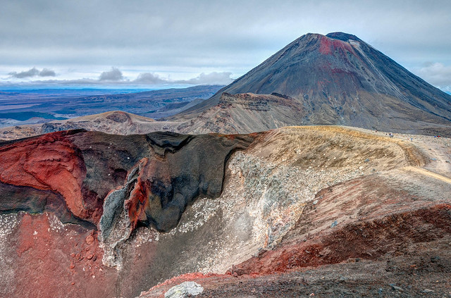 |
| Mt Ngauruhoe and Red Crater in Tongariro National Park, New Zealand |
… others have been carved out to become lofty and expansive …
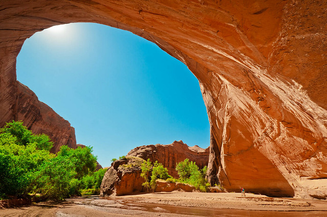 |
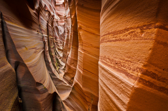
| John and Jean (lower right) in one of the alcoves along Coyote Creek in Grand Stair Case – Escalante National Monument, Utah |
… or to be broad and deep.
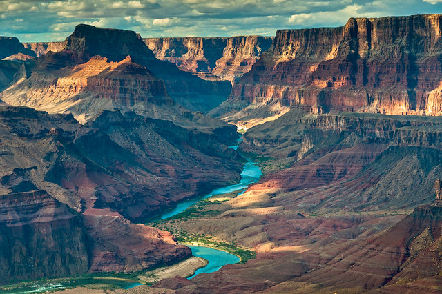 |
| Grand Canyon and the Colorado River seen from the Tanner Trail in Grand Canyon National Park, Arizona |
What other natural "sculptures" lack in stature, ...
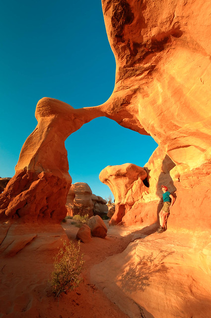 |
| Metate Arch in Devils Garden within Grand Staircase – Escalante National Monument, Utah |
... their intricacy …
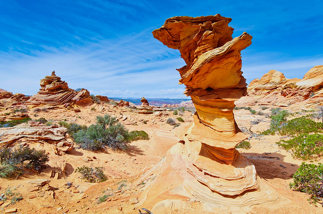 |
| Seen in South Coyote Buttes within the Paria Canyon-Vermilion Cliffs Wilderness, Arizona |
… and their intimacy more than makes up for it and they are no less impressive.
 |
| Zebra Canyon in Grand Staircase – Escalante National Monument, Utah |
The "works" within the “Natural World” are not limited to the “Visual Arts” as there are also numerous examples of the “Performing Arts” as well. The sky provides the stage for some "gifted performers" and we have marveled at the incredible "talent" exhibited by meteors during the night and a pair of courting hawks during the day. However, water is unsurpassed when it comes to versatility as a “performer”. It possesses an extensive "repertoire" being adept at rising delicately into the air …
 |
| Lower Emerald Lake in Tongariro National Park, New Zealand |
… and falling lightly from the sky.
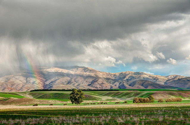 |
| Rain falling over the Lindis Valley, New Zealand |
Water is also skilled at gently floating ...
 |
| Fairy Falls in the Columbia River Gorge, Oregon |
… and gracefully flowing across a "stage".
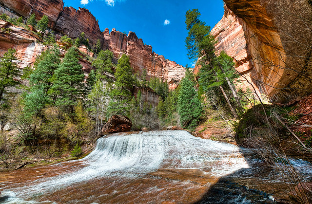 |
| Left Fork of North Creek waterfalls just below "The Subway" in Zion National Park, Utah |
In addition, "performances" by water can be quite dynamic …
 |
| Palisade Creek along the John Muir Trail in Kings Canyon National Park, California |
… as it is not only capable of lively skips, ...
 |
| The Surge Pool at Pancake Rocks in Punakaiki, New Zealand |
... but is known for its ability to leap, achieving great height, …
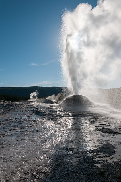 |
| Lion Geyser in Yellowstone National Park, Wyoming |
… and to execute dramatic dives over cliffs.
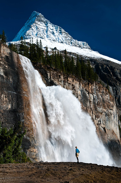 |
| Emperor Falls in Robson Provincial Park, British Columbia |
I must admit that many of the photos above were taken from places that can be very easily reached without backpacking. Countries, especially the US, have created National Parks, Monuments, etc and have built roads and constructed short trails to many notable natural “works of art”. However, in our mind, what can be seen from these pull outs and overlooks, Mt Whitney in this case, ...
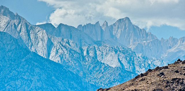 |
| Mt Whitney seen from the Eastern Sierra Interagency Visitor Center near Lone Pine, California |
… pales in comparison to the views of those very same features that we have had while backpacking.
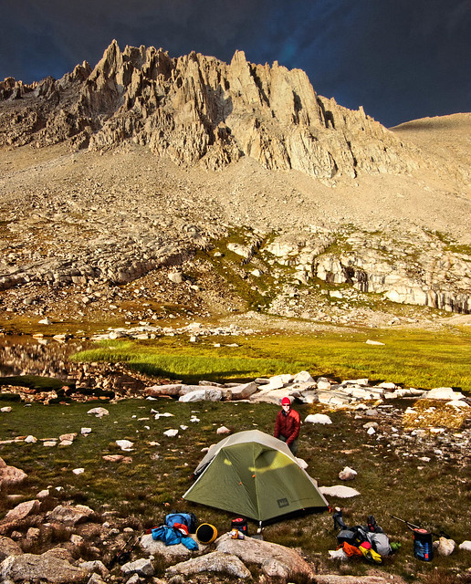 |
| Sunset over our camp below Mt Whitney along the John Muir Trail in Sequoia National Park, California |
Backpacking makes it possible for us to be in stunning locations at those times when the sun is "performing" at its best; in the early morning …
 |
| Sunrise over the Tasman River Valley seen from Mt Oliver in Aoraki/Mt Cook National Park, New Zealand |
… as well as late in the day, during what photographers call the “Golden Hour”,…
 |
| Sunset seen from the Tanner Trail in Grand Canyon National Parks, Arizona |
… before the sun concludes its "performance" ...
 |
| Sunset over Guitar Lake seen from the John Muir Trail in Sequoia National Park, California |
... and prepares to leave the "stage" for the night.
 |
| Sunset over Mt Robson and Berg Lake in Mt Robson Provincial Park, British Columbia |
However, the "show" doesn’t end there. Without the competition of the artificial light that is prevalent in populated areas the stars who make "appearances" on clear night skies are simply dazzling.
 |
| Our campsite within "The Enchantments" in Alpine Lakes Wilderness, Washington State |
Backpacking has also enabled us to hear some amazing "recitals" by local "vocalists". We have thoroughly enjoyed listening to the mournful howling of wolves and the enthusiastic yipping of coyotes. Our favorite "virtuosos" are the bull elk when they “serenade” the elk cows throughout the night in autumn.
In addition there are the “instrumentalists” we have enjoyed listening to from the comfort of our tent. The range of "Wind" can vary from a soft whisper through trees to a loud whistle through mountains. "Performances" by "Thunder" have enthralled us through more than one night.
 |
| The Esplanade in Grand Canyon National Park, Arizona |
Although we do appreciate it when the "concert" is concluded in time for us to leave our tent and eat our breakfast in quieter (and drier) conditions.
 |
| Lake MacDonald seen from the Sperry Campground in Glacier National Park |
Backpacking also enables us to spend time more exploring the remote "corridors" of the “Natural World” viewing more "masterpieces" and attending more of the “performances” by the “resident artists”. Backpacking can provide us with both the quiet and solitude that we desire.
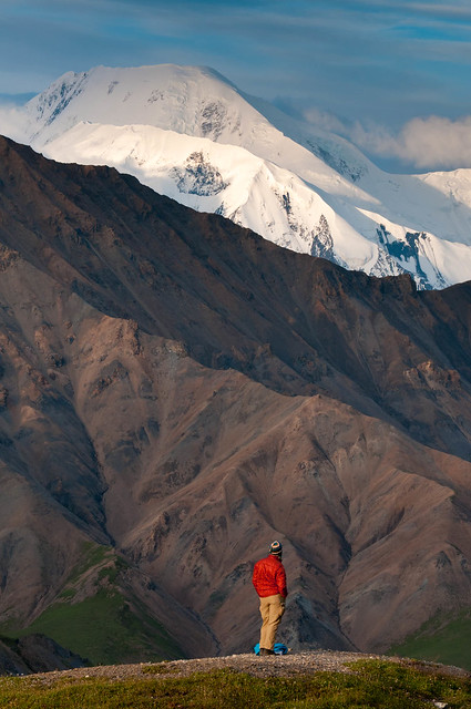 |
| Jean and Mt Mather in Denali National Park, Alaska |
I am happy that the “Natural World” makes many of its exhibits more accessible to those who are unable or simply disinclined to carry a heavy pack on rough trails for miles and sleep on the ground. Nevertheless, to us, so much of what is more accessible by roads or walkways and short trails …
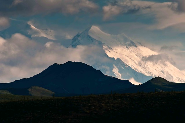 |
| Mt McKinley seen from the road in Denali National Park, Alaska |
… will never compare to the “masterpieces” that can be seen and the “performances” ...
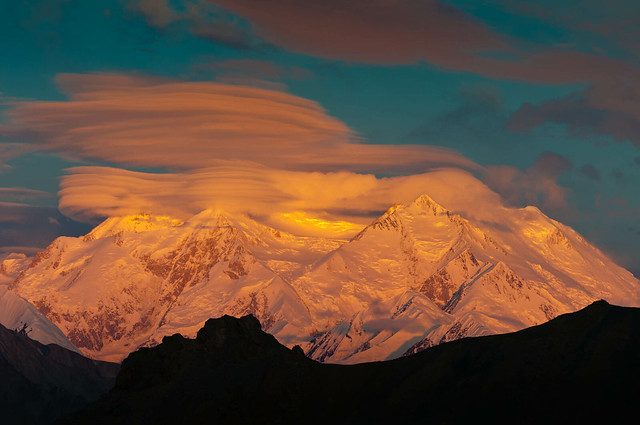 |
| Sunrise over Mt McKinley seen from Eielson Pass in Denali National Park, Alaska |
...
that can be experienced in the backcountry.
Our campsite on Eielson Pass in Denali National park, Alaska


4 comments:
Oh My God...What photos and story! So amazing they gave me goose bumps several times. Wonderful....Bob
Terrific images of an incredible variety of terrains! Your "Art in backpacking images offer a well-chosen variety of exceptionally beautiful and colorful visual experiences. Thank you for sharing them with those of us unable to visit these places.
I found your blog looking for ideas for a Grand Canyon backpack outing. I am moved and invigorated by your stories and photos!
Incredible post, photos are excellent and loved the trail details... Heading into the Winds next week to see some of the same areas... this was a great warm up.. Thanks Jeff
Post a Comment