When I use the word "privilege" I am thinking of this definition; "An especially rare or fortunate opportunity; the good fortune (to do something)". Over the past eleven years we have been extremely fortunate in the opportunities we have had to travel. We've hiked to the top of Mt Kilimanjaro in Tanzania, we've hiked up the Khumbu Valley in Nepal and we have hiked the Inca Trail to Machu Picchu in Peru. We felt privileged to be allowed to visit these iconic locations that have such spiritual significance for the local people. We had a similar feeling when we were allowed to visit the Havasupai Indian Reservation to see the pale turquoise water of Havasu Creek and its iconic waterfalls (described below). However, the word "privilege" has another definition that has, in my mind, a more negative connotation, "A particular benefit, advantage, or favor; a right or immunity enjoyed by some but not others; a prerogative, preferential treatment." To me, the latter definition is better suited for the word "entitlement" and, unfortunately, in our travels we have encountered other travelers who obviously felt they were entitled to do whatever they wanted from showing a distinct lack of consideration by playing loud music to wanton destruction by carving their initials in rock. To me these iconic natural wonders, including those contained within our own public lands, are holy places and it saddens, even angers me when other visitors abuse the privilege of being allowed to visit them. To me, every time we go into the backcountry it is an especially rare and fortunate opportunity, it is a true privilege for which we are are very grateful.
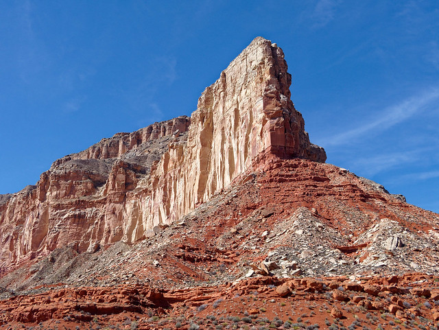
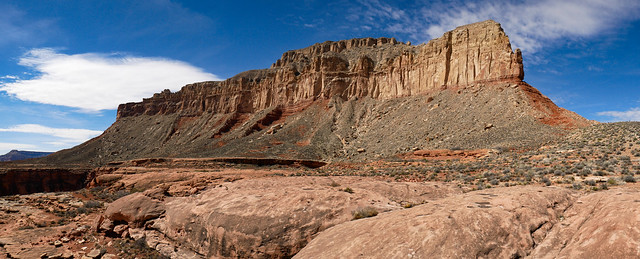
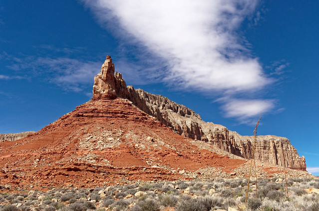
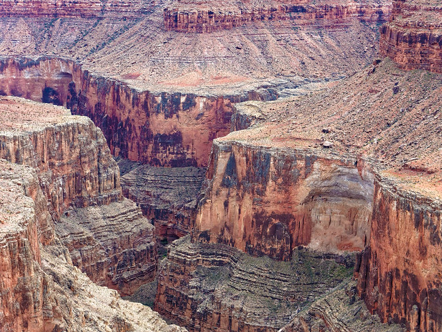
Where we have been – Grand Canyon, Arizona
2/26 – 4/30 2018
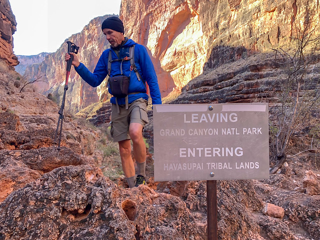
Havasupai Indian Reservation
Grand Canyon National Park
- 6 day/5 night backpack trip on the Tuckup Trail - eastern portion
- 6 day/5 night backpack trip on the Tuckup Trail - western portion
- 4 day/3 night backpack trip on the Thunder River and Deer Creek Trails
- Day hike on the Tanner Trail
- 6 day/5 night backpack trip on the Royal Arch Loop
The Havasupai Tourism Office in Supai, Arizona
Last year they had an online reservation system of a sorts which apparently crashed under the onslaught of individuals trying to obtain permits. However, this year they introduced a robust website that was purported to be able to handle 100,000 inquiries at once. We were hoping to go in late February which worked best with our other plans. An additional advantage for us was that February is reported to be the least popular time to go so in theory should not fill up as quickly as the more popular summer months. So, on February 1st I, along with countless others all around the world, waited anxiously while repeatedly refreshing our screens. Then right at 8:00, when the site became active, I was able choose our dates and obtain our permit for late February. We booked our reservation for the maximum time allowed on a single permit; four days and three nights. I later read that the entire season was largely booked within ten minutes (with only an odd night here and there still available).

If you want to go to the Havasupai Indian Reservation to see Havasu Falls etc:
- Reservations for the campground open each year at 8:00 AM on February 1st (Arizona time)
- Your best option is to go to the Havasupai/Havasu Falls Campground Reservation website
- OR you could try calling the Havasupai Tourism Office at (928) 448-2121
- Reservations for the Havasupai Lodge in Supai open each year on June 1st (for the following year) and can only be made by calling (928) 448-2111 or (928) 448-2201
- There is a Facebook Group devoted to Havasupai and Havasu Falls
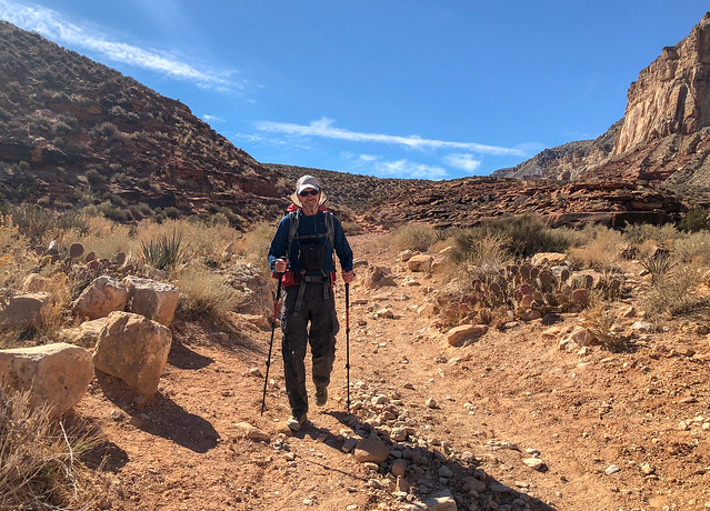
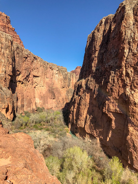
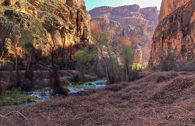
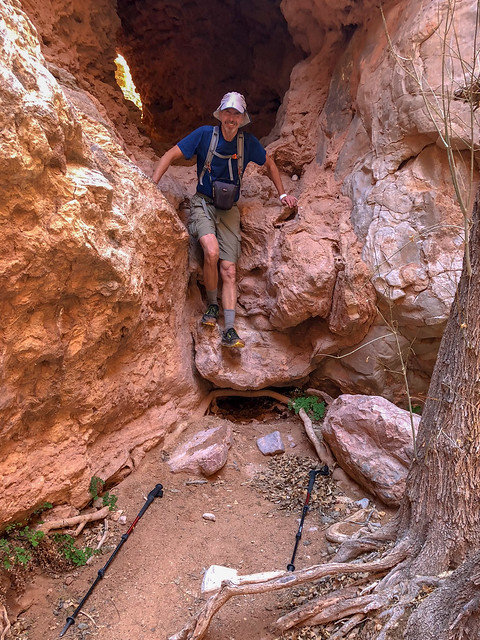
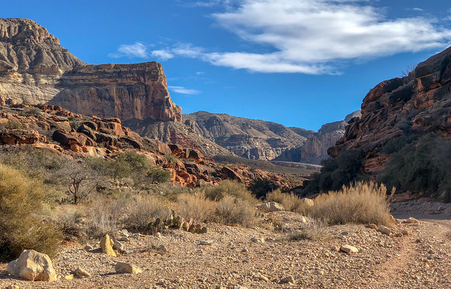
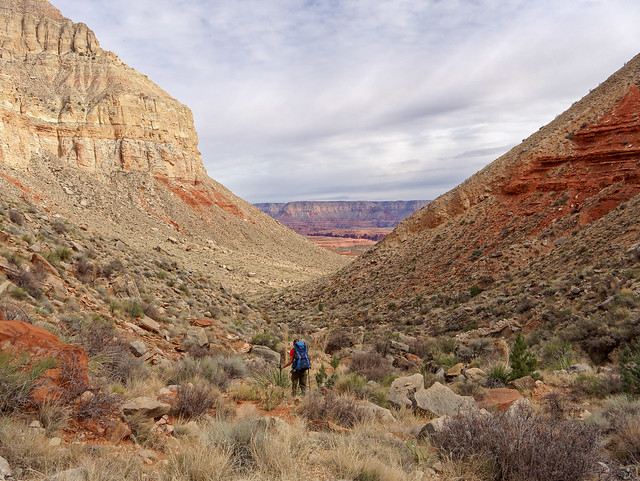
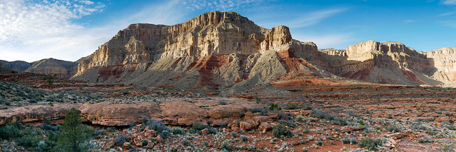
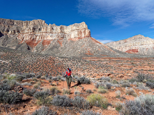
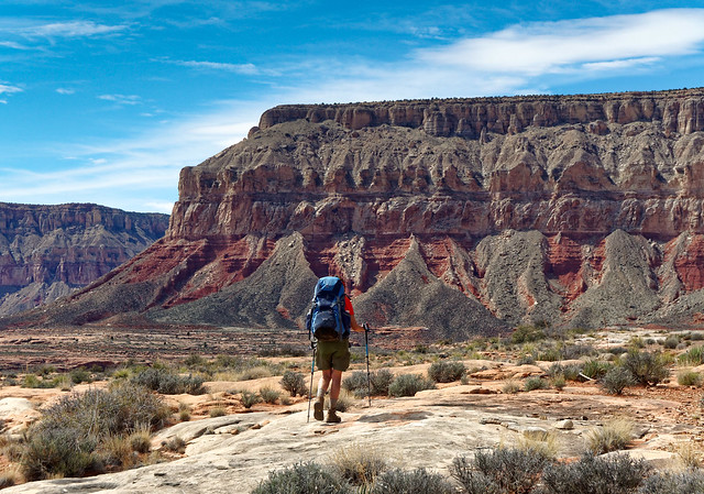
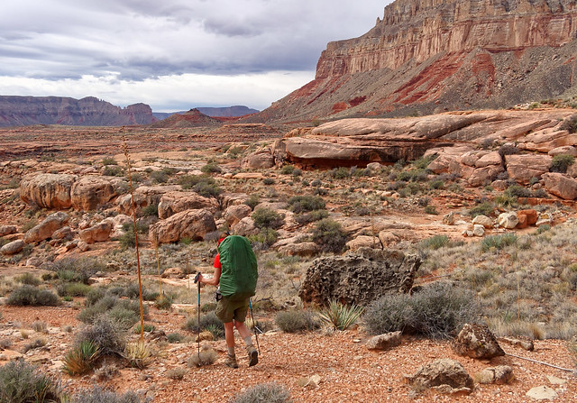
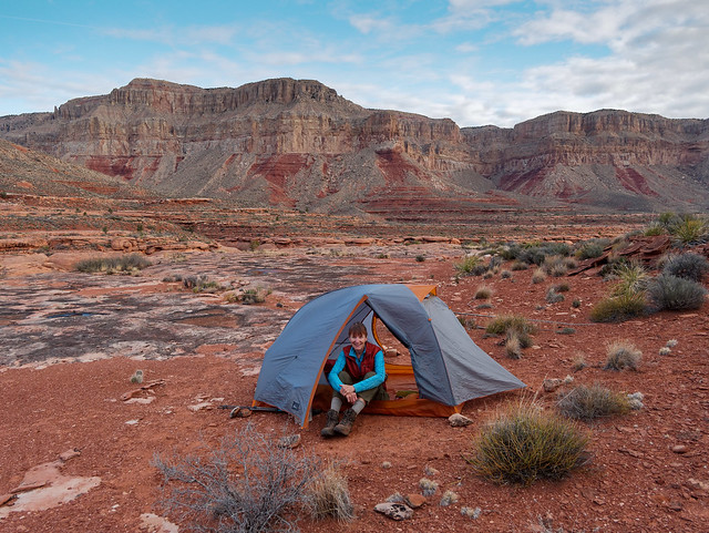
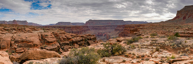
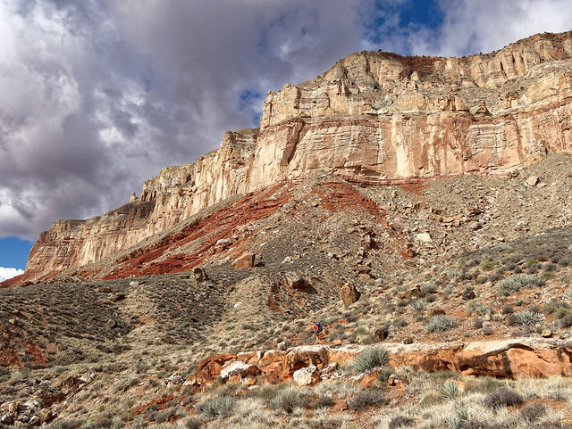
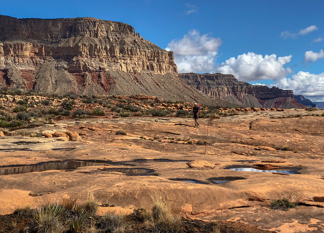
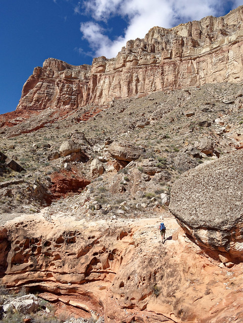
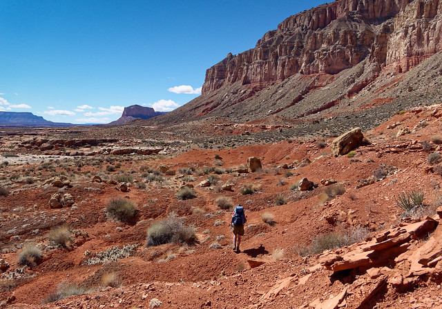
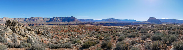
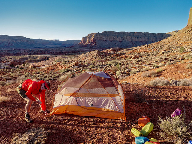
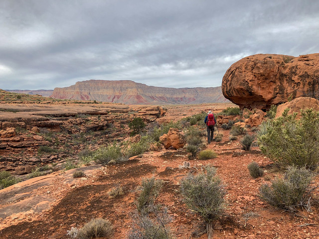
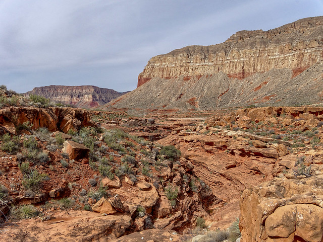
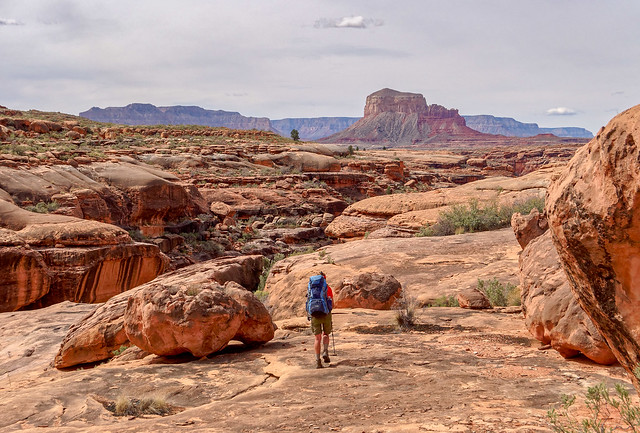
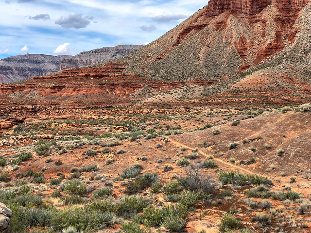
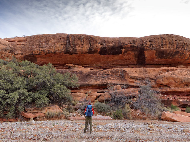
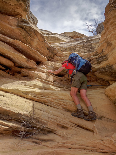
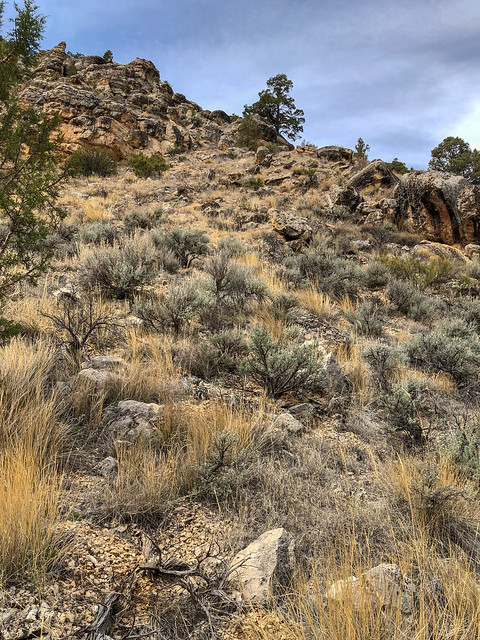
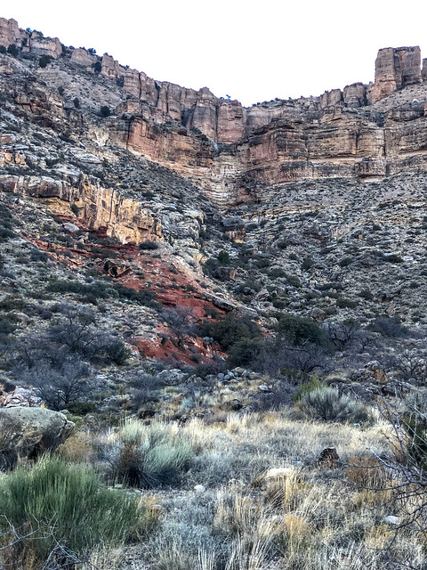
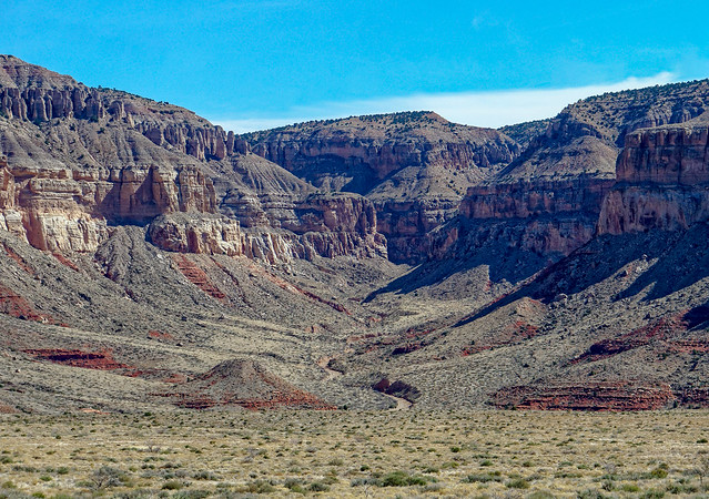
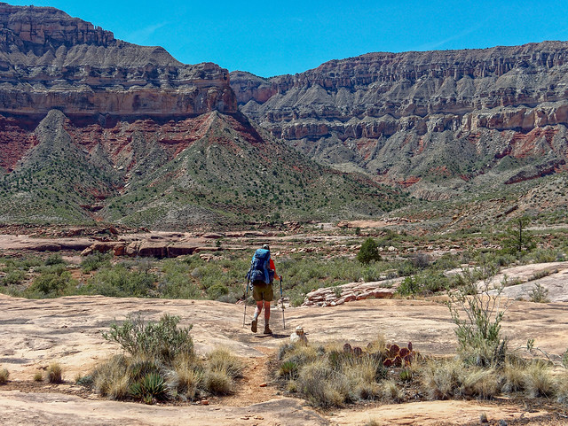
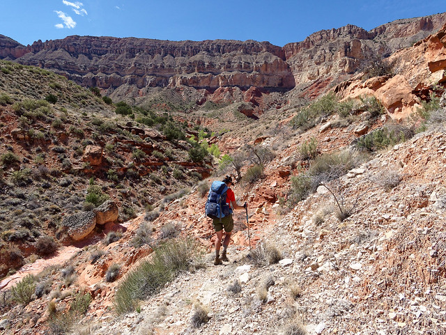
This was our first visit to Havasu Falls but we knew enough about what this has become to know to not expect a "backcountry experience". However, it is an iconic location that every backpacker should probably visit at least once. It was also our first of what we hoped would be many backpack trips this season so we were just happy to be on a trail once again. The ten mile hike to the campground begins at Hualapai Hilltop and expansive views of the canyon begin immediately.

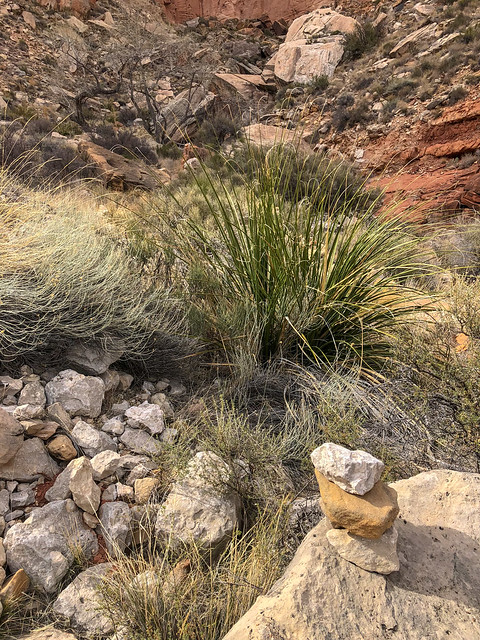
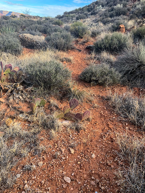
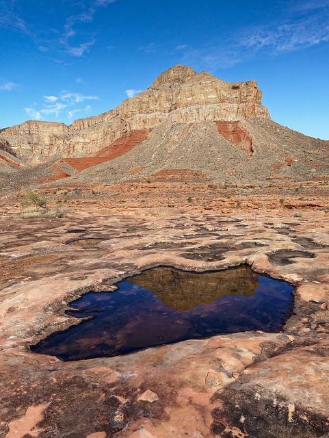
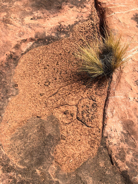
Seen while hiking in the Havasupai Indian Reservation, Arizona
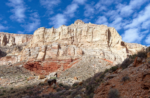
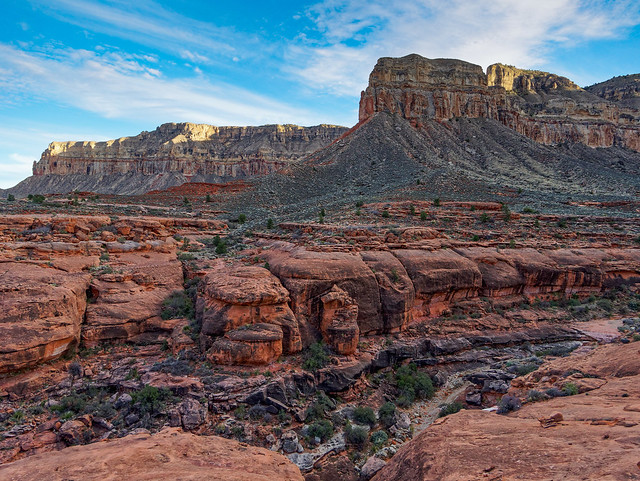
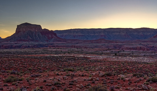
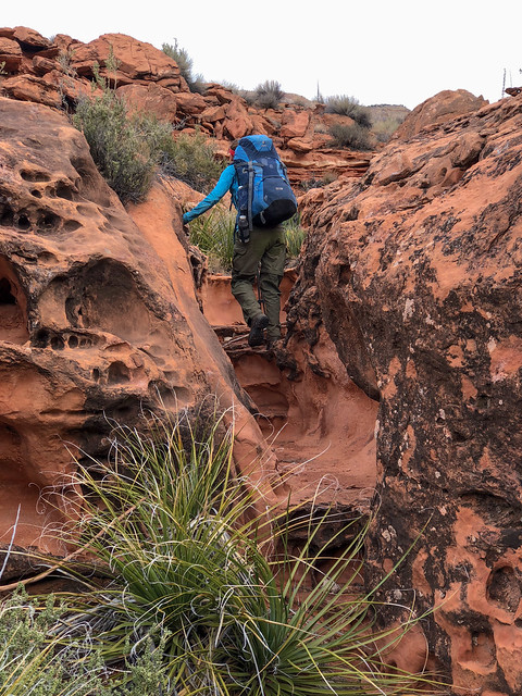
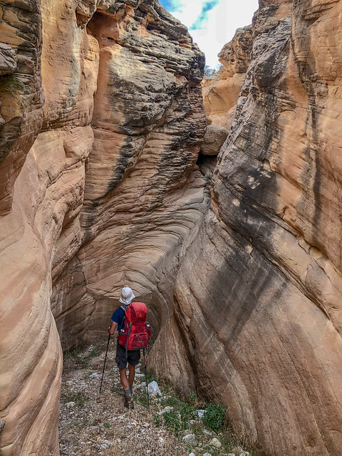
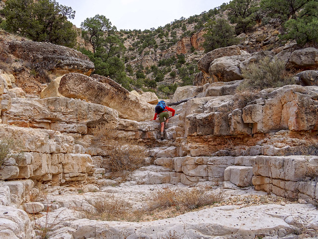
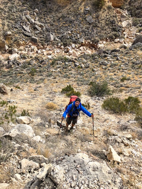
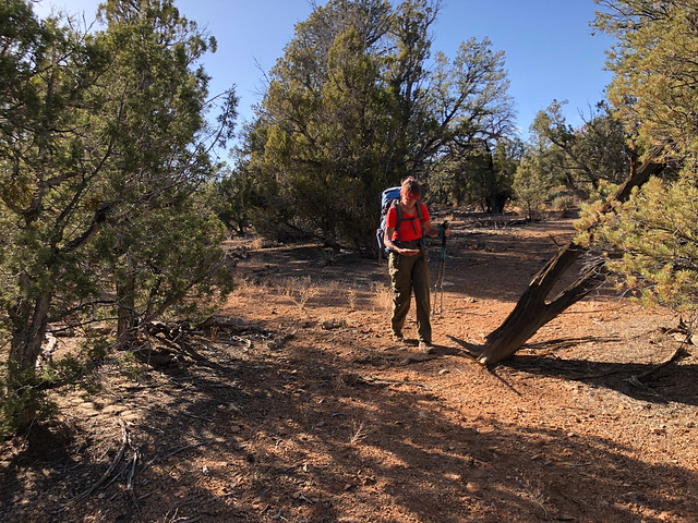
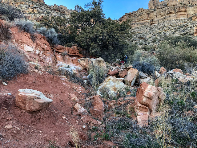
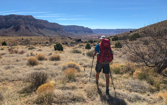
The hike down into Havasu Canyon was pleasant. It was late February and the weather was clear and the temperature crisp. The trail traverses a bit ...

Jean hiking in the Havasupai Indian Reservation, Arizona
... before a series of switchbacks take you deeper into the canyon.

Jean hiking in the Havasupai Indian Reservation, Arizona
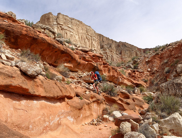
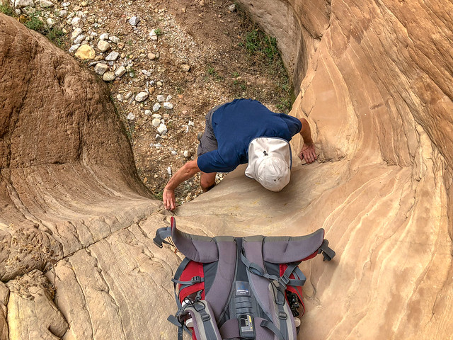
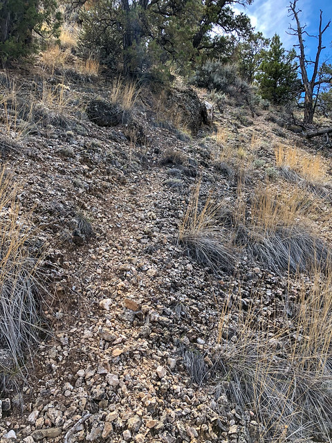
It is then a gradual descent ...
John hiking in the Havasupai Indian Reservation, Arizona
... with the canyon walls seeming to rise above you.
John hiking in the Havasupai Indian Reservation, Arizona
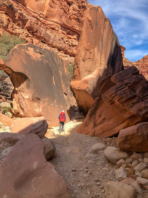
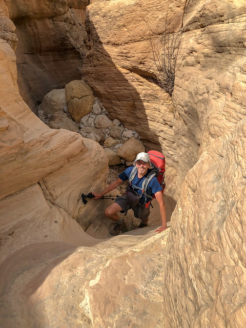
In eight miles you reach Supai and from the moment we first approached this remote village John and I both had the feeling we were on another international trip visiting a culture far different from our own. Not only did our pale skin put us in the minority there was a large number of international visitors speaking languages other than English.

Jean hiking in the Havasupai Indian Reservation, Arizona
While I had been aware the tribe uses helicopters to transport people and goods in and out of the canyon I had not translated that into regular helicopter traffic overhead. It was the one annoyance during the hike down. It reminded us of being on trails in Grand Canyon National Park unfortunate enough to be within the "flight zone".

Supai within the Havasupai Indian Reservation, Arizona

Supai within the Havasupai Indian Reservation, Arizona

Seen while hiking in the Havasupai Indian Reservation, Arizona
Because the Havasupai Indian Reservation has become such a popular destination it attracts tourists from all over the world, most who are not experienced hikers and backpackers. While the hike in and out of the canyon carrying our own packs was no big deal for us some choose to pay the cost of a helicopter ride.
Supai within the Havasupai Indian Reservation, Arizona
Others will hike in and out of the canyon but pay to have their packs hauled in and out on horses. This is a very controversial issue as there have been long standing concerns about animal abuse. More information is available at Save the Havasupai Horses. I had a horse in my youth so I did look closely at them as they went by. Many appeared thinner than horses I have been accustomed to seeing and it was obvious they are not groomed so they have an "unkempt" look to them but we did not witness any overt abuse.
Seen while hiking in the Havasupai Indian Reservation, Arizona
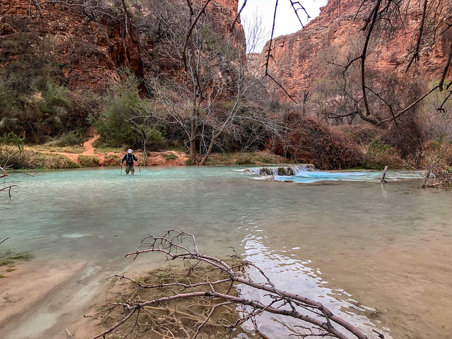
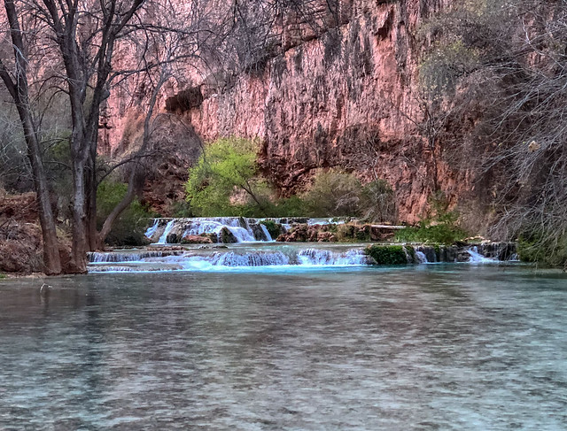
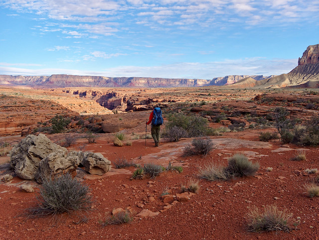
After leaving Supai it is another two miles to the campground. Havasu Creek comes into to view providing visitors with a tiny glimpse of what is yet to come.

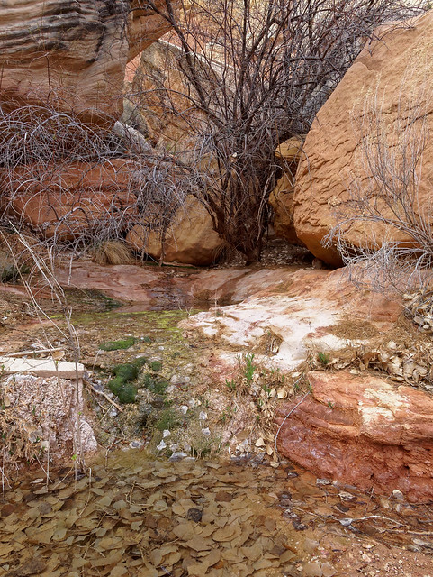
Havasu Creek seen while hiking in the Havasupai Indian Reservation, Arizona
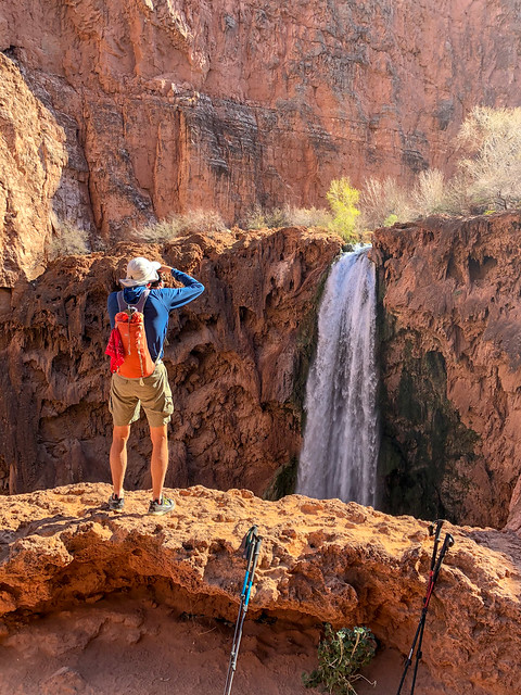
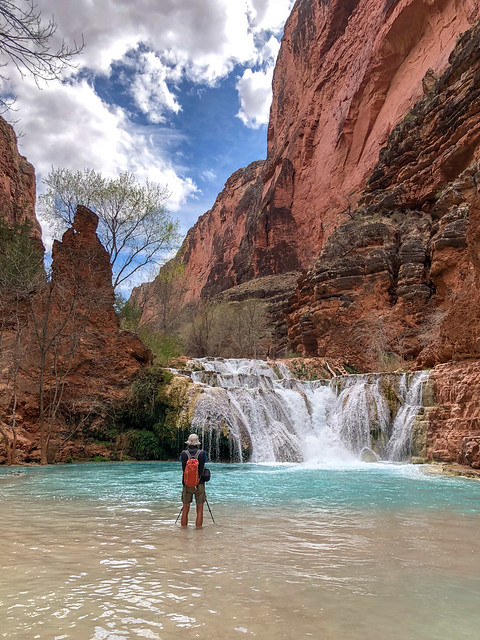
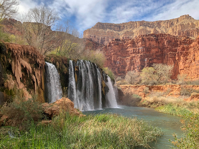
Shortly before the campground the trail makes another descent and we got our first view of Havasu Falls. During the summer months I imagine the area below would be full of people and float toys but in late February we had an unobstructed view of the falls and the beautiful turquoise pool below it.

Havasu Falls within the Havasupai Indian Reservation, Arizona
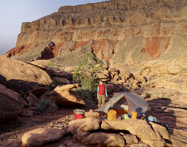
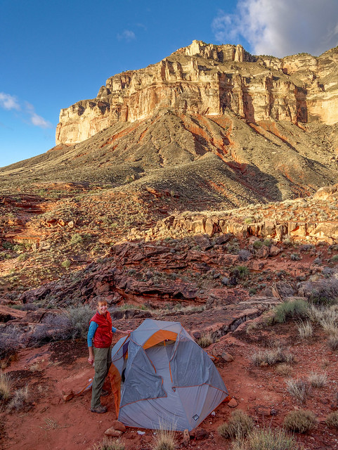
The campground is about one mile in length and is adjacent to Havasu Creek with countless established sites on both sides of the creek as well as on islands in the creek. There were quite a few people there and it had the party atmosphere of a popular state park on a busy holiday weekend. Definitely, not our "cup of tea". Fortunately, the tribe does not allow campfires or alcohol (although unfortunately some visitors do violate that second rule). Once we arrived at the campground we looked for a site farther away from the multitude of campers clustered along the creek in hopes of finding some semblance of privacy and we were for the most part successful. Fortunately, the sound of the creek helped to mask the sounds of loud voices and equally loud music.

Havasupai Campground within the Havasupai Indian Reservation, Arizona
The campground comes complete with a restaurant and the "Fry Bread Hut" apparently did a big business.

Seen at the campground in the Havasupai Indian Reservation, Arizona
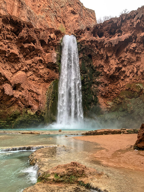
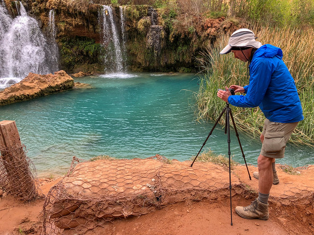
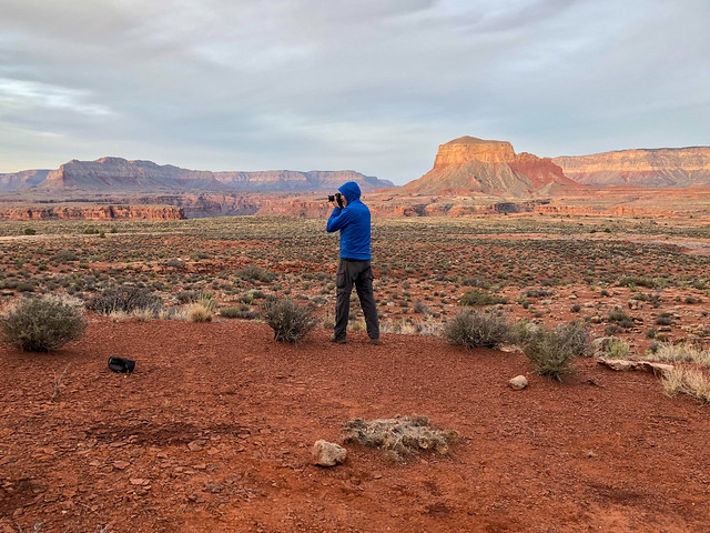
While I set up camp John went back to photograph Havasu Falls.

Havasu Falls within the Havasupai Indian Reservation, Arizona
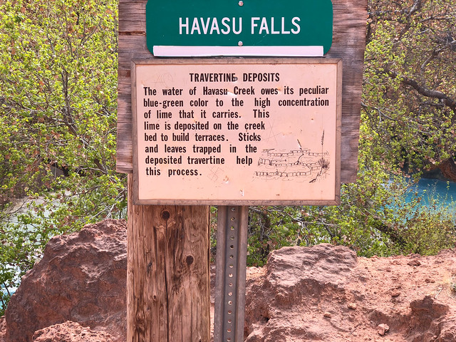
The color of the water comes from a high concentration of lime.
Havasupai Indian Reservation, Arizona
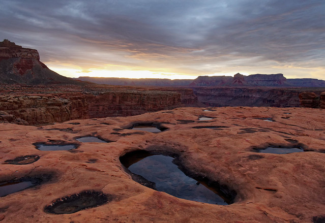
As the date for this trip approached we had watched the weather closely. Unfortunately, there was the possibility of rain, even snow, in the forecast which is always a concern when hiking within a narrow canyon. We hoped to be able to hike to the confluence of Havasu Creek and the Colorado River, a 17 mile round-trip hike. Fortunately, the weather seemed to be holding so the following day we hiked down canyon as far as Beaver Falls, about eight miles round trip. We believed that would give us some idea if hiking all the way to the river would be feasible given how short the days were in late February. From the campground, the trail heading down canyon first takes you to ...
Mooney Falls within the Havasupai Indian Reservation, Arizona
... a great view of Mooney Falls.

Mooney Falls within the Havasupai Indian Reservation, Arizona

Jean hiking within the Havasupai Indian Reservation, Arizona
John hiking within the Havasupai Indian Reservation, Arizona
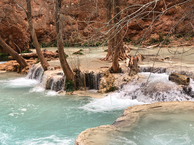
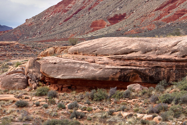
An unexpected treat was the "travertine" formations in the areas around the waterfalls. Apparently, in times of floods in the past when the water was muddy, clay particles were deposited along with the lime leaving countless weirdly attractive sculptures behind.
Jean hiking within the Havasupai Indian Reservation, Arizona
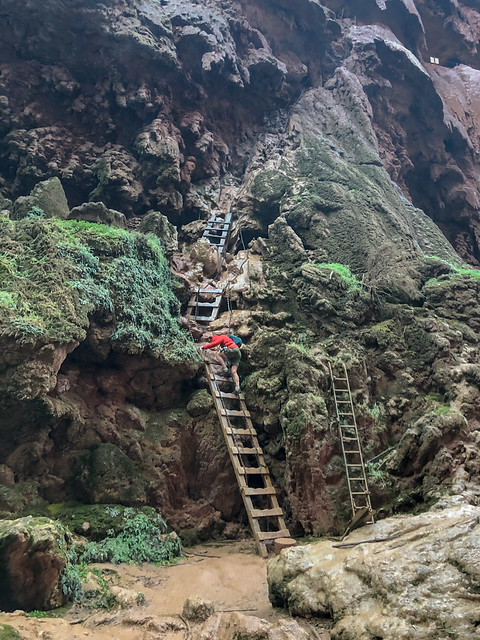
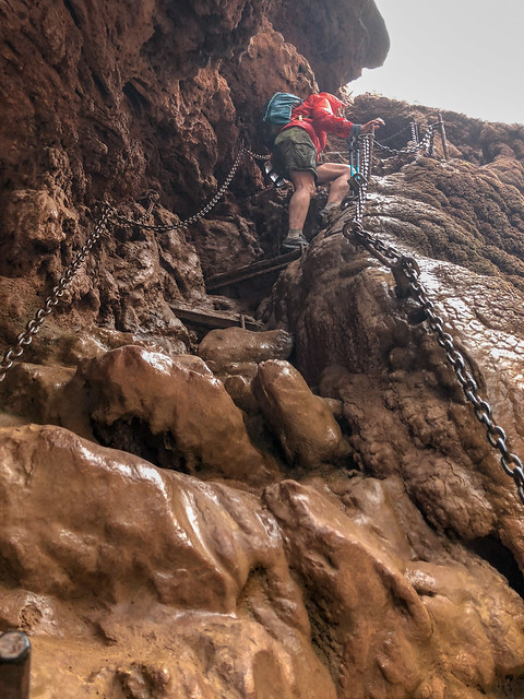
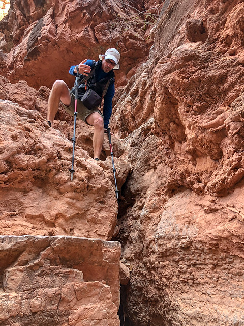
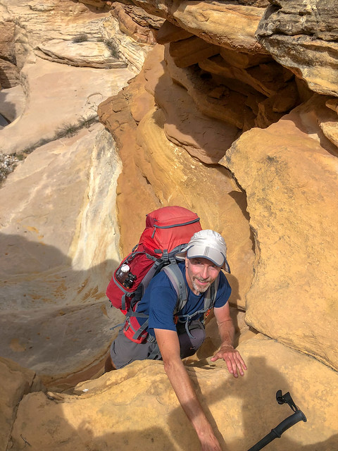
The steep climb down to the base of Mooney Falls begins with a tunnel ...
John hiking within the Havasupai Indian Reservation, Arizona
... that opens onto a "balcony" ...

Jean hiking within the Havasupai Indian Reservation, Arizona
... before descending some "stairs" ...

Jean hiking within the Havasupai Indian Reservation, Arizona
Jean hiking within the Havasupai Indian Reservation, Arizona
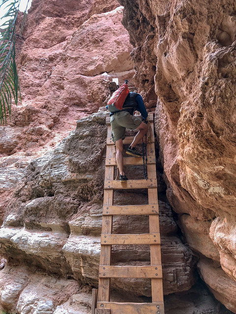
... and then a series of ladders. This route is not for the faint of heart. The entire area is wet from mist and slippery with mud from countless feet. I have read during the popular summer months it becomes quite congested and at times some less experienced visitors "freeze" from fear on the ladders but we experienced no delays.
Jean hiking within the Havasupai Indian Reservation, Arizona
We did not spend any time at Mooney Falls then as we wanted to head down canyon to Beaver Falls first.
Havasu Canyon within the Havasupai Indian Reservation, Arizona
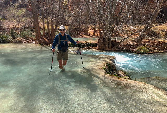
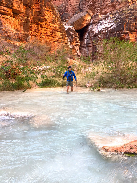
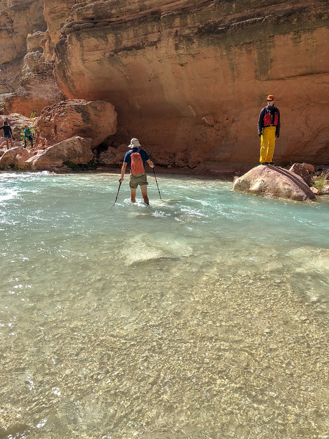
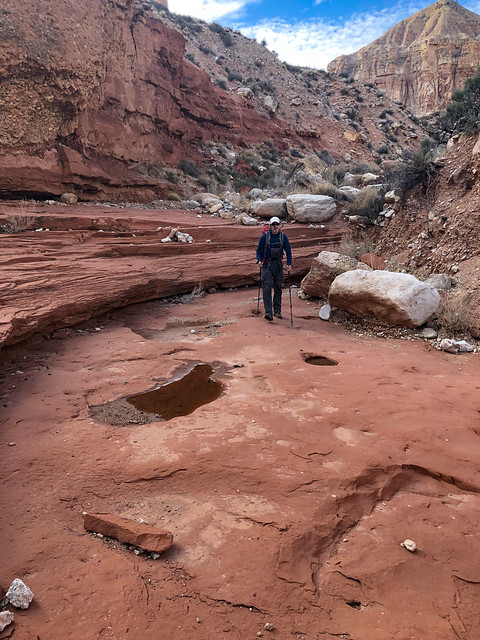
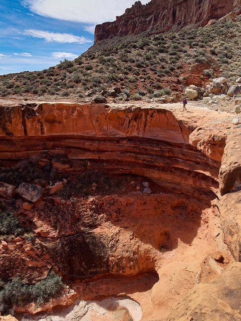
The route down canyon is clear and well marked with cairns. However, it does require hikers to cross Havasu Creek multiple times. We came prepared and brought suitable shoes for the trail conditions that we were willing to get wet. We observed others dutifully replacing their hiking boots with water shoes or sandals at every crossing but we found it far more convenient (and far less time consuming) to just wear wet shoes for the entire hike. Surprisingly, the water did not feel especially cold.

Jean hiking in Havasu Canyon within the Havasupai Indian Reservation, Arizona
We continued down canyon ...
Seen while hiking in Havasu Canyon within the Havasupai Indian Reservation, Arizona
... crossing the creek ...

Jean hiking in Havasu Canyon within the Havasupai Indian Reservation, Arizona
... multiple times.
John hiking in Havasu Canyon within the Havasupai Indian Reservation, Arizona

Jean hiking in Havasu Canyon within the Havasupai Indian Reservation, Arizona
Seen while hiking in Havasu Canyon within the Havasupai Indian Reservation, Arizona
Seen while hiking in Havasu Canyon within the Havasupai Indian Reservation, Arizona
We were uncertain how deep the water might get but it never reached higher than mid thigh.
Jean hiking in Havasu Canyon within the Havasupai Indian Reservation, Arizona
Write-ups about the area I had read previously seemed so focused on the major waterfalls. However, the Travertine limestone in the water causes cascading waterfalls to be formed all along the course of Havasu Creek. Many appear to have started with a branch (or tree) getting caught and leaves and other debris building up behind it. Then, over time, particles of limestone are deposited on the branches, leaves and debris creating intricately sculpted "shelves". The effect is fanciful and quite lovely.
Seen while hiking in Havasu Canyon within the Havasupai Indian Reservation, Arizona
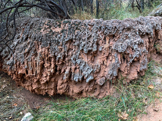
We also saw bizarre looking deposits left behind within the canyon after past flooding.
Seen while hiking in Havasu Canyon within the Havasupai Indian Reservation, Arizona
We continued to follow the creek down canyon ...

Seen while hiking in Havasu Canyon within the Havasupai Indian Reservation, Arizona
... and went through the "Palm Tree Tunnel".

Jean hiking in Havasu Canyon within the Havasupai Indian Reservation, Arizona
Sometimes the route takes you up ladders ...

Jean hiking in Havasu Canyon within the Havasupai Indian Reservation, Arizona
.. and above the creek.

Jean hiking in Havasu Canyon within the Havasupai Indian Reservation, Arizona
It is about four miles from Mooney Falls to Beaver Falls and it is well worth the effort as it is a beautiful and complex series of cascading waterfalls.
Beaver Falls within the Havasupai Indian Reservation, Arizona
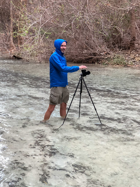
John got out his tripod and took countless photos.
John at Beaver Falls within the Havasupai Indian Reservation, Arizona

Beaver Falls within the Havasupai Indian Reservation, Arizona

Beaver Falls within the Havasupai Indian Reservation, Arizona
John hiking in Havasu Canyon within the Havasupai Indian Reservation, Arizona

Jean hiking in Havasu Canyon within the Havasupai Indian Reservation, Arizona
Mooney Falls within the Havasupai Indian Reservation, Arizona
John hiking in Havasu Canyon within the Havasupai Indian Reservation, Arizona

Jean and Mooney Falls within the Havasupai Indian Reservation, Arizona
Jean hiking in Havasu Canyon within the Havasupai Indian Reservation, Arizona
Seen while hiking in Havasu Canyon within the Havasupai Indian Reservation, Arizona

Seen while hiking in Havasu Canyon within the Havasupai Indian Reservation, Arizona
Seen while hiking in Havasu Canyon within the Havasupai Indian Reservation, Arizona
John hiking in Havasu Canyon within the Havasupai Indian Reservation, Arizona
John hiking in Havasu Canyon within the Havasupai Indian Reservation, Arizona

Seen while hiking in Havasu Canyon within Grand Canyon National Park, Arizona


John hiking in Havasu Canyon within Grand Canyon National Park, Arizona

Jean hiking in Havasu Canyon within Grand Canyon National Park, Arizona

Seen while hiking in Havasu Canyon within Grand Canyon National Park, Arizona
John hiking in Havasu Canyon within Grand Canyon National Park, Arizona

Jean hiking in Havasu Canyon within Grand Canyon National Park, Arizona
John hiking in Havasu Canyon within Grand Canyon National Park, Arizona
John hiking in Havasu Canyon within Grand Canyon National Park, Arizona

Jean hiking in Havasu Canyon within Grand Canyon National Park, Arizona
Seen while hiking in Havasu Canyon within Grand Canyon National Park, Arizona

Seen while hiking in Havasu Canyon within Grand Canyon National Park, Arizona

Seen while hiking in Havasu Canyon within Grand Canyon National Park, Arizona

Seen while hiking in Havasu Canyon within Grand Canyon National Park, Arizona
Seen while hiking in Havasu Canyon within Grand Canyon National Park, Arizona

Jean hiking in Havasu Canyon within Grand Canyon National Park, Arizona

Seen while hiking in Havasu Canyon within Grand Canyon National Park, Arizona

Seen while hiking in Havasu Canyon within Grand Canyon National Park, Arizona

Seen while hiking in Havasu Canyon within the Havasupai Indian Reservation, Arizona

Jean hiking in Havasu Canyon within the Havasupai Indian Reservation, Arizona

Seen while hiking in Havasu Canyon within the Havasupai Indian Reservation, Arizona

Seen while hiking in Havasu Canyon within the Havasupai Indian Reservation, Arizona
John hiking in Havasu Canyon within the Havasupai Indian Reservation, Arizona

Little Navajo Falls seen while hiking in Havasu Canyon within the Havasupai Indian Reservation, Arizona
Fifty-Foot Falls seen while hiking in Havasu Canyon within the Havasupai Indian Reservation, Arizona

Fifty-Foot Falls seen while hiking in Havasu Canyon within the Havasupai Indian Reservation, Arizona

Fifty-Foot Falls seen while hiking in Havasu Canyon within the Havasupai Indian Reservation, Arizona
Jean hiking through Supai within the Havasupai Indian Reservation, Arizona
Seen while hiking in Havasu Canyon within the Havasupai Indian Reservation, Arizona

Seen while hiking in Havasu Canyon within the Havasupai Indian Reservation, Arizona

Jean hiking in the Havasupai Indian Reservation, Arizona
Long exposures work so well with flowing water.
Beaver Falls within the Havasupai Indian Reservation, Arizona
Undoubtedly during the summer the area becomes a "water park" filled with people frolicking in the water and getting into each other photos but there were just a few individuals in the water when we were there. A few hardy souls only wore swimsuits and trunks but one well prepared couple brought wet-suits.
Beaver Falls within the Havasupai Indian Reservation, Arizona
We then headed back up canyon ...
... and crossing the creek ...
John hiking in Havasu Canyon within the Havasupai Indian Reservation, Arizona
... retracing our steps down ladders ...
John hiking in Havasu Canyon within the Havasupai Indian Reservation, Arizona
... and crossing the creek ...
John hiking in Havasu Canyon within the Havasupai Indian Reservation, Arizona
... back to Mooney Falls.
Jean hiking in Havasu Canyon within the Havasupai Indian Reservation, Arizona
It was late in the day and, with the exception of one other photographer, we had this popular spot to ourselves.
Mooney Falls within the Havasupai Indian Reservation, Arizona
John again got out his tripod ...
John hiking in Havasu Canyon within the Havasupai Indian Reservation, Arizona
... and took long exposures and captured images you just can't get with a smart phone camera.
Jean and Mooney Falls within the Havasupai Indian Reservation, Arizona
We then headed back up the slippery ladder and back to camp.
Jean hiking in Havasu Canyon within the Havasupai Indian Reservation, Arizona
We got an early start the next morning and again headed down canyon but our destination this day was the confluence of Havasu Creek and the Colorado River. The clear weather seemed to be holding and we hoped we had enough daylight to do it but took headlamps just in case. It was quite chilly that morning and one concern we had was that the stairs and ladders would be icy and dangerously slippery. However, not only were they not icy they were actually less slippery than they had been the evening before. Apparently, overnight the mist from the falls cleaned the mud off of the ladder rungs.
Seen while hiking in Havasu Canyon within the Havasupai Indian Reservation, Arizona
We hiked as fast as we could and only stopped briefly to take in the view of Beaver Falls.
Seen while hiking in Havasu Canyon within the Havasupai Indian Reservation, Arizona
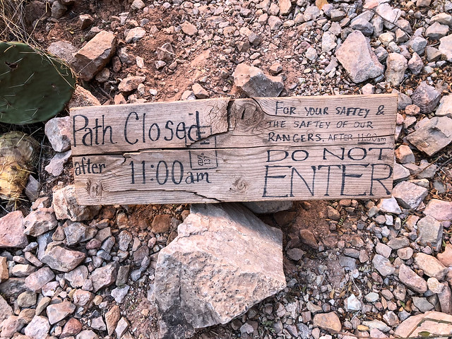
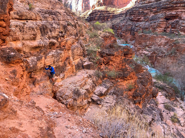
Once past Beaver Falls we were on unfamiliar ground. I had not been able to find out much about the route to the river and if there would be any navigation issues. I think very few visitors to Havasupai actually go as far as the river. The few accounts I had read were from the summer months where daylight was ample and they were focused more on the intense heat of the inner canyon, definitely not the conditions we faced. We arrived at this spot just before 9:00. Sunset would be about 6:30 and we decided our turn around time would be 1:00. Night hiking is not permitted according to Havasupai Indian Reservation rules and we intended to obey that rule if at all possible.
Seen while hiking in Havasu Canyon within the Havasupai Indian Reservation, Arizona
We found the less traveled route below Beaver Falls to be rougher but still easy to follow.
John hiking in Havasu Canyon within the Havasupai Indian Reservation, Arizona
The trail farther down the canyon takes you off tribal lands and into Grand Canyon National Park.
John hiking in Havasu Canyon within the Havasupai Indian Reservation, Arizona
As we continued down canyon ...
Seen while hiking in Havasu Canyon within Grand Canyon National Park, Arizona
... we encountered several Big Horn Sheep.
John hiking in Havasu Canyon within Grand Canyon National Park, Arizona
They were untroubled by our presence ...
Seen while hiking in Havasu Canyon within Grand Canyon National Park, Arizona
... and even appeared a bit curious.
Seen while hiking in Havasu Canyon within Grand Canyon National Park, Arizona
We encountered several more creek crossings ...
John hiking in Havasu Canyon within Grand Canyon National Park, Arizona
... and fortunately, the route was well marked with cairns so we wasted no time with route finding.
Jean hiking in Havasu Canyon within Grand Canyon National Park, Arizona
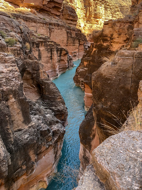
We hiked quickly but still took time to enjoy the beauty of the creek; the pale turquoise water contrasting with the orange of the canyon walls is a lovely combination.
Seen while hiking in Havasu Canyon within Grand Canyon National Park, Arizona
I had been concerned about the quality of the track below Beaver Falls but it was well worn and easy to follow.
John hiking in Havasu Canyon within Grand Canyon National Park, Arizona
We had no trouble ...
Jean hiking in Havasu Canyon within Grand Canyon National Park, Arizona
... negotiating the minor obstacles along the way.
John hiking in Havasu Canyon within Grand Canyon National Park, Arizona
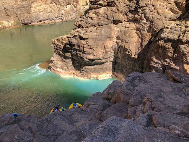
We approached the confluence on the east side of the creek and were perplexed about where to go. However, a rafter let us know in order to get to the confluence without swimming we needed to cross to the west side of the creek.
John hiking in Havasu Canyon within Grand Canyon National Park, Arizona
This is a popular stopping point for rafters and on our hike down we had encountered several who were hiking up canyon to Beaver Falls. Apparently some rafters even get as far as Mooney Falls.
Jean hiking in Havasu Canyon within Grand Canyon National Park, Arizona
I had hoped to be able to wade through the narrow portion of the canyon near the confluence ...
Seen while hiking in Havasu Canyon within Grand Canyon National Park, Arizona
... but it became apparent the water on the way to it was just too deep and I was not willing to swim in my clothes (and there were too many people around for me to get naked).
Seen while hiking in Havasu Canyon within Grand Canyon National Park, Arizona
Undoubtedly, the people belonging to these kayaks were wearing wet-suits.
Seen while hiking in Havasu Canyon within Grand Canyon National Park, Arizona
The sight of all of these fish also helped me to be more accepting of the fact I wouldn't be wading among them.
Seen while hiking in Havasu Canyon within Grand Canyon National Park, Arizona
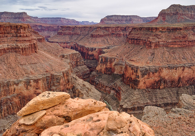
The confluence of Havasu Creek and the Colorado River is quite subtle compared to the drama of the confluence of the Colorado River and the Little Colorado River (photo).
Seen while hiking in Havasu Canyon within Grand Canyon National Park, Arizona
After lunch we started to head up back canyon. It was about 12:30 so well before our turn around time.
Jean hiking in Havasu Canyon within Grand Canyon National Park, Arizona
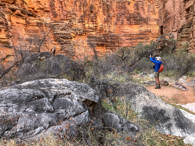
As we made our way back we again encountered several Big Horn Sheep including this ram ...
Seen while hiking in Havasu Canyon within Grand Canyon National Park, Arizona
... and these lambs.
Seen while hiking in Havasu Canyon within Grand Canyon National Park, Arizona
Once back at Beaver Falls we knew we only had about four more miles to go on a now familiar trail.
Seen while hiking in Havasu Canyon within the Havasupai Indian Reservation, Arizona
Our hope had been to get back to Mooney Falls before dark and we made it with about an hour to spare.
Jean hiking in Havasu Canyon within the Havasupai Indian Reservation, Arizona
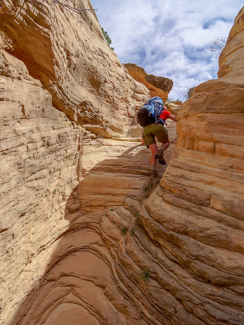
The next morning we packed up and headed up canyon taking in one last view of Havasu Falls.
Seen while hiking in Havasu Canyon within the Havasupai Indian Reservation, Arizona
We stopped several times along the way on the hike out ...
Seen while hiking in Havasu Canyon within the Havasupai Indian Reservation, Arizona
... so John could take more photos.
John hiking in Havasu Canyon within the Havasupai Indian Reservation, Arizona
A flash flood in 2008 diverted the creek destroying Navajo Falls but it created Little Navajo Falls.
Little Navajo Falls seen while hiking in Havasu Canyon within the Havasupai Indian Reservation, Arizona
We also stopped by Fifty-Foot Falls ...
Fifty-Foot Falls seen while hiking in Havasu Canyon within the Havasupai Indian Reservation, Arizona
... for more long exposure photos of the flowing water ...
Fifty-Foot Falls seen while hiking in Havasu Canyon within the Havasupai Indian Reservation, Arizona
... and the unusual travertine formations.
Fifty-Foot Falls seen while hiking in Havasu Canyon within the Havasupai Indian Reservation, Arizona
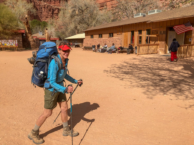
We again passed through the village of Supai and even stopped by the cafe for some Fry Bread.
Jean hiking through Supai within the Havasupai Indian Reservation, Arizona
As we hiked up the canyon we could not ignore the regular helicopter traffic. We determined there must have been three helicopters making the trip from Supai to Hualapai Hilltop and back again. However. it did enable us to identify the general location of our destination. The tiny dot barely visible roughly in the center of the photo below is a helicopter preparing to land.
Seen while hiking in Havasu Canyon within the Havasupai Indian Reservation, Arizona
But we didn't let the helicopters keep us from enjoying our time hiking out of the canyon in the deepening shadows of the late afternoon.
Seen while hiking in Havasu Canyon within the Havasupai Indian Reservation, Arizona
The Havasupai Indian Reservation is a place we have been intending to visit for a while now and we were very happy to have been able to get all the way to the confluence. Our fear at the beginning of the trip was that poor weather would prevent us from doing so and we would feel compelled to return. Now, we could leave Havasupai and never feel a need to come back. While many individuals develop a great passion for the area and return many times. For us, it just isn't worth it. While Havasu Canyon is truly a magical place it is now simply too crowded and the majority of visitors lack a "backpacker's mentality". All of our photos from this backpack trip are on Flickr.
Jean hiking in the Havasupai Indian Reservation, Arizona
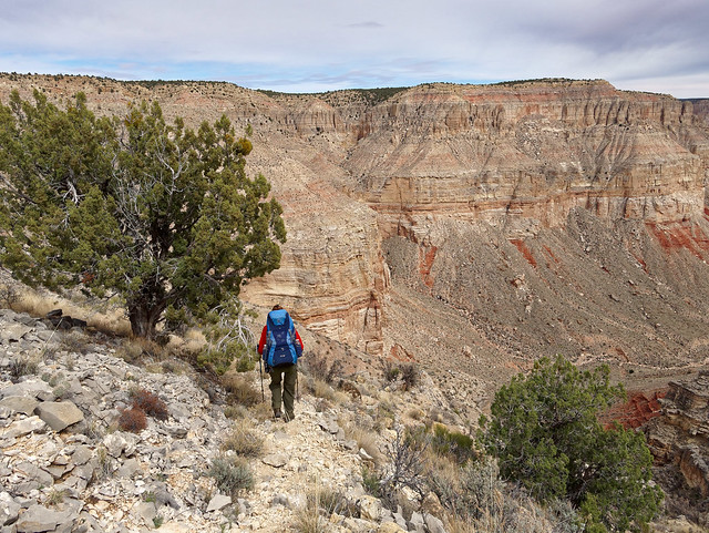
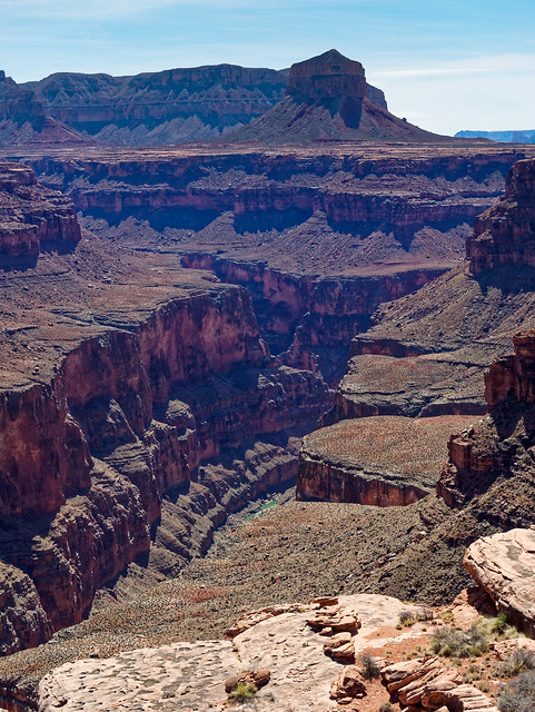
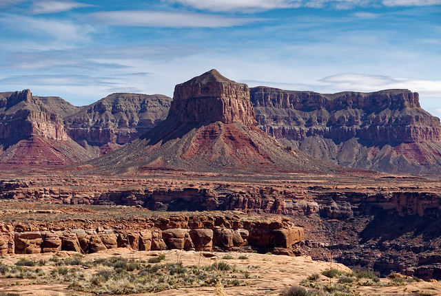
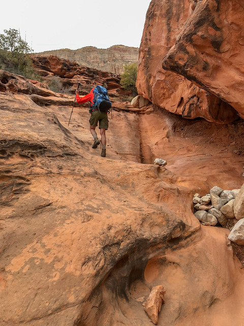
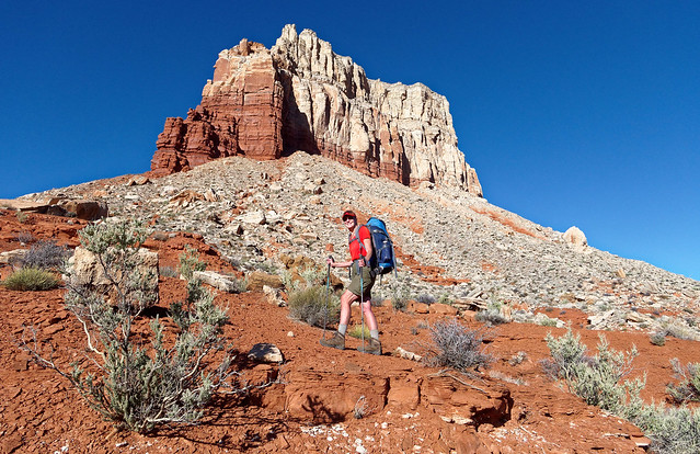
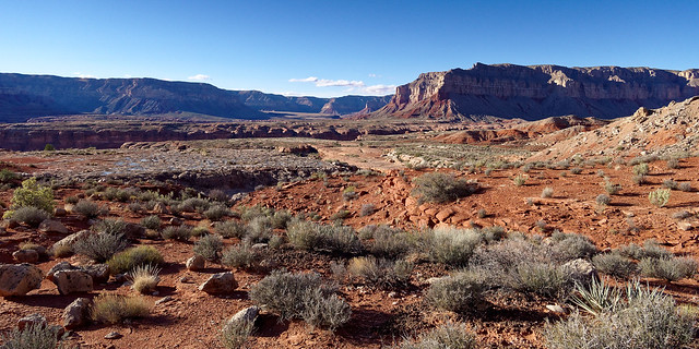
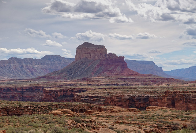
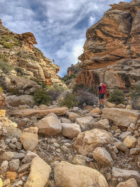
The next backpack trip we did was one we have talked about doing for a while now; hiking the entire Tuckup Trail from 150 Mile Canyon to Toroweap. It is located in the more remote northwestern portion of the National Park and the NPS Trail Description states that "The Tuckup area is a remote, vast expanse of labyrinthine gorges, sandstone slickrock, and fascinating history. However, the unique combination of heat, unreliable water sources, and inaccessibility, makes this one of the most challenging and least visited of Grand Canyon’s named trails". It also states "Mileages are very difficult/impossible to gauge, because the terrain is so convoluted, and routes vary. Total distance east to west is around 60 miles".

We initially assumed we would have to do it in one trip but that seemed too daunting to us. However, a conversation John had last spring with a North Rim Backcountry Ranger got him considering other options such as exiting to the rim by a side canyon and walking cross country back to our car. So he studied a map and realized if we started at the 150-Mile Canyon Trailhead and if we could exit Tuckup Canyon and get up to the rim then we would be relatively close to where our car would be parked at the trailhead. He also studied the map to see what would be the best way to do that. He determined the North Arm looked the most gradual of all of the arms off Tuckup Canyon. He read a trip report by Bob Bordasch who had done a trip on the Tuckup Trail beginning at 150-Mile Canyon. Their intent had been to exit via the North Arm but their plans changed and they ended up hiking back out to the 150-Mile Trailhead. However, we were reassured that an experienced (but older) Grand Canyon hiker believed it was feasible to exit there.

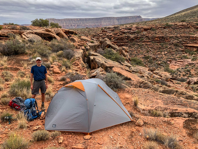
The next issue to consider was road access. The roads in this area are notorious for being impassable when wet and the dry winter was leading into a wet spring. We hunkered down in our motorhome in Fredonia, Arizona and watched the weather. We had recently met an avid Grand Canyon explorer who lives in Kanab, Utah and he loaned us some very useful equipment to help us in case we got stuck; a come-along, a shovel and some pieces of lumber.
Provided you can get to the trailhead the biggest issue with doing the Tuckup Trail is water. The winter had been dry so there were concerns about the springs. However, even in the best of times spring water in that part of Grand Canyon may contain a high concentration of minerals which will most likely cause gastrointestinal distress of varying degrees. Therefore, the most reliable and safest source of water will come from rain and snow melt collected in "potholes", natural depressions in the rock. While we waited in Fredonia we welcomed this snow especially after the weather then cleared. John obtained a permit and we made plans to start two days later.

Seen from our motorhome at Country Rose RV park in Fredonia, Arizona
To get to the trailhead we followed the directions in Todd Martin's book, Grand Canyoneering. Even just two days after snow the road was almost completely dry and we had no trouble in our Jeep Cherokee Trailhawk. Not surprisingly the trail from the rim is steep, loose and eroded in places. However, it was easy to follow.
Jean on the Tuckup Trail in Grand Canyon National Park, Arizona
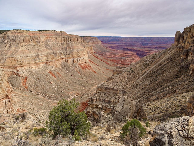
As we descended we had a great view down 150-Mile Canyon and could see all the way across the river to the South Rim.
150-Mile Canyon seen from the Tuckup Trail in Grand Canyon National Park, Arizona
While we did not yet need water, we were curious to see how well Buckhorn Spring was running as it could be an indication of how the other springs along the route were doing. What we found was a sluggish flow into a shallow pool clogged with leaves. This did not bode well for the other springs. Fortunately, the recent snow should have replenished the potholes.
Buckhorn Spring seen from the Tuckup Trail in Grand Canyon National Park, Arizona
We knew to not expect an established trail or even a rough track. While we did occasionally see a cairn ...
Seen from the Tuckup Trail in Grand Canyon National Park, Arizona
Seen from the Tuckup Trail in Grand Canyon National Park, Arizona
Seen from the Tuckup Trail in Grand Canyon National Park, Arizona
...and a bit of a track through the brush ...
Seen from the Tuckup Trail in Grand Canyon National Park, Arizona
... as well as a few fresh boot prints ...
Seen from the Tuckup Trail in Grand Canyon National Park, Arizona
... we primarily took the path of least resistance ...
Jean on the Tuckup Trail in Grand Canyon National Park, Arizona
... as we made our way down 150-Mile Canyon toward the Esplanade, a broad shelf within the canyon that is situated below the rim and above the river.

Jean on the Tuckup Trail in Grand Canyon National Park, Arizona
We had both just recently downloaded the Gaia GPS APP to our iPhones (we highly recommend it). Surprisingly, Gaia did show a route for Tuckup. However, it was more conceptual and it bore only a general relationship to the direction we needed to go and at times ignored the actual terrain we encountered. For example, in the image below the route according to Gaia is indicated in red and "she" seems to believe we were capable of levitating across the side canyons. Unfortunately, we couldn't so we had to take the long way around and the blue line marks where we actually hiked.

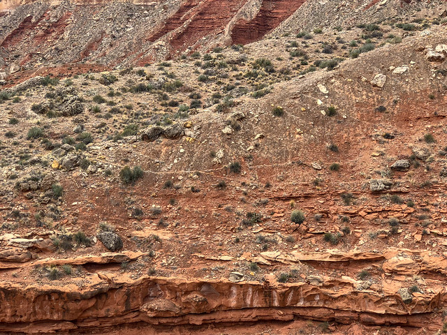
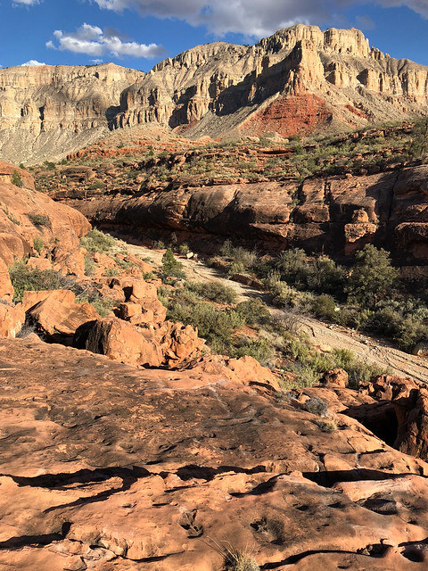
When hiking on established trails within Grand Canyon it is interesting to know the basic rock layers but when hiking on remote routes or doing off-trail exploration it is essential to know them. Good basic information about the rock layers and how they impact canyon exploration is available here. More detailed information about the geology of the Grand Canyon can be found here.

An easy way to learn the basic rock layers is the mnemonic phrase "Know the canyon's history, study rocks made by time very slowly". Or if you prefer, you can use the phrase used by notable canyon explorer and author, George Steck, "Kick the can hard, some rogue may bring along the vodka".
- K - Kaibab Formation
- T - Toroweap Formation
- C - Coconino Sandstone
- H - Hermit Shale
- S - Supai Group
- R - Redwall Limestone
- M - Muav Limestone
- B - Bright Angel Shale
- T - Tapeats Sandstone
- V - Vishnu Schist
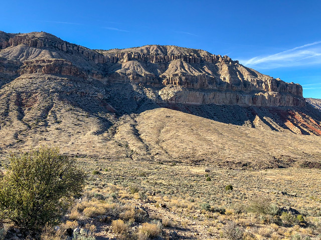
The photo below shows the imposing Coconino Sandstone rising above the red Hermit Shale.
Seen from the Tuckup Trail in Grand Canyon National Park, Arizona
 John on the Tuckup Trail in Grand Canyon National Park, Arizona
Jean on the Tuckup Trail in Grand Canyon National Park, Arizona
Boysag Point seen from the Tuckup Trail in Grand Canyon National Park, Arizona
Seen from the Tuckup Trail in Grand Canyon National Park, Arizona
 Source of image
Seen from the Tuckup Trail in Grand Canyon National Park, Arizona
Jean on the Tuckup Trail in Grand Canyon National Park, Arizona
Boysag Point seen from the Tuckup Trail in Grand Canyon National Park, Arizona
Seen from the Tuckup Trail in Grand Canyon National Park, Arizona
Jean on the Tuckup Trail in Grand Canyon National Park, Arizona
Seen from the Tuckup Trail in Grand Canyon National Park, Arizona
Jean on the Tuckup Trail in Grand Canyon National Park, Arizona
Seen from the Tuckup Trail in Grand Canyon National Park, Arizona
Seen from the Tuckup Trail in Grand Canyon National Park, Arizona
Seen from the Tuckup Trail in Grand Canyon National Park, Arizona
Jean on the Tuckup Trail in Grand Canyon National Park, Arizona
Seen from the Tuckup Trail in Grand Canyon National Park, Arizona
Seen from the Tuckup Trail in Grand Canyon National Park, Arizona
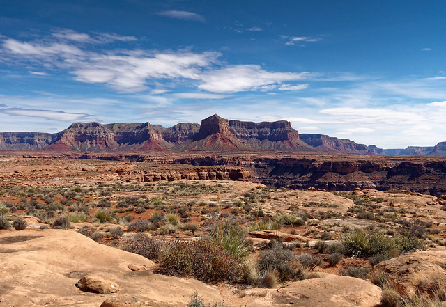
Mount Sinyella seen from the Tuckup Trail in Grand Canyon National Park, Arizona

Seen from the Tuckup Trail in Grand Canyon National Park, Arizona

Jean on the Tuckup Trail in Grand Canyon National Park, Arizona
John on the Tuckup Trail in Grand Canyon National Park, Arizona
Seen from the Tuckup Trail in Grand Canyon National Park, Arizona

Seen from the Tuckup Trail in Grand Canyon National Park, Arizona
Jean on the Tuckup Trail in Grand Canyon National Park, Arizona
Seen from the Tuckup Trail in Grand Canyon National Park, Arizona
Cowboy camp seen from the Tuckup Trail in Grand Canyon National Park, Arizona
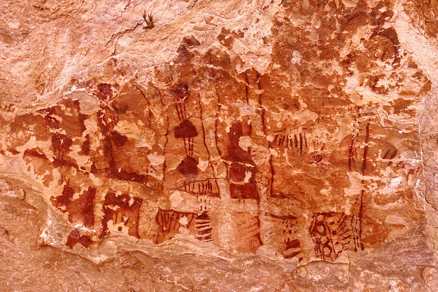
Pictographs seen from the Tuckup Trail in Grand Canyon National Park, Arizona
Seen from the Tuckup Trail in Grand Canyon National Park, Arizona
Seen from the Tuckup Trail in Grand Canyon National Park, Arizona
Our camp on the Tuckup Trail in Grand Canyon National Park, Arizona

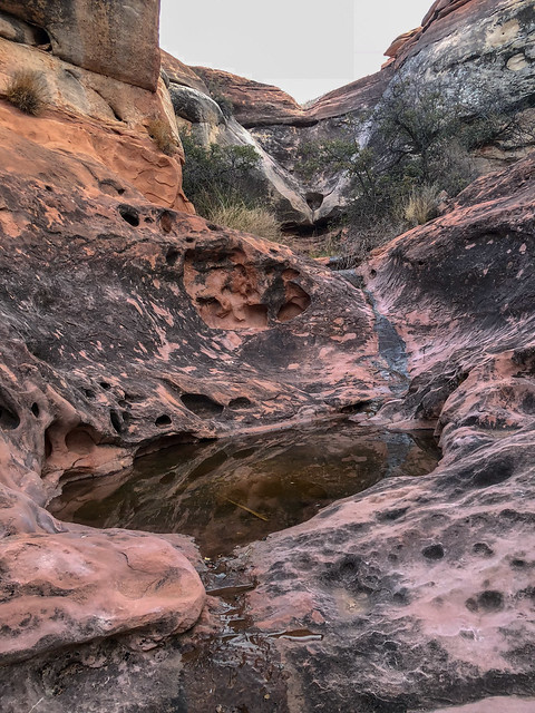
John at a pool in Cork Spring Canyon in Grand Canyon National Park, Arizona
Jean on the Tuckup Trail in Grand Canyon National Park, Arizona

John in our camp on the Tuckup Trail in Grand Canyon National Park, Arizona
Seen from the Tuckup Trail in Grand Canyon National Park, Arizona
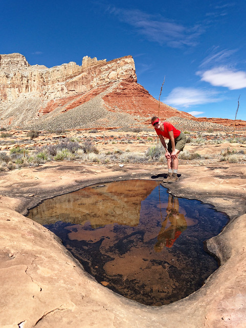
However, the rock layer we were most concerned with was the Supai which resides below the Hermit Shale as this is where we would find the life giving potholes of water. While we did not yet need water we were reassured to see these potholes early in our trip.
The entire Esplanade sits atop the Supai layer. Seven years earlier when we first hiked on the Esplanade while doing the Thunder River/Deer Creek Loop we found the going to be very easy and we were hopeful that hiking the Tuckup Trail across the Esplanade might be similar. Well, it was sometimes. Other times, not so much.
Jean on the Tuckup Trail in Grand Canyon National Park, Arizona
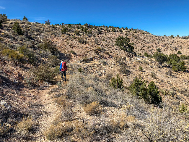
Once we left 150-Mile Canyon we began the long traverse around Boysag Point.
Boysag Point seen from the Tuckup Trail in Grand Canyon National Park, Arizona
Later in the day we encountered something we would encounter countless times on the Tuckup; a side canyon. Each time we encountered one we had to find a way across it or around it. It was a new experience for us to be forced to do so much route finding. It was time consuming and I felt a bit anxious as it was getting late and we needed water. Hotel Spring was the closest reliable source of water but first we would need to find it.
Seen from the Tuckup Trail in Grand Canyon National Park, Arizona
However, John had made note of the locations of some large potholes that Bob Bordasch had called out in his trip report ...

... and he was able to easily find this one so we did not need to locate the spring.
Seen from the Tuckup Trail in Grand Canyon National Park, Arizona
We set up camp near by.
Our camp on the Tuckup Trail in Grand Canyon National Park, Arizona
The next morning we headed out thinking we were leaving Boysag Point behind us.
Jean on the Tuckup Trail in Grand Canyon National Park, Arizona
However, Boysag Point is more than a single point. Rather it is an enormous feature that would be our companion for some time and it made us feel quite small and insignificant.
Boysag Point seen from the Tuckup Trail in Grand Canyon National Park, Arizona
Hiking on the Tuckup Trail reminded us of what we love so much about hiking the Tonto Platform, the other broad shelf within the canyon that is situated below the rim and above the river (but lower than the Esplanade). The expansive views up to rim, ...
Seen from the Tuckup Trail in Grand Canyon National Park, Arizona
... down side canyons, down to the river and across to the opposite rim.
Seen from the Tuckup Trail in Grand Canyon National Park, Arizona
After all the brush we had encountered on other parts of the route hiking directly on the Supai was a joy!
Jean on the Tuckup Trail in Grand Canyon National Park, Arizona
Before this trip was over we decided this was our all time favorite Grand Canyon backpack trip and we have done all the official named trails/routes within the National Park. That distinction was previously held by a trip we did on the West Tonto Trail from South Bass Trailhead to Hermits Rest, AKA "The Gems" (trip report). So Tuckup also bumped that trip out of its place as #4 on our list of 20 Favorite Backpacking, Tramping and Trekking Trips (and the competition is stiff!).
Seen from the Tuckup Trail in Grand Canyon National Park, Arizona
One of the best parts of this trip was the solitude. It was absolute! In the six days we spent on this portion of the Tuckup we did not see another soul. Granted, had we had a problem we were completely on our own but we accepted that risk. We carry a reasonable amount of first aid supplies and in this wide open area our Personal Locator Beacon would have worked. Also, we had instructed our son, Dan, to make a "overdue hiker" call to the Park Service if we did not contact him by a certain date and time, 48 hours after when we intended to be back. In the past we would have had him make the call when we were only 24 hours overdue. However, on past trips we have at times had to modify our itinerary and come out late so we allowed ourselves an additional 24 hours on this trip before the Park Service would be notified just in case. The last thing we want is for the Park Service to launch a search for us if we don't really need it.
Jean on the Tuckup Trail in Grand Canyon National Park, Arizona
Early that afternoon we found another large pothole.
Jean on the Tuckup Trail in Grand Canyon National Park, Arizona
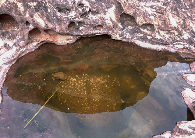
Because our very lives would depend on potholes I want to say a bit about them. There is an evolution that takes place and a future pothole begins as a shallow indentation in the rock that briefly holds water after rain or snow but it quickly dries up.
Seen from the Tuckup Trail in Grand Canyon National Park, Arizona
Over time, erosion from wind blown sand and grit enlarges it and particles of dust and debris are blown in and may settle in the bottom of it.
Seen from the Tuckup Trail in Grand Canyon National Park, Arizona
This accumulation of debris enables the growth of bacteria, fungi, and algae which leads to what is called "biological weathering" where the minerals are broken down increasing the weathering of the pothole (read more). In some potholes, enough sand and debris collect enabling the bacteria to create "Cryptobiotic Soil" (AKA "biological soil crust") which may allow plants to take root. It eventually may become a small desert garden.
Seen from the Tuckup Trail in Grand Canyon National Park, Arizona
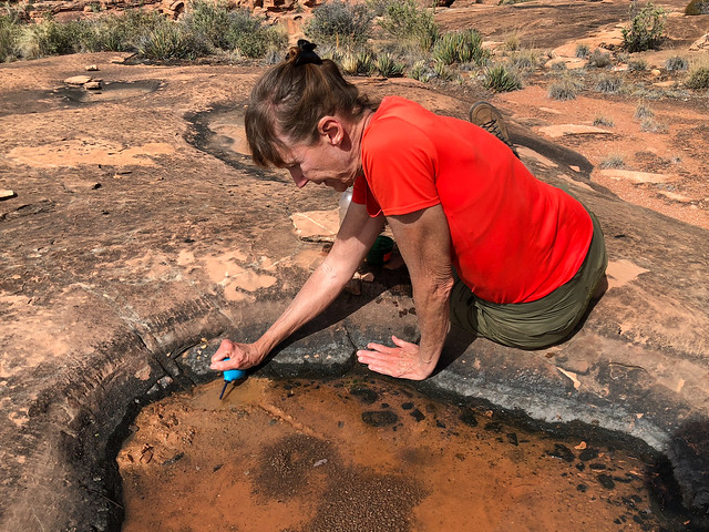
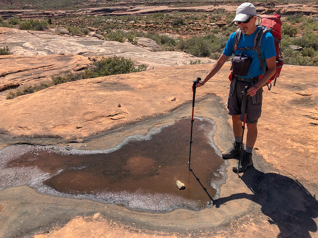
But some potholes become large and deep capable of holding water for a more extended period of time. These are a canyon backpacker's best friend as it is a simple matter to use a cup to scoop out water.
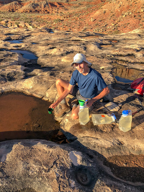
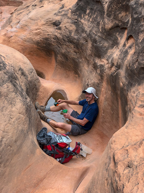
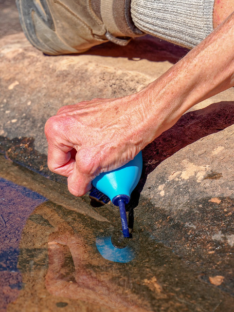
Others are quite shallow and just because it has water in it one day doesn't mean it will be there the next. In potholes this shallow the best way (if not the only way) to collect water is to use a bulb syringe.
John on the Tuckup Trail in Grand Canyon National Park, Arizona
Others are quite shallow and just because it has water in it one day doesn't mean it will be there the next. In potholes this shallow the best way (if not the only way) to collect water is to use a bulb syringe.
Jean on the Tuckup Trail in Grand Canyon National Park, Arizona
There is a knack to using a bulb syringe to get water out of a shallow pothole without sucking up insects or dust floating on the surface or disturbing the mud on the bottom.
Seen from the Tuckup Trail in Grand Canyon National Park, Arizona
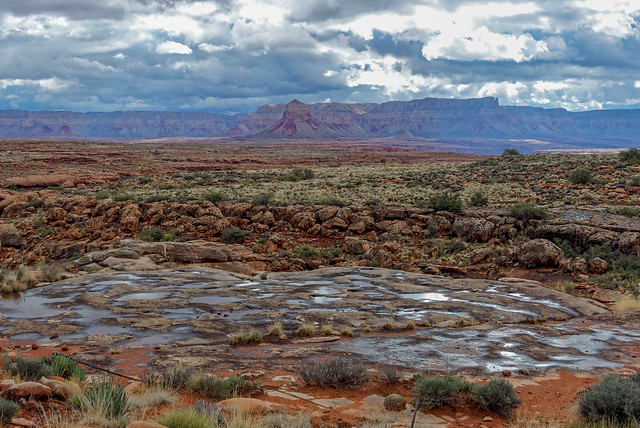
After some rain the Supai layer of rock "shimmers" with many reflections from the replenished potholes. This is truly a beautiful sight to a canyon backpacker!
Seen from the Tuckup Trail in Grand Canyon National Park, Arizona
But back to our trip ... we continued on and enjoyed views across the river to the South Rim ...
Seen from the Tuckup Trail in Grand Canyon National Park, Arizona
... including a view of the impressive Mount Sinyella. This was another feature which made us feel quite small and like we couldn't get away from it.
Mount Sinyella seen from the Tuckup Trail in Grand Canyon National Park, Arizona
With all of the navigation decisions we needed to make we found our progress was not what we had hoped. Normally, going ten miles a day is a leisurely pace for us but with the short days of early spring it became apparent we needed to make better use of our morning daylight. We simply had to get up earlier.
Seen from the Tuckup Trail in Grand Canyon National Park, Arizona
That night we made an interesting discovery. I had recently read an account of a backpacker who had picked up several ticks in the canyon but I did not give it much thought at the time. However, John had noticed a tick on his pack earlier during that day while we were taking a break. So, that night in our tent I jokingly suggested we both strip, get out our headlamps and check each other out (something that would have been much more fun 20 or 30 years ago). I checked him first and after a certain amount of kidding around I pronounced him "tick free". He then checked me. When he was looking at my back he said "You got one" and I admit I didn't believe him at first. Fortunately, we carry a very good set of tweezers in our first aid kit. I also have to admit it really creeped me out and I didn't sleep as well as I usually do while backpacking. I kept imagining I could feel something crawling on me and more than once I turned on my headlamp to look for ticks inside my sleeping bag.

A tick on Jean's back
We woke up early and were rewarded with a gorgeous sunrise!
Seen from the Tuckup Trail in Grand Canyon National Park, Arizona
We packed up our camp and headed out, earlier than usual but still not as early as we should have.
Our camp on the Tuckup Trail in Grand Canyon National Park, Arizona
We were still seeing potholes with water in them. We had read, and our experience confirmed it, that the potholes in the Supai nearer the "outboard" edge of the side canyons tended to be deeper and held water longer than those more "inboard".
Seen from the Tuckup Trail in Grand Canyon National Park, Arizona
There was some rain in the forecast and we even felt a few rain drops that morning, enough to put on our pack covers, but the bulk of the rain was not supposed to come before evening.
Jean on the Tuckup Trail in Grand Canyon National Park, Arizona
It was disheartening to find this Mylar balloon in such a remote area.
John on the Tuckup Trail in Grand Canyon National Park, Arizona
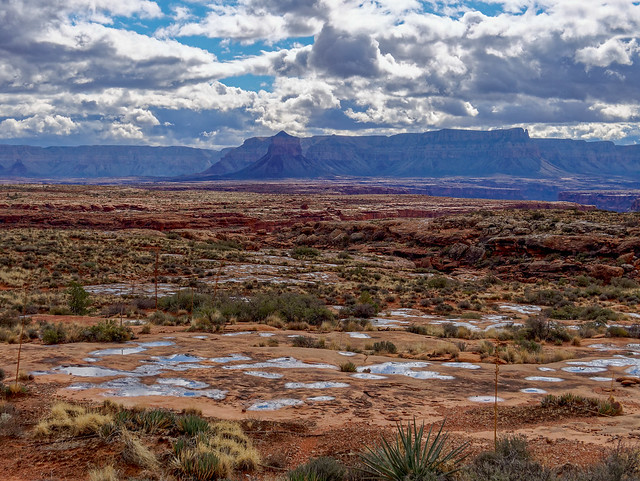
Something we had noticed on the map was how close we were to where Havasu Creek flows into the Colorado River. We were especially interested as we had just been there a few weeks earlier. So we decided to take the time and hike as close to the rim as we could to see what we could see.
Seen from the Tuckup Trail in Grand Canyon National Park, Arizona
We were curious to see if we could hike over to the rim and look down and see the confluence and according to Gaia we were directly opposite Havasu Canyon.

However, we were actually a bit down canyon from it and we did not have the time to hike back and try to get a better view.
Seen from the Tuckup Trail in Grand Canyon National Park, Arizona
As the day progressed we noted some dark clouds building to the west.
Jean on the Tuckup Trail in Grand Canyon National Park, Arizona
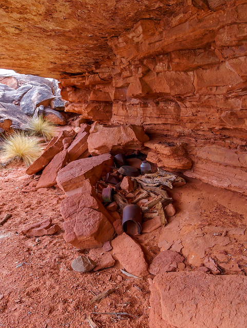
People have inhabited this area in the past and overhangs such as this one may contain evidence of their previous occupation.
Seen from the Tuckup Trail in Grand Canyon National Park, Arizona
This particular overhang is the location of a former "cowboy camp". I understand the debris left behind by these earlier visitors, the tin cans and such, are now protected "artifacts" but it still just looks like trash to me.
Cowboy camp seen from the Tuckup Trail in Grand Canyon National Park, Arizona
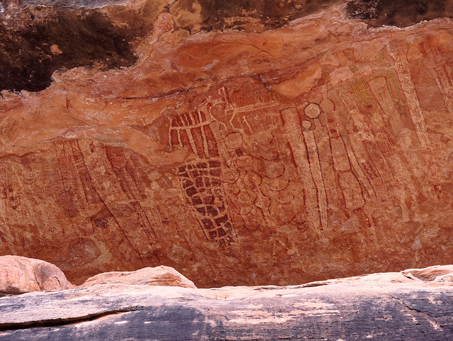
There were also some pictographs left behind by the Ancestral Puebloans who previously inhabited the area. This was not a large overhang and the pictographs have deteriorated over time, undoubtedly due to exposure to the elements, more than other better protected pictographs in the area which we would see later in the trip.
Pictographs seen from the Tuckup Trail in Grand Canyon National Park, Arizona
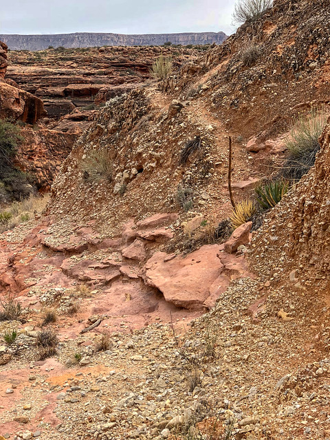
We encountered numerous side canyons and their many "arms". Carrying that terminology further it would seem we also encountered the many "hands" and "fingers" of these side canyons and we needed to find our way across or around each and every one of them. It was not hard, just time consuming. We got excited when we saw any evidence of an established track or even a cairn or two as it meant we would not have to make so many decisions and we could just walk and cover some distance.
Seen from the Tuckup Trail in Grand Canyon National Park, Arizona
However, we learned that just because someone had gone that way before and built a cairn or left a track did not mean it was the fastest way or the easiest way or even the best way. My theory was that younger, fitter hikers look for "shortcuts" over steeper looser slopes but more patient hikers (meaning older, less physically capable ones like us) prefer less steep traversing routes even if they are longer. Too many times we followed a rough track up a steep loose slope only to discover we had to immediately descend again. To add insult to injury once atop a steep slope I could sometimes see the longer but easier way we should have gone well below us.
Seen from the Tuckup Trail in Grand Canyon National Park, Arizona
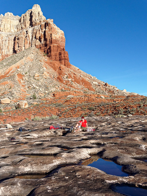
Of course, the biggest issue was where will we find our next water. On that day Cork Spring was the closest reliable source of water. John had studied Bob Bordasch's map and description of how they got there but it sounded time consuming. We hiked about half way around Cork Spring Canyon before stopping. We knew it would take time to locate the spring so we set up camp early enough to give us a couple of hours of daylight for this exploration.
Our camp on the Tuckup Trail in Grand Canyon National Park, Arizona
I wanted to make sure we could find our way back to our camps so I marked a "way point" on Gaia. It is the small tent symbol next to the "O" in Canyon. We backtracked (west) and dropped down into the side canyon (just to the right of the "O") with the plan to keep going down canyon until we found Cork Spring. However ...

... shortly after first dropping into the small side canyon we encountered a small pour over with a decent pool of water at its base. We were thrilled!
John at a pool in Cork Spring Canyon in Grand Canyon National Park, Arizona
We filled all of our bottles and Nalgene Canteens, for a total of about 400 oz of water, and hauled it back up to camp. We would live to see another day!
Jean on the Tuckup Trail in Grand Canyon National Park, Arizona
As it had not taken nearly as long to get water we had an unexpectedly leisurely evening in camp. Normally, we only use our iPhones for navigation and photos to conserve our batteries. However, John has a charger for our iPhones so he felt comfortable using up some of his battery life to play "Four Pics One Word", an easy but surprisingly addictive game.
John in our camp on the Tuckup Trail in Grand Canyon National Park, Arizona
On a seemingly different topic ... Something we discovered while hiking this route was we were going places that few people have been and we discovered that rocks, even quite large ones, were not as stable as they looked. We quickly learned to test a rock before committing our full weight to it. If this were a well traveled route these rocks would have been knocked into place over time by countless feet and hands but, as it was, we were encountering "virgin" rocks ready to cut loose at the slightest touch. I mention this now because it was true in camp as well. Later that evening John was sitting up in almost this same spot when a large rock (the one to the right of his feet in the above photo) broke loose and trapped both of his legs. I was unable to move it but fortunately, after some brief panic, I looked beneath it and could see a narrow gap. We were then able to maneuver his feet lower and work them out from between the rocks . While it was amusing in a way it was also a bit of a wake up call. We both recalled the fellow who amputated his own arm after it became pinned by a boulder. Neither of us looked at rocks, even large seemingly stable ones, in quite the same way after that.
From this point forward we had no intelligence about water so we were really hoping the weather forecast of rain that night would prove to be accurate. And it was! About 10:00 we began hearing thunder and seeing flashes of lightening and before long it started pouring rain. We had taken that into account when choosing a location for our tent and were confident we were in no danger from flash flooding. We could hear flowing water in the side canyon arm below us. The intense storm continued until about 1:00 and then settled down and we finally slept. We intended to get an early start and it was still dark out while we were having breakfast in the tent when all of a sudden we were hit with strong winds and pounding hail. Fortunately, it didn't last long and the hail soon melted. Once the storm had passed and the sun was up ...
From this point forward we had no intelligence about water so we were really hoping the weather forecast of rain that night would prove to be accurate. And it was! About 10:00 we began hearing thunder and seeing flashes of lightening and before long it started pouring rain. We had taken that into account when choosing a location for our tent and were confident we were in no danger from flash flooding. We could hear flowing water in the side canyon arm below us. The intense storm continued until about 1:00 and then settled down and we finally slept. We intended to get an early start and it was still dark out while we were having breakfast in the tent when all of a sudden we were hit with strong winds and pounding hail. Fortunately, it didn't last long and the hail soon melted. Once the storm had passed and the sun was up ...
Seen from the Tuckup Trail in Grand Canyon National Park, Arizona
... we left the comfort of our tent, packed up and headed out hopeful the potholes had been replenished.
Our camp on the Tuckup Trail in Grand Canyon National Park, Arizona
While the sky still held some grey clouds there was no more rain in the most recent weather forecast we had seen.
Seen from the Tuckup Trail in Grand Canyon National Park, Arizona
Our only weather related concern now was if the road would have sufficient time to dry out before we needed to drive out in two days. But we were prepared. In addition to the equipment loaned to us in case we got stuck we also had extra food, water and clothing in our car just in case we had to wait a day or so before making the drive out.
Seen from the Tuckup Trail in Grand Canyon National Park, Arizona
It was so gratifying to look in the distance and see the shimmer of countless potholes.
For someone who has not been in the situation of truly not knowing where your next drink of water is coming from it might be difficult to appreciate how happy (and relieved) this view made us feel.
Seen from the Tuckup Trail in Grand Canyon National Park, Arizona
For someone who has not been in the situation of truly not knowing where your next drink of water is coming from it might be difficult to appreciate how happy (and relieved) this view made us feel.
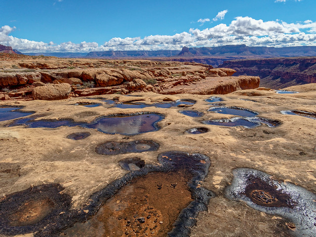
Seen from the Tuckup Trail in Grand Canyon National Park, Arizona
I didn't realize how concerned I had been about the availability of water past Cork Spring until that concern was eliminated or at least reduced.
John on the Tuckup Trail in Grand Canyon National Park, Arizona
The Tuckup continued its convoluted route ...
Jean on the Tuckup Trail in Grand Canyon National Park, Arizona
... around the countless side canyons. Although we maintained what, for us, was a steady pace it felt like our progress was slow. It seemed like we just couldn't get away from Mount Sinyella.
Seen from the Tuckup Trail in Grand Canyon National Park, Arizona
However, we were making forward, if slow, progress and another notable feature came in to view; this time "The Cork".
The Cork seen from the Tuckup Trail in Grand Canyon National Park, Arizona
The name seemed more appropriate once we got around it and saw it from the other side.
The Cork seen from the Tuckup Trail in Grand Canyon National Park, Arizona
Jean on the Tuckup Trail in Grand Canyon National Park, Arizona
Seen from the Tuckup Trail in Grand Canyon National Park, Arizona
Jean on the Tuckup Trail in Grand Canyon National Park, Arizona
Seen from the Tuckup Trail in Grand Canyon National Park, Arizona
Our camp on the Tuckup Trail in Grand Canyon National Park, Arizona
Seen from the Tuckup Trail in Grand Canyon National Park, Arizona
John on the Tuckup Trail in Grand Canyon National Park, Arizona
John on the Tuckup Trail in Grand Canyon National Park, Arizona
Jean on the Tuckup Trail in Grand Canyon National Park, Arizona

Seen from the Tuckup Trail in Grand Canyon National Park, Arizona
Seen from the Tuckup Trail in Grand Canyon National Park, Arizona
Jean on the Tuckup Trail in Grand Canyon National Park, Arizona
Seen from the Tuckup Trail in Grand Canyon National Park, Arizona
Jean on the Tuckup Trail in Grand Canyon National Park, Arizona
Seen from the Tuckup Trail in Grand Canyon National Park, Arizona
Seen from the Tuckup Trail in Grand Canyon National Park, Arizona
Seen from the Tuckup Trail in Grand Canyon National Park, Arizona
Seen from the Tuckup Trail in Grand Canyon National Park, Arizona
Seen from the Tuckup Trail in Grand Canyon National Park, Arizona

Seen from the Tuckup Trail in Grand Canyon National Park, Arizona
Seen from the Tuckup Trail in Grand Canyon National Park, Arizona
Seen from the Tuckup Trail in Grand Canyon National Park, Arizona
Our camp on the Tuckup Trail in Grand Canyon National Park, Arizona

Seen from the Tuckup Trail in Grand Canyon National Park, Arizona
John making his way down to Tuckup Canyon in Grand Canyon National Park, Arizona
John in Tuckup Canyon in Grand Canyon National Park, Arizona
Jean at Shaman's Gallery in Grand Canyon National Park, Arizona
Shaman's Gallery in Grand Canyon National Park, Arizona
Tuckup Canyon in Grand Canyon National Park, Arizona
John within the North Arm of Tuckup Canyon in Grand Canyon National Park, Arizona
John within the North Arm of Tuckup Canyon in Grand Canyon National Park, Arizona
John within the North Arm of Tuckup Canyon in Grand Canyon National Park, Arizona
Jean within the North Arm of Tuckup Canyon in Grand Canyon National Park, Arizona
John within the North Arm of Tuckup Canyon in Grand Canyon National Park, Arizona
Jean within the North Arm of Tuckup Canyon in Grand Canyon National Park, Arizona
John within the North Arm of Tuckup Canyon in Grand Canyon National Park, Arizona
Jean within the North Arm of Tuckup Canyon in Grand Canyon National Park, Arizona
Within the North Arm of Tuckup Canyon in Grand Canyon National Park, Arizona
Jean and John above the North Arm of Tuckup Canyon in Grand Canyon National Park, Arizona
Jean on the way back to the 150-Mile Trailhead in Grand Canyon National Park, Arizona
John on the way back to the 150-Mile Trailhead in Grand Canyon National Park, Arizona
John on the Tuckup Trail in Grand Canyon National Park, Arizona
Seen from the Tuckup Trail in Grand Canyon National Park, Arizona
Seen from the Tuckup Trail in Grand Canyon National Park, Arizona
John heading to Schmutz Spring in Grand Canyon National Park, Arizona
John getting water from Schmutz Spring in Grand Canyon National Park, Arizona
Seen from the Tuckup Trail in Grand Canyon National Park, Arizona

Seen from the Tuckup Trail in Grand Canyon National Park, Arizona
John on the Tuckup Trail in Grand Canyon National Park, Arizona
Seen from the Tuckup Trail in Grand Canyon National Park, Arizona
The Dome seen from the Tuckup Trail in Grand Canyon National Park, Arizona
Jean on the Tuckup Trail in Grand Canyon National Park, Arizona
John on the Tuckup Trail in Grand Canyon National Park, Arizona
Seen from the Tuckup Trail in Grand Canyon National Park, Arizona
Seen from the Tuckup Trail in Grand Canyon National Park, Arizona
Jean on the Tuckup Trail in Grand Canyon National Park, Arizona
While we had both developed some decent navigational skills ...
Seen from the Tuckup Trail in Grand Canyon National Park, Arizona
... we still appreciated the presence of an established track (no matter how short lived) as it gave us a break from decision making (and close encounters with prickly vegetation). As we continued another dominant feature came into view, The Dome.
Jean on the Tuckup Trail in Grand Canyon National Park, Arizona
Our destination that day was Hades Canyon.
Seen from the Tuckup Trail in Grand Canyon National Park, Arizona
However, late in the day as we were just rounding SB Point, it became obvious we would not get that far.
Jean on the Tuckup Trail in Grand Canyon National Park, Arizona
The hour was late and the sight of hundreds of potholes in the distance (as well as our own fatigue) convinced us to stop and camp nearby.
Seen from the Tuckup Trail in Grand Canyon National Park, Arizona
We first headed down to the potholes and had the luxury of being picky. I took some time to find one deep enough so John could use the cup to scoop up the water as well as being next to a comfortable sitting rock.
John on the Tuckup Trail in Grand Canyon National Park, Arizona
It is shear pleasure to be able to drink to one's heart's content while in the desert! I also took the opportunity to take a little sponge bath. So refreshing!
Jean on the Tuckup Trail in Grand Canyon National Park, Arizona
Then it was time for me to set up camp ...
Our camp on the Tuckup Trail in Grand Canyon National Park, Arizona
... while John did some photography in what little daylight we had left.
Seen from the Tuckup Trail in Grand Canyon National Park, Arizona
As we had stopped short of our goal it meant we had even more miles ahead of us. We fully intended to get a very early start and even woke up at 4:30. But we love our mornings in the comfort of our tent too much and it takes us around two hours to finally get going and be back on the trail. I found it especially hard to leave this place as it was one of my all time favorite camp sites.

Seen from the Tuckup Trail in Grand Canyon National Park, Arizona
These early starts were hard on John as mornings and evenings are his favorite times to do photography during what photographer's call the "Golden Hour". Evening chores, such as getting water, was chewing into his evening photography time as the early starts did to his morning photography time.
John on the Tuckup Trail in Grand Canyon National Park, Arizona
He was a bit frustrated with not being able to take the time he wanted and to wait for better light for the photography he wanted to do. A thought we have when in places that are hard to get to, is we may never be able to come back. So, allowing John the time to do photography is a usually a priority.
Seen from the Tuckup Trail in Grand Canyon National Park, Arizona
However, on that particular morning we both understood we had miles to go and (hopefully) more water to find. So unfortunately, on this rare occasion, John's photos don't really capture how I "felt" being there.
John on the Tuckup Trail in Grand Canyon National Park, Arizona
We continued on, negotiating whatever terrain was before us.
Jean on the Tuckup Trail in Grand Canyon National Park, Arizona
Eventually, Hades Canyon came into to view. If, for whatever the reason, we had been looking for a way to exit the canyon sooner than planned, then Hades would have provided us with such as exit.
Seen from the Tuckup Trail in Grand Canyon National Park, Arizona
John had read an account of a group who got to the rim by going up the steep, narrow side canyon to the left of center in the photo below.
Seen from the Tuckup Trail in Grand Canyon National Park, Arizona
However, we felt no need to end our trip early so we continued on.
Jean on the Tuckup Trail in Grand Canyon National Park, Arizona
As we made our way around Hades Canyon it became apparent we had chosen wisely by camping where we had the previous night as we did not encounter any water in Hades.
Seen from the Tuckup Trail in Grand Canyon National Park, Arizona
Once out of Hades Canyon, The Dome became our constant companion again.
Jean on the Tuckup Trail in Grand Canyon National Park, Arizona
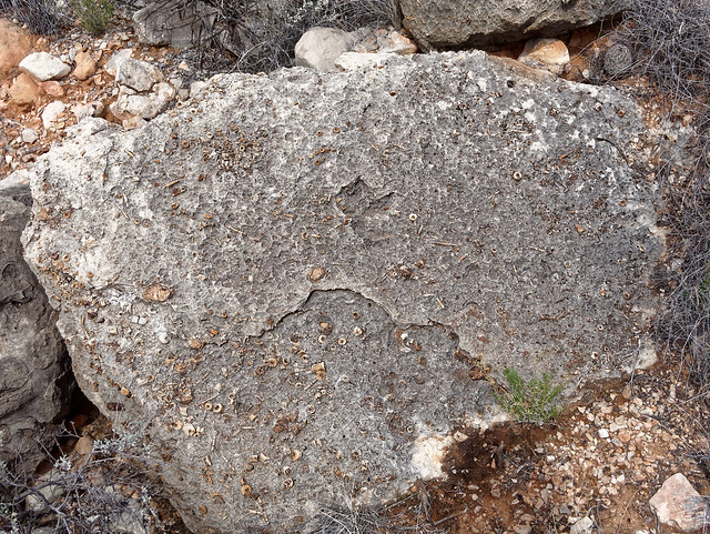
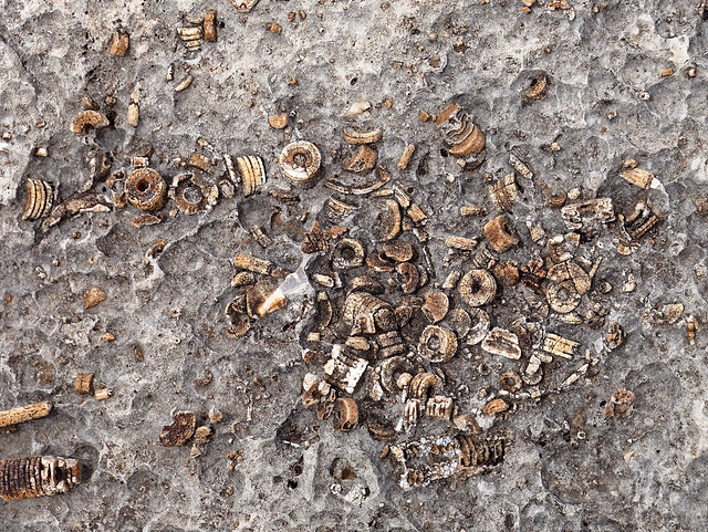
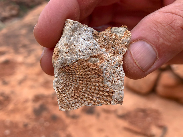
At different times during this trip we had seen fossilized remains of ancient sea creatures in the Toroweap rock layer.
Seen from the Tuckup Trail in Grand Canyon National Park, Arizona
It just seems so incongruous ...
Seen from the Tuckup Trail in Grand Canyon National Park, Arizona
... to find seashells in the desert.
Seen from the Tuckup Trail in Grand Canyon National Park, Arizona
Again, we appreciated the stretches of well established tracks that enabled us to make some time. However, these well worn tracks would then disappear in the vegetation. My intent was to stay on the main trail and not encourage the development of "social trails" but it was time consuming to try to discern from the multiple tracks which one was the "real" trail so we ended up doing what others must be doing, simply walking where it seemed easier.
Seen from the Tuckup Trail in Grand Canyon National Park, Arizona
We also inevitably encountered more side canyons that required slower and more careful navigation.
Seen from the Tuckup Trail in Grand Canyon National Park, Arizona
Later in the day we noted we were no longer hiking directly on the Supai rock layer. We were hiking on rocky sand and there were no potholes anywhere. The nearest reliable source of water was Schmutz Spring but we were quite a few miles away from there.
Seen from the Tuckup Trail in Grand Canyon National Park, Arizona
We were finding the terrain more tedious or maybe it just seemed that way because we were anxious about water. We have hiked down Tuckup Canyon from the Schmutz Spring Trailhead before so we knew that route would be way faster than the rocky/brushy "official" Tuckup Trail/Route. We could see the smooth gravel bottom of a side canyon that would lead to Tuckup Canyon. So we dropped down into it and thoroughly enjoyed the easy walking. We were making great progress until we reached a series of pour-offs we were unable to get down safely. We were disappointed to see we were still way too high above the bottom of Tuckup Canyon.
Seen from the Tuckup Trail in Grand Canyon National Park, Arizona
We had no other option but to backtrack and find a way back out of this side canyon, back up to the Tuckup Trail and continue forward. It was discouraging as we had lost valuable time and had gained nothing.
We were both becoming concerned about our situation. We still had some water and it was getting cooler so we were not in danger of deadly dehydration. One possibility was to dry camp, skip supper and breakfast, be moving at first light and hightail it to Schmutz Spring. However, that would decrease the likelihood we could then hike all the way out that day. The other option was to continue hiking after dark and hope we could get to Schmutz Spring safely AND actually locate the spring in the dark. We have done plenty of night hiking by headlamp but on actual trails and the rough terrain we needed to negotiate could make it challenging, even dangerous, so I was quite nervous about that prospect. We approached the next side canyon with hopes we could use it to get to the bottom of Tuckup Canyon. As we looked for a safe way to descend into it we saw the most beautiful sight in the growing darkness. A reflection ...
Seen from the Tuckup Trail in Grand Canyon National Park, Arizona
... from a deep pool of (reasonably clear) water!
As we made our way carefully down to it we also discovered a (relatively) flat spot just barely big enough for our ample tent nearby. It was such a relief!
Seen from the Tuckup Trail in Grand Canyon National Park, Arizona
As we made our way carefully down to it we also discovered a (relatively) flat spot just barely big enough for our ample tent nearby. It was such a relief!
Our camp on the Tuckup Trail in Grand Canyon National Park, Arizona
Our camp and the pool are located at the tent symbol roughly halfway between "Tuckup" and "Canyon" in the map below. The (conceptual) Tuckup Trail is indicated in red and our tracks are indicated in blue (day 5) and green (day 6). You can see Schmutz Spring to the far left and I believe this helps to illustrate why we were so relieved to find that pool of water.

The only bad part was while clearing the area for our tent I lifted up a large flat rock and there were two of the most colorful salamanders I have ever seen underneath it. It took them a moment to gather their wits before scuttling away. I set their rock down off to the side and they eventually found it. I felt terrible for disrupting their previously quiet existence but we were sort of desperate. I intended to move the rock back after we packed up the next morning but in my haste to get going I forgot. I hope the new location suits them.
Seen from the Tuckup Trail in Grand Canyon National Park, Arizona
The next morning we packed up and headed out. This, our last day, would be a long one and potentially very challenging depending on what we encountered on the way up the North Arm of Tuckup Canyon. We first headed down the narrow side canyon we had camped in but discovered we were still high above the Tuckup Canyon floor and unable to reach it safely. So, we then traversed for a while on some Supai ledges looking for a safe way down. But the further we went the more the canyon floor rose to meet us so it became a simple matter to climb the rest of the way down to it.
John making his way down to Tuckup Canyon in Grand Canyon National Park, Arizona
Once on the smooth gravel bottom of Tuckup Canyon we made good progress.
John in Tuckup Canyon in Grand Canyon National Park, Arizona
We knew we were close to Shaman's Gallery, the location of an extensive collection of some excellent pictographs. However, we did not know if we were above or below it but we simply did not have time to hike down canyon to look for it. However, after walking up canyon just a short distance we looked up to our right ...
Jean at Shaman's Gallery in Grand Canyon National Park, Arizona
... and there it was. John took just a few photographs as we could not afford the time. However, when we were there before he took more photos.
Shaman's Gallery in Grand Canyon National Park, Arizona
We continued up Tuckup Canyon but veered to the right to enter the North Arm.
Tuckup Canyon in Grand Canyon National Park, Arizona
As we hiked further into the canyon it became more narrow and we encountered more boulders which slowed our progress.
John within the North Arm of Tuckup Canyon in Grand Canyon National Park, Arizona
After a while we reached the part John had some concerns about, a very narrow portion he had seen on the map. We had only sketchy information about the obstacles we might encounter. If we couldn't get up the North Arm then our best option would be to go back and hike up the East Arm of Tuckup Canyon. It is shorter and steeper than the North Arm but we had been told it was not technical.
John within the North Arm of Tuckup Canyon in Grand Canyon National Park, Arizona
There are a few obstacles in the North Arm ...
John within the North Arm of Tuckup Canyon in Grand Canyon National Park, Arizona
... but most were easy even for a couple in their mid 60's.
Jean within the North Arm of Tuckup Canyon in Grand Canyon National Park, Arizona
Every one we got by without trouble brought us closer to the rim.
John within the North Arm of Tuckup Canyon in Grand Canyon National Park, Arizona
Unfortunately, we don't have any photos of the most challenging obstacle, a good sized chock stone. I needed John to give me a boost up and, once I was on top, he needed me to give him a hand. A lone backpacker (especially an older one) might have some trouble. We don't recall if there were any rocks nearby to step on but standing on one's pack might be enough (provided you also have a rope to haul your pack up).
Jean within the North Arm of Tuckup Canyon in Grand Canyon National Park, Arizona
We were relieved to make it all the way through this narrow section with so little trouble.
John within the North Arm of Tuckup Canyon in Grand Canyon National Park, Arizona
The canyon opened up and we continued on our way to the rim.
Jean within the North Arm of Tuckup Canyon in Grand Canyon National Park, Arizona
The canyon became quite open and we had a decision to make. Do we continue the gradual ascent in the general direction we are going and exit up toward the left but without knowing what is around the bend?
Within the North Arm of Tuckup Canyon in Grand Canyon National Park, Arizona
Or, do we break right and leave the canyon sooner and head up the steep slope?
Within the North Arm of Tuckup Canyon in Grand Canyon National Park, Arizona
We decided to head up the steep slope as it would bring us out on the rim closer to our car.
John within the North Arm of Tuckup Canyon in Grand Canyon National Park, Arizona
We even encountered a bit of what looked like a sketchy track.
Within the North Arm of Tuckup Canyon in Grand Canyon National Park, Arizona
Once on the rim we both heaved a sigh of relief. We would hike 17 miles that day and we were just over halfway back at this point but the hardest part was behind us.
Jean and John above the North Arm of Tuckup Canyon in Grand Canyon National Park, Arizona
Now all we needed to do was walk. While the USGS Topo map showed several roads they no longer existed and even had mature Juniper trees growing in the middle of them. However, the Gaia GPS proved to be quite accurate and by following it ...
Jean on the way back to the 150-Mile Trailhead in Grand Canyon National Park, Arizona
... we found our way back to SB Point Road. Once here we could walk quickly back to the trailhead, still some miles away. It was well after dark by the time we reached our car and then had to do the long slow drive back to civilization. Fortunately, the recent rain had not caused any issues with the road. We got back to our motorhome in Fredonia about 10:30 PM, very tired but euphoric at such a successful end to a challenging and amazing trip. All of our photos from this backpack trip are on Flickr.
John on the way back to the 150-Mile Trailhead in Grand Canyon National Park, Arizona
We then wanted to to the rest of the Tuckup Trail. As I mentioned before the NPS trail description states that "The Tuckup area is a remote, vast expanse of labyrinthine gorges, sandstone slickrock, and fascinating history. However, the unique combination of heat, unreliable water sources, and inaccessibility, makes this one of the most challenging and least visited of Grand Canyon’s named trails". It also states "Mileages are very difficult/impossible to gauge, because the terrain is so convoluted, and routes vary. Total distance east to west is around 60 miles".
This time we would start at the Schmutz Spring Trailhead and travel west and exit at Toroweap. We had recently met an avid Grand Canyon explorer who lived in Kanab, Utah. Ironically, he and his wife had previously lived just a few miles from us in Kent, Washington. He very generously offered to shuttle us to the trailhead after we first dropped our Jeep off at Toroweap. This was a huge help to us as our only other plan was to walk the road or go cross country back to our car as we had done on our previous trip on the eastern portion of the Tuckup Trail. However, due to the geography of the area this would have been an ordeal.
This time we would start at the Schmutz Spring Trailhead and travel west and exit at Toroweap. We had recently met an avid Grand Canyon explorer who lived in Kanab, Utah. Ironically, he and his wife had previously lived just a few miles from us in Kent, Washington. He very generously offered to shuttle us to the trailhead after we first dropped our Jeep off at Toroweap. This was a huge help to us as our only other plan was to walk the road or go cross country back to our car as we had done on our previous trip on the eastern portion of the Tuckup Trail. However, due to the geography of the area this would have been an ordeal.
We started this trip after having only two days off from our previous trip and we were still tired. However, we were concerned about water and the last rain had been six days earlier so we felt we needed to start sooner rather than later. When we got to Toroweap the volunteer Park Ranger mentioned there was a group of five backpackers who were also starting at Schmutz Spring Trailhead that day. While we were there we spent some time checking out the views from Toroweap ...
Jean and Jon at Toroweap in Grand Canyon National Park, Arizona
... before making the long, slow drive (which included some navigational issues) to the trailhead. As a result, we did not start walking until about 3:00.
John on the Tuckup Trail in Grand Canyon National Park, Arizona
We originally had planned to get as far as Cottonwood Spring that first day. However, we were concerned about bumping into that group of five and not just that first night. We realized we might be playing "Tag" with them for the entire trip. It is a fact that sound carries great distances in the open space and dry air of the desert and it has been our experience that a group of that size takes up a lot of "psychic space" in the backcountry. While we have enjoyed brief encounters with others when backpacking, we simply prefer quiet and solitude.
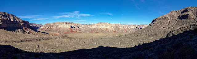
Seen from the Tuckup Trail in Grand Canyon National Park, Arizona
As we had sufficient time on our permit we decided to stop after hiking only 1.8 miles and camp near Schmutz Spring.
Seen from the Tuckup Trail in Grand Canyon National Park, Arizona
Our first task was to get water. On a past trip John had done some exploring and located Schmutz Spring ...
Seen from the Tuckup Trail in Grand Canyon National Park, Arizona
... so he knew about where to look and found it again with little trouble.
John heading to Schmutz Spring in Grand Canyon National Park, Arizona
The winter had been quite dry which reduced the flow of many normally reliable springs. However, Schmutz is unusual as it has been enlarged with dynamite in the past creating a large underground pool. Still, John had to reach well into it to collect enough water.
John getting water from Schmutz Spring in Grand Canyon National Park, Arizona
We had spent the previous two days in a frenzy of cleaning up from our previous 6 day trip on the eastern portion of Tuckup and preparing for this trip so we had not really taken any time to just rest. So making camp here was the best thing! We turned in early and slept well.
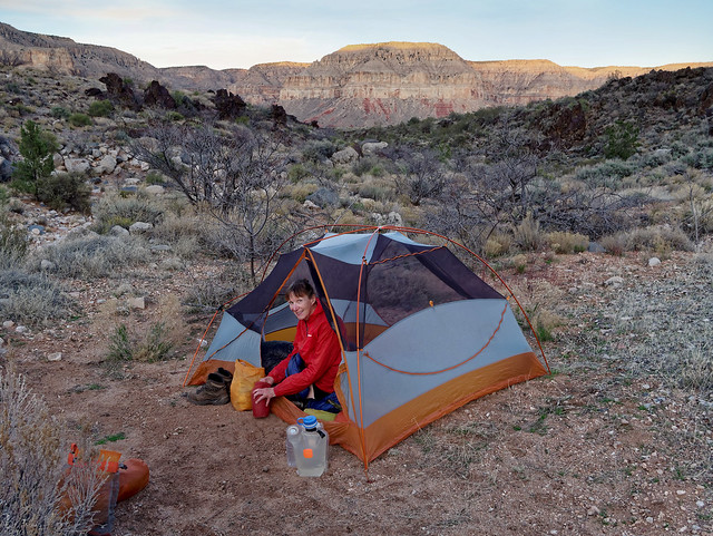
Our camp on the Tuckup Trail in Grand Canyon National Park, Arizona
It was a beautiful evening and night as the moon was almost full.
Seen from the Tuckup Trail in Grand Canyon National Park, Arizona
We allowed ourselves the luxury of sleeping late (late by Grand Canyon standards) and a leisurely morning in camp. While we were still in camp a group of about eight day hikers came down the trail on their way to Shaman's Gallery. John talked to them briefly but I was anxious for them to continue on. It is not that I am completely antisocial but one of the things I loved about where we were was how alone we were in such a wide open space.
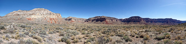
Seen from the Tuckup Trail in Grand Canyon National Park, Arizona
I found it interesting to look at a map of the Tuckup Trail as it goes around the long Tuckup Canyon.

It made me realize that by looking directly across from us we could see up the North Arm of Tuckup Canyon where we had exited the canyon to the rim just a few days earlier.
Seen from the Tuckup Trail in Grand Canyon National Park, Arizona
We could also see SB Point in the distance where we had camped in what became one of my all time favorite campsites.
John on the Tuckup Trail in Grand Canyon National Park, Arizona
The views were so expansive ...
Seen from the Tuckup Trail in Grand Canyon National Park, Arizona
... and included a prominent feature we had been well acquainted with on our previous trip; The Dome.
The Dome seen from the Tuckup Trail in Grand Canyon National Park, Arizona
As I've said before, we love the expansiveness of the broad shelves (the Esplanade and the Tonto Platform) within the canyon that are situated below the rim and above the river. Walking across the Esplanade on the smooth surface of the Supai layer of rock was a treat.
Jean on the Tuckup Trail in Grand Canyon National Park, Arizona
Our destination was Cottonwood Spring which was only about four miles from Schmutz Spring. Cottonwood Spring has a reputation of being mineralized, as do many of the springs in Grand Canyon. However, we have consumed Cottonwood Creek water where Cottonwood Canyon ends at Tuckup Canyon on a past trip (photo) and had no issues with it. But, it had been a very dry winter and this could cause the minerals in the springs to be more concentrated. Just after lunch we encountered this pothole and found it reassuring as we hoped it meant we would encounter some later in our trip. In hindsight, it might have been wise to collect some water here.
John on the Tuckup Trail in Grand Canyon National Park, Arizona
As we hiked we saw evidence of copper.
Seen from the Tuckup Trail in Grand Canyon National Park, Arizona
This former copper mine is now abandoned ...
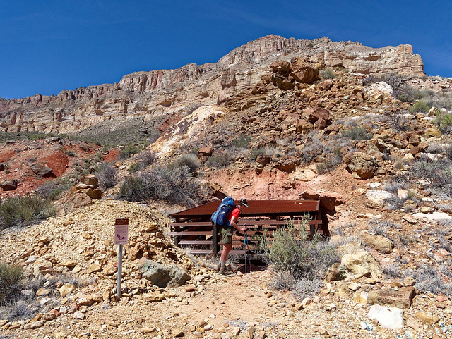
Jean on the Tuckup Trail in Grand Canyon National Park, Arizona
... but now provides a habitat for bats.
Seen from the Tuckup Trail in Grand Canyon National Park, Arizona
As we hiked up Cottonwood Canyon we got glimpses of the canyon's namesake. The leaves on the Cottonwood trees were a brilliant bright green that early in spring.
Jean on the Tuckup Trail in Grand Canyon National Park, Arizona
As we hiked further up the canyon we encountered water but it looked "scuzzy" and the white deposits on the surrounding rocks were indications of minerals. Higher up, the canyon divides into two drainage's and Gaia GPS indicated Cottonwood Spring was up the right drainage. We hiked up it a ways but did not find a good flow. We backtracked and then went up the left drainage as Gaia indicated there was an unnamed spring there.
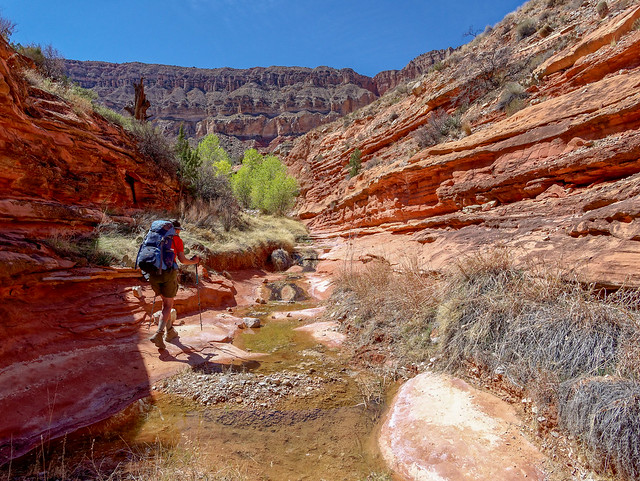
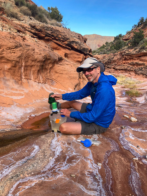
John getting water in Cottonwood Canyon in Grand Canyon National Park, Arizona
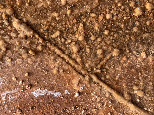
Seen in Cottonwood Canyon in Grand Canyon National Park, Arizona
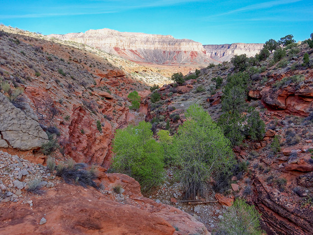
Seen from the Tuckup Trail in Grand Canyon National Park, Arizona
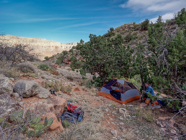
Seen from the Tuckup Trail in Grand Canyon National Park, Arizona
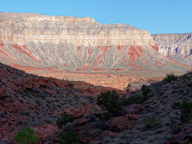
Seen from the Tuckup Trail in Grand Canyon National Park, Arizona
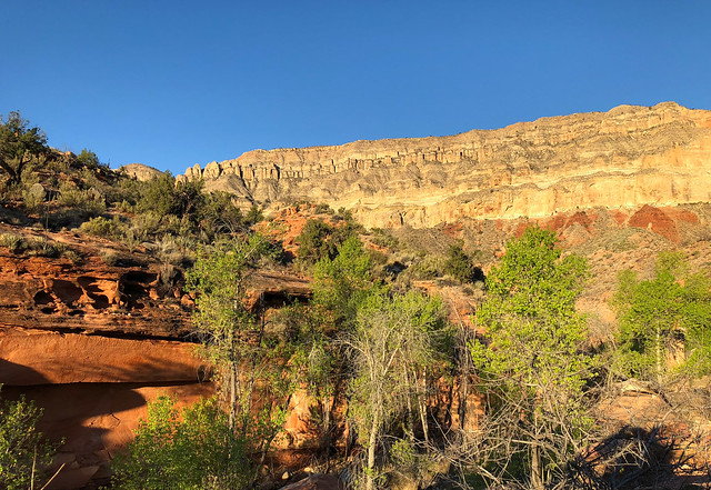
Seen from the Tuckup Trail in Grand Canyon National Park, Arizona
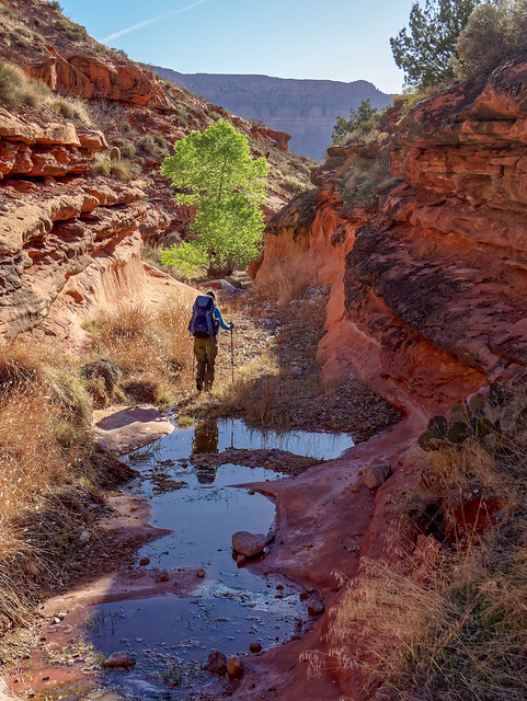
Seen from the Tuckup Trail in Grand Canyon National Park, Arizona
Seen from the Tuckup Trail in Grand Canyon National Park, Arizona
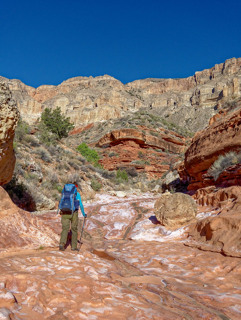
Seen from the Tuckup Trail in Grand Canyon National Park, Arizona
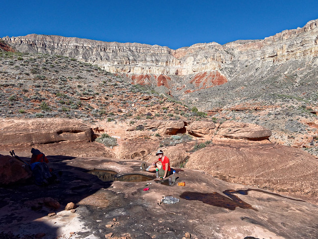
Seen from the Tuckup Trail in Grand Canyon National Park, Arizona
Seen from the Tuckup Trail in Grand Canyon National Park, Arizona
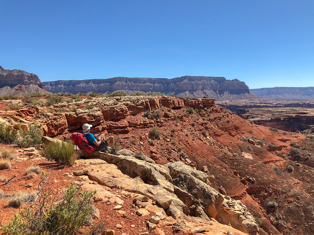
John on the Tuckup Trail in Grand Canyon National Park, Arizona
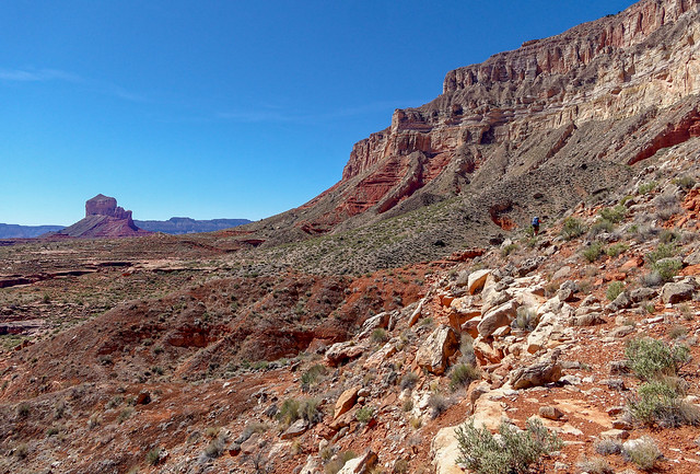
Seen from the Tuckup Trail in Grand Canyon National Park, Arizona
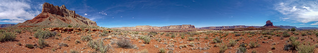
Seen from the Tuckup Trail in Grand Canyon National Park, Arizona
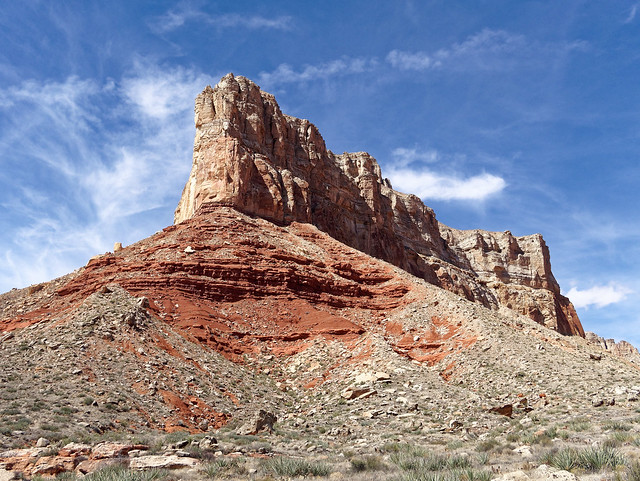
SB Point seen from the Tuckup Trail in Grand Canyon National Park, Arizona
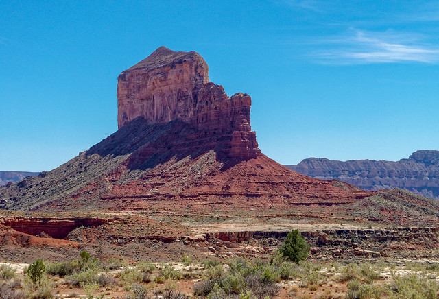
The Dome seen from the Tuckup Trail in Grand Canyon National Park, Arizona
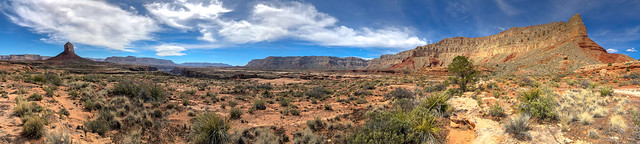
Seen from the Tuckup Trail in Grand Canyon National Park, Arizona
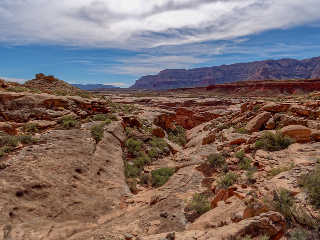
Seen from the Tuckup Trail in Grand Canyon National Park, Arizona
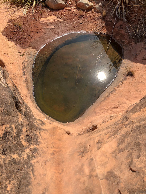
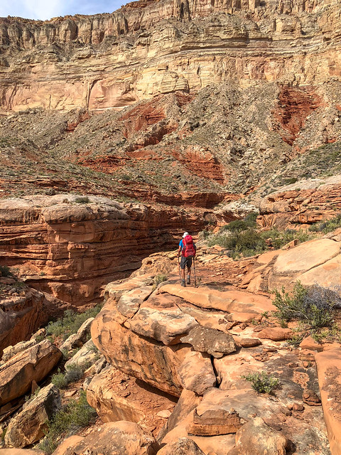
Seen from the Tuckup Trail in Grand Canyon National Park, Arizona
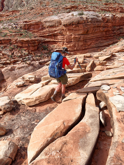
Jean on the Tuckup Trail in Grand Canyon National Park, Arizona
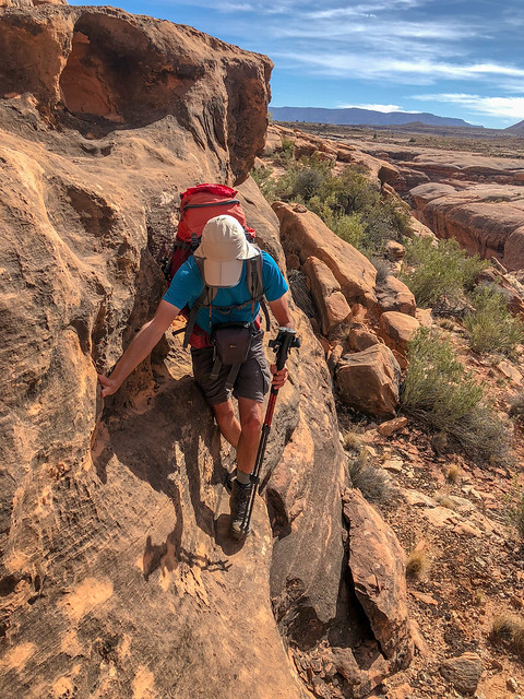
John on the Tuckup Trail in Grand Canyon National Park, Arizona
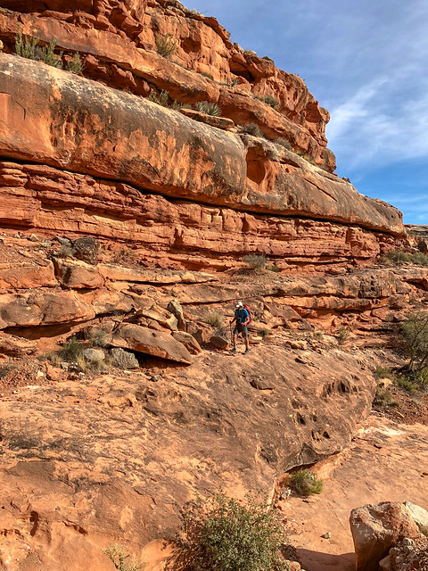
John on the Tuckup Trail in Grand Canyon National Park, Arizona
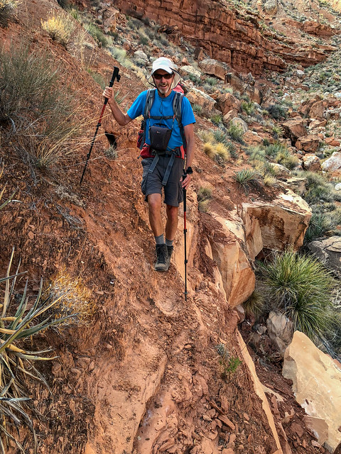
John on the Tuckup Trail in Grand Canyon National Park, Arizona
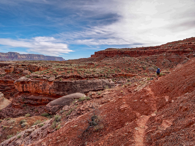
Seen from the Tuckup Trail in Grand Canyon National Park, Arizona
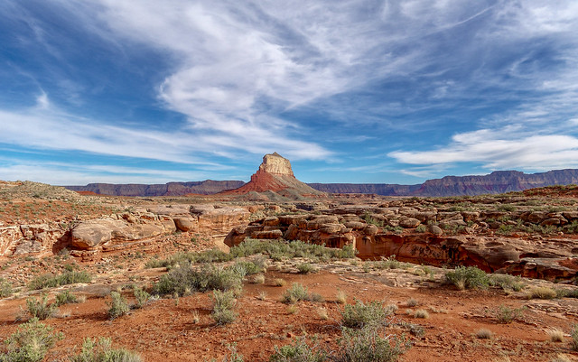
The Dome seen from the Tuckup Trail in Grand Canyon National Park, Arizona
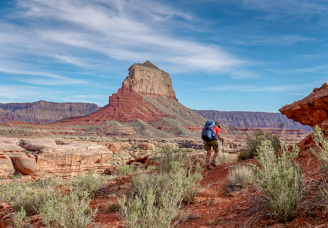
Jean on the Tuckup Trail in Grand Canyon National Park, Arizona
Seen from the Tuckup Trail in Grand Canyon National Park, Arizona
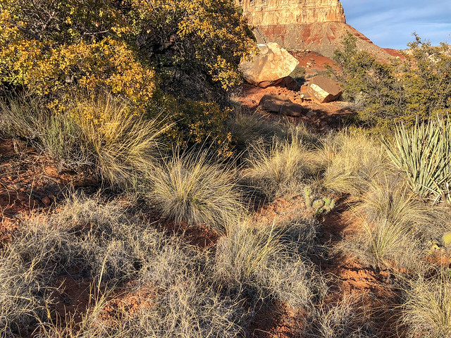
Seen from the Tuckup Trail in Grand Canyon National Park, Arizona
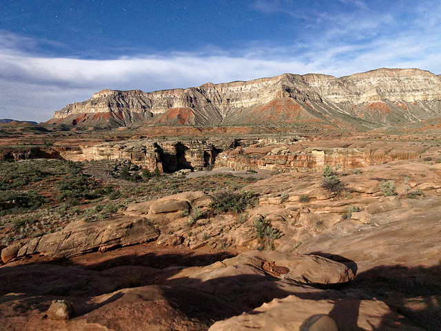
Seen from the Tuckup Trail in Grand Canyon National Park, Arizona
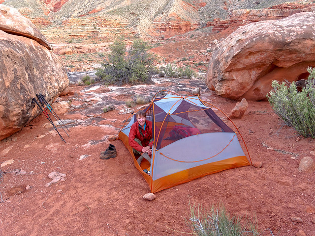
Seen from the Tuckup Trail in Grand Canyon National Park, Arizona
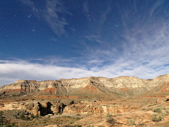
Seen from the Tuckup Trail in Grand Canyon National Park, Arizona
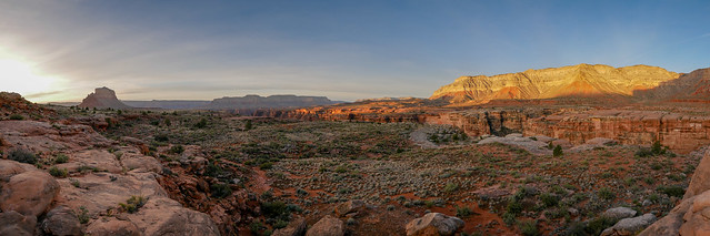
Seen from the Tuckup Trail in Grand Canyon National Park, Arizona
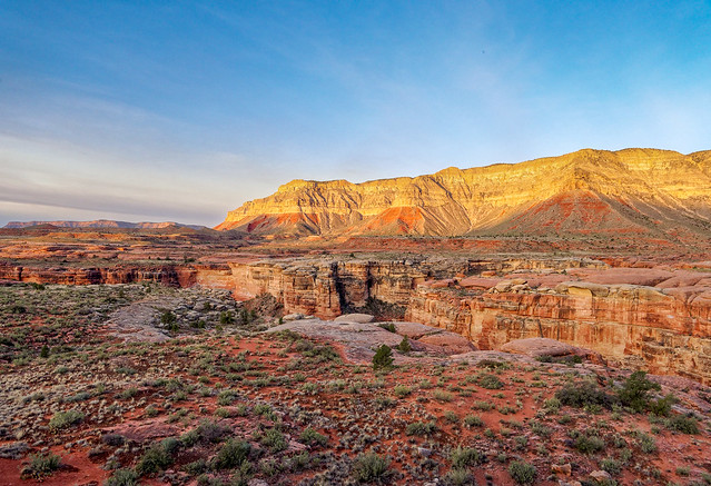
Seen from the Tuckup Trail in Grand Canyon National Park, Arizona
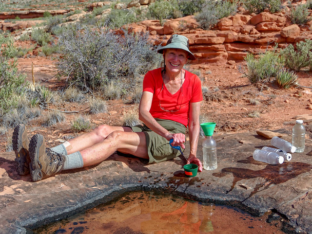
Seen from the Tuckup Trail in Grand Canyon National Park, Arizona
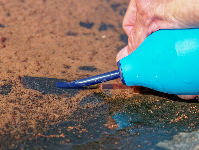
Seen from the Tuckup Trail in Grand Canyon National Park, Arizona
Jean on the Tuckup Trail in Grand Canyon National Park, Arizona
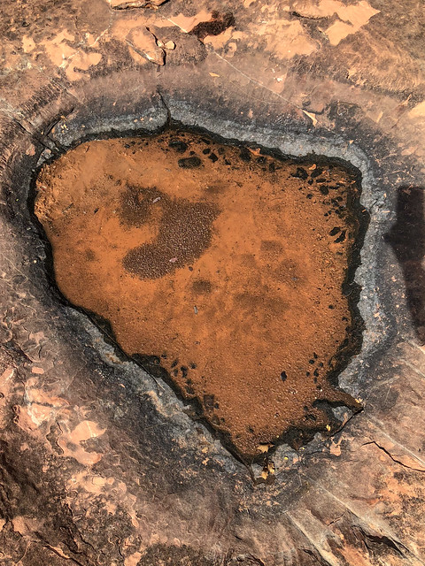
Seen from the Tuckup Trail in Grand Canyon National Park, Arizona
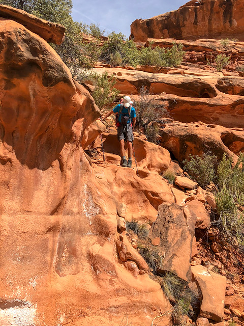
Seen from the Tuckup Trail in Grand Canyon National Park, Arizona
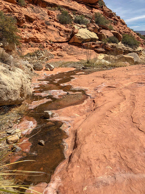
Seen from the Tuckup Trail in Grand Canyon National Park, Arizona
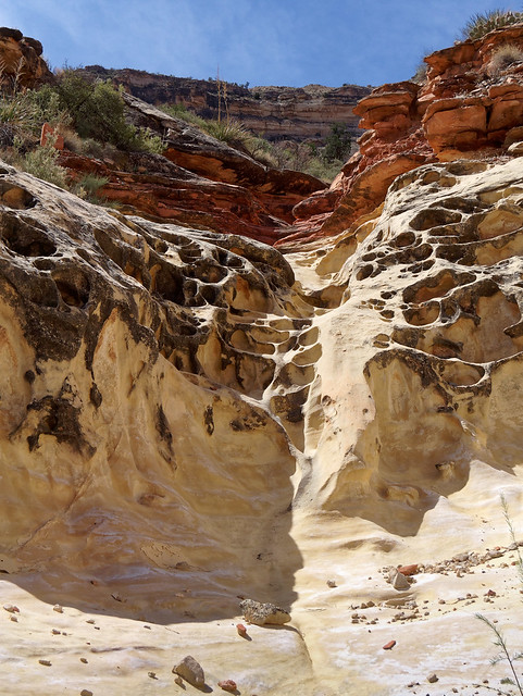
Seen from the Tuckup Trail in Grand Canyon National Park, Arizona
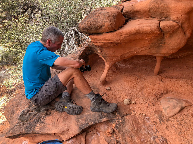
John on the Tuckup Trail in Grand Canyon National Park, Arizona
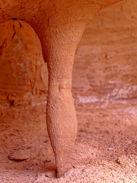
Seen from the Tuckup Trail in Grand Canyon National Park, Arizona
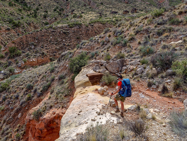
Seen from the Tuckup Trail in Grand Canyon National Park, Arizona
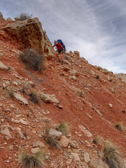
Seen from the Tuckup Trail in Grand Canyon National Park, Arizona
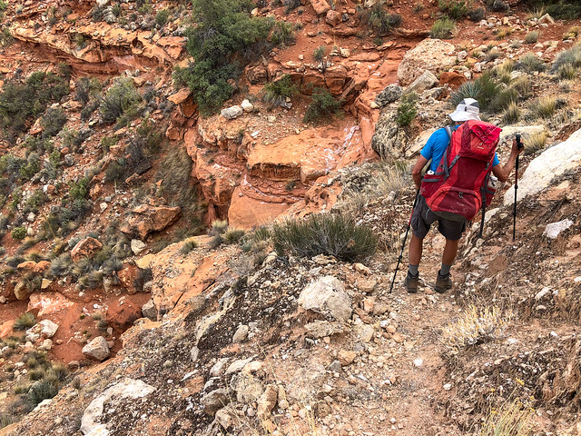
Seen from the Tuckup Trail in Grand Canyon National Park, Arizona
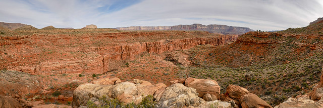
Seen from the Tuckup Trail in Grand Canyon National Park, Arizona
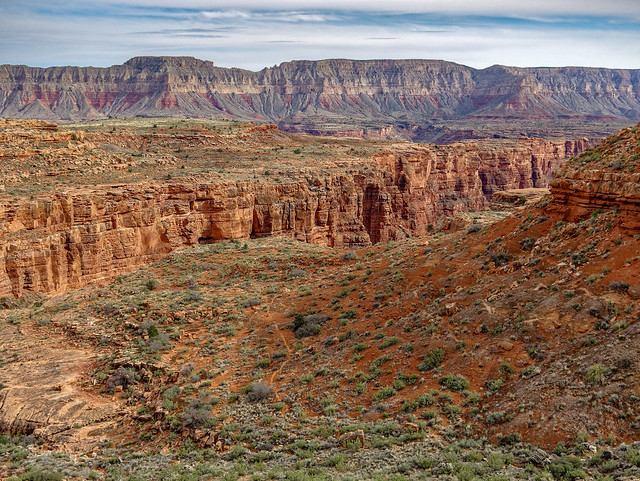
Seen from the Tuckup Trail in Grand Canyon National Park, Arizona
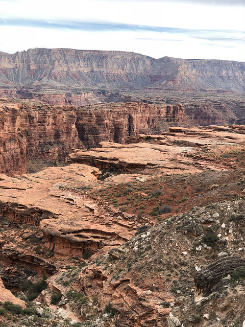
Seen from the Tuckup Trail in Grand Canyon National Park, Arizona
 Seen from the Tuckup Trail in Grand Canyon National Park, Arizona
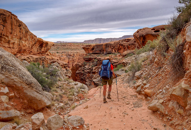
Jean near Stairway Canyon in Grand Canyon National Park, Arizona
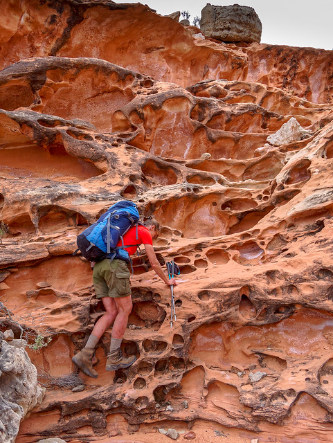
Jean near Stairway Canyon in Grand Canyon National Park, Arizona
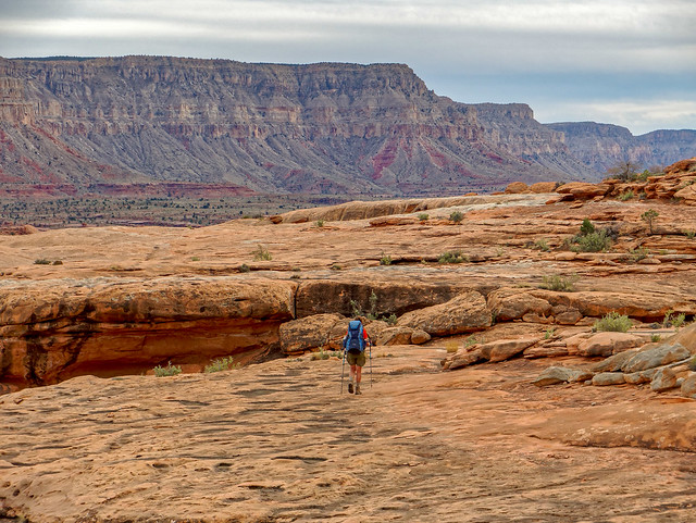
Jean near Stairway Canyon in Grand Canyon National Park, Arizona
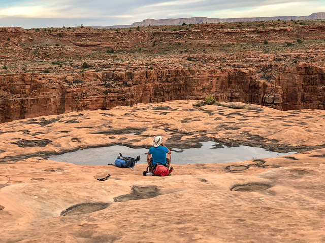
John near Stairway Canyon in Grand Canyon National Park, Arizona
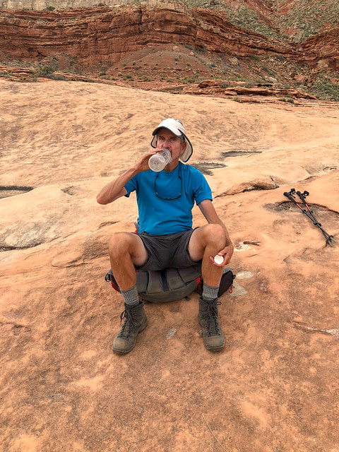
John near Stairway Canyon in Grand Canyon National Park, Arizona
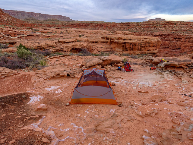
Our camp near Stairway Canyon in Grand Canyon National Park, Arizona
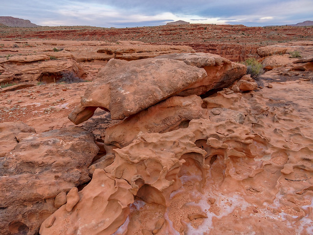
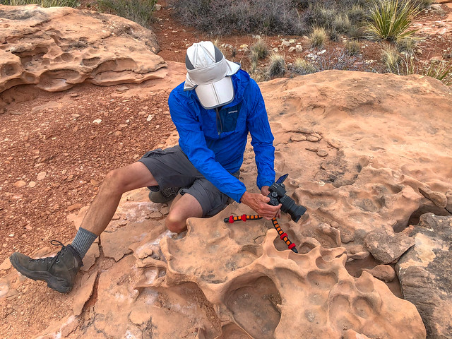
John near Stairway Canyon in Grand Canyon National Park, Arizona
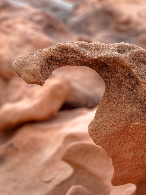
Seen near Stairway Canyon in Grand Canyon National Park, Arizona
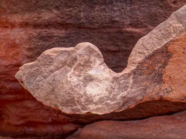
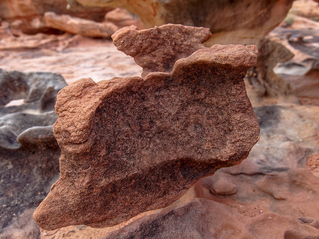
Seen near Stairway Canyon in Grand Canyon National Park, Arizona
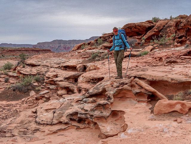
Jean near Stairway Canyon in Grand Canyon National Park, Arizona
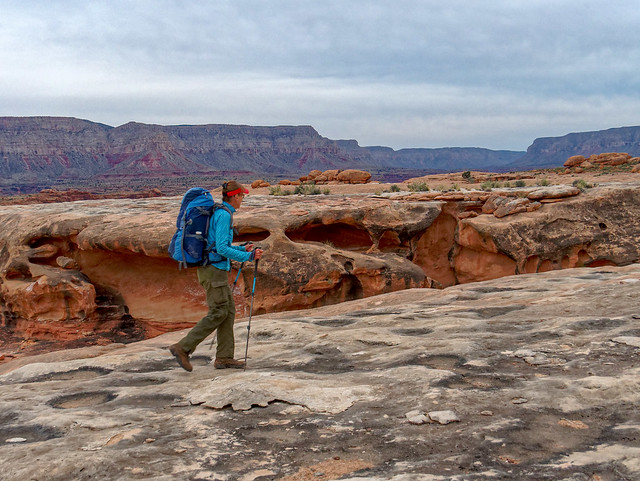
Jean on the Tuckup Trail in Grand Canyon National Park, Arizona
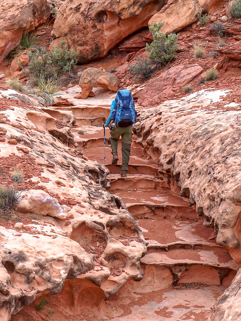
Jean on the Tuckup Trail in Grand Canyon National Park, Arizona
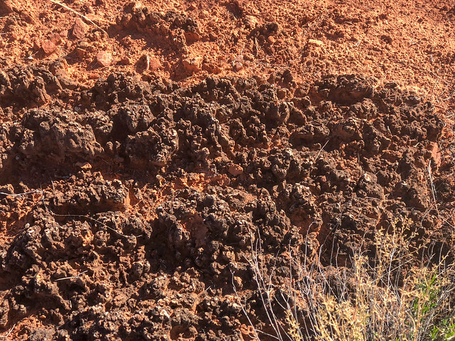
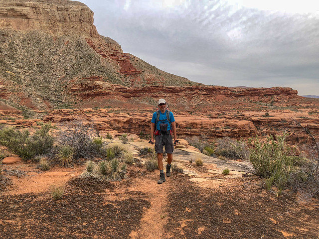
John on the Tuckup Trail in Grand Canyon National Park, Arizona
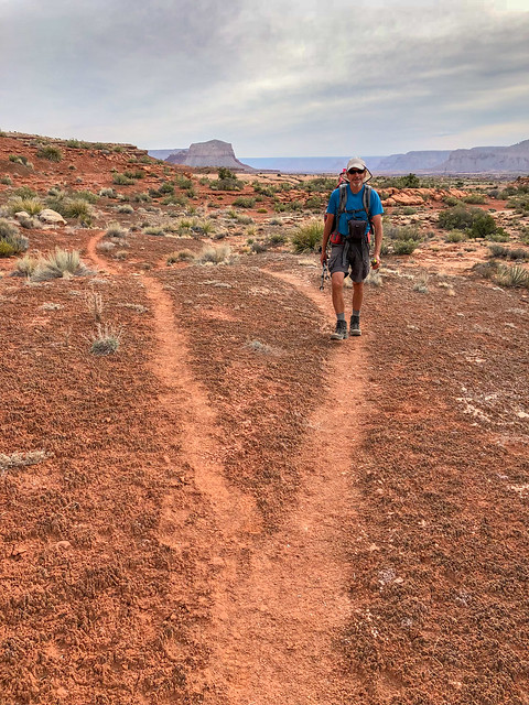
John on the Tuckup Trail in Grand Canyon National Park, Arizona
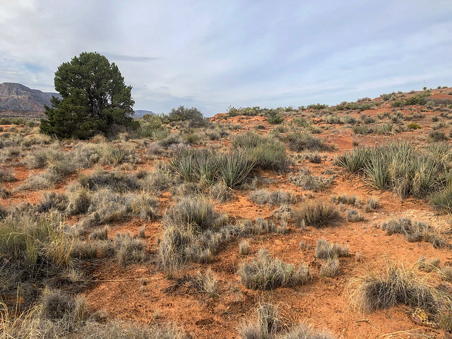
Seen from the Tuckup Trail in Grand Canyon National Park, Arizona
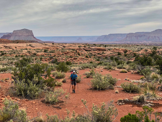
John on the Tuckup Trail in Grand Canyon National Park, Arizona
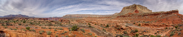
Seen from the Tuckup Trail in Grand Canyon National Park, Arizona
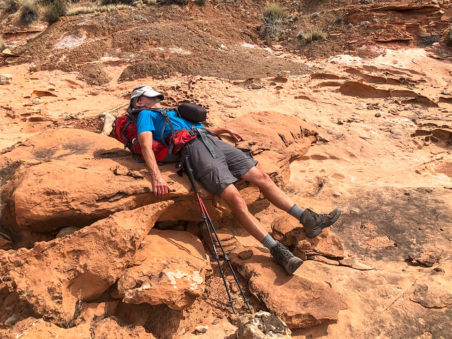
John on the Tuckup Trail in Grand Canyon National Park, Arizona
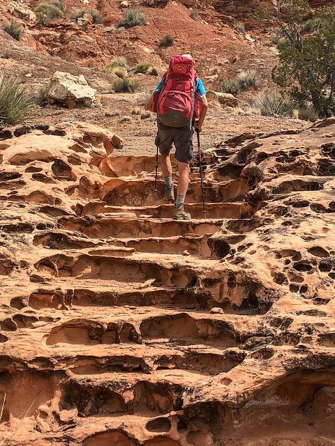
John on the Tuckup Trail in Grand Canyon National Park, Arizona
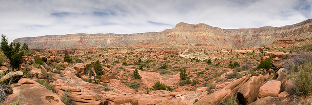 Seen from the Tuckup Trail in Grand Canyon National Park, Arizona
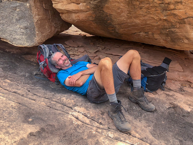
John on the Tuckup Trail in Grand Canyon National Park, Arizona
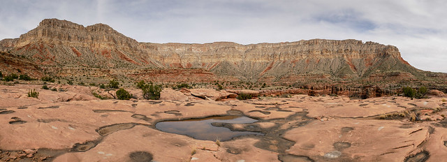
Seen from the Tuckup Trail in Grand Canyon National Park, Arizona
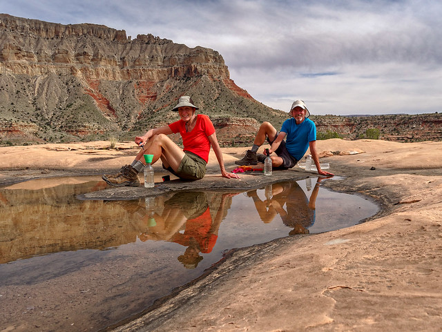
Jean and John on the Tuckup Trail in Grand Canyon National Park, Arizona
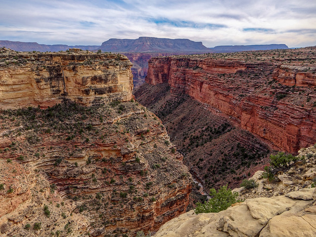
Seen from the Tuckup Trail in Grand Canyon National Park, Arizona
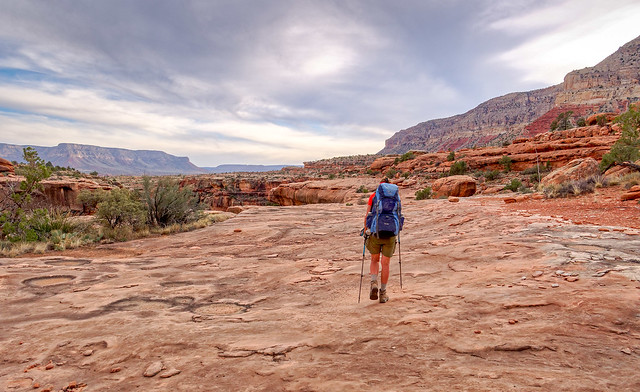
Jean on the Tuckup Trail in Grand Canyon National Park, Arizona
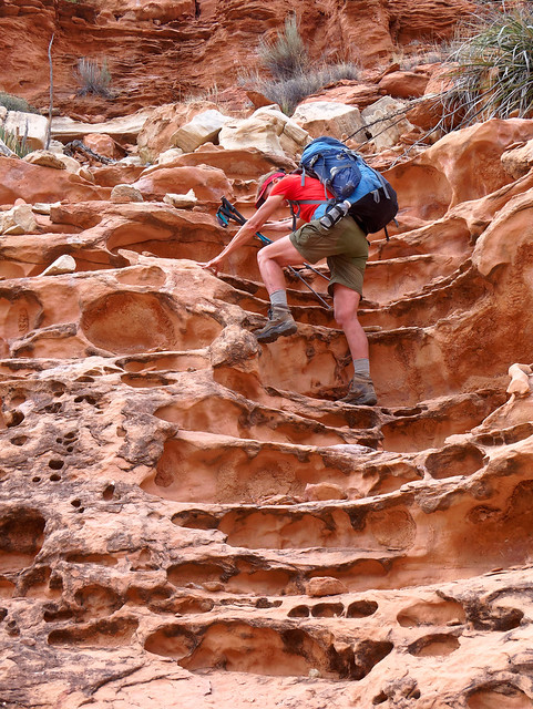
Jean on the Tuckup Trail in Grand Canyon National Park, Arizona
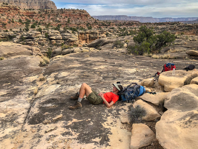
Jean on the Tuckup Trail in Grand Canyon National Park, Arizona
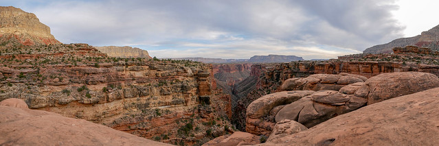
Seen from the Tuckup Trail in Grand Canyon National Park, Arizona
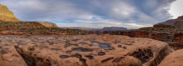
Seen from the Tuckup Trail in Grand Canyon National Park, Arizona
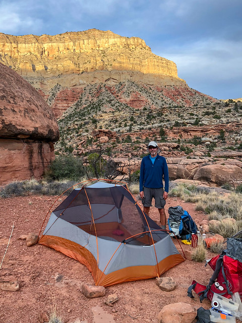
Our camp near Big Point Canyon in Grand Canyon National Park, Arizona
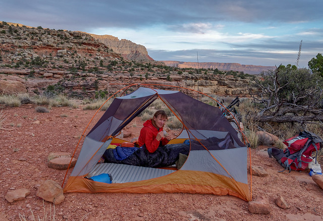
Our camp near Big Point Canyon in Grand Canyon National Park, Arizona
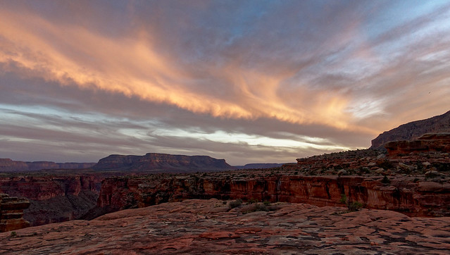
Seen near Big Point Canyon in Grand Canyon National Park, Arizona
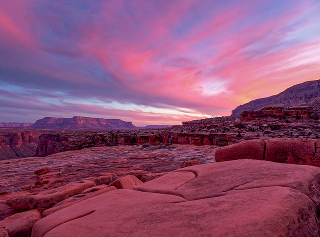
Seen near Big Point Canyon in Grand Canyon National Park, Arizona
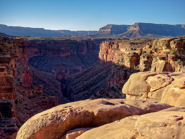
Seen near Big Point Canyon in Grand Canyon National Park, Arizona
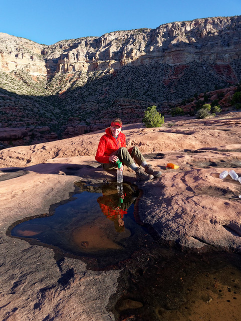
Jean near Big Point Canyon in Grand Canyon National Park, Arizona
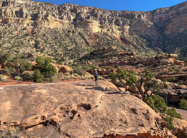
John on the Tuckup Trail in Grand Canyon National Park, Arizona
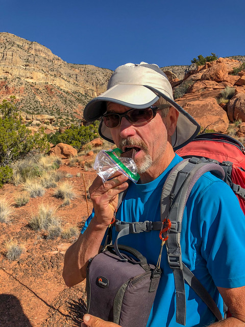
John on the Tuckup Trail in Grand Canyon National Park, Arizona
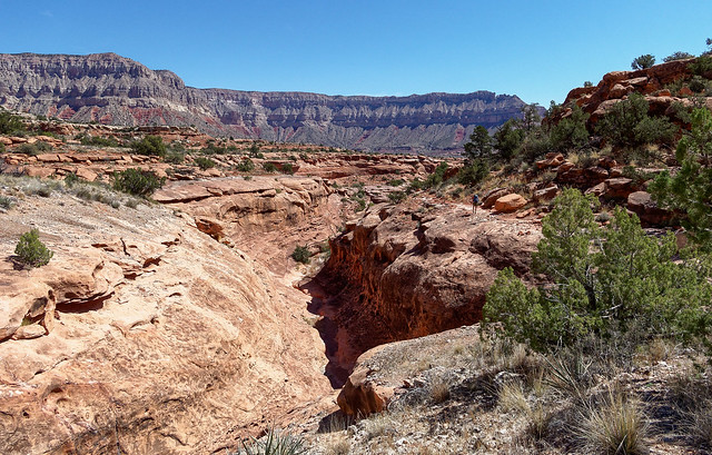
Seen from the Tuckup Trail in Grand Canyon National Park, Arizona
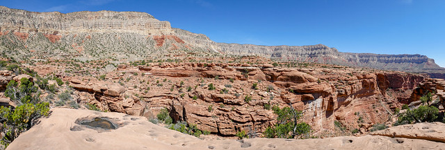
Seen from the Tuckup Trail in Grand Canyon National Park, Arizona
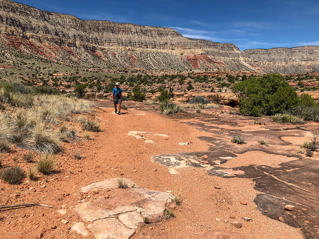
John on the Tuckup Trail in Grand Canyon National Park, Arizona
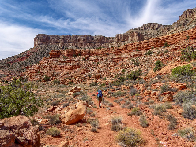
Jean on the Tuckup Trail in Grand Canyon National Park, Arizona
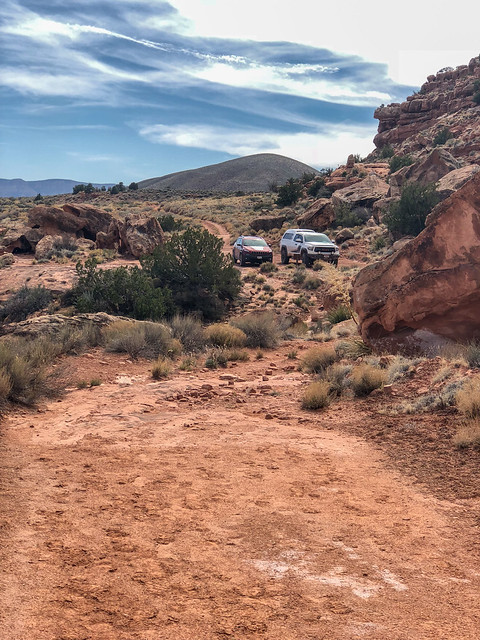
Seen from the Tuckup Trail in Grand Canyon National Park, Arizona
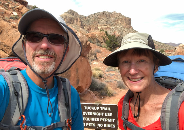
John and Jean at the Tuckup Trailhead at Toroweap in Grand Canyon National Park, Arizona
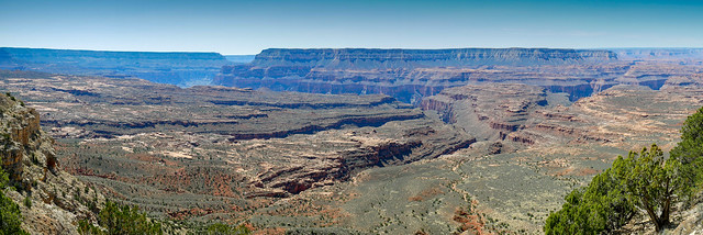
Seen from the Thunder River Trail in Grand Canyon National Park, Arizona
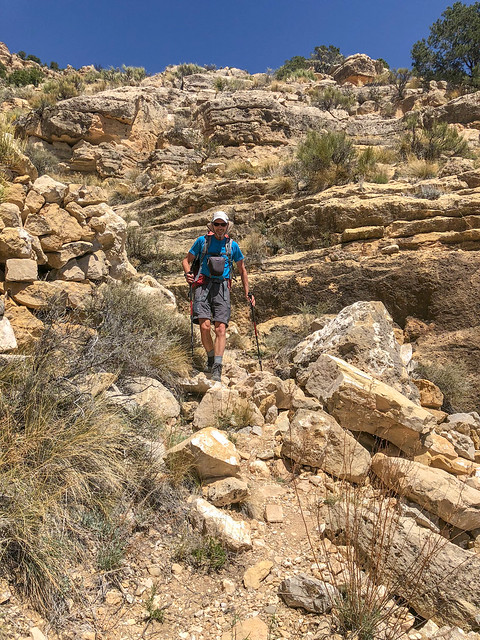
John on the Thunder River Trail in Grand Canyon National Park, Arizona
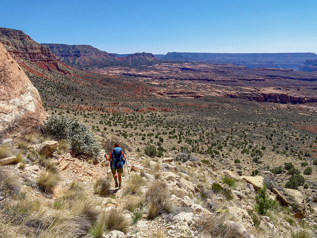
Jean on the Thunder River Trail in Grand Canyon National Park, Arizona
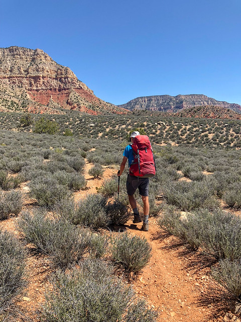
John on the Thunder River Trail in Grand Canyon National Park, Arizona
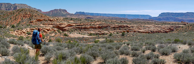
Jean on the Thunder River Trail in Grand Canyon National Park, Arizona
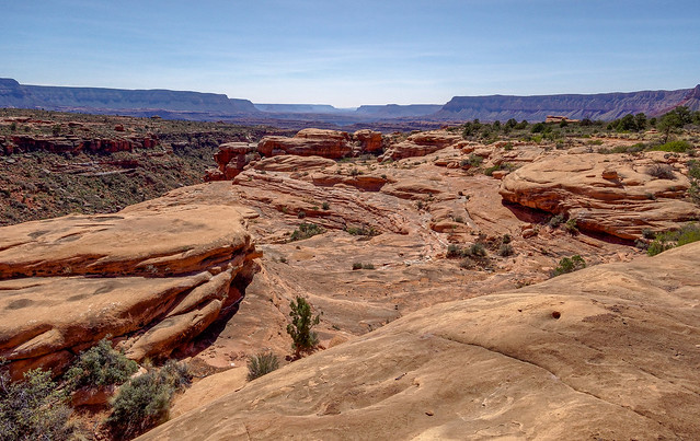
Seen from the Thunder River Trail in Grand Canyon National Park, Arizona
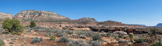
Seen from the Thunder River Trail in Grand Canyon National Park, Arizona
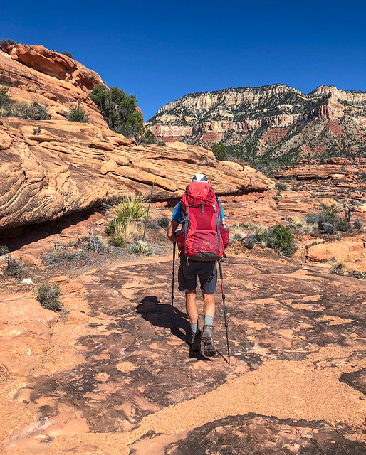
John on the Thunder River Trail in Grand Canyon National Park, Arizona
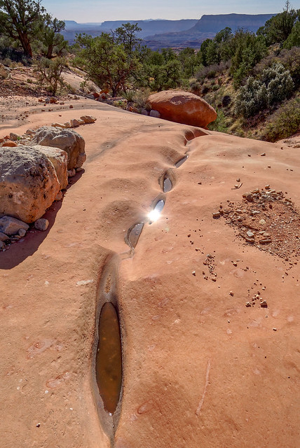
Seen from the Thunder River Trail in Grand Canyon National Park, Arizona
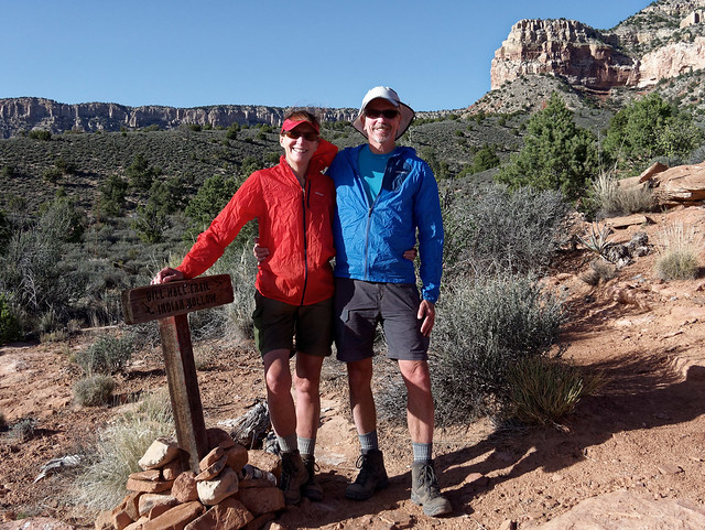
Jean and John on the Thunder River Trail in Grand Canyon National Park, Arizona
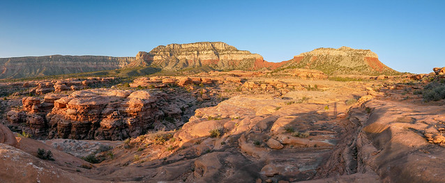
Seen from the Thunder River Trail in Grand Canyon National Park, Arizona
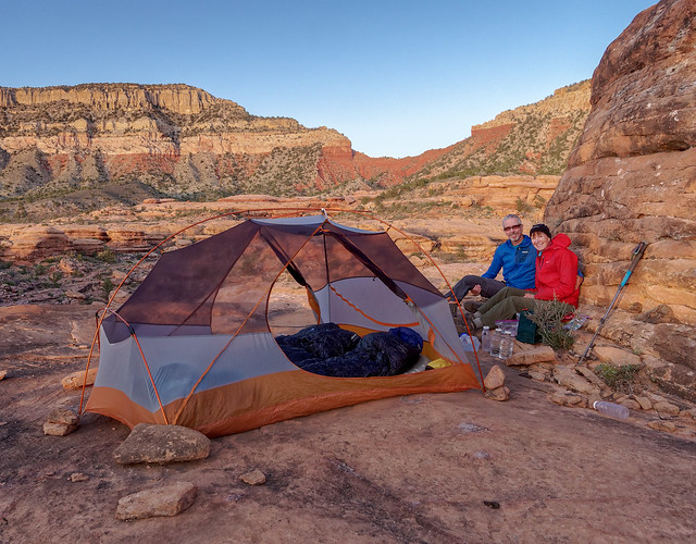
John and Jean in camp on the Esplanade in Grand Canyon National Park, Arizona
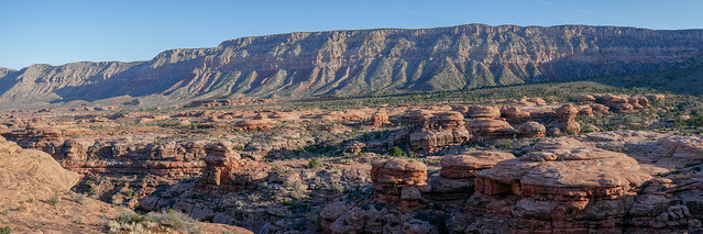
Seen from the Thunder River Trail in Grand Canyon National Park, Arizona
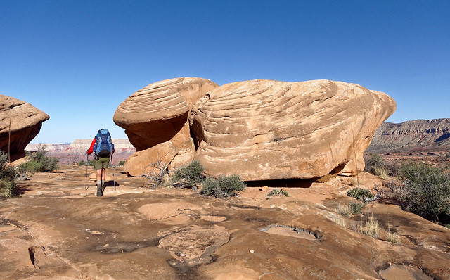
Jean on the Thunder River Trail in Grand Canyon National Park, Arizona
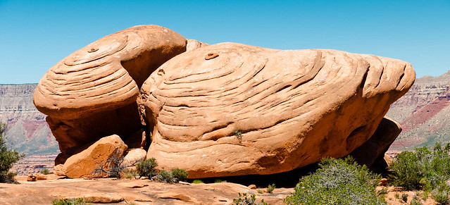
Seen from the Thunder River Trail in Grand Canyon National Park, Arizona in May 21011
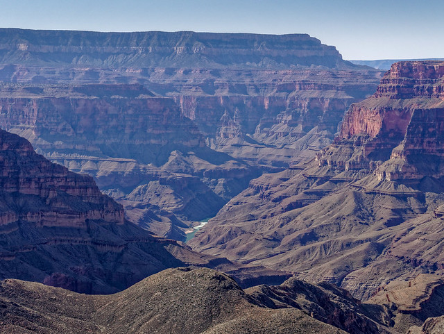
Seen from the Thunder River Trail in Grand Canyon National Park, Arizona
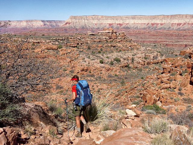
Jean on the Thunder River Trail in Grand Canyon National Park, Arizona
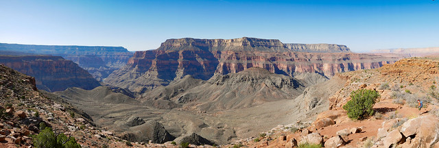
Seen from the Thunder River Trail in Grand Canyon National Park, Arizona
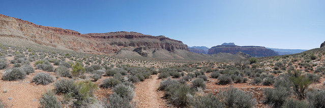
Seen from the Thunder River Trail in Grand Canyon National Park, Arizona
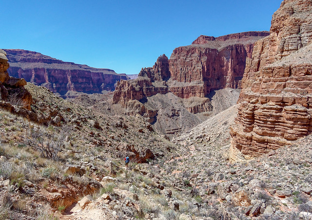
Jean on the Deer Creek Trail in Grand Canyon National Park, Arizona
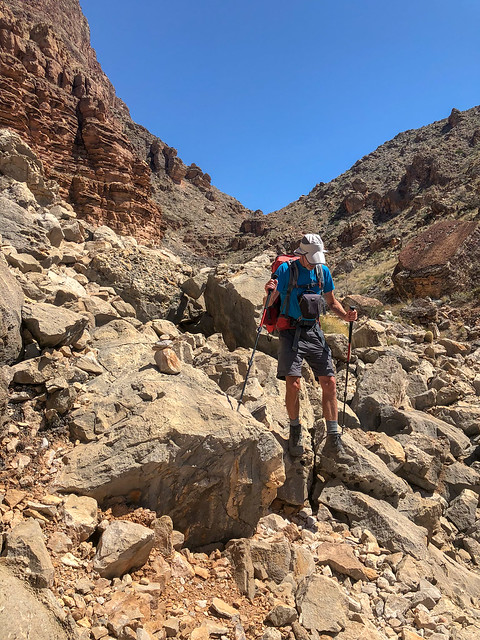
John on the Deer Creek Trail in Grand Canyon National Park, Arizona
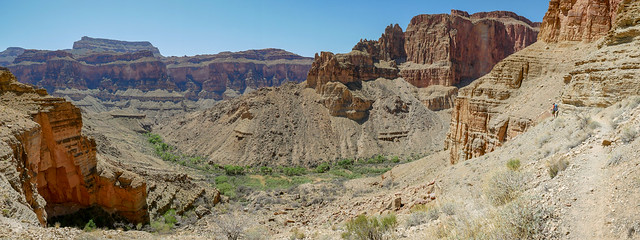
Seen from the Deer Creek Trail in Grand Canyon National Park, Arizona
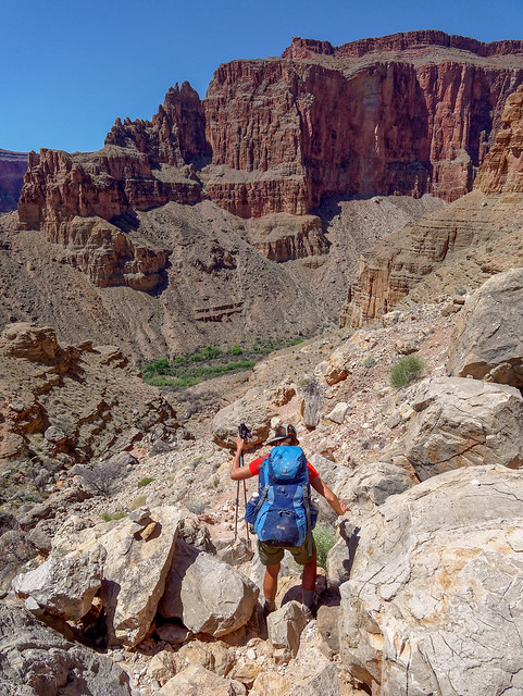
Jean on the Deer Creek Trail in Grand Canyon National Park, Arizona
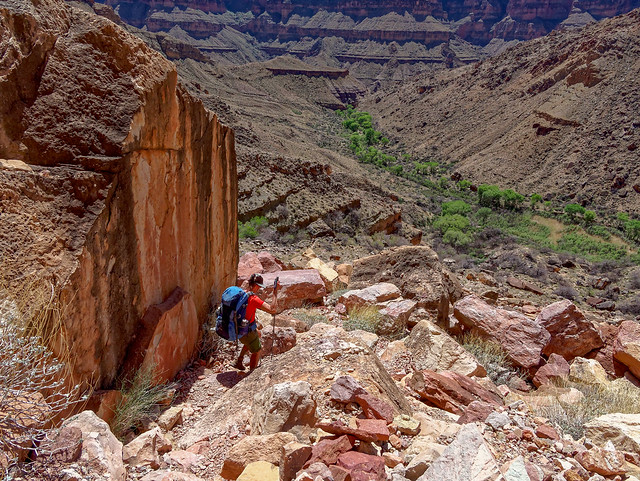
Jean on the Deer Creek Trail in Grand Canyon National Park, Arizona
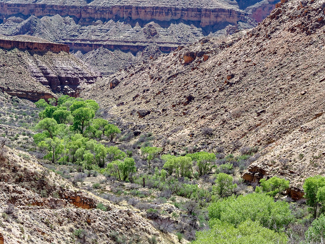
Seen from the Deer Creek Trail in Grand Canyon National Park, Arizona
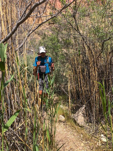
John on the Deer Creek Trail in Grand Canyon National Park, Arizona
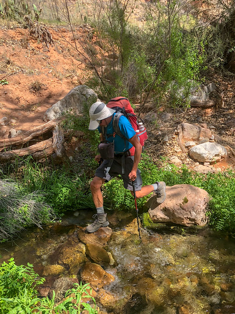
John on the Deer Creek Trail in Grand Canyon National Park, Arizona
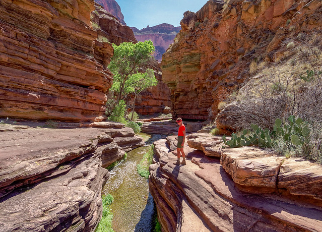
Jean in Deer Creek Canyon in Grand Canyon National Park, Arizona
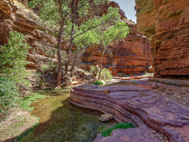
Jean in Deer Creek Canyon in Grand Canyon National Park, Arizona
However, we did not linger at The Patio because we wanted to get somewhere we hadn't gotten to the last time we were there, the base of Deer Creek Falls. By hiking down Deer Creek Canyon ...
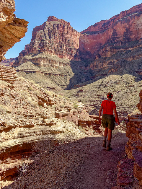
Jean in Deer Creek Canyon in Grand Canyon National Park, Arizona
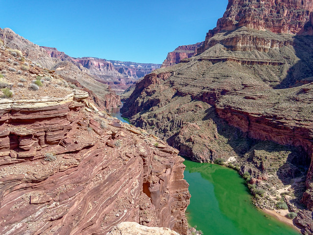
The Colorado River seen from Deer Creek Canyon in Grand Canyon National Park, Arizona
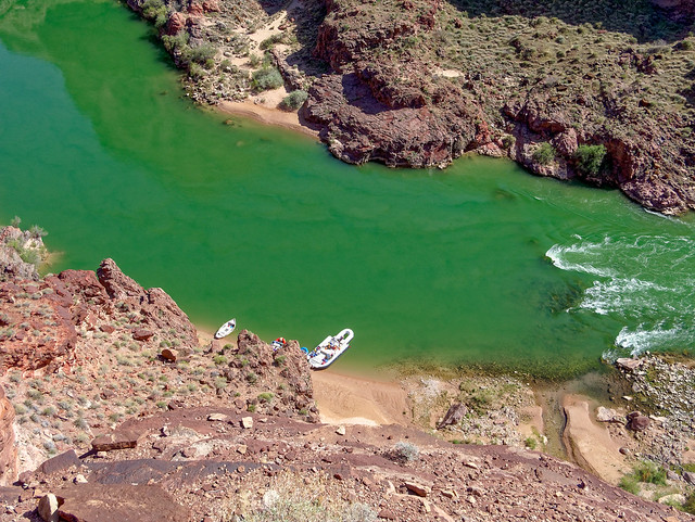
The Colorado River seen from Deer Creek Canyon in Grand Canyon National Park, Arizona

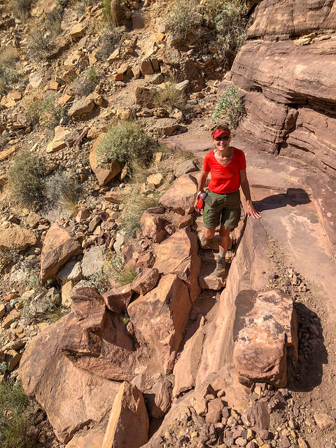
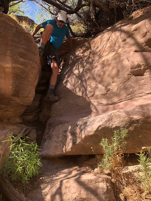
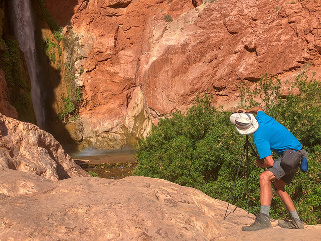
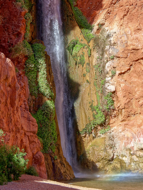
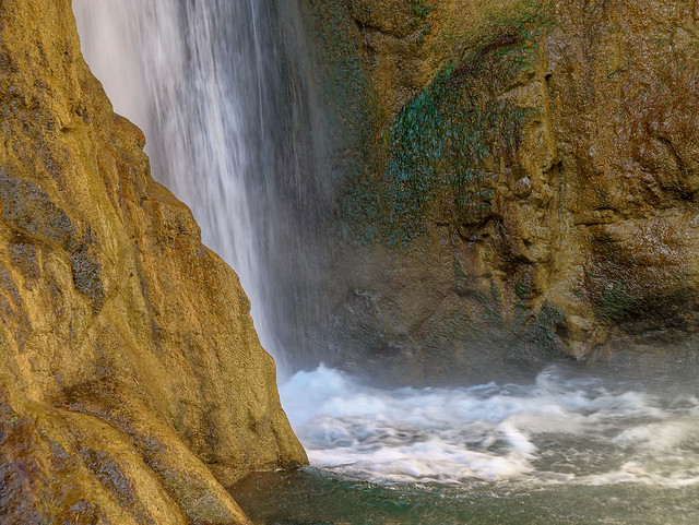
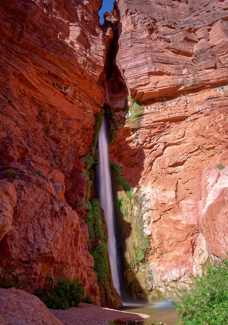
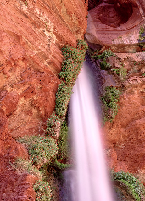
We then headed back up and I continued up the trail to go set up camp. On my way I noticed a group of six had shown up; four sunburned teenagers and two adults were cooling off in the creek. They had hiked over from Tapeats that day and I knew exactly how they felt.
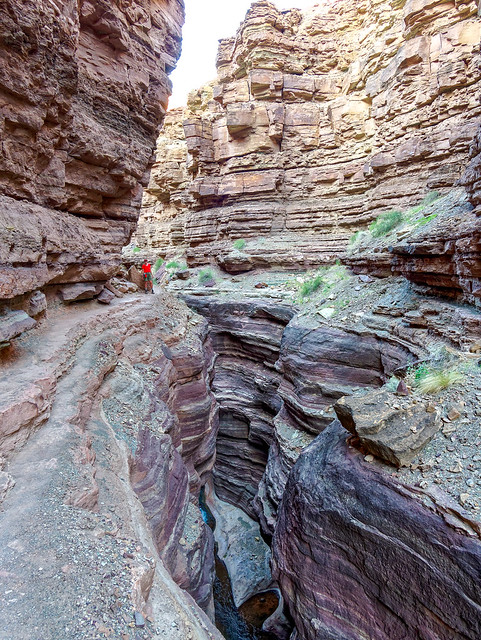
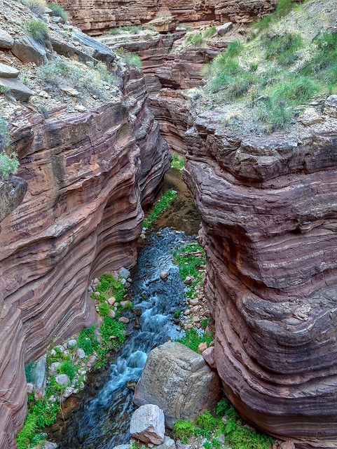
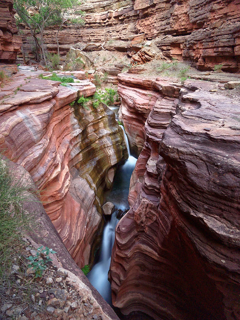
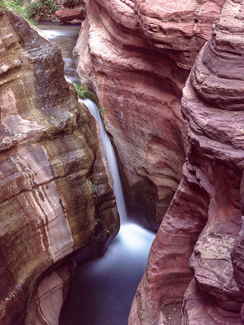
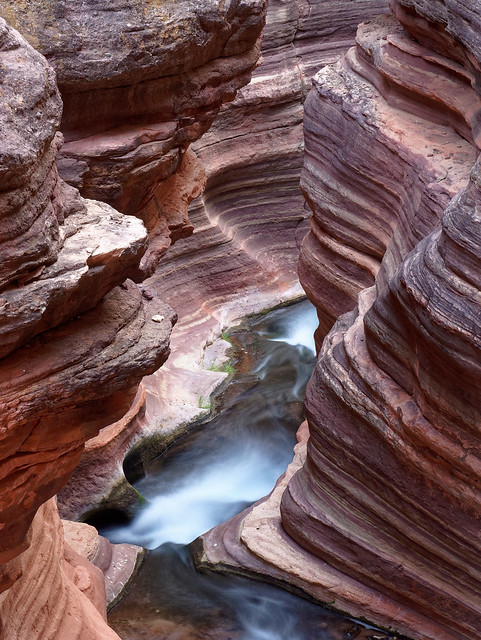
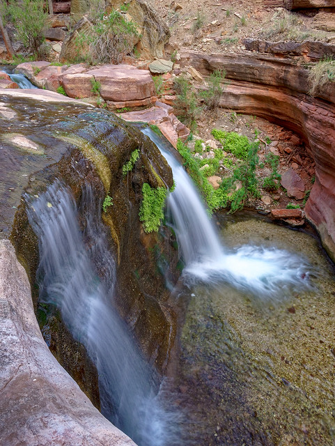
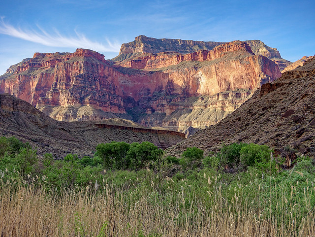
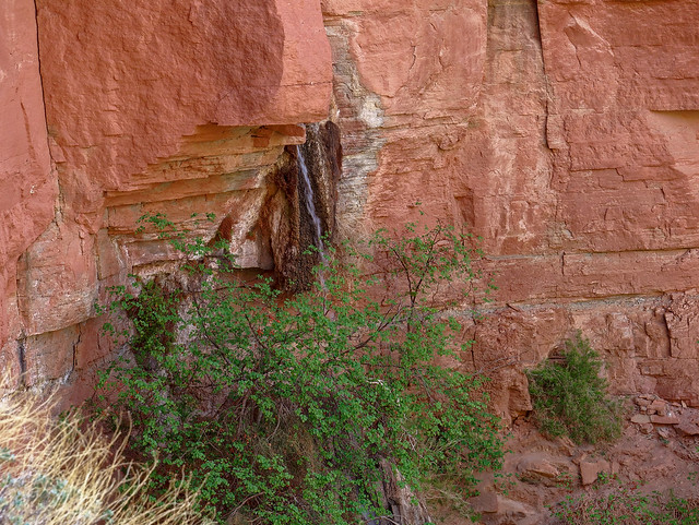
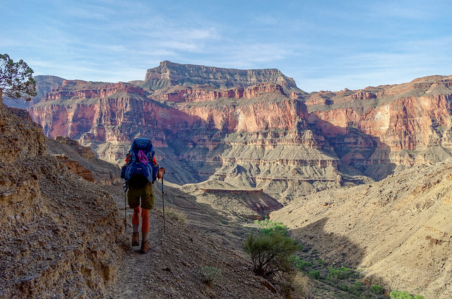
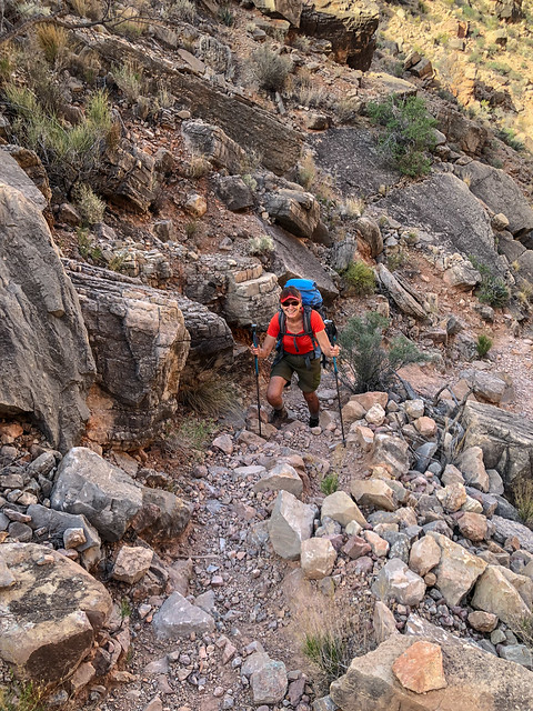
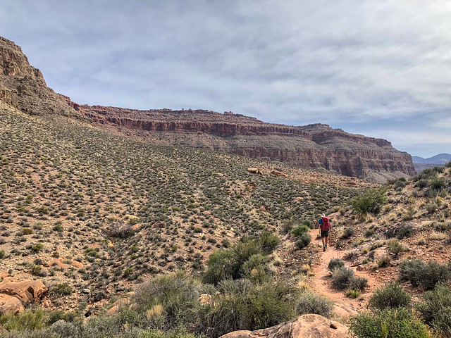
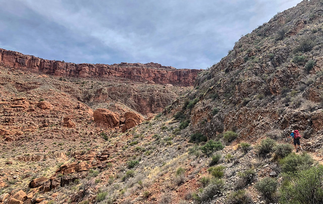
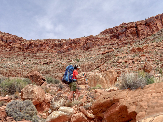
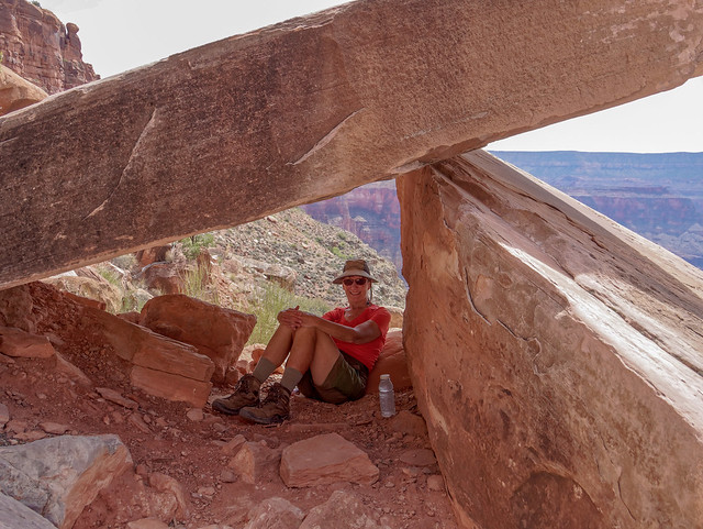
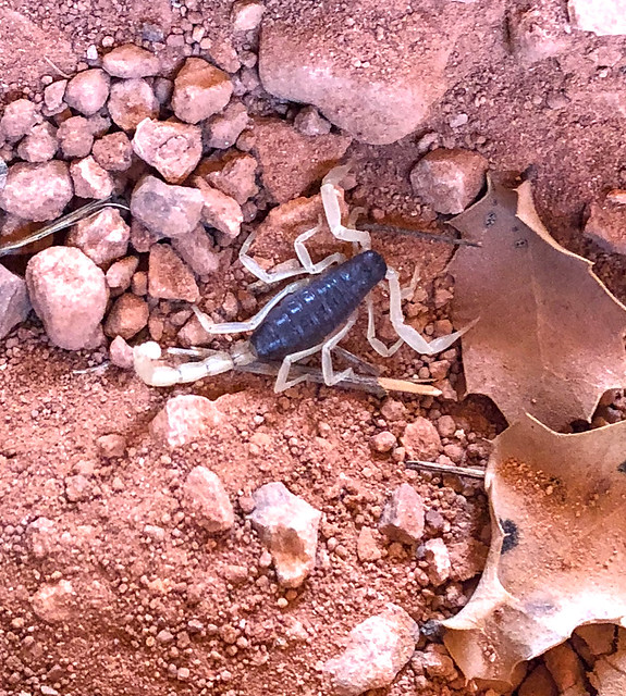
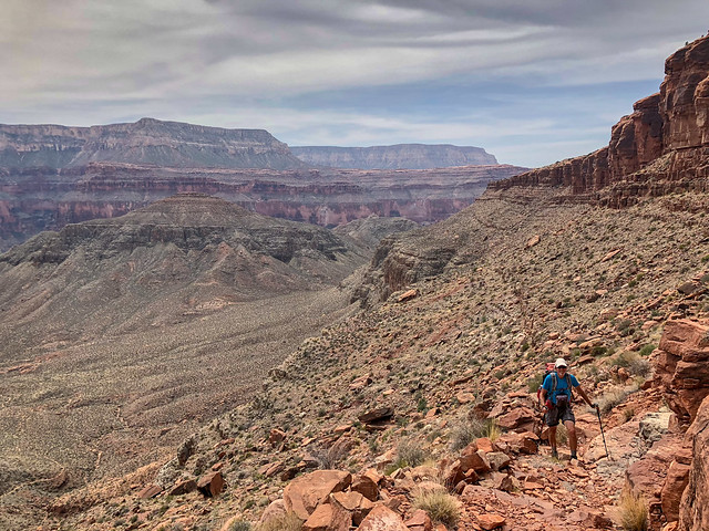
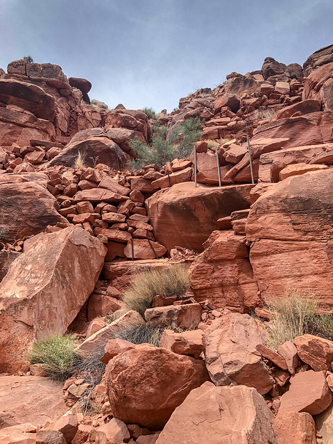
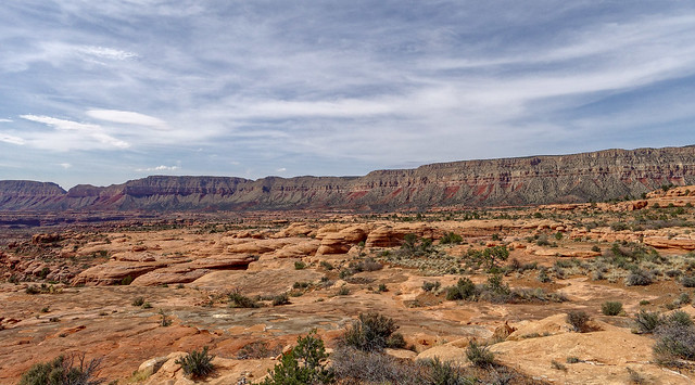
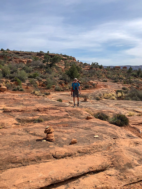
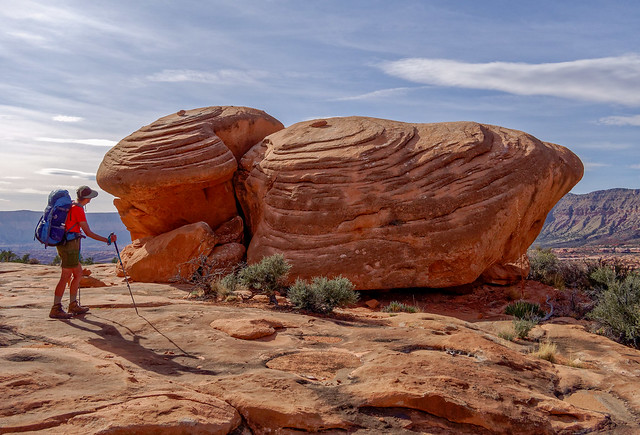
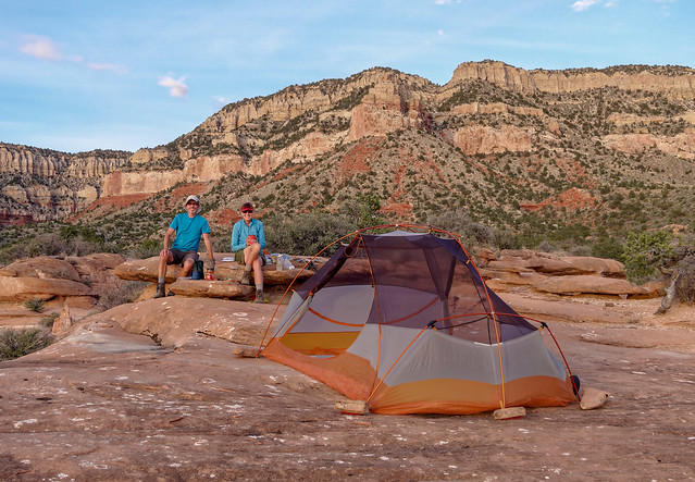
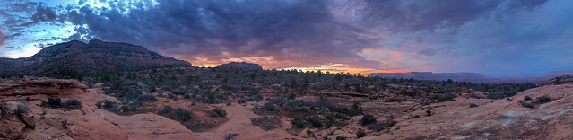
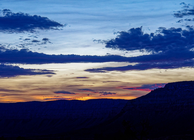
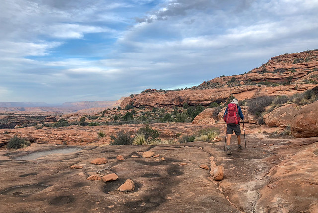
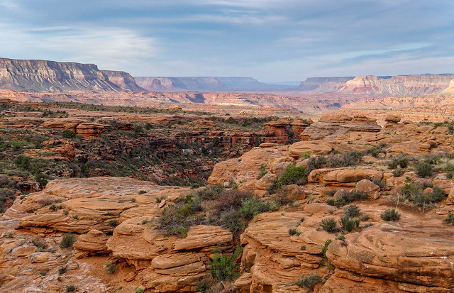
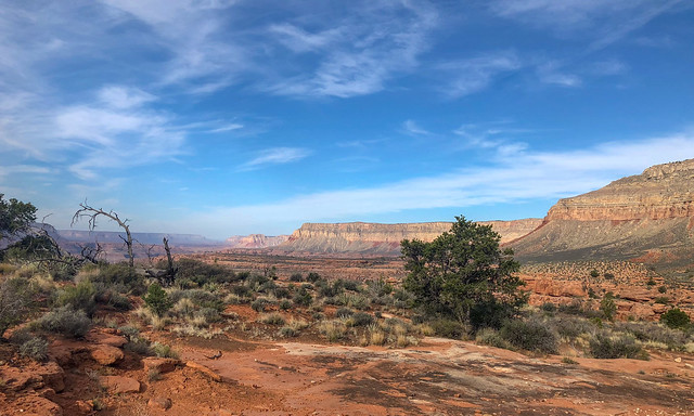
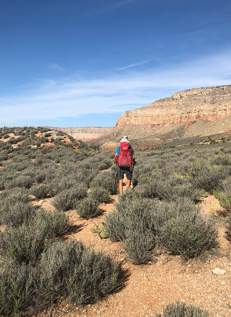
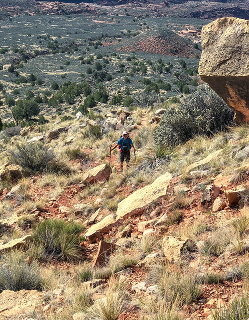
Jean in Cottonwood Canyon in Grand Canyon National Park, Arizona
The water from this spring seemed a bit clearer although there was plenty of evidence it was just as mineralized as Cottonwood Spring.
John getting water in Cottonwood Canyon in Grand Canyon National Park, Arizona
I noticed that there was a mineral buildup on small twigs and bits of gravel. This should have made me suspicious but we needed water.
Seen in Cottonwood Canyon in Grand Canyon National Park, Arizona
We set up camp on a ledge above the drainage.
Seen from the Tuckup Trail in Grand Canyon National Park, Arizona
After treating some of the water (using a SteriPen) I tasted it and found it to have an almost metallic "tang" to it. At the time I wondered if it could be due to copper but was later told it was probably due to Gypsum (calcium sulfate). While it did not negatively affect the flavors of our dinners it did mess with our breakfasts. It seemed to neutralize any sweetness in our morning coffee and tea. It also created a chemical reaction with my high fat/low carb coffee mix that made the stuff in my cup look (and taste) like a toxic waste dump. As it was a significant number of my daily calories I forced myself to consume it.
We learned a painful lesson about boiling water that has a high mineral content when backpacking along Washington's Pacific coast. We discovered that some minerals (sodium in that case) can cause the water to boil at too low a temperature to render it safe to consume (we both contracted Giardia as a result). What we decided to do in this situation was to treat the water first with the SteriPen before heating it for cooking. It may have been totally unnecessary but we felt better safe than sorry.
Seen from the Tuckup Trail in Grand Canyon National Park, Arizona
Despite our water challenges we enjoyed being there. We had a good view across Tuckup Canyon to Hades Knoll.
Seen from the Tuckup Trail in Grand Canyon National Park, Arizona
The next morning we packed up ...
Seen from the Tuckup Trail in Grand Canyon National Park, Arizona
... and headed back down the drainage loaded down with enough water to see us through the day.
Seen from the Tuckup Trail in Grand Canyon National Park, Arizona
The sight of this foam on the water downstream was not reassuring.
Seen from the Tuckup Trail in Grand Canyon National Park, Arizona
While John suffered no ill effects from the water it did seem to be messing with my gastrointestinal tract. The next reliable source of water was Willow Spring which is reported to be worse than Cottonwood Spring in this department. Needless to say, I wasn't looking forward to it.
Seen from the Tuckup Trail in Grand Canyon National Park, Arizona
And then, once out of Cottonwood Canyon and back up on the Supai, a miracle happened! We encountered a pothole! Had we only known we could have hiked a bit further the day before and had good water that would not have turned my coffee into a "Superfund" site!. We happily dumped out the Cottonwood water we had been carrying and loaded up with some of the most delicious water I have ever tasted.
Seen from the Tuckup Trail in Grand Canyon National Park, Arizona
Fortunately, after reading a trip report by a woman who did this same route, we had added a bulb syringe to our water collection repertoire. It was essential on this trip.
Seen from the Tuckup Trail in Grand Canyon National Park, Arizona
After this I think we both felt calmer knowing we were not dependent on Willow Spring and that there was still water in some potholes if we can only find them.
John on the Tuckup Trail in Grand Canyon National Park, Arizona
We continued on but found the going to be slow.
Seen from the Tuckup Trail in Grand Canyon National Park, Arizona
Looking back to the west we could see across to the other side of Tuckup Canyon ...
Seen from the Tuckup Trail in Grand Canyon National Park, Arizona
... including SB Point ...
SB Point seen from the Tuckup Trail in Grand Canyon National Park, Arizona
... and The Dome.
The Dome seen from the Tuckup Trail in Grand Canyon National Park, Arizona
After rounding Tuckup Rocky Point (to the right) ...
Seen from the Tuckup Trail in Grand Canyon National Park, Arizona
... we eventually approached an arm of Fern Glen Canyon.
Seen from the Tuckup Trail in Grand Canyon National Park, Arizona
I did see this nice deep pothole but we did not want to carry anymore water than we already were and it was too early to stop so we passed it by.
Seen from the Tuckup Trail in Grand Canyon National Park, Arizona
As we made our way around Fern Glen Canyon ...
Seen from the Tuckup Trail in Grand Canyon National Park, Arizona
... we carefully picked our way through the jumble of rocks.
Jean on the Tuckup Trail in Grand Canyon National Park, Arizona
But it was slow going at times.
John on the Tuckup Trail in Grand Canyon National Park, Arizona
We tried to make up time when we could ...
John on the Tuckup Trail in Grand Canyon National Park, Arizona
... before being forced to just slow down and go more carefully.
John on the Tuckup Trail in Grand Canyon National Park, Arizona
What we needed was more good clear track like this so we could just walk and cover some miles.
Seen from the Tuckup Trail in Grand Canyon National Park, Arizona
We continued on ...
The Dome seen from the Tuckup Trail in Grand Canyon National Park, Arizona
... under the watchful eye of The Dome.
Jean on the Tuckup Trail in Grand Canyon National Park, Arizona
We rejoiced when we encountered sections of well established trail ...
Seen from the Tuckup Trail in Grand Canyon National Park, Arizona
... and were dismayed when it would disappear in the vegetation. It was taking us forever to get to Willow Canyon. However, as we had water, we could dry camp if necessary so we decided to keep walking until 6:00 or stop anytime after 5:00 if we encountered water.
Seen from the Tuckup Trail in Grand Canyon National Park, Arizona
As we began to make our way around the edge of Willow Canyon we found ourselves on a good broad ledge. However, as we got closer to the head of the canyon we encountered boulders we couldn't get around. We realized we were just too high and would not be able to continue all the way around the canyon at that level. Nor could we safely climb up or down do a level that would work. But we were both too tired to backtrack all the way ...
Seen from the Tuckup Trail in Grand Canyon National Park, Arizona
... so we stopped part way back and set up camp.
Seen from the Tuckup Trail in Grand Canyon National Park, Arizona
Later that evening John did some long exposure photography. The photo below was taken well after dark, as evidenced by the presence of stars, but the moon lit up the canyon and the long exposure makes it look like the canyon is in full daylight.
Seen from the Tuckup Trail in Grand Canyon National Park, Arizona
We got up early the next morning ...
Seen from the Tuckup Trail in Grand Canyon National Park, Arizona
... and backtracked to where we could drop down to a lower level in hopes it would take us all the way around Willow Canyon. The going was frustratingly slow as we would find a track and then lose it. We needed water and hoped it would not have to be from Willow Spring.
Seen from the Tuckup Trail in Grand Canyon National Park, Arizona
The day was becoming quite warm and we were both feeling thirsty so we both kept scanning the surrounding area. Then I saw just a bit of a shimmer in the distance that could mean the presence of water in a pothole. This shallow pothole was one of the most beautiful sights I have ever seen.
Seen from the Tuckup Trail in Grand Canyon National Park, Arizona
I set to work with the bulb syringe and managed to develop a good technique of resting the tip just below the surface on a small rock I had cleared of mud.
Seen from the Tuckup Trail in Grand Canyon National Park, Arizona
It took a fair amount of time but it was necessary. I even dug out some of the mud at one end to create a depression and channeled the remaining water toward it. The last 20 ounces I got out were a bit cloudy but still much appreciated.
Jean on the Tuckup Trail in Grand Canyon National Park, Arizona
We drained that pothole completely and got a total of 240 ounces of water out of it. I was so relieved there was no sign of any tadpoles or other (visible) creatures living in it. I would have felt terrible for destroying their habitat. But, a pothole that shallow would not have lasted long in the hot sun so anything living there was doomed anyway.
Seen from the Tuckup Trail in Grand Canyon National Park, Arizona
We continued to make our slow way around Willow Canyon.
Seen from the Tuckup Trail in Grand Canyon National Park, Arizona
When we finally encountered Willow Spring we were both again very grateful for that shallow pothole so we didn't have to collect any of this "gut wrecking" water.
Seen from the Tuckup Trail in Grand Canyon National Park, Arizona
We noticed the character of the rock in the canyon was changing and we were seeing some unusual rock formations.
Seen from the Tuckup Trail in Grand Canyon National Park, Arizona
We also encountered interesting "sculptures" in the Supai layer ...
John on the Tuckup Trail in Grand Canyon National Park, Arizona
... including this one that looks remarkably like the back of a woman's leg.
Seen from the Tuckup Trail in Grand Canyon National Park, Arizona
We continued to make our way around the many arms of Willow Canyon.
Seen from the Tuckup Trail in Grand Canyon National Park, Arizona
The going continued to be slow ...
Seen from the Tuckup Trail in Grand Canyon National Park, Arizona
... despite the presence of a sketchy track every now and again.
Seen from the Tuckup Trail in Grand Canyon National Park, Arizona
Finally Stairway Canyon came into view ...
Seen from the Tuckup Trail in Grand Canyon National Park, Arizona
... and we were interested to see the presence of an obvious track below us apparently leading out of the canyon. We were interested because three years earlier we had tried to do the Tuckup/Stairway Loop (trip report) but were unsuccessful at finding our way past a major obstacle in Stairway Canyon, a 50 foot pour-off (photo). It appeared, had we found our way, we would have come out on the track we saw below us. What we realize now was we were in "over our heads" in more ways than one on that route. At that point in time we lacked the experience and the navigational skills needed for this remote area of the Grand Canyon. We were largely ignorant of potholes and how to find them and were assuming we would rely on both Willow and Cottonwood Springs for water. It was early May and we had not paid attention to the previous weather so had no idea when the last rain had been. Given what we know now I think we would have been headed for trouble, potentially serious trouble. It could be that not finding our way past that pour-off and having to go back the way we came was one of the luckiest things that ever happened to us.
Seen from the Tuckup Trail in Grand Canyon National Park, Arizona
By this point in the day we were both hot, tired, thirsty and cranky. Fortunately, John still had enough wits to scan the area and he saw a bit of a "shimmer" on the Supai in the distance (Do you see it?) We got excited because ...
Seen from the Tuckup Trail in Grand Canyon National Park, Arizona
... it might be a pothole.

So we pushed ourselves on ...
Jean near Stairway Canyon in Grand Canyon National Park, Arizona
... negotiating some more unusual rock formations ...
Jean near Stairway Canyon in Grand Canyon National Park, Arizona
... and headed toward it. As I got closer I hesitated to trust my eyes as I thought it must be a mirage ...
Jean near Stairway Canyon in Grand Canyon National Park, Arizona
... but instead we were welcomed by a glorious pothole!
John near Stairway Canyon in Grand Canyon National Park, Arizona
It was shear pleasure to drink our fill of the clear, cool water.
John near Stairway Canyon in Grand Canyon National Park, Arizona
We set up camp nearby ...
Our camp near Stairway Canyon in Grand Canyon National Park, Arizona
... in the middle of a veritable "Sculpture Garden".
Seen near Stairway Canyon in Grand Canyon National Park, Arizona
John spent a fair amount of time trying to capture the intricate shapes ...
John near Stairway Canyon in Grand Canyon National Park, Arizona
... but it was challenging.
Seen near Stairway Canyon in Grand Canyon National Park, Arizona
Each abstract shape was unique ...
Seen near Stairway Canyon in Grand Canyon National Park, Arizona
... and a work of art in its own right but the true beauty of the area was the entire "collection" and a photograph could not accurately capture it.
Seen near Stairway Canyon in Grand Canyon National Park, Arizona
One simply has to be there in person to fully appreciate this magical place. It is another of my favorite campsites and the next morning we reluctantly left it behind.
Jean near Stairway Canyon in Grand Canyon National Park, Arizona
However, we had once again hiked fewer miles than planned the previous day. This was supposed to have been our last day out but our best estimate was it was still at least 18 miles to Toroweap where our Jeep was patiently waiting for us. We tried to feel optimistic. We reasoned the closer to Toroweap we got the better the trail should be due to it getting more traffic. We reminded ourselves that the last day of our Tuckup east trip was a 17 mile day, more than half of which was "off trail" so maybe we could make it.
Jean on the Tuckup Trail in Grand Canyon National Park, Arizona
We encountered more unusual rock formations. When we attempted the Tuckup/Stairway Loop three years earlier I had idly wondered how Stairway Canyon had earned its name. I think I might have been given a clue.
Jean on the Tuckup Trail in Grand Canyon National Park, Arizona
When we encountered a clear track we were able to make good time. Our intent in the desert is to always stay on the trail and not damage the Cryptobiotic Soil, ("Crypto" for short and AKA "biological soil crust") that the desert depends on to prevent the sand from simply blowing away.
Cryptobiotic soil seen from the Tuckup Trail in Grand Canyon National Park, Arizona
The track through the "Crypto" was extremely easy to follow.
John on the Tuckup Trail in Grand Canyon National Park, Arizona
However, we encountered additional "social trails" through the delicate crust ...
John on the Tuckup Trail in Grand Canyon National Park, Arizona
... that got lost in the vegetation. I wasted too much time and mental energy trying to find the "real" trail and avoid stepping on and damaging more of the Cryptobiotic soil.
Seen from the Tuckup Trail in Grand Canyon National Park, Arizona
It was a treat when we could just walk on open gravelly terrain and the only mental energy we had to expend was to just enjoy being where we were.
John on the Tuckup Trail in Grand Canyon National Park, Arizona
But, as the day progressed and we rounded Big Point the terrain became more challenging ...
Seen from the Tuckup Trail in Grand Canyon National Park, Arizona
... and it took its toll so sometimes we just needed to stop and take a break.
John on the Tuckup Trail in Grand Canyon National Park, Arizona
We continued hiking trying to maintain a steady pace over the varied terrain ...
John on the Tuckup Trail in Grand Canyon National Park, Arizona
... but we were simply unable to maintain a pace that was fast enough for us to realistically reach Toroweap that day. Again we contemplated hiking after dark and knew the last two miles was an old road so it should be easy to follow after dark However, we still needed to get around some side canyons so were concerned about route finding by headlamp. It became apparent we might need to spend another night out which meant we were now short of food.
This was not the first time we have been forced to extend a backpack trip but in the past we realized the need early enough in the trip we could almost comfortably stretch our remaining food. Unfortunately, at this point in time we did not have much left, only a lunch for both of us and some snacks for John. In fact, I ate the last of my food for lunch that day. However, I was not concerned about getting hungry as about six months earlier I had adopted the "Ketogenic" way of eating, a diet that is low in carbohydrates, moderate in protein and very high in healthy fat. This enables a person's metabolism to convert to efficiently burning fat (both dietary as well as stored body fat) for fuel rather than being dependent on carbohydrates that would be converted to glucose. In a fasting state a person simply lives off of stored body fat. I didn't have a lot of extra body fat but I knew I had enough to easily see me through the next 24 or so hours of not eating. John, on the other hand, ate a more conventional high carbohydrate diet so he was less well prepared. He started rationing what little food he had left (nuts, dried fruit, granola bar, chocolate) consuming only enough to try to keep his blood glucose level up high enough to prevent "bonking".
John on the Tuckup Trail in Grand Canyon National Park, Arizona
We had both been conserving our water in case we were forced to dry camp that night so were both quite thirsty. Fortunately, early that afternoon we found another pothole.
Seen from the Tuckup Trail in Grand Canyon National Park, Arizona
We both drank our fill and felt much better. We were uncertain if we would encounter more water and considered loading up. However, the additional weight would slow us down significantly. It seemed possible we could encounter more potholes but there was no guarantee. We decided to take that chance so we didn't load up. One advantage at being out of food was we didn't need additional water to cook with.
Jean and John on the Tuckup Trail in Grand Canyon National Park, Arizona
We continued our slow progress. We had a sizeable group of side canyons ahead of us to get around, beginning with Big Point Canyon. I had hoped as we got closer to Toroweap that the Tuckup Trail would be more of a "trail" and less of a "route" requiring fewer navigational decisions. However, we were encountering even more "social trails" created by previous hikers who had varied ideas about which way to go. Some chose to take "short cuts" over steeper terrain rather than stick to a longer, more gradual route. We were "led astray" by such a track or an errant cairn more than once. I am ashamed to admit that in my frustration and fatigue that more than once I did what others have obviously done, I simply picked the path of least resistance and just walked whether I thought I was on the trail or not.
Seen from the Tuckup Trail in Grand Canyon National Park, Arizona
We walked fast when the terrain allowed, ...
Jean on the Tuckup Trail in Grand Canyon National Park, Arizona
... negotiated any obstacles we encountered ...
Jean on the Tuckup Trail in Grand Canyon National Park, Arizona
... and rested when we needed to.
Jean on the Tuckup Trail in Grand Canyon National Park, Arizona
Big Point Canyon seemed to go on forever. We had decided we would keep walking until 6:00 and dry camp. The next huge side canyon we encountered was Cove Canyon ...
Seen from the Tuckup Trail in Grand Canyon National Park, Arizona
... where we saw the tell-tale "shimmer" in the distance that indicated the presence of potholes!
Seen from the Tuckup Trail in Grand Canyon National Park, Arizona
So we set up camp nearby.
Our camp near Big Point Canyon in Grand Canyon National Park, Arizona
I was quite tired and happily climbed into my sleeping bag sipping a cup of ginger tea in lieu of supper ...
Our camp near Big Point Canyon in Grand Canyon National Park, Arizona
... while John, who was feeling surprisingly chipper, went out with his camera to photograph the lovely evening sky.
Seen near Big Point Canyon in Grand Canyon National Park, Arizona
The sight of this sunset put everything into perspective for us. It caused us both to feel so lucky to have been able to be in that exact place at that exact moment with the time and the leisure to simply enjoy it without the pressure of making the miles and covering the distance. Going without food was a very small price to pay for this experience.
Seen near Big Point Canyon in Grand Canyon National Park, Arizona
The next morning we slept late, at least by canyon standards.
Seen near Big Point Canyon in Grand Canyon National Park, Arizona
We collected enough water to see us the rest of the way out. We had extra water as well as some food in our car so for the first time in many days we knew exactly where our next source of water was and it was reassuring.
Jean near Big Point Canyon in Grand Canyon National Park, Arizona
We continued the long journey around the huge Cove Canyon.
John on the Tuckup Trail in Grand Canyon National Park, Arizona
John continued to ration his small amount of remaining food but I found that fasting while hiking was not difficult. While I felt tired, I did not feel hungry. Whereas, John "bonked" a few times and needed to take breaks, my energy level remained constant and my mood was quite positive bordering on euphoric.
John on the Tuckup Trail in Grand Canyon National Park, Arizona
After Cove Canyon came Burro Canyon ...
Seen from the Tuckup Trail in Grand Canyon National Park, Arizona
... and I can't honestly say which photo is of which canyon. At that point in time, after having spent 12 days hiking on the Tuckup Trail we were actually ready for a break from side canyons ...
Seen from the Tuckup Trail in Grand Canyon National Park, Arizona
... and were not sad to leave them behind.
John on the Tuckup Trail in Grand Canyon National Park, Arizona
Earlier that day we had encountered two fellows out for a day hike and we talked to them a bit (and one gave John a granola bar). They were the first people we had encountered on the entire trip. As we got closer to Toroweap we saw other day hikers so we knew we were getting close. The last two miles of the trail follows an old road so we hiked quickly.
Jean on the Tuckup Trail in Grand Canyon National Park, Arizona
I heaved a sigh of relief when I saw a "shimmer" in the distance. Not because it marked the location of another pothole. Rather, it came from another welcome sight, the windshield of our Jeep.
Seen from the Tuckup Trail in Grand Canyon National Park, Arizona
We were very happy to have completed the entire Tuckup Trail as we have been wanting to do it for a while. We learned a lot about "reading the canyon" and developed some necessary navigational skills. We were also lucky to find water when we needed to. There are no guarantees in life and this is especially true when hiking the Tuckup Trail/Route. Even though it is a "named trail" within Grand Canyon National Park it is unlike the rest and one must accept there is a certain amount of risk involved. But what you gain from the experience makes it all well worth the effort as well as the risk. All of our photos from this backpack trip are on Flickr.
John and Jean at the Tuckup Trailhead at Toroweap in Grand Canyon National Park, Arizona
The next trip we did was an easy one; we hiked down the Thunder River Trail from Indian Hollow to Deer Creek. We have done the Thunder River/Tapeats Creek/ Deer Creek Loop before (trip report). However, on that trip we had taken the shorter, steeper Bill Hall Trail. This trip had a great deal of significance for us. We had been working on a project to hike every "official" named trail/route in Grand Canyon National Park and after completing the Tuckup Trail we had just one more to do; the Thunder River Trail from Indian Hollow to the junction with the Bill Hall Trail. This trail starts with a short hike through some woods to the rim where hikers are presented with an expansive view.
Seen from the Thunder River Trail in Grand Canyon National Park, Arizona
After dropping a bit the trail begins a long traverse but it doesn't last. The National Park Service Trail Description states "The historical point of access to the esplanade was via the gentler but longer Thunder River Trail". What it fails to mention is that the trail must still drop through the Coconino layer of rock and that typically means steep and loose.
John on the Thunder River Trail in Grand Canyon National Park, Arizona
Once through the Coconino the trail makes a sweeping traverse back toward the Esplanade.
Jean on the Thunder River Trail in Grand Canyon National Park, Arizona
We found the hiking quite easy after our experience on the more remote Tuckup Trail.
John on the Thunder River Trail in Grand Canyon National Park, Arizona
I remember the first time we saw the Esplanade on our previous Deer Creek trip and fell in love with it. We both love the open expanse of the "shelves" in Grand Canyon; the Tonto Platform and the Esplanade, that are situated below the rim and above the river. I wondered if all the time we spent on it while doing the Tuckup Trail would somehow diminish this experience for me.
Jean on the Thunder River Trail in Grand Canyon National Park, Arizona
However, I needn't have worried. It was just as beautiful as I had remembered and this part of the Esplanade somehow seemed "softer" and more welcoming to us than where we had been on our two preceding trips on the Tuckup Trail.
Seen from the Thunder River Trail in Grand Canyon National Park, Arizona
We planned to dry camp somewhere on the Esplanade that first night ...
Seen from the Thunder River Trail in Grand Canyon National Park, Arizona
... so we were both carrying extra water. While we had been forced to rely on potholes on the Tuckup Trail we did not think it was wise to count on finding any on this trip.
John on the Thunder River Trail in Grand Canyon National Park, Arizona
However, we did find a few small murky pools of water. We would camp on the Esplanade again on our last night out as we had on our past trip. On that trip we had cached water on our way in but our plan this time was to carry what we needed for the last night up from Deer Creek. We reasoned it would be "good conditioning". We briefly considered collecting and caching some of the limited pothole water we encountered "just in case" but decided against it. Hopefully, we would not regret the decision.
Seen from the Thunder River Trail in Grand Canyon National Park, Arizona
Once we reached the junction with the Bill Hall Trail we had completed our goal. We had hiked every "official" named trail/route in Grand Canyon National Park!
Jean and John on the Thunder River Trail in Grand Canyon National Park, Arizona
One of the many reasons we love to backpack is being able to be in places like this in the golden evening light.
Seen from the Thunder River Trail in Grand Canyon National Park, Arizona
Even after all the nights we had recently spent camping on the Esplanade while hiking the Tuckup Trail it was a treat to get another one.
John and Jean in camp on the Esplanade in Grand Canyon National Park, Arizona
The next morning we headed out ...
Seen from the Thunder River Trail in Grand Canyon National Park, Arizona
... and passed a notable feature ...
Jean on the Thunder River Trail in Grand Canyon National Park, Arizona
... although they were lacking their artistic additions as seen in the photo below taken in 2011. So they no longer fit their names; "Booby Rocks" or "Titty Rocks". Perhaps, someone was offended by it or was simply opposed to any alteration to the natural environment. I can understand either point of view but back then neither of us had any issues with this small modification.
Seen from the Thunder River Trail in Grand Canyon National Park, Arizona in May 21011
But now I am conflicted. That was before the rise of Social Media and an unfortunate trend of people defacing the outdoors and posting photos online (such as this woman) and activities such as "rock stacking". Another issue is the Kindness Rock Project where people place painted rocks for others to find. This is controversial because people are not only taking rocks illegally from public lands to paint, they are also placing painted rocks on public lands. I have read where a fellow recently found one in Grand Canyon National Park and he carried it out and put it in the trash. This created a hot debate. While most people recognized this sort of thing is illegal on public lands, some saw it as harmless and accused him of being a "joyless soul". Besides violating "Leave No Trace" principles it is also against the project's rules. We would all do better to follow the words of Chief Seattle "Take nothing but memories, leave nothing but footprints".

Okay, off my soapbox and back to our trip. Looking to the east we got a glimpse of the Colorado River above Tapeats Creek.

Painted "Kindness Rock" illegally placed in Grand Canyon National Park, Arizona - Photos by Jeff Dublinske
Okay, off my soapbox and back to our trip. Looking to the east we got a glimpse of the Colorado River above Tapeats Creek.
Seen from the Thunder River Trail in Grand Canyon National Park, Arizona
From the Esplanade the trail drops down ...
Jean on the Thunder River Trail in Grand Canyon National Park, Arizona
... to an area now known as "Surprise Valley". However, apparently the Deer Creek area originally bore that name but a cartographer error moved the name further east to this open area where the only surprise is that it is not a valley.
Seen from the Thunder River Trail in Grand Canyon National Park, Arizona
But, for the lack of a better name we still call it Surprise Valley.
Seen from the Thunder River Trail in Grand Canyon National Park, Arizona
Eventually, the trail begins its steep descent toward Deer Creek.
Jean on the Deer Creek Trail in Grand Canyon National Park, Arizona
As we slowly made our way down steep, rough trail I began to question our decision to carry extra water up it for a dry camp on the Esplanade the following night. But like we kept telling ourselves, it would be good conditioning.
John on the Deer Creek Trail in Grand Canyon National Park, Arizona
We began to get views of our destination, the green trees growing along Deer Creek.
Seen from the Deer Creek Trail in Grand Canyon National Park, Arizona
We have gone up this trail before and would be going up it again the following day but I have to say I prefer going up it to down on it.
Jean on the Deer Creek Trail in Grand Canyon National Park, Arizona
It had been seven years since the last time we were on this trail and I simply didn't remember it. I think it is because we don't have any photos of us on the actual trail. John was more focused on landscapes and I didn't carry a camera or iPhone back then. Our trip reports have evolved since then and I now make a greater effort to show what a trail is really like so we both make a point of taking more photos of true trail conditions.
Jean on the Deer Creek Trail in Grand Canyon National Park, Arizona
It had become quite warm and the trees below looked more and more inviting.
Seen from the Deer Creek Trail in Grand Canyon National Park, Arizona
Once at the canyon floor we made our way through the thick vegetation ...
John on the Deer Creek Trail in Grand Canyon National Park, Arizona
... and crossed the creek.
John on the Deer Creek Trail in Grand Canyon National Park, Arizona
We located a campsite but just dropped most of our gear without setting up camp and headed down canyon.
Jean in Deer Creek Canyon in Grand Canyon National Park, Arizona
We were delighted to have this popular area, known as "The Patio", completely to ourselves! When we were there in 2011 we had just hiked along the "informal trail" above the river from our camp at Upper Tapeats Creek. It was the end of May and extremely hot so by the time we got here we were completely spent and all we wanted to do was rest in the cool shade and drink copious amounts of cold water. However, this is a popular spot for rafters and it seemed that literally every square inch of rock was covered with the lounging body of a rafter. Still more were splashing around in the water. It was overwhelming as it was just too much humanity for us at that moment. So we quickly left the area and headed upstream and set of camp next to the creek. Fortunately, we got to spend plenty of time exploring the creek and canyon later in the day after the rafters left.
Jean in Deer Creek Canyon in Grand Canyon National Park, Arizona
However, we did not linger at The Patio because we wanted to get somewhere we hadn't gotten to the last time we were there, the base of Deer Creek Falls. By hiking down Deer Creek Canyon ...
Jean in Deer Creek Canyon in Grand Canyon National Park, Arizona
... the Colorado River soon comes into view.
The Colorado River seen from Deer Creek Canyon in Grand Canyon National Park, Arizona
Not surprisingly there were some boats at the beach which meant we would not have the falls to ourselves.
The Colorado River seen from Deer Creek Canyon in Grand Canyon National Park, Arizona
There is a reasonably well established track that will take hikers from Deer Creek Canyon (just above the falls) down the steep slope to the left and back toward where Deer Creek flows into the river. There is a network of tracks through the thick vegetation that enable you to get to the pool below the falls.

Deer Creek Falls in Grand Canyon National Park, Arizona - Photo by Ken Stahley
For the most part the route is straight forward ...
Jean on the route to Deer Creek Falls in Grand Canyon National Park, Arizona
... with just a few obstacles.
John on the route to Deer Creek Falls in Grand Canyon National Park, Arizona
Fortunately, we had plenty of time so we could wait until the rafters left so John was able to take photos without having to work around other people.
John at Deer Creek Falls in Grand Canyon National Park, Arizona
It is a challenging enough area to photograph well ...
Deer Creek Falls in Grand Canyon National Park, Arizona
... and he tried different things ...
Deer Creek Falls in Grand Canyon National Park, Arizona
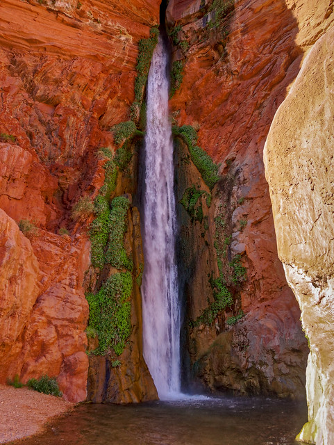
... to try to capture the "feel" of the area.
Deer Creek Falls in Grand Canyon National Park, Arizona
However, I think the long exposures work best ...
Deer Creek Falls in Grand Canyon National Park, Arizona
... and I love the contrast it creates between the smooth water and the rough texture of the surrounding rock and vegetation.
Deer Creek Falls in Grand Canyon National Park, Arizona
We then headed back up and I continued up the trail to go set up camp. On my way I noticed a group of six had shown up; four sunburned teenagers and two adults were cooling off in the creek. They had hiked over from Tapeats that day and I knew exactly how they felt.
Jean in Deer Creek Canyon in Grand Canyon National Park, Arizona
John stayed back to do more photography of the stunning canyon.
Deer Creek Canyon in Grand Canyon National Park, Arizona
Long exposures worked well here too.
Deer Creek Canyon in Grand Canyon National Park, Arizona
Deer Creek Canyon ...
Deer Creek Canyon in Grand Canyon National Park, Arizona
... is a magical place.
Deer Creek Canyon in Grand Canyon National Park, Arizona
I was very grateful to be there under these conditions ...
Deer Creek Canyon in Grand Canyon National Park, Arizona

... rather than during the flood pictured below.

Deer Creek during a flood in Grand Canyon National Park, Arizona - Photo by Randy Rohrer
The next morning ...
Seen from the Deer Creek Trail in Grand Canyon National Park, Arizona
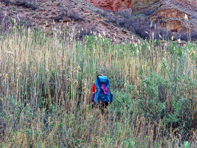
... we packed up and headed out.
Jean on the Deer Creek Trail in Grand Canyon National Park, Arizona
When we had hiked by Deer Creek Spring the day before we had noticed it was dry. We weren't concerned about it as we knew Deer Creek got its water from more springs than just this one. However, the next morning it was flowing.
Deer Creek Spring seen from the Deer Creek Trail in Grand Canyon National Park, Arizona
We got an early start and initially the trail was cool and shady ...
Jean on the Deer Creek Trail in Grand Canyon National Park, Arizona
... which was great as our packs were quite heavy with all the extra water we were carrying for our dry camp on the Esplanade that night.
Jean on the Deer Creek Trail in Grand Canyon National Park, Arizona
Eventually, we reached (the misnamed) Surprise Valley.
John on the Deer Creek Trail in Grand Canyon National Park, Arizona
As we climbed up toward the Esplanade ...
John on the Thunder River Trail in Grand Canyon National Park, Arizona
... the day really warmed up.
Jean on the Thunder River Trail in Grand Canyon National Park, Arizona
We felt lucky to find such a great spot to take a break. But we weren't alone. When John lifted a rock to move it out of his way ...
Jean on the Thunder River Trail in Grand Canyon National Park, Arizona
... it revealed a tiny scorpion.
Scorpion seen from the Thunder River Trail in Grand Canyon National Park, Arizona
We continued to make our way up ...
John on the Thunder River Trail in Grand Canyon National Park, Arizona
... the steep (and reinforced) trail.
Seen from the Thunder River Trail in Grand Canyon National Park, Arizona
We finally reached the Esplanade ...
Seen from the Thunder River Trail in Grand Canyon National Park, Arizona
... and we made better time.
John on the Thunder River Trail in Grand Canyon National Park, Arizona
As we walked by these rocks we both noticed that they adorned once again. There was a group sitting nearby in the shade and one fellow started laughing. John asked him if he had replaced the rocks and he admitted he had. I commented they weren't really anatomically correct and he agreed but apparently he hadn't been willing to spend much time searching for just the right rocks. It was a pity. After all, "A job worth doing is worth doing well". But as I said earlier, I am now conflicted by this "iconic" feature on this trail and I can only hope it won't become a Social Media trend to rearrange rocks on public lands to resemble body parts.
Jean on the Thunder River Trail in Grand Canyon National Park, Arizona
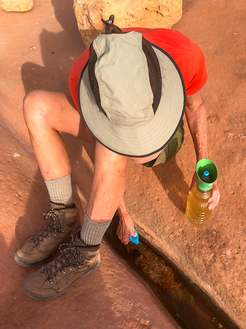
Jean on the Thunder River Trail in Grand Canyon National Park, Arizona
We had thought we had carried up enough water to see us through on the hike out the next day. However, I was concerned we could run short. So we decided to collect two more liters from one of the little murky pools we had seen the day before. It was more yellow than we had seen pothole water to be and I hoped that didn't mean that some thoughtless backpacker had urinated in it. We treated it three times with the SteriPen and I took a sip. Having never tasted urine I can't honestly say it wasn't but I've read urine tastes salty and this water just tasted "flat".
Jean on the Thunder River Trail in Grand Canyon National Park, Arizona
We had a great campsite ...
John and Jean and our camp on the Esplanade in Grand Canyon National Park, Arizona
Boiling some questionable pothole water
... which helped make up for the less than sparkling pothole water we used to cook our suppers with. It produced some disturbing foam when it boiled. Fortunately, neither of us had any digestives issues after consuming it.
Boiling some questionable pothole water
We had a great view from our campsite ...
Seen from our campsite on the Esplanade in Grand Canyon National Park, Arizona
... and thoroughly enjoyed the beautiful sunset on our last night out.
Seen from our campsite on the Esplanade in Grand Canyon National Park, Arizona
We got an early start the next morning ...
John on the Thunder River Trail in Grand Canyon National Park, Arizona
... enjoying the great views ...
Seen from the Thunder River Trail in Grand Canyon National Park, Arizona
... as we made our way across the Esplanade.
Seen from the Thunder River Trail in Grand Canyon National Park, Arizona
We were able to make good time on the easy trail through the desert ...
John on the Thunder River Trail in Grand Canyon National Park, Arizona
... until we started the climb out of the canyon where we slowed to a more sustainable pace.
John on the the Thunder River Trail in Grand Canyon National Park, Arizona
We gratefully reached the rim and took one last look before heading back into the trees on our way back to the trailhead. All of our photos from this backpack trip are on Flickr.
Seen from the Thunder River Trail in Grand Canyon National Park, Arizona
We then headed to the South Rim of Grand Canyon National Park as our son, Dan, was coming to visit us there. We would be taking him on the Royal Arch Loop. But first, we wanted to take him on at least one good conditioning hike so we did a day hike partway down the Tanner Trail.
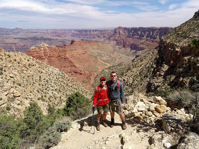
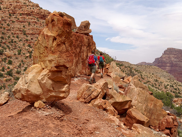
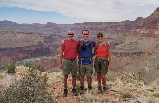
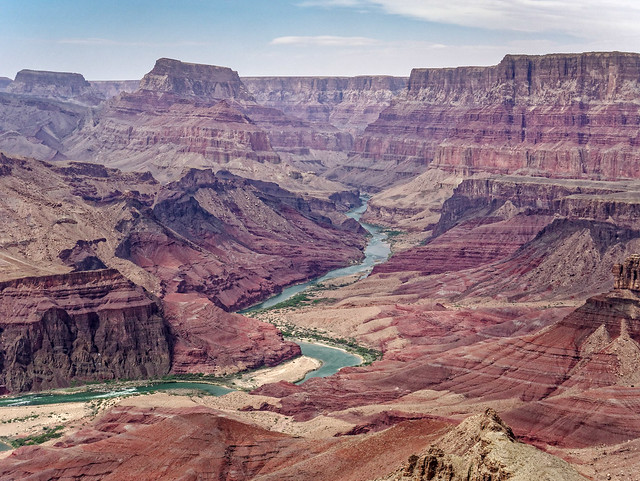
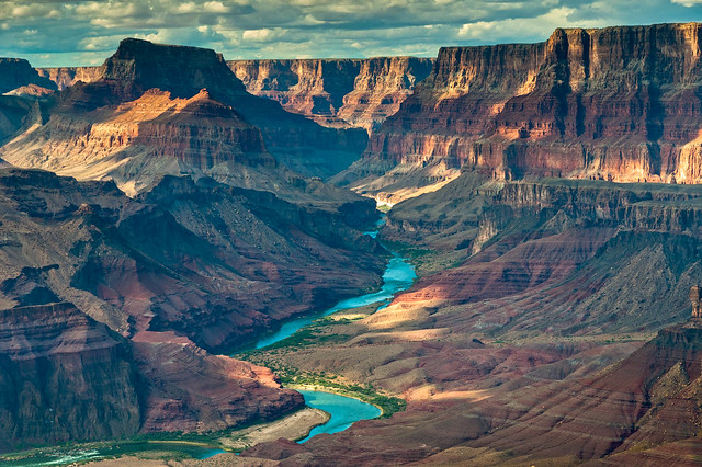
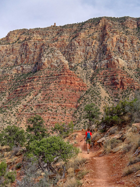
Jean and Dan on the Tanner Trail in Grand Canyon National Park, Arizona
This was a "walk down memory lane" for us as seven years earlier Dan joined us on our first backpack trip in Grand Canyon that started on the Tanner.
Dan and Jean on the Tanner Trail in Grand Canyon National Park, Arizona
We hiked down about four miles to a great viewpoint (and popular dry campsite) on top of the Redwall.
John, Dan and Jean on the Tanner Trail in Grand Canyon National Park, Arizona
This is one of our favorite views of the canyon but we were there mid-day with "flat" light. However, when we were in this same spot seven years ago ...
Seen from the Tanner Trail in Grand Canyon National Park, Arizona
... we saw this! It was later in the day and between the lower angle of the light and the dramatic sky it was a completely different experience. One of the many reasons we love backpacking is it enables us to be in beautiful places in early morning and late afternoon and evening when the light is better.
Seen from the Tanner Trail in Grand Canyon National Park, Arizona
We then headed back up to the rim. While it was only eight miles it provided us with a decent workout. All of our photos from this day hike (and others) are on Flickr.
Jean on the Tanner Trail in Grand Canyon National Park, Arizona
We then prepared for our backpack trip on the Royal Arch Loop. The National Park Service Trail Description states:
This trip starts and ends at the South Bass Trailhead which is about 30 miles from Grand Canyon Village. One issue is that the road out to the trailhead is dirt and impassable when wet. It is badly rutted and high clearance vehicles are recommended (for more info). However, it was dry the morning we headed out and our Jeep Cherokee Trailhawk had no trouble. The road briefly crosses the Havasupai Indian Reservation and they charge $25.00 to cross their land but there may or may not be someone there to collect the fee. This was the third time we have driven out to this trailhead but the first time we were stopped by someone to collect the fee. We paid him and could only assume he was a tribal "official".
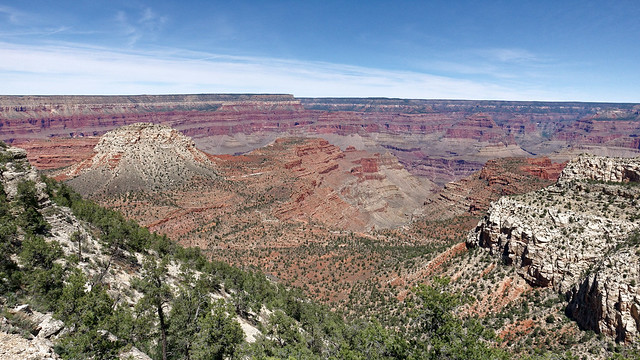
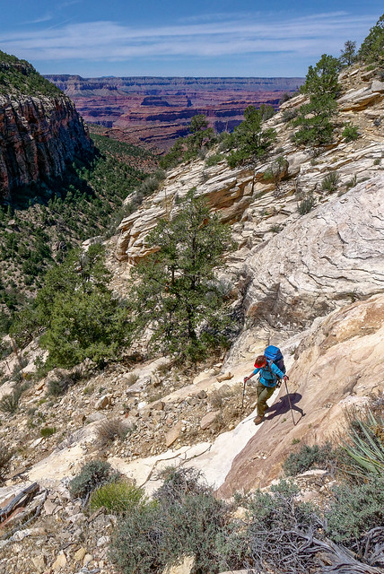
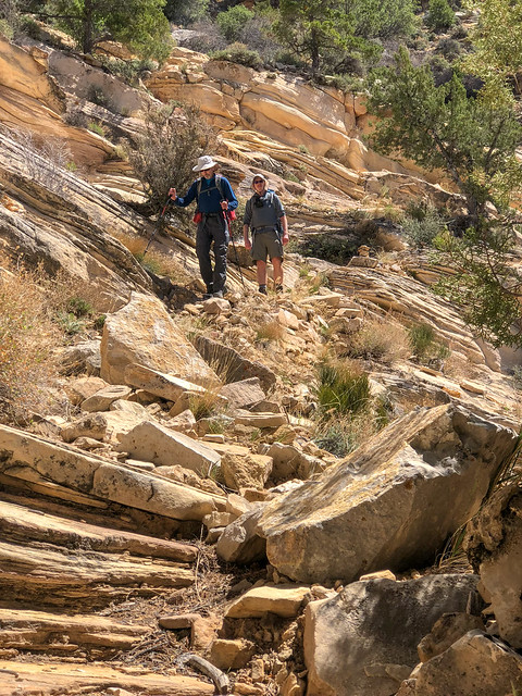
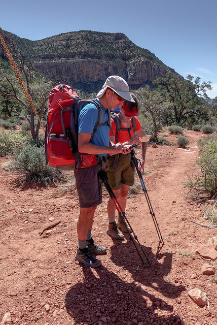
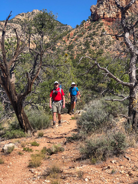
... of the imposing Mount Huethawali, ...
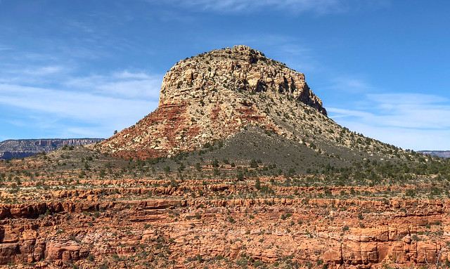
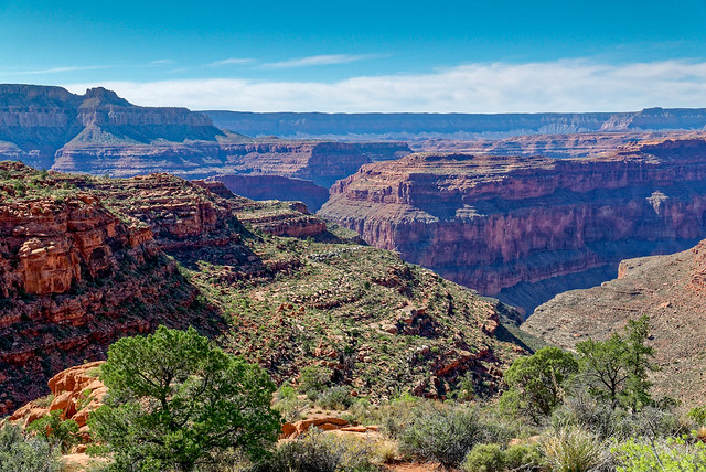
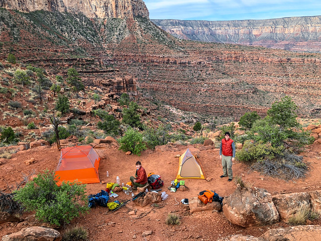
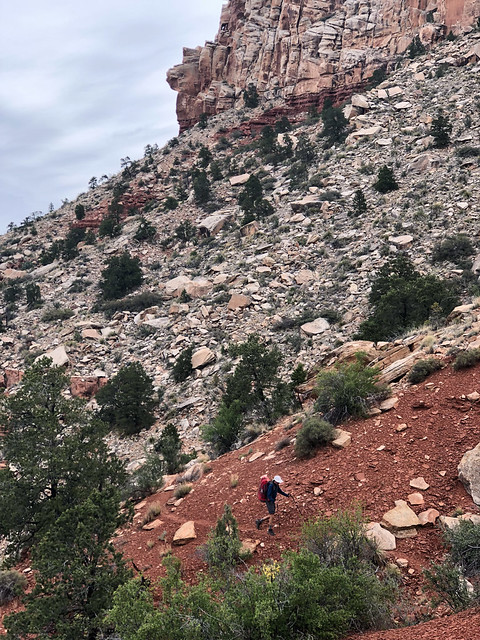
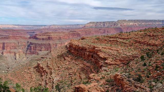
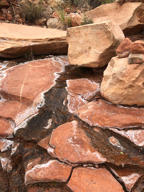
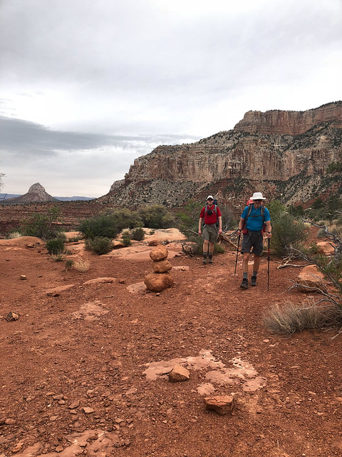
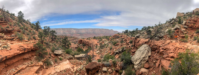
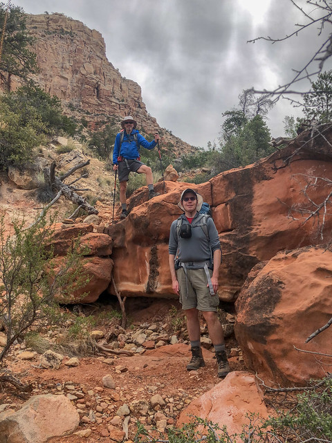
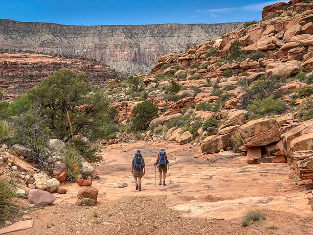
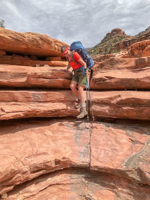
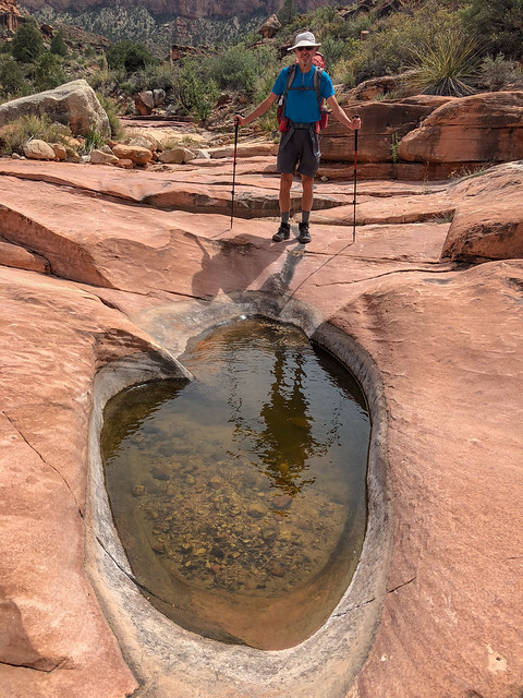
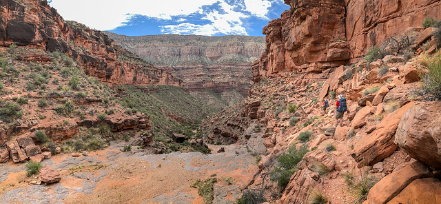
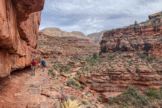
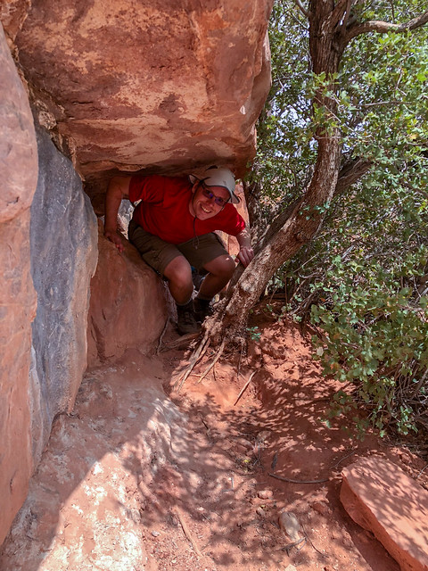
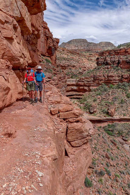
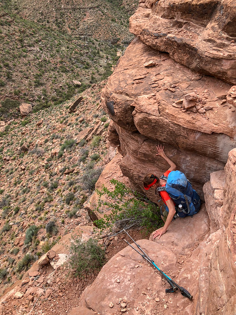
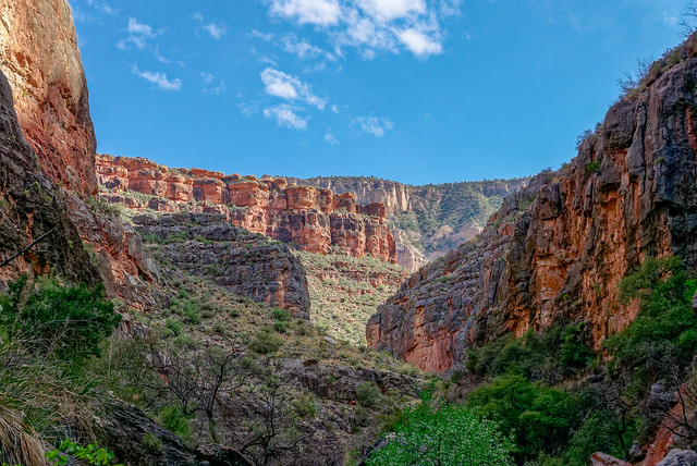
... it became deeper and more narrow.
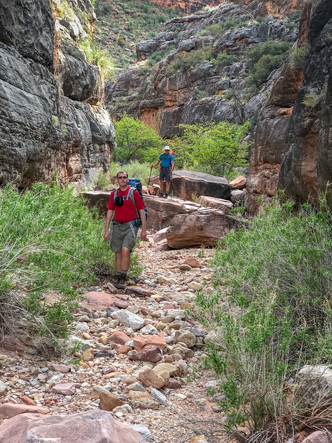
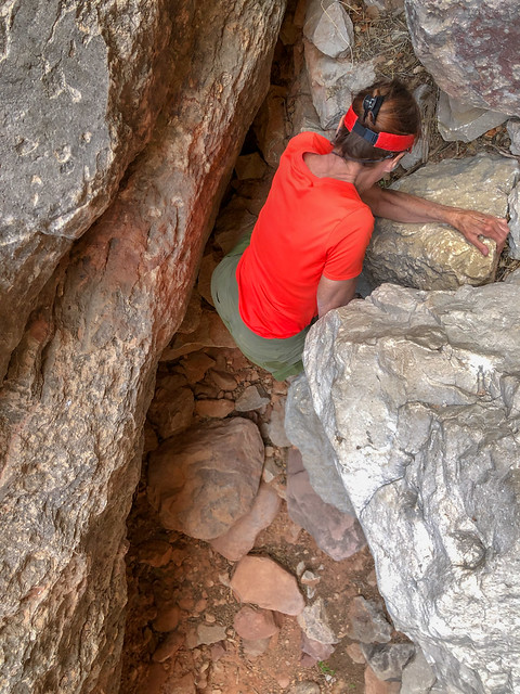
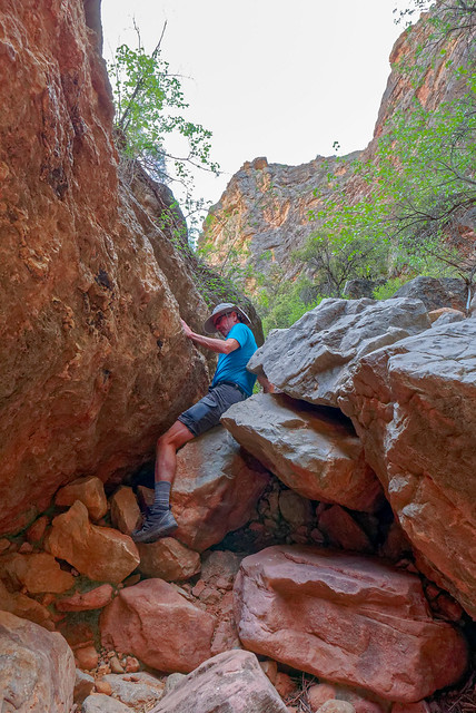
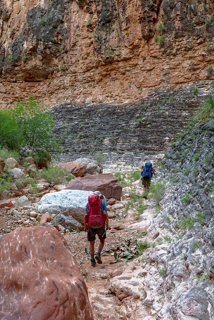
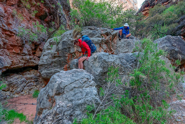
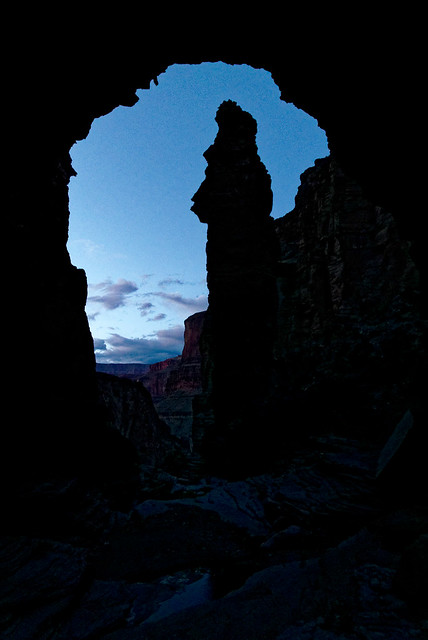
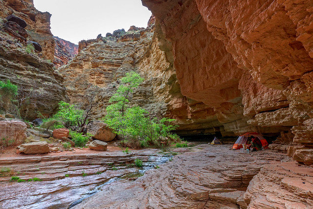
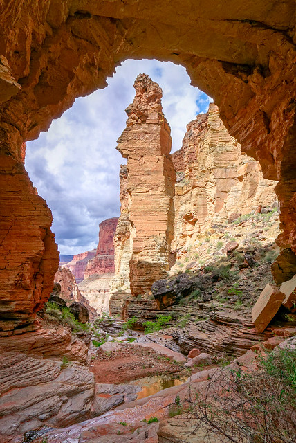
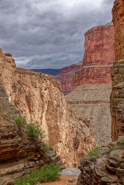
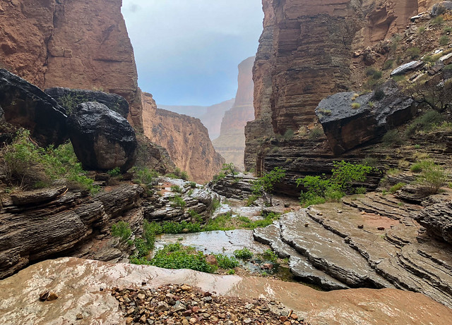
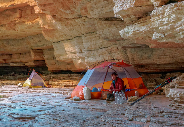
The thunderstorm eventually moved on and I spent my waking hours listening to the music of the creek and the songs of Canyon Wrens (with the occasional frog) ...
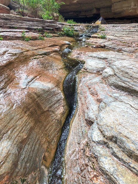
... while John and Dan spent their time taking copious photos. Note the trekking pole tripod.
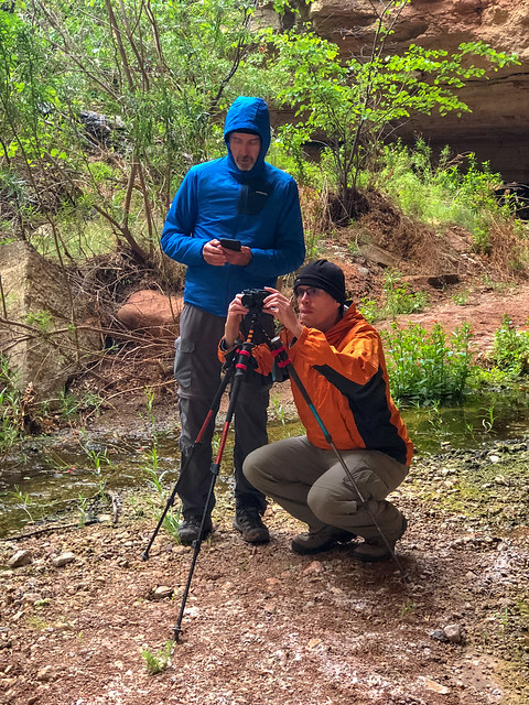
Dan also did some exploring above the arch ...
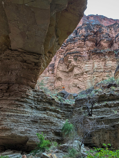
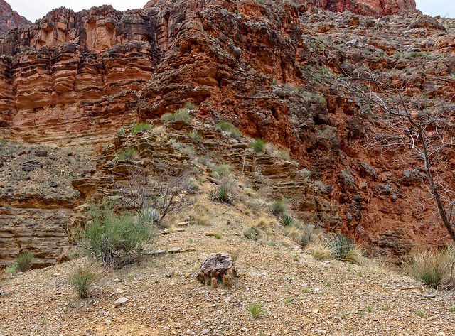
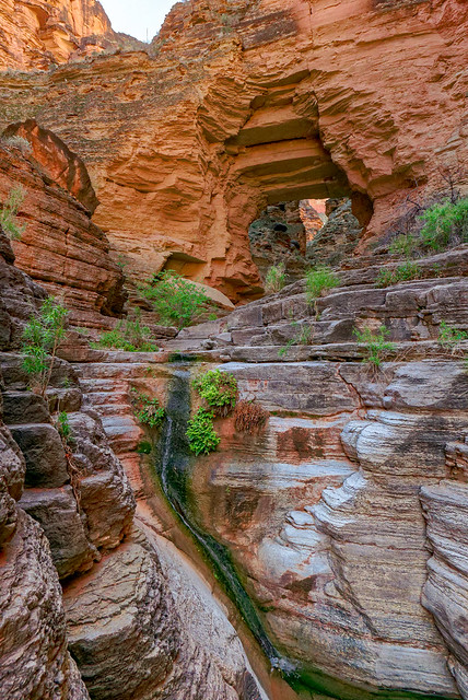
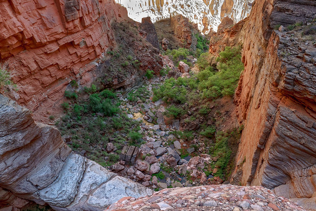
The next morning we again intended to get an early start but fell short of our goal. What became apparent is that John and I have a backpacking "style" that is very different than Dan's. He is a much faster hiker than we are now so he can afford to get a later start. Whereas, we simply need to spend more hours hiking to cover the same distance so we need an early start. But I was hesitant to wake him up any earlier and I refused to nag him to hurry up. I did too much of that when he and his brother were teenagers. As a result it was nearly 9:00 before we got moving.
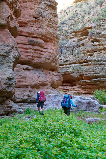
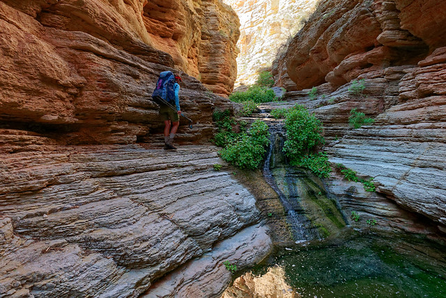
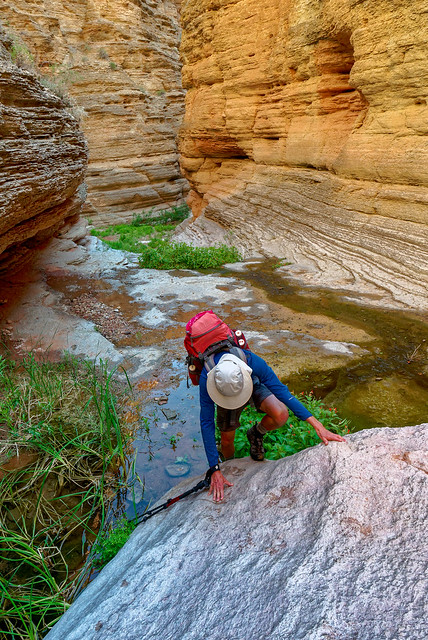
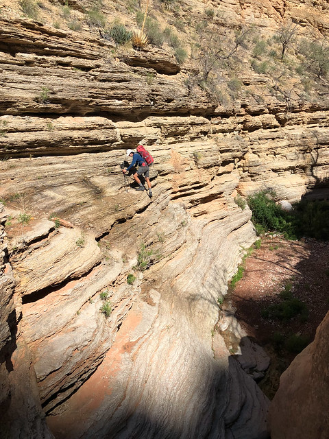
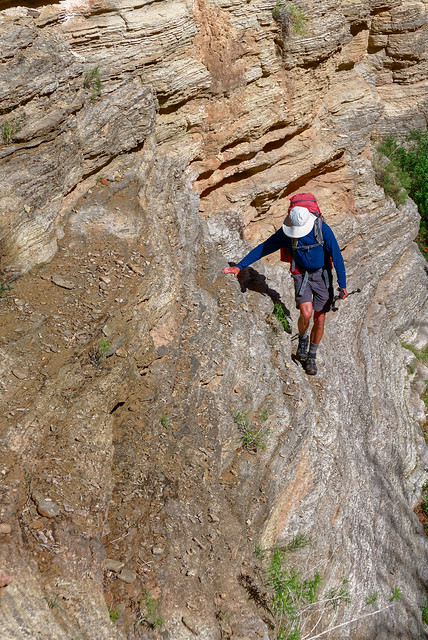
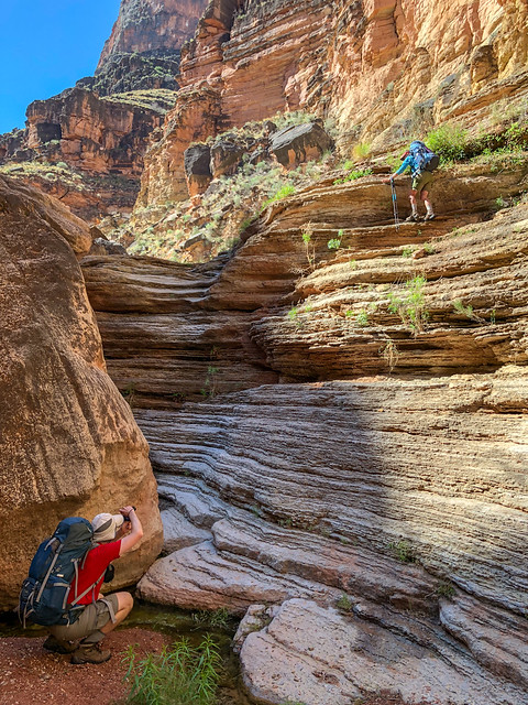
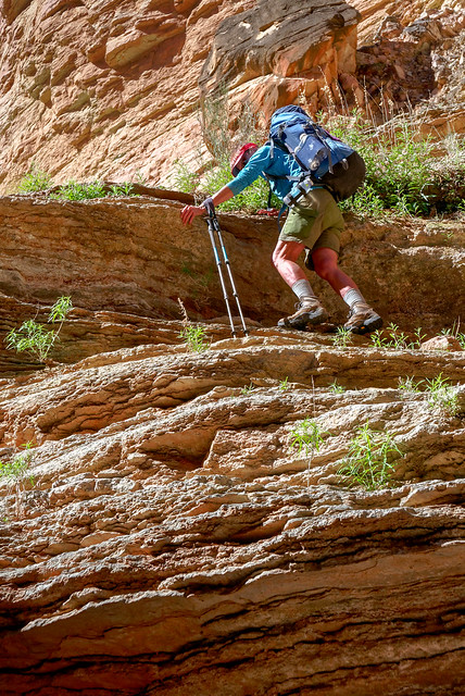
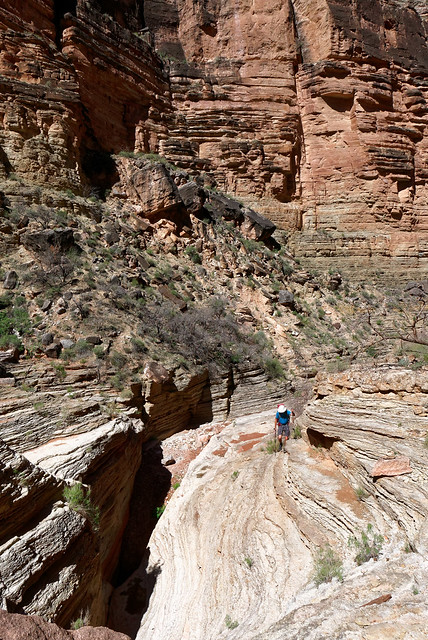
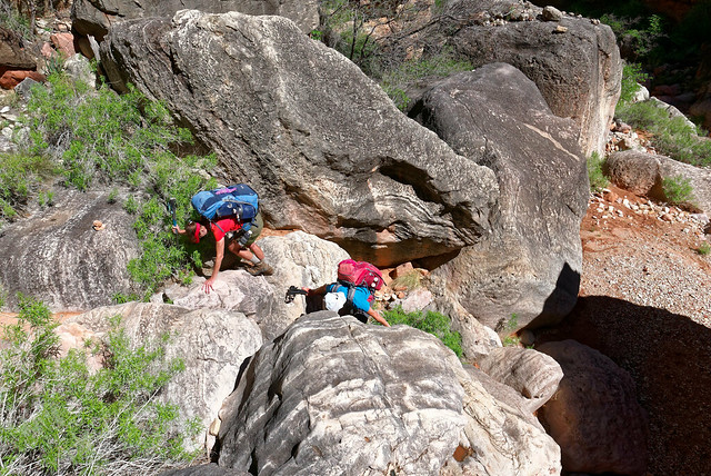
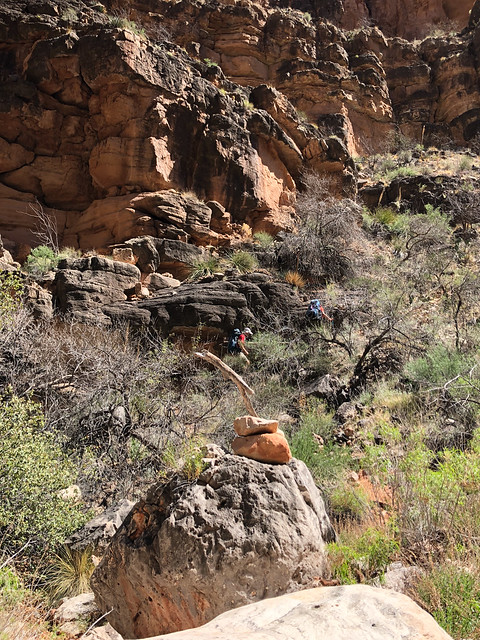
Dan and Jean on the Royal Arch Loop in Grand Canyon National Park, Arizona
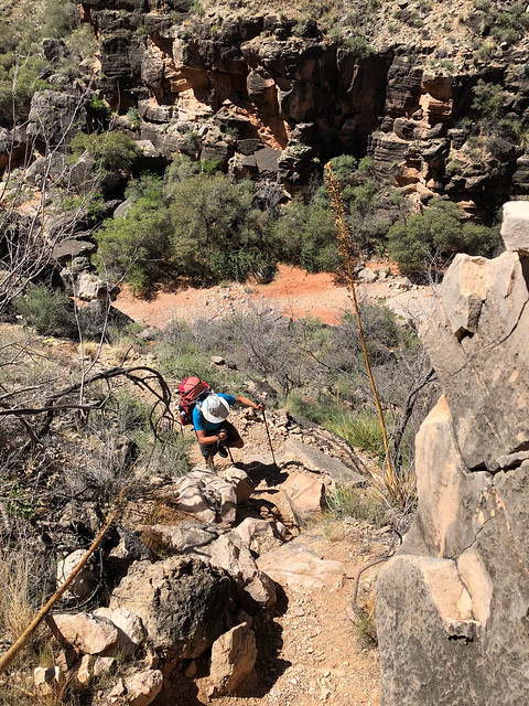
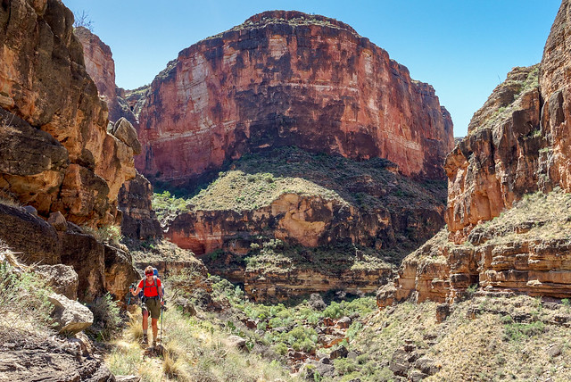
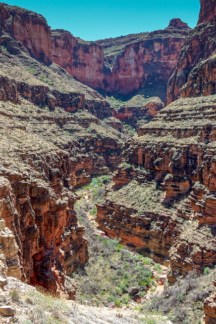
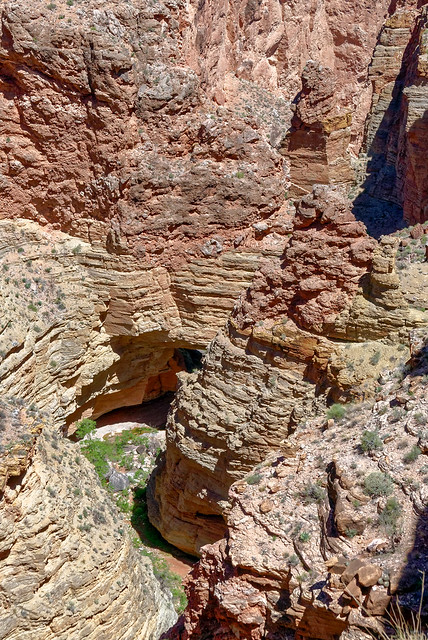
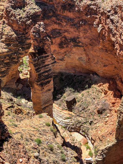
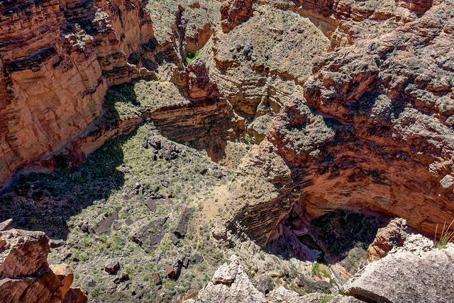
As we continued the views became expansive ...
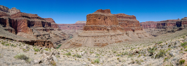
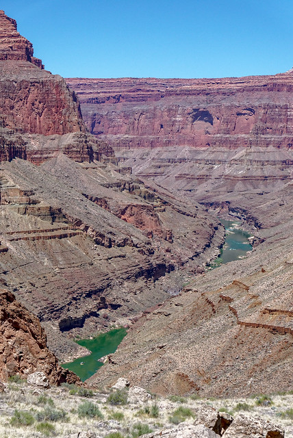
... and Toltec Beach where we would camp that night.
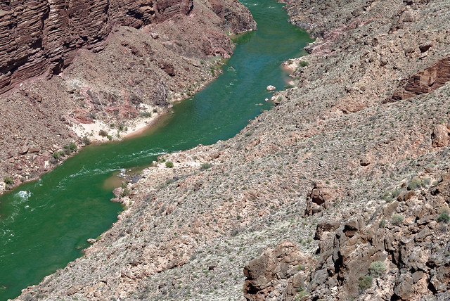
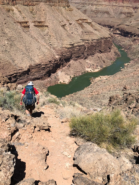
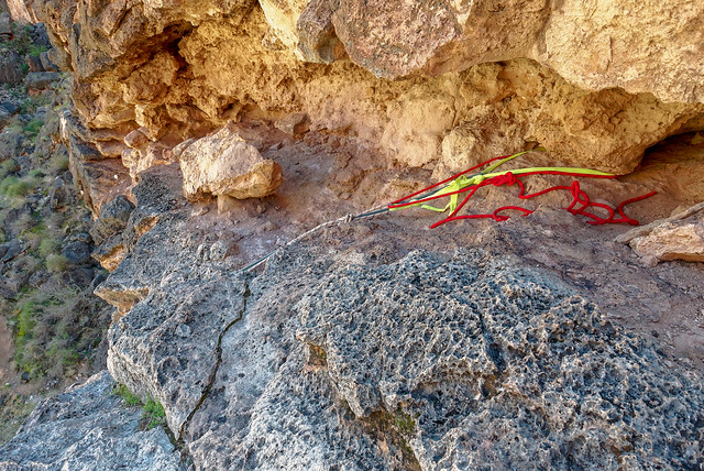
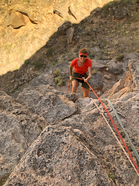
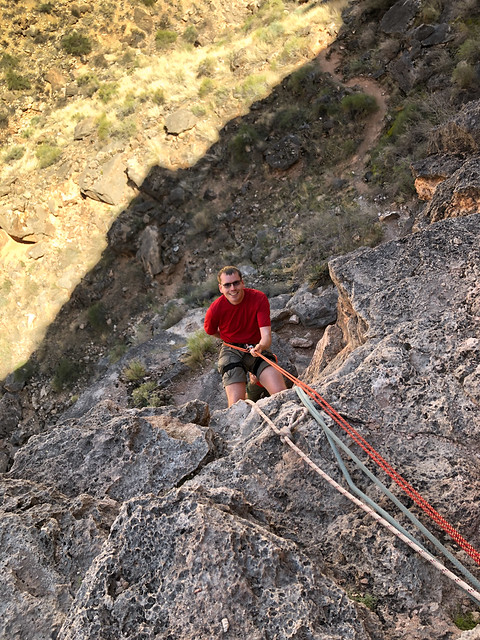
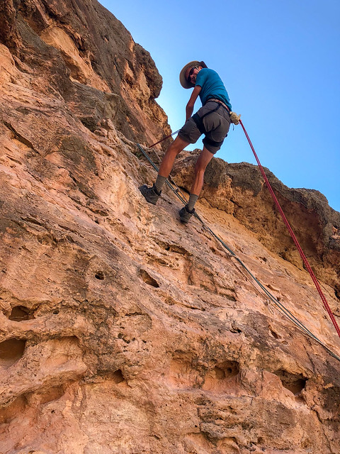

The rest must be down climbed and it takes time.
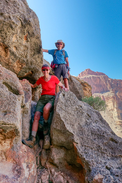
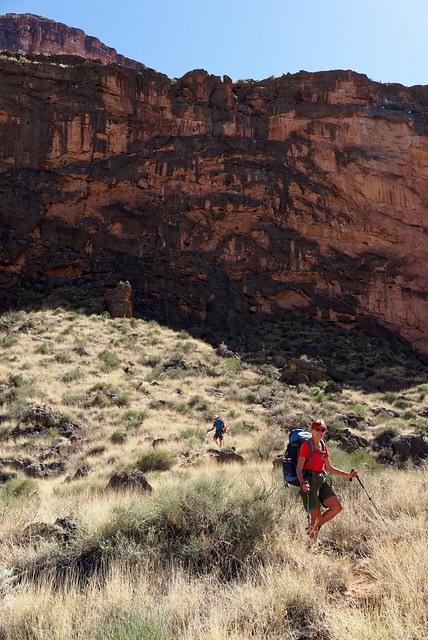
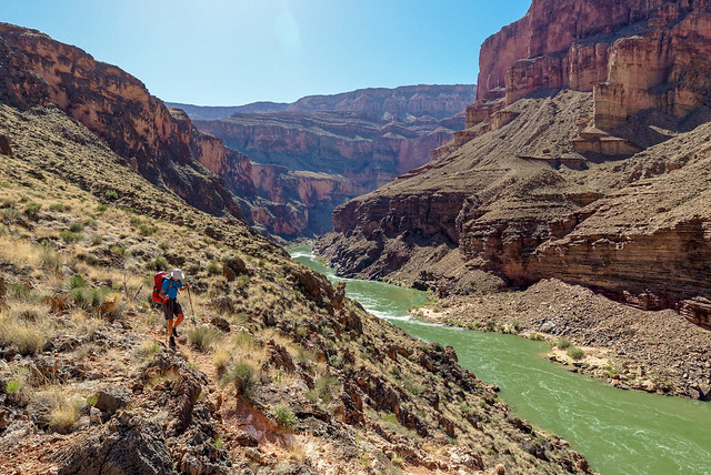
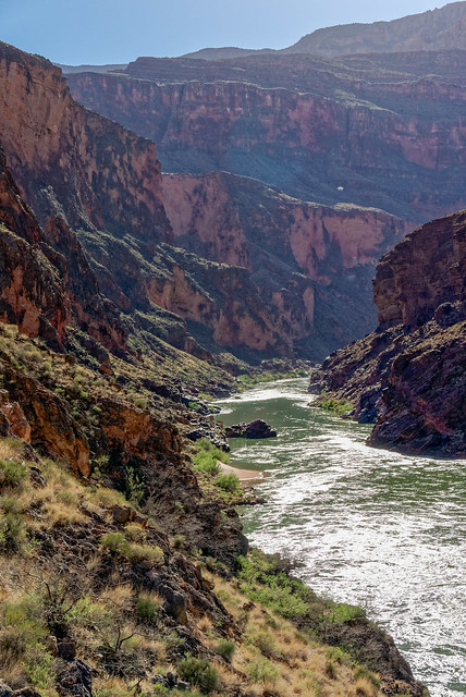

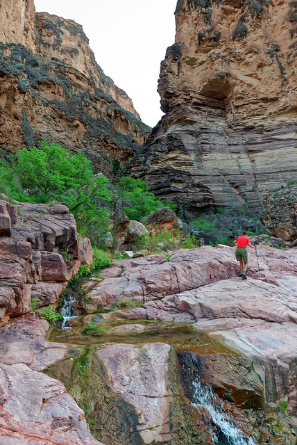
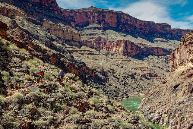
We then made our way up and out of Garnet Canyon to where the Tonto Trail begins.
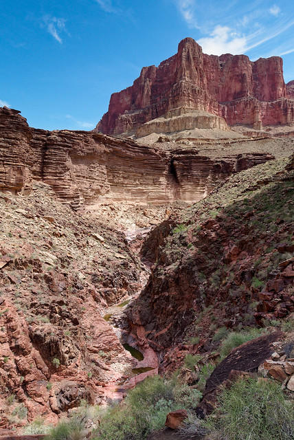
But first there were a few obstacles to negotiate.
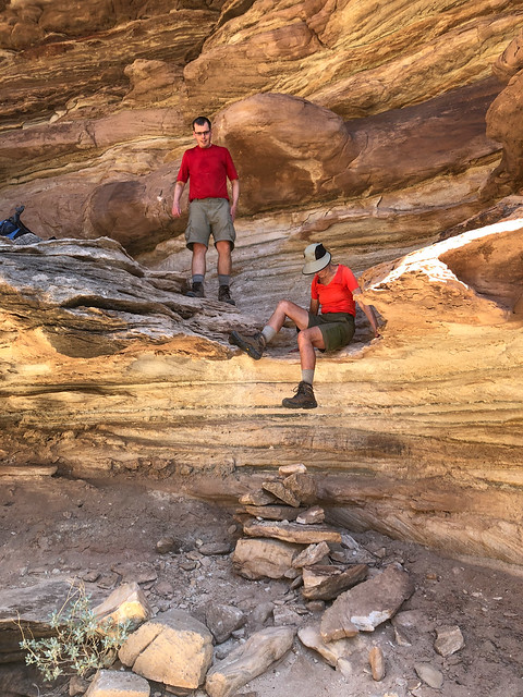
What is a bit exasperating is that I have since learned there is a route that is much more gradual and bypasses this series of ledges and pour-offs. Shortly before we started climbing up all this I do remember seeing a cairn leading off to the right but John said no, that wasn't the way we had gone before so we headed up these ledges. Routes like this are no problem for younger, stronger backpackers such as Dan. I don't usually mind doing such if they are within my physical capability and I even enjoy scrambling over rocks to a certain degree. But I sometimes wish there could be a universally known way to distinguish cairns marking more gradual routes suitable for senior citizens so we could decide how much abuse we are willing to subject our aging bodies to.
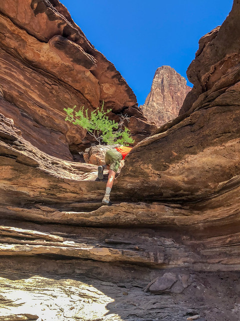
We continued working our way up to the Tonto Platform and what I promised Dan would be fast, easy hiking.
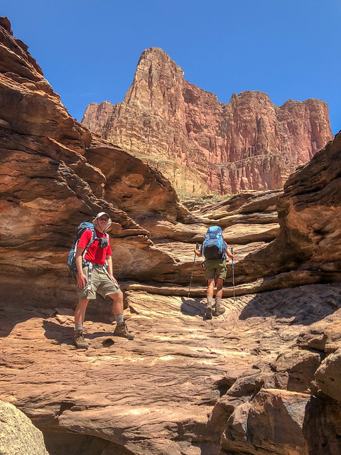
But first we had to get up there.
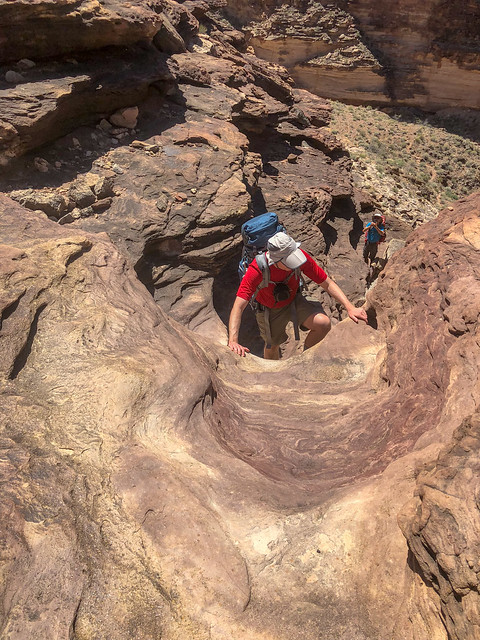
We all had to get up there.

We could then see our way out ...
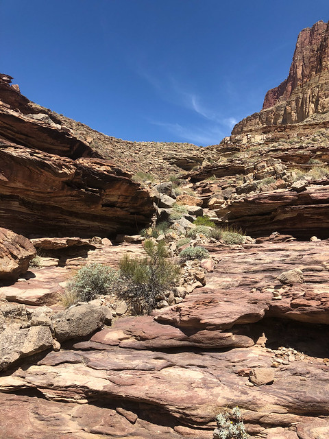
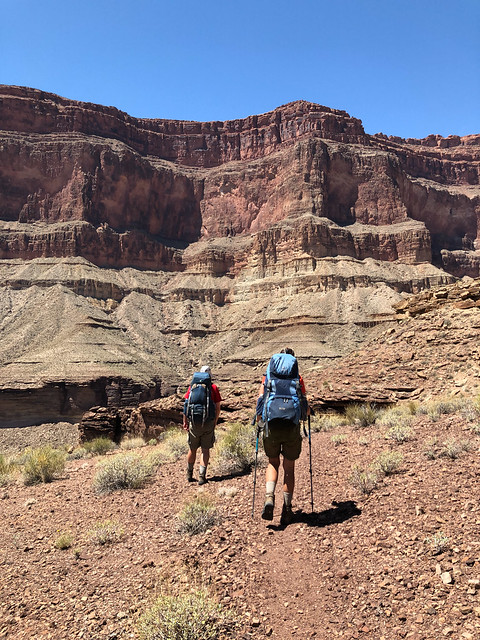
The temperature had become quite warm so when we came across some ample shade in a drainage we took a welcome break.
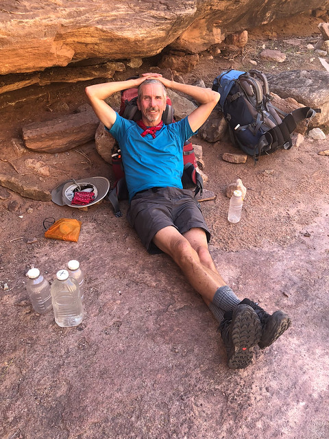
There were even some shallow puddles with just enough water to soak the bandanas we all wore around our necks which was very refreshing. I then soaked our shirts which were quite exhilarating to put back on!
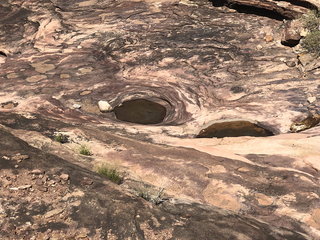
After a short rest we continued on. While I enjoyed the variety of experiences provided by going down Royal Arch Canyon I always enjoy hiking on the Tonto. There is just something about the open expanse, ...
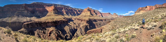
... and the views down to the river ...
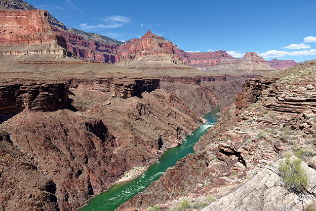
... and up to the rim.
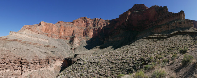
It was quite warm and we had some concerns about water so when we saw these potholes below us in a drainage we investigated. It wasn't the clearest pothole water we have seen but it seemed like a good idea to collect two liters to have in reserve just in case.
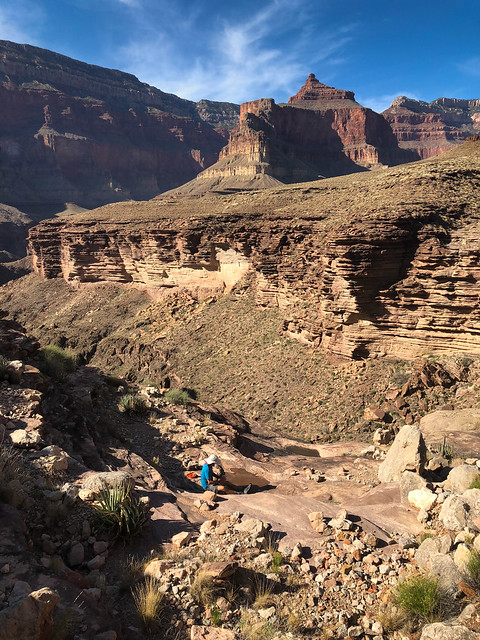
Our destination that day was Copper Canyon.
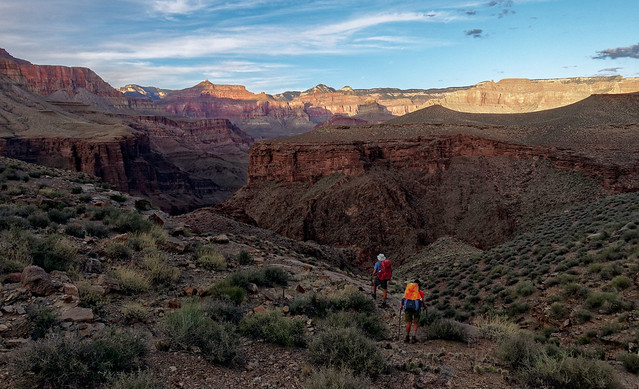
We had been given some instructions on how to find "Bass Camp" within Copper Canyon and the likely location of some potholes. But this would require some off trail exploration and we had intended to get there with plenty of daylight to do that safely.
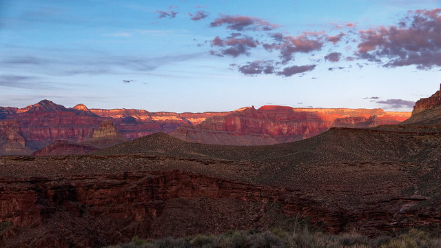
However, our time spent in the shady side canyon was working against us and it was later than was "optimal" for off trail exploration. But we really needed to locate water so we headed off the Tonto in what we thought was a likely spot to allow us to drop into the canyon. Unfortunately, we were losing light too fast and it was getting harder to choose our route. Given our experience on the remote Tuckup Trail John and I were more comfortable with this plan. We were also more confident we would find water so we had been drinking an adequate amount throughout the day. However, Dan has less experience and expressed discomfort with this off trail exploration. He had also been conserving his water and was becoming dehydrated.
So, we decided it would be safest to get back on the trail and hike by headlamp to where the Tonto crosses Copper Canyon, set up camp and look for water from there. Once at the crossing we dropped our packs and first headed up canyon but encountered no water in the gravelly canyon floor. Near the crossing I found a shallow puddle of funky water and started to collect what I could while John and Dan searched down canyon. They were both determined to keep going until they found water. And they did! They found some suitable potholes about 10 minutes down canyon. Dan explored a little further and saw more below a pour-off that could probably be down climbed if we needed it. Back at camp everyone drank their fill, had supper and went to bed.
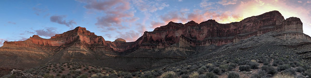
We intended to get a really early start for our hike out as it was supposed to get quite hot that day. However, hiking after dark, needing to spend so much time and effort getting water and eating late on multiple days is not conducive to early starts. John and Dan had to go get more water and it just takes time to treat that much for three people with one SteriPen. All I can say is we did the best we could under the circumstances. At least we knew where our next source of water was, in our Jeep at the trailhead.
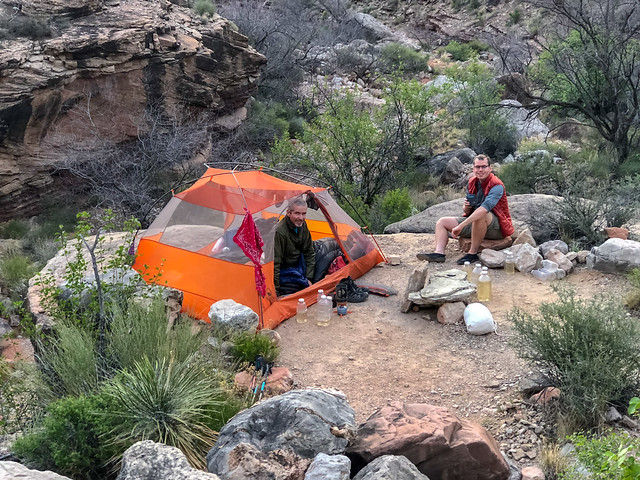
Looking down Copper Canyon from the Tonto ...
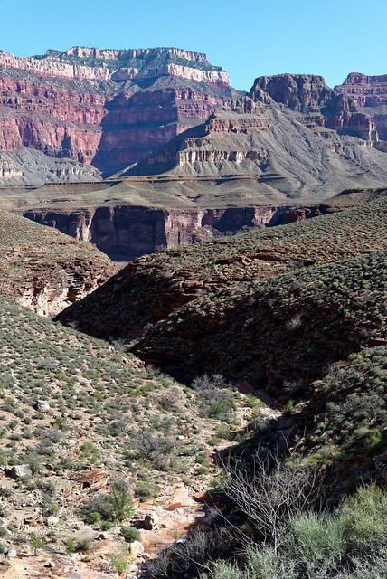
... you can see the pothole where John and Dan got water.
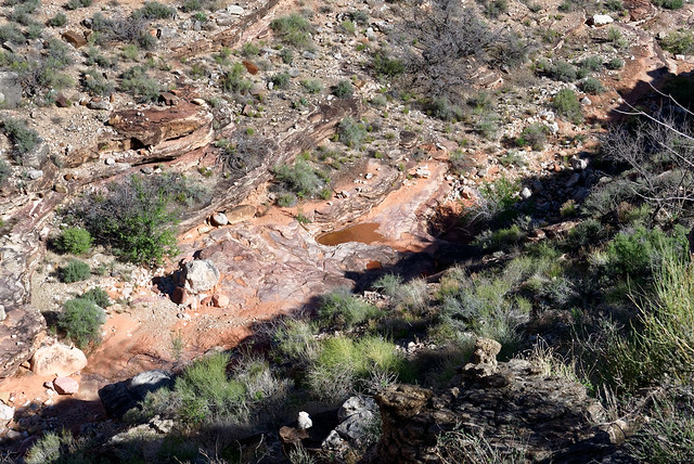
As we headed out on the Tonto we looked across Copper Canyon to where we had been doing our exploration the evening before.
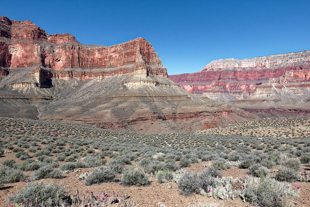
It did look like it would be possible to find a way down into Copper Canyon but we accepted it would not have been a good idea for us to try to do it in the dark. We've been told Copper Canyon is a beautiful canyon and well worth spending time in so perhaps John and I will come back sometime and plan to spend a couple of nights in Bass Camp and explore the area.
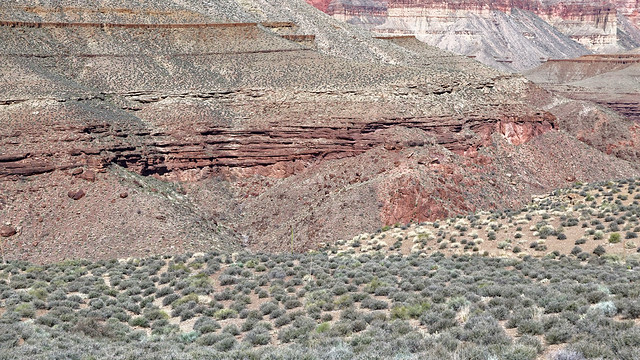
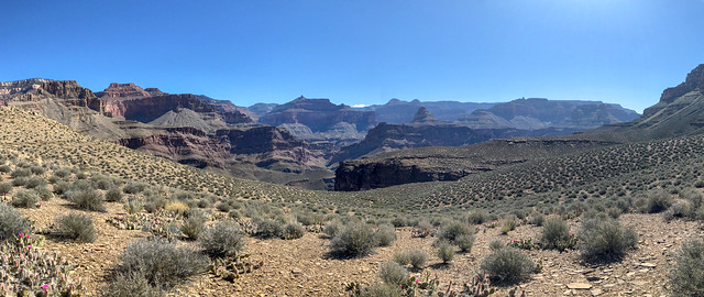
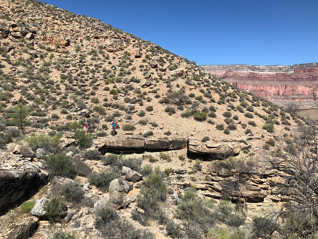
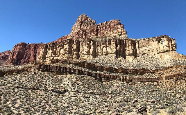
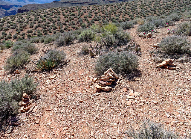
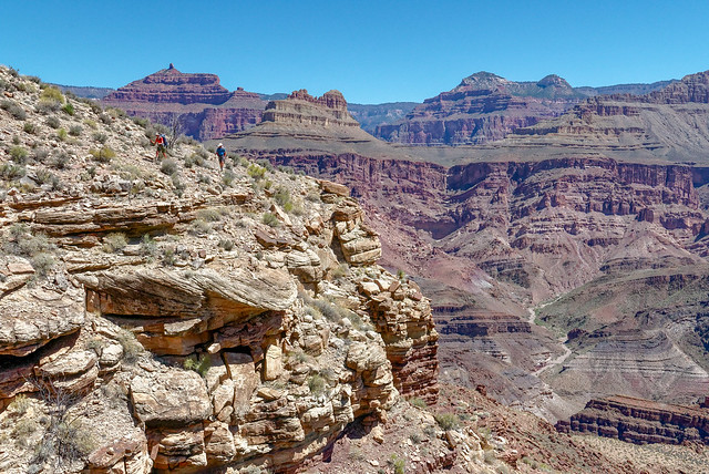
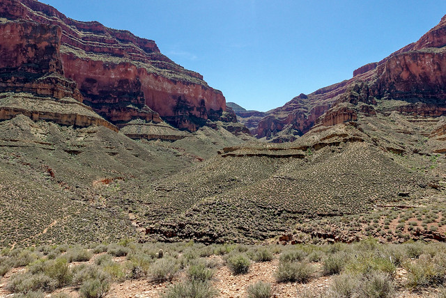
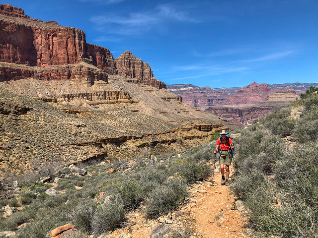
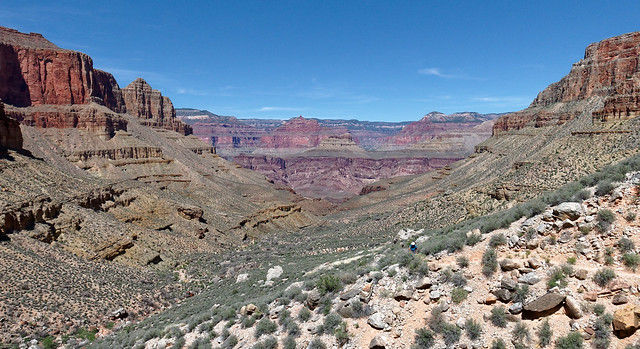
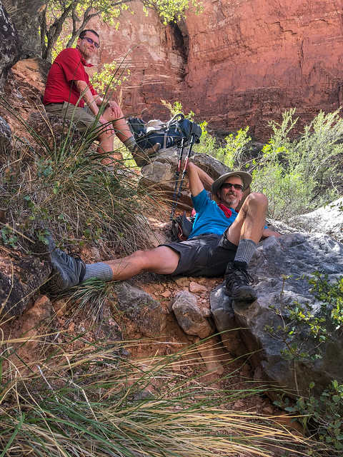
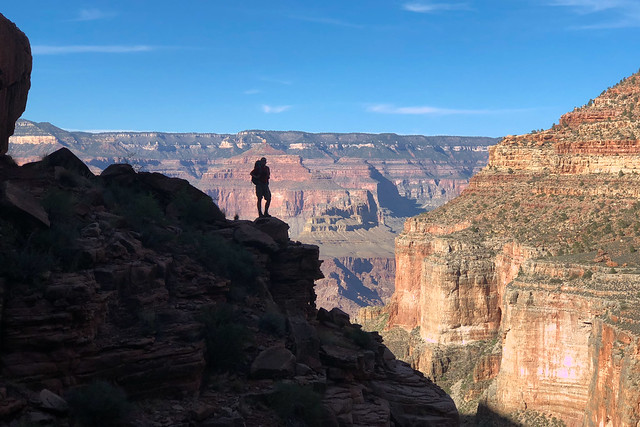
I am normally very careful where I place my feet and usually keep my eyes open for such hazards but this snake took me completely by surprise and startled me. Fortunately, at least for me, it was dead. I hope a live rattler would have the good sense to alert me way before I had a chance to get this close.
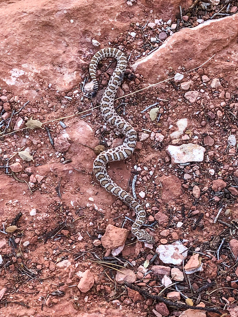
We took a well deserved break and finished any food we had left. I thought my fatigue may have been due to being short of calories so I was now quite grateful for the extra food Dan had insisted on bringing.
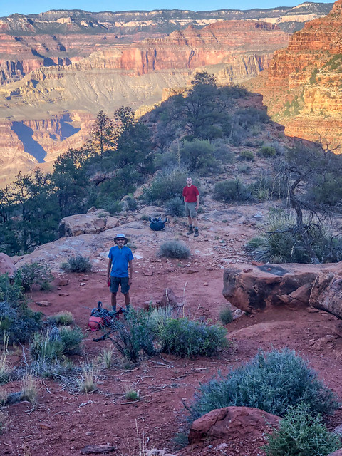
We also allowed ourselves a few minutes to just enjoy where we were. There is always a bittersweet feeling on the hike out from a backpack trip. Bitter because we would be thrust back into civilization and forced to give up our blessed solitude and sweet because hot showers awaited us.
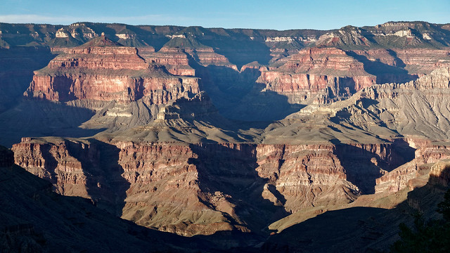
After a steep climb up the well constructed trail (complete with stone stairs) we were once again on the Esplanade.
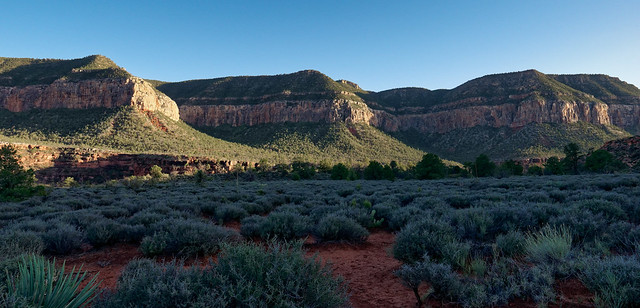
We then made our way...
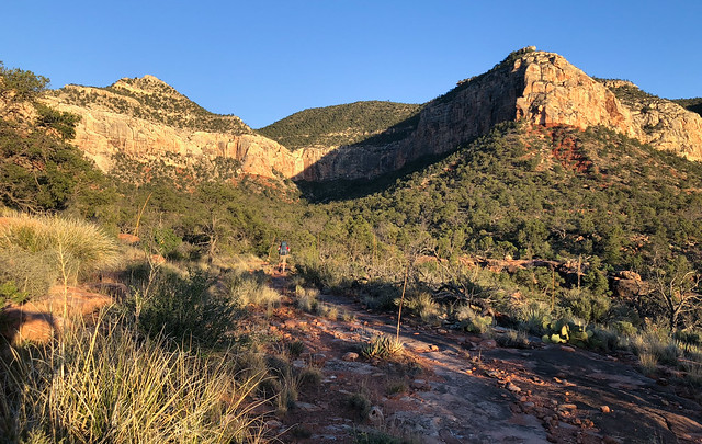
... up the trail with the rim looming above us.
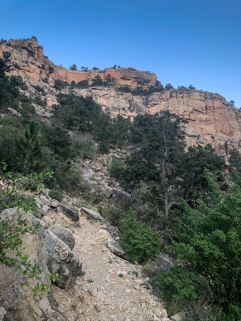
We continued on as the sun went down ...
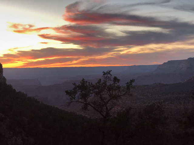
... and finished the day by headlamp, again. Royal Arch Loop is one of our favorite backpack trips. It offers such a wide variety of experiences and it makes you work hard enough for each and every one of them so you properly appreciate them. All of our photos from this backpack trip are on Flickr.
Shortly after Dan flew home we left Grand Canyon. We thoroughly enjoyed the time we spent there this winter and spring. Our experiences ran the gamut from the "circus" of Havasu Falls to the absolute solitude of the Tuckup Trail. But we were ready for a change and we began to head north with plans to spend the summer in Washington State where we have more big plans. I'll let you know how things went next time.
This next bit is just something Jean has been thinking about.
So, in September 1989 we loaded up our new travel trailer, including our two young boys (aged four and almost two) and my mother-in-law, and headed south in search of a change of scenery. And boy, did we get it! We visited Bryce Canyon National Park, Arches National Park, Canyonlands National Park in Utah and Grand Canyon National Park in Arizona. This was a monumental experience for me. I did not know such places existed in reality!

A highlight for me was a 15 mile day hike John and I did in Canyonlands. It was amazing!

I felt like a kid on a marvelous playground!

Over the years we did more trips to the southwest most often in the spring. It provided a welcome contrast to the Pacific Northwest; bright sun, blue skies, red rock and canyons. Not to mention the shapes! Southern Utah is like a giant sculpture garden displaying the works of the most creative (and psychotic) sculptors the natural world possesses.

In 2009 John and I took our new motorhome on its maiden voyage. John was still working so our time was limited. Still, we managed short trips to Bryce Canyon National Park, Zion National Park in Utah and the north rim of Grand Canyon National Park in Arizona.

Jean on the way up Angels Landing in Zion National Park, Utah
However, the highlight of this trip was a backpack trip we did within the Paria Canyon - Vermillion Cliffs Wilderness Area in Utah. We began by hiking through Buckskin Gulch. At over 13 miles it is reported to be the longest slot canyon in the world (source).

Hiking through a slot canyon was a new experience for me. The most common "obstacle" we encountered was mud and water of unknown depth.

The "Cesspool" is the most notorious.

In April 2010, after John retired and we sold our house, we hit the road in our motorhome. The first summer we spent three months traveling through British Columbia,Yukon and Alaska. However, in early 2011 we headed to the southwest. We visited Grand Staircase - Escalante National Monument in Utah where we hiked to some very accessible slot canyons including Zebra Canyon ...
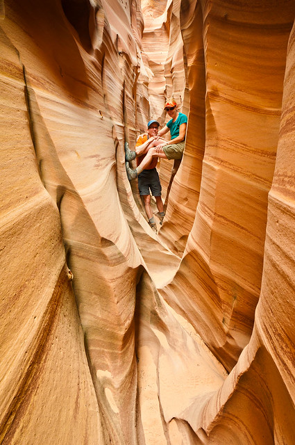
... and Tunnel Slot Canyon.
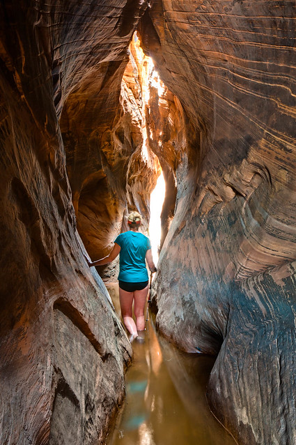
We also visited Zion National Park and did the long dayhike to see the "Subway", a unique slot canyon. It was early April and recent snow melt resulted in a high level of very cold water in the Left Fork of North Creek. Therefore, we rented dry pants and canyoneering boots for the countless creek crossings.
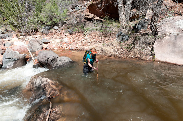
The high water level meant we needed to be very careful to avoid the numerous deep pools now obscured by the flowing water.
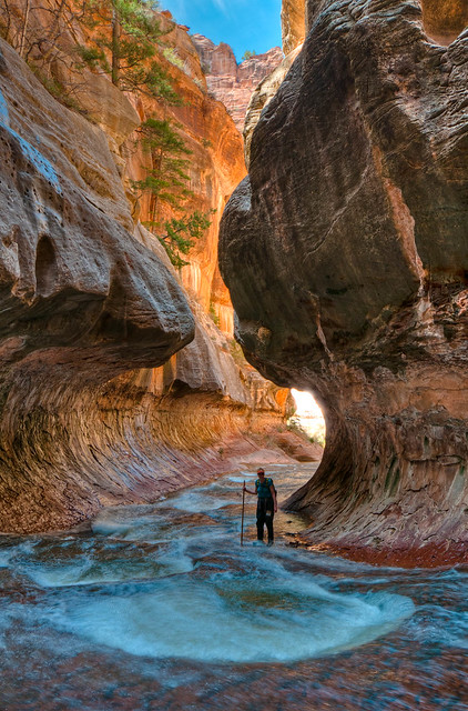
We were doing the non technical "bottom up" route but unfortunately, the high water level prevented us from being able to hike up canyon past this point. There is also a technical "top down" route. However, the high water level made that route difficult because many of the belay anchors were under water. In fact, the National Park Service closed the top down route that very day because of the high water level.
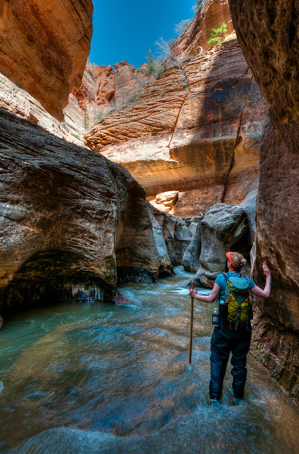
The water was much warmer in Coyote Creek so no "dry pants" were needed as we hiked down it while backpacking in Coyote Gulch.
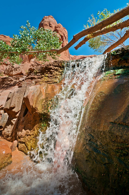
Then in May 2011 we did our first backpack trip within Grand Canyon National Park. We descended to the river on the Tanner Trail. This was our introduction to the steep, loose surface common on many trails beyond the "corridor trails" (Bright Angel, South Kaibab, North Kaibab Trails) within the National Park.
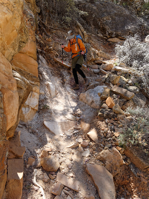
We then took the Escalante Route where we encountered the infamous "Papago Ledges".
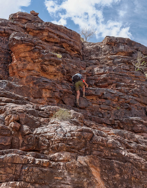
While John had done some rock climbing in the past, I had not and was anxious about it so he gave me some coaching and encouragement the first time.
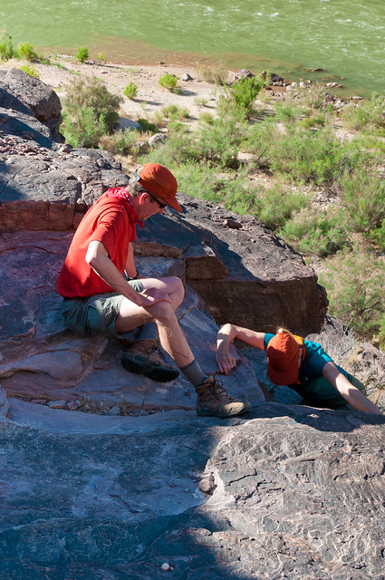
However, I had no trouble with it the next time we did it three years later.
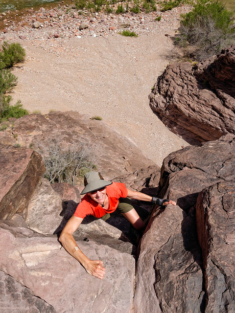
The next obstacle we encountered along the Escalante Route was the equally infamous "Papago Slide", a long tedious gully ...
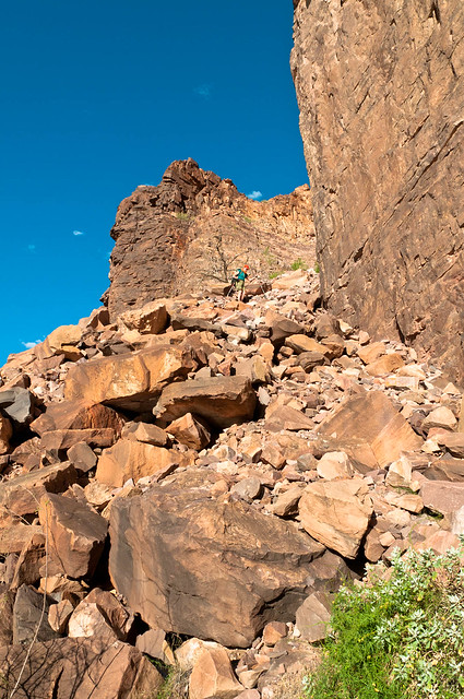
... filled with loose rock ranging in size from large boulders down to ball-bearing-like gravel.
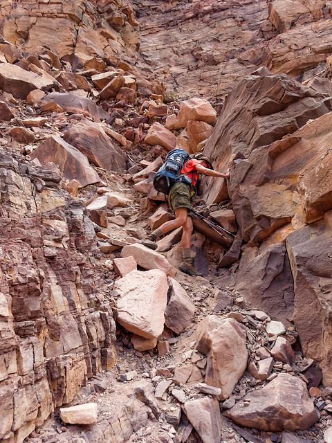
Backpacking in Grand Canyon has provided me with many opportunities to "expand my horizons" and practice new skills. The second backpack trip we did in Grand Canyon was the Thunder River, Tapeats Creek and Deer Creek Loop. We opted to take the shorter, steeper Bill Hall Trail which put me face-to-face with my first "down climb". John easily scrambled down it wearing his pack but I was uncomfortable so he came back up and carried my pack down for me. On our way out I cheated and used the rope someone had left to help me get back up.
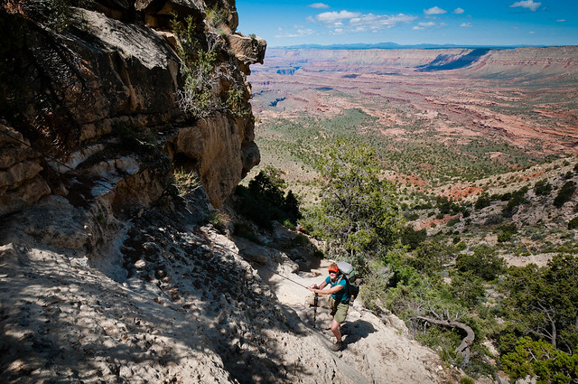
While backpacking to Monument Creek we explored down the short slot canyon that Monument Creek flows through and I got to practice "bridging" for the first time.
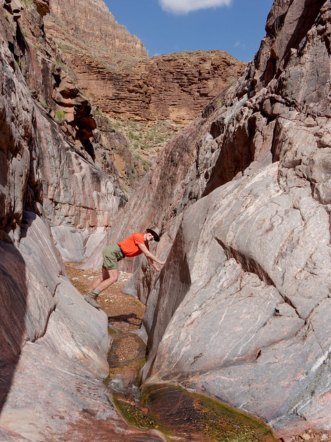
I got to try it again on our second trip to the area four years later.
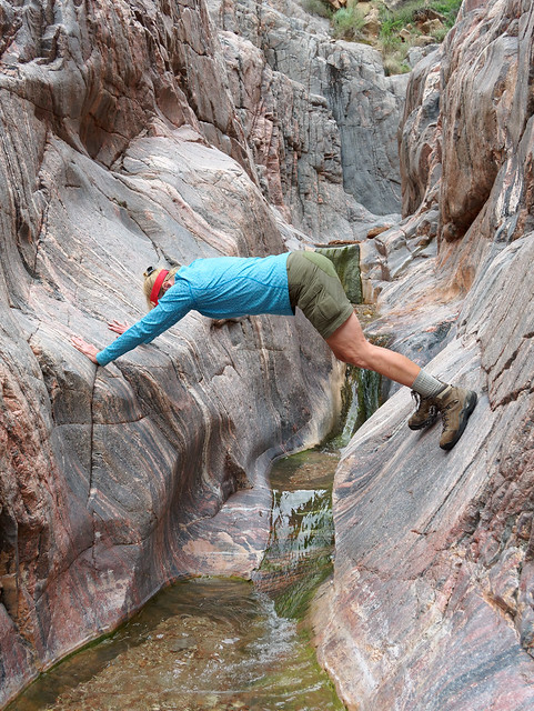
When we have done the Royal Arch Loop I have had opportunities to climb up, ...
... climb down ...
Another opportunity this route provides comes from the steep rock face that requires one to rappel about 20 feet. When we first did this route in 2013 I had never rappelled before. I had practiced a bit on the rear end of our motorhome and I understood the principles. However, that does not completely prepare you for that moment when you lean back, "commit to the rope" and take that first step backwards over the edge.
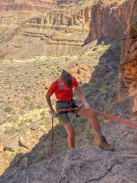
A highlight of the Royal Arch Loop is the opportunity to visit Elves Chasm. Getting there involves hiking down an informal trail from Toltec Beach.
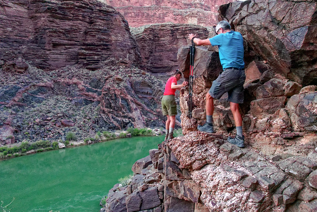
When we got to this hidden oasis I practiced another essential "canyon skill", the ability to endure the incredibly cold water long enough to get a photo.
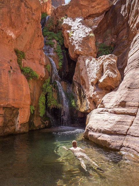
The same year we first did Royal Arch Loop we also did the West Tonto Trail from South Bass to Hermits Rest (AKA "The Gems”). An essential canyon skill one needs to master on this trip is managing water which means carrying enough to get you to the next reasonably reliable source and closely monitoring how much you are consuming.
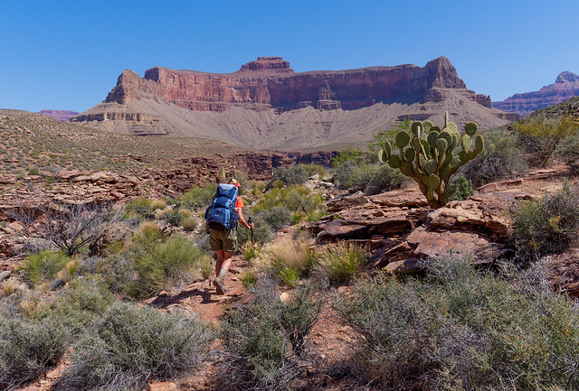
Another skill we practiced on that trip was making best use of any available shade to take breaks.
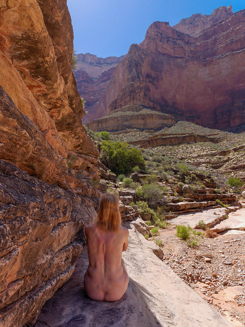
I think one of our best opportunities to experience exposure within Grand Canyon came courtesy of the Beamer Trail.
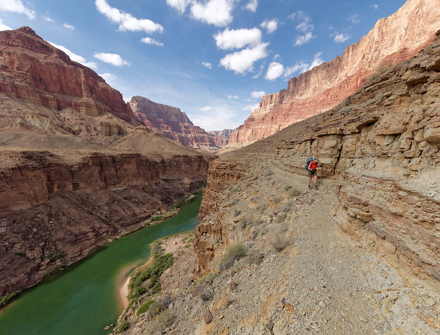
It was not long after we did some of these trips that I joined the Grand Canyon Hikers Yahoo Group. At that point I was feeling pretty good about myself and my abilities within Grand Canyon. However, it quickly became apparent that this group was NOT about hiking on trails. It appeared that most of the regular contributors to the group were all about doing off trail exploration into side canyons or to the top of peaks. There are apparently almost countless unofficial routes, some more “sporty” than others. They may involve tricky route finding, negotiating steep, loose surfaces, traveling through side canyons with various obstacles such as chock stones and up/down climbs that one may need to rappel. Or they might rely on using "packrafts" to float down or to cross the Colorado River. A few vocal members of the group made some derogatory comments about those who use of GPS, who want cairns to follow, who sleep in tents and who treat their water (all of which we do) as it detracted from the "adventure". I felt thoroughly intimidated as I could not see myself doing any of what these guys were describing. I realized I was merely a “Canyon Hiker” and they were “Canyon Explorers”. I had to accept I just didn't have what it takes to join their "club".

Well, there was still some territory in Grand Canyon for a couple of mere "Canyon Hikers" to cover. We decided we wanted to hike every official named trail/route within the National Park. So we did the Boucher Trail which according to the National Park Service Trail Description "... is arguably the most difficult and demanding of the south side trails."
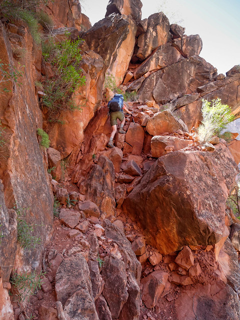
We also did the New Hance Trail which according to the National Park Service Trail Description it "... may be the most difficult established trail on the South Rim of the Grand Canyon".
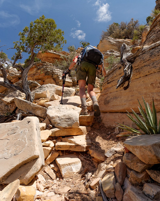
Then in 2015 we did the Nankoweap Trail. The National Park Service Trail Description states (in bold text no less) "This trail is classified as the MOST difficult” of the named trails in Grand Canyon". After reading that I thought back to all the trails we had already done and I took "MOST difficult" to mean that Nankoweap would be worse than the sum total of the most challenging parts of all the other trails put together so I was apprehensive. However, after doing this trip I had trouble understanding what all the fuss was about. Sure, it was a bit exposed at times ...
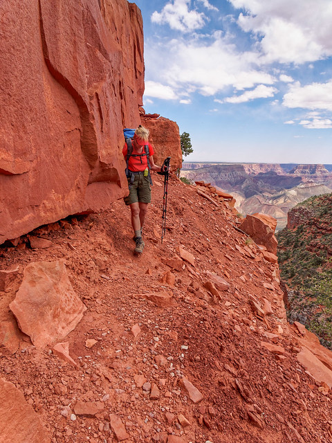
... as well as steep and loose in places but what non-corridor trail in Grand Canyon isn't?
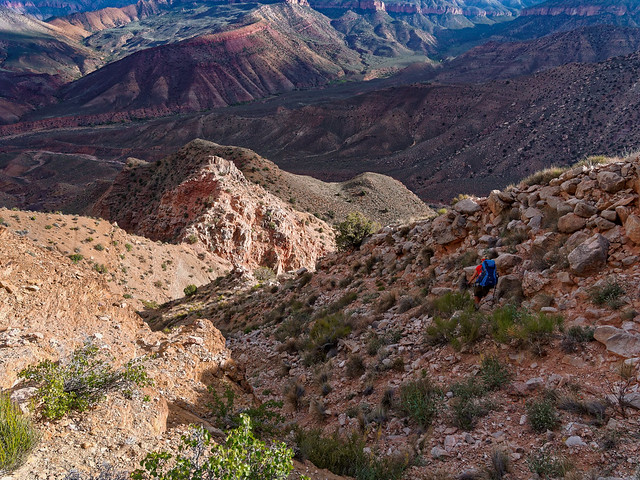
As part of our project we wanted to do the Tuckup Trail but that involved some challenging logistics; primarily unreliable water, route finding issues and transportation difficulties to/from trailheads and John had not yet figured it out. So, as a "consolation prize", he made plans for us to do a shorter but unofficial route; the Tuckup/Stairway Loop. I am embarrassed to admit I did not do much research about this route. In the past John has always done an excellent job researching our trips and handling route finding but I did not stop to think that this trip, as an "unofficial" route, would be different. I did not ask for any information or advice about it from the folks on the Grand Canyon Hiker Yahoo Group. I think I was afraid. Afraid I would be told if I had to ask my undoubtedly stupid questions then I had no business trying it. I was afraid I would be told I should stick to trails, that I obviously just didn't have "what it takes" to do some more challenging off trail exploration. Please realize this is what my insecure, paranoid mind thought, NOT what actually would have happened had I asked the group for advice.
I did see a few photographs of an obstacle in Tuckup Canyon often referred to as the "big down climb" and it made me nervous. As we were already taking a rope to raise and lower our packs John decided to throw in a harness so, if necessary, I could rappel down it. This helped me to feel a little less nervous.

I was blissfully ignorant of what else lay ahead of us as we first started down Tuckup Canyon. However, as we made our way down we encountered several obstacles that I found a bit challenging but others hadn't even bothered to mention in the trip reports I had glanced at.
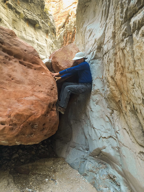
John, who has extensive mountaineering experience as well as some rock climbing experience had no trouble with anything we encountered.
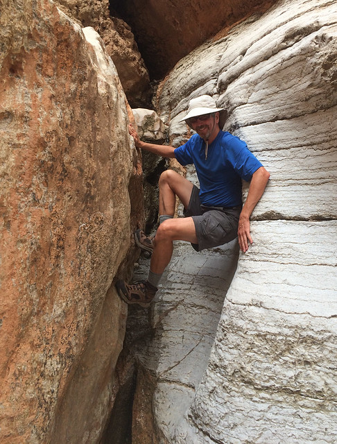
However, they all made me a little nervous so John would get the rope out and belay me. I never had to rely on it to arrest a fall but it did give me some badly needed self confidence.
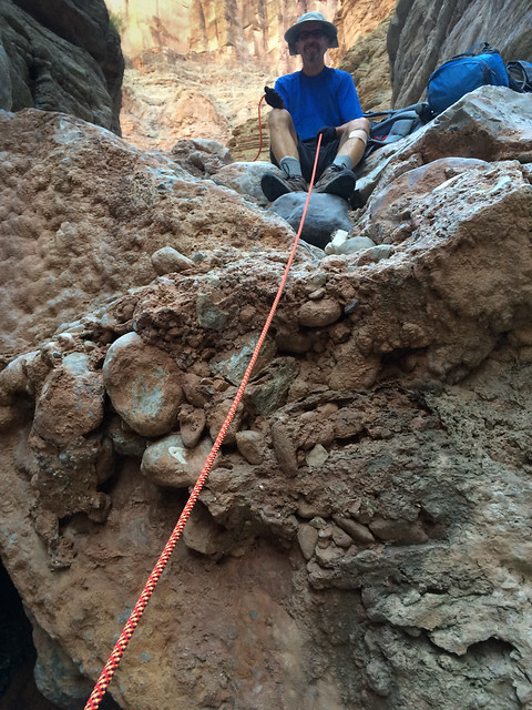
The irony is we never encountered the "big down climb". Apparently, as we were able to get down the pour-off pictured above (as there was no water flowing over it), we did not have to take the bypass around it that concluded in the big down climb. However, we did have to bypass other obstacles and I found these routes a bit "airy" at times.
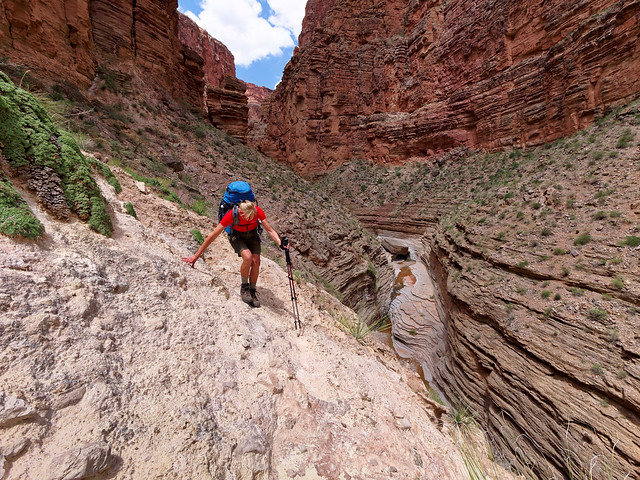
Once in Stairway Canyon we were focused on the four obstacles described by George Steck but just as we had in Tuckup Canyon we encountered obstacles I found challenging. We were both carrying nearly two gallons of water (in preparation for a dry camp that night) and I was dismayed to discover I was not strong enough to carry my own pack up these obstacles so we either used the rope to haul it up or John had to climb back down and carry it up for me.
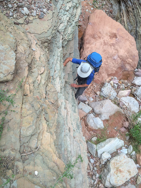
While I had read a bit about the obstacles in Stairway I mistakenly assumed that when we were there it would be obvious where we should go. However, when we got to the base of the 50 foot pour-off we simply could not see a way to bypass it. We then made the very demoralizing decision to turn around and go back the way we came. I have had a great deal of difficulty accepting this defeat and I have been haunted by our failure but I have not been able to imagine going back and trying it again.
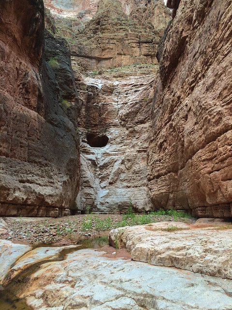
If you have read any of my more personal essays, then you know I have had ongoing issues with low self-esteem and a lack of self-confidence. I tend to discount my accomplishments but after this trip I felt I needed to make a concerted effort to just feel better about myself even though I don't have what it takes to be a "Canyon Explorer". I decided that being an experienced "Canyon Hiker" was nothing to be ashamed of so I wrote an essay about it.
After this we continued to work on our project to hike every official named trail/route in the National Park. Last spring we did the North Bass Trail which provided us with some more "up close and personal encounters" with dense vegetation ...

... including the Mexican Locust with its inch long thorns.
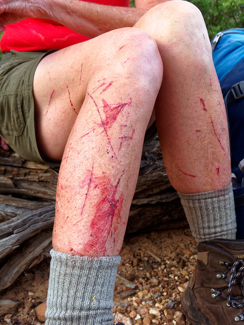
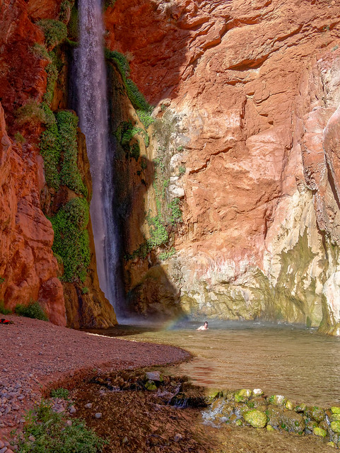
It would be the longest backpack trip Dan has done as well as the most challenging. However, he has done Tanner/Escalante/Grandview with us (Trip Report) and John and I have done the Royal Arch Loop before (Trip Report) so we were confident he would have no trouble with the terrain. However, we knew concerns about water could be a big issue for him as he likes to drink a lot and would not be acclimated to the dry climate (he lives in Pittsburgh). According to the NPS it is 14 miles from the trailhead to Royal Arch and guaranteed water. We knew there was a possibility of finding water in potholes in Royal Arch Canyon but we decided to play it safe and not depend on it. We knew from past experience it was unrealistic for us to get all the way to the arch in one day no matter how early we started. The route down Royal Arch Canyon is rugged and filled with boulders which makes for slow going. We wanted this to be a relaxing trip for him so we planned to dry camp somewhere on the Esplanade the first night and carry enough water to see us through to evening of the following day when we planned to reach Royal Arch."The Royal Arch Loop is appropriate for experienced canyon hikers only, walkers who have paid their dues and acquired the appropriate wilderness skills, whose experience allows proper rigging of rappel anchors, and who can easily and safely rope down vertical cliffs. For such people the Royal Arch Loop offers a top drawer canyon adventure, replete with more natural beauty than humans can absorb. For those lacking the required skill and judgment this hike offers about a million ways to get into serious trouble in a remote part of the Grand Canyon".
This trip starts and ends at the South Bass Trailhead which is about 30 miles from Grand Canyon Village. One issue is that the road out to the trailhead is dirt and impassable when wet. It is badly rutted and high clearance vehicles are recommended (for more info). However, it was dry the morning we headed out and our Jeep Cherokee Trailhawk had no trouble. The road briefly crosses the Havasupai Indian Reservation and they charge $25.00 to cross their land but there may or may not be someone there to collect the fee. This was the third time we have driven out to this trailhead but the first time we were stopped by someone to collect the fee. We paid him and could only assume he was a tribal "official".
Seen from the South Bass Trail in Grand Canyon National Park, Arizona
After eating lunch at the trailhead we hoisted our packs and headed down the steep trail.
Jean on the South Bass Trail in Grand Canyon National Park, Arizona
John and I have spreadsheets that help us to carefully calculate our backpacking food so we have just enough but not too much. We are motivated to keep our pack weight down. However, Dan prefers to error on having too much rather than risk coming up short and is willing to carry the additional weight. So between his ample food allotment and the extra water we were all carrying our packs were quite heavy.
John and Dan on the South Bass Trail in Grand Canyon National Park, Arizona
So heavy that John had made the painful decision to leave his camera at home and rely on his iPhone for photos. The camera on the iPhone 8 is better than previous versions but it remained to be seen if John would find the results satisfactory. We both had the route on Gaia GPS on our iPhones, a great phone App for hikers.
John and Jean on the Royal Arch Loop in Grand Canyon National Park, Arizona
Once we reached the Esplanade the going was easy.
Dan and John on the Royal Arch Loop in Grand Canyon National Park, Arizona
We had great views, of the Esplanade, ...
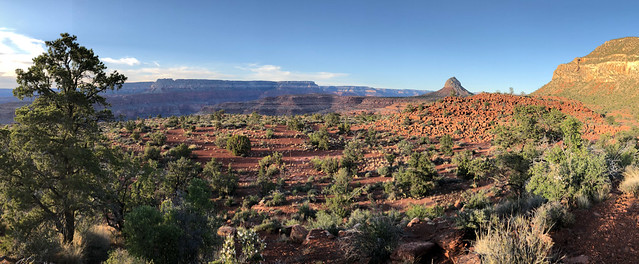
Seen from the Royal Arch Loop in Grand Canyon National Park, Arizona
... of the imposing Mount Huethawali, ...
Mount Huethawali seen from the Royal Arch Loop in Grand Canyon National Park, Arizona
... and down into the canyon.
Seen from the Royal Arch Loop in Grand Canyon National Park, Arizona
We only hiked about five miles that first day before stopping to make camp. One of our debates had been which sleeping bag to bring. Oftentimes in Grand Canyon we can get away with using our lightweight 40 degree bags if we are camping well within the canyon. However, we knew it could be chilly on the Esplanade in mid April so we decided to bring our heavier 20 degree bags as well as our tent fly (just in case).
Jean and Dan in our camp on the Esplanade in Grand Canyon National Park, Arizona
We intended to get an early start the next morning but it just took longer to get the three of us up and moving. The trail continued along the Esplanade for a time and we made good time.
John on the Royal Arch Loop in Grand Canyon National Park, Arizona
The great views continued.
Seen from the Royal Arch Loop in Grand Canyon National Park, Arizona
We passed this spring but viewed it with suspicion as we knew the white deposits indicate the presence of minerals which may cause gastrointestinal upset. But after such a dry winter it was good to see there was any water at all flowing from it.
Seen from the Royal Arch Loop in Grand Canyon National Park, Arizona
We continued on the easy and well-marked track ...
Dan and John on the Royal Arch Loop in Grand Canyon National Park, Arizona
... only slowing when we needed to get around the numerous drainages.
Dan on the Royal Arch Loop in Grand Canyon National Park, Arizona
We knew we needed to drop into the eastern arm of Royal Arch Canyon. When we reached this spot Gaia indicated we should continue on and drop in the next drainage. However, there were some cairns that indicated we should drop in here.
John and Dan on the Royal Arch Loop in Grand Canyon National Park, Arizona
We have learned that Gaia is sometimes more general and does not always know exactly where the "real" trail or route is located especially when it comes to navigating through or around drainages and side canyons. We have also learned that just because there is a cairn it does not mean that is the "right" way or even the "best" way. Neither of us remembered any route finding issues on our past trip so in this situation we chose to follow the cairns. In hindsight, we probably should have followed Gaia as route finding became more time consuming and the terrain more rugged as we descended but we had gone too far to turn back. In addition it became quite windy with strong gusts that forced me to stop frequently and brace myself to keep from being knocked over. It was just one more thing that slowed us down.
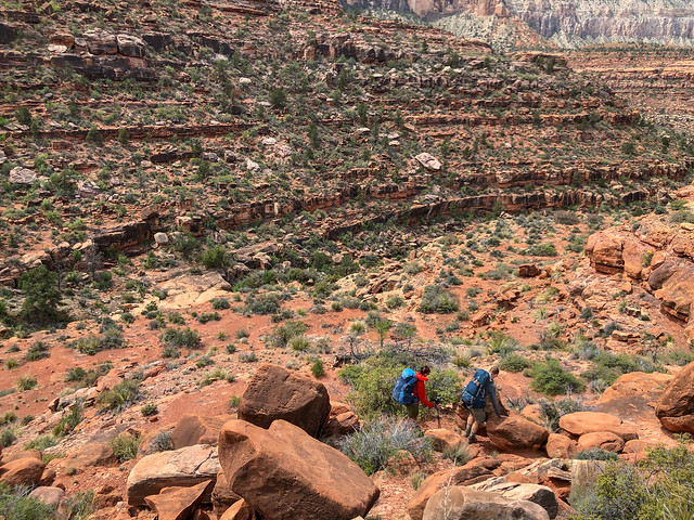
Fortunately, we finally joined the canyon we were supposed to be in and the going was much easier ...
Jean and Dan on the Royal Arch Loop in Grand Canyon National Park, Arizona
Fortunately, we finally joined the canyon we were supposed to be in and the going was much easier ...
Dan and Jean on the Royal Arch Loop in Grand Canyon National Park, Arizona
... with only some minor obstacles.
Jean on the Royal Arch Loop in Grand Canyon National Park, Arizona
We were not surprised to begin encountering some sizeable potholes in the Supai. However, we did not feel the need to collect any of the water but it was good to know our intuition had been correct.
John on the Royal Arch Loop in Grand Canyon National Park, Arizona
We later encountered the 200 foot pour-off. The most commonly used (and safest) bypass is on the right.
Dan on the Royal Arch Loop in Grand Canyon National Park, Arizona
However, some daring souls take the route to the left ...
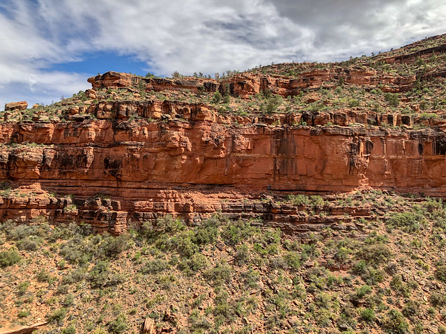
... and cross what is known as ...
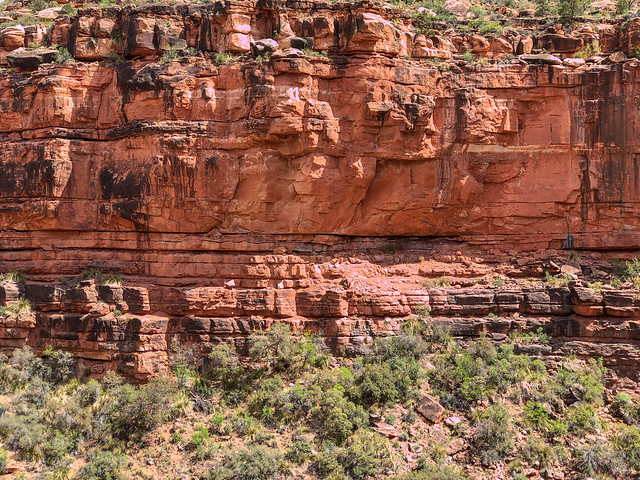
... the "Ledge of Death". If you are curious about this route here is a YouTube video.

Needless to say, we didn't go that way.
Seen from the Royal Arch Loop in Grand Canyon National Park, Arizona
... and cross what is known as ...
Seen from the Royal Arch Loop in Grand Canyon National Park, Arizona
... the "Ledge of Death". If you are curious about this route here is a YouTube video.

"Ledge of Death" in Royal Arch Canyon in Grand Canyon National Park, Arizona - Photo by Bradley Hanson
Needless to say, we didn't go that way.
Dan and John on the Royal Arch Loop in Grand Canyon National Park, Arizona
We took the "easy" way (at least it's easy if you are not in your mid 60's).
Dan on the Royal Arch Loop in Grand Canyon National Park, Arizona
This route follows a ledge for a while ...
Jean and John on the Royal Arch Loop in Grand Canyon National Park, Arizona
... until it is time to make the steep descent to the canyon floor.
Jean on the Royal Arch Loop in Grand Canyon National Park, Arizona
This route is hard on both clothing and packs.
John on the Royal Arch Loop in Grand Canyon National Park, Arizona
Once down to the canyon floor we began to encounter more obstacles. Dan was ahead of us so we didn't get to see how he got down this one.
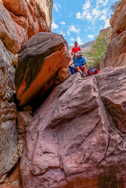
This became a common theme; ...
John and Jean on the Royal Arch Loop in Grand Canyon National Park, Arizona
This became a common theme; ...
John and Dan on the Royal Arch Loop in Grand Canyon National Park, Arizona
... photos of people taking photos of people getting up or down something.
John and Jean on the Royal Arch Loop in Grand Canyon National Park, Arizona
We don't usually get photos of John helping me get up or down obstacles. I'm not sure if Dan taking these is a good thing or not.
John and Jean on the Royal Arch Loop in Grand Canyon National Park, Arizona
As we continued down the canyon ...
Seen from the Royal Arch Loop in Grand Canyon National Park, Arizona
... it became deeper and more narrow.
Dan and John on the Royal Arch Loop in Grand Canyon National Park, Arizona
We encountered more obstacles, some requiring us to remove our packs and hand them down, ...
Jean on the Royal Arch Loop in Grand Canyon National Park, Arizona
... and our pace slowed again.
John on the Royal Arch Loop in Grand Canyon National Park, Arizona
It was getting late in the day and I began to wonder if we could even get as far as Royal Arch before dark. We are not adverse to hiking after dark on a trail but this was no trail. Another concern we had was if there would be other people camped at Royal Arch. While we are not antisocial we do prefer camping in solitude when backpacking but this was a popular destination. On our way down canyon we kept our eye out for alternative campsites. We hiked as fast as we could when the terrain allowed ...
John and Jean on the Royal Arch Loop in Grand Canyon National Park, Arizona
... but were forced to slow down when it didn't. It was getting dark and I was just about ready to get out my headlamp when we rounded yet another bend in the narrow dark canyon ...
Jean and John on the Royal Arch Loop in Grand Canyon National Park, Arizona
... and I saw a patch of the dusky sky through the opening of the arch. It was such a relief!
Seen from the Royal Arch Loop in Grand Canyon National Park, Arizona
And luck was with us as there were no other people there. We set up our tents under the large overhang as there was rain in the forecast. Originally we had planned to only spend one night at Royal Arch and continue on to Toltec Beach the following day. The sky was clear during the night but clouds moved in early in the morning. When we awoke to some drizzle and with the possibility of more rain later in the day we decided to spend two nights here.
Our camp at Royal Arch in Grand Canyon National Park, Arizona
The drizzle stopped sometime mid morning and I briefly thought we should pack up and move on. However, better sense prevailed. Not only would the boulders in the canyon we needed to climb up be wet and slippery, so would the 20-foot rock face we would be rappelling down.
Seen from Royal Arch in Grand Canyon National Park, Arizona
We have rarely camped in the same spot on multiple nights and then it was only when we had the opportunity to do some day hiking so spending an entire day in one spot was a new experience for us. When John and I were here before we only stopped briefly to eat lunch and for John to do some photography. However, on that trip we were soon joined by a group who quickly spread out and took up a great deal of "psychic space" so we soon headed out again. Having this time here now was a real treat!
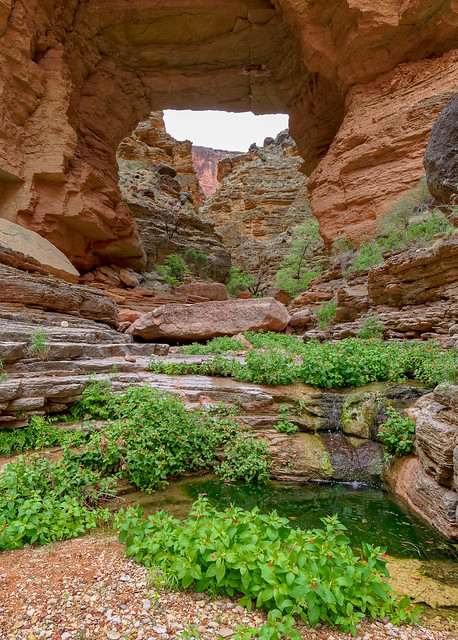
According to the forecast there was the possibility of a thunderstorm that day and that looked like a definite possibility when thick dark clouds moved in.
Royal Arch in Grand Canyon National Park, Arizona
Seen from Royal Arch in Grand Canyon National Park, Arizona
It rained quite hard for a while but we could enjoy it from the comfort of the large area protected from the rain under the overhang and the arch.
Seen from Royal Arch in Grand Canyon National Park, Arizona
The temperature was quite chilly so I spent much of the day in my sleeping bag drinking hot chocolate. Unfortunately, we had all left our long underwear bottoms at home not imagining we would need them. Fortunately, we had brought our warmer sleeping bags. We all even took naps that day, a backpacking first for us.
Jean in our camp at Royal Arch in Grand Canyon National Park, Arizona
Royal Arch Creek in Grand Canyon National Park, Arizona
John and Dan at Royal Arch in Grand Canyon National Park, Arizona
Dan also did some exploring above the arch ...
Dan above Royal Arch in Grand Canyon National Park, Arizona
... and saw a rough track leading higher above the arch but chose to not follow it.
Seen from above Royal Arch in Grand Canyon National Park, Arizona
Later in the afternoon the sky cleared and the wet rock glistened.
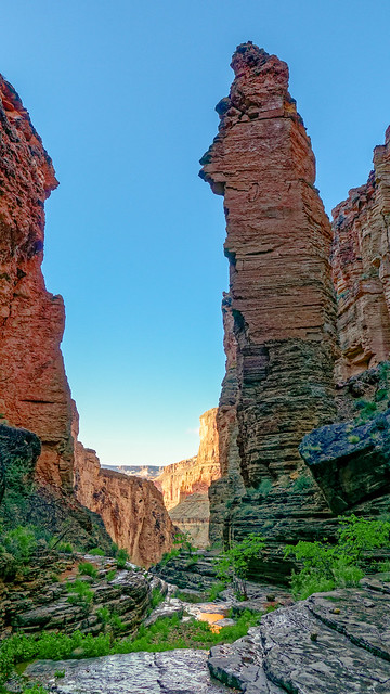
John and Dan took more photos looking up at the arch ...
Seen from Royal Arch in Grand Canyon National Park, Arizona
Royal Arch in Grand Canyon National Park, Arizona
... as well as of the canyon below.
The canyon below Royal Arch in Grand Canyon National Park, Arizona
John and Jean on the Royal Arch Loop in Grand Canyon National Park, Arizona
We made our way back up the canyon ...
Jean on the Royal Arch Loop in Grand Canyon National Park, Arizona
... and were grateful for the now dry rock.
John on the Royal Arch Loop in Grand Canyon National Park, Arizona
It made it so much easier to negotiate obstacles such as these ledges.
John on the Royal Arch Loop in Grand Canyon National Park, Arizona
Something I intended to do this time was get photos that accurately illustrate the type of obstacles backpackers encounter on this route.
John on the Royal Arch Loop in Grand Canyon National Park, Arizona
There is one spot where you have to slowly work your way around a rock shelf that juts out. It feels like it wants to push you off and it obscures your view of your feet on the uneven rock below so it can be disconcerting.
Dan and Jean on the Royal Arch Loop in Grand Canyon National Park, Arizona
Unfortunately, I don't think these photos completely capture it. John doesn't normally have issues with obstacles or exposure but even he moved gingerly along this shelf.
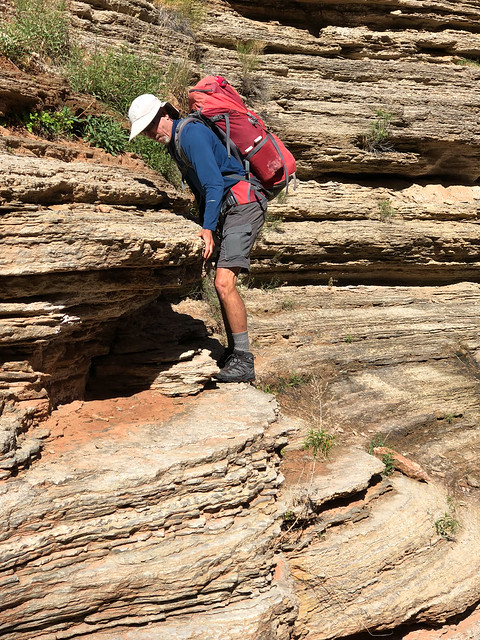
It made me quite nervous the first time I did it five years earlier but I had less trouble with it this time.
John on the Royal Arch Loop in Grand Canyon National Park, Arizona
It made me quite nervous the first time I did it five years earlier but I had less trouble with it this time.
Jean on the Royal Arch Loop in Grand Canyon National Park, Arizona
There were more ledges to hike up but these were straightforward.
John on the Royal Arch Loop in Grand Canyon National Park, Arizona
But other obstacles were less so and again, I was grateful for the dry rock.
Jean and John on the Royal Arch Loop in Grand Canyon National Park, Arizona
We continued up canyon until we reached the cairn marking the junction with the trail that would take us out of the canyon and ultimately to Toltec Beach, our destination for the day.
Dan and Jean on the Royal Arch Loop in Grand Canyon National Park, Arizona
We then made our way up the steep trail.
John on the Royal Arch Loop in Grand Canyon National Park, Arizona
It was a treat to leave the boulders behind and be back on an actual trail.
Jean on the Royal Arch Loop in Grand Canyon National Park, Arizona
It was still early in the season but some of the cacti were blooming.
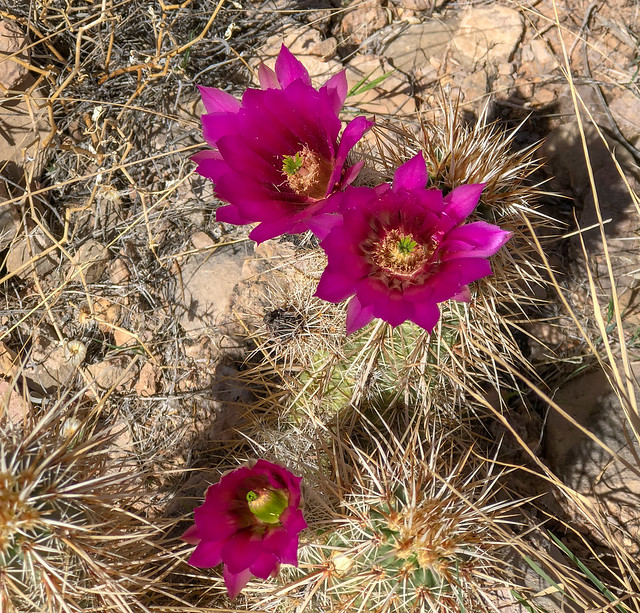
As we got higher we could look back down into Royal Arch Canyon ...
Seen from the Royal Arch Loop in Grand Canyon National Park, Arizona
As we got higher we could look back down into Royal Arch Canyon ...
Seen from the Royal Arch Loop in Grand Canyon National Park, Arizona
... and could see where we had camped under the overhang.
Seen from the Royal Arch Loop in Grand Canyon National Park, Arizona
We also got views of the monolith and the arch ...
Seen from the Royal Arch Loop in Grand Canyon National Park, Arizona
... as well as the area above the arch.
Seen from the Royal Arch Loop in Grand Canyon National Park, Arizona
Seen from the Royal Arch Loop in Grand Canyon National Park, Arizona
... including the Colorado River ...
Seen from the Royal Arch Loop in Grand Canyon National Park, Arizona
... and Toltec Beach where we would camp that night.
Seen from the Royal Arch Loop in Grand Canyon National Park, Arizona
It seemed so close but between us and Toltec ...
Dan on the Royal Arch Loop in Grand Canyon National Park, Arizona
... was a sizeable rock face that involves quite a bit of down climbing and a 20-foot rappel.
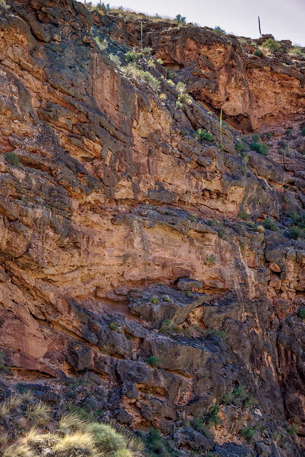
Seen from the Royal Arch Loop in Grand Canyon National Park, Arizona
It is not uncommon for there to be anchors and ropes here left behind by previous backpackers. It can become quite a hodgepodge of webbing and ropes of undetermined age or integrity and the Park Service periodically removes it. Just prior to this trip John had talked to a Backcountry Ranger who had recently done the Royal Arch Loop. Her plan had been to "clean it up" but she said it wasn't bad and she left these anchors and two ropes. However, as there is no guarantee there will be something there you'd be willing to stake your life on, we came prepared with webbing, rope and a harness.
Seen from the Royal Arch Loop in Grand Canyon National Park, Arizona
This was only the second time I have rappelled, the first being when we were here five years earlier.
Jean on the Royal Arch Loop in Grand Canyon National Park, Arizona
This was the first time Dan had rappelled. However, he got to try out the harness and practice a bit off the back of our motorhome a few days earlier. This is how I learned but in hindsight we should have found someplace he could practice under more realistic conditions. But he did fine despite his less than optimal training. That is until he was momentarily freaked when John said "Wait a sec!" as he thought it indicated a problem. But John only wanted him to stop, look up and smile for a photo.
Dan on the Royal Arch Loop in Grand Canyon National Park, Arizona
John came down last so a "butt shot" was the best we could get of him.
John on the Royal Arch Loop in Grand Canyon National Park, Arizona
The rappel (indicated by white box) only gets you down a small portion of the rock face.

Seen from the Royal Arch Loop in Grand Canyon National Park, Arizona
The rest must be down climbed and it takes time.
Jean and John on the Royal Arch Loop in Grand Canyon National Park, Arizona
Once down the rock face we were back on a trail ...
John and Jean on the Royal Arch Loop in Grand Canyon National Park, Arizona
... that took us down to the river and Toltec Beach.
John on the Royal Arch Loop in Grand Canyon National Park, Arizona
It was after 4:00 when we reached Toltec Beach. When we first planned this trip we thought we would spend two nights at Toltec allowing plenty of time to visit and photograph Elves Chasm. However, as we had spent two nights at Royal Arch we no longer had that option. If we were going to visit Elves Chasm it had to be then so we quickly stashed most of our gear and headed down canyon on the surprisingly well marked trail.
Seen from the route to Elves Chasm in Grand Canyon National Park, Arizona
When we did this trip five years earlier we encountered many sketchy "social trails" on the way down river to Elves Chasm but it now appears an effort has been made to create one "official" route. It took us higher up than we remember going in the past but we were in a hurry and in no position to question it. At one point we accidentally got off the main track which probably cost us some time before we found it again.
Jean on the route to Elves Chasm in Grand Canyon National Park, Arizona
Once at the creek we quickly made our way up the canyon ...
Jean on the route to Elves Chasm in Grand Canyon National Park, Arizona
... thoroughly enjoying the beautiful creek ...
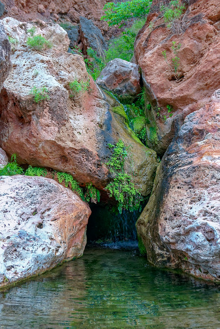
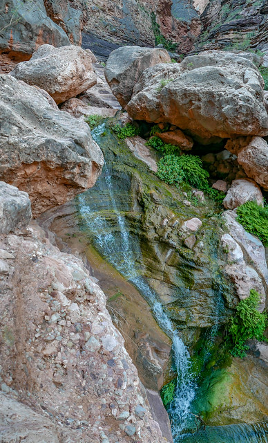
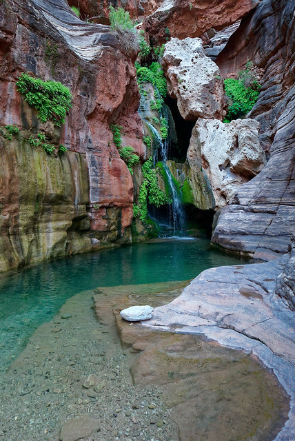
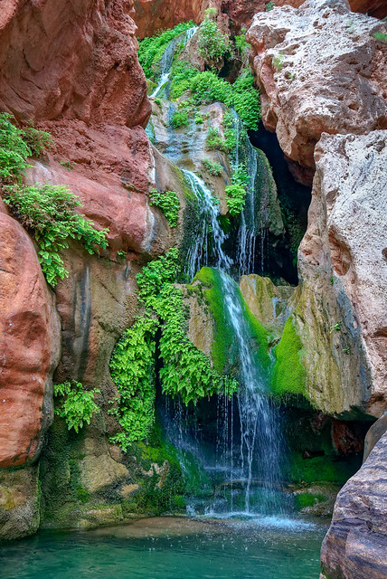
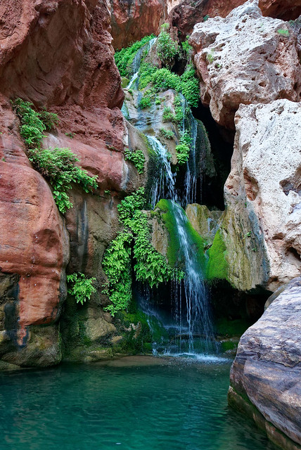
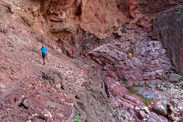
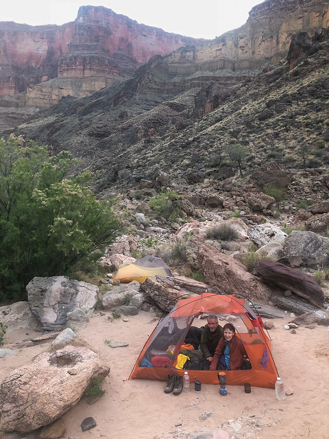
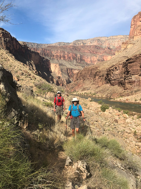
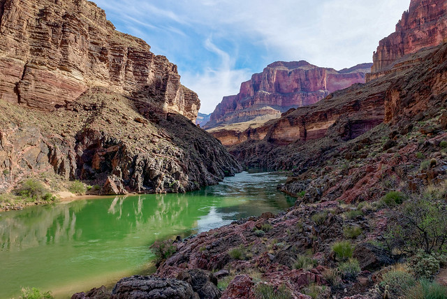
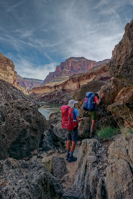
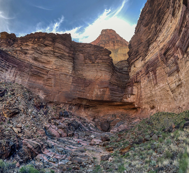
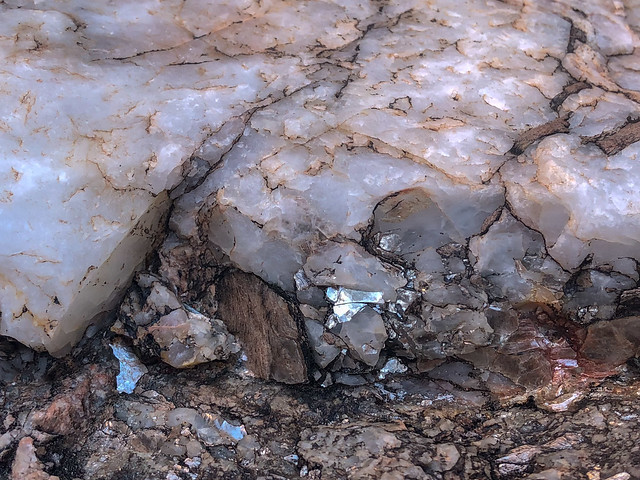
Seen from the route to Elves Chasm in Grand Canyon National Park, Arizona
... that gave us hints to what was still ahead. ...
Seen from the route to Elves Chasm in Grand Canyon National Park, Arizona
... the hidden oasis of Elves Chasm!
Elves Chasm in Grand Canyon National Park, Arizona
We so wanted Dan to see this lovely area and were happy to have gotten there while there was still enough daylight to enjoy it (even if there wasn't enough time to go swimming in the unbelievably cold water).
Elves Chasm in Grand Canyon National Park, Arizona
One advantage at being here so late in the day is all the rafters have already come and gone so we got to have this amazing place all to ourselves.
Elves Chasm in Grand Canyon National Park, Arizona
But we couldn't linger and before long we headed back. It had taken us about two hours to get there ...
John and Jean on the route to Elves Chasm in Grand Canyon National Park, Arizona
... and we wanted to get as far back as we could before it got dark. Dan has great night vision and was able to get all the way back to Toltec by moonlight but John and I both had to get out headlamps. Once back at Toltec we set up camp, cooked supper and went to bed.
Jean and John on the route to Elves Chasm in Grand Canyon National Park, Arizona
We were up early and managed to get a reasonably early start (all things considered).
Our camp at Toltec Beach in Grand Canyon National Park, Arizona
The trail was initially very easy ...
Dan and John on the Royal Arch Loop in Grand Canyon National Park, Arizona
... as it follows the river up canyon.
Seen from the Royal Arch Loop in Grand Canyon National Park, Arizona
However, it starts heading up and away from the river as it works its way through the rough, sometimes sharp, volcanic rock. It was slow going and some of us (namely me) gave blood along the way.
John and Jean on the Royal Arch Loop in Grand Canyon National Park, Arizona
We then encountered an unnamed side canyon. When John and I did this trip before it was late in the day and we breezed through it without giving it a second glance.
Seen from the Royal Arch Loop in Grand Canyon National Park, Arizona
However, this time we were all struck by the unique beauty of the rock; the pink granite contrasting with the black.
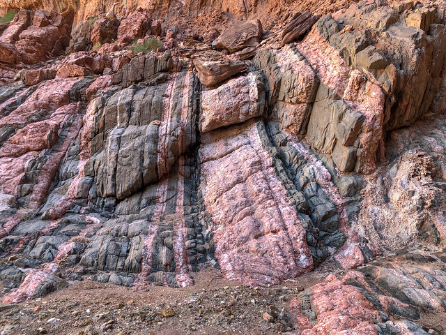
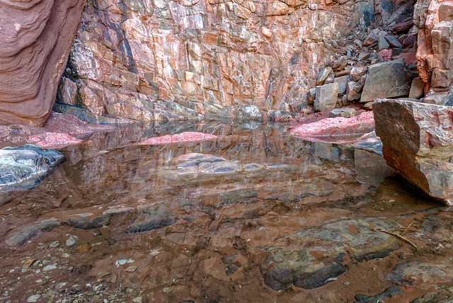
Seen from the Royal Arch Loop in Grand Canyon National Park, Arizona
We don't often get such a close up view of the Vishnu Schist, a rock layer buried deep within the canyon.
Seen from the Royal Arch Loop in Grand Canyon National Park, Arizona
In addition to the granite we could see quartz ...
Seen from the Royal Arch Loop in Grand Canyon National Park, Arizona
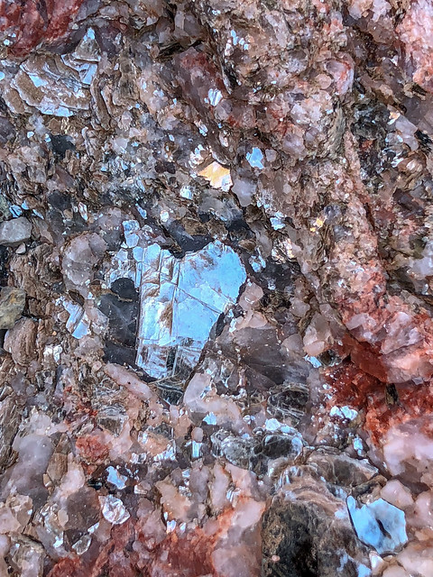
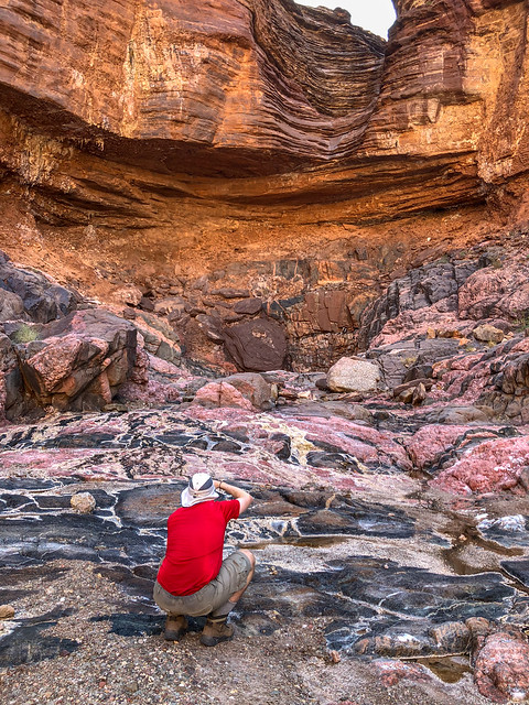
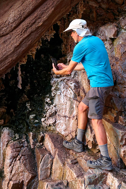
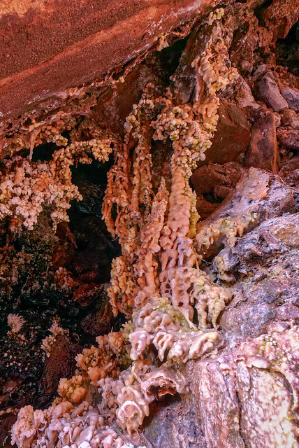
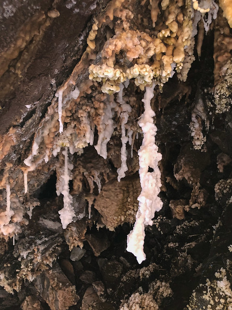
... and Mica sparkling in the sunlight.
Seen from the Royal Arch Loop in Grand Canyon National Park, Arizona
It had gotten quite warm and the sun was hot but this canyon was cool and shady so it was too easy for us to stop. Dan soon became engrossed in photography ...
Dan on the Royal Arch Loop in Grand Canyon National Park, Arizona
... quickly followed by John. There was more here than was initially seen ...
John on the Royal Arch Loop in Grand Canyon National Park, Arizona
... and closer examination revealed delicate mineral formations ...
Seen from the Royal Arch Loop in Grand Canyon National Park, Arizona
... not often seen outside of caves. The only other place in Grand Canyon where we have seen formations like these was in Hermit Canyon (photo).
Seen from the Royal Arch Loop in Grand Canyon National Park, Arizona
But we had miles to go so we finally pulled ourselves away from such an intriguing and inviting place and got back on the trail under the hot sun.
Seen from the Royal Arch Loop in Grand Canyon National Park, Arizona
We then made our way up and out of Garnet Canyon to where the Tonto Trail begins.
Garnet Canyon seen from the Royal Arch Loop in Grand Canyon National Park, Arizona
But first there were a few obstacles to negotiate.
Dan and Jean on the Royal Arch Loop in Grand Canyon National Park, Arizona
What is a bit exasperating is that I have since learned there is a route that is much more gradual and bypasses this series of ledges and pour-offs. Shortly before we started climbing up all this I do remember seeing a cairn leading off to the right but John said no, that wasn't the way we had gone before so we headed up these ledges. Routes like this are no problem for younger, stronger backpackers such as Dan. I don't usually mind doing such if they are within my physical capability and I even enjoy scrambling over rocks to a certain degree. But I sometimes wish there could be a universally known way to distinguish cairns marking more gradual routes suitable for senior citizens so we could decide how much abuse we are willing to subject our aging bodies to.
Jean on the Royal Arch Loop in Grand Canyon National Park, Arizona
We continued working our way up to the Tonto Platform and what I promised Dan would be fast, easy hiking.
Dan and Jean on the Royal Arch Loop in Grand Canyon National Park, Arizona
But first we had to get up there.
Dan on the Royal Arch Loop in Grand Canyon National Park, Arizona
We all had to get up there.
John on the Royal Arch Loop in Grand Canyon National Park, Arizona
We could then see our way out ...
Seen from the Royal Arch Loop in Grand Canyon National Park, Arizona
... and were finally on the Tonto Trail.
Dan and Jean on the Royal Arch Loop in Grand Canyon National Park, Arizona
The temperature had become quite warm so when we came across some ample shade in a drainage we took a welcome break.
John on the Royal Arch Loop in Grand Canyon National Park, Arizona
There were even some shallow puddles with just enough water to soak the bandanas we all wore around our necks which was very refreshing. I then soaked our shirts which were quite exhilarating to put back on!
Seen from the Royal Arch Loop in Grand Canyon National Park, Arizona
After a short rest we continued on. While I enjoyed the variety of experiences provided by going down Royal Arch Canyon I always enjoy hiking on the Tonto. There is just something about the open expanse, ...
Seen from the Royal Arch Loop in Grand Canyon National Park, Arizona
... and the views down to the river ...
Seen from the Royal Arch Loop in Grand Canyon National Park, Arizona
... and up to the rim.
Seen from the Royal Arch Loop in Grand Canyon National Park, Arizona
It was quite warm and we had some concerns about water so when we saw these potholes below us in a drainage we investigated. It wasn't the clearest pothole water we have seen but it seemed like a good idea to collect two liters to have in reserve just in case.
John on the Royal Arch Loop in Grand Canyon National Park, Arizona
Our destination that day was Copper Canyon.
John and Jean on the Royal Arch Loop in Grand Canyon National Park, Arizona
We had been given some instructions on how to find "Bass Camp" within Copper Canyon and the likely location of some potholes. But this would require some off trail exploration and we had intended to get there with plenty of daylight to do that safely.
Seen from the Royal Arch Loop in Grand Canyon National Park, Arizona
However, our time spent in the shady side canyon was working against us and it was later than was "optimal" for off trail exploration. But we really needed to locate water so we headed off the Tonto in what we thought was a likely spot to allow us to drop into the canyon. Unfortunately, we were losing light too fast and it was getting harder to choose our route. Given our experience on the remote Tuckup Trail John and I were more comfortable with this plan. We were also more confident we would find water so we had been drinking an adequate amount throughout the day. However, Dan has less experience and expressed discomfort with this off trail exploration. He had also been conserving his water and was becoming dehydrated.
So, we decided it would be safest to get back on the trail and hike by headlamp to where the Tonto crosses Copper Canyon, set up camp and look for water from there. Once at the crossing we dropped our packs and first headed up canyon but encountered no water in the gravelly canyon floor. Near the crossing I found a shallow puddle of funky water and started to collect what I could while John and Dan searched down canyon. They were both determined to keep going until they found water. And they did! They found some suitable potholes about 10 minutes down canyon. Dan explored a little further and saw more below a pour-off that could probably be down climbed if we needed it. Back at camp everyone drank their fill, had supper and went to bed.
Seen from the Royal Arch Loop in Grand Canyon National Park, Arizona
We intended to get a really early start for our hike out as it was supposed to get quite hot that day. However, hiking after dark, needing to spend so much time and effort getting water and eating late on multiple days is not conducive to early starts. John and Dan had to go get more water and it just takes time to treat that much for three people with one SteriPen. All I can say is we did the best we could under the circumstances. At least we knew where our next source of water was, in our Jeep at the trailhead.
John and Dan in our camp at Copper Canyon in Grand Canyon National Park, Arizona
Looking down Copper Canyon from the Tonto ...
Seen from the Royal Arch Loop in Grand Canyon National Park, Arizona
... you can see the pothole where John and Dan got water.
Seen from the Royal Arch Loop in Grand Canyon National Park, Arizona
As we headed out on the Tonto we looked across Copper Canyon to where we had been doing our exploration the evening before.
Seen from the Royal Arch Loop in Grand Canyon National Park, Arizona
It did look like it would be possible to find a way down into Copper Canyon but we accepted it would not have been a good idea for us to try to do it in the dark. We've been told Copper Canyon is a beautiful canyon and well worth spending time in so perhaps John and I will come back sometime and plan to spend a couple of nights in Bass Camp and explore the area.
Seen from the Royal Arch Loop in Grand Canyon National Park, Arizona
The way ahead of us now was straightforward. We had no decisions to make ...
Seen from the Royal Arch Loop in Grand Canyon National Park, Arizona
... and all we had to do was keep putting one foot in front of the other.
Dan and John on the Royal Arch Loop in Grand Canyon National Park, Arizona
As we approached South Bass Canyon we realized we could look across the river and up Shinumo Creek and the location of the North Bass Trail.
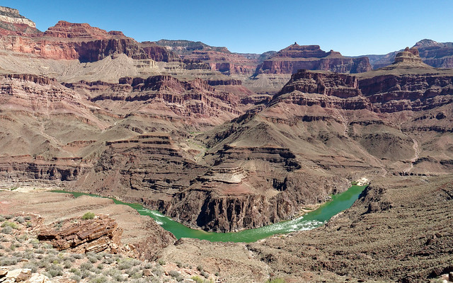
With Tyndall Dome to our right and South Bass Canyon directly ahead of us it was time to turn our back on the river and head toward the rim.
Seen from the Royal Arch Loop in Grand Canyon National Park, Arizona
With Tyndall Dome to our right and South Bass Canyon directly ahead of us it was time to turn our back on the river and head toward the rim.
Tyndall Dome seen from the Royal Arch Loop in Grand Canyon National Park, Arizona
Had we needed or wanted to go to South Bass Beach and the river we would have taken the short cut trail marked by this cairn.
Seen from the Royal Arch Loop in Grand Canyon National Park, Arizona
But we didn't so we followed the Tonto Trail as it circumvented South Bass Canyon.
Seen from the Royal Arch Loop in Grand Canyon National Park, Arizona
We eventually left the Tonto behind ...
Seen from the South Bass Trail in Grand Canyon National Park, Arizona
... when we reached the junction with the South Bass Trail ...
Jean on the South Bass Trail in Grand Canyon National Park, Arizona
... and made our way up the canyon.
Seen from the South Bass Trail in Grand Canyon National Park, Arizona
It was quite hot and it took its toll, especially on me. I was lagging behind ...
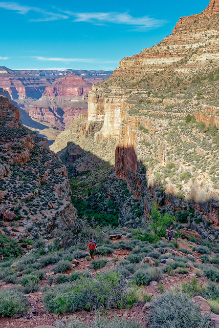
...but they always waited for me whenever they encountered the least bit of shade.
Jean on the South Bass Trail in Grand Canyon National Park, Arizona
Dan and John on the South Bass Trail in Grand Canyon National Park, Arizona
The advantage of our hiking this late in the afternoon was we were eventually in shade for much of our hike out.
Dan on the South Bass Trail in Grand Canyon National Park, Arizona
I am normally very careful where I place my feet and usually keep my eyes open for such hazards but this snake took me completely by surprise and startled me. Fortunately, at least for me, it was dead. I hope a live rattler would have the good sense to alert me way before I had a chance to get this close.
Seen from the South Bass Trail in Grand Canyon National Park, Arizona
We took a well deserved break and finished any food we had left. I thought my fatigue may have been due to being short of calories so I was now quite grateful for the extra food Dan had insisted on bringing.
John and Dan on the South Bass Trail in Grand Canyon National Park, Arizona
We also allowed ourselves a few minutes to just enjoy where we were. There is always a bittersweet feeling on the hike out from a backpack trip. Bitter because we would be thrust back into civilization and forced to give up our blessed solitude and sweet because hot showers awaited us.
Seen from the South Bass Trail in Grand Canyon National Park, Arizona
After a steep climb up the well constructed trail (complete with stone stairs) we were once again on the Esplanade.
Seen from the South Bass Trail in Grand Canyon National Park, Arizona
We then made our way...
Seen from the South Bass Trail in Grand Canyon National Park, Arizona
... up the trail with the rim looming above us.
Seen from the South Bass Trail in Grand Canyon National Park, Arizona
We continued on as the sun went down ...
Seen from the South Bass Trail in Grand Canyon National Park, Arizona
... and finished the day by headlamp, again. Royal Arch Loop is one of our favorite backpack trips. It offers such a wide variety of experiences and it makes you work hard enough for each and every one of them so you properly appreciate them. All of our photos from this backpack trip are on Flickr.
Jean and John on the South Bass Trail in Grand Canyon National Park, Arizona
Shortly after Dan flew home we left Grand Canyon. We thoroughly enjoyed the time we spent there this winter and spring. Our experiences ran the gamut from the "circus" of Havasu Falls to the absolute solitude of the Tuckup Trail. But we were ready for a change and we began to head north with plans to spend the summer in Washington State where we have more big plans. I'll let you know how things went next time.
This next bit is just something Jean has been thinking about.
Do I have what it takes to be a "Canyon Explorer?"
I absolutely love the southwest US but it is a part of the country I hardly knew even existed until I was in my mid 30's. I grew up in Kentucky and had rarely been out of the state until 1977 when John and I packed up and moved to western Washington. I loved being in Washington State; the tall trees, the alpine lakes, the glaciers, and most especially, the mountains. However, the grey, wet winters I could do without. And by "winter", I mean the period of time between September and July. As much as we loved Washington State, sometimes, we just needed a break.So, in September 1989 we loaded up our new travel trailer, including our two young boys (aged four and almost two) and my mother-in-law, and headed south in search of a change of scenery. And boy, did we get it! We visited Bryce Canyon National Park, Arches National Park, Canyonlands National Park in Utah and Grand Canyon National Park in Arizona. This was a monumental experience for me. I did not know such places existed in reality!

Jean and Tom in Arches National Park, Utah in 1989
A highlight for me was a 15 mile day hike John and I did in Canyonlands. It was amazing!

Jean in Canyonlands National Park, Utah in 1989
I felt like a kid on a marvelous playground!

Jean in Canyonlands National Park, Utah in 1989
Over the years we did more trips to the southwest most often in the spring. It provided a welcome contrast to the Pacific Northwest; bright sun, blue skies, red rock and canyons. Not to mention the shapes! Southern Utah is like a giant sculpture garden displaying the works of the most creative (and psychotic) sculptors the natural world possesses.

Dan, John, Jean and Tom in Goblin Valley State Park, Utah
In 2009 John and I took our new motorhome on its maiden voyage. John was still working so our time was limited. Still, we managed short trips to Bryce Canyon National Park, Zion National Park in Utah and the north rim of Grand Canyon National Park in Arizona.

Jean on the way up Angels Landing in Zion National Park, Utah
However, the highlight of this trip was a backpack trip we did within the Paria Canyon - Vermillion Cliffs Wilderness Area in Utah. We began by hiking through Buckskin Gulch. At over 13 miles it is reported to be the longest slot canyon in the world (source).

Jean entering Buckskin Gulch within the Paria Canyon - Vermillion Cliffs Wilderness Area, Utah
Hiking through a slot canyon was a new experience for me. The most common "obstacle" we encountered was mud and water of unknown depth.

Jean in Buckskin Gulch within the Paria Canyon - Vermillion Cliffs Wilderness Area, Utah
The "Cesspool" is the most notorious.

Jean in Buckskin Gulch within the Paria Canyon - Vermillion Cliffs Wilderness Area, Utah
In April 2010, after John retired and we sold our house, we hit the road in our motorhome. The first summer we spent three months traveling through British Columbia,Yukon and Alaska. However, in early 2011 we headed to the southwest. We visited Grand Staircase - Escalante National Monument in Utah where we hiked to some very accessible slot canyons including Zebra Canyon ...
John and Jean in Zebra Canyon within Grand Staircase - Escalante National Monument, Utah
... and Tunnel Slot Canyon.
Jean in Tunnel Slot Canyon within Grand Staircase - Escalante National Monument, Utah
We also visited Zion National Park and did the long dayhike to see the "Subway", a unique slot canyon. It was early April and recent snow melt resulted in a high level of very cold water in the Left Fork of North Creek. Therefore, we rented dry pants and canyoneering boots for the countless creek crossings.
Jean on the route to the Subway in Zion National Park, Utah
The high water level meant we needed to be very careful to avoid the numerous deep pools now obscured by the flowing water.
Jean in the Subway in Zion National Park, Utah
We were doing the non technical "bottom up" route but unfortunately, the high water level prevented us from being able to hike up canyon past this point. There is also a technical "top down" route. However, the high water level made that route difficult because many of the belay anchors were under water. In fact, the National Park Service closed the top down route that very day because of the high water level.
Jean in the Subway in Zion National Park, Utah
The water was much warmer in Coyote Creek so no "dry pants" were needed as we hiked down it while backpacking in Coyote Gulch.
Jean in Coyote Creek within Coyote Gulch in Grand Staircase - Escalante National Monument, Utah
Then in May 2011 we did our first backpack trip within Grand Canyon National Park. We descended to the river on the Tanner Trail. This was our introduction to the steep, loose surface common on many trails beyond the "corridor trails" (Bright Angel, South Kaibab, North Kaibab Trails) within the National Park.
Jean on the Tanner Trail in Grand Canyon National Park, Arizona
We then took the Escalante Route where we encountered the infamous "Papago Ledges".
Jean climbing the Papago Ledges on the Escalante Route in Grand Canyon National Park, Arizona
While John had done some rock climbing in the past, I had not and was anxious about it so he gave me some coaching and encouragement the first time.
Johan and Jean at the Papago Ledges on the Escalante Route in Grand Canyon National Park, Arizona
However, I had no trouble with it the next time we did it three years later.
Jean climbing the Papago Ledges on the Escalante Route in Grand Canyon National Park, Arizona
The next obstacle we encountered along the Escalante Route was the equally infamous "Papago Slide", a long tedious gully ...
Jean on the Escalante Route in Grand Canyon National Park, Arizona
... filled with loose rock ranging in size from large boulders down to ball-bearing-like gravel.
Jean on the Escalante Route in Grand Canyon National Park, Arizona
Backpacking in Grand Canyon has provided me with many opportunities to "expand my horizons" and practice new skills. The second backpack trip we did in Grand Canyon was the Thunder River, Tapeats Creek and Deer Creek Loop. We opted to take the shorter, steeper Bill Hall Trail which put me face-to-face with my first "down climb". John easily scrambled down it wearing his pack but I was uncomfortable so he came back up and carried my pack down for me. On our way out I cheated and used the rope someone had left to help me get back up.
Jean on the Bill Hall Trail in Grand Canyon National Park, Arizona
While backpacking to Monument Creek we explored down the short slot canyon that Monument Creek flows through and I got to practice "bridging" for the first time.
Jean in the Monument Creek slot canyon in Grand Canyon National Park, Arizona
I got to try it again on our second trip to the area four years later.
Jean in the Monument Creek slot canyon in Grand Canyon National Park, Arizona
When we have done the Royal Arch Loop I have had opportunities to climb up, ...
Jean and John on the Royal Arch Loop in Grand Canyon National Park, Arizona
... climb down ...
Jean on the Royal Arch Loop in Grand Canyon National Park, Arizona
... and shuffle across rocks.
Jean on the Royal Arch Loop in Grand Canyon National Park, Arizona
Jean on the Royal Arch Loop in Grand Canyon National Park, Arizona
A highlight of the Royal Arch Loop is the opportunity to visit Elves Chasm. Getting there involves hiking down an informal trail from Toltec Beach.
Jean and John on the route from Elves Chasm in Grand Canyon National Park, Arizona
When we got to this hidden oasis I practiced another essential "canyon skill", the ability to endure the incredibly cold water long enough to get a photo.
Jean at Elves Chasm in Grand Canyon National Park, Arizona
The same year we first did Royal Arch Loop we also did the West Tonto Trail from South Bass to Hermits Rest (AKA "The Gems”). An essential canyon skill one needs to master on this trip is managing water which means carrying enough to get you to the next reasonably reliable source and closely monitoring how much you are consuming.
Jean on the West Tonto Trail in Grand Canyon National Park, Arizona
Another skill we practiced on that trip was making best use of any available shade to take breaks.
Jean in Ruby Canyon on the West Tonto Trail in Grand Canyon National Park, Arizona
I think one of our best opportunities to experience exposure within Grand Canyon came courtesy of the Beamer Trail.
Jean on the Beamer Trail in Grand Canyon National Park, Arizona
It was not long after we did some of these trips that I joined the Grand Canyon Hikers Yahoo Group. At that point I was feeling pretty good about myself and my abilities within Grand Canyon. However, it quickly became apparent that this group was NOT about hiking on trails. It appeared that most of the regular contributors to the group were all about doing off trail exploration into side canyons or to the top of peaks. There are apparently almost countless unofficial routes, some more “sporty” than others. They may involve tricky route finding, negotiating steep, loose surfaces, traveling through side canyons with various obstacles such as chock stones and up/down climbs that one may need to rappel. Or they might rely on using "packrafts" to float down or to cross the Colorado River. A few vocal members of the group made some derogatory comments about those who use of GPS, who want cairns to follow, who sleep in tents and who treat their water (all of which we do) as it detracted from the "adventure". I felt thoroughly intimidated as I could not see myself doing any of what these guys were describing. I realized I was merely a “Canyon Hiker” and they were “Canyon Explorers”. I had to accept I just didn't have what it takes to join their "club".

Somewhere off trail in Grand Canyon, Arizona - Source of photo
Well, there was still some territory in Grand Canyon for a couple of mere "Canyon Hikers" to cover. We decided we wanted to hike every official named trail/route within the National Park. So we did the Boucher Trail which according to the National Park Service Trail Description "... is arguably the most difficult and demanding of the south side trails."
Jean on the Boucher Trail in Grand Canyon National Park, Arizona
We also did the New Hance Trail which according to the National Park Service Trail Description it "... may be the most difficult established trail on the South Rim of the Grand Canyon".
Jean on the New Hance Trail in Grand Canyon National Park, Arizona
Then in 2015 we did the Nankoweap Trail. The National Park Service Trail Description states (in bold text no less) "This trail is classified as the MOST difficult” of the named trails in Grand Canyon". After reading that I thought back to all the trails we had already done and I took "MOST difficult" to mean that Nankoweap would be worse than the sum total of the most challenging parts of all the other trails put together so I was apprehensive. However, after doing this trip I had trouble understanding what all the fuss was about. Sure, it was a bit exposed at times ...
Jean on the Nankoweap Trail in Grand Canyon National Park, Arizona
... as well as steep and loose in places but what non-corridor trail in Grand Canyon isn't?
Jean on the Nankoweap Trail in Grand Canyon National Park, Arizona
As part of our project we wanted to do the Tuckup Trail but that involved some challenging logistics; primarily unreliable water, route finding issues and transportation difficulties to/from trailheads and John had not yet figured it out. So, as a "consolation prize", he made plans for us to do a shorter but unofficial route; the Tuckup/Stairway Loop. I am embarrassed to admit I did not do much research about this route. In the past John has always done an excellent job researching our trips and handling route finding but I did not stop to think that this trip, as an "unofficial" route, would be different. I did not ask for any information or advice about it from the folks on the Grand Canyon Hiker Yahoo Group. I think I was afraid. Afraid I would be told if I had to ask my undoubtedly stupid questions then I had no business trying it. I was afraid I would be told I should stick to trails, that I obviously just didn't have "what it takes" to do some more challenging off trail exploration. Please realize this is what my insecure, paranoid mind thought, NOT what actually would have happened had I asked the group for advice.
I did see a few photographs of an obstacle in Tuckup Canyon often referred to as the "big down climb" and it made me nervous. As we were already taking a rope to raise and lower our packs John decided to throw in a harness so, if necessary, I could rappel down it. This helped me to feel a little less nervous.

Chris Forsyth negotiating the “big down climb” in Tuckup Canyon in Grand Canyon National Park, Arizona - Photo by Ned Bryant
I was blissfully ignorant of what else lay ahead of us as we first started down Tuckup Canyon. However, as we made our way down we encountered several obstacles that I found a bit challenging but others hadn't even bothered to mention in the trip reports I had glanced at.
John in Tuckup Canyon in Grand Canyon National Park, Arizona
John, who has extensive mountaineering experience as well as some rock climbing experience had no trouble with anything we encountered.
John in Tuckup Canyon in Grand Canyon National Park, Arizona
However, they all made me a little nervous so John would get the rope out and belay me. I never had to rely on it to arrest a fall but it did give me some badly needed self confidence.
John in Tuckup Canyon in Grand Canyon National Park, Arizona
The irony is we never encountered the "big down climb". Apparently, as we were able to get down the pour-off pictured above (as there was no water flowing over it), we did not have to take the bypass around it that concluded in the big down climb. However, we did have to bypass other obstacles and I found these routes a bit "airy" at times.
Jean in Tuckup Canyon in Grand Canyon National Park, Arizona
Once in Stairway Canyon we were focused on the four obstacles described by George Steck but just as we had in Tuckup Canyon we encountered obstacles I found challenging. We were both carrying nearly two gallons of water (in preparation for a dry camp that night) and I was dismayed to discover I was not strong enough to carry my own pack up these obstacles so we either used the rope to haul it up or John had to climb back down and carry it up for me.
John in Stairway Canyon in Grand Canyon National Park, Arizona
While I had read a bit about the obstacles in Stairway I mistakenly assumed that when we were there it would be obvious where we should go. However, when we got to the base of the 50 foot pour-off we simply could not see a way to bypass it. We then made the very demoralizing decision to turn around and go back the way we came. I have had a great deal of difficulty accepting this defeat and I have been haunted by our failure but I have not been able to imagine going back and trying it again.
The 50 ft pour-off in Stairway Canyon in Grand Canyon National Park, Arizona
If you have read any of my more personal essays, then you know I have had ongoing issues with low self-esteem and a lack of self-confidence. I tend to discount my accomplishments but after this trip I felt I needed to make a concerted effort to just feel better about myself even though I don't have what it takes to be a "Canyon Explorer". I decided that being an experienced "Canyon Hiker" was nothing to be ashamed of so I wrote an essay about it.
After this we continued to work on our project to hike every official named trail/route in the National Park. Last spring we did the North Bass Trail which provided us with some more "up close and personal encounters" with dense vegetation ...
Jean on the North Bass Trail in Grand Canyon National Park, Arizona
... including the Mexican Locust with its inch long thorns.
Jean on the North Bass Trail in Grand Canyon National Park, Arizona
After this we were very nearly done with our "every trail" project in Grand Canyon with the exception of the Tuckup Trail. We decided it was too long for us to do it in one trip so we were stymied. Fortunately, last spring John had a long conversation with a North Rim Backcountry Ranger and got some ideas about how we could do it in segments. John studied a topographic map and determined if we started at 150 mile canyon and hiked west we could most likely get back to the rim by hiking up the North Arm of Tuckup Canyon. On the map it looked gradual enough. We would then be only about eight (cross-country) miles from our car parked at the trailhead. This time I did ask the folks on the Grand Canyon Hiker Yahoo Group specifically about exiting via the North Arm and as a result we got some helpful information so we were optimistic
The eastern portion of the Tuckup Trail is not exactly a "trail" or even a "route", it is more of a “concept”. It did appear as a line on our Gaia GPS (an iPhone app we can highly recommend). However, the line only represented a general direction and it was not closely related to the terrain we were actually confronted with. We still needed to quickly learn how to “read the canyon” to help us find our way around or across the numerous side canyons we encountered. For example, in the image below the Tuckup Trail is indicated in red where it "levitates" across the steep sides of a side canyon, whereas, our actual walking route is indicated in blue.
 I have been a "technology phobe" in the past and have never bonded with any of the GPS devices John has owned but I found Gaia on my phone to be very easy to use. I ended up being in the lead most of the time and did much of the route finding. We encountered steep loose slopes, exposed ledges, up/down climbs; all of which used to make me quite anxious. But this time I met each situation with a positive attitude and negotiated them confidently and safely. John noticed this change and even commented on it. This trip was a huge confidence booster for me.
One possible explanation for my reduction in anxiety was that in the previous six months I had made some significant changes in my life affecting my health; both physical and mental. Last fall I changed to a Ketogenic way of eating (very low carbohydrate, moderate protein, high fat) to reduce overall inflammation in my body. This change in diet enabled me to go off of an antidepressant and a mood stabilizer; both prescribed in 2007 for Cyclothymia, a form of Bi Polar Disorder and possibly caused by inflammation of the brain. I am a fan of Dr Georgia Ede who has an interest in the exciting field of "Nutritional Psychiatry" and I encourage anyone interested in this topic to check out her website and blog and read some of the numerous articles she has written for Psychology Today magazine.
My recent experience on the Tuckup Trail has caused me to look at myself in a new more positive way and to revisit my original question “Do I have what it takes to be a Canyon Explorer”? Well, it would have helped to have learned some skills at a younger age. It would have been great if I could have learned rock climbing and canyoneering as a teenager or as a young adult with supportive instruction and opportunities to practice my skills. But I grew up in Kentucky in a "Great American Dysfunctional Family". My opportunities were nonexistent and support of any kind was in short supply.

What if John and I had made different choices? What if back in 1977 we had moved to the southwest rather than Washington State? Would we have developed a passion for off trail exploration and developed canyoneering skills? Could be, but we'll never know. Life is full of choices and missed opportunities and I briefly felt like Marlon Brando in "On the Waterfront". I wanted to cry out in desperation “I coulda’ been a Canyon Explorer!" But the past cannot be changed and besides, even knowing everything I know now I still believe moving to Washington State was the best decision for us. We both love mountains!

And I have no real regrets about how we spent our free time while living, working and raising our two boys there.

So what I need to do is figure out what I am capable of now. I know I need to face facts; I just turned 64, I have arthritis in my knees and I lack significant strength in my legs and upper body. While there are exercises I can do to increase strength and there are skills I can develop, but at this point in my life, there are greater limitations to what I can actually achieve. So, I need to accept that there will be times when accommodations must be made. For example, we need to be careful and well informed regarding route selection. And the best place to get the information we need will be from the experienced Canyon Explorers on the Yahoo Group. I also need to be willing to graciously accept assistance from others because sometimes I just need a little help to get to where we want to go.

Sometimes I might need a boost up.
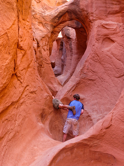
Sometimes, I may need to remove my pack and hand it to somebody ...
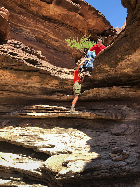
... before climbing up ...
... or down something.
Sometimes I will need to sit and scoot on my butt ...
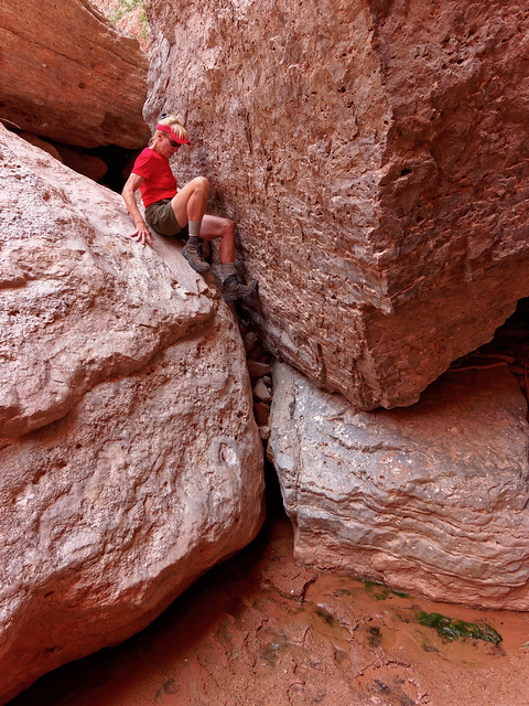
... but I might need someone to be ready in case I need them ...
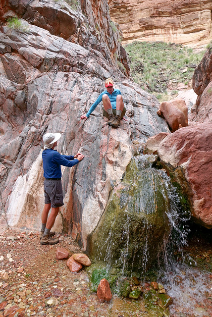
... to catch me.
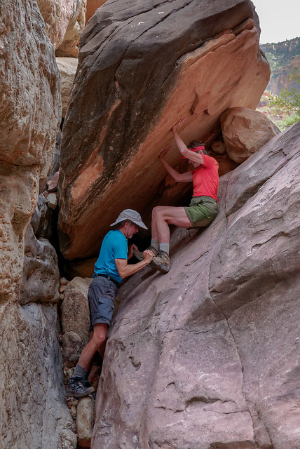
Sometimes I might need someone to be available ...
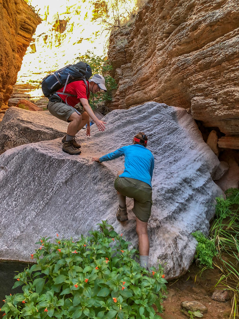
... in case I need to grab their arm ...
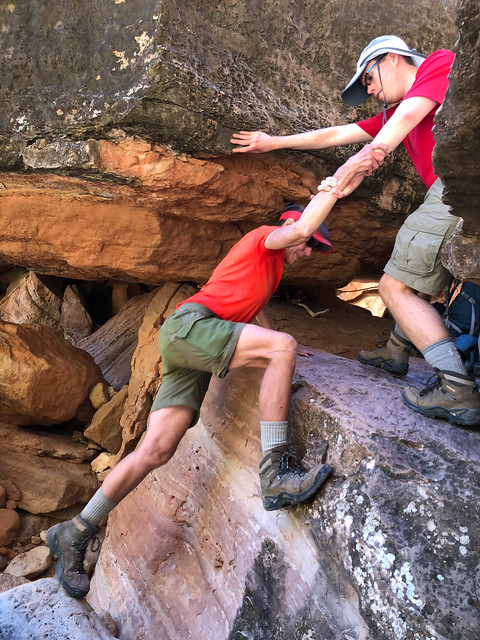
... or whatever other body part they have handy.
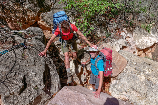
I have to admit that when I think of all the times I have needed help while hiking I feel discouraged. I feel old and weak. Intellectually, I know I shouldn't but it is the "nature of the beast". So how can I get past this ongoing negative self perception? Well, what if I pretend I am looking at photos of some other woman? Some other woman who is now in her mid 60's and has arthritis in her knees. Do I think that the woman in all of the photos above looks like a mere "Canyon Hiker" who should stick to established trails? No!
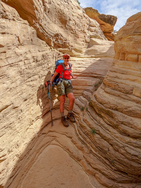
What I need to remember is that my original question was not “Am I a skilled Canyon Explorer?” or "Am I an experienced Canyon Explorer?" because I am not contemplating going out tomorrow and exploring down any side canyon no matter how "sporty" the route is. No, my question was “Do I have what it takes?” Well, what if I put my age, my physical limitations and my lack of experience aside for a moment and ask myself "Do I have the spirit of a Canyon Explorer?" Well, if that is the question then the answer has to be a resounding "Hell Yeah!!!"
The eastern portion of the Tuckup Trail is not exactly a "trail" or even a "route", it is more of a “concept”. It did appear as a line on our Gaia GPS (an iPhone app we can highly recommend). However, the line only represented a general direction and it was not closely related to the terrain we were actually confronted with. We still needed to quickly learn how to “read the canyon” to help us find our way around or across the numerous side canyons we encountered. For example, in the image below the Tuckup Trail is indicated in red where it "levitates" across the steep sides of a side canyon, whereas, our actual walking route is indicated in blue.

One possible explanation for my reduction in anxiety was that in the previous six months I had made some significant changes in my life affecting my health; both physical and mental. Last fall I changed to a Ketogenic way of eating (very low carbohydrate, moderate protein, high fat) to reduce overall inflammation in my body. This change in diet enabled me to go off of an antidepressant and a mood stabilizer; both prescribed in 2007 for Cyclothymia, a form of Bi Polar Disorder and possibly caused by inflammation of the brain. I am a fan of Dr Georgia Ede who has an interest in the exciting field of "Nutritional Psychiatry" and I encourage anyone interested in this topic to check out her website and blog and read some of the numerous articles she has written for Psychology Today magazine.
My recent experience on the Tuckup Trail has caused me to look at myself in a new more positive way and to revisit my original question “Do I have what it takes to be a Canyon Explorer”? Well, it would have helped to have learned some skills at a younger age. It would have been great if I could have learned rock climbing and canyoneering as a teenager or as a young adult with supportive instruction and opportunities to practice my skills. But I grew up in Kentucky in a "Great American Dysfunctional Family". My opportunities were nonexistent and support of any kind was in short supply.

My family and......................................................................... me at Fort Harrod, Kentucky in 1962
What if John and I had made different choices? What if back in 1977 we had moved to the southwest rather than Washington State? Would we have developed a passion for off trail exploration and developed canyoneering skills? Could be, but we'll never know. Life is full of choices and missed opportunities and I briefly felt like Marlon Brando in "On the Waterfront". I wanted to cry out in desperation “I coulda’ been a Canyon Explorer!" But the past cannot be changed and besides, even knowing everything I know now I still believe moving to Washington State was the best decision for us. We both love mountains!

John and Jean in Olympic National Park, Washington in 1978
And I have no real regrets about how we spent our free time while living, working and raising our two boys there.

Dan and Tom at Flaming Geyser State Park, Washington in 1989
So what I need to do is figure out what I am capable of now. I know I need to face facts; I just turned 64, I have arthritis in my knees and I lack significant strength in my legs and upper body. While there are exercises I can do to increase strength and there are skills I can develop, but at this point in my life, there are greater limitations to what I can actually achieve. So, I need to accept that there will be times when accommodations must be made. For example, we need to be careful and well informed regarding route selection. And the best place to get the information we need will be from the experienced Canyon Explorers on the Yahoo Group. I also need to be willing to graciously accept assistance from others because sometimes I just need a little help to get to where we want to go.

Tom assisting Jean while hiking in the "Maze" in Canyonlands National Park, Utah
Sometimes I might need a boost up.
Tom helping Jean into Peek-a-Boo Canyon in Grand Staircase-Escalante National Monument, Utah
Sometimes, I may need to remove my pack and hand it to somebody ...
Jean and Dan on Royal Arch Loop in Grand Canyon National Park, Arizona
... before climbing up ...
Jean on Royal Arch Loop in Grand Canyon National Park, Arizona
... or down something.
Jean on Royal Arch Loop in Grand Canyon National Park, Arizona
Sometimes I will need to sit and scoot on my butt ...
Jean in Tuckup Canyon within Grand Canyon National Park, Arizona
... but I might need someone to be ready in case I need them ...
John and Jean in the Monument Creek slot canyon in Grand Canyon National Park, Arizona
... to catch me.
John and Jean on the Royal Arch Loop in Grand Canyon National Park, Arizona
Sometimes I might need someone to be available ...
Dan and Jean on the Royal Arch Loop in Grand Canyon National Park, Arizona
... in case I need to grab their arm ...
Dan and Jean on the Royal Arch Loop in Grand Canyon National Park, Arizona
... or whatever other body part they have handy.
John and Jean on the Royal Arch Loop in Grand Canyon National Park, Arizona
I have to admit that when I think of all the times I have needed help while hiking I feel discouraged. I feel old and weak. Intellectually, I know I shouldn't but it is the "nature of the beast". So how can I get past this ongoing negative self perception? Well, what if I pretend I am looking at photos of some other woman? Some other woman who is now in her mid 60's and has arthritis in her knees. Do I think that the woman in all of the photos above looks like a mere "Canyon Hiker" who should stick to established trails? No!
Jean in the North Arm of Tuckup Canyon in Grand Canyon National Park, Arizona
What I need to remember is that my original question was not “Am I a skilled Canyon Explorer?” or "Am I an experienced Canyon Explorer?" because I am not contemplating going out tomorrow and exploring down any side canyon no matter how "sporty" the route is. No, my question was “Do I have what it takes?” Well, what if I put my age, my physical limitations and my lack of experience aside for a moment and ask myself "Do I have the spirit of a Canyon Explorer?" Well, if that is the question then the answer has to be a resounding "Hell Yeah!!!"
Jean at Deer Creek Falls in Grand Canyon National Park, Arizona


1 comment:
good blog
Post a Comment