When I first read “The Hobbit” and the “Lord of the Rings” trilogy I fell in love with Tolkien’s description of “Middle-earth”. When books that I have enjoyed are made into movies I am frequently disappointed with the result. This was not so with Peter Jackson’s “Lord of the Rings” film trilogy especially with his choice of filming locations as New Zealand epitomizes “Middle-earth”. We didn’t take any of the numerous LOTR film location tours available but periodically we would be driving or walking somewhere when I truly felt that I was in “Middle-earth”. It was a great adventure (although I am a bit disappointed that I didn't get to meet any of the “elves”).
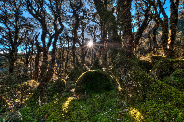
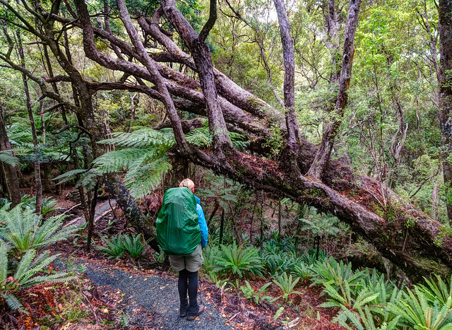
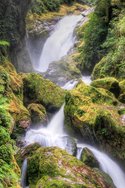
"Middle Earth" AKA the Enchanted Forest in Fiordland National Park, New Zealand
Where we’ve been – New Zealand, South Island (southern part)
3/5 - 4/1 2012
In this post:
- Kepler Track in Fiordland National Park
- Milford Track in Fiordland National Park
- Rakiura Track in Rakiura National Park
- Mueller Hut Track in Mt Cook National Park
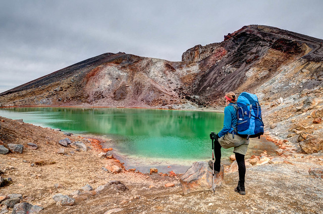
Jean and Upper Emerald Lake on the Tongariro Northern Circuit in Tongariro National Park, New Zealand
We now had three left to do on the South Island; the Kepler, the Milford and the Rakiura Tracks. We were already booked for the Milford Track but had not yet booked the other two as we wanted to watch the weather forecast (metvuw.com worked best for us). While on the Routeburn Track we learned that a period for “fine” weather was predicted. So as soon as we got back to Te Anau we went to the Fiordland National Park Visitor Center and took the earliest dates available and hoped the good weather would hold.
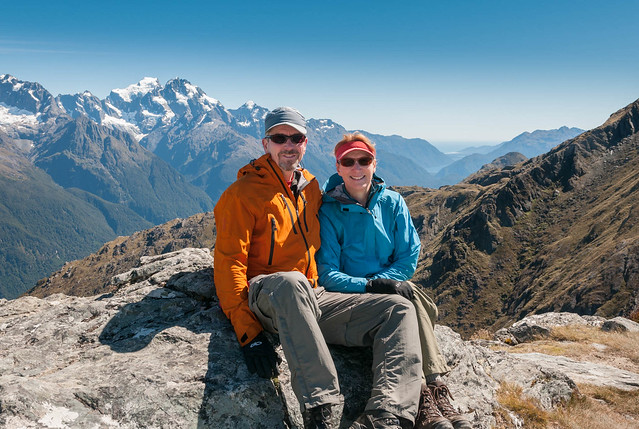
John and Jean on top of Conical Hill while on the Routeburn Track within Mt Aspiring National Park, New Zealand
Our preference would have been to camp in our tent while on the Kepler Track. Unfortunately there is no campground near the Luxmore Hut. Therefore campers, after starting their first day at Brod Bay, must hike about 10 hours up over the ridge and all the way down other side to the Iris Burn campground. That's a longer hiking day than we wanted to commit ourselves to and it wouldn't allow much time to enjoy views or take photos from the ridge. Therefore, just as we had done on the Heaphy and Routeburn Tracks, we decided to stay in DOC huts.
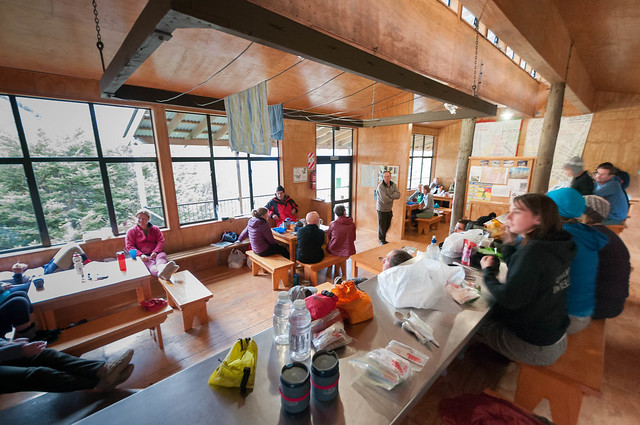
Inside the Routeburn Falls Hut in Mt Aspiring National Park, New Zealand
The Kepler Track is commonly done counterclockwise. However, the Luxmore Hut was fully booked the day we wanted to begin. So we did the Kepler Track clockwise knowing we would spend our first two days (and the remaining sunny weather) hiking through woods. We spent our first night in the Moturau Hut and the next morning we continued hiking (through the woods) on our way to the Iris Burn Hut.
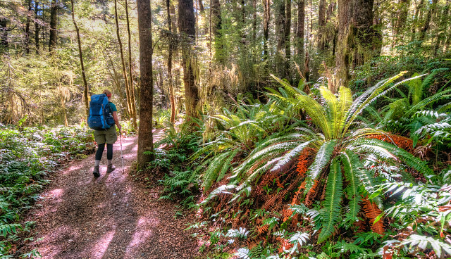
In the forest on the Kepler Track in Fiordland National Park, New Zealand
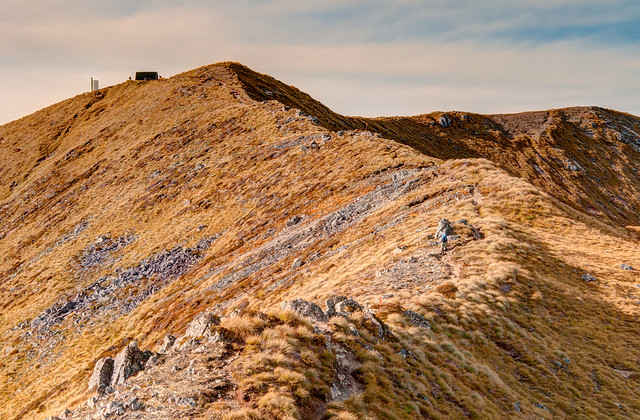
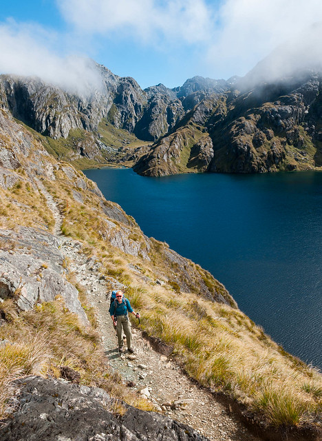
It was still sunny when we arrived at the Iris Burn Hut but the weather forecast predicted low clouds and strong winds (with gusts up to 55 mph) beginning the following morning. John suggested that we drop off most of our gear and hike up to the ridge that afternoon while the weather was still good. It took a while as the trail is steep with many switchbacks and quite a few steep stairs but it was well worth the effort. We had great views of the Murchison Mountains and Lake Te Anau below and thoroughly enjoyed the solitude on this high point of such a popular track.
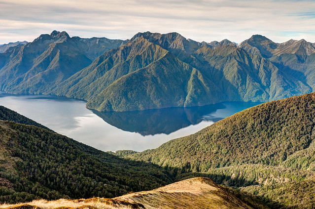
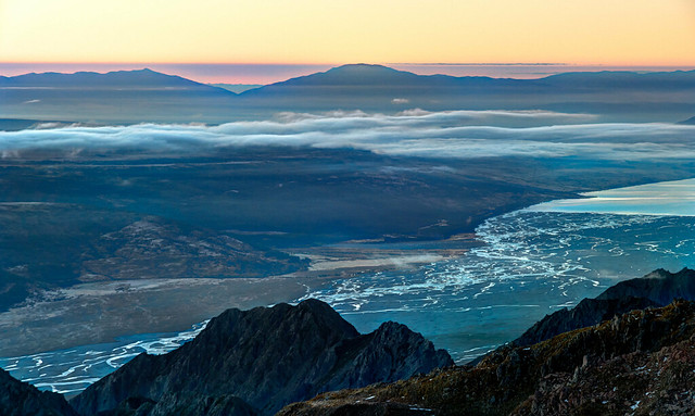
Lake Te Anau seen from the Kepler Track in Fiordland National Park, New Zealand
The next morning we packed up all of our gear and did the climb back up to the ridge but in very different conditions. We experienced strong cold winds while we hiked quickly across the ridge. We decided to pass on the opportunity to climb nearby Mt Luxmore. As we descended the other side of the ridge on our way to the Luxmore Hut we appreciated getting some protection from the wind.
The next morning - Lake Te Anau seen from the Kepler Track in Fiordland National Park, New Zealand
We were aware that nearly everyone else in the hut was doing the track in the customary counterclockwise direction. Therefore, they would all cross the high ridge the next day on their way to Iris Burn Hut but unfortunately the weather forecast predicted more rain and even stronger gusts of wind. When some of them asked about our experience crossing the ridge we tried to not sound too discouraging but we knew they would have an "adventure" to talk about when they got back home.
While most trampers get going early in the morning we were not surprised when most of the individuals at the Luxmore Hut were slow to start. The weather was abysmal and we could well understand their apprehension at the prospect of crossing the exposed ridge under present circumstances. However, apparently conditions such as these are not uncommon. A few days later we talked to couple who did cross the ridge that day. They told us that when they described their experience to Robbie, a Department of Conservation (DOC) Hut Warden, he responded “Did you have to crawl on your hands and knees across the ridge? Did you have to go down the stairs on your backside? Then you had an easy day”.
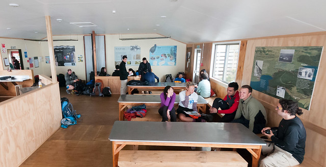
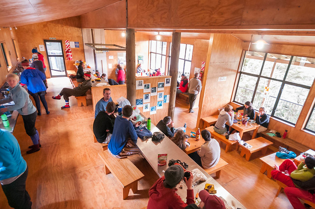
Inside the Luxmore Hut on the Kepler Track in Fiordland National Park, New Zealand
While most trampers get going early in the morning we were not surprised when most of the individuals at the Luxmore Hut were slow to start. The weather was abysmal and we could well understand their apprehension at the prospect of crossing the exposed ridge under present circumstances. However, apparently conditions such as these are not uncommon. A few days later we talked to couple who did cross the ridge that day. They told us that when they described their experience to Robbie, a Department of Conservation (DOC) Hut Warden, he responded “Did you have to crawl on your hands and knees across the ridge? Did you have to go down the stairs on your backside? Then you had an easy day”.
Jean on the ridge on the Kepler Track in Fiordland National Park, New Zealand
As we prepared to leave the Luxmore Hut we noticed that Fay, the DOC Hut Warden, had updated the weather forecast to an optimistic “breezy”. We were perplexed as this did not match the rain and strong wind we observed outside but she reassured us that this was “not bad”. I hope that one day I can be more like a Kiwi and believe that such weather is “not bad” and hiking through it is an “easy day”.
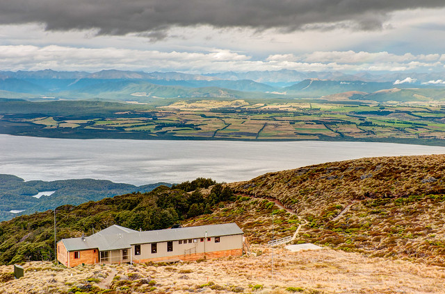
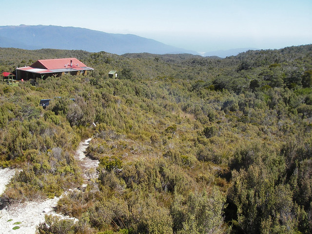
The Luxmore Hut on the Kepler Track in Fiordland National Park, New Zealand
Once we finally got started we began encountering trampers on their first day doing the Kepler Track and heading up to Luxmore Hut. Those who we passed crossing the windy exposed meadow were soaked and looked miserable. Once we lost enough elevation and reentered the forest we were relieved to be protected from the wind and the rain. The trampers we then began to encounter already looked tired. Several asked us how long it would be before they would finally get out of the woods and reach the hut. Again we tried to not be discouraging but many of them seemed unprepared for what they would soon face. I hope that none of them had to crawl across the ridge. All of our Kepler Track Photos are on Flickr.

Lake Manapouri on the Kepler Track in Fiordland National Park, New Zealand
After coming off the Kepler Track we had a few days to get cleaned up and resupplied before starting our next “Great Walk”, the Milford Track. This track is also located in Fiordland National Park and is frequently referred to as “The Finest Walk in the World”. Prior to arriving in New Zealand it was our preference to not book any of the Great Walks in advance so we could watch weather forecasts. However, we knew this would not be an option as the Milford Track is so popular that one must book this trip many months in advance. Only 40 trampers are permitted to begin the track each day. Last November, when we finally got around to making some firm plans for our trip and went to the DOC’s online booking we discovered that the first available date was March 15. It was later in the season than we would have preferred but we took it and hoped for the best. In reality we were extremely lucky there was anything still available at that late date.
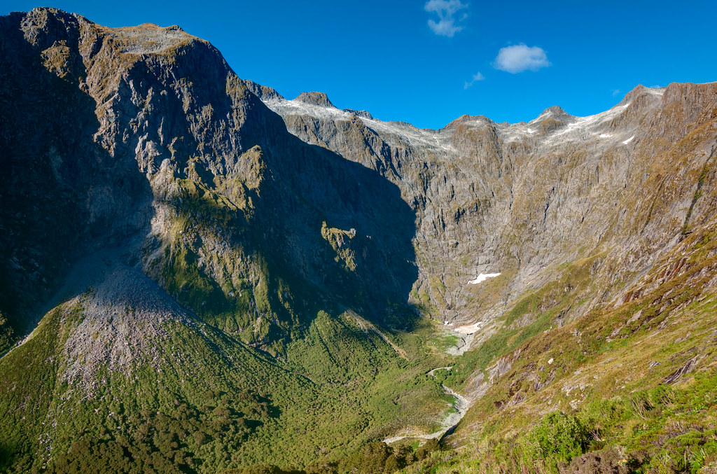
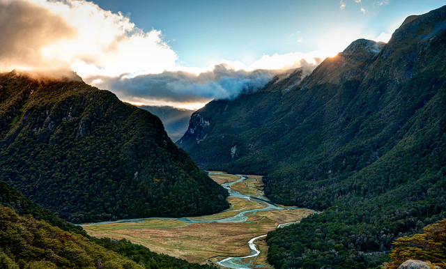
Clinton Canyon seen from Mackinnon Pass on the Milford Track in Fiordland National Park, New Zealand
This track is the most expensive of all the Great Walks as transportation at both the beginning and end of this track is a bit complicated. Getting to the beginning of the track requires an hour and a half boat ride up Lake Te Anau to Glade Wharf. At the end of the track one must take a 20 minute boat ride from Sandfly Point to the town of Milford Sound followed by an hour and a half long bus ride back to where we planned to leave our campervan. Including three nights in huts (camping is not allowed) and all transportation the total cost is about $325 per person.
For those who want to do the Milford Track but want more “creature comforts” (and are willing to pay for it) they can book a guided trip with Ultimate Hikes New Zealand. This "Glamour Tramping" is often called "Glamping". Up to 50 people, or “Glampers”, can start the track each day and stay in the Milford Track Lodges; enjoying hot showers, three course meals and comfortable beds (with private bedrooms with private bathrooms are available). These guided trips may not be fully booked so this is an option for anyone who really wants to do the Milford Track but was unable to book with the DOC. But it will cost you from $1,830 to $3,020 per person (depending on how badly you want that private bathroom)

Quintin Lodge on the Milford Track in Fiordland National Park, New Zealand
We had heard that Fiordland was best seen in the rain. Which is good because Fiordland gets about 12 to 24 feet of rain per year (depending on which side of Mackinnon Pass you are on) and that it rains more than 200 days per year. However, we really hoped to not spend the entire time in a cloud not being able to see anything. As the date approached we anxiously watched the weather forecast and became increasingly optimistic. It rained the day before we were to start and continued throughout the night but it had stopped by the time we caught the boat that would take us to Glade Wharf, where the track begins.
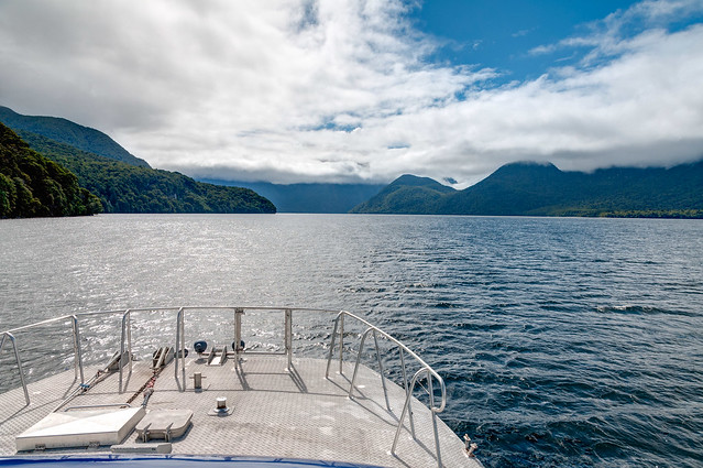
On our way to the start of the Milford Track in Fiordland National Park, New Zealand
After getting off the boat we did the short hike to the Clinton Hut in sunshine. It was still sunny the next day as we hiked through the forest along the Clinton River. Once we left the forest we began getting great views of the sheer rock walls of Clinton Canyon and Hirere Falls. We later heard that those who had hiked this way the previous day did so in the rain and were treated to the sight that Fiordland is famous for; countless waterfalls tumbling down the walls. They also hiked through deep water before reaching the next hut absolutely soaked. We may not have seen as many falls but we appreciated the clear skies as it enabled us to see the surrounding mountains and Mackinnon Pass.
Hirere Falls seen on the Milford Track in Fiordland National Park, New Zealand
We arrived at the Mintaro Hut by mid afternoon. The next day was when we would cross the high point of the track, Mackinnon Pass. Unfortunately the weather forecast for the following day predicted low clouds and rain. So we decided to do as we had done on the Kepler Track; drop most of our gear off at the hut and hike up the steep trail to the pass that afternoon.
Only six other people made the same decision and we all thought that the effort was well worth it. The views were great; of Mt Balloon, Mt Hart and down into the valleys. The weather was warm and the evening light was gorgeous! To top it off once everyone else headed back down we had the pass completely to ourselves; a rare treat on such a popular spot on this iconic track.
In Clinton Canyon (with Mackinnon Pass visible up to the right) on the Milford Track in Fiordland National park, New Zealand
Only six other people made the same decision and we all thought that the effort was well worth it. The views were great; of Mt Balloon, Mt Hart and down into the valleys. The weather was warm and the evening light was gorgeous! To top it off once everyone else headed back down we had the pass completely to ourselves; a rare treat on such a popular spot on this iconic track.
John and Jean (with Mt Balloon) on Mackinnon Pass on the Milford Track in Fiordland National park, New Zealand
The next morning we were happy to see that the dry weather would hold for a bit longer. We repeated our climb to the pass but this time found it to be quite cold and windy despite the mostly clear skies. The morning light was flat and some of the valleys were still in shadow so we felt lucky to have been there the previous afternoon. None of the trampers spent much time on the pass and headed quickly for the Mackinnon Pass Shelter to get out of the wind and make some tea. The track descends a rocky slope before reentering the forest and following alongside Cascade Creek.
Cascade Creek seen on the Milford Track in Fiordland National Park, New Zealand
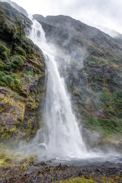
Sutherland Falls near the Milford Track in Fiordland National park, New Zealand
It continued to rain all the way to Dumpling Hut, our destination for the day. The next day we would continue on the track down the Arthur River valley. That evening Amanda, the DOC Ranger, informed us that the weather forecast called for heavy rain to begin about 4 AM. As the steep rock walls above the Arthur River act as a funnel a heavy rain can cause the level of the river to rise several feet which makes portions of the track temporarily impassable. We were instructed to be ready to leave by 7 AM but to wait for her to tell us if it was safe or not. Fortunately the heavy rain held off long enough that in the morning we were told it was safe to hike out but to not “dally along the way”.
The Arthur River (when it is not raining) on Milford Track in Fiordland National Park, New Zealand
We hiked more like a Kiwi that day; in shorts and without rain pants, accepting the fact that we would get soaked no matter what we wore. We were grateful that water over the track was not yet higher than our boots that morning. Later that day we got to see exactly why Fiordland is best seen in the rain. Once the track led us out of the woods we were surprised by the roaring sounds of multiple waterfalls pouring over the steep granite walls above the valley.
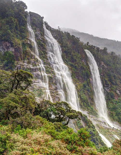
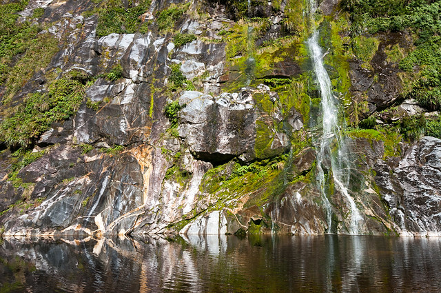
Some of the hundreds of waterfalls that form after rainfall along the Milford Track in Fiordland National Park, New Zealand
Not surprisingly we were thoroughly soaked when we finished the track and boarded the boat bound for the town of Milford Sound. We arrived at 2:15 and while we had been looking forward to changing into our dry clothes we didn’t relish the thought of having to wait until 5 PM to catch our bus for the long ride back to Te Anau Downs where we had left our campervan. However, we were able to squeeze onto the bus leaving at 2:30. Unfortunately, in order to do this we immediately had to handover our packs but thankfully John thought to grab a bag with two dry shirts in it, which was just enough to keep us acceptably warm on the hour and a half bus ride.
Back in November when we booked this track I knew we would do it no matter what the weather turned out to be. We hoped we not not be one of those who have done this track and were unable to see anything due to rain and low clouds. But I don’t think we could have planned for more perfect weather than what we had and we cannot be happier with how our Milford Track experience turned out. All of our Milford Track Photos are on Flickr.

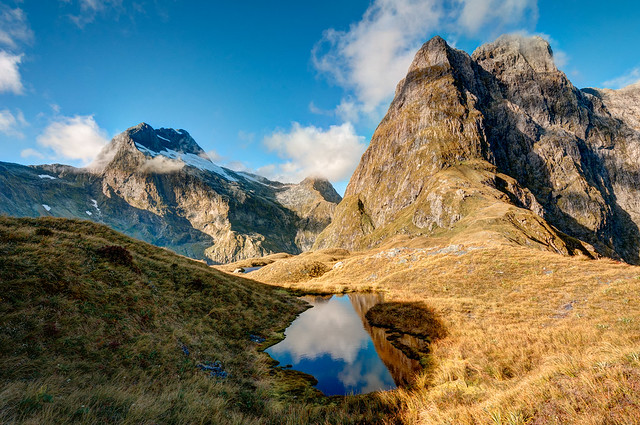
Mt Pillans seen from Mackinnon Pass on the Milford Track in Fiordland National Park, New Zealand
Rakiura Track in Rakiura National Park on Stewart Island, New Zealand
However, the weather was great and we were happy to be able to camp rather than sleeping in DOC huts. The easy track begins along the coast before entering the woods in order to cross a northern portion of the island. The track through woods alternated between well packed gravel to mud (which fortunately wasn’t knee deep due to dry weather). The highlight of the track was the wide variety of exotic bird calls we heard including Kiwi birds at night.
Rakiura Track in Rakiura National Park on Stewart Island, New Zealand
Our second night we were booked for at the North Arm campground. We had passed another couple that morning who were also planning to stay in this campground. As they were much younger than we are we kept expecting them to catch up and pass us. But they never did and we were delighted to have the area completely to ourselves; a rare treat for a “Great Walk” and a fitting end for our quest. All of our Rakiura Track Photos are on Flickr.
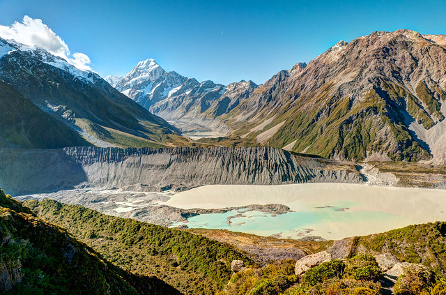
We then headed to Mt Cook National Park located deep within the Southern Alps and home to the county’s highest mountains including Mt Cook (12,316 feet) and Mt Tasman (11473 feet), as well as some notable glaciers.
We day hiked up the Hooker River Valley to the Hooker Lake at the mouth of the Hooker Glacier as well to the Tasman Glacier Lake and had good views of the Tasman Glacier. We also visited the Sir Edmund Hillary Alpine Centre which contains an excellent museum dedicated to Edmund Hillary.
Rakiura Track in Rakiura National Park on Stewart Island, New Zealand
We then headed to Mt Cook National Park located deep within the Southern Alps and home to the county’s highest mountains including Mt Cook (12,316 feet) and Mt Tasman (11473 feet), as well as some notable glaciers.
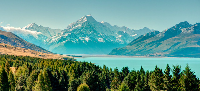
Mt Cook and Lake Pukaki seen while approaching Mt Cook National park, New Zealand
We day hiked up the Hooker River Valley to the Hooker Lake at the mouth of the Hooker Glacier as well to the Tasman Glacier Lake and had good views of the Tasman Glacier. We also visited the Sir Edmund Hillary Alpine Centre which contains an excellent museum dedicated to Edmund Hillary.
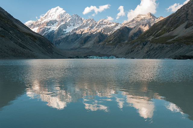
Mt Cook and Hooker Lake in Mt Cook National Park, New Zealand
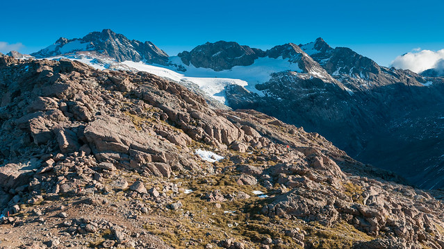
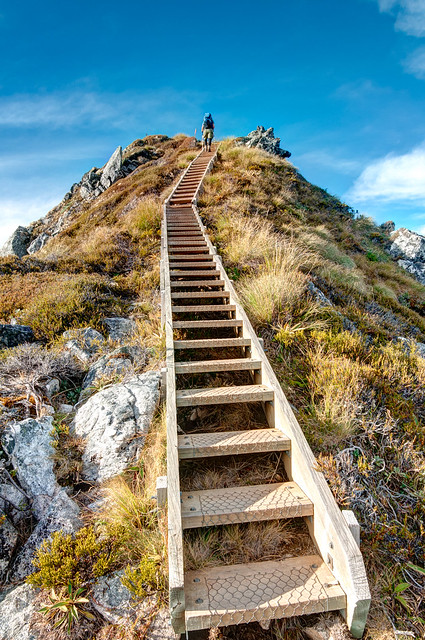
The highpoint of our visit was the overnight trip on the Mueller Hut Route. The track is well formed as far up as Sealy Tarns but later becomes an unmaintained route that is rocky and quite steep.
The track bends around the Sealy Range providing changing views of the surrounding mountains and glaciers.
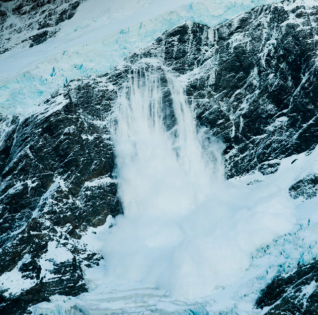
The Mueller Hut is well situated and offers incredible views of Mt Sefton and the Mueller Glacier. At one point we were startled by a deep rumbling sound and looked fast enough to see an avalanche on Mt Sefton.
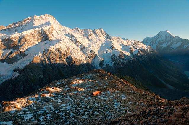
John, along with several others, got up early the next morning and hiked up Mt Oliver in time for sunrise (I got up later and enjoyed my tea and the view from the warmth of the hut).
Mueller Glacier Lake seen from the Mueller Hut Route in Mt Cook National Park, New Zealand
The track bends around the Sealy Range providing changing views of the surrounding mountains and glaciers.
Seen from the Mueller Hut Route in Mt Cook National Park, New Zealand
The Mueller Hut is well situated and offers incredible views of Mt Sefton and the Mueller Glacier. At one point we were startled by a deep rumbling sound and looked fast enough to see an avalanche on Mt Sefton.
Avalanche on Mt Sefton seen from the Mueller Hut in Mt Cook National Park, New Zealand
John, along with several others, got up early the next morning and hiked up Mt Oliver in time for sunrise (I got up later and enjoyed my tea and the view from the warmth of the hut).
Mt Sefton, Mueller Hut and Mt Cook seen from Mt Oliver in Mt Cook National park, New Zealand
Once the sun was up nearly everyone else came back down to the hut to get warmed up but John stayed up there longer. He said the views, especially of the Tasman River valley below, kept getting better as the sun got a bit higher. All of our Mt Cook National Park photos are on Flickr.
Early morning view of the Tasman River valley from Mt Oliver in Mt Cook National Park, New Zealand
Our time at the Mueller Hut provided us with our best opportunity to observe keas, an improbable alpine parrot. These are extremely intelligent, curious and frequently destructive birds. If you are interested in learning more about these “cheeky” birds you may want read more about their interactions with humans.
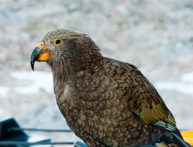
One of several Keas who spend their days looking for something to steal from unsuspecting trampers at the Mueller Hut in Mt Cook National Park, New Zealand
John's sister Elizabeth joined for our last two weeks in New Zealand. We showed her a bit of New Zealand, primarily places we had already seen but the highlight of her visit was taking a boat cruise in Milford Sound. But I'm going to wait to write about that as well as our time in Australia. I'm "out of words" and John needs a break from editing and processing photos but we'll get around to it eventually. First we are going to spend a week in Montana with our sons, Dan and Tom. And then we want to go have more adventures!
All of our New Zealand photos are on Flickr including the New Zealand Great Walks and other New Zealand Sights as well as some that we think illustrate the Best of New Zealand. Speaking of photos ...
All of our New Zealand photos are on Flickr including the New Zealand Great Walks and other New Zealand Sights as well as some that we think illustrate the Best of New Zealand. Speaking of photos ...
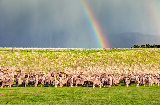
... I can't possibly end the account of our travels in New Zealand without at least one sheep photo.
This next bit is just something that Jean has been thinking about.
What makes a “Great Walk” a great walk?
Within the past two years we have done several great backpack trips including The John Muir Trail in California …

Jean on the John Muir Trail in Sequoia National Park, California
The view of Mt Mather from our campsite at Eielson Pass in Denali National Park, Alaska
We were really looking forward to backpacking in New Zealand but were overwhelmed by the many options available. The Department of Conservation (DOC) web site describes six categories of tracks, three of which are multiday trips. There are “Routes”, which can be rough steep and require that trampers be highly experienced. Then there are “Tramping Tracks” which can be unformed and require that trampers be more physically fit, self sufficient and have the skills needed for navigation and river crossings.
Finally there are the Great Walks/Easier Tramping Tracks which are characterized by having well formed and easy to follow tracks with plenty of direction signs; with conveniently located huts that are a higher standard, and all the major streams and rivers have bridges. Ah, bridges, now that got my attention. In our travels we have had to do a few river and stream crossings …
Finally there are the Great Walks/Easier Tramping Tracks which are characterized by having well formed and easy to follow tracks with plenty of direction signs; with conveniently located huts that are a higher standard, and all the major streams and rivers have bridges. Ah, bridges, now that got my attention. In our travels we have had to do a few river and stream crossings …
Jean crossing Crystal Creek, by far the easiest of 3 creek/river crossings while backpacking the Mt Eielson Loop in Denali National Park, Alaska
… including a particularly scary one. We needed to cross the Thorofare River in Denali National Park but had to bypass an easier spot because of a bear nearby. The water was cloudy with glacial silt and very cold. It was mid thigh in depth and the current was strong. I wish we had a photograph of it but the situation was too dangerous. I could barely stand up and John wanted to keep his hands free in case he needed to pull me out (I think he just didn't want to risk getting his camera wet). Ever since then I have really appreciated bridges.
We decided to take the easy way out and focus our attention on the “Great Walks”. There are nine tracks designated as “Great Walks” including the Lake Waikaremoana Great Walk, the Whanganui Journey (actually a canoe trip), the Tongariro Northern Circuit, the Abel Tasman Coast Track, the Heaphy Track, the Routeburn Track, the Kepler Track, the Milford Track and the Rakiura Track. Our goal was to do as many we could and we completed seven. In the interest of time we decided to forgo the Lake Waikaremoana Great Walk and the Whanganui Journey on the North Island in order to maximize our time on the South Island.
I was curious about these tracks and wondered just what it was that made them “great”. They are popular with overseas visitors due to heavy promotion by the Department of Conservation and New Zealand tourism operators. Only a moderate level of fitness is required and there are private guide services such as Ultimate Hikes New Zealand available. All of which enable less experienced and less fit individuals to explore some of New Zealand’s scenic beauty. These tracks provide hikers (trampers) with great opportunities to experience a wide selection of New Zealand’s diverse terrain. This includes hiking through volcanic terrain,..
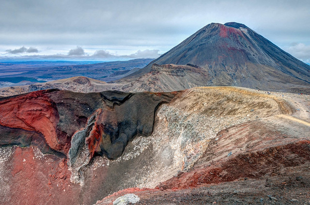
Mt Ngauruhoe and Red Crater seen from the Tongariro Northern Circuit in Tongariro National Park New Zealand
… around a lake, …
Tramper on Lake Waikaremoana Walk in Te Urewera National Park, New Zealand
… along a coast, …
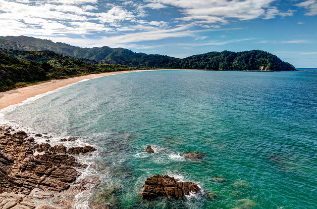
Tasman Bay seen from Abel Tasman Coastal Track in Abel Tasman National Park, New Zealand
… across tussocks, …
Mackay Hut on the Heaphy Track in Kahurangi National Park, New Zealand
… through forests, …
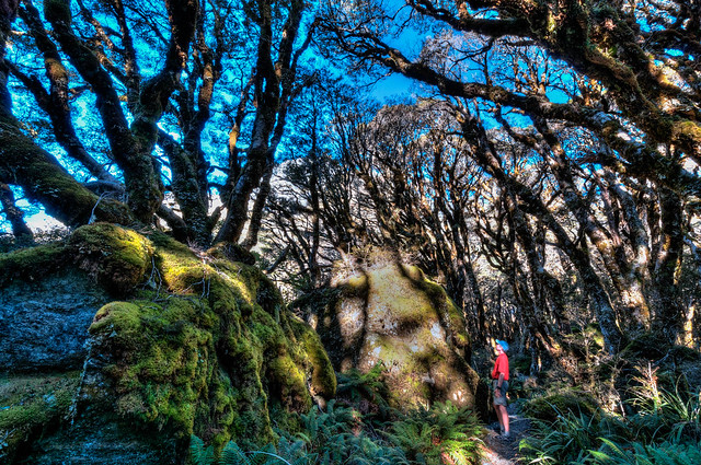
John in the "Enchanted Forest" on the Routeburn Track in Fiordland National Park, New Zealand
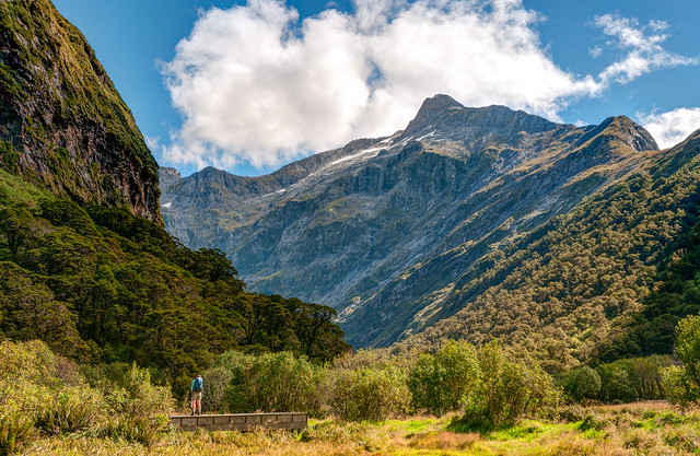
…up valleys, …
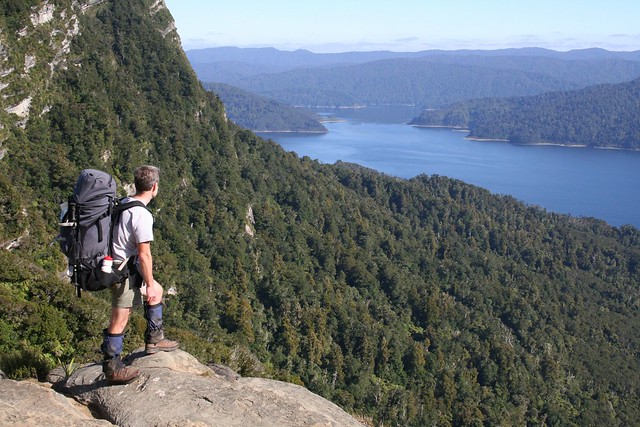
Routeburn Flats seen from the Routeburn Track in Mt Aspiring National Park, New Zealand
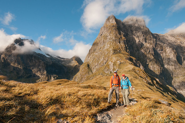
… over mountain passes, …
Mt Eliot and Mt Balloon seen from Mackinnon Pass on the Milford Track in Fiordland National park, New Zealand
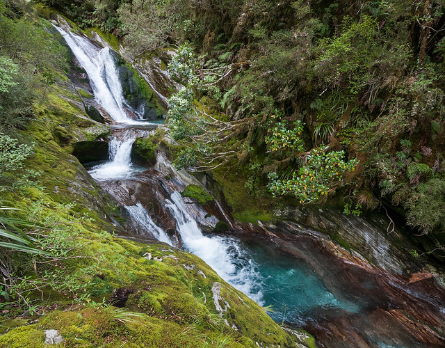
… by waterfalls …
Mackay Falls seen on the Milford Track in Fiordland National Park, New Zealand
… and across an island ..
Rakiura Track in Rakiura National Park on Stewart Island, New Zealand
… as well as floating down a river.
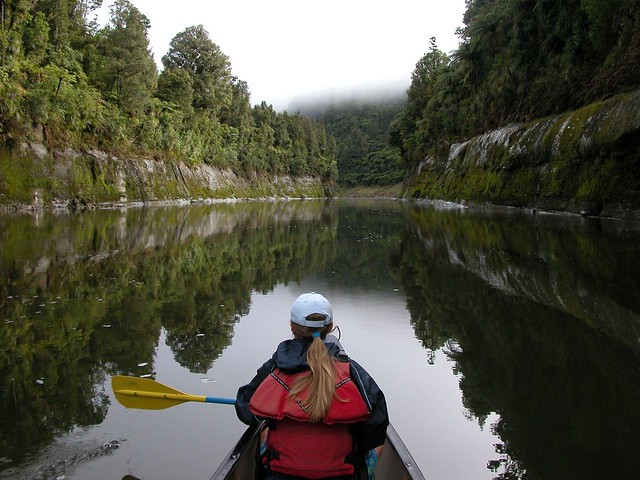
Canoeist on the Whanganui Journey in Whanganui National Park, New Zealand
These tracks are generally well built, …
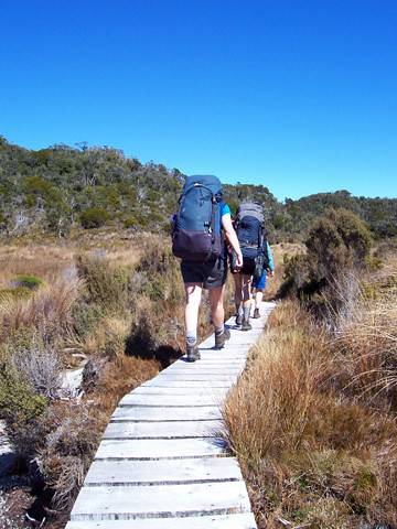
Jean hiking up the ridge while on the Kepler Track in Fiordland National Park, New Zealand
… well signed …
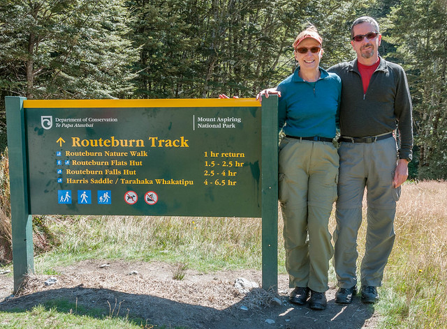
Beginning the Routeburn Track in Mt Aspiring National Park, New Zealand
… and easy to follow.
Jean on the Routeburn Track by Lake Harris in Mt Aspiring National Park, New Zealand
The Great Walks have huts that are of a higher standard …
Inside the Routeburn Falls Hut on the Routeburn Track in Mt Aspiring National Park, New Zealand
… and all have bridges over rivers and streams.

Jean crossing the Lewis River on the Heaphy Track in Kahurangi National Park, New Zealand
Some, such as the Kepler Track and the Tongariro Northern Circuit, can be done as a loop. However, others require that additional transportation arrangements be made to either get to the trailhead or to get back to where your vehicle is parked. However, in every case there are options readily available including being transported by boat, …
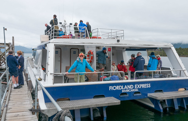
On the boat heading toward Glade Wharf on Lake Te Anau and the start of the Milford Track

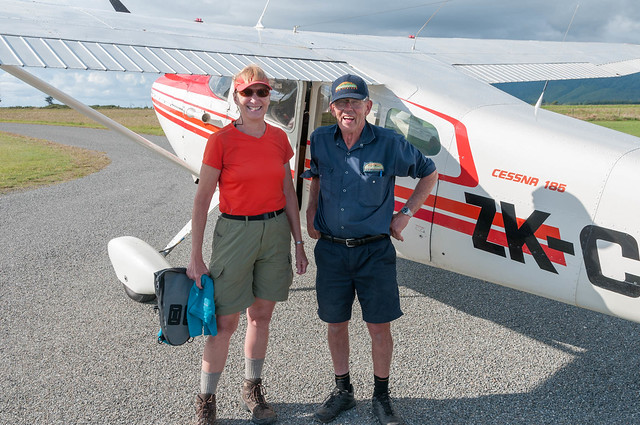
Jean and Jim of Remote Adventures prior to our flight from Karamea to the start of the Heaphy Track in Kahurangi National Park, New Zealand
… and taxi.
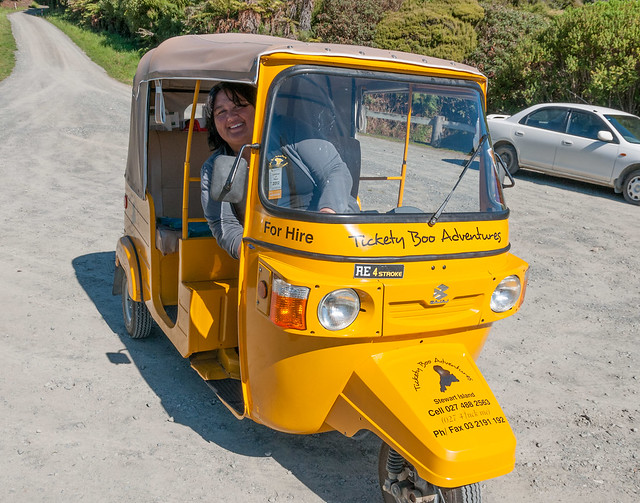
Terri and her “Tickety Boo” taxi in Oban on Stewart Island, New Zealand
On some tracks you can also pay someone to move your vehicle to the other end of the track. We had Mike Stone with Track Hopper move our campervan to the other end of the Routeburn Track. Mike is a very fit guy who, when he isn’t able to drive someone else’s vehicle back to where his vehicle is parked, will run the 20 miles (32 km) back (something he had already done 72 times).
Mt Ruapehu seen on the Tongariro Northern Circuit in Tongariro National Park, New Zealand
I can’t speak to the two we didn’t do except that photos of the Wanganui Journey don’t thrill me and we heard that a portion of this river trip is shared with jet boats. But after seeing some photos of the Lake Waikaremoana Track I now wish we had made the time to do it. While we thought the coast along the Abel Tasman Track was beautiful it was quite crowded due to the easy accessibility to many portions of the track. We undoubtedly would have enjoyed the Heaphy more in dry conditions rather than the heavy rain we encountered. The Rakiura is mostly a woodsy hike and while we really enjoyed listening to the wide variety of birdsong much of the track just didn’t seem all that scenic. On the other hand, due in part to our bias toward mountains, we both thoroughly enjoyed the Tongariro, Routeburn, Kepler and Milford Tracks and think it is completely appropriate to call them “Great Walks”.
Seen on the Kepler Track in Fiordland National Park, New Zealand
However, I do take issue with the DOC continuing to refer to the Milford Track as “The Finest Walk in the World” as this extravagant claim is not based any facts. While the DOC Milford Track brochure doesn’t completely disregard the origin the statement …
“Ever since the claim was made in the London Spectator in 1908, the Milford Track has been referred to as “the finest walk in the world”. This reputation has remained true, with people travelling from all over the world to experience the grandeur of the mountains in the heart of spectacular Fiordland National Park”.
… it does fail to say that way back in 1908 a Kiwi poet by the name of Blanche Baugham hiked the Milford Track and then submitted an essay to the London Spectator with the modest title - “A Notable Walk”. It was the magazine’s editor, someone who may never have even been to New Zealand, who changed the title of the essay to “The Finest Walk in the World” and the Milford Track has been called that ever since.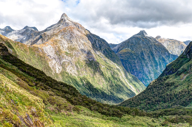
Mt Hart seen from the Milford Track in Fiordland National Park, New Zealand
I was not able to find any other organization that agrees with the statement. While BestHike.com does list it as one of the best hikes in New Zealand they consider the Tongariro Northern Circuit to be the best in the country and the third best in the world. The Milford Track doesn’t even make lists such as Walkopedia’s list of 100 Best Walks. The Lonely Planet's list of the 10 Best Treks in the World ignores the Milford but does list the Routeburn Track as the seventh best.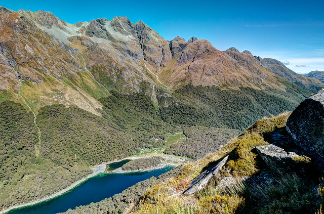
Lake Mackenzie seen on the Routeburn Track in Fiordland National Park, New Zealand
All of the hype that the Milford Track receives is why it is the only track that must be booked many months in advance. Whereas, excellent tracks such as the Tongariro Northern Circuit, the Kepler and the Routeburn Tracks are often overlooked and can often be booked at the last moment just as we did. I agree with Blanche that the Milford Track is a “Notable Walk”. It certainly deserves being one of the “Great Walks”. Many would even call it the “Best of the Great Walks". But is it “The finest walk in the world”? Of course not, no track, trail or route anywhere in the world can make that claim.

Clinton Canyon on the Milford Track, a notable walk, in Fiordland National Park, New Zealand
I am aware that many experienced New Zealand trampers feel disdain for the Great Walks, especially the Milford Track, viewing them as too crowded, too commercialized and too civilized. I can understand that as I feel the same about several iconic hikes in the US in particular the heavily used Bright Angel and North Kaibab trails within the Grand Canyon National Park, Arizona.
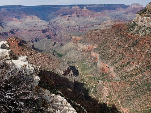
The Bright Angel Trail seen from the South Rim in Grand Canyon National Park, Arizona
These are the most popular trails for a backpacking to the bottom of the canyon but John and I will never do it. In our opinion these trails are too crowded and there are far more scenic trails and routes in the grand Canyon. But it is always easier to put down something once you have already done it and we have already hiked both of those trails as a day hike. In addition we have had the time and the opportunities to learn the skills necessary to safely do more adventurous trails and routes within the canyon; something that most visitors to Grand Canyon National Park have not had. So we don't try to discourage anyone from doing these trails; they just shouldn't be expecting a backcountry experience or any solitude. However, for experienced canyon hikers we can whole hardily recommend the Tanner/Grandview Trails and the Thunder River/Deer Creek Trails which are very scenic and uncrowded.
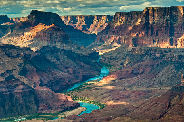
The Colorado River seen the Tanner Trail in Grand Canyon National Park, Arizona
I have come to realize that trips, such as backpacking into Grand Canyon on the Bright Angel Trail/North Kaibab Trails and doing the Milford Track, are “Peak Life Experiences” for some individuals. They just weren’t for us. But the "Great Walks" are New Zealand's iconic hikes and we are happy to have done most of them. We are also aware that they did not necessarily show us the best of what New Zealand has to offer.
We love New Zealand and hope to return while we are still physically enough to do some of the more challenging tracks and routes but it is no longer on the top of our list of future international destinations, Peru is. However, we are collecting suggestions for what tracks and routes we should do the next time we visit. Our list currently includes the Rees – Dart Track, the Hollyford Track and the Dusky Track but we hope that a few knowledgeable Kiwis will be willing to give us some advice (you can email us at panafoot@gmail.com).
We love New Zealand and hope to return while we are still physically enough to do some of the more challenging tracks and routes but it is no longer on the top of our list of future international destinations, Peru is. However, we are collecting suggestions for what tracks and routes we should do the next time we visit. Our list currently includes the Rees – Dart Track, the Hollyford Track and the Dusky Track but we hope that a few knowledgeable Kiwis will be willing to give us some advice (you can email us at panafoot@gmail.com).
One thing the Great Walks did give us - an introduction to what one can expect when hiking in a country that experiences as much rainfall as New Zealand does. We learned that what may be a great track when it’s dry…
Trampers on the portion of the Heaphy Track the Saxon and Mackay Huts in Kahurangi National Park, New Zealand
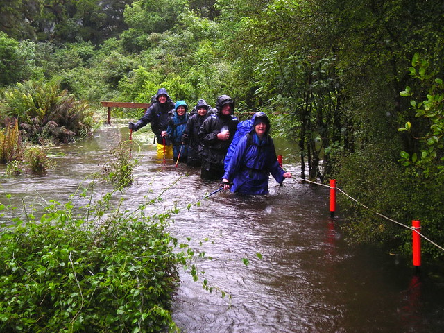
… may be covered with water after significant rain. I heard one DOC Hut Warden casually recount a time when water over the boardwalk on the Heaphy Track pictured above was chest deep but that it was “no problem because the water was clear enough to see the boardwalk below and the current wasn’t too strong”. On other tracks such as the Milford the track can disappear from view and finding one’s way requires tall trail markers.
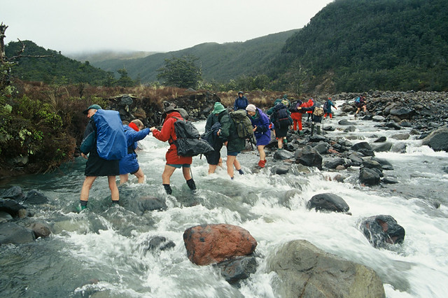
Trampers on the Milford Track in Fiordland National Park, New Zealand
We also learned that any bridge …

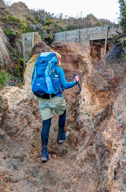
Tramper on one of the “Three Wire” bridges common on the Dusky Track in Fiordland National Park, New Zealand
… is better than no bridge.
Trampers on Whakapapaiti Valley Track in Tongariro National Park, New Zealand
Hopefully hiking on eroded tracks …
Jean negotiating one of many deep ruts in the track. Fortunately it wasn't wet! Seen on the Tongariro Northern Circuit (between Mangatepopo and Whakapapa) in Tongariro National Park on New Zealand's North Island
… will help us cope with mud that is common on other tracks.
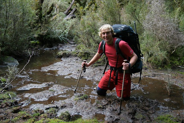
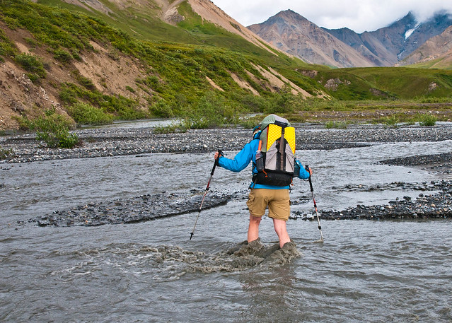
Tramper stuck in the mud while on the Dusky Track in Fiordland National Park, New Zealand
My greatest wish is that our experiences on the Great Walks has helped me learn how to face adversity with some of a Kiwi's adaptability, resiliency and cheerful attitude. But maybe before we go back to New Zealand, just to be on the safe side, I should grow some flippers.
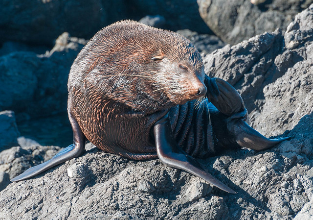
Fur Seal at Cape Palliser, New Zealand


No comments:
Post a Comment