We needed to get serious about preparing to hike the John Muir Trail in August so we left canyon country and went to Colorado. We traded wet bandanas around our necks for gaiters over our boots. We also traded the risk of death by heat stroke for that of being struck by lightning. We are so looking forward to hiking the John Muir Trail in weather that isn’t trying to kill us.
Where we have been - Weminuche Wilderness Area and the San Juan Mountains in Colorado
6/24 – 8/1 2011
In this post:
In this post:
- Dayhikes to the summits of 3 “fourteeners”; Handies Peak, Redcloud Peak and Sunshine Peak in the San Juan Mountains
- Backpack trip - 3 days/2 nights in the San Juan Mountains to attempt Uncompahgre Peak and Wetterhorn Peak
- Backpack trip – 3 days/2 nights starting on the Cunningham Gulch Trail to the Continental Divide Trail and out the Highland Mary Lakes Trail
- Backpack trip – 7 days/6 nights starting on the Weminuche Creek Trail and ending at Wolf Creek Pass
We spent time in Colorado in the San Juan Mountains primarily within the Weminuche Wilderness Area located in the southwest portion of the state. Colorado has 58 mountains over 14,000 feet, referred to as the “fourteeners”, and we decided to climb a few to help us acclimate to higher altitudes before doing some backpack trips along the Continental Divide Trail (CDT). Probably the most important skill one needs to have to do this is the ability to “read” the weather because afternoon thunder storms are common in the mountains and hikers are strongly advised to be off summits and ridges by noon. By far the best place to get route descriptions and current trip reports (plus much more) is 14ers.com.
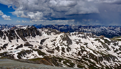
Storm moving in on Handies Peak, Colorado
We took advantage of a better weather day; thunder storms weren’t expected until late afternoon, to climb Redcloud Peak (14,034 feet) as well as its close neighbor, Sunshine Peak (14,001 feet). It’s a bit of a cheat as Sunshine is only 1 ½ miles away with an elevation loss (and regain) of only 500 feet. The day started out clear but by early afternoon puffy white clouds seemed to materialize out of thin air and gradually became darker as the afternoon progressed. It was disconcerting to be on one 14,000 foot peak with dark clouds moving in from behind and another 14,000 foot peak between you and safety. I am used to crossing occasional talus slopes as is common in the North Cascades but Sunshine and Redcloud are covered in talus and trails littered with loose rock so descending seemed agonizingly slow. But as Gerry Roach indicates in his book, Colorado’s Fourteeners, there is a lot of talus and scree on Colorado peaks and “ball bearing” rock on trails so one had better get used to it.
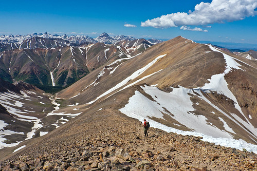
Jean on the trail from Sunshine Peak back to Redcloud Peak, Colorado
Two days later we climbed Handies Peak (14,048 feet). The day started out clear and we made it to the summit by noon.
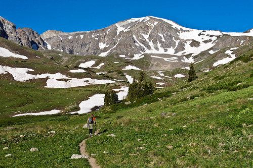
Jean on the trail to Handies Peak, Colorado
Just like clockwork the dark clouds began moving in from three sides of the peak. So after a few photos we were more than happy to descend. The trail head for Handies is off the same parking lot as the trail head for Redcloud and Sunshine so apparently it is not uncommon for some ambitious individuals to try to do Handies after having done Redcloud and Sunshine earlier in the day (three fourteeners in one day does sound impressive). We met one such fellow on our way down but he was not deterred by our reports of an impending storm. Hopefully he made it up and back down safely. All of our photos taken in the San Juan Mountains are on Flicker.
Storm moving in on Handies Peak, Colorado
We then did a 3 day/2 night backpack trip in the San Juan Mountains with plans to climb Uncompahgre Peak (14,309 feet) on the second day and Wetterhorn Peak (14,015 feet) on the third day before hiking out. But things don’t always go as planned. We were camped at about 12,000 feet and we both had some trouble sleeping at that altitude and got up late. I felt a distinct lack of energy and became slightly nauseated by about 13,000 feet so our pace was slow. Once the dark clouds moved in it became apparent we did not have time to reach the summit safely so we turned back.
Uncompahgre Peak, Colorado
We hiked back to camp in rain and waited for a break in the weather to move our camp to the base of Wetterhorn Peak. We were delighted with how much the weather improved later in the day!
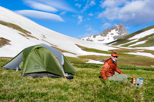
Our camp with Wetterhorn Peak in the distance, Colorado
However, there was a tremendous thunder and lightning storm that night, one strike sounding quite close, accompanied by strong winds. We were very disappointed to wake up the next morning to dark clouds rather than the expected clear sky. It didn’t rain as we headed up Wetterhorn but once we gained the ridge we were hit with strong gusts of cold wind. We still had about 1,000 feet to gain ascending a narrow ridge followed by 150 feet of “class 3” rock before reaching the summit. We dropped down a bit to shelter from the wind and put on more clothing before deciding what to do.
I had been apprehensive about the rock climbing ahead of me given my lack of experience. In reality except for the exposure it probably wasn’t any worse than the scrambling I have done many times before. But the thought of ascending (and descending) the narrow ridge, climbing up and back down (especially back down) the exposed rock in strong gusts of wind with dark clouds looming overhead was more than I could face. So once again we turned back.
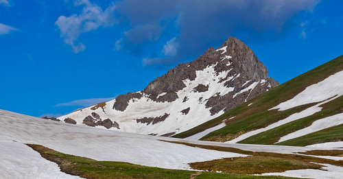
Wetterhorn Peak (and great weather) the day before, Colorado
After we had descended a bit we noticed the grey clouds were breaking up and being replaced by white clouds and blue sky. It was maddening and I kept wondering if we should turn around and try again but I was still having some altitude related appetite problems and it was still windy. John made the decision we should continue back to camp, pack up and hike out. I was pretty demoralized after failing to reach the summit of either peak but John reminded me that even though we hadn’t achieved those goals we did meet our objective, to hike and camp above 12,000 feet for multiple days to help with acclimatization.
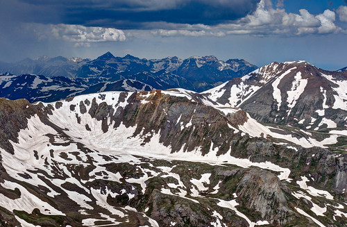
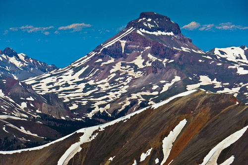
Wetterhorn Peak, Uncompahgre Peak and Redcloud Peak, Colorado
We both had to get new larger and sturdier packs as we would both need to carry a bear canister on the John Muir Trail and we wanted to try them out. So we did a 3 day/2 night backpack trip hiking up the Cunningham Gulch Trail to the CDT. The second day we day hiked from camp further down the CDT for several miles just managing to get back to camp right before a hard rain started. We were camped just above 12,000 feet and we both were still having some altitude related issues primarily headache and loss of appetite. We hiked out on the Highland Mary Lake Trail. All of our photos taken in the San Juan Mountains are on Flickr.
We both had to get new larger and sturdier packs as we would both need to carry a bear canister on the John Muir Trail and we wanted to try them out. So we did a 3 day/2 night backpack trip hiking up the Cunningham Gulch Trail to the CDT. The second day we day hiked from camp further down the CDT for several miles just managing to get back to camp right before a hard rain started. We were camped just above 12,000 feet and we both were still having some altitude related issues primarily headache and loss of appetite. We hiked out on the Highland Mary Lake Trail. All of our photos taken in the San Juan Mountains are on Flickr.
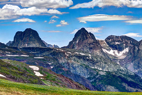
The Grenadier Range seen from the Continental Divide Trail in the Weminuche Wilderness Area, Colorado
As our final preparation for hiking the John Muir Trail we did a 7 day/6 night backpack trip starting out at Thirty Mile Campground traveling up Weminuche Creek to join the CDT at Weminuche Pass. As the CDT is one of the premier trails in the country we were expecting it to be well signed and well traveled but when we got to where we were supposed to join the CDT we were faced with a vague junction sign, no visible trail and a marshy meadow.
Can you see the trail? You're looking right at it. Continental Divide Trail in the Weminuche Wilderness Area, Colorado
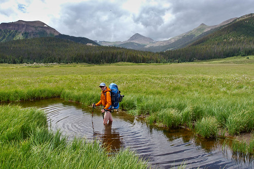
We had made the mistake of forgetting our map but the trail guide we had said to cross the meadow and “jump the canal” (apparently someone owns the water rights here and dug a canal through the valley to divert the water). We could see a couple posts in the distance and headed toward them and partway across we reached the canal. It was about eight feet across with steep muddy sides and the dark water appeared to be about two feet deep and had a deep mud bottom. How were we supposed to “jump” it? Neither of us wanted to risk getting our shorts wet so…
John crossing the canal (fortunately we found a shallow spot where the bottom had some gravel in it).
Continental Divide Trail in the Weminuche Wilderness Area, Colorado
Continental Divide Trail in the Weminuche Wilderness Area, Colorado
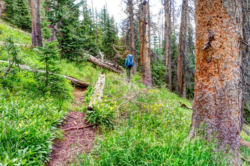
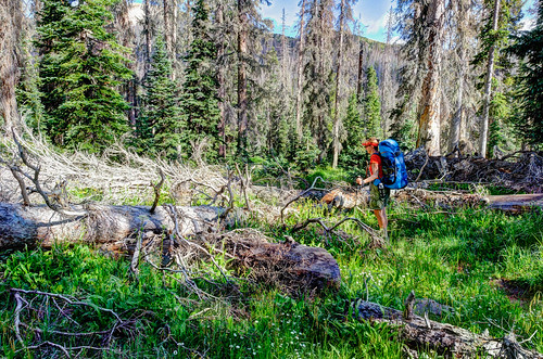
While much of this section of the CDT is in reasonable shape and well traveled far too often the trail is ambiguous or nonexistent in places and the junctions poorly signed. Our Delorme GPS did not have all of the side trails on its map and more than once the side trail was more apparent than the main trail. Through wooded sections there were a number of downed trees crossing the trail sometimes requiring detours. As so many of the standing trees are dead (more about that later) there is quite a bit of tall grass growing in the woods which makes it surprisingly difficult to find one’s way back to the trail. We are accustomed to poor trail conditions and occasional route finding issues but it really bothered us here to waste so much time, time we needed to get to our destination before an afternoon thunder storm moved in.
Jean detouring around a tree…again on the Continental Divide Trail in the Weminuche Wilderness Area, Colorado
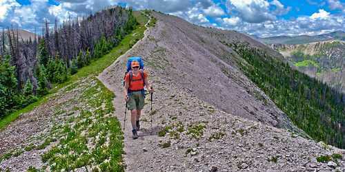
These afternoon thunder storms create a big challenge hiking the CDT in Colorado. There are numerous ridges and one must decide if there is time to ascend, traverse and descend an upcoming ridge before a storm hits. We only had one day where we started up a little concerned as to whether or not we had made the right decision but we really needed to ascend from Piedra Pass and cross the saddle adjacent to South River Peak. We monitored the dark clouds ahead and the direction of the wind and it seemed that even though we were in the rain that the worst of the storm would bypass us. We were unnerved by the thunder and great dark cloud behind us but it didn’t seem to be getting any closer. It was the darkest scariest cloud I’ve ever seen and I wish John could have taken a photo of it but we felt it was more important to just keep moving, which was pretty easy because the thunder was a great motivator. We were relieved once we started down the other side and continued on until we found a somewhat sheltered spot to camp.
Jean on one of many ridges along the CDT (we had plenty time that morning to descend this one before the afternoon storm moved in).
Continental Divide Trail in the Weminuche Wilderness Area, Colorado
Continental Divide Trail in the Weminuche Wilderness Area, Colorado
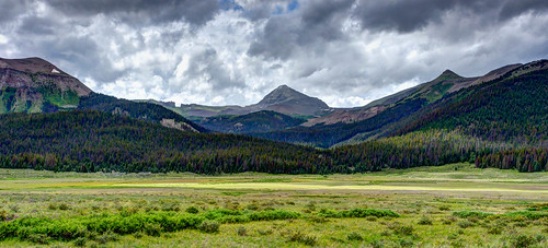
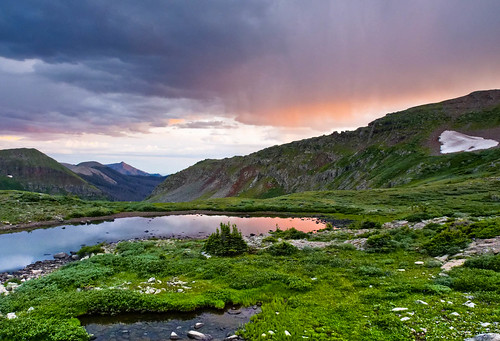
We hiked 65 miles before exiting at Wolf Creek Pass (we previously had left our car at Wolf Creek Pass so we didn’t have to hitchhike the 70 miles back to our motorhome). As you have undoubtedly gathered the weather and altitude were dominant issues for us in Colorado. Regarding the beautiful scenery we saw I will let John’s photos speak for themselves. One thing I do have to say is the dynamic weather did create some of the most dramatic skies either of us has ever seen. All of our photos from this backpack trip are on Flickr.
Seen from the Continental Divide Trail in the Weminuche Wilderness Area, Colorado
We were pleased with our performance on this trip. We both started out with heavier packs than we have carried in a very long time and we managed to keep going despite the altitude. We hope we have done enough preparation for hiking the John Muir Trail. We are now heading to California and will begin hiking the JMT on August 16th. We plan to take 3 weeks to complete it. I’ll let you know how it went (once John has finished editing the countless photos he will undoubtedly take).
This next bit is just something that Jean has been thinking about.
The choice is ours
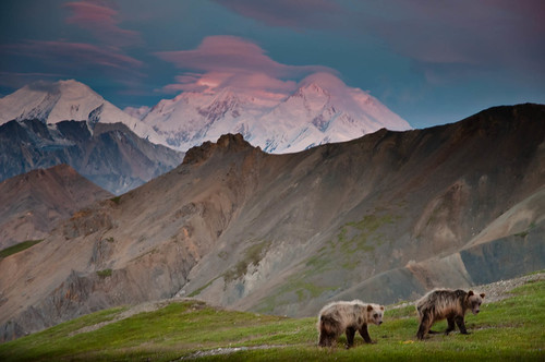
Something we both experienced while backpacking in Denali was how small and insignificant we humans are. We were in an area with a large population of grizzly bears so we needed to be constantly on alert and aware of our surroundings. We felt like “prey”.
Some of our early morning visitors
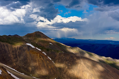
We had similar feelings of vulnerability while backpacking in Colorado when dark clouds moved in and the thunder and lightning began.
A storm moving in…again
We felt that Mother Nature was putting us in “our place”, reminding us that even though she is concerned with the survival of our species the life of an individual human is no more or no less important than the life of any other individual living thing.
I don’t want to get into the whole Creation versus Evolution debate and it is not my intent to offend anyone but I have to say it makes me angry to read or hear of the bible’s account (Genesis 1:28) of God’s instructions to us; that we are to “multiply” and have “dominion” over “all the earth”, that we are to “fill it” and “subdue it”. It just sounds so arrogant to me. However, it seems that many, at least in the US, have apparently taken those instructions literally and as a culture we are doing our “best” to try to dominate and subdue our environment.
Las Vegas strip, the epitome of man’s attempt to have “dominion” over the earth
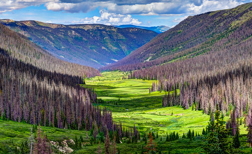
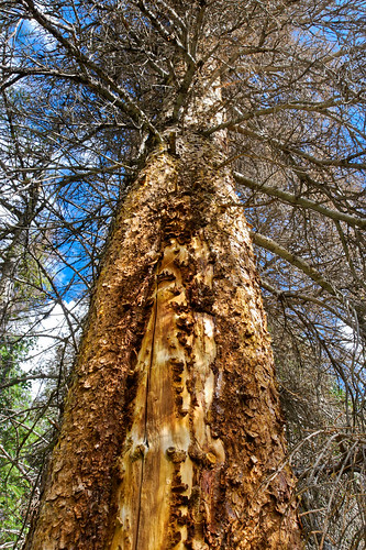
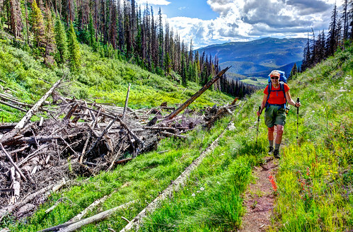
Unfortunately in the process we are also destroying it. This was made painfully obvious to us while hiking and backpacking in the Weminuche Wilderness Area. The once green mountain sides are now largely brown. At least 70% of the spruce trees are dead.
The culprit? Spruce Bark Beetles. While we were shocked last summer when driving through British Columbia by the devastation to forests there caused by the Mountain Pine Beetles this was different. We were face-to-face with it and it felt personal. We hiked many a mile through dead forests seeing up close the damage done to so many mature trees.
We frequently had to step or climb over downed trees. Sometimes there were so many down in one place across the trail we had to detour well around them. Unfortunately Federal budget cuts now prohibit rangers from being able to do all the routine trail maintenance needed much less repair the damage done by environmental issues such as this.
Perhaps the most disheartening was hiking on trails covered not only by brown needles but green needles that had recently been dropped by trees currently in the process of dying.
It’s a complicated issue but global warming appears to be the root of the problem. Warmer winter temperatures have allowed bark beetles to survive at a higher rate and reduce their life cycle from two years to one. Warmer temperatures have also provided the trees a longer growing season which leads to their increased need of water. Unfortunately draught has become more common which stresses the trees and reduces their ability to defend themselves against the beetles, exuding sap to force the beetles out. A further consequence is that these now dead trees are no longer removing carbon dioxide from the air. In addition as they decompose, or are burned in an inevitable forest fire, they will add large amounts of carbon back into the atmosphere...which will just add to the underlying problem.
Unfortunately this forest devastation is just one of countless results of human’s negative impact on the earth. And if we continue as we are things will only get worse. There are simply too many of us…
… and we expect to have too much.
Over population is obviously a very difficult issue to address both nationally and globally given the many differences in political, cultural and religious beliefs but the Population Connection (formerly Zero Population Growth) is trying to keep the subject alive. Concerns about the sustainability of our current standard of living are expressed in the PBS program, “Affluenza”. One of the concepts explored in the book Your Money or Your Life , by Vicki Robin and Joe Dominguez, is that of “enoughness” recognizing that once someone has acquired “enough” having more does not equate more happiness and that having too much can be a burden.
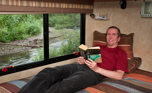
I know we enjoy the relief from the burden of owning a large suburban house and yard. It’s a funny feeling to realize that all the floor space we didn’t use in our previous master bedroom …
…is greater than the total floor space we currently have in our entire motorhome (26A Winnebago Access) and find quite comfortable for the two of us (and anything that could have been done in our previous bedroom can certainly be done in our current one).
And our experiences backpacking prove that we can be happy with far less.
Air, water, food, shelter with a view and each other. What more do we really need?
Okay, I am well aware that the limited space we now live in is extreme and not practical for most and as much as I love backpacking I don’t want to live full-time in our tent. But we know from personal experience that when you really look at all of your stuff and figure out what you actually use then it can be surprising to realize how little that is and how little space it needs.
I believe that there are big changes coming that will alter how people will be able to live. Not in our lifetime and maybe not in our children’s lifetime but it’s coming. The question is will we be proactive and use the information and technology we already have to make a serious attempt to slow the rate of destruction of our environment? Will we put ourselves back in “our place” and learn how to live in balance with the natural world instead of continuing to “fill it” and try to “subdue” it? Or will we be reactive, continuing to do things the same way as we are and wait until we are forced to change our ways? The choice is ours.
I’m reminded of one of Dan’s favorite books as a kid, The Lorax by Dr Seuss, where the greedy “Once-ler” cuts down all the Truffula trees despite the objections of the Lorax, who “speaks for the trees”. It ends with the Once-ler seeing his mistake and he gives the last Truffula tree seed to a boy telling him “Unless someone like you cares a whole awful lot, nothing's going to get better. It's not”.
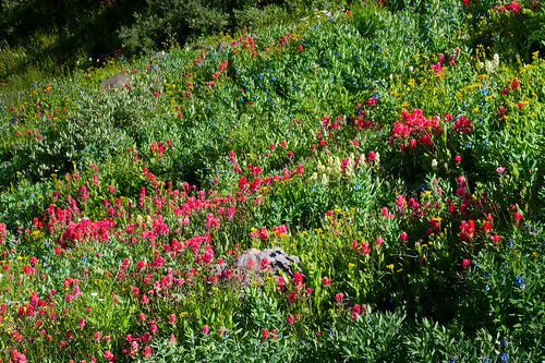
Regardless of what happens to the human race the natural world will survive. Mother Nature has been abused but she most certainly has not been subdued. One result of the dying spruce trees in the Rocky Mountains is there is now more light available to plants growing on the forest floor. Grass is growing which will support more deer and elk, which will attract and support more mountain lions and wolves. Wildflowers are also thriving in the thinning forests. Aspen saplings will eventually grow tall enough to once again shade the forest floor and perhaps some spruce will survive and possibly flourish once again. I am saddened to know that I will not live to see the return of these trees but I am comforted to know that one of our descendents may.
This reminds me of one of Tom’s favorite books as a kid, The Wump World by Bill Peet. “Wumps” are brown animals that look to me like a cross between a moose and a guinea pig. Their unspoiled world is invaded by the “Pollutians” who thoroughly trash their planet before abandoning it for another. The book ends with the Wumps coming out from the caves where they had been hiding to a very changed world, one that is covered in buildings and concrete and where all of the resources have been used up. However, they see a small flower growing out of a crack in the sidewalk and there is hope.







3 comments:
Ah, Colorado! Gunnison County is where my family originates. Thunder in the afternoon, always. Enjoy your shots AND commentary. Safe travels!..Bob Okrie
Ah Jean - the philosopher! How could you be any other way after spending so much time in the wilderness? I know that I always feel as though I am home when I am wandering along trails and enjoying communion with nature. But, alas, I love being in my home as well.
I can hardly wait to hear about your experience on the JMT. I just responded to a scoping survey by the national park service as they are writing a new wilderness plan for SEKI (sequoia and Kings Canyon National Parks) - anyone who loves the sierra's (or enjoying the wilderness areas in general) should get involved. If we want to have an impact on the revamping of a backcountry management plan this is an opportunity to be heard.
Hope to see you in October for the balloon fiesta. We will be in Panama most of September so will have to communicate via email! ¡buena suerte! Kipp
too many good pictures here :)
Post a Comment